National Water-Quality Assessment (NAWQA) Project
Back to Article Information || Previous Figure
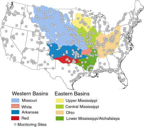
The USGS network of monitoring stations available for use in the USGS model was about 425 stations. Unfortunately, surface-water quality monitoring has declined significantly over time, declining from 425 stations in the early 1990s to about 35 stations today that have comparable nutrient data and stream flow measurements.

![]() U.S. Department of the Interior | U.S. Geological Survey
U.S. Department of the Interior | U.S. Geological Survey
URL: http://water.usgs.gov/nawqa/sparrow/gulf_findings/sites.html
Page Contact Information: gs-w_nawqa_whq@usgs.gov
Page Last Modified: Tuesday, 04-Mar-2014 14:45:03 EST
