National Water-Quality Assessment (NAWQA) Program
Go to:
Using Chemical, Hydrologic, and Age Dating Analysis to Delineate Redox Processes and Flow Paths in the Riparian Zone of a Glacial Outwash Aquifer-Stream System
By Larry J. Puckett, Timothy K. Cowdery, Peter B. McMahon, Lan H. Tornes, and Jeffrey D. Stoner
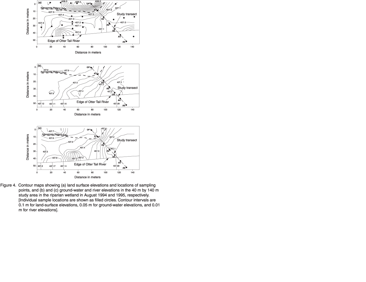
[Water Resources Research, vol. 38, no. 8, August 2002]Figure 4. Contour maps showing (a) land surface elevations and locations of sampling points, and (b) and (c) ground-water and river elevations in the 40 m by 140 m study area in the riparian wetland in August 1994 and 1995, respectively. [Individual sample locations are shown as filled circles. Contour intervals are 0.1 m for land-surface elevations, 0.05 m for ground-water elevations, and 0.01 m for river elevations.]
Return to main report.

![]() U.S. Department of the Interior |
U.S. Geological Survey
U.S. Department of the Interior |
U.S. Geological Survey
URL: http://water.usgs.gov/nawqa/nutrients/pubs/wrr_v38/fig4.html
Page Contact Information: gs-w_nawqa_whq@usgs.gov
Page Last Modified: Tuesday, 04-Mar-2014 14:44:14 EST
