Water Resources of the United States


USGS Flood-related Publications

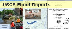
Visit the USGS Flood Reports page for floods dating back over 100 years.

Related Links

Archive of USGS Project Alert flood notices - local and regional flood briefs since 2008.
100-Year Flood--It's All About Chance - poster discussing the meaning and use of probability language in flood characterization.
Video: 2011: The Year of the Flood

State-based Flood Information

There is a USGS Water Science Center office in each State. Alabama Arkansas Georgia Illinois Indiana Kansas Louisiana Montana North Carolina North Dakota Oklahoma South Carolina Tennessee Wyoming Texas Alaska Arizona California Caribbean Colorado Connecticut Florida Hawaii Idaho Iowa Kentucky Maine Maryland-Delaware-D.C. Massachusettes Michigan Minnesota Mississippi Missouri Nebraska Nevada New Hampshire New Jersey New Mexico New York Ohio Oregon Pennsylvania Rhode Island South Dakota Utah Vermont Virginia Washington West Virginia Wisconsin

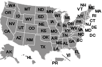
Click the map above to visit a State-specific flood page (if available), or check out one of these State flood databases:


Colorado Flood Database

Oklahoma Flood Database

USGS Contact Information

For questions related to this site or to contribute content, please email TODD KOENIG or BOB HOLMES.

USGS Flood Information   

The USGS provides practical, unbiased information about the Nation's rivers and streams that is crucial in mitigating hazards associated with floods. This site provides information about the USGS activities, data, and services provided during regional high-flow events, such as hurricanes or multi-state flooding events. The USGS response to these events is typically managed by the National Floods Specialist.

Heavy rainfall occurred across South Carolina during October 1 to 5, 2015, as a result of an upper atmospheric low-pressure system that funneled tropical moisture from Hurricane Joaquin into the State. The storm caused major flooding in the central and coastal parts of South Carolina. Almost 27 inches of rain fell near Mount Pleasant in Charleston County during this period. U.S. Geological Survey (USGS) streamgages recorded peaks of record at 17 locations, and 15 other locations had peaks that ranked in the top 5 for the period of record.

During the October 2015 flood event, USGS personnel made about 140 streamflow measurements at 86 locations to verify, update, or extend existing rating curves (which are used to compute streamflow from monitored river stage). Immediately after the storm event, USGS personnel documented 602 high-water marks, noting the location and height of the water above land surface. Later in October, 50 additional high-water marks were documented near bridges for South Carolina Department of Transportation. Using a subset of these high-water marks, 20 flood-inundation maps of 12 communities were created. Digital datasets of the inundation area, modeling boundary, and water depth rasters are all available for download.

Use the links below to download data or click the report image to read the full report:

OFR2016-1019_DATA.zip: 130 mb zipped file with all 20 Communities
  • OFR2016-1019_DATA_Black.zip: 53 mb zipped file includes:

    • Black_Creek_Darlington
    • Black_Creek_Florence
    • Black_Creek_Andrews
    • Black_Creek_Kingstree

  • OFR2016-1019_DATA_Coastal.zip: 5 mb zipped file includes:

    • Coastal_Charleston
    • Coastal_Georgetown
    • Coastal_North_Myrtle_Beach

  • OFR2016-1019_DATA_Columbia.zip: 22 mb zipped file includes:

    • Gills_Creek_Columbia
    • Kinley_Creek_Columbia *
    • Mill_Creek_Columbia
    • Rawls_Creek_Columbia
    • Rocky_Branch_Columbia
    • Saluda_Broad_Congaree_Rivers_Columbia
    • Smith_Branch_Columbia
    • Stoop_Creek_Columbia

  • OFR2016-1019_DATA_Other.zip: 48 mb zipped file includes:

    • Ashley_River_Charleston
    • Crab_Tree_Swamp_Conway
    • Green_Swamp_Sumter
    • North_Fork_Edisto_River_Orangeburg
    • Pocotaligo_River_Manning

Image of USGS OFR 2016-1019.  Click to go to report.

* Update (Apr 11, 2016): Please note that the Kinley_Creek_Columbia dataset has been modified to correct the use of the wrong depth layer found in downloads prior to April 11, 2016, and all files above have been updated to correct a spelling mistake in the filenames.


For questions related to this site or to contribute content, please email Todd Koenig or Bob Holmes at the USGS Office of Surface Water.

USGS Home Core Science Ecosystems Energy and Minerals Environmental Health Land Resources Hazards Water

Accessibility FOIA Privacy Policies and Notices

U.S. Department of the Interior | U.S. Geological Survey

URL: https://water.usgs.gov/floods/events/2015/Joaquin/data_ofr20161019/

Page Contact Information: Water Webserver Team
Page Last Modified: Monday, 11-Apr-2016 14:49:57 EDT