
Water Resources of the United States
 Visit the USGS Flood Reports page for floods dating back over 100 years.
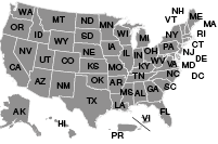
Click the map above to visit a State-specific flood page (if available), or check out one of these State flood databases:
The USGS provides practical, unbiased information about the Nation's rivers and streams that is crucial in mitigating hazards associated with floods. This site provides information about the USGS activities, data, and services provided during regional high-flow events, such as hurricanes or multi-state flooding events. The USGS response to these events is typically managed by the National Floods Specialist.

← Select the image at left for a full-size map of the measurement locations, or... click here to download a KML version.
Summary data for all measurements can be found in the Streamflow Measurements Table.
Select a grid item in the sections below to download a compressed folder of measurement data.
Select the station number in a section title below to jump to an NWIS summary of all measurements at that station.

Apr 26(<1 MB)
May 3 (20 MB)
May 17(<1 MB)
May 31(<1 MB)

Apr 28 (10 MB)
Apr 29 (10 MB)
May 3 (11 MB)
May 10 (6 MB)
Jun 7 (5 MB)

Apr 29 main (7 MB)
Apr 29 overflow 7 MB)
Apr 30 combined (18 MB)
May 1 combined (8 MB)
May 2 combined (6 MB)
May 3 main (5 MB)
May 3 overflow (<1 MB)
May 4 combined (15 MB)
May 5 combined (14 MB)
May 6 combined (7 MB)
May 8 main (3 MB)
May 8 overflow (<1 MB)
May 9 combined (17 MB)
May 10 combined (15 MB)
May 11 combined (11 MB)
May 12 combined (15 MB)
May 14 combined (5 MB)
May 15 combined (14 MB)
May 16 combined (10 MB)
May 17 combined (10 MB)
May 18 main (10 MB)
May 18 overflow (<1 MB)
May 20 combined (14 MB)
May 21 main (11 MB)
May 21 overflow (<1 MB)
May 22 main(9 MB)
May 22 overflow (<1 MB)
May 23 main (10 MB)
May 23 overflow (<1 MB)
May 24 combined (10 MB)

Apr 29 main (20 MB)
Apr 29 overflow (<1 MB)
Apr 30 main (11 MB)
Apr 30 overflow (<1 MB)
May 1 main (13 MB)
May 1 overflow (<1 MB)
May 2 main (13 MB)
May 2 overflow (<1 MB)
May 3 main (8 MB)
May 3 overflow (<1 MB)
May 4 main (9 MB)
May 4 overflow (32 MB)
May 5 main (7 MB)
May 5 overflow (<1 MB)
May 6 main (5 MB)
May 6 overflow (<1 MB)
May 8 main (3 MB)
May 8 overflow (<1 MB)
May 9 main (8 MB)
May 9 overflow (<1 MB)
May 10 overflow only (14 MB)
May 11 main (9 MB)
May 11 main (4 MB)
May 11 overflow (<1 MB)
May 12 main (6 MB)
May 12 overflow (15 MB)
May 14 main (4 MB)
May 14 overflow (<1 MB)
May 15 main (5 MB)
May 15 overflow (20 MB)
May 16 main (8 MB)
May 16 overflow (7 MB)
May 17 main (8 MB)
May 17 overflow (<1 MB)
May 18 main (15 MB)
May 18 overflow (6 MB)
May 20 combined (18 MB)
May 21 combined (16 MB)
May 22 combined (18 MB)
May 23 combined (16 MB)
May 24 combined (15 MB)

May 3 (7 MB)
May 4 (29 MB)
May 4 (13 MB)
May 5 (47 MB)
May 6 (11 MB)
May 6 (19 MB)
May 7 (7 MB)
May 8 (11 MB)
May 9 (15 MB)
May 10 (7 MB)
May 11 (5 MB)
May 12 (5 MB)
May 13 (9 MB)
May 14 (12 MB)
May 15 (18 MB)
May 16 (16 MB)
May 17 (12 MB)
May 18 (14 MB)
May 19 (<1 MB)
May 19 (30 MB)
May 20 (16 MB)
May 21 (10 MB)
May 24 (7 MB)
May 25 (5 MB)
May 26 (5 MB)
May 27 (5 MB)
May 28 (2 MB)
May 29 (4 MB)
May 30 (5 MB)
May 31 (8 MB)
Jun 1 (5 MB)
Jun 2 (5 MB)
Jun 3 (3 MB)
Jun 4 (2 MB)
Jun 5 (3 MB)

Apr 28 (22 MB)
Apr 30 (18 MB)
May 1 (12 MB)
May 3 (11 MB)
May 4 (12 MB)
May 5 (10 MB)
May 6 (7 MB)
May 14 (6 MB)
May 16 (11 MB)
May 20 (15 MB)
May 21 (15 MB)
May 22 (16 MB)
May 23 (20 MB)

May 6 (4 MB)
May 8 (<1 MB)
May 9 (<1 MB)
May 10 (5 MB)
May 11 (6 MB)
May 12 (6 MB)
May 13 (5 MB)
May 14 (5 MB)
May 15 (4 MB)
May 16 (4 MB)
May 17 (3 MB)
May 18 (5 MB)
May 19 (6 MB)
May 20 (4 MB)
May 21 (6 MB)
May 22 (5 MB)
May 24 (4 MB)
May 26 (4 MB)
May 27 (4 MB)
May 28 (5 MB)
May 29 (3 MB)
May 30 (4 MB)
May 31 (3 MB)
Jun 1 (3 MB)
Jun 2 (3 MB)
Jun 3 (3 MB)
Jun 4 (3 MB)
Jun 5 (2 MB)
Jun 6 (4 MB)
Jun 7 (8 MB)

May 4 (23 MB)
May 6 (11 MB)
May 7 (12 MB)
May 8 (16 MB)
May 9 (11 MB)
May 10 (13 MB)
May 11 (12 MB)
May 12 (16 MB)
May 13 (12 MB)
May 14 (11 MB)
May 15 (18 MB)
May 16 (17 MB)
May 17 (17 MB)
May 18 (10 MB)
May 19 (16 MB)
May 20 (8 MB)
May 21 (20 MB)
May 22 (9 MB)
May 23 (8 MB)
May 24 (12 MB)
May 25 (11 MB)
May 26 (16 MB)
May 27 (21 MB)
May 28 (19 MB)
Jun 6 (3 MB)
Jun 7 (3 MB)
Jun 8 (3 MB)
Jun 9 (2 MB)
Jun 10 (2 MB)
Jun 11 (9 MB)
Jun 11 (3 MB)
Jun 12 (2 MB)
Jun 12 (2 MB)
Jun 13 (4 MB)
Jun 14 (3 MB)
May 3 (3 MB)
May 30 (1 MB)
May 31 (1 MB)
Jun 1 (1 MB)
Jun 2 (2 MB)
Jun 3 (1 MB)
Jun 4 (1 MB)
Jun 5 (1 MB)
May 3 (6 MB)
May 30 (7 MB)
May 31 (7 MB)
Jun 1 (6 MB)
Jun 2 (6 MB)
Jun 3 (6 MB)
Jun 4 (6 MB)
Jun 5 (6 MB)

May 5 (16 MB)