Use WaterWatch to track flooding in your area
The USGS WaterWatch website is a map-based tool that displays maps, graphs, and tables describing real-time, recent, and past streamflow conditions for the United States. This page shows how to use WaterWatch to view up-to-the-hour flood stage conditions at specific sites across the United States.
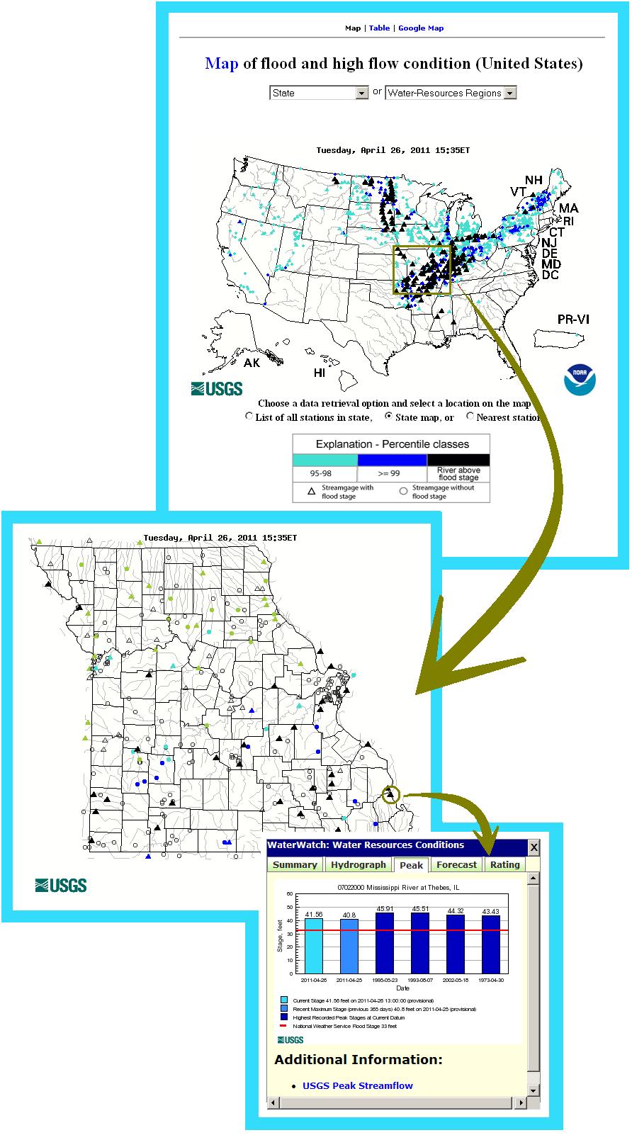
The image below shows an example of a WaterWatch Flood map from April of 2011. Users visiting the WaterWatch Flood site can find local flood information by following three simple steps:
- Click on a State to zoom in to a map of streamgages for that State.
- Click on a triangle representing a streamgage that is currently in flood stage.
- Click the "Peak" tab to see information about how the current flood stage compares to previous floods.
Click anywhere in the image below to go to the WaterWatch Flood site and try it out: