PROVISIONAL DATA SUBJECT TO REVISION
Click to hidestation-specific text
Funding for this site is provided by:
 STATION.--01566000 TUSCARORA CREEK NEAR PORT ROYAL,
PA
STATION.--01566000 TUSCARORA CREEK NEAR PORT ROYAL,
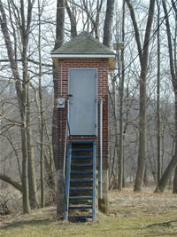
PA LOCATION.--Lat 40`30'55", long 77`25'10", Juniata County, Hydrologic Unit 02050304, at single-span bridge on SR 3008, 2.0 mi southwest of Port Royal, and 3.5 mi upstream from mouth.
DRAINAGE AREA.--214 square miles.
PERIOD OF RECORD.--Water years October 1910 to September 1958, continuous-record; October 1981 to September 1987, low flow partial-record; October 1987 to September 1990 crest-stage partial-record; October 1991 to September 1995, miscellaneous measurements; October 1995 to September 2001, crest-stage partial record and miscellaneous measurements; October 2001 to current year, continuous record.
GAGE.--Water-stage recorder and crest-stage gage. Datum of gage is 420.47 ft above National Geodetic Vertical Datum of 1929.
COOPERATION.--Funding for the operation of this station is provided by the Pennsylvania Department of Environmental Protection.
REMARKS.--Some regulation at low and medium stages from mills upstream.
GAGE HEIGHTS OF IMPORTANCE.-
Supplied by USGS: Data transmitter operational limit - 37.2 ft;
Supplied by NWS: Flood stage-10 ft.
Summary of all available data for this site
Instantaneous-data availability statement

