| schema location: | C:\usgswork\5.0\XML\schema\UsgsHydroML.xsd |
| attribute form default: | |
| element form default: | qualified |
| targetNamespace: | http://water.usgs.gov/XML/NWIS/5.0 |
| Elements |
| HandlingHistory |
| RetrievalPeriod |
| Source |
| UsgsHydroML |
| schema location: | C:\usgswork\5.0\XML\schema\site\Site.xsd |
| attribute form default: | |
| element form default: | qualified |
| targetNamespace: | http://water.usgs.gov/XML/NWIS/5.0 |
| Elements | Complex types |
| Site | SiteType |
| schema location: | C:\usgswork\5.0\XML\schema\sitevisit\FieldEquipment.xsd |
| attribute form default: | |
| element form default: | qualified |
| targetNamespace: | http://water.usgs.gov/XML/NWIS/5.0 |
| Elements |
| FieldEquipment |
| schema location: | C:\usgswork\5.0\XML\schema\sitevisit\EquipmentActivities.xsd |
| attribute form default: | |
| element form default: | qualified |
| targetNamespace: | http://water.usgs.gov/XML/NWIS/5.0 |
| Elements |
| EquipmentActivities |
| schema location: | C:\usgswork\5.0\XML\schema\shared\IEEE754FloatValue.xsd |
| attribute form default: | |
| element form default: | qualified |
| targetNamespace: | http://water.usgs.gov/XML/NWIS/5.0 |
| Elements | Complex types |
| IEEE754FloatValue | IEEE754FloatValueType |
| schema location: | C:\usgswork\5.0\XML\schema\shared\RecordHistory.xsd |
| attribute form default: | |
| element form default: | qualified |
| targetNamespace: | http://water.usgs.gov/XML/NWIS/5.0 |
| Complex types |
| RecordHistoryType |
| schema location: | C:\usgswork\5.0\XML\schema\shared\DateTimeWithDatum.xsd |
| attribute form default: | |
| element form default: | qualified |
| targetNamespace: | http://water.usgs.gov/XML/NWIS/5.0 |
| Complex types |
| DateTimeWithDatum |
| schema location: | C:\usgswork\5.0\XML\schema\shared\DataAgingCode.xsd |
| attribute form default: | |
| element form default: | qualified |
| targetNamespace: | http://water.usgs.gov/XML/NWIS/5.0 |
| Elements |
| DataAgingCode |
| schema location: | C:\usgswork\5.0\XML\schema\shared\string1.xsd |
| attribute form default: | |
| element form default: | qualified |
| targetNamespace: | http://water.usgs.gov/XML/NWIS/5.0 |
| Simple types |
| string1 |
| schema location: | C:\usgswork\5.0\XML\schema\shared\string16.xsd |
| attribute form default: | |
| element form default: | qualified |
| targetNamespace: | http://water.usgs.gov/XML/NWIS/5.0 |
| Simple types |
| string16 |
| schema location: | C:\usgswork\5.0\XML\schema\shared\Equipment.xsd |
| attribute form default: | |
| element form default: | qualified |
| targetNamespace: | http://water.usgs.gov/XML/NWIS/5.0 |
| Complex types |
| Equipment |
| schema location: | C:\usgswork\5.0\XML\schema\site\AbsoluteLocation.xsd |
| attribute form default: | |
| element form default: | qualified |
| targetNamespace: | http://water.usgs.gov/XML/NWIS/5.0 |
| Complex types |
| AbsoluteLocationType |
| schema location: | C:\usgswork\5.0\XML\schema\site\AgencySiteUse.xsd |
| attribute form default: | |
| element form default: | qualified |
| targetNamespace: | http://water.usgs.gov/XML/NWIS/5.0 |
| Complex types |
| AgencySiteUseType |
| schema location: | C:\usgswork\5.0\XML\schema\site\Aquifer.xsd |
| attribute form default: | |
| element form default: | qualified |
| targetNamespace: | http://water.usgs.gov/XML/NWIS/5.0 |
| Complex types |
| AquiferType |
| schema location: | C:\usgswork\5.0\XML\schema\site\Basin.xsd |
| attribute form default: | |
| element form default: | qualified |
| targetNamespace: | http://water.usgs.gov/XML/NWIS/5.0 |
| Complex types |
| BasinType |
| schema location: | C:\usgswork\5.0\XML\schema\site\BasinDrainageArea.xsd |
| attribute form default: | |
| element form default: | qualified |
| targetNamespace: | http://water.usgs.gov/XML/NWIS/5.0 |
| Complex types |
| BasinDrainageAreaType |
| schema location: | C:\usgswork\5.0\XML\schema\site\Country.xsd |
| attribute form default: | |
| element form default: | qualified |
| targetNamespace: | http://water.usgs.gov/XML/NWIS/5.0 |
| Complex types |
| CountryType |
| schema location: | C:\usgswork\5.0\XML\schema\site\County.xsd |
| attribute form default: | |
| element form default: | qualified |
| targetNamespace: | http://water.usgs.gov/XML/NWIS/5.0 |
| Complex types |
| CountyType |
| schema location: | C:\usgswork\5.0\XML\schema\site\DataType.xsd |
| attribute form default: | |
| element form default: | qualified |
| targetNamespace: | http://water.usgs.gov/XML/NWIS/5.0 |
| Complex types |
| DataTypeType |
| schema location: | C:\usgswork\5.0\XML\schema\site\HydrologicUnit.xsd |
| attribute form default: | |
| element form default: | qualified |
| targetNamespace: | http://water.usgs.gov/XML/NWIS/5.0 |
| Complex types |
| HydrologicUnitType |
| schema location: | C:\usgswork\5.0\XML\schema\site\Instrument.xsd |
| attribute form default: | |
| element form default: | qualified |
| targetNamespace: | http://water.usgs.gov/XML/NWIS/5.0 |
| Complex types |
| InstrumentType |
| schema location: | C:\usgswork\5.0\XML\schema\site\Map.xsd |
| attribute form default: | |
| element form default: | qualified |
| targetNamespace: | http://water.usgs.gov/XML/NWIS/5.0 |
| Complex types |
| MapType |
| schema location: | C:\usgswork\5.0\XML\schema\site\NationalAquifer.xsd |
| attribute form default: | |
| element form default: | qualified |
| targetNamespace: | http://water.usgs.gov/XML/NWIS/5.0 |
| Complex types |
| NationalAquiferType |
| schema location: | C:\usgswork\5.0\XML\schema\site\NationalWaterUse.xsd |
| attribute form default: | |
| element form default: | qualified |
| targetNamespace: | http://water.usgs.gov/XML/NWIS/5.0 |
| Complex types |
| NationalWaterUseType |
| schema location: | C:\usgswork\5.0\XML\schema\site\PLSSArea.xsd |
| attribute form default: | |
| element form default: | qualified |
| targetNamespace: | http://water.usgs.gov/XML/NWIS/5.0 |
| Complex types |
| PLSSAreaType |
| schema location: | C:\usgswork\5.0\XML\schema\shared\PartialDate.xsd |
| attribute form default: | |
| element form default: | qualified |
| targetNamespace: | http://water.usgs.gov/XML/NWIS/5.0 |
| Simple types |
| PartialDateType |
| schema location: | C:\usgswork\5.0\XML\schema\site\PrincipalAdministrativeDivision.xsd |
| attribute form default: | |
| element form default: | qualified |
| targetNamespace: | http://water.usgs.gov/XML/NWIS/5.0 |
| Elements | Complex types |
| PrincipalAdministrativeDivision | PrincipalAdministrativeDivisionType |
| schema location: | C:\usgswork\5.0\XML\schema\site\Reliability.xsd |
| attribute form default: | |
| element form default: | qualified |
| targetNamespace: | http://water.usgs.gov/XML/NWIS/5.0 |
| Complex types |
| ReliabilityType |
| schema location: | C:\usgswork\5.0\XML\schema\site\SiteData.xsd |
| attribute form default: | |
| element form default: | qualified |
| targetNamespace: | http://water.usgs.gov/XML/NWIS/5.0 |
| Complex types |
| SiteDataType |
| schema location: | C:\usgswork\5.0\XML\schema\site\SiteContent.xsd |
| attribute form default: | |
| element form default: | qualified |
| targetNamespace: | http://water.usgs.gov/XML/NWIS/5.0 |
| Complex types |
| SiteContentType |
| schema location: | C:\usgswork\5.0\XML\schema\site\SiteIdentifier.xsd |
| attribute form default: | |
| element form default: | qualified |
| targetNamespace: | http://water.usgs.gov/XML/NWIS/5.0 |
| Elements | Complex types |
| SiteIdentifier | SiteIdentifierType |
| schema location: | C:\usgswork\5.0\XML\schema\site\SiteTimeZone.xsd |
| attribute form default: | |
| element form default: | qualified |
| targetNamespace: | http://water.usgs.gov/XML/NWIS/5.0 |
| Complex types |
| SiteTimeZoneType |
| schema location: | C:\usgswork\5.0\XML\schema\site\SiteType.xsd |
| attribute form default: | |
| element form default: | qualified |
| targetNamespace: | http://water.usgs.gov/XML/NWIS/5.0 |
| Complex types |
| SiteTypeType |
| schema location: | C:\usgswork\5.0\XML\schema\site\SiteUse.xsd |
| attribute form default: | |
| element form default: | qualified |
| targetNamespace: | http://water.usgs.gov/XML/NWIS/5.0 |
| Complex types |
| SiteUseType |
| schema location: | C:\usgswork\5.0\XML\schema\shared\Text.xsd |
| attribute form default: | |
| element form default: | qualified |
| targetNamespace: | http://water.usgs.gov/XML/NWIS/5.0 |
| Complex types |
| TextType |
| schema location: | C:\usgswork\5.0\XML\schema\site\TopographicSetting.xsd |
| attribute form default: | |
| element form default: | qualified |
| targetNamespace: | http://water.usgs.gov/XML/NWIS/5.0 |
| Complex types |
| TopographicSettingType |
| schema location: | C:\usgswork\5.0\XML\schema\site\WSC.xsd |
| attribute form default: | |
| element form default: | qualified |
| targetNamespace: | http://water.usgs.gov/XML/NWIS/5.0 |
| Elements | Complex types |
| WSC | WSCType |
| schema location: | C:\usgswork\5.0\XML\schema\site\WaterUseSiteUse.xsd |
| attribute form default: | |
| element form default: | qualified |
| targetNamespace: | http://water.usgs.gov/XML/NWIS/5.0 |
| Complex types |
| WaterUseSiteUseType |
| schema location: | C:\usgswork\5.0\XML\schema\site\State.xsd |
| attribute form default: | |
| element form default: | qualified |
| targetNamespace: | http://water.usgs.gov/XML/NWIS/5.0 |
| Elements | Complex types |
| State | StateType |
| schema location: | C:\usgswork\5.0\XML\schema\sitevisit\Sensor.xsd |
| attribute form default: | |
| element form default: | qualified |
| targetNamespace: | http://water.usgs.gov/XML/NWIS/5.0 |
| Complex types |
| Sensor |
| schema location: | C:\usgswork\5.0\XML\schema\sitevisit\GeneralVelocitySensor.xsd |
| attribute form default: | |
| element form default: | qualified |
| targetNamespace: | http://water.usgs.gov/XML/NWIS/5.0 |
| Elements |
| GeneralVelocitySensor |
| schema location: | C:\usgswork\5.0\XML\schema\sitevisit\MechanicalVelocitySensor.xsd |
| attribute form default: | |
| element form default: | qualified |
| targetNamespace: | http://water.usgs.gov/XML/NWIS/5.0 |
| Elements |
| MechanicalVelocitySensor |
| schema location: | C:\usgswork\5.0\XML\schema\sitevisit\AcousticDopplerCurrentProfiler.xsd |
| attribute form default: | |
| element form default: | qualified |
| targetNamespace: | http://water.usgs.gov/XML/NWIS/5.0 |
| Elements |
| AcousticDopplerCurrentProfiler |
| schema location: | C:\usgswork\5.0\XML\schema\sitevisit\AcousticDopplerVelocitySensor.xsd |
| attribute form default: | |
| element form default: | qualified |
| targetNamespace: | http://water.usgs.gov/XML/NWIS/5.0 |
| Elements |
| AcousticDopplerVelocitySensor |
| schema location: | C:\usgswork\5.0\XML\schema\sitevisit\Equipment.xsd |
| attribute form default: | |
| element form default: | qualified |
| targetNamespace: | http://water.usgs.gov/XML/NWIS/5.0 |
| Complex types |
| EquipmentType |
| schema location: | C:\usgswork\5.0\XML\schema\sitevisit\MonitorInspection.xsd |
| attribute form default: | |
| element form default: | qualified |
| targetNamespace: | http://water.usgs.gov/XML/NWIS/5.0 |
| Elements |
| MonitorInspection |
| schema location: | C:\usgswork\5.0\XML\schema\shared\Display.xsd |
| attribute form default: | |
| element form default: | qualified |
| targetNamespace: | http://water.usgs.gov/XML/NWIS/5.0 |
| Simple types |
| DisplayType |
| schema location: | C:\usgswork\5.0\XML\schema\shared\DisplayDecimal.xsd |
| attribute form default: | |
| element form default: | qualified |
| targetNamespace: | http://water.usgs.gov/XML/NWIS/5.0 |
| Elements | Simple types |
| DisplayDecimal | DisplayDecimalType |
| schema location: | C:\usgswork\5.0\XML\schema\shared\HexValue.xsd |
| attribute form default: | |
| element form default: | qualified |
| targetNamespace: | http://water.usgs.gov/XML/NWIS/5.0 |
| Simple types |
| HexValueType |
| schema location: | C:\usgswork\5.0\XML\schema\shared\Precision.xsd |
| attribute form default: | |
| element form default: | qualified |
| targetNamespace: | http://water.usgs.gov/XML/NWIS/5.0 |
| Simple types |
| PrecisionType |
| schema location: | C:\usgswork\5.0\XML\schema\shared\EquipmentManufacturerName.xsd |
| attribute form default: | |
| element form default: | qualified |
| targetNamespace: | http://water.usgs.gov/XML/NWIS/5.0 |
| Simple types |
| EquipmentManufacturerName |
| schema location: | C:\usgswork\5.0\XML\schema\shared\EquipmentModelNumber.xsd |
| attribute form default: | |
| element form default: | qualified |
| targetNamespace: | http://water.usgs.gov/XML/NWIS/5.0 |
| Simple types |
| EquipmentModelNumber |
| schema location: | C:\usgswork\5.0\XML\schema\shared\EquipmentSerialNumber.xsd |
| attribute form default: | |
| element form default: | qualified |
| targetNamespace: | http://water.usgs.gov/XML/NWIS/5.0 |
| Simple types |
| EquipmentSerialNumber |
| schema location: | C:\usgswork\5.0\XML\schema\site\Elevation.xsd |
| attribute form default: | |
| element form default: | qualified |
| targetNamespace: | http://water.usgs.gov/XML/NWIS/5.0 |
| Complex types |
| ElevationType |
| schema location: | C:\usgswork\5.0\XML\schema\site\Location.xsd |
| attribute form default: | |
| element form default: | qualified |
| targetNamespace: | http://water.usgs.gov/XML/NWIS/5.0 |
| Complex types |
| LocationType |
| schema location: | C:\usgswork\5.0\XML\schema\site\StandardizedCoordinate.xsd |
| attribute form default: | |
| element form default: | qualified |
| targetNamespace: | http://water.usgs.gov/XML/NWIS/5.0 |
| Complex types |
| StandardizedCoordinateType |
| schema location: | C:\usgswork\5.0\XML\schema\shared\Area.xsd |
| attribute form default: | |
| element form default: | qualified |
| targetNamespace: | http://water.usgs.gov/XML/NWIS/5.0 |
| Complex types |
| AreaType |
| schema location: | C:\usgswork\5.0\XML\schema\ADAPS\TsLocation.xsd |
| attribute form default: | |
| element form default: | qualified |
| targetNamespace: | http://water.usgs.gov/XML/NWIS/5.0 |
| Elements |
| Location |
| schema location: | C:\usgswork\5.0\XML\schema\ADAPS\UnitValueInventory.xsd |
| attribute form default: | |
| element form default: | qualified |
| targetNamespace: | http://water.usgs.gov/XML/NWIS/5.0 |
| Elements |
| UnitValueInventory |
| schema location: | C:\usgswork\5.0\XML\schema\ADAPS\DailyValueInventory.xsd |
| attribute form default: | |
| element form default: | qualified |
| targetNamespace: | http://water.usgs.gov/XML/NWIS/5.0 |
| Elements |
| DailyValueInventory |
| schema location: | C:\usgswork\5.0\XML\schema\sitevisit\LocationSensor.xsd |
| attribute form default: | |
| element form default: | qualified |
| targetNamespace: | http://water.usgs.gov/XML/NWIS/5.0 |
| Complex types |
| LocationSensor |
| schema location: | C:\usgswork\5.0\XML\schema\sitevisit\SiteEquipment.xsd |
| attribute form default: | |
| element form default: | qualified |
| targetNamespace: | http://water.usgs.gov/XML/NWIS/5.0 |
| Elements |
| SiteEquipment |
| schema location: | C:\usgswork\5.0\XML\schema\sitevisit\SiteVisit.xsd |
| attribute form default: | |
| element form default: | qualified |
| targetNamespace: | http://water.usgs.gov/XML/NWIS/5.0 |
| Elements |
| SiteVisit |
| schema location: | C:\usgswork\5.0\XML\schema\sitevisit\SiteVisitDescription.xsd |
| attribute form default: | |
| element form default: | qualified |
| targetNamespace: | http://water.usgs.gov/XML/NWIS/5.0 |
| Elements |
| SiteVisitDescription |
| schema location: | C:\usgswork\5.0\XML\schema\shared\TimeZone.xsd |
| attribute form default: | |
| element form default: | qualified |
| targetNamespace: | http://water.usgs.gov/XML/NWIS/5.0 |
| Complex types |
| TimeZoneType |
| schema location: | C:\usgswork\5.0\XML\schema\site\Organization.xsd |
| attribute form default: | |
| element form default: | qualified |
| targetNamespace: | http://water.usgs.gov/XML/NWIS/5.0 |
| Elements | Complex types |
| Organization | OrganizationType |
| schema location: | C:\usgswork\5.0\XML\schema\sitevisit\SensorType.xsd |
| attribute form default: | |
| element form default: | qualified |
| targetNamespace: | http://water.usgs.gov/XML/NWIS/5.0 |
| Elements |
| SensorType |
| schema location: | C:\usgswork\5.0\XML\schema\shared\HistoryGroup.xsd |
| attribute form default: | |
| element form default: | qualified |
| targetNamespace: | http://water.usgs.gov/XML/NWIS/5.0 |
| Groups |
| HistoryGroup |
| schema location: | C:\usgswork\5.0\XML\schema\sitevisit\MechanicalVelocitySensorInspection.xsd |
| attribute form default: | |
| element form default: | qualified |
| targetNamespace: | http://water.usgs.gov/XML/NWIS/5.0 |
| Complex types |
| MechanicalVelocitySensorInspectionType |
| schema location: | C:\usgswork\5.0\XML\schema\sitevisit\SensorGroup.xsd |
| attribute form default: | |
| element form default: | qualified |
| targetNamespace: | http://water.usgs.gov/XML/NWIS/5.0 |
| Groups |
| SensorGroup |
| schema location: | C:\usgswork\5.0\XML\schema\shared\ReferenceListCodeType.xsd |
| attribute form default: | |
| element form default: | qualified |
| targetNamespace: | http://water.usgs.gov/XML/NWIS/5.0 |
| Complex types |
| ReferenceListCodeType |
| schema location: | C:\usgswork\5.0\XML\schema\sitevisit\EquipmentType.xsd |
| attribute form default: | |
| element form default: | qualified |
| targetNamespace: | http://water.usgs.gov/XML/NWIS/5.0 |
| Elements |
| EquipmentType |
| schema location: | C:\usgswork\5.0\XML\schema\sitevisit\EquipmentSensor.xsd |
| attribute form default: | |
| element form default: | qualified |
| targetNamespace: | http://water.usgs.gov/XML/NWIS/5.0 |
| Complex types |
| EquipmentSensor |
| schema location: | C:\usgswork\5.0\XML\schema\sitevisit\DriftCheckConductance.xsd |
| attribute form default: | |
| element form default: | qualified |
| targetNamespace: | http://water.usgs.gov/XML/NWIS/5.0 |
| Elements |
| DriftCheckConductance |
| schema location: | C:\usgswork\5.0\XML\schema\sitevisit\DriftCheckDissolvedOxygen.xsd |
| attribute form default: | |
| element form default: | qualified |
| targetNamespace: | http://water.usgs.gov/XML/NWIS/5.0 |
| Elements |
| DriftCheckDissolvedOxygen |
| schema location: | C:\usgswork\5.0\XML\schema\sitevisit\DriftCheckPh.xsd |
| attribute form default: | |
| element form default: | qualified |
| targetNamespace: | http://water.usgs.gov/XML/NWIS/5.0 |
| Elements |
| DriftCheckPh |
| schema location: | C:\usgswork\5.0\XML\schema\sitevisit\DriftCheckTurbidity.xsd |
| attribute form default: | |
| element form default: | qualified |
| targetNamespace: | http://water.usgs.gov/XML/NWIS/5.0 |
| Elements |
| DriftCheckTurbidity |
| schema location: | C:\usgswork\5.0\XML\schema\sitevisit\DriftCheckWaterTemperature.xsd |
| attribute form default: | |
| element form default: | qualified |
| targetNamespace: | http://water.usgs.gov/XML/NWIS/5.0 |
| Elements |
| DriftCheckWaterTemperature |
| schema location: | C:\usgswork\5.0\XML\schema\sitevisit\MonitorCheckReadingSet.xsd |
| attribute form default: | |
| element form default: | qualified |
| targetNamespace: | http://water.usgs.gov/XML/NWIS/5.0 |
| Elements |
| MonitorCheckReadingSet |
| schema location: | C:\usgswork\5.0\XML\schema\shared\SexagesimalCoordinate.xsd |
| attribute form default: | |
| element form default: | qualified |
| targetNamespace: | http://water.usgs.gov/XML/NWIS/5.0 |
| Complex types | Simple types |
| SexagesimalLatitudeType | LatitudeDegreesType |
| SexagesimalLongitudeType | LongitudeDegreesType |
| MinutesType |
| schema location: | C:\usgswork\5.0\XML\schema\ADAPS\DataDescriptor.xsd |
| attribute form default: | |
| element form default: | qualified |
| targetNamespace: | http://water.usgs.gov/XML/NWIS/5.0 |
| Elements |
| DataDescriptor |
| schema location: | C:\usgswork\5.0\XML\schema\ADAPS\UnitValuesTransportCode.xsd |
| attribute form default: | |
| element form default: | qualified |
| targetNamespace: | http://water.usgs.gov/XML/NWIS/5.0 |
| Complex types | Simple types |
| UnitValuesTransportCode | TransportCodeContents |
| schema location: | C:\usgswork\5.0\XML\schema\shared\StatisticCode.xsd |
| attribute form default: | |
| element form default: | qualified |
| targetNamespace: | http://water.usgs.gov/XML/NWIS/5.0 |
| Elements |
| StatisticCode |
| schema location: | C:\usgswork\5.0\XML\schema\sitevisit\GageMeasurementPoint.xsd |
| attribute form default: | |
| element form default: | qualified |
| targetNamespace: | http://water.usgs.gov/XML/NWIS/5.0 |
| Elements |
| GageMeasurementPoint |
| schema location: | C:\usgswork\5.0\XML\schema\sitevisit\DischargeMeasurement.xsd |
| attribute form default: | |
| element form default: | qualified |
| targetNamespace: | http://water.usgs.gov/XML/NWIS/5.0 |
| Elements |
| DischargeMeasurement |
| schema location: | C:\usgswork\5.0\XML\schema\sitevisit\EnvironmentalMeasurementList.xsd |
| attribute form default: | |
| element form default: | qualified |
| targetNamespace: | http://water.usgs.gov/XML/NWIS/5.0 |
| Elements |
| EnvironmentalMeasurementList |
| schema location: | C:\usgswork\5.0\XML\schema\sitevisit\HighWaterMarkObservation.xsd |
| attribute form default: | |
| element form default: | qualified |
| targetNamespace: | http://water.usgs.gov/XML/NWIS/5.0 |
| Elements |
| HighWaterMarkObservation |
| schema location: | C:\usgswork\5.0\XML\schema\sitevisit\StreamFlowControlInspection.xsd |
| attribute form default: | |
| element form default: | qualified |
| targetNamespace: | http://water.usgs.gov/XML/NWIS/5.0 |
| Elements |
| StreamFlowControlInspection |
| schema location: | C:\usgswork\5.0\XML\schema\sitevisit\StreamZeroFlowInspection.xsd |
| attribute form default: | |
| element form default: | qualified |
| targetNamespace: | http://water.usgs.gov/XML/NWIS/5.0 |
| Elements |
| StreamZeroFlowInspection |
| schema location: | C:\usgswork\5.0\XML\schema\sitevisit\StillingWellInspection.xsd |
| attribute form default: | |
| element form default: | qualified |
| targetNamespace: | http://water.usgs.gov/XML/NWIS/5.0 |
| Elements |
| StillingWellInspection |
| schema location: | C:\usgswork\5.0\XML\schema\sitevisit\SensorInspection.xsd |
| attribute form default: | |
| element form default: | qualified |
| targetNamespace: | http://water.usgs.gov/XML/NWIS/5.0 |
| Elements |
| SensorInspection |
| schema location: | C:\usgswork\5.0\XML\schema\sitevisit\CrossSectionSurvey.xsd |
| attribute form default: | |
| element form default: | qualified |
| targetNamespace: | http://water.usgs.gov/XML/NWIS/5.0 |
| Elements |
| CrossSectionSurvey |
| schema location: | C:\usgswork\5.0\XML\schema\shared\DateTimeWithDatumPartial.xsd |
| attribute form default: | |
| element form default: | qualified |
| targetNamespace: | http://water.usgs.gov/XML/NWIS/5.0 |
| Complex types |
| DateTimeWithDatumPartial |
| schema location: | C:\usgswork\5.0\XML\schema\sitevisit\DischargeMeasurementDescription.xsd |
| attribute form default: | |
| element form default: | qualified |
| targetNamespace: | http://water.usgs.gov/XML/NWIS/5.0 |
| Elements |
| DischargeMeasurementDescription |
| schema location: | C:\usgswork\5.0\XML\schema\site\Address.xsd |
| attribute form default: | |
| element form default: | qualified |
| targetNamespace: | http://water.usgs.gov/XML/NWIS/5.0 |
| Complex types |
| AddressType |
| schema location: | C:\usgswork\5.0\XML\schema\shared\TimeDuration.xsd |
| attribute form default: | |
| element form default: | qualified |
| targetNamespace: | http://water.usgs.gov/XML/NWIS/5.0 |
| Elements | Simple types |
| TimeDuration | TimeDurationType |
| schema location: | C:\usgswork\5.0\XML\schema\sitevisit\DriftCheckDissolvedOxygenReading.xsd |
| attribute form default: | |
| element form default: | qualified |
| targetNamespace: | http://water.usgs.gov/XML/NWIS/5.0 |
| Elements |
| DriftCheckDissolvedOxygenReading |
| schema location: | C:\usgswork\5.0\XML\schema\sitevisit\DriftCheckConductanceReading.xsd |
| attribute form default: | |
| element form default: | qualified |
| targetNamespace: | http://water.usgs.gov/XML/NWIS/5.0 |
| Elements |
| DriftCheckConductanceReading |
| schema location: | C:\usgswork\5.0\XML\schema\sitevisit\DriftCheckPhReading.xsd |
| attribute form default: | |
| element form default: | qualified |
| targetNamespace: | http://water.usgs.gov/XML/NWIS/5.0 |
| Elements |
| DriftCheckPhReading |
| schema location: | C:\usgswork\5.0\XML\schema\sitevisit\DriftCheckTurbidityReading.xsd |
| attribute form default: | |
| element form default: | qualified |
| targetNamespace: | http://water.usgs.gov/XML/NWIS/5.0 |
| Elements |
| DriftCheckTurbidityReading |
| schema location: | C:\usgswork\5.0\XML\schema\shared\IEEE754UncertaintyFloatValue.xsd |
| attribute form default: | |
| element form default: | qualified |
| targetNamespace: | http://water.usgs.gov/XML/NWIS/5.0 |
| Complex types |
| IEEE754UncertaintyFloatValueType |
| schema location: | C:\usgswork\5.0\XML\schema\sitevisit\MonitorCheckReading.xsd |
| attribute form default: | |
| element form default: | qualified |
| targetNamespace: | http://water.usgs.gov/XML/NWIS/5.0 |
| Elements |
| MonitorCheckReading |
| schema location: | C:\usgswork\5.0\XML\schema\ADAPS\TimeSeriesComputation.xsd |
| attribute form default: | |
| element form default: | qualified |
| targetNamespace: | http://water.usgs.gov/XML/NWIS/5.0 |
| schema location: | C:\usgswork\5.0\XML\schema\ADAPS\Rating.xsd |
| attribute form default: | |
| element form default: | qualified |
| targetNamespace: | http://water.usgs.gov/XML/NWIS/5.0 |
| Elements |
| Rating |
| schema location: | C:\usgswork\5.0\XML\schema\ADAPS\UnitValues.xsd |
| attribute form default: | |
| element form default: | qualified |
| targetNamespace: | http://water.usgs.gov/XML/NWIS/5.0 |
| Elements |
| UnitValues |
| schema location: | C:\usgswork\5.0\XML\schema\ADAPS\DailyValues.xsd |
| attribute form default: | |
| element form default: | qualified |
| targetNamespace: | http://water.usgs.gov/XML/NWIS/5.0 |
| Elements |
| DailyValues |
| schema location: | C:\usgswork\5.0\XML\schema\ADAPS\DataAging.xsd |
| attribute form default: | |
| element form default: | qualified |
| targetNamespace: | http://water.usgs.gov/XML/NWIS/5.0 |
| Elements |
| DataAging |
| schema location: | C:\usgswork\5.0\XML\schema\ADAPS\DataCorrection.xsd |
| attribute form default: | |
| element form default: | qualified |
| targetNamespace: | http://water.usgs.gov/XML/NWIS/5.0 |
| Elements |
| DataCorrection |
| schema location: | C:\usgswork\5.0\XML\schema\ADAPS\StatisticalSummary.xsd |
| attribute form default: | |
| element form default: | qualified |
| targetNamespace: | http://water.usgs.gov/XML/NWIS/5.0 |
| Elements |
| StatisticalSummary |
| schema location: | C:\usgswork\5.0\XML\schema\sitevisit\Channel.xsd |
| attribute form default: | |
| element form default: | qualified |
| targetNamespace: | http://water.usgs.gov/XML/NWIS/5.0 |
| Elements |
| Channel |
| schema location: | C:\usgswork\5.0\XML\schema\sitevisit\MidSectionDischargeMeasurement.xsd |
| attribute form default: | |
| element form default: | qualified |
| targetNamespace: | http://water.usgs.gov/XML/NWIS/5.0 |
| Elements |
| MidSectionDischargeMeasurement |
| schema location: | C:\usgswork\5.0\XML\schema\sitevisit\VolumetricDischargeMeasurement.xsd |
| attribute form default: | |
| element form default: | qualified |
| targetNamespace: | http://water.usgs.gov/XML/NWIS/5.0 |
| Elements |
| VolumetricDischargeMeasurement |
| schema location: | C:\usgswork\5.0\XML\schema\sitevisit\FlumeDischargeMeasurement.xsd |
| attribute form default: | |
| element form default: | qualified |
| targetNamespace: | http://water.usgs.gov/XML/NWIS/5.0 |
| Elements |
| FlumeDischargeMeasurement |
| schema location: | C:\usgswork\5.0\XML\schema\sitevisit\AdcpDischargeMeasurement.xsd |
| attribute form default: | |
| element form default: | qualified |
| targetNamespace: | http://water.usgs.gov/XML/NWIS/5.0 |
| Elements |
| AdcpDischargeMeasurement |
| schema location: | C:\usgswork\5.0\XML\schema\sitevisit\DischargeMeasurementShiftAnalysis.xsd |
| attribute form default: | |
| element form default: | qualified |
| targetNamespace: | http://water.usgs.gov/XML/NWIS/5.0 |
| Elements |
| ShiftAnalysis |
| schema location: | C:\usgswork\5.0\XML\schema\sitevisit\EnvironmentalMeasurement.xsd |
| attribute form default: | |
| element form default: | qualified |
| targetNamespace: | http://water.usgs.gov/XML/NWIS/5.0 |
| Elements |
| EnvironmentalMeasurement |
| schema location: | C:\usgswork\5.0\XML\schema\sitevisit\BubbleGageInspection.xsd |
| attribute form default: | |
| element form default: | qualified |
| targetNamespace: | http://water.usgs.gov/XML/NWIS/5.0 |
| Elements |
| BubbleGageInspection |
| schema location: | C:\usgswork\5.0\XML\schema\sitevisit\CrestStageGageInspection.xsd |
| attribute form default: | |
| element form default: | qualified |
| targetNamespace: | http://water.usgs.gov/XML/NWIS/5.0 |
| Elements |
| CrestStageGageInspection |
| schema location: | C:\usgswork\5.0\XML\schema\sitevisit\WireWeightGageInspection.xsd |
| attribute form default: | |
| element form default: | qualified |
| targetNamespace: | http://water.usgs.gov/XML/NWIS/5.0 |
| Elements |
| WireWeightGageInspection |
| schema location: | C:\usgswork\5.0\XML\schema\sitevisit\MaximumMinimumGageInspection.xsd |
| attribute form default: | |
| element form default: | qualified |
| targetNamespace: | http://water.usgs.gov/XML/NWIS/5.0 |
| Elements |
| MaximumMinimumGageInspection |
| schema location: | C:\usgswork\5.0\XML\schema\sitevisit\SensorReading.xsd |
| attribute form default: | |
| element form default: | qualified |
| targetNamespace: | http://water.usgs.gov/XML/NWIS/5.0 |
| Elements |
| SensorReading |
| schema location: | C:\usgswork\5.0\XML\schema\sitevisit\CrossSectionStation.xsd |
| attribute form default: | |
| element form default: | qualified |
| targetNamespace: | http://water.usgs.gov/XML/NWIS/5.0 |
| Complex types |
| CrossSectionStationType |
| schema location: | C:\usgswork\5.0\XML\schema\ADAPS\Shift.xsd |
| attribute form default: | |
| element form default: | qualified |
| targetNamespace: | http://water.usgs.gov/XML/NWIS/5.0 |
| Elements |
| Shift |
| schema location: | C:\usgswork\5.0\XML\schema\ADAPS\RatingDate.xsd |
| attribute form default: | |
| element form default: | qualified |
| targetNamespace: | http://water.usgs.gov/XML/NWIS/5.0 |
| Elements |
| RatingDate |
| schema location: | C:\usgswork\5.0\XML\schema\shared\curve\LinearCurve.xsd |
| attribute form default: | |
| element form default: | qualified |
| targetNamespace: | http://water.usgs.gov/XML/NWIS/5.0 |
| Elements |
| LinearCurve |
| schema location: | C:\usgswork\5.0\XML\schema\shared\curve\LogCurve.xsd |
| attribute form default: | |
| element form default: | qualified |
| targetNamespace: | http://water.usgs.gov/XML/NWIS/5.0 |
| Elements |
| LogCurve |
| schema location: | C:\usgswork\5.0\XML\schema\shared\curve\StandardEquationCurve.xsd |
| attribute form default: | |
| element form default: | qualified |
| targetNamespace: | http://water.usgs.gov/XML/NWIS/5.0 |
| Elements |
| StandardEquationCurve |
| schema location: | C:\usgswork\5.0\XML\schema\ADAPS\UnitValue.xsd |
| attribute form default: | |
| element form default: | qualified |
| targetNamespace: | http://water.usgs.gov/XML/NWIS/5.0 |
| Elements |
| UnitValue |
| schema location: | C:\usgswork\5.0\XML\schema\ADAPS\UnitValuesStreamGroup.xsd |
| attribute form default: | |
| element form default: | qualified |
| targetNamespace: | http://water.usgs.gov/XML/NWIS/5.0 |
| Groups |
| UnitValuesStreamGroup |
| schema location: | C:\usgswork\5.0\XML\schema\ADAPS\UnitValuesRemarks.xsd |
| attribute form default: | |
| element form default: | qualified |
| targetNamespace: | http://water.usgs.gov/XML/NWIS/5.0 |
| Complex types |
| UnitValuesRemarks |
| schema location: | C:\usgswork\5.0\XML\schema\shared\WaterYear.xsd |
| attribute form default: | |
| element form default: | qualified |
| targetNamespace: | http://water.usgs.gov/XML/NWIS/5.0 |
| Elements |
| WaterYear |
| schema location: | C:\usgswork\5.0\XML\schema\ADAPS\DailyValue.xsd |
| attribute form default: | |
| element form default: | qualified |
| targetNamespace: | http://water.usgs.gov/XML/NWIS/5.0 |
| Elements |
| DailyValue |
| schema location: | C:\usgswork\5.0\XML\schema\ADAPS\DailyValuesStream.xsd |
| attribute form default: | |
| element form default: | qualified |
| targetNamespace: | http://water.usgs.gov/XML/NWIS/5.0 |
| Elements |
| DailyValuesStream |
| schema location: | C:\usgswork\5.0\XML\schema\ADAPS\DailyValuesRemarks.xsd |
| attribute form default: | |
| element form default: | qualified |
| targetNamespace: | http://water.usgs.gov/XML/NWIS/5.0 |
| Complex types |
| DailyValuesRemarks |
| schema location: | C:\usgswork\5.0\XML\schema\ADAPS\DailyValueStatistics.xsd |
| attribute form default: | |
| element form default: | qualified |
| targetNamespace: | http://water.usgs.gov/XML/NWIS/5.0 |
| schema location: | C:\usgswork\5.0\XML\schema\ADAPS\encoding.xsd |
| attribute form default: | |
| element form default: | qualified |
| targetNamespace: | http://water.usgs.gov/XML/NWIS/5.0 |
| Attributes |
| encoding |
| schema location: | C:\usgswork\5.0\XML\schema\ADAPS\DataAgingPeriod.xsd |
| attribute form default: | |
| element form default: | qualified |
| targetNamespace: | http://water.usgs.gov/XML/NWIS/5.0 |
| Elements |
| DataAgingPeriod |
| schema location: | C:\usgswork\5.0\XML\schema\ADAPS\DataAgingHistory.xsd |
| attribute form default: | |
| element form default: | qualified |
| targetNamespace: | http://water.usgs.gov/XML/NWIS/5.0 |
| Elements |
| DataAgingHistory |
| schema location: | C:\usgswork\5.0\XML\schema\ADAPS\StatisticalSummaryMonthly.xsd |
| attribute form default: | |
| element form default: | qualified |
| targetNamespace: | http://water.usgs.gov/XML/NWIS/5.0 |
| Elements |
| StatisticalSummaryMonthly |
| schema location: | C:\usgswork\5.0\XML\schema\ADAPS\StatisticalSummaryAnnual.xsd |
| attribute form default: | |
| element form default: | qualified |
| targetNamespace: | http://water.usgs.gov/XML/NWIS/5.0 |
| Elements |
| StatisticalSummaryAnnual |
| schema location: | C:\usgswork\5.0\XML\schema\ADAPS\StatisticalSummaryPeriod.xsd |
| attribute form default: | |
| element form default: | qualified |
| targetNamespace: | http://water.usgs.gov/XML/NWIS/5.0 |
| Elements |
| StatisticalSummaryPeriod |
| schema location: | C:\usgswork\5.0\XML\schema\sitevisit\MidSectionStation.xsd |
| attribute form default: | |
| element form default: | qualified |
| targetNamespace: | http://water.usgs.gov/XML/NWIS/5.0 |
| Elements |
| MidSectionStation |
| schema location: | C:\usgswork\5.0\XML\schema\sitevisit\VolumetricReading.xsd |
| attribute form default: | |
| element form default: | qualified |
| targetNamespace: | http://water.usgs.gov/XML/NWIS/5.0 |
| Elements |
| VolumetricReading |
| schema location: | C:\usgswork\5.0\XML\schema\sitevisit\FlumeHeadMeasurement.xsd |
| attribute form default: | |
| element form default: | qualified |
| targetNamespace: | http://water.usgs.gov/XML/NWIS/5.0 |
| Elements |
| FlumeHeadMeasurement |
| schema location: | C:\usgswork\5.0\XML\schema\sitevisit\AdcpTransect.xsd |
| attribute form default: | |
| element form default: | qualified |
| targetNamespace: | http://water.usgs.gov/XML/NWIS/5.0 |
| Elements |
| AdcpTransect |
| schema location: | C:\usgswork\5.0\XML\schema\sitevisit\CrestStageGageReading.xsd |
| attribute form default: | |
| element form default: | qualified |
| targetNamespace: | http://water.usgs.gov/XML/NWIS/5.0 |
| Elements |
| CrestStageGageReading |
| schema location: | C:\usgswork\5.0\XML\schema\sitevisit\CrossSectionStationReading.xsd |
| attribute form default: | |
| element form default: | qualified |
| targetNamespace: | http://water.usgs.gov/XML/NWIS/5.0 |
| Complex types |
| CrossSectionStationReadingType |
| schema location: | C:\usgswork\5.0\XML\schema\shared\curve\ExpandCode.xsd |
| attribute form default: | |
| element form default: | qualified |
| targetNamespace: | http://water.usgs.gov/XML/NWIS/5.0 |
| Elements |
| ExpandCode |
| schema location: | C:\usgswork\5.0\XML\schema\shared\curve\PointPair.xsd |
| attribute form default: | |
| element form default: | qualified |
| targetNamespace: | http://water.usgs.gov/XML/NWIS/5.0 |
| Elements |
| PointPair |
| schema location: | C:\usgswork\5.0\XML\schema\shared\curve\Offset.xsd |
| attribute form default: | |
| element form default: | qualified |
| targetNamespace: | http://water.usgs.gov/XML/NWIS/5.0 |
| Elements |
| Offset |
| schema location: | C:\usgswork\5.0\XML\schema\ADAPS\StreamDefinition.xsd |
| attribute form default: | |
| element form default: | qualified |
| targetNamespace: | http://water.usgs.gov/XML/NWIS/5.0 |
| Elements |
| StreamDefinition |
| schema location: | C:\usgswork\5.0\XML\schema\ADAPS\DailyValueCode.xsd |
| attribute form default: | |
| element form default: | qualified |
| targetNamespace: | http://water.usgs.gov/XML/NWIS/5.0 |
| Elements |
| DailyValueCode |
| schema location: | C:\usgswork\5.0\XML\schema\sitevisit\MidSectionVelocityObservation.xsd |
| attribute form default: | |
| element form default: | qualified |
| targetNamespace: | http://water.usgs.gov/XML/NWIS/5.0 |
| Elements |
| MidSectionVelocityObservation |
| schema location: | C:\usgswork\5.0\XML\schema\sitevisit\AdcpTransectAttribute.xsd |
| attribute form default: | |
| element form default: | qualified |
| targetNamespace: | http://water.usgs.gov/XML/NWIS/5.0 |
| Elements |
| AdcpTransectAttribute |
element HandlingHistory
| diagram | 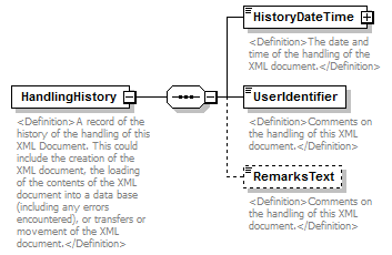 |
||
| namespace | http://water.usgs.gov/XML/NWIS/5.0 | ||
| properties |
|
||
| children | HistoryDateTime UserIdentifier RemarksText | ||
| used by |
|
||
| annotation |
|
||
| source | <xsd:element name="HandlingHistory"> <xsd:annotation> <xsd:documentation> <Definition>A record of the history of the handling of this XML Document. This could include the creation of the XML document, the loading of the contents of the XML document into a data base (including any errors encountered), or transfers or movement of the XML document.</Definition> </xsd:documentation> </xsd:annotation> <xsd:complexType> <xsd:sequence> <xsd:element name="HistoryDateTime" type="DateTimeWithDatum"> <xsd:annotation> <xsd:documentation> <Definition>The date and time of the handling of the XML document.</Definition> </xsd:documentation> </xsd:annotation> </xsd:element> <xsd:element name="UserIdentifier" type="xsd:string"> <xsd:annotation> <xsd:documentation> <Definition>Comments on the handling of this XML document.</Definition> </xsd:documentation> </xsd:annotation> </xsd:element> <xsd:element name="RemarksText" type="xsd:string" minOccurs="0"> <xsd:annotation> <xsd:documentation> <Definition>Comments on the handling of this XML document.</Definition> </xsd:documentation> </xsd:annotation> </xsd:element> </xsd:sequence> </xsd:complexType> </xsd:element> |
element HandlingHistory/HistoryDateTime
| diagram | 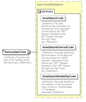 |
||||||||||||||||||||||||||||||
| namespace | http://water.usgs.gov/XML/NWIS/5.0 | ||||||||||||||||||||||||||||||
| type | DateTimeWithDatum | ||||||||||||||||||||||||||||||
| properties |
|
||||||||||||||||||||||||||||||
| attributes |
|
||||||||||||||||||||||||||||||
| annotation |
|
||||||||||||||||||||||||||||||
| source | <xsd:element name="HistoryDateTime" type="DateTimeWithDatum"> <xsd:annotation> <xsd:documentation> <Definition>The date and time of the handling of the XML document.</Definition> </xsd:documentation> </xsd:annotation> </xsd:element> |
element HandlingHistory/UserIdentifier
| diagram | 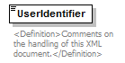 |
||||
| namespace | http://water.usgs.gov/XML/NWIS/5.0 | ||||
| type | xsd:string | ||||
| properties |
|
||||
| annotation |
|
||||
| source | <xsd:element name="UserIdentifier" type="xsd:string"> <xsd:annotation> <xsd:documentation> <Definition>Comments on the handling of this XML document.</Definition> </xsd:documentation> </xsd:annotation> </xsd:element> |
element HandlingHistory/RemarksText
| diagram | 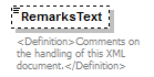 |
||||||||
| namespace | http://water.usgs.gov/XML/NWIS/5.0 | ||||||||
| type | xsd:string | ||||||||
| properties |
|
||||||||
| annotation |
|
||||||||
| source | <xsd:element name="RemarksText" type="xsd:string" minOccurs="0"> <xsd:annotation> <xsd:documentation> <Definition>Comments on the handling of this XML document.</Definition> </xsd:documentation> </xsd:annotation> </xsd:element> |
element RetrievalPeriod
| diagram | 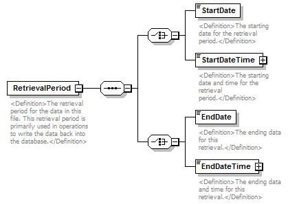 |
||
| namespace | http://water.usgs.gov/XML/NWIS/5.0 | ||
| properties |
|
||
| children | StartDate StartDateTime EndDate EndDateTime | ||
| used by |
|
||
| annotation |
|
||
| source | <xsd:element name="RetrievalPeriod"> <xsd:annotation> <xsd:documentation> <Definition>The retrieval period for the data in this file. This retrieval period is primarily used in operations to write the data back into the database.</Definition> </xsd:documentation> </xsd:annotation> <xsd:complexType> <xsd:sequence> <xsd:choice> <xsd:element name="StartDate" type="xsd:date"> <xsd:annotation> <xsd:documentation> <Definition>The starting date for the retrieval period.</Definition> </xsd:documentation> </xsd:annotation> </xsd:element> <xsd:element name="StartDateTime" type="DateTimeWithDatum"> <xsd:annotation> <xsd:documentation> <Definition>The starting date and time for the retrieval period.</Definition> </xsd:documentation> </xsd:annotation> </xsd:element> </xsd:choice> <xsd:choice> <xsd:element name="EndDate" type="xsd:date"> <xsd:annotation> <xsd:documentation> <Definition>The ending data for this retrieval.</Definition> </xsd:documentation> </xsd:annotation> </xsd:element> <xsd:element name="EndDateTime" type="DateTimeWithDatum"> <xsd:annotation> <xsd:documentation> <Definition>The ending data and time for this retrieval.</Definition> </xsd:documentation> </xsd:annotation> </xsd:element> </xsd:choice> </xsd:sequence> </xsd:complexType> </xsd:element> |
element RetrievalPeriod/StartDate
| diagram | 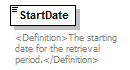 |
||||
| namespace | http://water.usgs.gov/XML/NWIS/5.0 | ||||
| type | xsd:date | ||||
| properties |
|
||||
| annotation |
|
||||
| source | <xsd:element name="StartDate" type="xsd:date"> <xsd:annotation> <xsd:documentation> <Definition>The starting date for the retrieval period.</Definition> </xsd:documentation> </xsd:annotation> </xsd:element> |
element RetrievalPeriod/StartDateTime
| diagram | 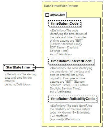 |
||||||||||||||||||||||||||||||
| namespace | http://water.usgs.gov/XML/NWIS/5.0 | ||||||||||||||||||||||||||||||
| type | DateTimeWithDatum | ||||||||||||||||||||||||||||||
| properties |
|
||||||||||||||||||||||||||||||
| attributes |
|
||||||||||||||||||||||||||||||
| annotation |
|
||||||||||||||||||||||||||||||
| source | <xsd:element name="StartDateTime" type="DateTimeWithDatum"> <xsd:annotation> <xsd:documentation> <Definition>The starting date and time for the retrieval period.</Definition> </xsd:documentation> </xsd:annotation> </xsd:element> |
element RetrievalPeriod/EndDate
| diagram | 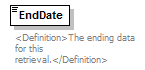 |
||||
| namespace | http://water.usgs.gov/XML/NWIS/5.0 | ||||
| type | xsd:date | ||||
| properties |
|
||||
| annotation |
|
||||
| source | <xsd:element name="EndDate" type="xsd:date"> <xsd:annotation> <xsd:documentation> <Definition>The ending data for this retrieval.</Definition> </xsd:documentation> </xsd:annotation> </xsd:element> |
element RetrievalPeriod/EndDateTime
| diagram |  |
||||||||||||||||||||||||||||||
| namespace | http://water.usgs.gov/XML/NWIS/5.0 | ||||||||||||||||||||||||||||||
| type | DateTimeWithDatum | ||||||||||||||||||||||||||||||
| properties |
|
||||||||||||||||||||||||||||||
| attributes |
|
||||||||||||||||||||||||||||||
| annotation |
|
||||||||||||||||||||||||||||||
| source | <xsd:element name="EndDateTime" type="DateTimeWithDatum"> <xsd:annotation> <xsd:documentation> <Definition>The ending data and time for this retrieval.</Definition> </xsd:documentation> </xsd:annotation> </xsd:element> |
element Source
| diagram | 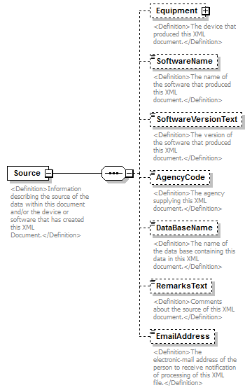 |
||
| namespace | http://water.usgs.gov/XML/NWIS/5.0 | ||
| properties |
|
||
| children | Equipment SoftwareName SoftwareVersionText AgencyCode DataBaseName RemarksText EmailAddress | ||
| used by |
|
||
| annotation |
|
||
| source | <xsd:element name="Source"> <xsd:annotation> <xsd:documentation> <Definition>Information describing the source of the data within this document and/or the device or software that has created this XML Document.</Definition> </xsd:documentation> </xsd:annotation> <xsd:complexType> <xsd:sequence> <xsd:element name="Equipment" type="Equipment" minOccurs="0"> <xsd:annotation> <xsd:documentation> <Definition>The device that produced this XML document.</Definition> </xsd:documentation> </xsd:annotation> </xsd:element> <xsd:element name="SoftwareName" type="xsd:string" minOccurs="0"> <xsd:annotation> <xsd:documentation> <Definition>The name of the software that produced this XML document.</Definition> </xsd:documentation> </xsd:annotation> </xsd:element> <xsd:element name="SoftwareVersionText" type="xsd:string" minOccurs="0"> <xsd:annotation> <xsd:documentation> <Definition>The version of the software that produced this XML document.</Definition> </xsd:documentation> </xsd:annotation> </xsd:element> <xsd:element name="AgencyCode" type="xsd:string" minOccurs="0"> <xsd:annotation> <xsd:documentation> <Definition>The agency supplying this XML document.</Definition> </xsd:documentation> </xsd:annotation> </xsd:element> <xsd:element name="DataBaseName" type="xsd:string" minOccurs="0"> <xsd:annotation> <xsd:documentation> <Definition>The name of the data base containing this data in this XML document.</Definition> </xsd:documentation> </xsd:annotation> </xsd:element> <xsd:element name="RemarksText" type="xsd:string" minOccurs="0"> <xsd:annotation> <xsd:documentation> <Definition>Comments about the source of this XML document.</Definition> </xsd:documentation> </xsd:annotation> </xsd:element> <xsd:element name="EmailAddress" type="xsd:string" minOccurs="0"> <xsd:annotation> <xsd:documentation> <Definition>The electronic-mail address of the person to receive notification of processing of this XML file.</Definition> </xsd:documentation> </xsd:annotation> </xsd:element> </xsd:sequence> </xsd:complexType> </xsd:element> |
element Source/Equipment
| diagram | 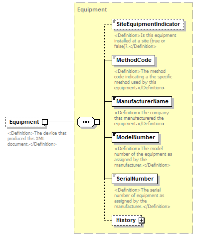 |
||||||||
| namespace | http://water.usgs.gov/XML/NWIS/5.0 | ||||||||
| type | Equipment | ||||||||
| properties |
|
||||||||
| children | SiteEquipmentIndicator MethodCode ManufacturerName ModelNumber SerialNumber History | ||||||||
| annotation |
|
||||||||
| source | <xsd:element name="Equipment" type="Equipment" minOccurs="0"> <xsd:annotation> <xsd:documentation> <Definition>The device that produced this XML document.</Definition> </xsd:documentation> </xsd:annotation> </xsd:element> |
element Source/SoftwareName
| diagram | 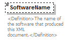 |
||||||||
| namespace | http://water.usgs.gov/XML/NWIS/5.0 | ||||||||
| type | xsd:string | ||||||||
| properties |
|
||||||||
| annotation |
|
||||||||
| source | <xsd:element name="SoftwareName" type="xsd:string" minOccurs="0"> <xsd:annotation> <xsd:documentation> <Definition>The name of the software that produced this XML document.</Definition> </xsd:documentation> </xsd:annotation> </xsd:element> |
element Source/SoftwareVersionText
| diagram | 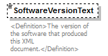 |
||||||||
| namespace | http://water.usgs.gov/XML/NWIS/5.0 | ||||||||
| type | xsd:string | ||||||||
| properties |
|
||||||||
| annotation |
|
||||||||
| source | <xsd:element name="SoftwareVersionText" type="xsd:string" minOccurs="0"> <xsd:annotation> <xsd:documentation> <Definition>The version of the software that produced this XML document.</Definition> </xsd:documentation> </xsd:annotation> </xsd:element> |
element Source/AgencyCode
| diagram | 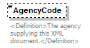 |
||||||||
| namespace | http://water.usgs.gov/XML/NWIS/5.0 | ||||||||
| type | xsd:string | ||||||||
| properties |
|
||||||||
| annotation |
|
||||||||
| source | <xsd:element name="AgencyCode" type="xsd:string" minOccurs="0"> <xsd:annotation> <xsd:documentation> <Definition>The agency supplying this XML document.</Definition> </xsd:documentation> </xsd:annotation> </xsd:element> |
element Source/DataBaseName
| diagram | 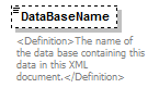 |
||||||||
| namespace | http://water.usgs.gov/XML/NWIS/5.0 | ||||||||
| type | xsd:string | ||||||||
| properties |
|
||||||||
| annotation |
|
||||||||
| source | <xsd:element name="DataBaseName" type="xsd:string" minOccurs="0"> <xsd:annotation> <xsd:documentation> <Definition>The name of the data base containing this data in this XML document.</Definition> </xsd:documentation> </xsd:annotation> </xsd:element> |
element Source/RemarksText
| diagram | 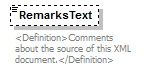 |
||||||||
| namespace | http://water.usgs.gov/XML/NWIS/5.0 | ||||||||
| type | xsd:string | ||||||||
| properties |
|
||||||||
| annotation |
|
||||||||
| source | <xsd:element name="RemarksText" type="xsd:string" minOccurs="0"> <xsd:annotation> <xsd:documentation> <Definition>Comments about the source of this XML document.</Definition> </xsd:documentation> </xsd:annotation> </xsd:element> |
element Source/EmailAddress
| diagram | 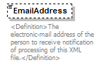 |
||||||||
| namespace | http://water.usgs.gov/XML/NWIS/5.0 | ||||||||
| type | xsd:string | ||||||||
| properties |
|
||||||||
| annotation |
|
||||||||
| source | <xsd:element name="EmailAddress" type="xsd:string" minOccurs="0"> <xsd:annotation> <xsd:documentation> <Definition>The electronic-mail address of the person to receive notification of processing of this XML file.</Definition> </xsd:documentation> </xsd:annotation> </xsd:element> |
element UsgsHydroML
| diagram | 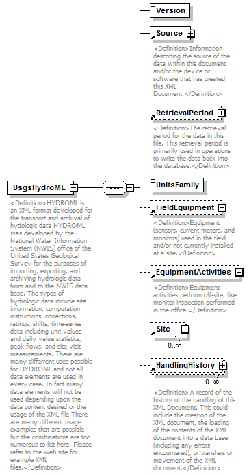 |
||
| namespace | http://water.usgs.gov/XML/NWIS/5.0 | ||
| properties |
|
||
| children | Version Source RetrievalPeriod UnitsFamily FieldEquipment EquipmentActivities Site HandlingHistory | ||
| annotation |
|
||
| source | <xsd:element name="UsgsHydroML"> <xsd:annotation> <xsd:documentation source="http://water.usgs.gov/nwis_activities/xml/nwis_hml.html"> <Definition>HYDROML is an XML format developed for the transport and archival of hydologic data HYDROML was developed by the National Water Information System (NWIS) office of the United States Geological Survey for the purposes of importing, exporting, and archiving hydrologic data from and to the NWIS data base. The types of hydrologic data include site information, computation instructions, corrections, ratings, shifts, time-series data including unit values and daily value statistics, peak flows, and site visit measurements. There are many differrent uses possible for HYDROML and not all data elements are used in every case. In fact many data elements will not be used depending upon the data content desired or the usage of the XML file.There are many different usage examples that are possible but the combinations are too numerous to list here. Please refer to the web site for example XML files.</Definition> </xsd:documentation> </xsd:annotation> <xsd:complexType> <xsd:sequence> <xsd:element name="Version" type="xsd:string"/> <xsd:element ref="Source"/> <xsd:element ref="RetrievalPeriod" minOccurs="0"/> <xsd:element name="UnitsFamily"> <xsd:simpleType> <xsd:restriction base="xsd:NMTOKEN"> <xsd:enumeration value="English"/> <xsd:enumeration value="Metric"/> </xsd:restriction> </xsd:simpleType> </xsd:element> <xsd:element ref="FieldEquipment" minOccurs="0"/> <xsd:element ref="EquipmentActivities" minOccurs="0"/> <xsd:element ref="Site" minOccurs="0" maxOccurs="unbounded"/> <xsd:element ref="HandlingHistory" minOccurs="0" maxOccurs="unbounded"/> </xsd:sequence> </xsd:complexType> </xsd:element> |
element UsgsHydroML/Version
| diagram |  |
||||
| namespace | http://water.usgs.gov/XML/NWIS/5.0 | ||||
| type | xsd:string | ||||
| properties |
|
||||
| source | <xsd:element name="Version" type="xsd:string"/> |
element UsgsHydroML/UnitsFamily
| diagram |  |
|||||||||
| namespace | http://water.usgs.gov/XML/NWIS/5.0 | |||||||||
| type | restriction of xsd:NMTOKEN | |||||||||
| properties |
|
|||||||||
| facets |
|
|||||||||
| source | <xsd:element name="UnitsFamily"> <xsd:simpleType> <xsd:restriction base="xsd:NMTOKEN"> <xsd:enumeration value="English"/> <xsd:enumeration value="Metric"/> </xsd:restriction> </xsd:simpleType> </xsd:element> |
element Site
| diagram | 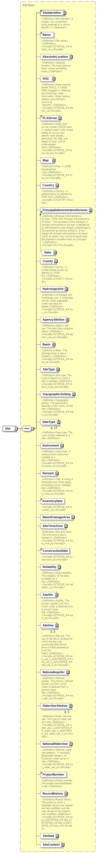 |
||
| namespace | http://water.usgs.gov/XML/NWIS/5.0 | ||
| type | SiteType | ||
| properties |
|
||
| children | SiteIdentifier Name AbsoluteLocation WSC PLSSArea Map Country PrincipalAdministrativeDivision County HydrologicUnit AgencySiteUse Basin SiteType TopographicSetting DataType Instrument Remark InventoryDate BasinDrainageArea SiteTimeZone ConstructionDate Reliability Aquifer SiteUse NationalAquifer WaterUseSiteUse NationalWaterUse ProjectNumber RecordHistory SiteData SiteContent | ||
| used by |
|
||
| source | <xsd:element name="Site" type="SiteType"/> |
complexType SiteType
| diagram |  |
||
| namespace | http://water.usgs.gov/XML/NWIS/5.0 | ||
| properties |
|
||
| children | SiteIdentifier Name AbsoluteLocation WSC PLSSArea Map Country PrincipalAdministrativeDivision County HydrologicUnit AgencySiteUse Basin SiteType TopographicSetting DataType Instrument Remark InventoryDate BasinDrainageArea SiteTimeZone ConstructionDate Reliability Aquifer SiteUse NationalAquifer WaterUseSiteUse NationalWaterUse ProjectNumber RecordHistory SiteData SiteContent | ||
| used by |
|
||
| annotation |
|
||
| source | <xsd:complexType name="SiteType" abstract="false"> <xsd:annotation> <xsd:documentation> <Definition>Site. The location of an observation, structure, object, or other thing, whether actual, virtual, abandoned, extant, or planned.</Definition> <Nwisdb>SITE_##/SITEFILE_##</Nwisdb> </xsd:documentation> </xsd:annotation> <xsd:sequence> <xsd:element name="SiteIdentifier" type="SiteIdentifierType"> <xsd:annotation> <xsd:documentation> <Definition>Site identifier. A unique, two component string assigned to a site to identify it.</Definition> </xsd:documentation> </xsd:annotation> </xsd:element> <xsd:element name="Name" minOccurs="0"> <xsd:annotation> <xsd:documentation> <Definition>Site name. </Definition> <Nwisdb>SITEFILE_##.station_nm</Nwisdb> </xsd:documentation> </xsd:annotation> <xsd:simpleType> <xsd:restriction base="xsd:normalizedString"> <xsd:minLength value="1"/> <xsd:maxLength value="50"/> </xsd:restriction> </xsd:simpleType> </xsd:element> <xsd:element name="AbsoluteLocation" type="AbsoluteLocationType" minOccurs="0"> <xsd:annotation> <xsd:documentation> <Definition>Absolute location. The exact spot on Earth where something exists.</Definition> </xsd:documentation> </xsd:annotation> </xsd:element> <xsd:element name="WSC" type="WSCType" minOccurs="0"> <xsd:annotation> <xsd:documentation> <Definition>Water science center (WSC). A USGS office engaged in collecting and analyzing water information. Water science centers were formerly known as "districts".</Definition> <Nwisdb>SITEFILE_##.district_cd</Nwisdb> </xsd:documentation> </xsd:annotation> </xsd:element> <xsd:element name="PLSSArea" type="PLSSAreaType" minOccurs="0"> <xsd:annotation> <xsd:documentation> <Definition>Public land survey system (PLSS) area. A method used in the United States to survey and identify land parcels, particularly for titles and deeds of rural, wild or undeveloped land.</Definition> <Nwisdb>SITEFILE_##.land_net_ds</Nwisdb> </xsd:documentation> </xsd:annotation> </xsd:element> <xsd:element name="Map" type="MapType" minOccurs="0"> <xsd:annotation> <xsd:documentation> <Definition>Map. A USGS topographical map.</Definition> <Nwisdb>SITEFILE_##.map_nm</Nwisdb> </xsd:documentation> </xsd:annotation> </xsd:element> <xsd:element name="Country" type="CountryType" minOccurs="0"> <xsd:annotation> <xsd:documentation> <Definition>Country. A political entity as defined by FIPS 10-4.</Definition> <Nwisdb>COUNTRY</Nwisdb> </xsd:documentation> </xsd:annotation> </xsd:element> <xsd:element ref="PrincipalAdministrativeDivision" minOccurs="0"> <xsd:annotation> <xsd:documentation> <Definition>Principal Administrative Division. FIPS 10-4 Principal Administrative Division: " For purposes of this standard, a principal administrative division is defined as an administrative area directly subordinate to the pertinent governing authority. Even though all principal administrative divisions within an entity may not be of equal rank, this Standard considers them as 'principal.' "</Definition> <Nwisdb>STATE</Nwisdb> </xsd:documentation> </xsd:annotation> </xsd:element> <xsd:element name="County" type="CountyType" minOccurs="0"> <xsd:annotation> <xsd:documentation> <Definition>County. A United States county as defined by FIPS 6-4.</Definition> <Nwisdb>COUNTY</Nwisdb> </xsd:documentation> </xsd:annotation> </xsd:element> <xsd:element name="HydrologicUnit" type="HydrologicUnitType" minOccurs="0"> <xsd:annotation> <xsd:documentation> <Definition>Hydrologic unit. Hydrologic unit. A hydrologic unit for which aggregate water-use data are stored.</Definition> <Nwisdb>SITEFILE_##.huc_cd</Nwisdb> </xsd:documentation> </xsd:annotation> </xsd:element> <xsd:element name="AgencySiteUse" type="AgencySiteUseType" minOccurs="0"> <xsd:annotation> <xsd:documentation> <Definition>Agency site use. The site's data collection status.</Definition> <Nwisdb>SITEFILE_##.agency_use_cd</Nwisdb> </xsd:documentation> </xsd:annotation> </xsd:element> <xsd:element name="Basin" type="BasinType" minOccurs="0"> <xsd:annotation> <xsd:documentation> <Definition>Basin. The drainage basin a site is located in.</Definition> <Nwisdb>SITEFILE_##.basin_cd</Nwisdb> </xsd:documentation> </xsd:annotation> </xsd:element> <xsd:element name="SiteType" type="SiteTypeType" minOccurs="0"> <xsd:annotation> <xsd:documentation> <Definition>Site type. The type of feature at which a site is installed.</Definition> <Nwisdb>SITEFILE_##.station_type_cd</Nwisdb> </xsd:documentation> </xsd:annotation> </xsd:element> <xsd:element name="TopographicSetting" type="TopographicSettingType" minOccurs="0"> <xsd:annotation> <xsd:documentation> <Definition>Topographic setting. The geomorphic features in the vicinity of the site.</Definition> <Nwisdb>SITEFILE_##.topo_cd</Nwisdb> </xsd:documentation> </xsd:annotation> </xsd:element> <xsd:element name="DataType" type="DataTypeType" minOccurs="0" maxOccurs="17"> <xsd:annotation> <xsd:documentation> <Definition>Data type. The type of data collected at a site.</Definition> </xsd:documentation> </xsd:annotation> </xsd:element> <xsd:element name="Instrument" type="InstrumentType" minOccurs="0"> <xsd:annotation> <xsd:documentation> <Definition>Instrument. A measurement instrument installed at a site.</Definition> <Nwisdb>SITEFILE_##.instruments_cd</Nwisdb> </xsd:documentation> </xsd:annotation> </xsd:element> <xsd:element name="Remark" type="TextType" minOccurs="0"> <xsd:annotation> <xsd:documentation> <Definition>Text. A string of characters and white space, comprising human readable text.</Definition> <Nwisdb>SITEFILE_##.site_rmks_tx</Nwisdb> </xsd:documentation> </xsd:annotation> </xsd:element> <xsd:element name="InventoryDate" type="PartialDateType" minOccurs="0"> <xsd:annotation> <xsd:documentation> <Nwisdb>SITEFILE_##.inventory_dt</Nwisdb> </xsd:documentation> </xsd:annotation> </xsd:element> <xsd:element name="BasinDrainageArea" type="BasinDrainageAreaType" minOccurs="0"> <xsd:annotation> <xsd:documentation/> </xsd:annotation> </xsd:element> <xsd:element name="SiteTimeZone" type="SiteTimeZoneType" minOccurs="0"> <xsd:annotation> <xsd:documentation> <Definition>Site time zone. The time zone a site is located in.</Definition> <Nwisdb>SITEFILE_##.local_time_fg</Nwisdb> </xsd:documentation> </xsd:annotation> </xsd:element> <xsd:element name="ConstructionDate" type="PartialDateType" minOccurs="0"> <xsd:annotation> <xsd:documentation> <Nwisdb>SITEFILE_##.construction_dt</Nwisdb> </xsd:documentation> </xsd:annotation> </xsd:element> <xsd:element name="Reliability" type="ReliabilityType" minOccurs="0"> <xsd:annotation> <xsd:documentation> <Definition>Data reliability. The reliability of the data available for a site.</Definition> <Nwisdb>SITEFILE_##.reliability_cd</Nwisdb> </xsd:documentation> </xsd:annotation> </xsd:element> <xsd:element name="Aquifer" type="AquiferType" minOccurs="0"> <xsd:annotation> <xsd:documentation> <Definition>Aquifer. The primary aquifer unit from which water is obtained from a ground water site.</Definition> <Nwisdb>SITEFILE_##.aqfr_cd</Nwisdb> </xsd:documentation> </xsd:annotation> </xsd:element> <xsd:element name="SiteUse" type="SiteUseType" minOccurs="0" maxOccurs="3"> <xsd:annotation> <xsd:documentation> <Definition>Site use. The use of the site or purpose for which the site was constructed (the former always holds precedence over the latter).</Definition> <Nwisdb>SITEFILE_##.site_use_1_cd/SITEFILE_##.site_use_2_cd/SITEFILE_##.site_use_3_cd</Nwisdb> </xsd:documentation> </xsd:annotation> </xsd:element> <xsd:element name="NationalAquifer" type="NationalAquiferType" minOccurs="0"> <xsd:annotation> <xsd:documentation> <Definition>National aquifer. The primary national aquifer unit from which water is obtained from a ground water site.</Definition> <Nwisdb>SITEFILE_##.nat_aqfr_cd</Nwisdb> </xsd:documentation> </xsd:annotation> </xsd:element> <xsd:element name="WaterUseSiteUse" type="WaterUseSiteUseType" minOccurs="0" maxOccurs="3"> <xsd:annotation> <xsd:documentation> <Definition>Water Use site use. The type of water use at a site.</Definition> <Nwisdb>SITEFILE_##.water_use_1_cd/SITEFILE_##.water_use_2_cd/SITEFILE_##.water_use_3_cd</Nwisdb> </xsd:documentation> </xsd:annotation> </xsd:element> <xsd:element name="NationalWaterUse" type="NationalWaterUseType" minOccurs="0"> <xsd:annotation> <xsd:documentation> <Definition>National water use category. A nationally designated category of functional water use at a site.</Definition> <Nwisdb>SITEFILE_##.nat_water_use_cd</Nwisdb> </xsd:documentation> </xsd:annotation> </xsd:element> <xsd:element name="ProjectNumber" type="xsd:token" minOccurs="0"> <xsd:annotation> <xsd:documentation> <Definition>Project number. The project that established a site.</Definition> </xsd:documentation> </xsd:annotation> </xsd:element> <xsd:element name="RecordHistory" type="RecordHistoryType" minOccurs="0"> <xsd:annotation> <xsd:documentation> <Definition>Record history. The points at which a database record was created and last modified, and the user names of the creators and modifiers.</Definition> <Nwisdb>SITEFILE_##.site_cn/SITEFILE_##.site_cr/SITEFILE_##.site_mn/SITEFILE_##.site_md</Nwisdb> </xsd:documentation> </xsd:annotation> </xsd:element> <xsd:element name="SiteData" type="SiteDataType" minOccurs="0"> <xsd:annotation> <xsd:documentation/> </xsd:annotation> </xsd:element> <xsd:element name="SiteContent" type="SiteContentType" minOccurs="0"> <xsd:annotation> <xsd:documentation/> </xsd:annotation> </xsd:element> </xsd:sequence> </xsd:complexType> |
element SiteType/SiteIdentifier
| diagram | 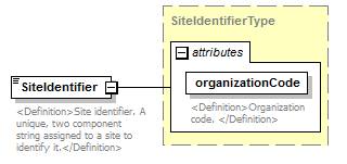 |
||||||||||||||
| namespace | http://water.usgs.gov/XML/NWIS/5.0 | ||||||||||||||
| type | SiteIdentifierType | ||||||||||||||
| properties |
|
||||||||||||||
| used by |
|
||||||||||||||
| attributes |
|
||||||||||||||
| annotation |
|
||||||||||||||
| source | <xsd:element name="SiteIdentifier" type="SiteIdentifierType"> <xsd:annotation> <xsd:documentation> <Definition>Site identifier. A unique, two component string assigned to a site to identify it.</Definition> </xsd:documentation> </xsd:annotation> </xsd:element> |
element SiteType/Name
| diagram | 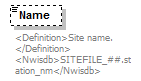 |
|||||||||
| namespace | http://water.usgs.gov/XML/NWIS/5.0 | |||||||||
| type | restriction of xsd:normalizedString | |||||||||
| properties |
|
|||||||||
| facets |
|
|||||||||
| annotation |
|
|||||||||
| source | <xsd:element name="Name" minOccurs="0"> <xsd:annotation> <xsd:documentation> <Definition>Site name. </Definition> <Nwisdb>SITEFILE_##.station_nm</Nwisdb> </xsd:documentation> </xsd:annotation> <xsd:simpleType> <xsd:restriction base="xsd:normalizedString"> <xsd:minLength value="1"/> <xsd:maxLength value="50"/> </xsd:restriction> </xsd:simpleType> </xsd:element> |
element SiteType/AbsoluteLocation
| diagram | 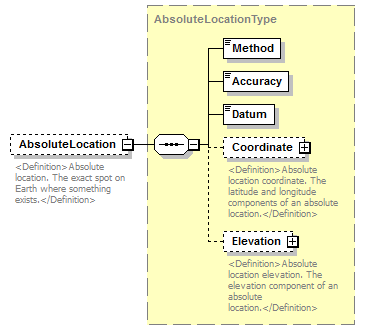 |
||||||||
| namespace | http://water.usgs.gov/XML/NWIS/5.0 | ||||||||
| type | AbsoluteLocationType | ||||||||
| properties |
|
||||||||
| children | Method Accuracy Datum Coordinate Elevation | ||||||||
| annotation |
|
||||||||
| source | <xsd:element name="AbsoluteLocation" type="AbsoluteLocationType" minOccurs="0"> <xsd:annotation> <xsd:documentation> <Definition>Absolute location. The exact spot on Earth where something exists.</Definition> </xsd:documentation> </xsd:annotation> </xsd:element> |
element SiteType/WSC
| diagram |  |
||||||||
| namespace | http://water.usgs.gov/XML/NWIS/5.0 | ||||||||
| type | WSCType | ||||||||
| properties |
|
||||||||
| children | Code Address History Name | ||||||||
| annotation |
|
||||||||
| source | <xsd:element name="WSC" type="WSCType" minOccurs="0"> <xsd:annotation> <xsd:documentation> <Definition>Water science center (WSC). A USGS office engaged in collecting and analyzing water information. Water science centers were formerly known as "districts".</Definition> <Nwisdb>SITEFILE_##.district_cd</Nwisdb> </xsd:documentation> </xsd:annotation> </xsd:element> |
element SiteType/PLSSArea
| diagram | 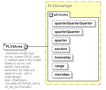 |
||||||||||||||||||||||||||||||||||||||||||||||||
| namespace | http://water.usgs.gov/XML/NWIS/5.0 | ||||||||||||||||||||||||||||||||||||||||||||||||
| type | PLSSAreaType | ||||||||||||||||||||||||||||||||||||||||||||||||
| properties |
|
||||||||||||||||||||||||||||||||||||||||||||||||
| attributes |
|
||||||||||||||||||||||||||||||||||||||||||||||||
| annotation |
|
||||||||||||||||||||||||||||||||||||||||||||||||
| source | <xsd:element name="PLSSArea" type="PLSSAreaType" minOccurs="0"> <xsd:annotation> <xsd:documentation> <Definition>Public land survey system (PLSS) area. A method used in the United States to survey and identify land parcels, particularly for titles and deeds of rural, wild or undeveloped land.</Definition> <Nwisdb>SITEFILE_##.land_net_ds</Nwisdb> </xsd:documentation> </xsd:annotation> </xsd:element> |
element SiteType/Map
| diagram | 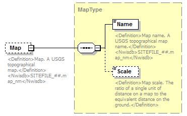 |
||||||||
| namespace | http://water.usgs.gov/XML/NWIS/5.0 | ||||||||
| type | MapType | ||||||||
| properties |
|
||||||||
| children | Name Scale | ||||||||
| annotation |
|
||||||||
| source | <xsd:element name="Map" type="MapType" minOccurs="0"> <xsd:annotation> <xsd:documentation> <Definition>Map. A USGS topographical map.</Definition> <Nwisdb>SITEFILE_##.map_nm</Nwisdb> </xsd:documentation> </xsd:annotation> </xsd:element> |
element SiteType/Country
| diagram | 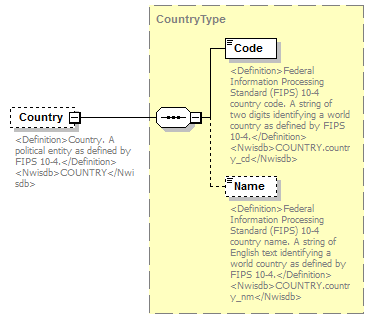 |
||||||||
| namespace | http://water.usgs.gov/XML/NWIS/5.0 | ||||||||
| type | CountryType | ||||||||
| properties |
|
||||||||
| children | Code Name | ||||||||
| annotation |
|
||||||||
| source | <xsd:element name="Country" type="CountryType" minOccurs="0"> <xsd:annotation> <xsd:documentation> <Definition>Country. A political entity as defined by FIPS 10-4.</Definition> <Nwisdb>COUNTRY</Nwisdb> </xsd:documentation> </xsd:annotation> </xsd:element> |
element SiteType/County
| diagram | 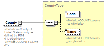 |
||||||||
| namespace | http://water.usgs.gov/XML/NWIS/5.0 | ||||||||
| type | CountyType | ||||||||
| properties |
|
||||||||
| children | Code Name | ||||||||
| annotation |
|
||||||||
| source | <xsd:element name="County" type="CountyType" minOccurs="0"> <xsd:annotation> <xsd:documentation> <Definition>County. A United States county as defined by FIPS 6-4.</Definition> <Nwisdb>COUNTY</Nwisdb> </xsd:documentation> </xsd:annotation> </xsd:element> |
element SiteType/HydrologicUnit
| diagram | 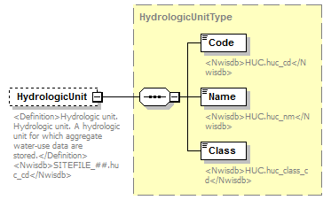 |
||||||||
| namespace | http://water.usgs.gov/XML/NWIS/5.0 | ||||||||
| type | HydrologicUnitType | ||||||||
| properties |
|
||||||||
| children | Code Name Class | ||||||||
| annotation |
|
||||||||
| source | <xsd:element name="HydrologicUnit" type="HydrologicUnitType" minOccurs="0"> <xsd:annotation> <xsd:documentation> <Definition>Hydrologic unit. Hydrologic unit. A hydrologic unit for which aggregate water-use data are stored.</Definition> <Nwisdb>SITEFILE_##.huc_cd</Nwisdb> </xsd:documentation> </xsd:annotation> </xsd:element> |
element SiteType/AgencySiteUse
| diagram | 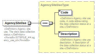 |
||||||||
| namespace | http://water.usgs.gov/XML/NWIS/5.0 | ||||||||
| type | AgencySiteUseType | ||||||||
| properties |
|
||||||||
| children | Code Description | ||||||||
| annotation |
|
||||||||
| source | <xsd:element name="AgencySiteUse" type="AgencySiteUseType" minOccurs="0"> <xsd:annotation> <xsd:documentation> <Definition>Agency site use. The site's data collection status.</Definition> <Nwisdb>SITEFILE_##.agency_use_cd</Nwisdb> </xsd:documentation> </xsd:annotation> </xsd:element> |
element SiteType/Basin
| diagram | 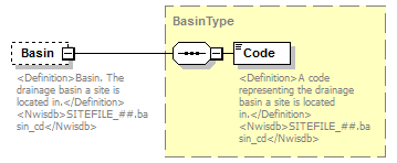 |
||||||||
| namespace | http://water.usgs.gov/XML/NWIS/5.0 | ||||||||
| type | BasinType | ||||||||
| properties |
|
||||||||
| children | Code | ||||||||
| annotation |
|
||||||||
| source | <xsd:element name="Basin" type="BasinType" minOccurs="0"> <xsd:annotation> <xsd:documentation> <Definition>Basin. The drainage basin a site is located in.</Definition> <Nwisdb>SITEFILE_##.basin_cd</Nwisdb> </xsd:documentation> </xsd:annotation> </xsd:element> |
element SiteType/SiteType
| diagram | 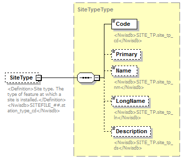 |
||||||||
| namespace | http://water.usgs.gov/XML/NWIS/5.0 | ||||||||
| type | SiteTypeType | ||||||||
| properties |
|
||||||||
| children | Code Primary Name LongName Description | ||||||||
| annotation |
|
||||||||
| source | <xsd:element name="SiteType" type="SiteTypeType" minOccurs="0"> <xsd:annotation> <xsd:documentation> <Definition>Site type. The type of feature at which a site is installed.</Definition> <Nwisdb>SITEFILE_##.station_type_cd</Nwisdb> </xsd:documentation> </xsd:annotation> </xsd:element> |
element SiteType/TopographicSetting
| diagram | 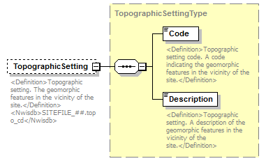 |
||||||||
| namespace | http://water.usgs.gov/XML/NWIS/5.0 | ||||||||
| type | TopographicSettingType | ||||||||
| properties |
|
||||||||
| children | Code Description | ||||||||
| annotation |
|
||||||||
| source | <xsd:element name="TopographicSetting" type="TopographicSettingType" minOccurs="0"> <xsd:annotation> <xsd:documentation> <Definition>Topographic setting. The geomorphic features in the vicinity of the site.</Definition> <Nwisdb>SITEFILE_##.topo_cd</Nwisdb> </xsd:documentation> </xsd:annotation> </xsd:element> |
element SiteType/DataType
| diagram | 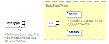 |
||||||||
| namespace | http://water.usgs.gov/XML/NWIS/5.0 | ||||||||
| type | DataTypeType | ||||||||
| properties |
|
||||||||
| children | Name Status | ||||||||
| annotation |
|
||||||||
| source | <xsd:element name="DataType" type="DataTypeType" minOccurs="0" maxOccurs="17"> <xsd:annotation> <xsd:documentation> <Definition>Data type. The type of data collected at a site.</Definition> </xsd:documentation> </xsd:annotation> </xsd:element> |
element SiteType/Instrument
| diagram | 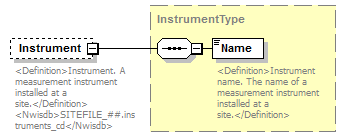 |
||||||||
| namespace | http://water.usgs.gov/XML/NWIS/5.0 | ||||||||
| type | InstrumentType | ||||||||
| properties |
|
||||||||
| children | Name | ||||||||
| annotation |
|
||||||||
| source | <xsd:element name="Instrument" type="InstrumentType" minOccurs="0"> <xsd:annotation> <xsd:documentation> <Definition>Instrument. A measurement instrument installed at a site.</Definition> <Nwisdb>SITEFILE_##.instruments_cd</Nwisdb> </xsd:documentation> </xsd:annotation> </xsd:element> |
element SiteType/Remark
| diagram | 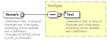 |
||||||||
| namespace | http://water.usgs.gov/XML/NWIS/5.0 | ||||||||
| type | TextType | ||||||||
| properties |
|
||||||||
| children | Text | ||||||||
| annotation |
|
||||||||
| source | <xsd:element name="Remark" type="TextType" minOccurs="0"> <xsd:annotation> <xsd:documentation> <Definition>Text. A string of characters and white space, comprising human readable text.</Definition> <Nwisdb>SITEFILE_##.site_rmks_tx</Nwisdb> </xsd:documentation> </xsd:annotation> </xsd:element> |
element SiteType/InventoryDate
| diagram | 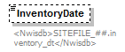 |
||||||||
| namespace | http://water.usgs.gov/XML/NWIS/5.0 | ||||||||
| type | PartialDateType | ||||||||
| properties |
|
||||||||
| annotation |
|
||||||||
| source | <xsd:element name="InventoryDate" type="PartialDateType" minOccurs="0"> <xsd:annotation> <xsd:documentation> <Nwisdb>SITEFILE_##.inventory_dt</Nwisdb> </xsd:documentation> </xsd:annotation> </xsd:element> |
element SiteType/BasinDrainageArea
| diagram | 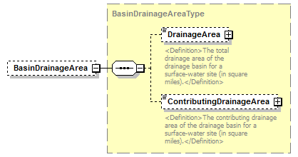 |
||||||||
| namespace | http://water.usgs.gov/XML/NWIS/5.0 | ||||||||
| type | BasinDrainageAreaType | ||||||||
| properties |
|
||||||||
| children | DrainageArea ContributingDrainageArea | ||||||||
| source | <xsd:element name="BasinDrainageArea" type="BasinDrainageAreaType" minOccurs="0"> <xsd:annotation> <xsd:documentation/> </xsd:annotation> </xsd:element> |
element SiteType/SiteTimeZone
| diagram | 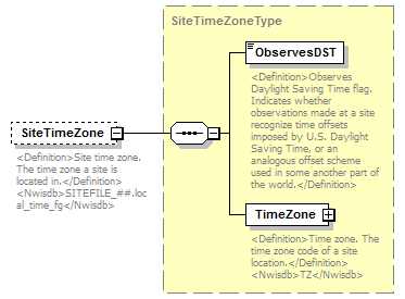 |
||||||||
| namespace | http://water.usgs.gov/XML/NWIS/5.0 | ||||||||
| type | SiteTimeZoneType | ||||||||
| properties |
|
||||||||
| children | ObservesDST TimeZone | ||||||||
| annotation |
|
||||||||
| source | <xsd:element name="SiteTimeZone" type="SiteTimeZoneType" minOccurs="0"> <xsd:annotation> <xsd:documentation> <Definition>Site time zone. The time zone a site is located in.</Definition> <Nwisdb>SITEFILE_##.local_time_fg</Nwisdb> </xsd:documentation> </xsd:annotation> </xsd:element> |
element SiteType/ConstructionDate
| diagram | 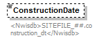 |
||||||||
| namespace | http://water.usgs.gov/XML/NWIS/5.0 | ||||||||
| type | PartialDateType | ||||||||
| properties |
|
||||||||
| annotation |
|
||||||||
| source | <xsd:element name="ConstructionDate" type="PartialDateType" minOccurs="0"> <xsd:annotation> <xsd:documentation> <Nwisdb>SITEFILE_##.construction_dt</Nwisdb> </xsd:documentation> </xsd:annotation> </xsd:element> |
element SiteType/Reliability
| diagram | 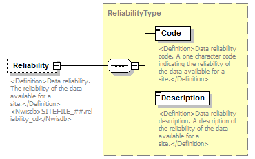 |
||||||||
| namespace | http://water.usgs.gov/XML/NWIS/5.0 | ||||||||
| type | ReliabilityType | ||||||||
| properties |
|
||||||||
| children | Code Description | ||||||||
| annotation |
|
||||||||
| source | <xsd:element name="Reliability" type="ReliabilityType" minOccurs="0"> <xsd:annotation> <xsd:documentation> <Definition>Data reliability. The reliability of the data available for a site.</Definition> <Nwisdb>SITEFILE_##.reliability_cd</Nwisdb> </xsd:documentation> </xsd:annotation> </xsd:element> |
element SiteType/Aquifer
| diagram | 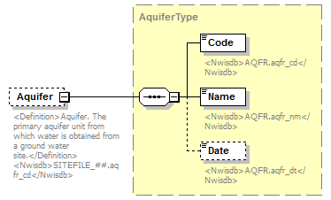 |
||||||||
| namespace | http://water.usgs.gov/XML/NWIS/5.0 | ||||||||
| type | AquiferType | ||||||||
| properties |
|
||||||||
| children | Code Name Date | ||||||||
| annotation |
|
||||||||
| source | <xsd:element name="Aquifer" type="AquiferType" minOccurs="0"> <xsd:annotation> <xsd:documentation> <Definition>Aquifer. The primary aquifer unit from which water is obtained from a ground water site.</Definition> <Nwisdb>SITEFILE_##.aqfr_cd</Nwisdb> </xsd:documentation> </xsd:annotation> </xsd:element> |
element SiteType/SiteUse
| diagram | 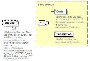 |
||||||||
| namespace | http://water.usgs.gov/XML/NWIS/5.0 | ||||||||
| type | SiteUseType | ||||||||
| properties |
|
||||||||
| children | Code Description | ||||||||
| annotation |
|
||||||||
| source | <xsd:element name="SiteUse" type="SiteUseType" minOccurs="0" maxOccurs="3"> <xsd:annotation> <xsd:documentation> <Definition>Site use. The use of the site or purpose for which the site was constructed (the former always holds precedence over the latter).</Definition> <Nwisdb>SITEFILE_##.site_use_1_cd/SITEFILE_##.site_use_2_cd/SITEFILE_##.site_use_3_cd</Nwisdb> </xsd:documentation> </xsd:annotation> </xsd:element> |
element SiteType/NationalAquifer
| diagram | 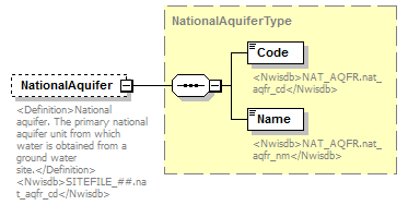 |
||||||||
| namespace | http://water.usgs.gov/XML/NWIS/5.0 | ||||||||
| type | NationalAquiferType | ||||||||
| properties |
|
||||||||
| children | Code Name | ||||||||
| annotation |
|
||||||||
| source | <xsd:element name="NationalAquifer" type="NationalAquiferType" minOccurs="0"> <xsd:annotation> <xsd:documentation> <Definition>National aquifer. The primary national aquifer unit from which water is obtained from a ground water site.</Definition> <Nwisdb>SITEFILE_##.nat_aqfr_cd</Nwisdb> </xsd:documentation> </xsd:annotation> </xsd:element> |
element SiteType/WaterUseSiteUse
| diagram | 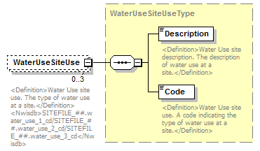 |
||||||||
| namespace | http://water.usgs.gov/XML/NWIS/5.0 | ||||||||
| type | WaterUseSiteUseType | ||||||||
| properties |
|
||||||||
| children | Description Code | ||||||||
| annotation |
|
||||||||
| source | <xsd:element name="WaterUseSiteUse" type="WaterUseSiteUseType" minOccurs="0" maxOccurs="3"> <xsd:annotation> <xsd:documentation> <Definition>Water Use site use. The type of water use at a site.</Definition> <Nwisdb>SITEFILE_##.water_use_1_cd/SITEFILE_##.water_use_2_cd/SITEFILE_##.water_use_3_cd</Nwisdb> </xsd:documentation> </xsd:annotation> </xsd:element> |
element SiteType/NationalWaterUse
| diagram | 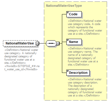 |
||||||||
| namespace | http://water.usgs.gov/XML/NWIS/5.0 | ||||||||
| type | NationalWaterUseType | ||||||||
| properties |
|
||||||||
| children | Code Name Description | ||||||||
| annotation |
|
||||||||
| source | <xsd:element name="NationalWaterUse" type="NationalWaterUseType" minOccurs="0"> <xsd:annotation> <xsd:documentation> <Definition>National water use category. A nationally designated category of functional water use at a site.</Definition> <Nwisdb>SITEFILE_##.nat_water_use_cd</Nwisdb> </xsd:documentation> </xsd:annotation> </xsd:element> |
element SiteType/ProjectNumber
| diagram | 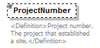 |
||||||||
| namespace | http://water.usgs.gov/XML/NWIS/5.0 | ||||||||
| type | xsd:token | ||||||||
| properties |
|
||||||||
| annotation |
|
||||||||
| source | <xsd:element name="ProjectNumber" type="xsd:token" minOccurs="0"> <xsd:annotation> <xsd:documentation> <Definition>Project number. The project that established a site.</Definition> </xsd:documentation> </xsd:annotation> </xsd:element> |
element SiteType/RecordHistory
| diagram | 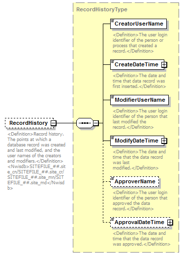 |
||||||||
| namespace | http://water.usgs.gov/XML/NWIS/5.0 | ||||||||
| type | RecordHistoryType | ||||||||
| properties |
|
||||||||
| children | CreatorUserName CreateDateTime ModifierUserName ModifyDateTime ApproverName ApprovalDateTime | ||||||||
| annotation |
|
||||||||
| source | <xsd:element name="RecordHistory" type="RecordHistoryType" minOccurs="0"> <xsd:annotation> <xsd:documentation> <Definition>Record history. The points at which a database record was created and last modified, and the user names of the creators and modifiers.</Definition> <Nwisdb>SITEFILE_##.site_cn/SITEFILE_##.site_cr/SITEFILE_##.site_mn/SITEFILE_##.site_md</Nwisdb> </xsd:documentation> </xsd:annotation> </xsd:element> |
element SiteType/SiteData
| diagram | 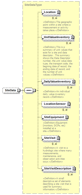 |
||||||||
| namespace | http://water.usgs.gov/XML/NWIS/5.0 | ||||||||
| type | SiteDataType | ||||||||
| properties |
|
||||||||
| children | Location UnitValueInventory DailyValueInventory LocationSensor SiteEquipment SiteVisit SiteVisitDescription | ||||||||
| source | <xsd:element name="SiteData" type="SiteDataType" minOccurs="0"> <xsd:annotation> <xsd:documentation/> </xsd:annotation> </xsd:element> |
element SiteType/SiteContent
| diagram | 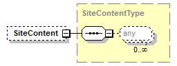 |
||||||||
| namespace | http://water.usgs.gov/XML/NWIS/5.0 | ||||||||
| type | SiteContentType | ||||||||
| properties |
|
||||||||
| source | <xsd:element name="SiteContent" type="SiteContentType" minOccurs="0"> <xsd:annotation> <xsd:documentation/> </xsd:annotation> </xsd:element> |
element FieldEquipment
| diagram | 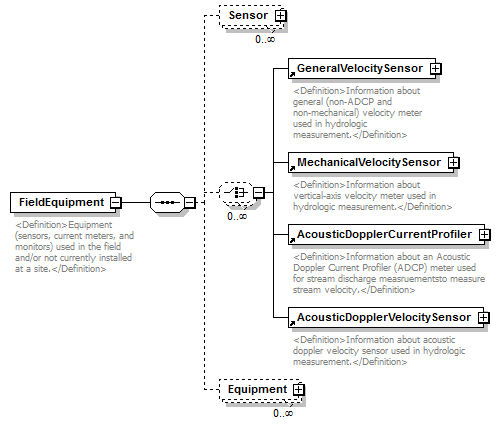 |
||
| namespace | http://water.usgs.gov/XML/NWIS/5.0 | ||
| properties |
|
||
| children | Sensor GeneralVelocitySensor MechanicalVelocitySensor AcousticDopplerCurrentProfiler AcousticDopplerVelocitySensor Equipment | ||
| used by |
|
||
| annotation |
|
||
| source | <xsd:element name="FieldEquipment"> <xsd:annotation> <xsd:documentation> <Definition>Equipment (sensors, current meters, and monitors) used in the field and/or not currently installed at a site.</Definition> </xsd:documentation> </xsd:annotation> <xsd:complexType> <xsd:sequence> <xsd:element name="Sensor" type="Sensor" minOccurs="0" maxOccurs="unbounded"/> <xsd:choice minOccurs="0" maxOccurs="unbounded"> <xsd:element ref="GeneralVelocitySensor"/> <xsd:element ref="MechanicalVelocitySensor"/> <xsd:element ref="AcousticDopplerCurrentProfiler"/> <xsd:element ref="AcousticDopplerVelocitySensor"/> </xsd:choice> <xsd:element name="Equipment" type="EquipmentType" minOccurs="0" maxOccurs="unbounded"/> </xsd:sequence> </xsd:complexType> </xsd:element> |
element FieldEquipment/Sensor
| diagram | 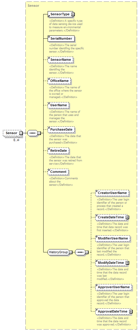 |
||||||||
| namespace | http://water.usgs.gov/XML/NWIS/5.0 | ||||||||
| type | Sensor | ||||||||
| properties |
|
||||||||
| children | SensorType SerialNumber SensorName OfficeName UserName PurchaseDate RetireDate Comment CreatorUserName CreateDateTime ModifierUserName ModifyDateTime ApproverUserName ApprovalDateTime | ||||||||
| source | <xsd:element name="Sensor" type="Sensor" minOccurs="0" maxOccurs="unbounded"/> |
element FieldEquipment/Equipment
| diagram |  |
||||||||
| namespace | http://water.usgs.gov/XML/NWIS/5.0 | ||||||||
| type | EquipmentType | ||||||||
| properties |
|
||||||||
| children | EquipmentType SiteEquipmentIndicator SerialNumber PurchaseDate RetireDate Comment EquipmentSensor CreatorUserName CreateDateTime ModifierUserName ModifyDateTime ApproverUserName ApprovalDateTime | ||||||||
| source | <xsd:element name="Equipment" type="EquipmentType" minOccurs="0" maxOccurs="unbounded"/> |
element EquipmentActivities
| diagram | 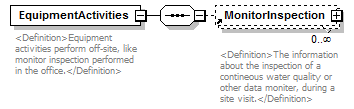 |
||
| namespace | http://water.usgs.gov/XML/NWIS/5.0 | ||
| properties |
|
||
| children | MonitorInspection | ||
| used by |
|
||
| annotation |
|
||
| source | <xsd:element name="EquipmentActivities"> <xsd:annotation> <xsd:documentation> <Definition>Equipment activities perform off-site, like monitor inspection performed in the office.</Definition> </xsd:documentation> </xsd:annotation> <xsd:complexType> <xsd:sequence> <xsd:element ref="MonitorInspection" minOccurs="0" maxOccurs="unbounded"/> </xsd:sequence> </xsd:complexType> </xsd:element> |
element IEEE754FloatValue
| diagram | 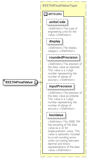 |
||||||||||||||||||||||||||||||||||||||||||||||
| namespace | http://water.usgs.gov/XML/NWIS/5.0 | ||||||||||||||||||||||||||||||||||||||||||||||
| type | IEEE754FloatValueType | ||||||||||||||||||||||||||||||||||||||||||||||
| properties |
|
||||||||||||||||||||||||||||||||||||||||||||||
| facets |
|
||||||||||||||||||||||||||||||||||||||||||||||
| attributes |
|
||||||||||||||||||||||||||||||||||||||||||||||
| source | <xsd:element name="IEEE754FloatValue" type="IEEE754FloatValueType" substitutionGroup="DisplayDecimal"/> |
complexType IEEE754FloatValueType
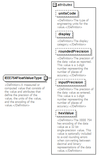
attribute IEEE754FloatValueType/@unitsCode
| type | xsd:string | ||||
| properties |
|
||||
| annotation |
|
||||
| source | <xsd:attribute name="unitsCode" type="xsd:string" use="optional"> <xsd:annotation> <xsd:documentation> <Definition>The type of engineering units for the value.</Definition> </xsd:documentation> </xsd:annotation> </xsd:attribute> |
attribute IEEE754FloatValueType/@display
| type | DisplayType | |||||||||
| properties |
|
|||||||||
| facets |
|
|||||||||
| annotation |
|
|||||||||
| source | <xsd:attribute name="display" type="DisplayType" use="optional"> <xsd:annotation> <xsd:documentation> <Definition>The display category.</Definition> </xsd:documentation> </xsd:annotation> </xsd:attribute> |
attribute IEEE754FloatValueType/@roundedPrecision
| type | PrecisionType | |||||||||
| properties |
|
|||||||||
| facets |
|
|||||||||
| annotation |
|
|||||||||
| source | <xsd:attribute name="roundedPrecision" type="PrecisionType" use="optional"> <xsd:annotation> <xsd:documentation> <Definition>The precision of the data value as reported. This value is a 1-digit number representing the number of places of accuracy.</Definition> </xsd:documentation> </xsd:annotation> </xsd:attribute> |
attribute IEEE754FloatValueType/@inputPrecision
| type | PrecisionType | |||||||||
| properties |
|
|||||||||
| facets |
|
|||||||||
| annotation |
|
|||||||||
| source | <xsd:attribute name="inputPrecision" type="PrecisionType" use="optional"> <xsd:annotation> <xsd:documentation> <Definition>The precision of the data value as entered. This value is a 1-digit number representing the number of places of accuracy.</Definition> </xsd:documentation> </xsd:annotation> </xsd:attribute> |
attribute IEEE754FloatValueType/@hexValue
| type | HexValueType | ||||||||||||
| properties |
|
||||||||||||
| facets |
|
||||||||||||
| annotation |
|
||||||||||||
| source | <xsd:attribute name="hexValue" type="HexValueType" use="optional"> <xsd:annotation> <xsd:documentation> <Definition>The IEEE 754 hex encoding of the data value as a 32 bit single-precision value. This value is optionally included to avoid rounding errors when converting between decimal and binary representations of the data value.</Definition> </xsd:documentation> </xsd:annotation> </xsd:attribute> |
complexType RecordHistoryType
| diagram | 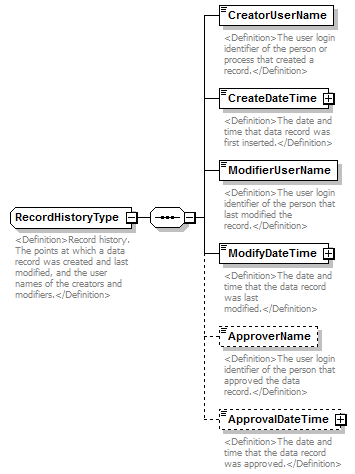 |
||
| namespace | http://water.usgs.gov/XML/NWIS/5.0 | ||
| properties |
|
||
| children | CreatorUserName CreateDateTime ModifierUserName ModifyDateTime ApproverName ApprovalDateTime | ||
| used by |
|
||
| annotation |
|
||
| source | <xsd:complexType name="RecordHistoryType" abstract="false"> <xsd:annotation> <xsd:documentation> <Definition>Record history. The points at which a data record was created and last modified, and the user names of the creators and modifiers.</Definition> </xsd:documentation> </xsd:annotation> <xsd:sequence> <xsd:element name="CreatorUserName"> <xsd:annotation> <xsd:documentation> <Definition>The user login identifier of the person or process that created a record.</Definition> </xsd:documentation> </xsd:annotation> <xsd:simpleType> <xsd:restriction base="xsd:token"> <xsd:minLength value="1"/> <xsd:maxLength value="8"/> </xsd:restriction> </xsd:simpleType> </xsd:element> <xsd:element name="CreateDateTime" type="DateTimeWithDatum"> <xsd:annotation> <xsd:documentation> <Definition>The date and time that data record was first inserted.</Definition> </xsd:documentation> </xsd:annotation> </xsd:element> <xsd:element name="ModifierUserName"> <xsd:annotation> <xsd:documentation> <Definition>The user login identifier of the person that last modified the record.</Definition> </xsd:documentation> </xsd:annotation> <xsd:simpleType> <xsd:restriction base="xsd:token"> <xsd:minLength value="1"/> <xsd:maxLength value="8"/> </xsd:restriction> </xsd:simpleType> </xsd:element> <xsd:element name="ModifyDateTime" type="DateTimeWithDatum"> <xsd:annotation> <xsd:documentation> <Definition>The date and time that the data record was last modified.</Definition> </xsd:documentation> </xsd:annotation> </xsd:element> <xsd:element name="ApproverName" type="xsd:token" minOccurs="0" maxOccurs="1"> <xsd:annotation> <xsd:documentation> <Definition>The user login identifier of the person that approved the data record.</Definition> </xsd:documentation> </xsd:annotation> </xsd:element> <xsd:element name="ApprovalDateTime" type="DateTimeWithDatum" minOccurs="0" maxOccurs="1"> <xsd:annotation> <xsd:documentation> <Definition>The date and time that the data record was approved.</Definition> </xsd:documentation> </xsd:annotation> </xsd:element> </xsd:sequence> </xsd:complexType> |
element RecordHistoryType/CreatorUserName
| diagram |  |
|||||||||
| namespace | http://water.usgs.gov/XML/NWIS/5.0 | |||||||||
| type | restriction of xsd:token | |||||||||
| properties |
|
|||||||||
| facets |
|
|||||||||
| annotation |
|
|||||||||
| source | <xsd:element name="CreatorUserName"> <xsd:annotation> <xsd:documentation> <Definition>The user login identifier of the person or process that created a record.</Definition> </xsd:documentation> </xsd:annotation> <xsd:simpleType> <xsd:restriction base="xsd:token"> <xsd:minLength value="1"/> <xsd:maxLength value="8"/> </xsd:restriction> </xsd:simpleType> </xsd:element> |
element RecordHistoryType/CreateDateTime
| diagram |  |
||||||||||||||||||||||||||||||
| namespace | http://water.usgs.gov/XML/NWIS/5.0 | ||||||||||||||||||||||||||||||
| type | DateTimeWithDatum | ||||||||||||||||||||||||||||||
| properties |
|
||||||||||||||||||||||||||||||
| attributes |
|
||||||||||||||||||||||||||||||
| annotation |
|
||||||||||||||||||||||||||||||
| source | <xsd:element name="CreateDateTime" type="DateTimeWithDatum"> <xsd:annotation> <xsd:documentation> <Definition>The date and time that data record was first inserted.</Definition> </xsd:documentation> </xsd:annotation> </xsd:element> |
element RecordHistoryType/ModifierUserName
| diagram | 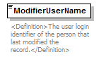 |
|||||||||
| namespace | http://water.usgs.gov/XML/NWIS/5.0 | |||||||||
| type | restriction of xsd:token | |||||||||
| properties |
|
|||||||||
| facets |
|
|||||||||
| annotation |
|
|||||||||
| source | <xsd:element name="ModifierUserName"> <xsd:annotation> <xsd:documentation> <Definition>The user login identifier of the person that last modified the record.</Definition> </xsd:documentation> </xsd:annotation> <xsd:simpleType> <xsd:restriction base="xsd:token"> <xsd:minLength value="1"/> <xsd:maxLength value="8"/> </xsd:restriction> </xsd:simpleType> </xsd:element> |
element RecordHistoryType/ModifyDateTime
| diagram |  |
||||||||||||||||||||||||||||||
| namespace | http://water.usgs.gov/XML/NWIS/5.0 | ||||||||||||||||||||||||||||||
| type | DateTimeWithDatum | ||||||||||||||||||||||||||||||
| properties |
|
||||||||||||||||||||||||||||||
| attributes |
|
||||||||||||||||||||||||||||||
| annotation |
|
||||||||||||||||||||||||||||||
| source | <xsd:element name="ModifyDateTime" type="DateTimeWithDatum"> <xsd:annotation> <xsd:documentation> <Definition>The date and time that the data record was last modified.</Definition> </xsd:documentation> </xsd:annotation> </xsd:element> |
element RecordHistoryType/ApproverName
| diagram | 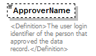 |
||||||||
| namespace | http://water.usgs.gov/XML/NWIS/5.0 | ||||||||
| type | xsd:token | ||||||||
| properties |
|
||||||||
| annotation |
|
||||||||
| source | <xsd:element name="ApproverName" type="xsd:token" minOccurs="0" maxOccurs="1"> <xsd:annotation> <xsd:documentation> <Definition>The user login identifier of the person that approved the data record.</Definition> </xsd:documentation> </xsd:annotation> </xsd:element> |
element RecordHistoryType/ApprovalDateTime
| diagram |  |
||||||||||||||||||||||||||||||
| namespace | http://water.usgs.gov/XML/NWIS/5.0 | ||||||||||||||||||||||||||||||
| type | DateTimeWithDatum | ||||||||||||||||||||||||||||||
| properties |
|
||||||||||||||||||||||||||||||
| attributes |
|
||||||||||||||||||||||||||||||
| annotation |
|
||||||||||||||||||||||||||||||
| source | <xsd:element name="ApprovalDateTime" type="DateTimeWithDatum" minOccurs="0" maxOccurs="1"> <xsd:annotation> <xsd:documentation> <Definition>The date and time that the data record was approved.</Definition> </xsd:documentation> </xsd:annotation> </xsd:element> |
complexType DateTimeWithDatum
| diagram | 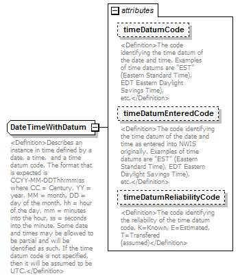 |
||||||||||||||||||||||||||||||
| namespace | http://water.usgs.gov/XML/NWIS/5.0 | ||||||||||||||||||||||||||||||
| type | extension of xsd:dateTime | ||||||||||||||||||||||||||||||
| properties |
|
||||||||||||||||||||||||||||||
| used by |
|
||||||||||||||||||||||||||||||
| attributes |
|
||||||||||||||||||||||||||||||
| annotation |
|
||||||||||||||||||||||||||||||
| source | <xsd:complexType name="DateTimeWithDatum"> <xsd:annotation> <xsd:documentation> <Definition>Describes an instance in time defined by a date, a time, and a time datum code. The format that is expected is CCYY-MM-DDThh:mm:ss where CC = Century, YY = year, MM = month, DD = day of the month, hh = hour of the day, mm = minutes into the hour, ss = seconds into the minute. Some date and times may be allowed to be partial and will be identified as such. If the time datum code is not specified, then it will be assumed to be UTC.</Definition> </xsd:documentation> </xsd:annotation> <xsd:simpleContent> <xsd:extension base="xsd:dateTime"> <xsd:attribute name="timeDatumCode" type="xsd:NMTOKEN"> <xsd:annotation> <xsd:documentation> <Definition>The code identifying the time datum of the date and time. Examples of time datums are "EST" (Eastern Standard Time), EDT Eastern Daylight Savings Time), etc.</Definition> </xsd:documentation> </xsd:annotation> </xsd:attribute> <xsd:attribute name="timeDatumEnteredCode" type="xsd:NMTOKEN" use="optional"> <xsd:annotation> <xsd:documentation> <Definition>The code identifying the time datum of the date and time as entered into NWIS originally. Examples of time datums are "EST" (Eastern Standard Time), EDT Eastern Daylight Savings Time), etc.</Definition> </xsd:documentation> </xsd:annotation> </xsd:attribute> <xsd:attribute name="timeDatumReliabilityCode" use="optional"> <xsd:annotation> <xsd:documentation> <Definition>The code identifying the reliability of the time datum code. K=Known, E=Estimated, T=Transfered (assumed)</Definition> </xsd:documentation> </xsd:annotation> <xsd:simpleType> <xsd:restriction base="xsd:token"> <xsd:enumeration value="K"/> <xsd:enumeration value="E"/> <xsd:enumeration value="T"/> </xsd:restriction> </xsd:simpleType> </xsd:attribute> </xsd:extension> </xsd:simpleContent> </xsd:complexType> |
attribute DateTimeWithDatum/@timeDatumCode
| type | xsd:NMTOKEN | ||
| properties |
|
||
| annotation |
|
||
| source | <xsd:attribute name="timeDatumCode" type="xsd:NMTOKEN"> <xsd:annotation> <xsd:documentation> <Definition>The code identifying the time datum of the date and time. Examples of time datums are "EST" (Eastern Standard Time), EDT Eastern Daylight Savings Time), etc.</Definition> </xsd:documentation> </xsd:annotation> </xsd:attribute> |
attribute DateTimeWithDatum/@timeDatumEnteredCode
| type | xsd:NMTOKEN | ||||
| properties |
|
||||
| annotation |
|
||||
| source | <xsd:attribute name="timeDatumEnteredCode" type="xsd:NMTOKEN" use="optional"> <xsd:annotation> <xsd:documentation> <Definition>The code identifying the time datum of the date and time as entered into NWIS originally. Examples of time datums are "EST" (Eastern Standard Time), EDT Eastern Daylight Savings Time), etc.</Definition> </xsd:documentation> </xsd:annotation> </xsd:attribute> |
attribute DateTimeWithDatum/@timeDatumReliabilityCode
| type | restriction of xsd:token | ||||||||||||
| properties |
|
||||||||||||
| facets |
|
||||||||||||
| annotation |
|
||||||||||||
| source | <xsd:attribute name="timeDatumReliabilityCode" use="optional"> <xsd:annotation> <xsd:documentation> <Definition>The code identifying the reliability of the time datum code. K=Known, E=Estimated, T=Transfered (assumed)</Definition> </xsd:documentation> </xsd:annotation> <xsd:simpleType> <xsd:restriction base="xsd:token"> <xsd:enumeration value="K"/> <xsd:enumeration value="E"/> <xsd:enumeration value="T"/> </xsd:restriction> </xsd:simpleType> </xsd:attribute> |
element DataAgingCode
| diagram | 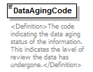 |
||||
| namespace | http://water.usgs.gov/XML/NWIS/5.0 | ||||
| type | xsd:string | ||||
| properties |
|
||||
| used by |
|
||||
| annotation |
|
||||
| source | <xsd:element name="DataAgingCode" type="xsd:string" default="W"> <xsd:annotation> <xsd:documentation> <Definition>The code indicating the data aging status of the information. This indicates the level of review the data has undergone.</Definition> </xsd:documentation> </xsd:annotation> </xsd:element> |
simpleType string1
| namespace | http://water.usgs.gov/XML/NWIS/5.0 | ||||||
| type | restriction of xsd:string | ||||||
| properties |
|
||||||
| used by |
|
||||||
| facets |
|
||||||
| source | <xsd:simpleType name="string1"> <xsd:restriction base="xsd:string"> <xsd:maxLength value="1"/> </xsd:restriction> </xsd:simpleType> |
simpleType string16
| namespace | http://water.usgs.gov/XML/NWIS/5.0 | ||||||
| type | restriction of xsd:string | ||||||
| properties |
|
||||||
| used by |
|
||||||
| facets |
|
||||||
| source | <xsd:simpleType name="string16"> <xsd:restriction base="xsd:string"> <xsd:maxLength value="16"/> </xsd:restriction> </xsd:simpleType> |
complexType Equipment
| diagram | 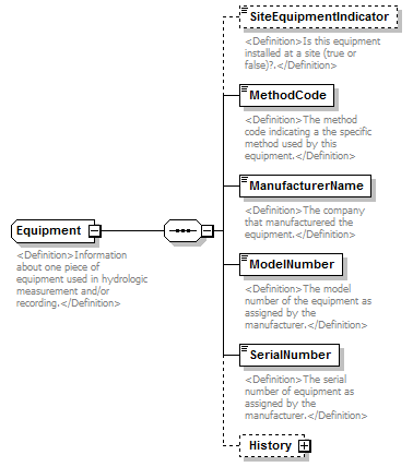 |
||
| namespace | http://water.usgs.gov/XML/NWIS/5.0 | ||
| properties |
|
||
| children | SiteEquipmentIndicator MethodCode ManufacturerName ModelNumber SerialNumber History | ||
| used by |
|
||
| annotation |
|
||
| source | <xsd:complexType name="Equipment" abstract="false"> <xsd:annotation> <xsd:documentation> <Definition>Information about one piece of equipment used in hydrologic measurement and/or recording.</Definition> </xsd:documentation> </xsd:annotation> <xsd:sequence> <xsd:element name="SiteEquipmentIndicator" type="xsd:boolean" minOccurs="0"> <xsd:annotation> <xsd:documentation> <Definition>Is this equipment installed at a site (true or false)?.</Definition> </xsd:documentation> </xsd:annotation> </xsd:element> <xsd:element name="MethodCode" type="xsd:NMTOKEN"> <xsd:annotation> <xsd:documentation> <Definition>The method code indicating a the specific method used by this equipment.</Definition> </xsd:documentation> </xsd:annotation> </xsd:element> <xsd:element name="ManufacturerName" type="EquipmentManufacturerName"> <xsd:annotation> <xsd:documentation> <Definition>The company that manufacturered the equipment.</Definition> </xsd:documentation> </xsd:annotation> </xsd:element> <xsd:element name="ModelNumber" type="EquipmentModelNumber"> <xsd:annotation> <xsd:documentation> <Definition>The model number of the equipment as assigned by the manufacturer.</Definition> </xsd:documentation> </xsd:annotation> </xsd:element> <xsd:element name="SerialNumber" type="EquipmentSerialNumber"> <xsd:annotation> <xsd:documentation> <Definition>The serial number of equipment as assigned by the manufacturer.</Definition> </xsd:documentation> </xsd:annotation> </xsd:element> <xsd:element name="History" type="RecordHistoryType" minOccurs="0"/> </xsd:sequence> </xsd:complexType> |
element Equipment/SiteEquipmentIndicator
| diagram |  |
||||||||
| namespace | http://water.usgs.gov/XML/NWIS/5.0 | ||||||||
| type | xsd:boolean | ||||||||
| properties |
|
||||||||
| annotation |
|
||||||||
| source | <xsd:element name="SiteEquipmentIndicator" type="xsd:boolean" minOccurs="0"> <xsd:annotation> <xsd:documentation> <Definition>Is this equipment installed at a site (true or false)?.</Definition> </xsd:documentation> </xsd:annotation> </xsd:element> |
element Equipment/MethodCode
| diagram | 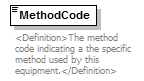 |
||||
| namespace | http://water.usgs.gov/XML/NWIS/5.0 | ||||
| type | xsd:NMTOKEN | ||||
| properties |
|
||||
| annotation |
|
||||
| source | <xsd:element name="MethodCode" type="xsd:NMTOKEN"> <xsd:annotation> <xsd:documentation> <Definition>The method code indicating a the specific method used by this equipment.</Definition> </xsd:documentation> </xsd:annotation> </xsd:element> |
element Equipment/ManufacturerName
| diagram | 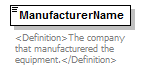 |
||||||
| namespace | http://water.usgs.gov/XML/NWIS/5.0 | ||||||
| type | EquipmentManufacturerName | ||||||
| properties |
|
||||||
| facets |
|
||||||
| annotation |
|
||||||
| source | <xsd:element name="ManufacturerName" type="EquipmentManufacturerName"> <xsd:annotation> <xsd:documentation> <Definition>The company that manufacturered the equipment.</Definition> </xsd:documentation> </xsd:annotation> </xsd:element> |
element Equipment/ModelNumber
| diagram |  |
||||||
| namespace | http://water.usgs.gov/XML/NWIS/5.0 | ||||||
| type | EquipmentModelNumber | ||||||
| properties |
|
||||||
| facets |
|
||||||
| annotation |
|
||||||
| source | <xsd:element name="ModelNumber" type="EquipmentModelNumber"> <xsd:annotation> <xsd:documentation> <Definition>The model number of the equipment as assigned by the manufacturer.</Definition> </xsd:documentation> </xsd:annotation> </xsd:element> |
element Equipment/SerialNumber
| diagram |  |
||||||
| namespace | http://water.usgs.gov/XML/NWIS/5.0 | ||||||
| type | EquipmentSerialNumber | ||||||
| properties |
|
||||||
| facets |
|
||||||
| annotation |
|
||||||
| source | <xsd:element name="SerialNumber" type="EquipmentSerialNumber"> <xsd:annotation> <xsd:documentation> <Definition>The serial number of equipment as assigned by the manufacturer.</Definition> </xsd:documentation> </xsd:annotation> </xsd:element> |
element Equipment/History
| diagram |  |
||||||||
| namespace | http://water.usgs.gov/XML/NWIS/5.0 | ||||||||
| type | RecordHistoryType | ||||||||
| properties |
|
||||||||
| children | CreatorUserName CreateDateTime ModifierUserName ModifyDateTime ApproverName ApprovalDateTime | ||||||||
| source | <xsd:element name="History" type="RecordHistoryType" minOccurs="0"/> |
complexType AbsoluteLocationType
| diagram | 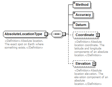 |
||||
| namespace | http://water.usgs.gov/XML/NWIS/5.0 | ||||
| type | extension of LocationType | ||||
| properties |
|
||||
| children | Method Accuracy Datum Coordinate Elevation | ||||
| used by |
|
||||
| annotation |
|
||||
| source | <xsd:complexType name="AbsoluteLocationType" abstract="false"> <xsd:annotation> <xsd:documentation source="http://en.wikipedia.org/wiki/Absolute_location"> <Definition>Absolute location. The exact spot on Earth where something exists.</Definition> </xsd:documentation> </xsd:annotation> <xsd:complexContent> <xsd:extension base="LocationType"> <xsd:sequence> <xsd:element name="Method" type="xsd:token"/> <xsd:element name="Accuracy" type="xsd:token"/> <xsd:element name="Datum" type="xsd:token"/> <xsd:element name="Coordinate" type="StandardizedCoordinateType" minOccurs="0"> <xsd:annotation> <xsd:documentation> <Definition>Absolute location coordinate. The latitude and longitude components of an absolute location.</Definition> </xsd:documentation> </xsd:annotation> </xsd:element> <xsd:element name="Elevation" type="ElevationType" minOccurs="0"> <xsd:annotation> <xsd:documentation> <Definition>Absolute location elevation. The elevation component of an absolute location.</Definition> </xsd:documentation> </xsd:annotation> </xsd:element> </xsd:sequence> </xsd:extension> </xsd:complexContent> </xsd:complexType> |
element AbsoluteLocationType/Method
| diagram |  |
||||
| namespace | http://water.usgs.gov/XML/NWIS/5.0 | ||||
| type | xsd:token | ||||
| properties |
|
||||
| source | <xsd:element name="Method" type="xsd:token"/> |
element AbsoluteLocationType/Accuracy
| diagram |  |
||||
| namespace | http://water.usgs.gov/XML/NWIS/5.0 | ||||
| type | xsd:token | ||||
| properties |
|
||||
| source | <xsd:element name="Accuracy" type="xsd:token"/> |
element AbsoluteLocationType/Datum
| diagram |  |
||||
| namespace | http://water.usgs.gov/XML/NWIS/5.0 | ||||
| type | xsd:token | ||||
| properties |
|
||||
| source | <xsd:element name="Datum" type="xsd:token"/> |
element AbsoluteLocationType/Coordinate
| diagram | 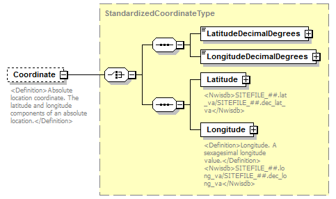 |
||||||||
| namespace | http://water.usgs.gov/XML/NWIS/5.0 | ||||||||
| type | StandardizedCoordinateType | ||||||||
| properties |
|
||||||||
| children | LatitudeDecimalDegrees LongitudeDecimalDegrees Latitude Longitude | ||||||||
| annotation |
|
||||||||
| source | <xsd:element name="Coordinate" type="StandardizedCoordinateType" minOccurs="0"> <xsd:annotation> <xsd:documentation> <Definition>Absolute location coordinate. The latitude and longitude components of an absolute location.</Definition> </xsd:documentation> </xsd:annotation> </xsd:element> |
element AbsoluteLocationType/Elevation
| diagram | 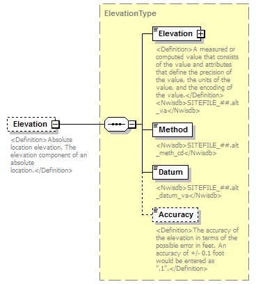 |
||||||||
| namespace | http://water.usgs.gov/XML/NWIS/5.0 | ||||||||
| type | ElevationType | ||||||||
| properties |
|
||||||||
| children | Elevation Method Datum Accuracy | ||||||||
| annotation |
|
||||||||
| source | <xsd:element name="Elevation" type="ElevationType" minOccurs="0"> <xsd:annotation> <xsd:documentation> <Definition>Absolute location elevation. The elevation component of an absolute location.</Definition> </xsd:documentation> </xsd:annotation> </xsd:element> |
complexType AgencySiteUseType
| diagram | 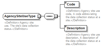 |
||
| namespace | http://water.usgs.gov/XML/NWIS/5.0 | ||
| properties |
|
||
| children | Code Description | ||
| used by |
|
||
| annotation |
|
||
| source | <xsd:complexType name="AgencySiteUseType" abstract="false"> <xsd:annotation> <xsd:documentation source="http://wwwnwis.er.usgs.gov/dbms/4.7/cm-dd.html#SITEFILE.agency_use_cd"> <Definition>Agency site use. The site's data collection status.</Definition> </xsd:documentation> </xsd:annotation> <xsd:sequence> <xsd:element name="Code"> <xsd:annotation> <xsd:documentation> <Definition>Agency site use code. A code abbreviating the data collection status at a site.</Definition> </xsd:documentation> </xsd:annotation> <xsd:simpleType> <xsd:restriction base="xsd:token"> <xsd:length value="1"/> </xsd:restriction> </xsd:simpleType> </xsd:element> <xsd:element name="Description"> <xsd:annotation> <xsd:documentation> <Definition>Agency site use description. A description of the data collection status at a site.</Definition> </xsd:documentation> </xsd:annotation> <xsd:simpleType> <xsd:restriction base="xsd:token"> <xsd:minLength value="1"/> <xsd:maxLength value="45"/> </xsd:restriction> </xsd:simpleType> </xsd:element> </xsd:sequence> </xsd:complexType> |
element AgencySiteUseType/Code
| diagram | 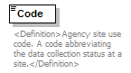 |
||||||
| namespace | http://water.usgs.gov/XML/NWIS/5.0 | ||||||
| type | restriction of xsd:token | ||||||
| properties |
|
||||||
| facets |
|
||||||
| annotation |
|
||||||
| source | <xsd:element name="Code"> <xsd:annotation> <xsd:documentation> <Definition>Agency site use code. A code abbreviating the data collection status at a site.</Definition> </xsd:documentation> </xsd:annotation> <xsd:simpleType> <xsd:restriction base="xsd:token"> <xsd:length value="1"/> </xsd:restriction> </xsd:simpleType> </xsd:element> |
element AgencySiteUseType/Description
| diagram | 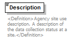 |
|||||||||
| namespace | http://water.usgs.gov/XML/NWIS/5.0 | |||||||||
| type | restriction of xsd:token | |||||||||
| properties |
|
|||||||||
| facets |
|
|||||||||
| annotation |
|
|||||||||
| source | <xsd:element name="Description"> <xsd:annotation> <xsd:documentation> <Definition>Agency site use description. A description of the data collection status at a site.</Definition> </xsd:documentation> </xsd:annotation> <xsd:simpleType> <xsd:restriction base="xsd:token"> <xsd:minLength value="1"/> <xsd:maxLength value="45"/> </xsd:restriction> </xsd:simpleType> </xsd:element> |
complexType AquiferType
| diagram | 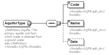 |
||
| namespace | http://water.usgs.gov/XML/NWIS/5.0 | ||
| properties |
|
||
| children | Code Name Date | ||
| used by |
|
||
| annotation |
|
||
| source | <xsd:complexType name="AquiferType" abstract="false"> <xsd:annotation> <xsd:documentation source="http://wwwnwis.er.usgs.gov/nwisdocs4_6/gw/gwcoding_Sect2-1.pdf"> <Definition>Aquifer. The primary aquifer unit from which water is obtained from a ground water site.</Definition> <Nwisdb>AQFR</Nwisdb> </xsd:documentation> </xsd:annotation> <xsd:sequence> <xsd:element name="Code"> <xsd:annotation> <xsd:documentation> <Nwisdb>AQFR.aqfr_cd</Nwisdb> </xsd:documentation> </xsd:annotation> <xsd:simpleType> <xsd:restriction base="xsd:token"> <xsd:minLength value="1"/> <xsd:maxLength value="8"/> </xsd:restriction> </xsd:simpleType> </xsd:element> <xsd:element name="Name"> <xsd:annotation> <xsd:documentation> <Nwisdb>AQFR.aqfr_nm</Nwisdb> </xsd:documentation> </xsd:annotation> <xsd:simpleType> <xsd:restriction base="xsd:token"> <xsd:minLength value="1"/> <xsd:maxLength value="70"/> </xsd:restriction> </xsd:simpleType> </xsd:element> <xsd:element name="Date" type="PartialDateType" minOccurs="0" maxOccurs="1"> <xsd:annotation> <xsd:documentation> <Nwisdb>AQFR.aqfr_dt</Nwisdb> </xsd:documentation> </xsd:annotation> </xsd:element> </xsd:sequence> </xsd:complexType> |
element AquiferType/Code
| diagram |  |
|||||||||
| namespace | http://water.usgs.gov/XML/NWIS/5.0 | |||||||||
| type | restriction of xsd:token | |||||||||
| properties |
|
|||||||||
| facets |
|
|||||||||
| annotation |
|
|||||||||
| source | <xsd:element name="Code"> <xsd:annotation> <xsd:documentation> <Nwisdb>AQFR.aqfr_cd</Nwisdb> </xsd:documentation> </xsd:annotation> <xsd:simpleType> <xsd:restriction base="xsd:token"> <xsd:minLength value="1"/> <xsd:maxLength value="8"/> </xsd:restriction> </xsd:simpleType> </xsd:element> |
element AquiferType/Name
| diagram |  |
|||||||||
| namespace | http://water.usgs.gov/XML/NWIS/5.0 | |||||||||
| type | restriction of xsd:token | |||||||||
| properties |
|
|||||||||
| facets |
|
|||||||||
| annotation |
|
|||||||||
| source | <xsd:element name="Name"> <xsd:annotation> <xsd:documentation> <Nwisdb>AQFR.aqfr_nm</Nwisdb> </xsd:documentation> </xsd:annotation> <xsd:simpleType> <xsd:restriction base="xsd:token"> <xsd:minLength value="1"/> <xsd:maxLength value="70"/> </xsd:restriction> </xsd:simpleType> </xsd:element> |
element AquiferType/Date
| diagram | 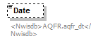 |
||||||||
| namespace | http://water.usgs.gov/XML/NWIS/5.0 | ||||||||
| type | PartialDateType | ||||||||
| properties |
|
||||||||
| annotation |
|
||||||||
| source | <xsd:element name="Date" type="PartialDateType" minOccurs="0" maxOccurs="1"> <xsd:annotation> <xsd:documentation> <Nwisdb>AQFR.aqfr_dt</Nwisdb> </xsd:documentation> </xsd:annotation> </xsd:element> |
complexType BasinType
| diagram | 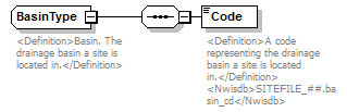 |
||
| namespace | http://water.usgs.gov/XML/NWIS/5.0 | ||
| properties |
|
||
| children | Code | ||
| used by |
|
||
| annotation |
|
||
| source | <xsd:complexType name="BasinType" abstract="false"> <xsd:annotation> <xsd:documentation source="http://wwwnwis.er.usgs.gov/dbms/4.7/cm-dd.html#SITEFILE.basin_cd"> <Definition>Basin. The drainage basin a site is located in.</Definition> </xsd:documentation> </xsd:annotation> <xsd:sequence> <xsd:element name="Code"> <xsd:annotation> <xsd:documentation> <Definition>A code representing the drainage basin a site is located in.</Definition> <Nwisdb>SITEFILE_##.basin_cd</Nwisdb> </xsd:documentation> </xsd:annotation> <xsd:simpleType> <xsd:restriction base="xsd:token"> <xsd:length value="2"/> </xsd:restriction> </xsd:simpleType> </xsd:element> </xsd:sequence> </xsd:complexType> |
element BasinType/Code
| diagram | 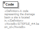 |
||||||
| namespace | http://water.usgs.gov/XML/NWIS/5.0 | ||||||
| type | restriction of xsd:token | ||||||
| properties |
|
||||||
| facets |
|
||||||
| annotation |
|
||||||
| source | <xsd:element name="Code"> <xsd:annotation> <xsd:documentation> <Definition>A code representing the drainage basin a site is located in.</Definition> <Nwisdb>SITEFILE_##.basin_cd</Nwisdb> </xsd:documentation> </xsd:annotation> <xsd:simpleType> <xsd:restriction base="xsd:token"> <xsd:length value="2"/> </xsd:restriction> </xsd:simpleType> </xsd:element> |
complexType BasinDrainageAreaType
| diagram | 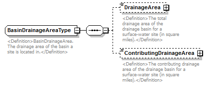 |
||
| namespace | http://water.usgs.gov/XML/NWIS/5.0 | ||
| properties |
|
||
| children | DrainageArea ContributingDrainageArea | ||
| used by |
|
||
| annotation |
|
||
| source | <xsd:complexType name="BasinDrainageAreaType" abstract="false"> <xsd:annotation> <xsd:documentation source="http://wwwnwis.er.usgs.gov/dbms/4.7/cm-dd.html#SITEFILE.basin_cd"> <Definition>BasinDrainageArea. The drainage area of the basin a site is located in.</Definition> </xsd:documentation> </xsd:annotation> <xsd:sequence> <xsd:element name="DrainageArea" type="IEEE754FloatValueType" minOccurs="0"> <xsd:annotation> <xsd:documentation> <Definition>The total drainage area of the drainage basin for a surface-water site (in square miles).</Definition> </xsd:documentation> </xsd:annotation> </xsd:element> <xsd:element name="ContributingDrainageArea" type="IEEE754FloatValueType" minOccurs="0"> <xsd:annotation> <xsd:documentation> <Definition>The contributing drainage area of the drainage basin for a surface-water site (in square miles).</Definition> </xsd:documentation> </xsd:annotation> </xsd:element> </xsd:sequence> </xsd:complexType> |
element BasinDrainageAreaType/DrainageArea
| diagram |  |
||||||||||||||||||||||||||||||||||||||||||||||
| namespace | http://water.usgs.gov/XML/NWIS/5.0 | ||||||||||||||||||||||||||||||||||||||||||||||
| type | IEEE754FloatValueType | ||||||||||||||||||||||||||||||||||||||||||||||
| properties |
|
||||||||||||||||||||||||||||||||||||||||||||||
| facets |
|
||||||||||||||||||||||||||||||||||||||||||||||
| attributes |
|
||||||||||||||||||||||||||||||||||||||||||||||
| annotation |
|
||||||||||||||||||||||||||||||||||||||||||||||
| source | <xsd:element name="DrainageArea" type="IEEE754FloatValueType" minOccurs="0"> <xsd:annotation> <xsd:documentation> <Definition>The total drainage area of the drainage basin for a surface-water site (in square miles).</Definition> </xsd:documentation> </xsd:annotation> </xsd:element> |
element BasinDrainageAreaType/ContributingDrainageArea
| diagram |  |
||||||||||||||||||||||||||||||||||||||||||||||
| namespace | http://water.usgs.gov/XML/NWIS/5.0 | ||||||||||||||||||||||||||||||||||||||||||||||
| type | IEEE754FloatValueType | ||||||||||||||||||||||||||||||||||||||||||||||
| properties |
|
||||||||||||||||||||||||||||||||||||||||||||||
| facets |
|
||||||||||||||||||||||||||||||||||||||||||||||
| attributes |
|
||||||||||||||||||||||||||||||||||||||||||||||
| annotation |
|
||||||||||||||||||||||||||||||||||||||||||||||
| source | <xsd:element name="ContributingDrainageArea" type="IEEE754FloatValueType" minOccurs="0"> <xsd:annotation> <xsd:documentation> <Definition>The contributing drainage area of the drainage basin for a surface-water site (in square miles).</Definition> </xsd:documentation> </xsd:annotation> </xsd:element> |
complexType CountryType
| diagram | 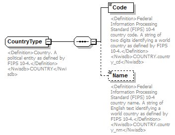 |
||||
| namespace | http://water.usgs.gov/XML/NWIS/5.0 | ||||
| type | extension of AreaType | ||||
| properties |
|
||||
| children | Code Name | ||||
| used by |
|
||||
| annotation |
|
||||
| source | <xsd:complexType name="CountryType" abstract="false"> <xsd:annotation> <xsd:documentation source="http://www.itl.nist.gov/fipspubs/fip10-4.htm"> <Definition>Country. A political entity as defined by FIPS 10-4.</Definition> <Nwisdb>COUNTRY</Nwisdb> </xsd:documentation> </xsd:annotation> <xsd:complexContent> <xsd:extension base="AreaType"> <xsd:sequence> <xsd:element name="Code"> <xsd:annotation> <xsd:documentation source="http://www.itl.nist.gov/fipspubs/fip10-4.htm"> <Definition>Federal Information Processing Standard (FIPS) 10-4 country code. A string of two digits identifying a world country as defined by FIPS 10-4.</Definition> <Nwisdb>COUNTRY.country_cd</Nwisdb> </xsd:documentation> </xsd:annotation> <xsd:simpleType> <xsd:restriction base="xsd:token"> <xsd:length value="2"/> <xsd:pattern value="[A-Z]{2}"/> </xsd:restriction> </xsd:simpleType> </xsd:element> <xsd:element name="Name" minOccurs="0"> <xsd:annotation> <xsd:documentation source="http://www.itl.nist.gov/fipspubs/fip10-4.htm"> <Definition>Federal Information Processing Standard (FIPS) 10-4 country name. A string of English text identifying a world country as defined by FIPS 10-4.</Definition> <Nwisdb>COUNTRY.country_nm</Nwisdb> </xsd:documentation> </xsd:annotation> <xsd:simpleType> <xsd:restriction base="xsd:token"> <xsd:minLength value="1"/> <xsd:maxLength value="48"/> </xsd:restriction> </xsd:simpleType> </xsd:element> </xsd:sequence> </xsd:extension> </xsd:complexContent> </xsd:complexType> |
element CountryType/Code
| diagram | 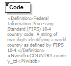 |
|||||||||
| namespace | http://water.usgs.gov/XML/NWIS/5.0 | |||||||||
| type | restriction of xsd:token | |||||||||
| properties |
|
|||||||||
| facets |
|
|||||||||
| annotation |
|
|||||||||
| source | <xsd:element name="Code"> <xsd:annotation> <xsd:documentation source="http://www.itl.nist.gov/fipspubs/fip10-4.htm"> <Definition>Federal Information Processing Standard (FIPS) 10-4 country code. A string of two digits identifying a world country as defined by FIPS 10-4.</Definition> <Nwisdb>COUNTRY.country_cd</Nwisdb> </xsd:documentation> </xsd:annotation> <xsd:simpleType> <xsd:restriction base="xsd:token"> <xsd:length value="2"/> <xsd:pattern value="[A-Z]{2}"/> </xsd:restriction> </xsd:simpleType> </xsd:element> |
element CountryType/Name
| diagram | 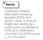 |
|||||||||
| namespace | http://water.usgs.gov/XML/NWIS/5.0 | |||||||||
| type | restriction of xsd:token | |||||||||
| properties |
|
|||||||||
| facets |
|
|||||||||
| annotation |
|
|||||||||
| source | <xsd:element name="Name" minOccurs="0"> <xsd:annotation> <xsd:documentation source="http://www.itl.nist.gov/fipspubs/fip10-4.htm"> <Definition>Federal Information Processing Standard (FIPS) 10-4 country name. A string of English text identifying a world country as defined by FIPS 10-4.</Definition> <Nwisdb>COUNTRY.country_nm</Nwisdb> </xsd:documentation> </xsd:annotation> <xsd:simpleType> <xsd:restriction base="xsd:token"> <xsd:minLength value="1"/> <xsd:maxLength value="48"/> </xsd:restriction> </xsd:simpleType> </xsd:element> |
complexType CountyType
| diagram | 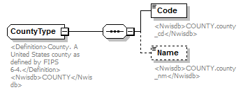 |
||||
| namespace | http://water.usgs.gov/XML/NWIS/5.0 | ||||
| type | extension of AreaType | ||||
| properties |
|
||||
| children | Code Name | ||||
| used by |
|
||||
| annotation |
|
||||
| source | <xsd:complexType name="CountyType" abstract="false"> <xsd:annotation> <xsd:documentation source="http://www.itl.nist.gov/fipspubs/fip6-4.htm"> <Definition>County. A United States county as defined by FIPS 6-4.</Definition> <Nwisdb>COUNTY</Nwisdb> </xsd:documentation> </xsd:annotation> <xsd:complexContent> <xsd:extension base="AreaType"> <xsd:sequence> <xsd:element name="Code"> <xsd:annotation> <xsd:documentation> <Nwisdb>COUNTY.county_cd</Nwisdb> </xsd:documentation> </xsd:annotation> <xsd:simpleType> <xsd:restriction base="xsd:token"> <xsd:length value="3"/> </xsd:restriction> </xsd:simpleType> </xsd:element> <xsd:element name="Name" minOccurs="0"> <xsd:annotation> <xsd:documentation> <Nwisdb>COUNTY.county_nm</Nwisdb> </xsd:documentation> </xsd:annotation> <xsd:simpleType> <xsd:restriction base="xsd:token"> <xsd:minLength value="1"/> <xsd:maxLength value="48"/> </xsd:restriction> </xsd:simpleType> </xsd:element> </xsd:sequence> </xsd:extension> </xsd:complexContent> </xsd:complexType> |
element CountyType/Code
| diagram | 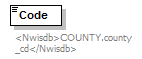 |
||||||
| namespace | http://water.usgs.gov/XML/NWIS/5.0 | ||||||
| type | restriction of xsd:token | ||||||
| properties |
|
||||||
| facets |
|
||||||
| annotation |
|
||||||
| source | <xsd:element name="Code"> <xsd:annotation> <xsd:documentation> <Nwisdb>COUNTY.county_cd</Nwisdb> </xsd:documentation> </xsd:annotation> <xsd:simpleType> <xsd:restriction base="xsd:token"> <xsd:length value="3"/> </xsd:restriction> </xsd:simpleType> </xsd:element> |
element CountyType/Name
| diagram | 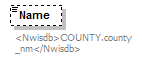 |
|||||||||
| namespace | http://water.usgs.gov/XML/NWIS/5.0 | |||||||||
| type | restriction of xsd:token | |||||||||
| properties |
|
|||||||||
| facets |
|
|||||||||
| annotation |
|
|||||||||
| source | <xsd:element name="Name" minOccurs="0"> <xsd:annotation> <xsd:documentation> <Nwisdb>COUNTY.county_nm</Nwisdb> </xsd:documentation> </xsd:annotation> <xsd:simpleType> <xsd:restriction base="xsd:token"> <xsd:minLength value="1"/> <xsd:maxLength value="48"/> </xsd:restriction> </xsd:simpleType> </xsd:element> |
complexType DataTypeType
| diagram | 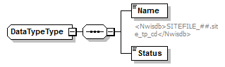 |
||
| namespace | http://water.usgs.gov/XML/NWIS/5.0 | ||
| properties |
|
||
| children | Name Status | ||
| used by |
|
||
| source | <xsd:complexType name="DataTypeType" abstract="false"> <xsd:sequence> <xsd:element name="Name" type="xsd:token"> <xsd:annotation> <xsd:documentation> <Nwisdb>SITEFILE_##.site_tp_cd</Nwisdb> </xsd:documentation> </xsd:annotation> </xsd:element> <xsd:element name="Status" type="xsd:token"/> </xsd:sequence> </xsd:complexType> |
element DataTypeType/Name
| diagram | 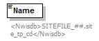 |
||||
| namespace | http://water.usgs.gov/XML/NWIS/5.0 | ||||
| type | xsd:token | ||||
| properties |
|
||||
| annotation |
|
||||
| source | <xsd:element name="Name" type="xsd:token"> <xsd:annotation> <xsd:documentation> <Nwisdb>SITEFILE_##.site_tp_cd</Nwisdb> </xsd:documentation> </xsd:annotation> </xsd:element> |
element DataTypeType/Status
| diagram |  |
||||
| namespace | http://water.usgs.gov/XML/NWIS/5.0 | ||||
| type | xsd:token | ||||
| properties |
|
||||
| source | <xsd:element name="Status" type="xsd:token"/> |
complexType HydrologicUnitType
| diagram | 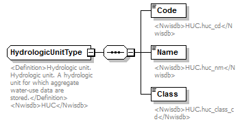 |
||
| namespace | http://water.usgs.gov/XML/NWIS/5.0 | ||
| properties |
|
||
| children | Code Name Class | ||
| used by |
|
||
| annotation |
|
||
| source | <xsd:complexType name="HydrologicUnitType" abstract="false"> <xsd:annotation> <xsd:documentation source="http://wwwnwis.er.usgs.gov/dbms/4.7/cm-dd.html#HUC"> <Definition>Hydrologic unit. Hydrologic unit. A hydrologic unit for which aggregate water-use data are stored.</Definition> <Nwisdb>HUC</Nwisdb> </xsd:documentation> </xsd:annotation> <xsd:sequence> <xsd:element name="Code"> <xsd:annotation> <xsd:documentation> <Nwisdb>HUC.huc_cd</Nwisdb> </xsd:documentation> </xsd:annotation> <xsd:simpleType> <xsd:restriction base="xsd:token"> <xsd:minLength value="2"/> <xsd:maxLength value="16"/> </xsd:restriction> </xsd:simpleType> </xsd:element> <xsd:element name="Name"> <xsd:annotation> <xsd:documentation> <Nwisdb>HUC.huc_nm</Nwisdb> </xsd:documentation> </xsd:annotation> <xsd:simpleType> <xsd:restriction base="xsd:token"> <xsd:minLength value="1"/> <xsd:maxLength value="64"/> </xsd:restriction> </xsd:simpleType> </xsd:element> <xsd:element name="Class"> <xsd:annotation> <xsd:documentation> <Nwisdb>HUC.huc_class_cd</Nwisdb> </xsd:documentation> </xsd:annotation> <xsd:simpleType> <xsd:restriction base="xsd:token"> <xsd:length value="1"/> </xsd:restriction> </xsd:simpleType> </xsd:element> </xsd:sequence> </xsd:complexType> |
element HydrologicUnitType/Code
| diagram | 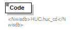 |
|||||||||
| namespace | http://water.usgs.gov/XML/NWIS/5.0 | |||||||||
| type | restriction of xsd:token | |||||||||
| properties |
|
|||||||||
| facets |
|
|||||||||
| annotation |
|
|||||||||
| source | <xsd:element name="Code"> <xsd:annotation> <xsd:documentation> <Nwisdb>HUC.huc_cd</Nwisdb> </xsd:documentation> </xsd:annotation> <xsd:simpleType> <xsd:restriction base="xsd:token"> <xsd:minLength value="2"/> <xsd:maxLength value="16"/> </xsd:restriction> </xsd:simpleType> </xsd:element> |
element HydrologicUnitType/Name
| diagram | 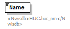 |
|||||||||
| namespace | http://water.usgs.gov/XML/NWIS/5.0 | |||||||||
| type | restriction of xsd:token | |||||||||
| properties |
|
|||||||||
| facets |
|
|||||||||
| annotation |
|
|||||||||
| source | <xsd:element name="Name"> <xsd:annotation> <xsd:documentation> <Nwisdb>HUC.huc_nm</Nwisdb> </xsd:documentation> </xsd:annotation> <xsd:simpleType> <xsd:restriction base="xsd:token"> <xsd:minLength value="1"/> <xsd:maxLength value="64"/> </xsd:restriction> </xsd:simpleType> </xsd:element> |
element HydrologicUnitType/Class
| diagram | 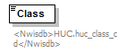 |
||||||
| namespace | http://water.usgs.gov/XML/NWIS/5.0 | ||||||
| type | restriction of xsd:token | ||||||
| properties |
|
||||||
| facets |
|
||||||
| annotation |
|
||||||
| source | <xsd:element name="Class"> <xsd:annotation> <xsd:documentation> <Nwisdb>HUC.huc_class_cd</Nwisdb> </xsd:documentation> </xsd:annotation> <xsd:simpleType> <xsd:restriction base="xsd:token"> <xsd:length value="1"/> </xsd:restriction> </xsd:simpleType> </xsd:element> |
complexType InstrumentType
| diagram | 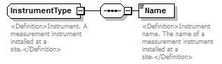 |
||
| namespace | http://water.usgs.gov/XML/NWIS/5.0 | ||
| properties |
|
||
| children | Name | ||
| used by |
|
||
| annotation |
|
||
| source | <xsd:complexType name="InstrumentType" abstract="false"> <xsd:annotation> <xsd:documentation source="http://wwwnwis.er.usgs.gov/nwisdocs4_6/gw/gwcoding_Sect2-1.pdf"> <Definition>Instrument. A measurement instrument installed at a site.</Definition> </xsd:documentation> </xsd:annotation> <xsd:sequence> <xsd:element name="Name"> <xsd:annotation> <xsd:documentation> <Definition>Instrument name. The name of a measurement instrument installed at a site.</Definition> </xsd:documentation> </xsd:annotation> <xsd:simpleType> <xsd:restriction base="xsd:token"> <xsd:minLength value="1"/> <xsd:maxLength value="26"/> </xsd:restriction> </xsd:simpleType> </xsd:element> </xsd:sequence> </xsd:complexType> |
element InstrumentType/Name
| diagram | 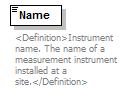 |
|||||||||
| namespace | http://water.usgs.gov/XML/NWIS/5.0 | |||||||||
| type | restriction of xsd:token | |||||||||
| properties |
|
|||||||||
| facets |
|
|||||||||
| annotation |
|
|||||||||
| source | <xsd:element name="Name"> <xsd:annotation> <xsd:documentation> <Definition>Instrument name. The name of a measurement instrument installed at a site.</Definition> </xsd:documentation> </xsd:annotation> <xsd:simpleType> <xsd:restriction base="xsd:token"> <xsd:minLength value="1"/> <xsd:maxLength value="26"/> </xsd:restriction> </xsd:simpleType> </xsd:element> |
complexType MapType
| diagram | 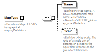 |
||
| namespace | http://water.usgs.gov/XML/NWIS/5.0 | ||
| properties |
|
||
| children | Name Scale | ||
| used by |
|
||
| annotation |
|
||
| source | <xsd:complexType name="MapType" abstract="false"> <xsd:annotation> <xsd:documentation> <Definition>Map. A USGS topographical map.</Definition> </xsd:documentation> </xsd:annotation> <xsd:sequence> <xsd:element name="Name"> <xsd:annotation> <xsd:documentation> <Definition>Map name. A USGS topographical map name.</Definition> <Nwisdb>SITEFILE_##.map_nm</Nwisdb> </xsd:documentation> </xsd:annotation> <xsd:simpleType> <xsd:restriction base="xsd:token"> <xsd:minLength value="1"/> <xsd:maxLength value="20"/> </xsd:restriction> </xsd:simpleType> </xsd:element> <xsd:element name="Scale" type="xsd:token" minOccurs="0" maxOccurs="1"> <xsd:annotation> <xsd:documentation> <Definition>Map scale. The ratio of a single unit of distance on a map to the equivalent distance on the ground.</Definition> </xsd:documentation> </xsd:annotation> </xsd:element> </xsd:sequence> </xsd:complexType> |
element MapType/Name
| diagram | 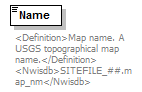 |
|||||||||
| namespace | http://water.usgs.gov/XML/NWIS/5.0 | |||||||||
| type | restriction of xsd:token | |||||||||
| properties |
|
|||||||||
| facets |
|
|||||||||
| annotation |
|
|||||||||
| source | <xsd:element name="Name"> <xsd:annotation> <xsd:documentation> <Definition>Map name. A USGS topographical map name.</Definition> <Nwisdb>SITEFILE_##.map_nm</Nwisdb> </xsd:documentation> </xsd:annotation> <xsd:simpleType> <xsd:restriction base="xsd:token"> <xsd:minLength value="1"/> <xsd:maxLength value="20"/> </xsd:restriction> </xsd:simpleType> </xsd:element> |
element MapType/Scale
| diagram |  |
||||||||
| namespace | http://water.usgs.gov/XML/NWIS/5.0 | ||||||||
| type | xsd:token | ||||||||
| properties |
|
||||||||
| annotation |
|
||||||||
| source | <xsd:element name="Scale" type="xsd:token" minOccurs="0" maxOccurs="1"> <xsd:annotation> <xsd:documentation> <Definition>Map scale. The ratio of a single unit of distance on a map to the equivalent distance on the ground.</Definition> </xsd:documentation> </xsd:annotation> </xsd:element> |
complexType NationalAquiferType
| diagram | 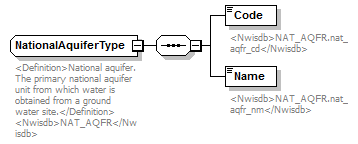 |
||
| namespace | http://water.usgs.gov/XML/NWIS/5.0 | ||
| properties |
|
||
| children | Code Name | ||
| used by |
|
||
| annotation |
|
||
| source | <xsd:complexType name="NationalAquiferType" abstract="false"> <xsd:annotation> <xsd:documentation source="http://wwwnwis.er.usgs.gov/nwisdocs4_6/gw/gwcoding_Sect2-1.pdf"> <Definition>National aquifer. The primary national aquifer unit from which water is obtained from a ground water site.</Definition> <Nwisdb>NAT_AQFR</Nwisdb> </xsd:documentation> </xsd:annotation> <xsd:sequence> <xsd:element name="Code"> <xsd:annotation> <xsd:documentation> <Nwisdb>NAT_AQFR.nat_aqfr_cd</Nwisdb> </xsd:documentation> </xsd:annotation> <xsd:simpleType> <xsd:restriction base="xsd:token"> <xsd:minLength value="1"/> <xsd:maxLength value="10"/> </xsd:restriction> </xsd:simpleType> </xsd:element> <xsd:element name="Name"> <xsd:annotation> <xsd:documentation> <Nwisdb>NAT_AQFR.nat_aqfr_nm</Nwisdb> </xsd:documentation> </xsd:annotation> <xsd:simpleType> <xsd:restriction base="xsd:token"> <xsd:minLength value="1"/> <xsd:maxLength value="64"/> </xsd:restriction> </xsd:simpleType> </xsd:element> </xsd:sequence> </xsd:complexType> |
element NationalAquiferType/Code
| diagram |  |
|||||||||
| namespace | http://water.usgs.gov/XML/NWIS/5.0 | |||||||||
| type | restriction of xsd:token | |||||||||
| properties |
|
|||||||||
| facets |
|
|||||||||
| annotation |
|
|||||||||
| source | <xsd:element name="Code"> <xsd:annotation> <xsd:documentation> <Nwisdb>NAT_AQFR.nat_aqfr_cd</Nwisdb> </xsd:documentation> </xsd:annotation> <xsd:simpleType> <xsd:restriction base="xsd:token"> <xsd:minLength value="1"/> <xsd:maxLength value="10"/> </xsd:restriction> </xsd:simpleType> </xsd:element> |
element NationalAquiferType/Name
| diagram |  |
|||||||||
| namespace | http://water.usgs.gov/XML/NWIS/5.0 | |||||||||
| type | restriction of xsd:token | |||||||||
| properties |
|
|||||||||
| facets |
|
|||||||||
| annotation |
|
|||||||||
| source | <xsd:element name="Name"> <xsd:annotation> <xsd:documentation> <Nwisdb>NAT_AQFR.nat_aqfr_nm</Nwisdb> </xsd:documentation> </xsd:annotation> <xsd:simpleType> <xsd:restriction base="xsd:token"> <xsd:minLength value="1"/> <xsd:maxLength value="64"/> </xsd:restriction> </xsd:simpleType> </xsd:element> |
complexType NationalWaterUseType
| diagram | 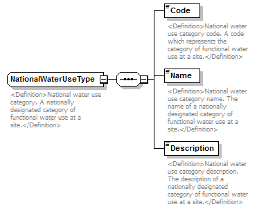 |
||
| namespace | http://water.usgs.gov/XML/NWIS/5.0 | ||
| properties |
|
||
| children | Code Name Description | ||
| used by |
|
||
| annotation |
|
||
| source | <xsd:complexType name="NationalWaterUseType" abstract="false"> <xsd:annotation> <xsd:documentation> <Definition>National water use category. A nationally designated category of functional water use at a site.</Definition> </xsd:documentation> </xsd:annotation> <xsd:sequence> <xsd:element name="Code"> <xsd:annotation> <xsd:documentation> <Definition>National water use category code. A code which represents the category of functional water use at a site.</Definition> </xsd:documentation> </xsd:annotation> <xsd:simpleType> <xsd:restriction base="xsd:token"> <xsd:length value="2"/> </xsd:restriction> </xsd:simpleType> </xsd:element> <xsd:element name="Name" type="xsd:token"> <xsd:annotation> <xsd:documentation> <Definition>National water use category name. The name of a nationally designated category of functional water use at a site.</Definition> </xsd:documentation> </xsd:annotation> </xsd:element> <xsd:element name="Description"> <xsd:annotation> <xsd:documentation source="http://wwwnwis.er.usgs.gov/dbms/4.7/cm-dd.html#NAT_WATER_USE_CD"> <Definition>National water use category description. The description of a nationally designated category of functional water use at a site.</Definition> </xsd:documentation> </xsd:annotation> <xsd:simpleType> <xsd:restriction base="xsd:token"> <xsd:minLength value="1"/> <xsd:maxLength value="512"/> </xsd:restriction> </xsd:simpleType> </xsd:element> </xsd:sequence> </xsd:complexType> |
element NationalWaterUseType/Code
| diagram | 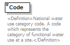 |
||||||
| namespace | http://water.usgs.gov/XML/NWIS/5.0 | ||||||
| type | restriction of xsd:token | ||||||
| properties |
|
||||||
| facets |
|
||||||
| annotation |
|
||||||
| source | <xsd:element name="Code"> <xsd:annotation> <xsd:documentation> <Definition>National water use category code. A code which represents the category of functional water use at a site.</Definition> </xsd:documentation> </xsd:annotation> <xsd:simpleType> <xsd:restriction base="xsd:token"> <xsd:length value="2"/> </xsd:restriction> </xsd:simpleType> </xsd:element> |
element NationalWaterUseType/Name
| diagram | 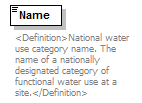 |
||||
| namespace | http://water.usgs.gov/XML/NWIS/5.0 | ||||
| type | xsd:token | ||||
| properties |
|
||||
| annotation |
|
||||
| source | <xsd:element name="Name" type="xsd:token"> <xsd:annotation> <xsd:documentation> <Definition>National water use category name. The name of a nationally designated category of functional water use at a site.</Definition> </xsd:documentation> </xsd:annotation> </xsd:element> |
element NationalWaterUseType/Description
| diagram | 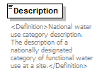 |
|||||||||
| namespace | http://water.usgs.gov/XML/NWIS/5.0 | |||||||||
| type | restriction of xsd:token | |||||||||
| properties |
|
|||||||||
| facets |
|
|||||||||
| annotation |
|
|||||||||
| source | <xsd:element name="Description"> <xsd:annotation> <xsd:documentation source="http://wwwnwis.er.usgs.gov/dbms/4.7/cm-dd.html#NAT_WATER_USE_CD"> <Definition>National water use category description. The description of a nationally designated category of functional water use at a site.</Definition> </xsd:documentation> </xsd:annotation> <xsd:simpleType> <xsd:restriction base="xsd:token"> <xsd:minLength value="1"/> <xsd:maxLength value="512"/> </xsd:restriction> </xsd:simpleType> </xsd:element> |
complexType PLSSAreaType
| diagram | 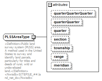 |
||||||||||||||||||||||||||||||||||||||||||||||||
| namespace | http://water.usgs.gov/XML/NWIS/5.0 | ||||||||||||||||||||||||||||||||||||||||||||||||
| type | extension of xsd:token | ||||||||||||||||||||||||||||||||||||||||||||||||
| properties |
|
||||||||||||||||||||||||||||||||||||||||||||||||
| used by |
|
||||||||||||||||||||||||||||||||||||||||||||||||
| attributes |
|
||||||||||||||||||||||||||||||||||||||||||||||||
| annotation |
|
||||||||||||||||||||||||||||||||||||||||||||||||
| source | <xsd:complexType name="PLSSAreaType" abstract="false"> <xsd:annotation> <xsd:documentation source="http://en.wikipedia.org/wiki/Public_Lands_Survey_System"> <Definition>Public land survey system (PLSS) area. A method used in the United States to survey and identify land parcels, particularly for titles and deeds of rural, wild or undeveloped land.</Definition> <Nwisdb>SITEFILE_##.land_net_ds</Nwisdb> </xsd:documentation> </xsd:annotation> <xsd:simpleContent> <xsd:extension base="xsd:token"> <xsd:attribute name="quarterQuarterQuarter" type="xsd:token" use="optional"> <xsd:annotation> <xsd:documentation/> </xsd:annotation> </xsd:attribute> <xsd:attribute name="quarterQuarter" type="xsd:token" use="optional"> <xsd:annotation> <xsd:documentation/> </xsd:annotation> </xsd:attribute> <xsd:attribute name="quarter" type="xsd:token" use="optional"> <xsd:annotation> <xsd:documentation/> </xsd:annotation> </xsd:attribute> <xsd:attribute name="section" type="xsd:token" use="optional"> <xsd:annotation> <xsd:documentation/> </xsd:annotation> </xsd:attribute> <xsd:attribute name="township" type="xsd:token" use="optional"> <xsd:annotation> <xsd:documentation/> </xsd:annotation> </xsd:attribute> <xsd:attribute name="range" type="xsd:token" use="optional"> <xsd:annotation> <xsd:documentation/> </xsd:annotation> </xsd:attribute> <xsd:attribute name="meridian" type="xsd:token" use="optional"> <xsd:annotation> <xsd:documentation/> </xsd:annotation> </xsd:attribute> </xsd:extension> </xsd:simpleContent> </xsd:complexType> |
attribute PLSSAreaType/@quarterQuarterQuarter
| type | xsd:token | ||||
| properties |
|
||||
| source | <xsd:attribute name="quarterQuarterQuarter" type="xsd:token" use="optional"> <xsd:annotation> <xsd:documentation/> </xsd:annotation> </xsd:attribute> |
attribute PLSSAreaType/@quarterQuarter
| type | xsd:token | ||||
| properties |
|
||||
| source | <xsd:attribute name="quarterQuarter" type="xsd:token" use="optional"> <xsd:annotation> <xsd:documentation/> </xsd:annotation> </xsd:attribute> |
attribute PLSSAreaType/@quarter
| type | xsd:token | ||||
| properties |
|
||||
| source | <xsd:attribute name="quarter" type="xsd:token" use="optional"> <xsd:annotation> <xsd:documentation/> </xsd:annotation> </xsd:attribute> |
attribute PLSSAreaType/@section
| type | xsd:token | ||||
| properties |
|
||||
| source | <xsd:attribute name="section" type="xsd:token" use="optional"> <xsd:annotation> <xsd:documentation/> </xsd:annotation> </xsd:attribute> |
attribute PLSSAreaType/@township
| type | xsd:token | ||||
| properties |
|
||||
| source | <xsd:attribute name="township" type="xsd:token" use="optional"> <xsd:annotation> <xsd:documentation/> </xsd:annotation> </xsd:attribute> |
attribute PLSSAreaType/@range
| type | xsd:token | ||||
| properties |
|
||||
| source | <xsd:attribute name="range" type="xsd:token" use="optional"> <xsd:annotation> <xsd:documentation/> </xsd:annotation> </xsd:attribute> |
attribute PLSSAreaType/@meridian
| type | xsd:token | ||||
| properties |
|
||||
| source | <xsd:attribute name="meridian" type="xsd:token" use="optional"> <xsd:annotation> <xsd:documentation/> </xsd:annotation> </xsd:attribute> |
simpleType PartialDateType
| namespace | http://water.usgs.gov/XML/NWIS/5.0 | ||
| type | union of (xsd:date, xsd:gYearMonth, xsd:gYear) | ||
| used by |
|
||
| source | <xsd:simpleType name="PartialDateType"> <xsd:annotation> <xsd:documentation/> </xsd:annotation> <xsd:union memberTypes="xsd:date xsd:gYearMonth xsd:gYear"/> </xsd:simpleType> |
element PrincipalAdministrativeDivision
| diagram | 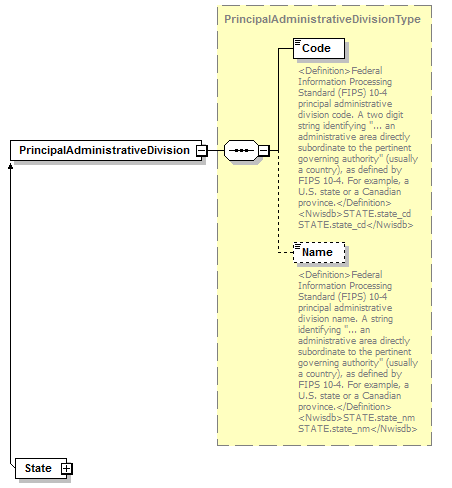 |
||
| namespace | http://water.usgs.gov/XML/NWIS/5.0 | ||
| type | PrincipalAdministrativeDivisionType | ||
| properties |
|
||
| children | Code Name | ||
| used by |
|
||
| source | <xsd:element name="PrincipalAdministrativeDivision" type="PrincipalAdministrativeDivisionType"/> |
complexType PrincipalAdministrativeDivisionType
| diagram | 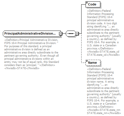 |
||||
| namespace | http://water.usgs.gov/XML/NWIS/5.0 | ||||
| type | extension of AreaType | ||||
| properties |
|
||||
| children | Code Name | ||||
| used by |
|
||||
| annotation |
|
||||
| source | <xsd:complexType name="PrincipalAdministrativeDivisionType" abstract="false"> <xsd:annotation> <xsd:documentation source="http://www.itl.nist.gov/fipspubs/fip10-4.htm"> <Definition>Principal Administrative Division. FIPS 10-4 Principal Administrative Division: " For purposes of this standard, a principal administrative division is defined as an administrative area directly subordinate to the pertinent governing authority. Even though all principal administrative divisions within an entity may not be of equal rank, this Standard considers them as 'principal.' "</Definition> <Nwisdb>STATE</Nwisdb> </xsd:documentation> </xsd:annotation> <xsd:complexContent> <xsd:extension base="AreaType"> <xsd:sequence> <xsd:element name="Code"> <xsd:annotation> <xsd:documentation source="http://www.itl.nist.gov/fipspubs/fip10-4.htm"> <Definition>Federal Information Processing Standard (FIPS) 10-4 principal administrative division code. A two digit string identifying "... an administrative area directly subordinate to the pertinent governing authority" (usually a country), as defined by FIPS 10-4. For example, a U.S. state or a Canadian province.</Definition> <Nwisdb>STATE.state_cd STATE.state_cd</Nwisdb> </xsd:documentation> </xsd:annotation> <xsd:simpleType> <xsd:restriction base="xsd:token"> <xsd:length value="2"/> <xsd:pattern value="[0-9][0-9]"/> </xsd:restriction> </xsd:simpleType> </xsd:element> <xsd:element name="Name" minOccurs="0"> <xsd:annotation> <xsd:documentation source="http://www.itl.nist.gov/fipspubs/fip10-4.htm"> <Definition>Federal Information Processing Standard (FIPS) 10-4 principal administrative division name. A string identifying "... an administrative area directly subordinate to the pertinent governing authority" (usually a country), as defined by FIPS 10-4. For example, a U.S. state or a Canadian province.</Definition> <Nwisdb>STATE.state_nm STATE.state_nm</Nwisdb> </xsd:documentation> </xsd:annotation> <xsd:simpleType> <xsd:restriction base="xsd:token"> <xsd:minLength value="1"/> <xsd:maxLength value="53"/> </xsd:restriction> </xsd:simpleType> </xsd:element> </xsd:sequence> </xsd:extension> </xsd:complexContent> </xsd:complexType> |
element PrincipalAdministrativeDivisionType/Code
| diagram | 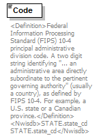 |
|||||||||
| namespace | http://water.usgs.gov/XML/NWIS/5.0 | |||||||||
| type | restriction of xsd:token | |||||||||
| properties |
|
|||||||||
| facets |
|
|||||||||
| annotation |
|
|||||||||
| source | <xsd:element name="Code"> <xsd:annotation> <xsd:documentation source="http://www.itl.nist.gov/fipspubs/fip10-4.htm"> <Definition>Federal Information Processing Standard (FIPS) 10-4 principal administrative division code. A two digit string identifying "... an administrative area directly subordinate to the pertinent governing authority" (usually a country), as defined by FIPS 10-4. For example, a U.S. state or a Canadian province.</Definition> <Nwisdb>STATE.state_cd STATE.state_cd</Nwisdb> </xsd:documentation> </xsd:annotation> <xsd:simpleType> <xsd:restriction base="xsd:token"> <xsd:length value="2"/> <xsd:pattern value="[0-9][0-9]"/> </xsd:restriction> </xsd:simpleType> </xsd:element> |
element PrincipalAdministrativeDivisionType/Name
| diagram | 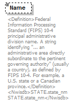 |
|||||||||
| namespace | http://water.usgs.gov/XML/NWIS/5.0 | |||||||||
| type | restriction of xsd:token | |||||||||
| properties |
|
|||||||||
| facets |
|
|||||||||
| annotation |
|
|||||||||
| source | <xsd:element name="Name" minOccurs="0"> <xsd:annotation> <xsd:documentation source="http://www.itl.nist.gov/fipspubs/fip10-4.htm"> <Definition>Federal Information Processing Standard (FIPS) 10-4 principal administrative division name. A string identifying "... an administrative area directly subordinate to the pertinent governing authority" (usually a country), as defined by FIPS 10-4. For example, a U.S. state or a Canadian province.</Definition> <Nwisdb>STATE.state_nm STATE.state_nm</Nwisdb> </xsd:documentation> </xsd:annotation> <xsd:simpleType> <xsd:restriction base="xsd:token"> <xsd:minLength value="1"/> <xsd:maxLength value="53"/> </xsd:restriction> </xsd:simpleType> </xsd:element> |
complexType ReliabilityType
| diagram | 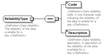 |
||
| namespace | http://water.usgs.gov/XML/NWIS/5.0 | ||
| properties |
|
||
| children | Code Description | ||
| used by |
|
||
| annotation |
|
||
| source | <xsd:complexType name="ReliabilityType" abstract="false"> <xsd:annotation> <xsd:documentation source="http://wwwnwis.er.usgs.gov/nwisdocs4_6/gw/gwcoding_Sect2-1.pdf"> <Definition>Data reliability. The reliability of the data available for a site.</Definition> </xsd:documentation> </xsd:annotation> <xsd:sequence> <xsd:element name="Code"> <xsd:annotation> <xsd:documentation> <Definition>Data reliability code. A one character code indicating the reliability of the data available for a site.</Definition> </xsd:documentation> </xsd:annotation> <xsd:simpleType> <xsd:restriction base="xsd:token"> <xsd:minLength value="1"/> <xsd:maxLength value="1"/> </xsd:restriction> </xsd:simpleType> </xsd:element> <xsd:element name="Description"> <xsd:annotation> <xsd:documentation> <Definition>Data reliability description. A description of the reliability of the data available for a site.</Definition> </xsd:documentation> </xsd:annotation> <xsd:simpleType> <xsd:restriction base="xsd:token"> <xsd:minLength value="1"/> <xsd:maxLength value="111"/> </xsd:restriction> </xsd:simpleType> </xsd:element> </xsd:sequence> </xsd:complexType> |
element ReliabilityType/Code
| diagram | 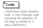 |
|||||||||
| namespace | http://water.usgs.gov/XML/NWIS/5.0 | |||||||||
| type | restriction of xsd:token | |||||||||
| properties |
|
|||||||||
| facets |
|
|||||||||
| annotation |
|
|||||||||
| source | <xsd:element name="Code"> <xsd:annotation> <xsd:documentation> <Definition>Data reliability code. A one character code indicating the reliability of the data available for a site.</Definition> </xsd:documentation> </xsd:annotation> <xsd:simpleType> <xsd:restriction base="xsd:token"> <xsd:minLength value="1"/> <xsd:maxLength value="1"/> </xsd:restriction> </xsd:simpleType> </xsd:element> |
element ReliabilityType/Description
| diagram | 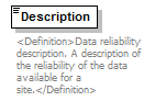 |
|||||||||
| namespace | http://water.usgs.gov/XML/NWIS/5.0 | |||||||||
| type | restriction of xsd:token | |||||||||
| properties |
|
|||||||||
| facets |
|
|||||||||
| annotation |
|
|||||||||
| source | <xsd:element name="Description"> <xsd:annotation> <xsd:documentation> <Definition>Data reliability description. A description of the reliability of the data available for a site.</Definition> </xsd:documentation> </xsd:annotation> <xsd:simpleType> <xsd:restriction base="xsd:token"> <xsd:minLength value="1"/> <xsd:maxLength value="111"/> </xsd:restriction> </xsd:simpleType> </xsd:element> |
complexType SiteDataType
| diagram |  |
||
| namespace | http://water.usgs.gov/XML/NWIS/5.0 | ||
| properties |
|
||
| children | Location UnitValueInventory DailyValueInventory LocationSensor SiteEquipment SiteVisit SiteVisitDescription | ||
| used by |
|
||
| source | <xsd:complexType name="SiteDataType" abstract="false"> <xsd:sequence> <xsd:element ref="Location" minOccurs="0" maxOccurs="unbounded"/> <xsd:element ref="UnitValueInventory" minOccurs="0" maxOccurs="unbounded"/> <xsd:element ref="DailyValueInventory" minOccurs="0" maxOccurs="unbounded"/> <xsd:element name="LocationSensor" type="LocationSensor" minOccurs="0" maxOccurs="unbounded"/> <xsd:element ref="SiteEquipment" minOccurs="0"/> <xsd:element ref="SiteVisit" minOccurs="0" maxOccurs="unbounded"/> <xsd:element ref="SiteVisitDescription" minOccurs="0" maxOccurs="unbounded"/> </xsd:sequence> </xsd:complexType> |
element SiteDataType/LocationSensor
| diagram | 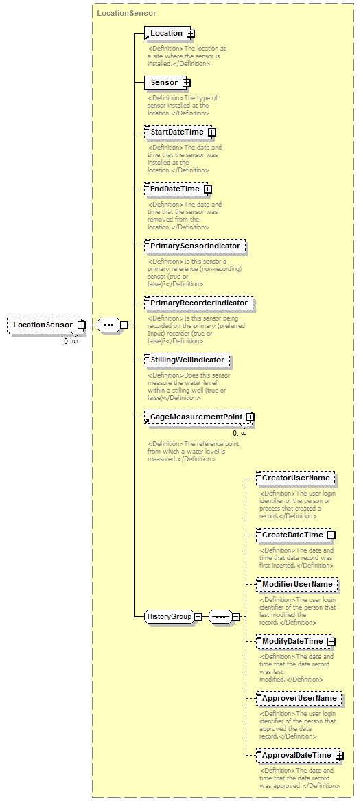 |
||||||||
| namespace | http://water.usgs.gov/XML/NWIS/5.0 | ||||||||
| type | LocationSensor | ||||||||
| properties |
|
||||||||
| children | Location Sensor StartDateTime EndDateTime PrimarySensorIndicator PrimaryRecorderIndicator StillingWellIndicator GageMeasurementPoint CreatorUserName CreateDateTime ModifierUserName ModifyDateTime ApproverUserName ApprovalDateTime | ||||||||
| source | <xsd:element name="LocationSensor" type="LocationSensor" minOccurs="0" maxOccurs="unbounded"/> |
complexType SiteContentType
| diagram | 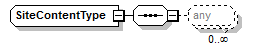 |
||
| namespace | http://water.usgs.gov/XML/NWIS/5.0 | ||
| properties |
|
||
| used by |
|
||
| source | <xsd:complexType name="SiteContentType" abstract="false"> <xsd:sequence> <xsd:any minOccurs="0" maxOccurs="unbounded"/> </xsd:sequence> </xsd:complexType> |
element SiteIdentifier
| diagram | 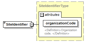 |
||||||||||||||
| namespace | http://water.usgs.gov/XML/NWIS/5.0 | ||||||||||||||
| type | SiteIdentifierType | ||||||||||||||
| properties |
|
||||||||||||||
| used by |
|
||||||||||||||
| attributes |
|
||||||||||||||
| source | <xsd:element name="SiteIdentifier" type="SiteIdentifierType"/> |
complexType SiteIdentifierType
| diagram | 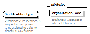 |
||||||||||||||
| namespace | http://water.usgs.gov/XML/NWIS/5.0 | ||||||||||||||
| type | extension of xsd:token | ||||||||||||||
| properties |
|
||||||||||||||
| used by |
|
||||||||||||||
| attributes |
|
||||||||||||||
| annotation |
|
||||||||||||||
| source | <xsd:complexType name="SiteIdentifierType" abstract="false"> <xsd:annotation> <xsd:documentation> <Definition>Site identifier. A unique, two component string assigned to a site to identify it.</Definition> </xsd:documentation> </xsd:annotation> <xsd:simpleContent> <xsd:extension base="xsd:token"> <xsd:attribute name="organizationCode" type="xsd:token" use="required"> <xsd:annotation> <xsd:documentation> <Definition>Organization code. </Definition> </xsd:documentation> </xsd:annotation> </xsd:attribute> </xsd:extension> </xsd:simpleContent> </xsd:complexType> |
attribute SiteIdentifierType/@organizationCode
| type | xsd:token | ||||
| properties |
|
||||
| annotation |
|
||||
| source | <xsd:attribute name="organizationCode" type="xsd:token" use="required"> <xsd:annotation> <xsd:documentation> <Definition>Organization code. </Definition> </xsd:documentation> </xsd:annotation> </xsd:attribute> |
complexType SiteTimeZoneType
| diagram | 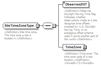 |
||
| namespace | http://water.usgs.gov/XML/NWIS/5.0 | ||
| properties |
|
||
| children | ObservesDST TimeZone | ||
| used by |
|
||
| annotation |
|
||
| source | <xsd:complexType name="SiteTimeZoneType" abstract="false"> <xsd:annotation> <xsd:documentation> <Definition>Site time zone. The time zone a site is located in.</Definition> </xsd:documentation> </xsd:annotation> <xsd:sequence> <xsd:element name="ObservesDST" type="xsd:boolean"> <xsd:annotation> <xsd:documentation> <Definition>Observes Daylight Saving Time flag. Indicates whether observations made at a site recognize time offsets imposed by U.S. Daylight Saving Time, or an analogous offset scheme used in some another part of the world.</Definition> </xsd:documentation> </xsd:annotation> </xsd:element> <xsd:element name="TimeZone" type="TimeZoneType" minOccurs="1" maxOccurs="1"> <xsd:annotation> <xsd:documentation> <Definition>Time zone. The time zone code of a site location.</Definition> <Nwisdb>TZ</Nwisdb> </xsd:documentation> </xsd:annotation> </xsd:element> </xsd:sequence> </xsd:complexType> |
element SiteTimeZoneType/ObservesDST
| diagram | 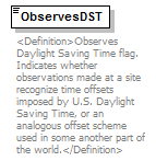 |
||||
| namespace | http://water.usgs.gov/XML/NWIS/5.0 | ||||
| type | xsd:boolean | ||||
| properties |
|
||||
| annotation |
|
||||
| source | <xsd:element name="ObservesDST" type="xsd:boolean"> <xsd:annotation> <xsd:documentation> <Definition>Observes Daylight Saving Time flag. Indicates whether observations made at a site recognize time offsets imposed by U.S. Daylight Saving Time, or an analogous offset scheme used in some another part of the world.</Definition> </xsd:documentation> </xsd:annotation> </xsd:element> |
element SiteTimeZoneType/TimeZone
| diagram | 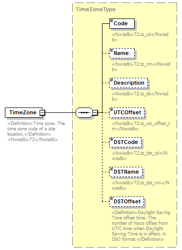 |
||||
| namespace | http://water.usgs.gov/XML/NWIS/5.0 | ||||
| type | TimeZoneType | ||||
| properties |
|
||||
| children | Code Name Description UTCOffset DSTCode DSTName DSTOffset | ||||
| annotation |
|
||||
| source | <xsd:element name="TimeZone" type="TimeZoneType" minOccurs="1" maxOccurs="1"> <xsd:annotation> <xsd:documentation> <Definition>Time zone. The time zone code of a site location.</Definition> <Nwisdb>TZ</Nwisdb> </xsd:documentation> </xsd:annotation> </xsd:element> |
complexType SiteTypeType
| diagram | 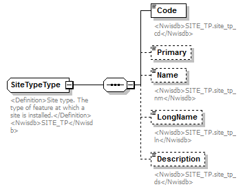 |
||
| namespace | http://water.usgs.gov/XML/NWIS/5.0 | ||
| properties |
|
||
| children | Code Primary Name LongName Description | ||
| used by |
|
||
| annotation |
|
||
| source | <xsd:complexType name="SiteTypeType" abstract="false"> <xsd:annotation> <xsd:documentation source="http://wwwnwis.er.usgs.gov/dbms/4.7/cm-dd.html#SITEFILE.site_tp_cd"> <Definition>Site type. The type of feature at which a site is installed.</Definition> <Nwisdb>SITE_TP</Nwisdb> </xsd:documentation> </xsd:annotation> <xsd:sequence> <xsd:element name="Code"> <xsd:annotation> <xsd:documentation> <Nwisdb>SITE_TP.site_tp_cd</Nwisdb> </xsd:documentation> </xsd:annotation> <xsd:simpleType> <xsd:restriction base="xsd:token"> <xsd:minLength value="1"/> <xsd:maxLength value="7"/> </xsd:restriction> </xsd:simpleType> </xsd:element> <xsd:element name="Primary" minOccurs="0"> <xsd:annotation> <xsd:documentation/> </xsd:annotation> <xsd:simpleType> <xsd:restriction base="xsd:token"> <xsd:length value="1"/> </xsd:restriction> </xsd:simpleType> </xsd:element> <xsd:element name="Name" minOccurs="0"> <xsd:annotation> <xsd:documentation> <Nwisdb>SITE_TP.site_tp_nm</Nwisdb> </xsd:documentation> </xsd:annotation> <xsd:simpleType> <xsd:restriction base="xsd:token"> <xsd:minLength value="1"/> <xsd:maxLength value="10"/> </xsd:restriction> </xsd:simpleType> </xsd:element> <xsd:element name="LongName" minOccurs="0"> <xsd:annotation> <xsd:documentation> <Nwisdb>SITE_TP.site_tp_ln</Nwisdb> </xsd:documentation> </xsd:annotation> <xsd:simpleType> <xsd:restriction base="xsd:token"> <xsd:minLength value="1"/> <xsd:maxLength value="37"/> </xsd:restriction> </xsd:simpleType> </xsd:element> <xsd:element name="Description" minOccurs="0"> <xsd:annotation> <xsd:documentation> <Nwisdb>SITE_TP.site_tp_ds</Nwisdb> </xsd:documentation> </xsd:annotation> <xsd:simpleType> <xsd:restriction base="xsd:token"> <xsd:minLength value="1"/> <xsd:maxLength value="838"/> </xsd:restriction> </xsd:simpleType> </xsd:element> </xsd:sequence> </xsd:complexType> |
element SiteTypeType/Code
| diagram | 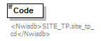 |
|||||||||
| namespace | http://water.usgs.gov/XML/NWIS/5.0 | |||||||||
| type | restriction of xsd:token | |||||||||
| properties |
|
|||||||||
| facets |
|
|||||||||
| annotation |
|
|||||||||
| source | <xsd:element name="Code"> <xsd:annotation> <xsd:documentation> <Nwisdb>SITE_TP.site_tp_cd</Nwisdb> </xsd:documentation> </xsd:annotation> <xsd:simpleType> <xsd:restriction base="xsd:token"> <xsd:minLength value="1"/> <xsd:maxLength value="7"/> </xsd:restriction> </xsd:simpleType> </xsd:element> |
element SiteTypeType/Primary
| diagram |  |
||||||||
| namespace | http://water.usgs.gov/XML/NWIS/5.0 | ||||||||
| type | restriction of xsd:token | ||||||||
| properties |
|
||||||||
| facets |
|
||||||||
| source | <xsd:element name="Primary" minOccurs="0"> <xsd:annotation> <xsd:documentation/> </xsd:annotation> <xsd:simpleType> <xsd:restriction base="xsd:token"> <xsd:length value="1"/> </xsd:restriction> </xsd:simpleType> </xsd:element> |
element SiteTypeType/Name
| diagram | 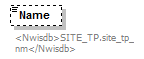 |
|||||||||
| namespace | http://water.usgs.gov/XML/NWIS/5.0 | |||||||||
| type | restriction of xsd:token | |||||||||
| properties |
|
|||||||||
| facets |
|
|||||||||
| annotation |
|
|||||||||
| source | <xsd:element name="Name" minOccurs="0"> <xsd:annotation> <xsd:documentation> <Nwisdb>SITE_TP.site_tp_nm</Nwisdb> </xsd:documentation> </xsd:annotation> <xsd:simpleType> <xsd:restriction base="xsd:token"> <xsd:minLength value="1"/> <xsd:maxLength value="10"/> </xsd:restriction> </xsd:simpleType> </xsd:element> |
element SiteTypeType/LongName
| diagram | 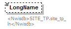 |
|||||||||
| namespace | http://water.usgs.gov/XML/NWIS/5.0 | |||||||||
| type | restriction of xsd:token | |||||||||
| properties |
|
|||||||||
| facets |
|
|||||||||
| annotation |
|
|||||||||
| source | <xsd:element name="LongName" minOccurs="0"> <xsd:annotation> <xsd:documentation> <Nwisdb>SITE_TP.site_tp_ln</Nwisdb> </xsd:documentation> </xsd:annotation> <xsd:simpleType> <xsd:restriction base="xsd:token"> <xsd:minLength value="1"/> <xsd:maxLength value="37"/> </xsd:restriction> </xsd:simpleType> </xsd:element> |
element SiteTypeType/Description
| diagram | 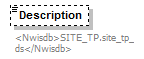 |
|||||||||
| namespace | http://water.usgs.gov/XML/NWIS/5.0 | |||||||||
| type | restriction of xsd:token | |||||||||
| properties |
|
|||||||||
| facets |
|
|||||||||
| annotation |
|
|||||||||
| source | <xsd:element name="Description" minOccurs="0"> <xsd:annotation> <xsd:documentation> <Nwisdb>SITE_TP.site_tp_ds</Nwisdb> </xsd:documentation> </xsd:annotation> <xsd:simpleType> <xsd:restriction base="xsd:token"> <xsd:minLength value="1"/> <xsd:maxLength value="838"/> </xsd:restriction> </xsd:simpleType> </xsd:element> |
complexType SiteUseType
| diagram | 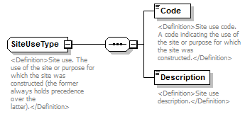 |
||
| namespace | http://water.usgs.gov/XML/NWIS/5.0 | ||
| properties |
|
||
| children | Code Description | ||
| used by |
|
||
| annotation |
|
||
| source | <xsd:complexType name="SiteUseType" abstract="false"> <xsd:annotation> <xsd:documentation source="http://wwwnwis.er.usgs.gov/nwisdocs4_6/gw/gwcoding_Sect2-1.pdf"> <Definition>Site use. The use of the site or purpose for which the site was constructed (the former always holds precedence over the latter).</Definition> </xsd:documentation> </xsd:annotation> <xsd:sequence> <xsd:element name="Code"> <xsd:annotation> <xsd:documentation> <Definition>Site use code. A code indicating the use of the site or purpose for which the site was constructed.</Definition> </xsd:documentation> </xsd:annotation> <xsd:simpleType> <xsd:restriction base="xsd:token"> <xsd:minLength value="1"/> <xsd:maxLength value="1"/> </xsd:restriction> </xsd:simpleType> </xsd:element> <xsd:element name="Description"> <xsd:annotation> <xsd:documentation> <Definition>Site use description.</Definition> </xsd:documentation> </xsd:annotation> <xsd:simpleType> <xsd:restriction base="xsd:token"> <xsd:minLength value="1"/> <xsd:maxLength value="24"/> </xsd:restriction> </xsd:simpleType> </xsd:element> </xsd:sequence> </xsd:complexType> |
element SiteUseType/Code
| diagram | 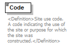 |
|||||||||
| namespace | http://water.usgs.gov/XML/NWIS/5.0 | |||||||||
| type | restriction of xsd:token | |||||||||
| properties |
|
|||||||||
| facets |
|
|||||||||
| annotation |
|
|||||||||
| source | <xsd:element name="Code"> <xsd:annotation> <xsd:documentation> <Definition>Site use code. A code indicating the use of the site or purpose for which the site was constructed.</Definition> </xsd:documentation> </xsd:annotation> <xsd:simpleType> <xsd:restriction base="xsd:token"> <xsd:minLength value="1"/> <xsd:maxLength value="1"/> </xsd:restriction> </xsd:simpleType> </xsd:element> |
element SiteUseType/Description
| diagram | 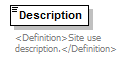 |
|||||||||
| namespace | http://water.usgs.gov/XML/NWIS/5.0 | |||||||||
| type | restriction of xsd:token | |||||||||
| properties |
|
|||||||||
| facets |
|
|||||||||
| annotation |
|
|||||||||
| source | <xsd:element name="Description"> <xsd:annotation> <xsd:documentation> <Definition>Site use description.</Definition> </xsd:documentation> </xsd:annotation> <xsd:simpleType> <xsd:restriction base="xsd:token"> <xsd:minLength value="1"/> <xsd:maxLength value="24"/> </xsd:restriction> </xsd:simpleType> </xsd:element> |
complexType TextType
| diagram | 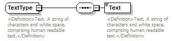 |
||
| namespace | http://water.usgs.gov/XML/NWIS/5.0 | ||
| properties |
|
||
| children | Text | ||
| used by |
|
||
| annotation |
|
||
| source | <xsd:complexType name="TextType" abstract="false"> <xsd:annotation> <xsd:documentation> <Definition>Text. A string of characters and white space, comprising human readable text.</Definition> </xsd:documentation> </xsd:annotation> <xsd:sequence> <xsd:element name="Text"> <xsd:annotation> <xsd:documentation> <Definition>Text. A string of characters and white space, comprising human readable text.</Definition> </xsd:documentation> </xsd:annotation> <xsd:simpleType> <xsd:restriction base="xsd:string"> <xsd:minLength value="1"/> <xsd:maxLength value="50"/> </xsd:restriction> </xsd:simpleType> </xsd:element> </xsd:sequence> </xsd:complexType> |
element TextType/Text
| diagram | 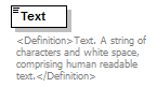 |
|||||||||
| namespace | http://water.usgs.gov/XML/NWIS/5.0 | |||||||||
| type | restriction of xsd:string | |||||||||
| properties |
|
|||||||||
| facets |
|
|||||||||
| annotation |
|
|||||||||
| source | <xsd:element name="Text"> <xsd:annotation> <xsd:documentation> <Definition>Text. A string of characters and white space, comprising human readable text.</Definition> </xsd:documentation> </xsd:annotation> <xsd:simpleType> <xsd:restriction base="xsd:string"> <xsd:minLength value="1"/> <xsd:maxLength value="50"/> </xsd:restriction> </xsd:simpleType> </xsd:element> |
complexType TopographicSettingType
| diagram | 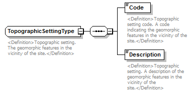 |
||
| namespace | http://water.usgs.gov/XML/NWIS/5.0 | ||
| properties |
|
||
| children | Code Description | ||
| used by |
|
||
| annotation |
|
||
| source | <xsd:complexType name="TopographicSettingType" abstract="false"> <xsd:annotation> <xsd:documentation source="http://wwwnwis.er.usgs.gov/nwisdocs4_6/gw/gwcoding_Sect2-1.pdf"> <Definition>Topographic setting. The geomorphic features in the vicinity of the site.</Definition> </xsd:documentation> </xsd:annotation> <xsd:sequence> <xsd:element name="Code"> <xsd:annotation> <xsd:documentation> <Definition>Topographic setting code. A code indicating the geomorphic features in the vicinity of the site.</Definition> </xsd:documentation> </xsd:annotation> <xsd:simpleType> <xsd:restriction base="xsd:token"> <xsd:length value="1"/> </xsd:restriction> </xsd:simpleType> </xsd:element> <xsd:element name="Description"> <xsd:annotation> <xsd:documentation> <Definition>Topographic setting. A description of the geomorphic features in the vicinity of the site.</Definition> </xsd:documentation> </xsd:annotation> <xsd:simpleType> <xsd:restriction base="xsd:token"> <xsd:minLength value="1"/> <xsd:maxLength value="34"/> </xsd:restriction> </xsd:simpleType> </xsd:element> </xsd:sequence> </xsd:complexType> |
element TopographicSettingType/Code
| diagram | 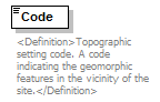 |
||||||
| namespace | http://water.usgs.gov/XML/NWIS/5.0 | ||||||
| type | restriction of xsd:token | ||||||
| properties |
|
||||||
| facets |
|
||||||
| annotation |
|
||||||
| source | <xsd:element name="Code"> <xsd:annotation> <xsd:documentation> <Definition>Topographic setting code. A code indicating the geomorphic features in the vicinity of the site.</Definition> </xsd:documentation> </xsd:annotation> <xsd:simpleType> <xsd:restriction base="xsd:token"> <xsd:length value="1"/> </xsd:restriction> </xsd:simpleType> </xsd:element> |
element TopographicSettingType/Description
| diagram | 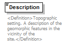 |
|||||||||
| namespace | http://water.usgs.gov/XML/NWIS/5.0 | |||||||||
| type | restriction of xsd:token | |||||||||
| properties |
|
|||||||||
| facets |
|
|||||||||
| annotation |
|
|||||||||
| source | <xsd:element name="Description"> <xsd:annotation> <xsd:documentation> <Definition>Topographic setting. A description of the geomorphic features in the vicinity of the site.</Definition> </xsd:documentation> </xsd:annotation> <xsd:simpleType> <xsd:restriction base="xsd:token"> <xsd:minLength value="1"/> <xsd:maxLength value="34"/> </xsd:restriction> </xsd:simpleType> </xsd:element> |
element WSC
| diagram | 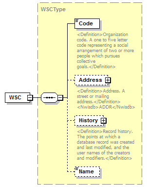 |
||||
| namespace | http://water.usgs.gov/XML/NWIS/5.0 | ||||
| type | WSCType | ||||
| properties |
|
||||
| children | Code Address History Name | ||||
| source | <xsd:element name="WSC" type="WSCType" substitutionGroup="Organization"/> |
complexType WSCType
| diagram | 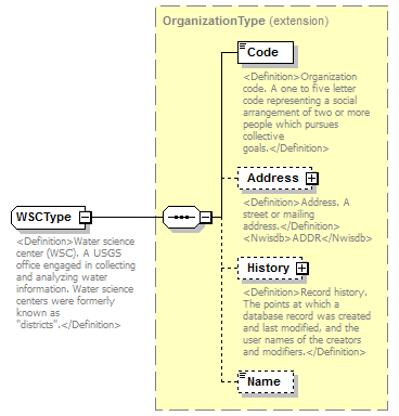 |
||||
| namespace | http://water.usgs.gov/XML/NWIS/5.0 | ||||
| type | extension of OrganizationType | ||||
| properties |
|
||||
| children | Code Address History Name | ||||
| used by |
|
||||
| annotation |
|
||||
| source | <xsd:complexType name="WSCType" abstract="false"> <xsd:annotation> <xsd:documentation source="http://water.usgs.gov/district_chief.html"> <Definition>Water science center (WSC). A USGS office engaged in collecting and analyzing water information. Water science centers were formerly known as "districts".</Definition> </xsd:documentation> </xsd:annotation> <xsd:complexContent> <xsd:extension base="OrganizationType"/> </xsd:complexContent> </xsd:complexType> |
complexType WaterUseSiteUseType
| diagram | 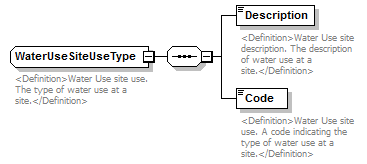 |
||
| namespace | http://water.usgs.gov/XML/NWIS/5.0 | ||
| properties |
|
||
| children | Description Code | ||
| used by |
|
||
| annotation |
|
||
| source | <xsd:complexType name="WaterUseSiteUseType" abstract="false"> <xsd:annotation> <xsd:documentation source="http://wwwnwis.er.usgs.gov/nwisdocs4_7/gw/gwcoding_Sect2-1.pdf"> <Definition>Water Use site use. The type of water use at a site.</Definition> </xsd:documentation> </xsd:annotation> <xsd:sequence> <xsd:element name="Description"> <xsd:annotation> <xsd:documentation> <Definition>Water Use site description. The description of water use at a site.</Definition> </xsd:documentation> </xsd:annotation> <xsd:simpleType> <xsd:restriction base="xsd:token"> <xsd:maxLength value="20"/> <xsd:minLength value="1"/> </xsd:restriction> </xsd:simpleType> </xsd:element> <xsd:element name="Code"> <xsd:annotation> <xsd:documentation> <Definition>Water Use site use. A code indicating the type of water use at a site.</Definition> </xsd:documentation> </xsd:annotation> <xsd:simpleType> <xsd:restriction base="xsd:token"> <xsd:length value="1"/> </xsd:restriction> </xsd:simpleType> </xsd:element> </xsd:sequence> </xsd:complexType> |
element WaterUseSiteUseType/Description
| diagram | 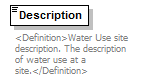 |
|||||||||
| namespace | http://water.usgs.gov/XML/NWIS/5.0 | |||||||||
| type | restriction of xsd:token | |||||||||
| properties |
|
|||||||||
| facets |
|
|||||||||
| annotation |
|
|||||||||
| source | <xsd:element name="Description"> <xsd:annotation> <xsd:documentation> <Definition>Water Use site description. The description of water use at a site.</Definition> </xsd:documentation> </xsd:annotation> <xsd:simpleType> <xsd:restriction base="xsd:token"> <xsd:maxLength value="20"/> <xsd:minLength value="1"/> </xsd:restriction> </xsd:simpleType> </xsd:element> |
element WaterUseSiteUseType/Code
| diagram |  |
||||||
| namespace | http://water.usgs.gov/XML/NWIS/5.0 | ||||||
| type | restriction of xsd:token | ||||||
| properties |
|
||||||
| facets |
|
||||||
| annotation |
|
||||||
| source | <xsd:element name="Code"> <xsd:annotation> <xsd:documentation> <Definition>Water Use site use. A code indicating the type of water use at a site.</Definition> </xsd:documentation> </xsd:annotation> <xsd:simpleType> <xsd:restriction base="xsd:token"> <xsd:length value="1"/> </xsd:restriction> </xsd:simpleType> </xsd:element> |
element State
| diagram |  |
||||
| namespace | http://water.usgs.gov/XML/NWIS/5.0 | ||||
| type | StateType | ||||
| properties |
|
||||
| children | Code Name PostalCode | ||||
| source | <xsd:element name="State" type="StateType" substitutionGroup="PrincipalAdministrativeDivision"/> |
complexType StateType
| diagram |  |
||||
| namespace | http://water.usgs.gov/XML/NWIS/5.0 | ||||
| type | extension of PrincipalAdministrativeDivisionType | ||||
| properties |
|
||||
| children | Code Name PostalCode | ||||
| used by |
|
||||
| annotation |
|
||||
| source | <xsd:complexType name="StateType" abstract="false"> <xsd:annotation> <xsd:documentation source="http://www.itl.nist.gov/fipspubs/fip5-2.htm"> <Definition>State. A United States state as defined by FIPS 5-2.</Definition> <Nwisdb>STATE</Nwisdb> </xsd:documentation> </xsd:annotation> <xsd:complexContent> <xsd:extension base="PrincipalAdministrativeDivisionType"> <xsd:sequence> <xsd:element name="PostalCode"> <xsd:annotation> <xsd:documentation source="http://www.itl.nist.gov/fipspubs/fip5-2.htm"> <Definition>State postal code. A two letter string identifying a U.S. state, as defined by the U.S. Postal Service (USPS).</Definition> <Nwisdb>STATE.state_post_cd STATE.state_post_cd</Nwisdb> </xsd:documentation> </xsd:annotation> <xsd:simpleType> <xsd:restriction base="xsd:token"> <xsd:length value="2"/> </xsd:restriction> </xsd:simpleType> </xsd:element> </xsd:sequence> </xsd:extension> </xsd:complexContent> </xsd:complexType> |
element StateType/PostalCode
| diagram |  |
||||||
| namespace | http://water.usgs.gov/XML/NWIS/5.0 | ||||||
| type | restriction of xsd:token | ||||||
| properties |
|
||||||
| facets |
|
||||||
| annotation |
|
||||||
| source | <xsd:element name="PostalCode"> <xsd:annotation> <xsd:documentation source="http://www.itl.nist.gov/fipspubs/fip5-2.htm"> <Definition>State postal code. A two letter string identifying a U.S. state, as defined by the U.S. Postal Service (USPS).</Definition> <Nwisdb>STATE.state_post_cd STATE.state_post_cd</Nwisdb> </xsd:documentation> </xsd:annotation> <xsd:simpleType> <xsd:restriction base="xsd:token"> <xsd:length value="2"/> </xsd:restriction> </xsd:simpleType> </xsd:element> |
complexType Sensor
| diagram | 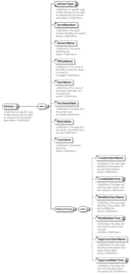 |
||
| namespace | http://water.usgs.gov/XML/NWIS/5.0 | ||
| properties |
|
||
| children | SensorType SerialNumber SensorName OfficeName UserName PurchaseDate RetireDate Comment CreatorUserName CreateDateTime ModifierUserName ModifyDateTime ApproverUserName ApprovalDateTime | ||
| used by |
|
||
| annotation |
|
||
| source | <xsd:complexType name="Sensor" abstract="false"> <xsd:annotation> <xsd:documentation> <Definition>A specific type of data sensing device used to measure environmental parameters.</Definition> </xsd:documentation> </xsd:annotation> <xsd:sequence> <xsd:element ref="SensorType"/> <xsd:element name="SerialNumber" type="xsd:string"> <xsd:annotation> <xsd:documentation> <Definition>The serial number identifing the specific sensor.</Definition> </xsd:documentation> </xsd:annotation> </xsd:element> <xsd:element name="SensorName" type="xsd:string" minOccurs="0"> <xsd:annotation> <xsd:documentation> <Definition>The name identifing the sensor.</Definition> </xsd:documentation> </xsd:annotation> </xsd:element> <xsd:element name="OfficeName" type="xsd:string" minOccurs="0"> <xsd:annotation> <xsd:documentation> <Definition>The name of the office where the sensor is owned or managed.</Definition> </xsd:documentation> </xsd:annotation> </xsd:element> <xsd:element name="UserName" type="xsd:string" minOccurs="0"> <xsd:annotation> <xsd:documentation> <Definition>The name of the person that uses and manages the sensor.</Definition> </xsd:documentation> </xsd:annotation> </xsd:element> <xsd:element name="PurchaseDate" type="xsd:date" minOccurs="0"> <xsd:annotation> <xsd:documentation> <Definition>The date that the sensor was purchased</Definition> </xsd:documentation> </xsd:annotation> </xsd:element> <xsd:element name="RetireDate" type="xsd:date" minOccurs="0"> <xsd:annotation> <xsd:documentation> <Definition>The date that the sensor was retired from service</Definition> </xsd:documentation> </xsd:annotation> </xsd:element> <xsd:element name="Comment" type="xsd:string" minOccurs="0"> <xsd:annotation> <xsd:documentation> <Definition>Comments about the sensor</Definition> </xsd:documentation> </xsd:annotation> </xsd:element> <xsd:group ref="HistoryGroup"/> </xsd:sequence> </xsd:complexType> |
element Sensor/SerialNumber
| diagram |  |
||||
| namespace | http://water.usgs.gov/XML/NWIS/5.0 | ||||
| type | xsd:string | ||||
| properties |
|
||||
| annotation |
|
||||
| source | <xsd:element name="SerialNumber" type="xsd:string"> <xsd:annotation> <xsd:documentation> <Definition>The serial number identifing the specific sensor.</Definition> </xsd:documentation> </xsd:annotation> </xsd:element> |
element Sensor/SensorName
| diagram |  |
||||||||
| namespace | http://water.usgs.gov/XML/NWIS/5.0 | ||||||||
| type | xsd:string | ||||||||
| properties |
|
||||||||
| annotation |
|
||||||||
| source | <xsd:element name="SensorName" type="xsd:string" minOccurs="0"> <xsd:annotation> <xsd:documentation> <Definition>The name identifing the sensor.</Definition> </xsd:documentation> </xsd:annotation> </xsd:element> |
element Sensor/OfficeName
| diagram |  |
||||||||
| namespace | http://water.usgs.gov/XML/NWIS/5.0 | ||||||||
| type | xsd:string | ||||||||
| properties |
|
||||||||
| annotation |
|
||||||||
| source | <xsd:element name="OfficeName" type="xsd:string" minOccurs="0"> <xsd:annotation> <xsd:documentation> <Definition>The name of the office where the sensor is owned or managed.</Definition> </xsd:documentation> </xsd:annotation> </xsd:element> |
element Sensor/UserName
| diagram |  |
||||||||
| namespace | http://water.usgs.gov/XML/NWIS/5.0 | ||||||||
| type | xsd:string | ||||||||
| properties |
|
||||||||
| annotation |
|
||||||||
| source | <xsd:element name="UserName" type="xsd:string" minOccurs="0"> <xsd:annotation> <xsd:documentation> <Definition>The name of the person that uses and manages the sensor.</Definition> </xsd:documentation> </xsd:annotation> </xsd:element> |
element Sensor/PurchaseDate
| diagram |  |
||||||||
| namespace | http://water.usgs.gov/XML/NWIS/5.0 | ||||||||
| type | xsd:date | ||||||||
| properties |
|
||||||||
| annotation |
|
||||||||
| source | <xsd:element name="PurchaseDate" type="xsd:date" minOccurs="0"> <xsd:annotation> <xsd:documentation> <Definition>The date that the sensor was purchased</Definition> </xsd:documentation> </xsd:annotation> </xsd:element> |
element Sensor/RetireDate
| diagram |  |
||||||||
| namespace | http://water.usgs.gov/XML/NWIS/5.0 | ||||||||
| type | xsd:date | ||||||||
| properties |
|
||||||||
| annotation |
|
||||||||
| source | <xsd:element name="RetireDate" type="xsd:date" minOccurs="0"> <xsd:annotation> <xsd:documentation> <Definition>The date that the sensor was retired from service</Definition> </xsd:documentation> </xsd:annotation> </xsd:element> |
element Sensor/Comment
| diagram |  |
||||||||
| namespace | http://water.usgs.gov/XML/NWIS/5.0 | ||||||||
| type | xsd:string | ||||||||
| properties |
|
||||||||
| annotation |
|
||||||||
| source | <xsd:element name="Comment" type="xsd:string" minOccurs="0"> <xsd:annotation> <xsd:documentation> <Definition>Comments about the sensor</Definition> </xsd:documentation> </xsd:annotation> </xsd:element> |
element GeneralVelocitySensor
| diagram | 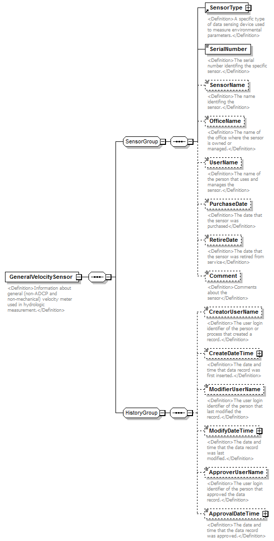 |
||
| namespace | http://water.usgs.gov/XML/NWIS/5.0 | ||
| properties |
|
||
| children | SensorType SerialNumber SensorName OfficeName UserName PurchaseDate RetireDate Comment CreatorUserName CreateDateTime ModifierUserName ModifyDateTime ApproverUserName ApprovalDateTime | ||
| used by |
|
||
| annotation |
|
||
| source | <xsd:element name="GeneralVelocitySensor"> <xsd:annotation> <xsd:documentation> <Definition>Information about general (non-ADCP and non-mechanical) velocity meter used in hydrologic measurement.</Definition> </xsd:documentation> </xsd:annotation> <xsd:complexType> <xsd:sequence> <xsd:group ref="SensorGroup"/> <xsd:group ref="HistoryGroup"/> </xsd:sequence> </xsd:complexType> </xsd:element> |
element MechanicalVelocitySensor
| diagram | 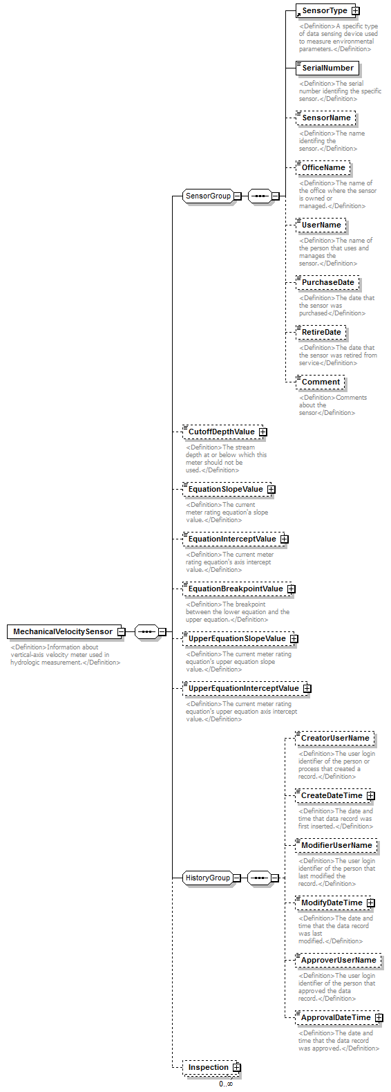 |
||
| namespace | http://water.usgs.gov/XML/NWIS/5.0 | ||
| properties |
|
||
| children | SensorType SerialNumber SensorName OfficeName UserName PurchaseDate RetireDate Comment CutoffDepthValue EquationSlopeValue EquationInterceptValue EquationBreakpointValue UpperEquationSlopeValue UpperEquationInterceptValue CreatorUserName CreateDateTime ModifierUserName ModifyDateTime ApproverUserName ApprovalDateTime Inspection | ||
| used by |
|
||
| annotation |
|
||
| source | <xsd:element name="MechanicalVelocitySensor"> <xsd:annotation> <xsd:documentation> <Definition>Information about vertical-axis velocity meter used in hydrologic measurement.</Definition> </xsd:documentation> </xsd:annotation> <xsd:complexType> <xsd:sequence> <xsd:group ref="SensorGroup"/> <xsd:element name="CutoffDepthValue" type="IEEE754FloatValueType" minOccurs="0"> <xsd:annotation> <xsd:documentation> <Definition>The stream depth at or below which this meter should not be used.</Definition> </xsd:documentation> </xsd:annotation> </xsd:element> <xsd:element name="EquationSlopeValue" type="IEEE754FloatValueType" minOccurs="0"> <xsd:annotation> <xsd:documentation> <Definition>The current meter rating equation'a slope value.</Definition> </xsd:documentation> </xsd:annotation> </xsd:element> <xsd:element name="EquationInterceptValue" type="IEEE754FloatValueType" minOccurs="0"> <xsd:annotation> <xsd:documentation> <Definition>The current meter rating equation's axis intercept value.</Definition> </xsd:documentation> </xsd:annotation> </xsd:element> <xsd:element name="EquationBreakpointValue" type="IEEE754FloatValueType" minOccurs="0"> <xsd:annotation> <xsd:documentation> <Definition>The breakpoint between the lower equation and the upper equation.</Definition> </xsd:documentation> </xsd:annotation> </xsd:element> <xsd:element name="UpperEquationSlopeValue" type="IEEE754FloatValueType" minOccurs="0"> <xsd:annotation> <xsd:documentation> <Definition>The current meter rating equation's upper equation slope value.</Definition> </xsd:documentation> </xsd:annotation> </xsd:element> <xsd:element name="UpperEquationInterceptValue" type="IEEE754FloatValueType" minOccurs="0"> <xsd:annotation> <xsd:documentation> <Definition>The current meter rating equation's upper equation axis intercept value.</Definition> </xsd:documentation> </xsd:annotation> </xsd:element> <xsd:group ref="HistoryGroup"/> <xsd:element name="Inspection" type="MechanicalVelocitySensorInspectionType" minOccurs="0" maxOccurs="unbounded"/> </xsd:sequence> </xsd:complexType> </xsd:element> |
element MechanicalVelocitySensor/CutoffDepthValue
| diagram | 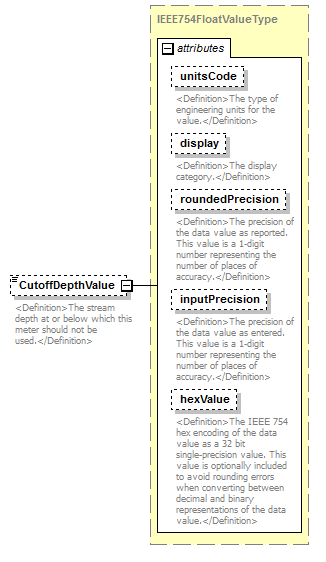 |
||||||||||||||||||||||||||||||||||||||||||||||
| namespace | http://water.usgs.gov/XML/NWIS/5.0 | ||||||||||||||||||||||||||||||||||||||||||||||
| type | IEEE754FloatValueType | ||||||||||||||||||||||||||||||||||||||||||||||
| properties |
|
||||||||||||||||||||||||||||||||||||||||||||||
| facets |
|
||||||||||||||||||||||||||||||||||||||||||||||
| attributes |
|
||||||||||||||||||||||||||||||||||||||||||||||
| annotation |
|
||||||||||||||||||||||||||||||||||||||||||||||
| source | <xsd:element name="CutoffDepthValue" type="IEEE754FloatValueType" minOccurs="0"> <xsd:annotation> <xsd:documentation> <Definition>The stream depth at or below which this meter should not be used.</Definition> </xsd:documentation> </xsd:annotation> </xsd:element> |
element MechanicalVelocitySensor/EquationSlopeValue
| diagram | 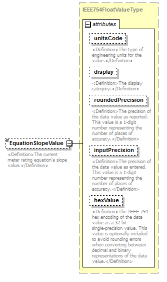 |
||||||||||||||||||||||||||||||||||||||||||||||
| namespace | http://water.usgs.gov/XML/NWIS/5.0 | ||||||||||||||||||||||||||||||||||||||||||||||
| type | IEEE754FloatValueType | ||||||||||||||||||||||||||||||||||||||||||||||
| properties |
|
||||||||||||||||||||||||||||||||||||||||||||||
| facets |
|
||||||||||||||||||||||||||||||||||||||||||||||
| attributes |
|
||||||||||||||||||||||||||||||||||||||||||||||
| annotation |
|
||||||||||||||||||||||||||||||||||||||||||||||
| source | <xsd:element name="EquationSlopeValue" type="IEEE754FloatValueType" minOccurs="0"> <xsd:annotation> <xsd:documentation> <Definition>The current meter rating equation'a slope value.</Definition> </xsd:documentation> </xsd:annotation> </xsd:element> |
element MechanicalVelocitySensor/EquationInterceptValue
| diagram |  |
||||||||||||||||||||||||||||||||||||||||||||||
| namespace | http://water.usgs.gov/XML/NWIS/5.0 | ||||||||||||||||||||||||||||||||||||||||||||||
| type | IEEE754FloatValueType | ||||||||||||||||||||||||||||||||||||||||||||||
| properties |
|
||||||||||||||||||||||||||||||||||||||||||||||
| facets |
|
||||||||||||||||||||||||||||||||||||||||||||||
| attributes |
|
||||||||||||||||||||||||||||||||||||||||||||||
| annotation |
|
||||||||||||||||||||||||||||||||||||||||||||||
| source | <xsd:element name="EquationInterceptValue" type="IEEE754FloatValueType" minOccurs="0"> <xsd:annotation> <xsd:documentation> <Definition>The current meter rating equation's axis intercept value.</Definition> </xsd:documentation> </xsd:annotation> </xsd:element> |
element MechanicalVelocitySensor/EquationBreakpointValue
| diagram | 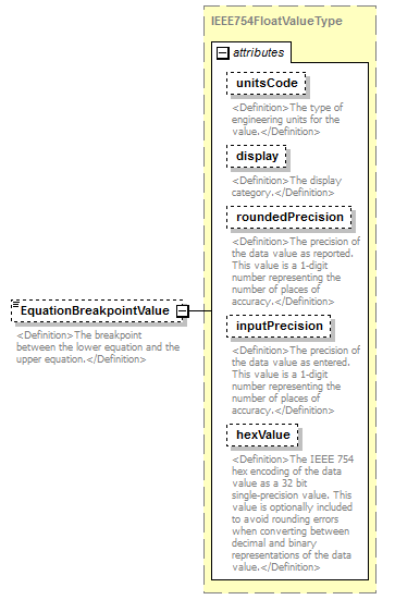 |
||||||||||||||||||||||||||||||||||||||||||||||
| namespace | http://water.usgs.gov/XML/NWIS/5.0 | ||||||||||||||||||||||||||||||||||||||||||||||
| type | IEEE754FloatValueType | ||||||||||||||||||||||||||||||||||||||||||||||
| properties |
|
||||||||||||||||||||||||||||||||||||||||||||||
| facets |
|
||||||||||||||||||||||||||||||||||||||||||||||
| attributes |
|
||||||||||||||||||||||||||||||||||||||||||||||
| annotation |
|
||||||||||||||||||||||||||||||||||||||||||||||
| source | <xsd:element name="EquationBreakpointValue" type="IEEE754FloatValueType" minOccurs="0"> <xsd:annotation> <xsd:documentation> <Definition>The breakpoint between the lower equation and the upper equation.</Definition> </xsd:documentation> </xsd:annotation> </xsd:element> |
element MechanicalVelocitySensor/UpperEquationSlopeValue
| diagram |  |
||||||||||||||||||||||||||||||||||||||||||||||
| namespace | http://water.usgs.gov/XML/NWIS/5.0 | ||||||||||||||||||||||||||||||||||||||||||||||
| type | IEEE754FloatValueType | ||||||||||||||||||||||||||||||||||||||||||||||
| properties |
|
||||||||||||||||||||||||||||||||||||||||||||||
| facets |
|
||||||||||||||||||||||||||||||||||||||||||||||
| attributes |
|
||||||||||||||||||||||||||||||||||||||||||||||
| annotation |
|
||||||||||||||||||||||||||||||||||||||||||||||
| source | <xsd:element name="UpperEquationSlopeValue" type="IEEE754FloatValueType" minOccurs="0"> <xsd:annotation> <xsd:documentation> <Definition>The current meter rating equation's upper equation slope value.</Definition> </xsd:documentation> </xsd:annotation> </xsd:element> |
element MechanicalVelocitySensor/UpperEquationInterceptValue
| diagram |  |
||||||||||||||||||||||||||||||||||||||||||||||
| namespace | http://water.usgs.gov/XML/NWIS/5.0 | ||||||||||||||||||||||||||||||||||||||||||||||
| type | IEEE754FloatValueType | ||||||||||||||||||||||||||||||||||||||||||||||
| properties |
|
||||||||||||||||||||||||||||||||||||||||||||||
| facets |
|
||||||||||||||||||||||||||||||||||||||||||||||
| attributes |
|
||||||||||||||||||||||||||||||||||||||||||||||
| annotation |
|
||||||||||||||||||||||||||||||||||||||||||||||
| source | <xsd:element name="UpperEquationInterceptValue" type="IEEE754FloatValueType" minOccurs="0"> <xsd:annotation> <xsd:documentation> <Definition>The current meter rating equation's upper equation axis intercept value.</Definition> </xsd:documentation> </xsd:annotation> </xsd:element> |
element MechanicalVelocitySensor/Inspection
| diagram | 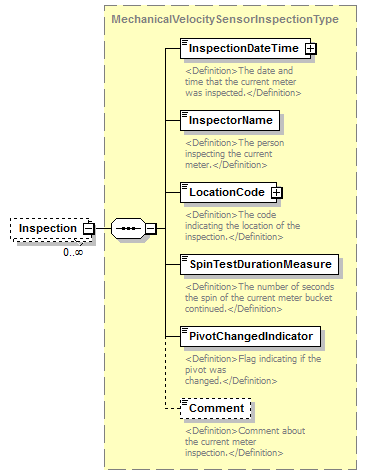 |
||||||||
| namespace | http://water.usgs.gov/XML/NWIS/5.0 | ||||||||
| type | MechanicalVelocitySensorInspectionType | ||||||||
| properties |
|
||||||||
| children | InspectionDateTime InspectorName LocationCode SpinTestDurationMeasure PivotChangedIndicator Comment | ||||||||
| source | <xsd:element name="Inspection" type="MechanicalVelocitySensorInspectionType" minOccurs="0" maxOccurs="unbounded"/> |
element AcousticDopplerCurrentProfiler
| diagram | 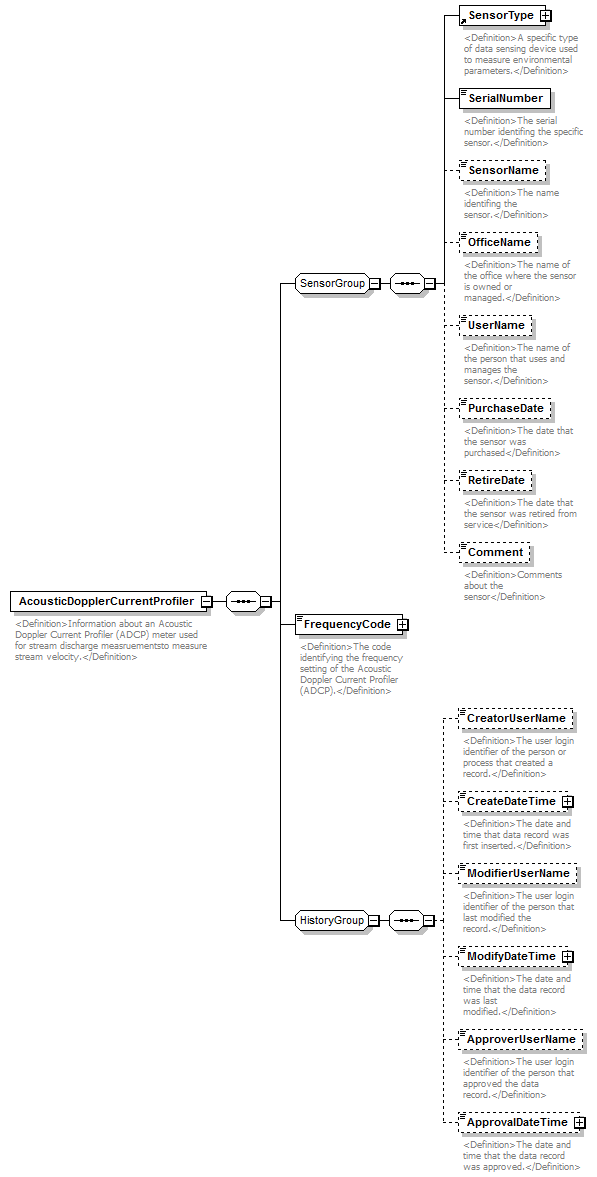 |
||
| namespace | http://water.usgs.gov/XML/NWIS/5.0 | ||
| properties |
|
||
| children | SensorType SerialNumber SensorName OfficeName UserName PurchaseDate RetireDate Comment FrequencyCode CreatorUserName CreateDateTime ModifierUserName ModifyDateTime ApproverUserName ApprovalDateTime | ||
| used by |
|
||
| annotation |
|
||
| source | <xsd:element name="AcousticDopplerCurrentProfiler"> <xsd:annotation> <xsd:documentation> <Definition>Information about an Acoustic Doppler Current Profiler (ADCP) meter used for stream discharge measruementsto measure stream velocity.</Definition> </xsd:documentation> </xsd:annotation> <xsd:complexType> <xsd:sequence> <xsd:group ref="SensorGroup"/> <xsd:element name="FrequencyCode" type="ReferenceListCodeType"> <xsd:annotation> <xsd:documentation> <Definition>The code identifying the frequency setting of the Acoustic Doppler Current Profiler (ADCP).</Definition> </xsd:documentation> </xsd:annotation> </xsd:element> <xsd:group ref="HistoryGroup"/> </xsd:sequence> </xsd:complexType> </xsd:element> |
element AcousticDopplerCurrentProfiler/FrequencyCode
| diagram | 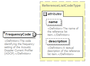 |
||||||||||||||||||||||
| namespace | http://water.usgs.gov/XML/NWIS/5.0 | ||||||||||||||||||||||
| type | ReferenceListCodeType | ||||||||||||||||||||||
| properties |
|
||||||||||||||||||||||
| attributes |
|
||||||||||||||||||||||
| annotation |
|
||||||||||||||||||||||
| source | <xsd:element name="FrequencyCode" type="ReferenceListCodeType"> <xsd:annotation> <xsd:documentation> <Definition>The code identifying the frequency setting of the Acoustic Doppler Current Profiler (ADCP).</Definition> </xsd:documentation> </xsd:annotation> </xsd:element> |
element AcousticDopplerVelocitySensor
| diagram | 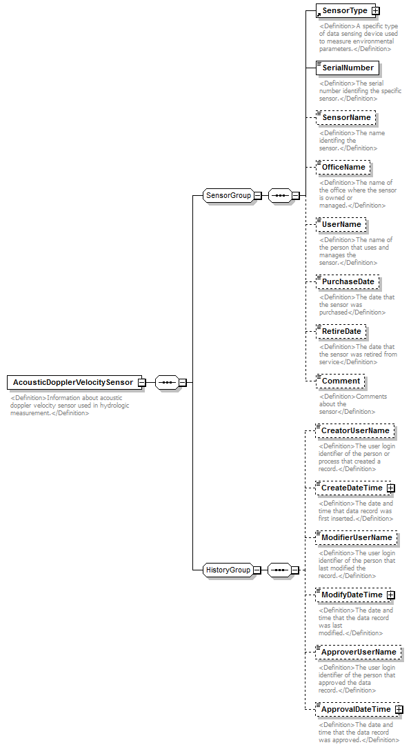 |
||
| namespace | http://water.usgs.gov/XML/NWIS/5.0 | ||
| properties |
|
||
| children | SensorType SerialNumber SensorName OfficeName UserName PurchaseDate RetireDate Comment CreatorUserName CreateDateTime ModifierUserName ModifyDateTime ApproverUserName ApprovalDateTime | ||
| used by |
|
||
| annotation |
|
||
| source | <xsd:element name="AcousticDopplerVelocitySensor"> <xsd:annotation> <xsd:documentation> <Definition>Information about acoustic doppler velocity sensor used in hydrologic measurement.</Definition> </xsd:documentation> </xsd:annotation> <xsd:complexType> <xsd:sequence> <xsd:group ref="SensorGroup"/> <xsd:group ref="HistoryGroup"/> </xsd:sequence> </xsd:complexType> </xsd:element> |
complexType EquipmentType
| diagram | 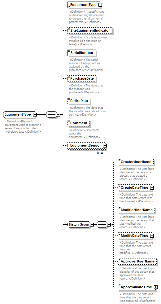 |
||
| namespace | http://water.usgs.gov/XML/NWIS/5.0 | ||
| properties |
|
||
| children | EquipmentType SiteEquipmentIndicator SerialNumber PurchaseDate RetireDate Comment EquipmentSensor CreatorUserName CreateDateTime ModifierUserName ModifyDateTime ApproverUserName ApprovalDateTime | ||
| used by |
|
||
| annotation |
|
||
| source | <xsd:complexType name="EquipmentType" abstract="false"> <xsd:annotation> <xsd:documentation> <Definition>Electronic equipment used to monitor a series of sensors to collect hydrologic data</Definition> </xsd:documentation> </xsd:annotation> <xsd:sequence> <xsd:element ref="EquipmentType"/> <xsd:element name="SiteEquipmentIndicator" type="xsd:boolean" minOccurs="0"> <xsd:annotation> <xsd:documentation> <Definition>Is this equipment installed at a site (true or false)?.</Definition> </xsd:documentation> </xsd:annotation> </xsd:element> <xsd:element name="SerialNumber" type="EquipmentSerialNumber"> <xsd:annotation> <xsd:documentation> <Definition>The serial number of equipment as assigned by the manufacturer.</Definition> </xsd:documentation> </xsd:annotation> </xsd:element> <xsd:element name="PurchaseDate" type="xsd:date" minOccurs="0"> <xsd:annotation> <xsd:documentation> <Definition>The date that the monitor was purchased</Definition> </xsd:documentation> </xsd:annotation> </xsd:element> <xsd:element name="RetireDate" type="xsd:date" minOccurs="0"> <xsd:annotation> <xsd:documentation> <Definition>The date that the monitor was retired from service.</Definition> </xsd:documentation> </xsd:annotation> </xsd:element> <xsd:element name="Comment" type="xsd:string" minOccurs="0"> <xsd:annotation> <xsd:documentation> <Definition>Comments about the equipment.</Definition> </xsd:documentation> </xsd:annotation> </xsd:element> <xsd:element name="EquipmentSensor" type="EquipmentSensor" minOccurs="0" maxOccurs="unbounded"/> <xsd:group ref="HistoryGroup"/> </xsd:sequence> </xsd:complexType> |
element EquipmentType/SiteEquipmentIndicator
| diagram |  |
||||||||
| namespace | http://water.usgs.gov/XML/NWIS/5.0 | ||||||||
| type | xsd:boolean | ||||||||
| properties |
|
||||||||
| annotation |
|
||||||||
| source | <xsd:element name="SiteEquipmentIndicator" type="xsd:boolean" minOccurs="0"> <xsd:annotation> <xsd:documentation> <Definition>Is this equipment installed at a site (true or false)?.</Definition> </xsd:documentation> </xsd:annotation> </xsd:element> |
element EquipmentType/SerialNumber
| diagram |  |
||||||
| namespace | http://water.usgs.gov/XML/NWIS/5.0 | ||||||
| type | EquipmentSerialNumber | ||||||
| properties |
|
||||||
| facets |
|
||||||
| annotation |
|
||||||
| source | <xsd:element name="SerialNumber" type="EquipmentSerialNumber"> <xsd:annotation> <xsd:documentation> <Definition>The serial number of equipment as assigned by the manufacturer.</Definition> </xsd:documentation> </xsd:annotation> </xsd:element> |
element EquipmentType/PurchaseDate
| diagram |  |
||||||||
| namespace | http://water.usgs.gov/XML/NWIS/5.0 | ||||||||
| type | xsd:date | ||||||||
| properties |
|
||||||||
| annotation |
|
||||||||
| source | <xsd:element name="PurchaseDate" type="xsd:date" minOccurs="0"> <xsd:annotation> <xsd:documentation> <Definition>The date that the monitor was purchased</Definition> </xsd:documentation> </xsd:annotation> </xsd:element> |
element EquipmentType/RetireDate
| diagram |  |
||||||||
| namespace | http://water.usgs.gov/XML/NWIS/5.0 | ||||||||
| type | xsd:date | ||||||||
| properties |
|
||||||||
| annotation |
|
||||||||
| source | <xsd:element name="RetireDate" type="xsd:date" minOccurs="0"> <xsd:annotation> <xsd:documentation> <Definition>The date that the monitor was retired from service.</Definition> </xsd:documentation> </xsd:annotation> </xsd:element> |
element EquipmentType/Comment
| diagram |  |
||||||||
| namespace | http://water.usgs.gov/XML/NWIS/5.0 | ||||||||
| type | xsd:string | ||||||||
| properties |
|
||||||||
| annotation |
|
||||||||
| source | <xsd:element name="Comment" type="xsd:string" minOccurs="0"> <xsd:annotation> <xsd:documentation> <Definition>Comments about the equipment.</Definition> </xsd:documentation> </xsd:annotation> </xsd:element> |
element EquipmentType/EquipmentSensor
| diagram | 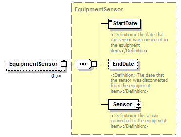 |
||||||||
| namespace | http://water.usgs.gov/XML/NWIS/5.0 | ||||||||
| type | EquipmentSensor | ||||||||
| properties |
|
||||||||
| children | StartDate EndDate Sensor | ||||||||
| source | <xsd:element name="EquipmentSensor" type="EquipmentSensor" minOccurs="0" maxOccurs="unbounded"/> |
element MonitorInspection
| diagram | 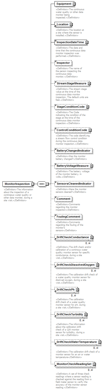 |
||
| namespace | http://water.usgs.gov/XML/NWIS/5.0 | ||
| properties |
|
||
| children | Equipment Location InspectionDateTime Inspector StreamStageMeasure StageConditionCode ControlConditionCode BatteryChangedIndicator BatteryVoltageMeasure SensorsCleanedIndicator Comment FoulingComment DriftCheckConductance DriftCheckDissolvedOxygen DriftCheckPh DriftCheckTurbidity DriftCheckWaterTemperature MonitorCheckReadingSet | ||
| used by |
|
||
| annotation |
|
||
| source | <xsd:element name="MonitorInspection"> <xsd:annotation> <xsd:documentation> <Definition>The information about the inspection of a contineous water quality or other data moniter, during a site visit.</Definition> </xsd:documentation> </xsd:annotation> <xsd:complexType> <xsd:sequence> <xsd:element name="Equipment" type="EquipmentType"> <xsd:annotation> <xsd:documentation> <Definition>The continuous water quality or other data monitor being inspected.</Definition> </xsd:documentation> </xsd:annotation> </xsd:element> <xsd:element ref="Location"> <xsd:annotation> <xsd:documentation> <Definition>The location at a site where the sensor is installed.</Definition> </xsd:documentation> </xsd:annotation> </xsd:element> <xsd:element name="InspectionDateTime" type="DateTimeWithDatum"> <xsd:annotation> <xsd:documentation> <Definition>The date and time that the continuous data monitor inspection was performed.</Definition> </xsd:documentation> </xsd:annotation> </xsd:element> <xsd:element name="Inspector" type="xsd:string" minOccurs="0"> <xsd:annotation> <xsd:documentation> <Definition>The name of the person inspecting the continuous data monitor.</Definition> </xsd:documentation> </xsd:annotation> </xsd:element> <xsd:element name="StreamStageMeasure" type="IEEE754FloatValueType" minOccurs="0"> <xsd:annotation> <xsd:documentation> <Definition>The stream stage value at the time of the continuous data monitor inspection. The default units are feet.</Definition> </xsd:documentation> </xsd:annotation> </xsd:element> <xsd:element name="StageConditionCode" type="ReferenceListCodeType" minOccurs="0"> <xsd:annotation> <xsd:documentation> <Definition>The Code indicating the condition of the stage at the time of the continuous data monitor inspection.</Definition> </xsd:documentation> </xsd:annotation> </xsd:element> <xsd:element name="ControlConditionCode" type="ReferenceListCodeType" minOccurs="0"> <xsd:annotation> <xsd:documentation> <Definition>The code identifying a stream flow control condition during the continuous data monitor inspection.</Definition> </xsd:documentation> </xsd:annotation> </xsd:element> <xsd:element name="BatteryChangedIndicator" type="xsd:boolean" minOccurs="0"> <xsd:annotation> <xsd:documentation> <Definition>Was the monitor battery changed?</Definition> </xsd:documentation> </xsd:annotation> </xsd:element> <xsd:element name="BatteryVoltageMeasure" type="IEEE754FloatValueType" minOccurs="0"> <xsd:annotation> <xsd:documentation> <Definition>The battery voltage of the monitor battery, in volts.</Definition> </xsd:documentation> </xsd:annotation> </xsd:element> <xsd:element name="SensorsCleanedIndicator" type="xsd:boolean" minOccurs="0"> <xsd:annotation> <xsd:documentation> <Definition>Were the monitor sensors cleaned?</Definition> </xsd:documentation> </xsd:annotation> </xsd:element> <xsd:element name="Comment" type="xsd:string" minOccurs="0"> <xsd:annotation> <xsd:documentation> <Definition>Comments regarding the monitor inspection</Definition> </xsd:documentation> </xsd:annotation> </xsd:element> <xsd:element name="FoulingComment" type="xsd:string" minOccurs="0"> <xsd:annotation> <xsd:documentation> <Definition>Comments regarding the fouling of the monitor's sensors</Definition> </xsd:documentation> </xsd:annotation> </xsd:element> <xsd:element ref="DriftCheckConductance" minOccurs="0" maxOccurs="unbounded"/> <xsd:element ref="DriftCheckDissolvedOxygen" minOccurs="0" maxOccurs="unbounded"/> <xsd:element ref="DriftCheckPh" minOccurs="0" maxOccurs="unbounded"/> <xsd:element ref="DriftCheckTurbidity" minOccurs="0" maxOccurs="unbounded"/> <xsd:element ref="DriftCheckWaterTemperature" minOccurs="0" maxOccurs="unbounded"/> <xsd:element ref="MonitorCheckReadingSet" minOccurs="0" maxOccurs="unbounded"/> </xsd:sequence> </xsd:complexType> </xsd:element> |
element MonitorInspection/Equipment
| diagram | 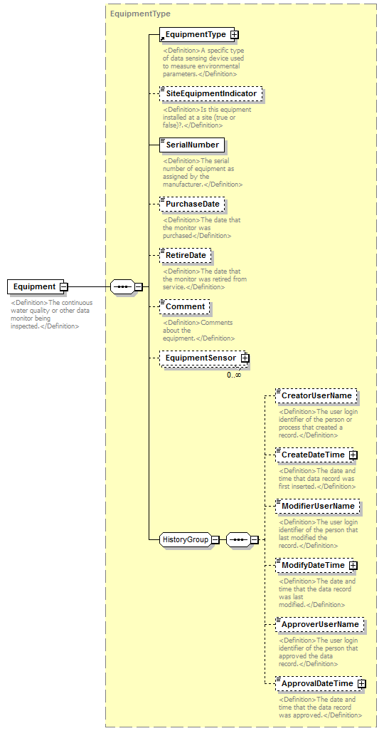 |
||||
| namespace | http://water.usgs.gov/XML/NWIS/5.0 | ||||
| type | EquipmentType | ||||
| properties |
|
||||
| children | EquipmentType SiteEquipmentIndicator SerialNumber PurchaseDate RetireDate Comment EquipmentSensor CreatorUserName CreateDateTime ModifierUserName ModifyDateTime ApproverUserName ApprovalDateTime | ||||
| annotation |
|
||||
| source | <xsd:element name="Equipment" type="EquipmentType"> <xsd:annotation> <xsd:documentation> <Definition>The continuous water quality or other data monitor being inspected.</Definition> </xsd:documentation> </xsd:annotation> </xsd:element> |
element MonitorInspection/InspectionDateTime
| diagram | 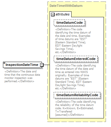 |
||||||||||||||||||||||||||||||
| namespace | http://water.usgs.gov/XML/NWIS/5.0 | ||||||||||||||||||||||||||||||
| type | DateTimeWithDatum | ||||||||||||||||||||||||||||||
| properties |
|
||||||||||||||||||||||||||||||
| attributes |
|
||||||||||||||||||||||||||||||
| annotation |
|
||||||||||||||||||||||||||||||
| source | <xsd:element name="InspectionDateTime" type="DateTimeWithDatum"> <xsd:annotation> <xsd:documentation> <Definition>The date and time that the continuous data monitor inspection was performed.</Definition> </xsd:documentation> </xsd:annotation> </xsd:element> |
element MonitorInspection/Inspector
| diagram |  |
||||||||
| namespace | http://water.usgs.gov/XML/NWIS/5.0 | ||||||||
| type | xsd:string | ||||||||
| properties |
|
||||||||
| annotation |
|
||||||||
| source | <xsd:element name="Inspector" type="xsd:string" minOccurs="0"> <xsd:annotation> <xsd:documentation> <Definition>The name of the person inspecting the continuous data monitor.</Definition> </xsd:documentation> </xsd:annotation> </xsd:element> |
element MonitorInspection/StreamStageMeasure
| diagram |  |
||||||||||||||||||||||||||||||||||||||||||||||
| namespace | http://water.usgs.gov/XML/NWIS/5.0 | ||||||||||||||||||||||||||||||||||||||||||||||
| type | IEEE754FloatValueType | ||||||||||||||||||||||||||||||||||||||||||||||
| properties |
|
||||||||||||||||||||||||||||||||||||||||||||||
| facets |
|
||||||||||||||||||||||||||||||||||||||||||||||
| attributes |
|
||||||||||||||||||||||||||||||||||||||||||||||
| annotation |
|
||||||||||||||||||||||||||||||||||||||||||||||
| source | <xsd:element name="StreamStageMeasure" type="IEEE754FloatValueType" minOccurs="0"> <xsd:annotation> <xsd:documentation> <Definition>The stream stage value at the time of the continuous data monitor inspection. The default units are feet.</Definition> </xsd:documentation> </xsd:annotation> </xsd:element> |
element MonitorInspection/StageConditionCode
| diagram | 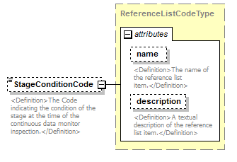 |
||||||||||||||||||||||
| namespace | http://water.usgs.gov/XML/NWIS/5.0 | ||||||||||||||||||||||
| type | ReferenceListCodeType | ||||||||||||||||||||||
| properties |
|
||||||||||||||||||||||
| attributes |
|
||||||||||||||||||||||
| annotation |
|
||||||||||||||||||||||
| source | <xsd:element name="StageConditionCode" type="ReferenceListCodeType" minOccurs="0"> <xsd:annotation> <xsd:documentation> <Definition>The Code indicating the condition of the stage at the time of the continuous data monitor inspection.</Definition> </xsd:documentation> </xsd:annotation> </xsd:element> |
element MonitorInspection/ControlConditionCode
| diagram |  |
||||||||||||||||||||||
| namespace | http://water.usgs.gov/XML/NWIS/5.0 | ||||||||||||||||||||||
| type | ReferenceListCodeType | ||||||||||||||||||||||
| properties |
|
||||||||||||||||||||||
| attributes |
|
||||||||||||||||||||||
| annotation |
|
||||||||||||||||||||||
| source | <xsd:element name="ControlConditionCode" type="ReferenceListCodeType" minOccurs="0"> <xsd:annotation> <xsd:documentation> <Definition>The code identifying a stream flow control condition during the continuous data monitor inspection.</Definition> </xsd:documentation> </xsd:annotation> </xsd:element> |
element MonitorInspection/BatteryChangedIndicator
| diagram | 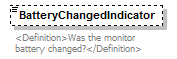 |
||||||||
| namespace | http://water.usgs.gov/XML/NWIS/5.0 | ||||||||
| type | xsd:boolean | ||||||||
| properties |
|
||||||||
| annotation |
|
||||||||
| source | <xsd:element name="BatteryChangedIndicator" type="xsd:boolean" minOccurs="0"> <xsd:annotation> <xsd:documentation> <Definition>Was the monitor battery changed?</Definition> </xsd:documentation> </xsd:annotation> </xsd:element> |
element MonitorInspection/BatteryVoltageMeasure
| diagram | 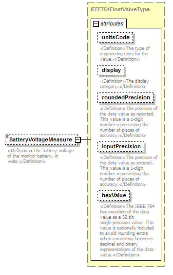 |
||||||||||||||||||||||||||||||||||||||||||||||
| namespace | http://water.usgs.gov/XML/NWIS/5.0 | ||||||||||||||||||||||||||||||||||||||||||||||
| type | IEEE754FloatValueType | ||||||||||||||||||||||||||||||||||||||||||||||
| properties |
|
||||||||||||||||||||||||||||||||||||||||||||||
| facets |
|
||||||||||||||||||||||||||||||||||||||||||||||
| attributes |
|
||||||||||||||||||||||||||||||||||||||||||||||
| annotation |
|
||||||||||||||||||||||||||||||||||||||||||||||
| source | <xsd:element name="BatteryVoltageMeasure" type="IEEE754FloatValueType" minOccurs="0"> <xsd:annotation> <xsd:documentation> <Definition>The battery voltage of the monitor battery, in volts.</Definition> </xsd:documentation> </xsd:annotation> </xsd:element> |
element MonitorInspection/SensorsCleanedIndicator
| diagram |  |
||||||||
| namespace | http://water.usgs.gov/XML/NWIS/5.0 | ||||||||
| type | xsd:boolean | ||||||||
| properties |
|
||||||||
| annotation |
|
||||||||
| source | <xsd:element name="SensorsCleanedIndicator" type="xsd:boolean" minOccurs="0"> <xsd:annotation> <xsd:documentation> <Definition>Were the monitor sensors cleaned?</Definition> </xsd:documentation> </xsd:annotation> </xsd:element> |
element MonitorInspection/Comment
| diagram |  |
||||||||
| namespace | http://water.usgs.gov/XML/NWIS/5.0 | ||||||||
| type | xsd:string | ||||||||
| properties |
|
||||||||
| annotation |
|
||||||||
| source | <xsd:element name="Comment" type="xsd:string" minOccurs="0"> <xsd:annotation> <xsd:documentation> <Definition>Comments regarding the monitor inspection</Definition> </xsd:documentation> </xsd:annotation> </xsd:element> |
element MonitorInspection/FoulingComment
| diagram | 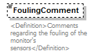 |
||||||||
| namespace | http://water.usgs.gov/XML/NWIS/5.0 | ||||||||
| type | xsd:string | ||||||||
| properties |
|
||||||||
| annotation |
|
||||||||
| source | <xsd:element name="FoulingComment" type="xsd:string" minOccurs="0"> <xsd:annotation> <xsd:documentation> <Definition>Comments regarding the fouling of the monitor's sensors</Definition> </xsd:documentation> </xsd:annotation> </xsd:element> |
simpleType DisplayType
| namespace | http://water.usgs.gov/XML/NWIS/5.0 | |||||||||
| type | restriction of xsd:string | |||||||||
| properties |
|
|||||||||
| used by |
|
|||||||||
| facets |
|
|||||||||
| annotation |
|
|||||||||
| source | <xsd:simpleType name="DisplayType"> <xsd:annotation> <xsd:documentation> <Definition>The display category.</Definition> </xsd:documentation> </xsd:annotation> <xsd:restriction base="xsd:string"> <xsd:enumeration value="rounded"/> <xsd:enumeration value="input"/> </xsd:restriction> </xsd:simpleType> |
element DisplayDecimal
| diagram |  |
||||||
| namespace | http://water.usgs.gov/XML/NWIS/5.0 | ||||||
| type | DisplayDecimalType | ||||||
| properties |
|
||||||
| facets |
|
||||||
| source | <xsd:element name="DisplayDecimal" type="DisplayDecimalType"/> |
simpleType DisplayDecimalType
| namespace | http://water.usgs.gov/XML/NWIS/5.0 | ||||||
| type | restriction of xsd:string | ||||||
| properties |
|
||||||
| used by |
|
||||||
| facets |
|
||||||
| source | <xsd:simpleType name="DisplayDecimalType"> <xsd:annotation> <xsd:documentation/> </xsd:annotation> <xsd:restriction base="xsd:string"> <xsd:pattern value="-?[0-9]*\.?[0-9]+"/> </xsd:restriction> </xsd:simpleType> |
simpleType HexValueType
| namespace | http://water.usgs.gov/XML/NWIS/5.0 | ||||||||||||
| type | restriction of xsd:string | ||||||||||||
| properties |
|
||||||||||||
| used by |
|
||||||||||||
| facets |
|
||||||||||||
| source | <xsd:simpleType name="HexValueType"> <xsd:restriction base="xsd:string"> <xsd:minLength value="8"/> <xsd:maxLength value="8"/> <xsd:pattern value="[0-9A-F]+"/> </xsd:restriction> </xsd:simpleType> |
simpleType PrecisionType
| namespace | http://water.usgs.gov/XML/NWIS/5.0 | |||||||||
| type | restriction of xsd:integer | |||||||||
| properties |
|
|||||||||
| used by |
|
|||||||||
| facets |
|
|||||||||
| source | <xsd:simpleType name="PrecisionType"> <xsd:restriction base="xsd:integer"> <xsd:minInclusive value="0"/> <xsd:maxInclusive value="9"/> </xsd:restriction> </xsd:simpleType> |
simpleType EquipmentManufacturerName
| namespace | http://water.usgs.gov/XML/NWIS/5.0 | ||||||
| type | restriction of xsd:string | ||||||
| properties |
|
||||||
| used by |
|
||||||
| facets |
|
||||||
| source | <xsd:simpleType name="EquipmentManufacturerName"> <xsd:restriction base="xsd:string"> <xsd:maxLength value="100"/> </xsd:restriction> </xsd:simpleType> |
simpleType EquipmentModelNumber
| namespace | http://water.usgs.gov/XML/NWIS/5.0 | ||||||
| type | restriction of xsd:string | ||||||
| properties |
|
||||||
| used by |
|
||||||
| facets |
|
||||||
| source | <xsd:simpleType name="EquipmentModelNumber"> <xsd:restriction base="xsd:string"> <xsd:maxLength value="50"/> </xsd:restriction> </xsd:simpleType> |
simpleType EquipmentSerialNumber
| namespace | http://water.usgs.gov/XML/NWIS/5.0 | ||||||
| type | restriction of xsd:string | ||||||
| properties |
|
||||||
| used by |
|
||||||
| facets |
|
||||||
| source | <xsd:simpleType name="EquipmentSerialNumber"> <xsd:restriction base="xsd:string"> <xsd:maxLength value="50"/> </xsd:restriction> </xsd:simpleType> |
complexType ElevationType
| diagram | 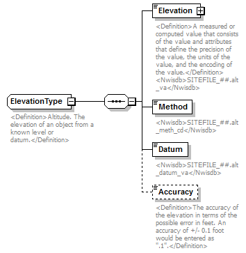 |
||
| namespace | http://water.usgs.gov/XML/NWIS/5.0 | ||
| properties |
|
||
| children | Elevation Method Datum Accuracy | ||
| used by |
|
||
| annotation |
|
||
| source | <xsd:complexType name="ElevationType" abstract="false"> <xsd:annotation> <xsd:documentation> <Definition>Altitude. The elevation of an object from a known level or datum.</Definition> </xsd:documentation> </xsd:annotation> <xsd:sequence> <xsd:element name="Elevation" type="IEEE754FloatValueType" minOccurs="1" maxOccurs="1"> <xsd:annotation> <xsd:documentation> <Definition>A measured or computed value that consists of the value and attributes that define the precision of the value, the units of the value, and the encoding of the value.</Definition> <Nwisdb>SITEFILE_##.alt_va</Nwisdb> </xsd:documentation> </xsd:annotation> </xsd:element> <xsd:element name="Method"> <xsd:annotation> <xsd:documentation> <Nwisdb>SITEFILE_##.alt_meth_cd</Nwisdb> </xsd:documentation> </xsd:annotation> <xsd:simpleType> <xsd:restriction base="xsd:token"> <xsd:length value="1"/> </xsd:restriction> </xsd:simpleType> </xsd:element> <xsd:element name="Datum"> <xsd:annotation> <xsd:documentation> <Nwisdb>SITEFILE_##.alt_datum_va</Nwisdb> </xsd:documentation> </xsd:annotation> <xsd:simpleType> <xsd:restriction base="xsd:token"> <xsd:minLength value="1"/> <xsd:maxLength value="10"/> </xsd:restriction> </xsd:simpleType> </xsd:element> <xsd:element name="Accuracy" type="xsd:token" minOccurs="0" maxOccurs="1"> <xsd:annotation> <xsd:documentation> <Definition>The accuracy of the elevation in terms of the possible error in feet. An accuracy of +/- 0.1 foot would be entered as ".1".</Definition> </xsd:documentation> </xsd:annotation> </xsd:element> </xsd:sequence> </xsd:complexType> |
element ElevationType/Elevation
| diagram | 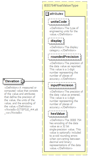 |
||||||||||||||||||||||||||||||||||||||||||||||
| namespace | http://water.usgs.gov/XML/NWIS/5.0 | ||||||||||||||||||||||||||||||||||||||||||||||
| type | IEEE754FloatValueType | ||||||||||||||||||||||||||||||||||||||||||||||
| properties |
|
||||||||||||||||||||||||||||||||||||||||||||||
| facets |
|
||||||||||||||||||||||||||||||||||||||||||||||
| attributes |
|
||||||||||||||||||||||||||||||||||||||||||||||
| annotation |
|
||||||||||||||||||||||||||||||||||||||||||||||
| source | <xsd:element name="Elevation" type="IEEE754FloatValueType" minOccurs="1" maxOccurs="1"> <xsd:annotation> <xsd:documentation> <Definition>A measured or computed value that consists of the value and attributes that define the precision of the value, the units of the value, and the encoding of the value.</Definition> <Nwisdb>SITEFILE_##.alt_va</Nwisdb> </xsd:documentation> </xsd:annotation> </xsd:element> |
element ElevationType/Method
| diagram |  |
||||||
| namespace | http://water.usgs.gov/XML/NWIS/5.0 | ||||||
| type | restriction of xsd:token | ||||||
| properties |
|
||||||
| facets |
|
||||||
| annotation |
|
||||||
| source | <xsd:element name="Method"> <xsd:annotation> <xsd:documentation> <Nwisdb>SITEFILE_##.alt_meth_cd</Nwisdb> </xsd:documentation> </xsd:annotation> <xsd:simpleType> <xsd:restriction base="xsd:token"> <xsd:length value="1"/> </xsd:restriction> </xsd:simpleType> </xsd:element> |
element ElevationType/Datum
| diagram |  |
|||||||||
| namespace | http://water.usgs.gov/XML/NWIS/5.0 | |||||||||
| type | restriction of xsd:token | |||||||||
| properties |
|
|||||||||
| facets |
|
|||||||||
| annotation |
|
|||||||||
| source | <xsd:element name="Datum"> <xsd:annotation> <xsd:documentation> <Nwisdb>SITEFILE_##.alt_datum_va</Nwisdb> </xsd:documentation> </xsd:annotation> <xsd:simpleType> <xsd:restriction base="xsd:token"> <xsd:minLength value="1"/> <xsd:maxLength value="10"/> </xsd:restriction> </xsd:simpleType> </xsd:element> |
element ElevationType/Accuracy
| diagram |  |
||||||||
| namespace | http://water.usgs.gov/XML/NWIS/5.0 | ||||||||
| type | xsd:token | ||||||||
| properties |
|
||||||||
| annotation |
|
||||||||
| source | <xsd:element name="Accuracy" type="xsd:token" minOccurs="0" maxOccurs="1"> <xsd:annotation> <xsd:documentation> <Definition>The accuracy of the elevation in terms of the possible error in feet. An accuracy of +/- 0.1 foot would be entered as ".1".</Definition> </xsd:documentation> </xsd:annotation> </xsd:element> |
complexType LocationType
| diagram |  |
||
| namespace | http://water.usgs.gov/XML/NWIS/5.0 | ||
| properties |
|
||
| used by |
|
||
| source | <xsd:complexType name="LocationType" abstract="true"> <xsd:annotation> <xsd:documentation source="http://en.wikipedia.org/wiki/Location_%28geography%29"/> </xsd:annotation> </xsd:complexType> |
complexType StandardizedCoordinateType
| diagram | 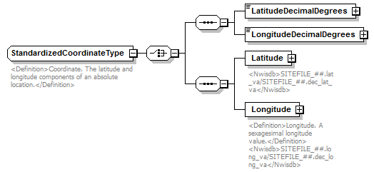 |
||
| namespace | http://water.usgs.gov/XML/NWIS/5.0 | ||
| properties |
|
||
| children | LatitudeDecimalDegrees LongitudeDecimalDegrees Latitude Longitude | ||
| used by |
|
||
| annotation |
|
||
| source | <xsd:complexType name="StandardizedCoordinateType" abstract="false"> <xsd:annotation> <xsd:documentation> <Definition>Coordinate. The latitude and longitude components of an absolute location.</Definition> </xsd:documentation> </xsd:annotation> <xsd:choice> <xsd:sequence> <xsd:element name="LatitudeDecimalDegrees" type="IEEE754FloatValueType"/> <xsd:element name="LongitudeDecimalDegrees" type="IEEE754FloatValueType"/> </xsd:sequence> <xsd:sequence> <xsd:element name="Latitude" type="SexagesimalLatitudeType"> <xsd:annotation> <xsd:documentation source="http://en.wikipedia.org/wiki/Latitude"> <Nwisdb>SITEFILE_##.lat_va/SITEFILE_##.dec_lat_va</Nwisdb> </xsd:documentation> </xsd:annotation> <!-- <xsd:simpleType> <xsd:restriction base="xsd:token"> <xsd:minLength value="13"/> <xsd:maxLength value="16"/> </xsd:restriction> </xsd:simpleType> --> </xsd:element> <xsd:element name="Longitude" type="SexagesimalLongitudeType"> <xsd:annotation> <xsd:documentation source="http://en.wikipedia.org/wiki/Longitude"> <Definition>Longitude. A sexagesimal longitude value.</Definition> <Nwisdb>SITEFILE_##.long_va/SITEFILE_##.dec_long_va</Nwisdb> </xsd:documentation> </xsd:annotation> <!-- <xsd:simpleType> <xsd:restriction base="xsd:token"> <xsd:minLength value="13"/> <xsd:maxLength value="16"/> </xsd:restriction> </xsd:simpleType> --> </xsd:element> </xsd:sequence> </xsd:choice> </xsd:complexType> |
element StandardizedCoordinateType/LatitudeDecimalDegrees
| diagram | 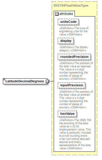 |
||||||||||||||||||||||||||||||||||||||||||||||
| namespace | http://water.usgs.gov/XML/NWIS/5.0 | ||||||||||||||||||||||||||||||||||||||||||||||
| type | IEEE754FloatValueType | ||||||||||||||||||||||||||||||||||||||||||||||
| properties |
|
||||||||||||||||||||||||||||||||||||||||||||||
| facets |
|
||||||||||||||||||||||||||||||||||||||||||||||
| attributes |
|
||||||||||||||||||||||||||||||||||||||||||||||
| source | <xsd:element name="LatitudeDecimalDegrees" type="IEEE754FloatValueType"/> |
element StandardizedCoordinateType/LongitudeDecimalDegrees
| diagram | 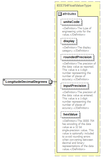 |
||||||||||||||||||||||||||||||||||||||||||||||
| namespace | http://water.usgs.gov/XML/NWIS/5.0 | ||||||||||||||||||||||||||||||||||||||||||||||
| type | IEEE754FloatValueType | ||||||||||||||||||||||||||||||||||||||||||||||
| properties |
|
||||||||||||||||||||||||||||||||||||||||||||||
| facets |
|
||||||||||||||||||||||||||||||||||||||||||||||
| attributes |
|
||||||||||||||||||||||||||||||||||||||||||||||
| source | <xsd:element name="LongitudeDecimalDegrees" type="IEEE754FloatValueType"/> |
element StandardizedCoordinateType/Latitude
| diagram | 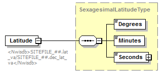 |
||||
| namespace | http://water.usgs.gov/XML/NWIS/5.0 | ||||
| type | SexagesimalLatitudeType | ||||
| properties |
|
||||
| children | Degrees Minutes Seconds | ||||
| annotation |
|
||||
| source | <xsd:element name="Latitude" type="SexagesimalLatitudeType"> <xsd:annotation> <xsd:documentation source="http://en.wikipedia.org/wiki/Latitude"> <Nwisdb>SITEFILE_##.lat_va/SITEFILE_##.dec_lat_va</Nwisdb> </xsd:documentation> </xsd:annotation> <!-- <xsd:simpleType> <xsd:restriction base="xsd:token"> <xsd:minLength value="13"/> <xsd:maxLength value="16"/> </xsd:restriction> </xsd:simpleType> --> </xsd:element> |
element StandardizedCoordinateType/Longitude
| diagram | 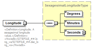 |
||||
| namespace | http://water.usgs.gov/XML/NWIS/5.0 | ||||
| type | SexagesimalLongitudeType | ||||
| properties |
|
||||
| children | Degrees Minutes Seconds | ||||
| annotation |
|
||||
| source | <xsd:element name="Longitude" type="SexagesimalLongitudeType"> <xsd:annotation> <xsd:documentation source="http://en.wikipedia.org/wiki/Longitude"> <Definition>Longitude. A sexagesimal longitude value.</Definition> <Nwisdb>SITEFILE_##.long_va/SITEFILE_##.dec_long_va</Nwisdb> </xsd:documentation> </xsd:annotation> <!-- <xsd:simpleType> <xsd:restriction base="xsd:token"> <xsd:minLength value="13"/> <xsd:maxLength value="16"/> </xsd:restriction> </xsd:simpleType> --> </xsd:element> |
complexType AreaType
| diagram | 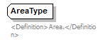 |
||
| namespace | http://water.usgs.gov/XML/NWIS/5.0 | ||
| properties |
|
||
| used by |
|
||
| annotation |
|
||
| source | <xsd:complexType name="AreaType" abstract="true"> <xsd:annotation> <xsd:documentation> <Definition>Area.</Definition> </xsd:documentation> </xsd:annotation> </xsd:complexType> |
element Location
| diagram | 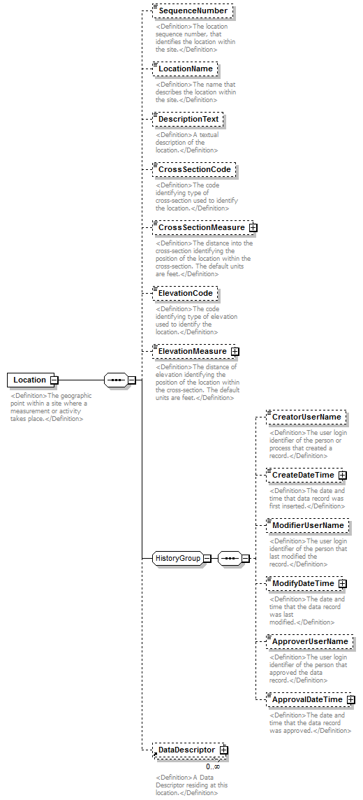 |
||||
| namespace | http://water.usgs.gov/XML/NWIS/5.0 | ||||
| properties |
|
||||
| children | SequenceNumber LocationName DescriptionText CrossSectionCode CrossSectionMeasure ElevationCode ElevationMeasure CreatorUserName CreateDateTime ModifierUserName ModifyDateTime ApproverUserName ApprovalDateTime DataDescriptor | ||||
| used by |
|
||||
| annotation |
|
||||
| source | <xsd:element name="Location"> <xsd:annotation> <xsd:documentation> <Definition>The geographic point within a site where a measurement or activity takes place.</Definition> </xsd:documentation> </xsd:annotation> <xsd:complexType> <xsd:sequence> <xsd:element name="SequenceNumber" type="xsd:integer" minOccurs="0"> <xsd:annotation> <xsd:documentation> <Definition>The location sequence number, that identifies the location within the site.</Definition> </xsd:documentation> </xsd:annotation> </xsd:element> <xsd:element name="LocationName" type="xsd:string" minOccurs="0"> <xsd:annotation> <xsd:documentation> <Definition>The name that describes the location within the site.</Definition> </xsd:documentation> </xsd:annotation> </xsd:element> <xsd:element name="DescriptionText" type="xsd:string" minOccurs="0"> <xsd:annotation> <xsd:documentation> <Definition>A textual description of the location.</Definition> </xsd:documentation> </xsd:annotation> </xsd:element> <xsd:element name="CrossSectionCode" type="xsd:string" minOccurs="0"> <xsd:annotation> <xsd:documentation> <Definition>The code identifying type of cross-section used to identify the location.</Definition> </xsd:documentation> </xsd:annotation> </xsd:element> <xsd:element name="CrossSectionMeasure" type="IEEE754FloatValueType" minOccurs="0"> <xsd:annotation> <xsd:documentation> <Definition>The distance into the cross-section identifying the position of the location within the cross-section. The default units are feet.</Definition> </xsd:documentation> </xsd:annotation> </xsd:element> <xsd:element name="ElevationCode" type="xsd:string" minOccurs="0"> <xsd:annotation> <xsd:documentation> <Definition>The code identifying type of elevation used to identify the location.</Definition> </xsd:documentation> </xsd:annotation> </xsd:element> <xsd:element name="ElevationMeasure" type="IEEE754FloatValueType" minOccurs="0"> <xsd:annotation> <xsd:documentation> <Definition>The distance of elevation identifying the position of the location within the cross-section. The default units are feet.</Definition> </xsd:documentation> </xsd:annotation> </xsd:element> <xsd:group ref="HistoryGroup"/> <xsd:element ref="DataDescriptor" minOccurs="0" maxOccurs="unbounded"> <xsd:annotation> <xsd:documentation> <Definition>A Data Descriptor residing at this location.</Definition> </xsd:documentation> </xsd:annotation> </xsd:element> </xsd:sequence> </xsd:complexType> </xsd:element> |
element Location/SequenceNumber
| diagram |  |
||||||||
| namespace | http://water.usgs.gov/XML/NWIS/5.0 | ||||||||
| type | xsd:integer | ||||||||
| properties |
|
||||||||
| annotation |
|
||||||||
| source | <xsd:element name="SequenceNumber" type="xsd:integer" minOccurs="0"> <xsd:annotation> <xsd:documentation> <Definition>The location sequence number, that identifies the location within the site.</Definition> </xsd:documentation> </xsd:annotation> </xsd:element> |
element Location/LocationName
| diagram |  |
||||||||
| namespace | http://water.usgs.gov/XML/NWIS/5.0 | ||||||||
| type | xsd:string | ||||||||
| properties |
|
||||||||
| annotation |
|
||||||||
| source | <xsd:element name="LocationName" type="xsd:string" minOccurs="0"> <xsd:annotation> <xsd:documentation> <Definition>The name that describes the location within the site.</Definition> </xsd:documentation> </xsd:annotation> </xsd:element> |
element Location/DescriptionText
| diagram |  |
||||||||
| namespace | http://water.usgs.gov/XML/NWIS/5.0 | ||||||||
| type | xsd:string | ||||||||
| properties |
|
||||||||
| annotation |
|
||||||||
| source | <xsd:element name="DescriptionText" type="xsd:string" minOccurs="0"> <xsd:annotation> <xsd:documentation> <Definition>A textual description of the location.</Definition> </xsd:documentation> </xsd:annotation> </xsd:element> |
element Location/CrossSectionCode
| diagram |  |
||||||||
| namespace | http://water.usgs.gov/XML/NWIS/5.0 | ||||||||
| type | xsd:string | ||||||||
| properties |
|
||||||||
| annotation |
|
||||||||
| source | <xsd:element name="CrossSectionCode" type="xsd:string" minOccurs="0"> <xsd:annotation> <xsd:documentation> <Definition>The code identifying type of cross-section used to identify the location.</Definition> </xsd:documentation> </xsd:annotation> </xsd:element> |
element Location/CrossSectionMeasure
| diagram | 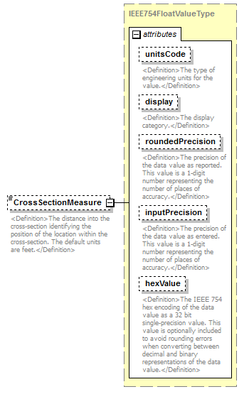 |
||||||||||||||||||||||||||||||||||||||||||||||
| namespace | http://water.usgs.gov/XML/NWIS/5.0 | ||||||||||||||||||||||||||||||||||||||||||||||
| type | IEEE754FloatValueType | ||||||||||||||||||||||||||||||||||||||||||||||
| properties |
|
||||||||||||||||||||||||||||||||||||||||||||||
| facets |
|
||||||||||||||||||||||||||||||||||||||||||||||
| attributes |
|
||||||||||||||||||||||||||||||||||||||||||||||
| annotation |
|
||||||||||||||||||||||||||||||||||||||||||||||
| source | <xsd:element name="CrossSectionMeasure" type="IEEE754FloatValueType" minOccurs="0"> <xsd:annotation> <xsd:documentation> <Definition>The distance into the cross-section identifying the position of the location within the cross-section. The default units are feet.</Definition> </xsd:documentation> </xsd:annotation> </xsd:element> |
element Location/ElevationCode
| diagram | 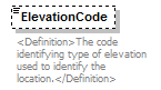 |
||||||||
| namespace | http://water.usgs.gov/XML/NWIS/5.0 | ||||||||
| type | xsd:string | ||||||||
| properties |
|
||||||||
| annotation |
|
||||||||
| source | <xsd:element name="ElevationCode" type="xsd:string" minOccurs="0"> <xsd:annotation> <xsd:documentation> <Definition>The code identifying type of elevation used to identify the location.</Definition> </xsd:documentation> </xsd:annotation> </xsd:element> |
element Location/ElevationMeasure
| diagram | 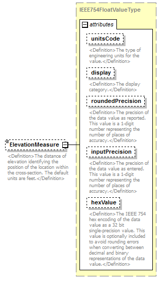 |
||||||||||||||||||||||||||||||||||||||||||||||
| namespace | http://water.usgs.gov/XML/NWIS/5.0 | ||||||||||||||||||||||||||||||||||||||||||||||
| type | IEEE754FloatValueType | ||||||||||||||||||||||||||||||||||||||||||||||
| properties |
|
||||||||||||||||||||||||||||||||||||||||||||||
| facets |
|
||||||||||||||||||||||||||||||||||||||||||||||
| attributes |
|
||||||||||||||||||||||||||||||||||||||||||||||
| annotation |
|
||||||||||||||||||||||||||||||||||||||||||||||
| source | <xsd:element name="ElevationMeasure" type="IEEE754FloatValueType" minOccurs="0"> <xsd:annotation> <xsd:documentation> <Definition>The distance of elevation identifying the position of the location within the cross-section. The default units are feet.</Definition> </xsd:documentation> </xsd:annotation> </xsd:element> |
element UnitValueInventory
| diagram | 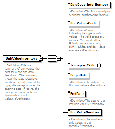 |
||
| namespace | http://water.usgs.gov/XML/NWIS/5.0 | ||
| properties |
|
||
| children | DataDescriptorNumber UnitValuesCode TransportCode BeginDate EndDate UnitValueNumber | ||
| used by |
|
||
| annotation |
|
||
| source | <xsd:element name="UnitValueInventory"> <xsd:annotation> <xsd:documentation> <Definition>This is a summary of unit values that exist for a site and data descriptor. This summary shows the Data Descriptor number, the unit value data type, the transport code, the begining date of record, the ending date of record, and the number of unit values.</Definition> </xsd:documentation> </xsd:annotation> <xsd:complexType> <xsd:sequence> <xsd:element name="DataDescriptorNumber" type="xsd:string"> <xsd:annotation> <xsd:documentation> <Definition>The Data descriptor sequence number.</Definition> </xsd:documentation> </xsd:annotation> </xsd:element> <xsd:element name="UnitValuesCode" type="xsd:string"> <xsd:annotation> <xsd:documentation> <Definition>A code indicating the type of unit values. The valid codes are meas = Measured,edit = Edited, corr = corrections, shift = Shifts, and da = data analysis.</Definition>> </xsd:documentation> </xsd:annotation> </xsd:element> <xsd:element name="TransportCode" type="UnitValuesTransportCode" minOccurs="0"/> <xsd:element name="BeginDate" type="xsd:date"> <xsd:annotation> <xsd:documentation> <Definition>The date of the first unit value.</Definition> </xsd:documentation> </xsd:annotation> </xsd:element> <xsd:element name="EndDate" type="xsd:date"> <xsd:annotation> <xsd:documentation> <Definition>The date of the last unit value.</Definition> </xsd:documentation> </xsd:annotation> </xsd:element> <xsd:element name="UnitValueNumber" type="xsd:integer"> <xsd:annotation> <xsd:documentation> <Definition>The number of unit values in the record.</Definition> </xsd:documentation> </xsd:annotation> </xsd:element> </xsd:sequence> </xsd:complexType> </xsd:element> |
element UnitValueInventory/DataDescriptorNumber
| diagram |  |
||||
| namespace | http://water.usgs.gov/XML/NWIS/5.0 | ||||
| type | xsd:string | ||||
| properties |
|
||||
| annotation |
|
||||
| source | <xsd:element name="DataDescriptorNumber" type="xsd:string"> <xsd:annotation> <xsd:documentation> <Definition>The Data descriptor sequence number.</Definition> </xsd:documentation> </xsd:annotation> </xsd:element> |
element UnitValueInventory/UnitValuesCode
| diagram |  |
||||
| namespace | http://water.usgs.gov/XML/NWIS/5.0 | ||||
| type | xsd:string | ||||
| properties |
|
||||
| annotation |
|
||||
| source | <xsd:element name="UnitValuesCode" type="xsd:string"> <xsd:annotation> <xsd:documentation> <Definition>A code indicating the type of unit values. The valid codes are meas = Measured,edit = Edited, corr = corrections, shift = Shifts, and da = data analysis.</Definition>> </xsd:documentation> </xsd:annotation> </xsd:element> |
element UnitValueInventory/TransportCode
| diagram |  |
||||||||||||
| namespace | http://water.usgs.gov/XML/NWIS/5.0 | ||||||||||||
| type | UnitValuesTransportCode | ||||||||||||
| properties |
|
||||||||||||
| attributes |
|
||||||||||||
| source | <xsd:element name="TransportCode" type="UnitValuesTransportCode" minOccurs="0"/> |
element UnitValueInventory/BeginDate
| diagram |  |
||||
| namespace | http://water.usgs.gov/XML/NWIS/5.0 | ||||
| type | xsd:date | ||||
| properties |
|
||||
| annotation |
|
||||
| source | <xsd:element name="BeginDate" type="xsd:date"> <xsd:annotation> <xsd:documentation> <Definition>The date of the first unit value.</Definition> </xsd:documentation> </xsd:annotation> </xsd:element> |
element UnitValueInventory/EndDate
| diagram |  |
||||
| namespace | http://water.usgs.gov/XML/NWIS/5.0 | ||||
| type | xsd:date | ||||
| properties |
|
||||
| annotation |
|
||||
| source | <xsd:element name="EndDate" type="xsd:date"> <xsd:annotation> <xsd:documentation> <Definition>The date of the last unit value.</Definition> </xsd:documentation> </xsd:annotation> </xsd:element> |
element UnitValueInventory/UnitValueNumber
| diagram |  |
||||
| namespace | http://water.usgs.gov/XML/NWIS/5.0 | ||||
| type | xsd:integer | ||||
| properties |
|
||||
| annotation |
|
||||
| source | <xsd:element name="UnitValueNumber" type="xsd:integer"> <xsd:annotation> <xsd:documentation> <Definition>The number of unit values in the record.</Definition> </xsd:documentation> </xsd:annotation> </xsd:element> |
element DailyValueInventory
| diagram | 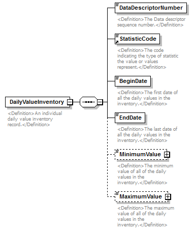 |
||
| namespace | http://water.usgs.gov/XML/NWIS/5.0 | ||
| properties |
|
||
| children | DataDescriptorNumber StatisticCode BeginDate EndDate MinimumValue MaximumValue | ||
| used by |
|
||
| annotation |
|
||
| source | <xsd:element name="DailyValueInventory"> <xsd:annotation> <xsd:documentation> <Definition>An individual daily value inventory record.</Definition> </xsd:documentation> </xsd:annotation> <xsd:complexType> <xsd:sequence> <xsd:element name="DataDescriptorNumber" type="xsd:string"> <xsd:annotation> <xsd:documentation> <Definition>The Data descriptor sequence number.</Definition> </xsd:documentation> </xsd:annotation> </xsd:element> <xsd:element ref="StatisticCode"/> <xsd:element name="BeginDate" type="xsd:date"> <xsd:annotation> <xsd:documentation> <Definition>The first date of all the daily values in the inventory.</Definition> </xsd:documentation> </xsd:annotation> </xsd:element> <xsd:element name="EndDate" type="xsd:date"> <xsd:annotation> <xsd:documentation> <Definition>The last date of all the daily values in the inventory.</Definition> </xsd:documentation> </xsd:annotation> </xsd:element> <xsd:element name="MinimumValue" type="IEEE754FloatValueType" nillable="true" minOccurs="0"> <xsd:annotation> <xsd:documentation> <Definition>The minimum value of all of the daily values in the inventory.</Definition> </xsd:documentation> </xsd:annotation> </xsd:element> <xsd:element name="MaximumValue" type="IEEE754FloatValueType" nillable="true" minOccurs="0"> <xsd:annotation> <xsd:documentation> <Definition>The maximum value of all of the daily values in the inventory.</Definition> </xsd:documentation> </xsd:annotation> </xsd:element> </xsd:sequence> </xsd:complexType> </xsd:element> |
element DailyValueInventory/DataDescriptorNumber
| diagram |  |
||||
| namespace | http://water.usgs.gov/XML/NWIS/5.0 | ||||
| type | xsd:string | ||||
| properties |
|
||||
| annotation |
|
||||
| source | <xsd:element name="DataDescriptorNumber" type="xsd:string"> <xsd:annotation> <xsd:documentation> <Definition>The Data descriptor sequence number.</Definition> </xsd:documentation> </xsd:annotation> </xsd:element> |
element DailyValueInventory/BeginDate
| diagram |  |
||||
| namespace | http://water.usgs.gov/XML/NWIS/5.0 | ||||
| type | xsd:date | ||||
| properties |
|
||||
| annotation |
|
||||
| source | <xsd:element name="BeginDate" type="xsd:date"> <xsd:annotation> <xsd:documentation> <Definition>The first date of all the daily values in the inventory.</Definition> </xsd:documentation> </xsd:annotation> </xsd:element> |
element DailyValueInventory/EndDate
| diagram |  |
||||
| namespace | http://water.usgs.gov/XML/NWIS/5.0 | ||||
| type | xsd:date | ||||
| properties |
|
||||
| annotation |
|
||||
| source | <xsd:element name="EndDate" type="xsd:date"> <xsd:annotation> <xsd:documentation> <Definition>The last date of all the daily values in the inventory.</Definition> </xsd:documentation> </xsd:annotation> </xsd:element> |
element DailyValueInventory/MinimumValue
| diagram |  |
||||||||||||||||||||||||||||||||||||||||||||||
| namespace | http://water.usgs.gov/XML/NWIS/5.0 | ||||||||||||||||||||||||||||||||||||||||||||||
| type | IEEE754FloatValueType | ||||||||||||||||||||||||||||||||||||||||||||||
| properties |
|
||||||||||||||||||||||||||||||||||||||||||||||
| facets |
|
||||||||||||||||||||||||||||||||||||||||||||||
| attributes |
|
||||||||||||||||||||||||||||||||||||||||||||||
| annotation |
|
||||||||||||||||||||||||||||||||||||||||||||||
| source | <xsd:element name="MinimumValue" type="IEEE754FloatValueType" nillable="true" minOccurs="0"> <xsd:annotation> <xsd:documentation> <Definition>The minimum value of all of the daily values in the inventory.</Definition> </xsd:documentation> </xsd:annotation> </xsd:element> |
element DailyValueInventory/MaximumValue
| diagram |  |
||||||||||||||||||||||||||||||||||||||||||||||
| namespace | http://water.usgs.gov/XML/NWIS/5.0 | ||||||||||||||||||||||||||||||||||||||||||||||
| type | IEEE754FloatValueType | ||||||||||||||||||||||||||||||||||||||||||||||
| properties |
|
||||||||||||||||||||||||||||||||||||||||||||||
| facets |
|
||||||||||||||||||||||||||||||||||||||||||||||
| attributes |
|
||||||||||||||||||||||||||||||||||||||||||||||
| annotation |
|
||||||||||||||||||||||||||||||||||||||||||||||
| source | <xsd:element name="MaximumValue" type="IEEE754FloatValueType" nillable="true" minOccurs="0"> <xsd:annotation> <xsd:documentation> <Definition>The maximum value of all of the daily values in the inventory.</Definition> </xsd:documentation> </xsd:annotation> </xsd:element> |
complexType LocationSensor
| diagram | 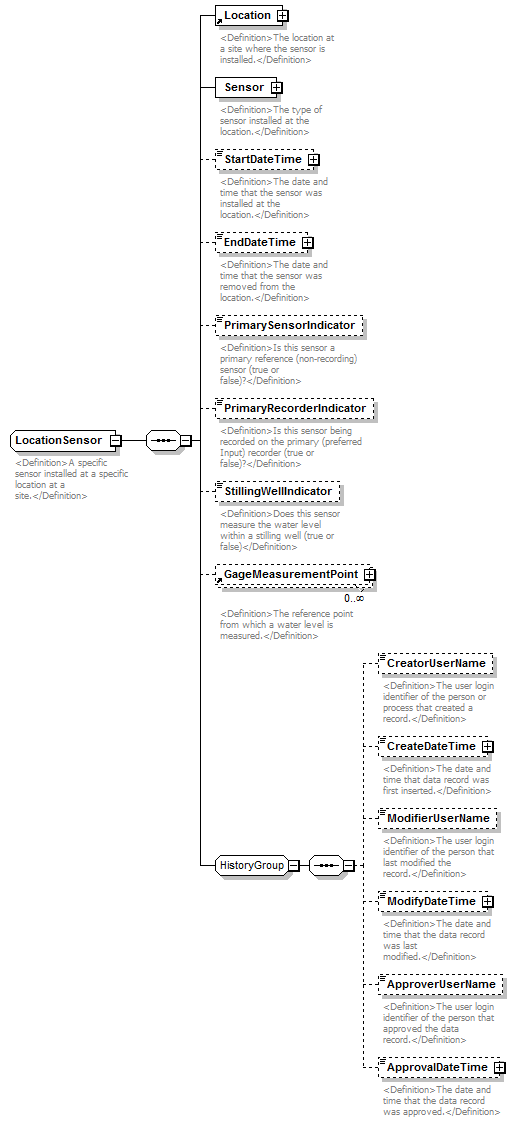 |
||
| namespace | http://water.usgs.gov/XML/NWIS/5.0 | ||
| properties |
|
||
| children | Location Sensor StartDateTime EndDateTime PrimarySensorIndicator PrimaryRecorderIndicator StillingWellIndicator GageMeasurementPoint CreatorUserName CreateDateTime ModifierUserName ModifyDateTime ApproverUserName ApprovalDateTime | ||
| used by |
|
||
| annotation |
|
||
| source | <xsd:complexType name="LocationSensor" abstract="false"> <xsd:annotation> <xsd:documentation> <Definition>A specific sensor installed at a specific location at a site.</Definition> </xsd:documentation> </xsd:annotation> <xsd:sequence> <xsd:element ref="Location"> <xsd:annotation> <xsd:documentation> <Definition>The location at a site where the sensor is installed.</Definition> </xsd:documentation> </xsd:annotation> </xsd:element> <xsd:element name="Sensor" type="Sensor"> <xsd:annotation> <xsd:documentation> <Definition>The type of sensor installed at the location.</Definition> </xsd:documentation> </xsd:annotation> </xsd:element> <xsd:element name="StartDateTime" type="DateTimeWithDatum" minOccurs="0"> <xsd:annotation> <xsd:documentation> <Definition>The date and time that the sensor was installed at the location.</Definition> </xsd:documentation> </xsd:annotation> </xsd:element> <xsd:element name="EndDateTime" type="DateTimeWithDatum" minOccurs="0"> <xsd:annotation> <xsd:documentation> <Definition>The date and time that the sensor was removed from the location.</Definition> </xsd:documentation> </xsd:annotation> </xsd:element> <xsd:element name="PrimarySensorIndicator" type="xsd:boolean" minOccurs="0"> <xsd:annotation> <xsd:documentation> <Definition>Is this sensor a primary reference (non-recording) sensor (true or false)?</Definition> </xsd:documentation> </xsd:annotation> </xsd:element> <xsd:element name="PrimaryRecorderIndicator" type="xsd:boolean" minOccurs="0"> <xsd:annotation> <xsd:documentation> <Definition>Is this sensor being recorded on the primary (preferred Input) recorder (true or false)?</Definition> </xsd:documentation> </xsd:annotation> </xsd:element> <xsd:element name="StillingWellIndicator" type="xsd:boolean" minOccurs="0"> <xsd:annotation> <xsd:documentation> <Definition>Does this sensor measure the water level within a stilling well (true or false)</Definition> </xsd:documentation> </xsd:annotation> </xsd:element> <xsd:element ref="GageMeasurementPoint" minOccurs="0" maxOccurs="unbounded"/> <xsd:group ref="HistoryGroup"/> </xsd:sequence> </xsd:complexType> |
element LocationSensor/Sensor
| diagram | 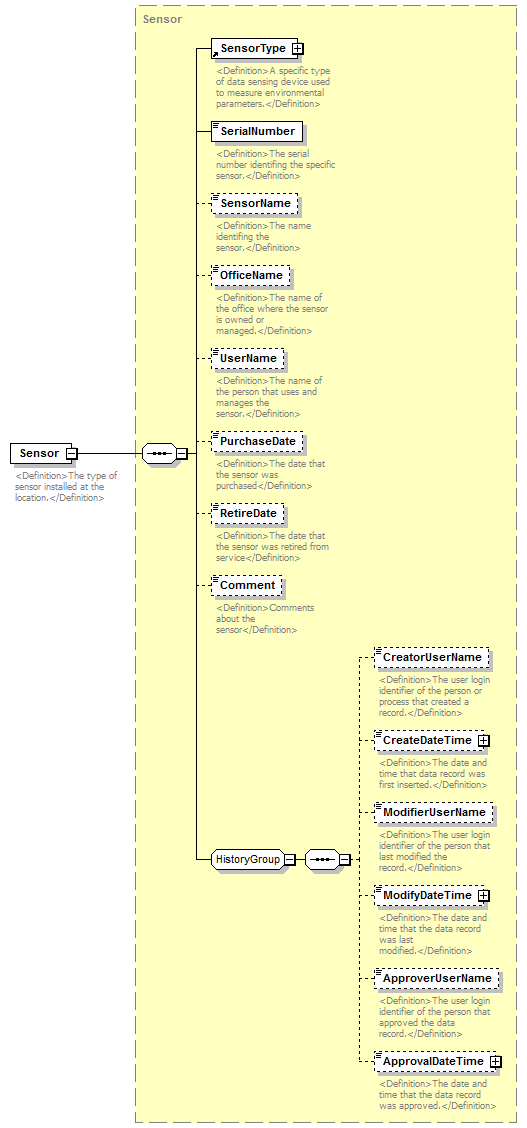 |
||||
| namespace | http://water.usgs.gov/XML/NWIS/5.0 | ||||
| type | Sensor | ||||
| properties |
|
||||
| children | SensorType SerialNumber SensorName OfficeName UserName PurchaseDate RetireDate Comment CreatorUserName CreateDateTime ModifierUserName ModifyDateTime ApproverUserName ApprovalDateTime | ||||
| annotation |
|
||||
| source | <xsd:element name="Sensor" type="Sensor"> <xsd:annotation> <xsd:documentation> <Definition>The type of sensor installed at the location.</Definition> </xsd:documentation> </xsd:annotation> </xsd:element> |
element LocationSensor/StartDateTime
| diagram | 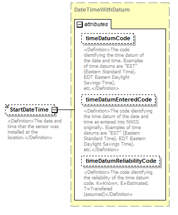 |
||||||||||||||||||||||||||||||
| namespace | http://water.usgs.gov/XML/NWIS/5.0 | ||||||||||||||||||||||||||||||
| type | DateTimeWithDatum | ||||||||||||||||||||||||||||||
| properties |
|
||||||||||||||||||||||||||||||
| attributes |
|
||||||||||||||||||||||||||||||
| annotation |
|
||||||||||||||||||||||||||||||
| source | <xsd:element name="StartDateTime" type="DateTimeWithDatum" minOccurs="0"> <xsd:annotation> <xsd:documentation> <Definition>The date and time that the sensor was installed at the location.</Definition> </xsd:documentation> </xsd:annotation> </xsd:element> |
element LocationSensor/EndDateTime
| diagram |  |
||||||||||||||||||||||||||||||
| namespace | http://water.usgs.gov/XML/NWIS/5.0 | ||||||||||||||||||||||||||||||
| type | DateTimeWithDatum | ||||||||||||||||||||||||||||||
| properties |
|
||||||||||||||||||||||||||||||
| attributes |
|
||||||||||||||||||||||||||||||
| annotation |
|
||||||||||||||||||||||||||||||
| source | <xsd:element name="EndDateTime" type="DateTimeWithDatum" minOccurs="0"> <xsd:annotation> <xsd:documentation> <Definition>The date and time that the sensor was removed from the location.</Definition> </xsd:documentation> </xsd:annotation> </xsd:element> |
element LocationSensor/PrimarySensorIndicator
| diagram |  |
||||||||
| namespace | http://water.usgs.gov/XML/NWIS/5.0 | ||||||||
| type | xsd:boolean | ||||||||
| properties |
|
||||||||
| annotation |
|
||||||||
| source | <xsd:element name="PrimarySensorIndicator" type="xsd:boolean" minOccurs="0"> <xsd:annotation> <xsd:documentation> <Definition>Is this sensor a primary reference (non-recording) sensor (true or false)?</Definition> </xsd:documentation> </xsd:annotation> </xsd:element> |
element LocationSensor/PrimaryRecorderIndicator
| diagram |  |
||||||||
| namespace | http://water.usgs.gov/XML/NWIS/5.0 | ||||||||
| type | xsd:boolean | ||||||||
| properties |
|
||||||||
| annotation |
|
||||||||
| source | <xsd:element name="PrimaryRecorderIndicator" type="xsd:boolean" minOccurs="0"> <xsd:annotation> <xsd:documentation> <Definition>Is this sensor being recorded on the primary (preferred Input) recorder (true or false)?</Definition> </xsd:documentation> </xsd:annotation> </xsd:element> |
element LocationSensor/StillingWellIndicator
| diagram |  |
||||||||
| namespace | http://water.usgs.gov/XML/NWIS/5.0 | ||||||||
| type | xsd:boolean | ||||||||
| properties |
|
||||||||
| annotation |
|
||||||||
| source | <xsd:element name="StillingWellIndicator" type="xsd:boolean" minOccurs="0"> <xsd:annotation> <xsd:documentation> <Definition>Does this sensor measure the water level within a stilling well (true or false)</Definition> </xsd:documentation> </xsd:annotation> </xsd:element> |
element SiteEquipment
| diagram | 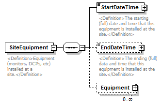 |
||
| namespace | http://water.usgs.gov/XML/NWIS/5.0 | ||
| properties |
|
||
| children | StartDateTime EndDateTime Equipment | ||
| used by |
|
||
| annotation |
|
||
| source | <xsd:element name="SiteEquipment"> <xsd:annotation> <xsd:documentation> <Definition>Equipment (monitors, DCPs, etc) installed at a site.</Definition> </xsd:documentation> </xsd:annotation> <xsd:complexType> <xsd:sequence> <xsd:element name="StartDateTime" type="DateTimeWithDatumPartial"> <xsd:annotation> <xsd:documentation> <Definition>The starting (full) date and time that this equipment is installed at the site.</Definition> </xsd:documentation> </xsd:annotation> </xsd:element> <xsd:element name="EndDateTime" type="DateTimeWithDatumPartial" minOccurs="0"> <xsd:annotation> <xsd:documentation> <Definition>The ending (full) data and time that this equipment is installed at the site.</Definition> </xsd:documentation> </xsd:annotation> </xsd:element> <xsd:element name="Equipment" type="EquipmentType" minOccurs="0" maxOccurs="unbounded"/> </xsd:sequence> </xsd:complexType> </xsd:element> |
element SiteEquipment/StartDateTime
| diagram | 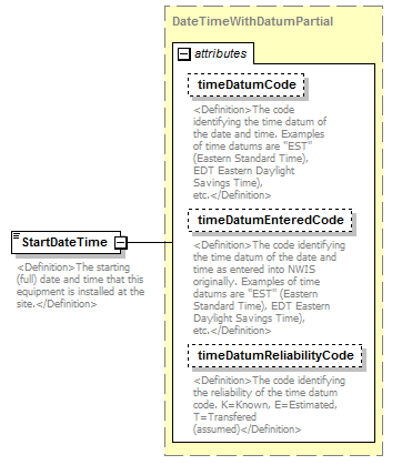 |
||||||||||||||||||||||||||||||
| namespace | http://water.usgs.gov/XML/NWIS/5.0 | ||||||||||||||||||||||||||||||
| type | DateTimeWithDatumPartial | ||||||||||||||||||||||||||||||
| properties |
|
||||||||||||||||||||||||||||||
| attributes |
|
||||||||||||||||||||||||||||||
| annotation |
|
||||||||||||||||||||||||||||||
| source | <xsd:element name="StartDateTime" type="DateTimeWithDatumPartial"> <xsd:annotation> <xsd:documentation> <Definition>The starting (full) date and time that this equipment is installed at the site.</Definition> </xsd:documentation> </xsd:annotation> </xsd:element> |
element SiteEquipment/EndDateTime
| diagram | 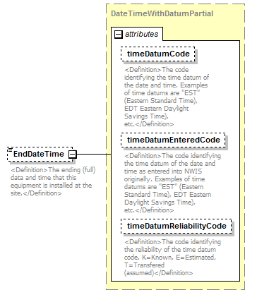 |
||||||||||||||||||||||||||||||
| namespace | http://water.usgs.gov/XML/NWIS/5.0 | ||||||||||||||||||||||||||||||
| type | DateTimeWithDatumPartial | ||||||||||||||||||||||||||||||
| properties |
|
||||||||||||||||||||||||||||||
| attributes |
|
||||||||||||||||||||||||||||||
| annotation |
|
||||||||||||||||||||||||||||||
| source | <xsd:element name="EndDateTime" type="DateTimeWithDatumPartial" minOccurs="0"> <xsd:annotation> <xsd:documentation> <Definition>The ending (full) data and time that this equipment is installed at the site.</Definition> </xsd:documentation> </xsd:annotation> </xsd:element> |
element SiteEquipment/Equipment
| diagram | 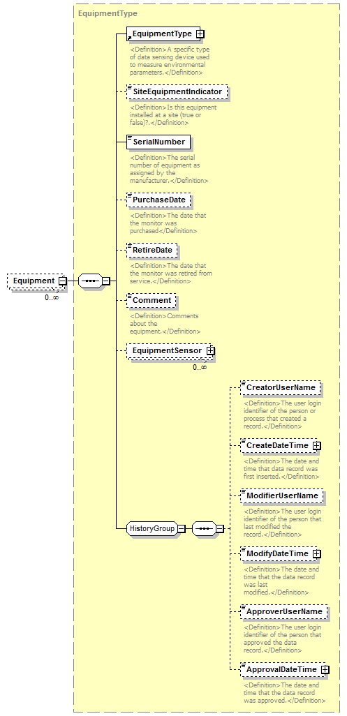 |
||||||||
| namespace | http://water.usgs.gov/XML/NWIS/5.0 | ||||||||
| type | EquipmentType | ||||||||
| properties |
|
||||||||
| children | EquipmentType SiteEquipmentIndicator SerialNumber PurchaseDate RetireDate Comment EquipmentSensor CreatorUserName CreateDateTime ModifierUserName ModifyDateTime ApproverUserName ApprovalDateTime | ||||||||
| source | <xsd:element name="Equipment" type="EquipmentType" minOccurs="0" maxOccurs="unbounded"/> |
element SiteVisit
| diagram | 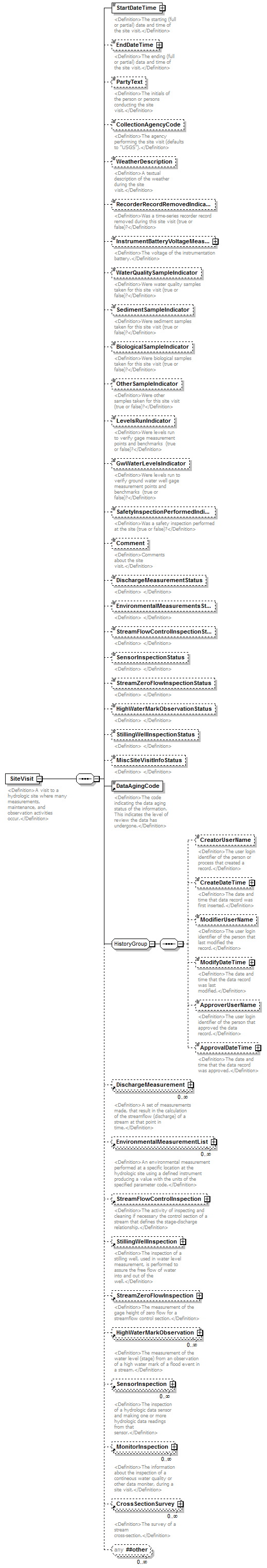 |
||
| namespace | http://water.usgs.gov/XML/NWIS/5.0 | ||
| properties |
|
||
| children | StartDateTime EndDateTime PartyText CollectionAgencyCode WeatherDescription RecorderRecordRemovedIndicator InstrumentBatteryVoltageMeasure WaterQualitySampleIndicator SedimentSampleIndicator BiologicalSampleIndicator OtherSampleIndicator LevelsRunIndicator GwWaterLevelsIndicator SafetyInspectionPerformedIndicator Comment DischargeMeasurementStatus EnvironmentalMeasurementsStatus StreamFlowControlInspectionStatus SensorInspectionStatus StreamZeroFlowInspectionStatus HighWaterMarkObservationStatus StillingWellInspectionStatus MiscSiteVisitInfoStatus DataAgingCode CreatorUserName CreateDateTime ModifierUserName ModifyDateTime ApproverUserName ApprovalDateTime DischargeMeasurement EnvironmentalMeasurementList StreamFlowControlInspection StillingWellInspection StreamZeroFlowInspection HighWaterMarkObservation SensorInspection MonitorInspection CrossSectionSurvey | ||
| used by |
|
||
| annotation |
|
||
| source | <xsd:element name="SiteVisit"> <xsd:annotation> <xsd:documentation> <Definition>A visit to a hydrologic site where many measurements, maintenance, and observation activities occur.</Definition> </xsd:documentation> </xsd:annotation> <xsd:complexType> <xsd:sequence> <xsd:element name="StartDateTime" type="DateTimeWithDatumPartial"> <xsd:annotation> <xsd:documentation> <Definition>The starting (full or partial) date and time of the site visit.</Definition> </xsd:documentation> </xsd:annotation> </xsd:element> <xsd:element name="EndDateTime" type="DateTimeWithDatumPartial" minOccurs="0"> <xsd:annotation> <xsd:documentation> <Definition>The ending (full or partial) data and time of the site visit.</Definition> </xsd:documentation> </xsd:annotation> </xsd:element> <xsd:element name="PartyText" type="xsd:string" minOccurs="0"> <xsd:annotation> <xsd:documentation> <Definition>The initials of the person or persons conducting the site visit.</Definition> </xsd:documentation> </xsd:annotation> </xsd:element> <xsd:element name="CollectionAgencyCode" type="xsd:token" minOccurs="0"> <xsd:annotation> <xsd:documentation> <Definition>The agency performing the site visit (defaults to "USGS").</Definition> </xsd:documentation> </xsd:annotation> </xsd:element> <xsd:element name="WeatherDescription" type="xsd:string" minOccurs="0"> <xsd:annotation> <xsd:documentation> <Definition>A textual description of the weather during the site visit.</Definition> </xsd:documentation> </xsd:annotation> </xsd:element> <xsd:element name="RecorderRecordRemovedIndicator" type="xsd:boolean" minOccurs="0"> <xsd:annotation> <xsd:documentation> <Definition>Was a time-series recorder record removed during this site visit (true or false)?</Definition> </xsd:documentation> </xsd:annotation> </xsd:element> <xsd:element name="InstrumentBatteryVoltageMeasure" type="IEEE754FloatValueType" minOccurs="0"> <xsd:annotation> <xsd:documentation> <Definition>The voltage of the instrumentation battery.</Definition> </xsd:documentation> </xsd:annotation> </xsd:element> <xsd:element name="WaterQualitySampleIndicator" type="xsd:boolean" minOccurs="0"> <xsd:annotation> <xsd:documentation> <Definition>Were water quality samples taken for this site visit (true or false)?</Definition> </xsd:documentation> </xsd:annotation> </xsd:element> <xsd:element name="SedimentSampleIndicator" type="xsd:boolean" minOccurs="0"> <xsd:annotation> <xsd:documentation> <Definition>Were sediment samples taken for this site visit (true or false)?</Definition> </xsd:documentation> </xsd:annotation> </xsd:element> <xsd:element name="BiologicalSampleIndicator" type="xsd:boolean" minOccurs="0"> <xsd:annotation> <xsd:documentation> <Definition>Were biological samples taken for this site visit (true or false)?</Definition> </xsd:documentation> </xsd:annotation> </xsd:element> <xsd:element name="OtherSampleIndicator" type="xsd:boolean" minOccurs="0"> <xsd:annotation> <xsd:documentation> <Definition>Were other samples taken for this site visit (true or false)?</Definition> </xsd:documentation> </xsd:annotation> </xsd:element> <xsd:element name="LevelsRunIndicator" type="xsd:boolean" minOccurs="0"> <xsd:annotation> <xsd:documentation> <Definition>Were levels run to verify gage measurement points and benchmarks (true or false)?</Definition> </xsd:documentation> </xsd:annotation> </xsd:element> <xsd:element name="GwWaterLevelsIndicator" type="xsd:boolean" minOccurs="0"> <xsd:annotation> <xsd:documentation> <Definition>Were levels run to verify ground water well gage measurement points and benchmarks (true or false)?</Definition> </xsd:documentation> </xsd:annotation> </xsd:element> <xsd:element name="SafetyInspectionPerformedIndicator" type="xsd:boolean" minOccurs="0"> <xsd:annotation> <xsd:documentation> <Definition>Was a safety inspection performed at the site (true or false)?</Definition> </xsd:documentation> </xsd:annotation> </xsd:element> <xsd:element name="Comment" type="xsd:string" minOccurs="0"> <xsd:annotation> <xsd:documentation> <Definition>Comments about the site visit.</Definition> </xsd:documentation> </xsd:annotation> </xsd:element> <xsd:element name="DischargeMeasurementStatus" type="xsd:string" minOccurs="0"> <xsd:annotation> <xsd:documentation> <Definition> </Definition> </xsd:documentation> </xsd:annotation> </xsd:element> <xsd:element name="EnvironmentalMeasurementsStatus" type="xsd:string" minOccurs="0"> <xsd:annotation> <xsd:documentation> <Definition> </Definition> </xsd:documentation> </xsd:annotation> </xsd:element> <xsd:element name="StreamFlowControlInspectionStatus" type="xsd:string" minOccurs="0"> <xsd:annotation> <xsd:documentation> <Definition> </Definition> </xsd:documentation> </xsd:annotation> </xsd:element> <xsd:element name="SensorInspectionStatus" type="xsd:string" minOccurs="0"> <xsd:annotation> <xsd:documentation> <Definition> </Definition> </xsd:documentation> </xsd:annotation> </xsd:element> <xsd:element name="StreamZeroFlowInspectionStatus" type="xsd:string" minOccurs="0"> <xsd:annotation> <xsd:documentation> <Definition> </Definition> </xsd:documentation> </xsd:annotation> </xsd:element> <xsd:element name="HighWaterMarkObservationStatus" type="xsd:string" minOccurs="0"> <xsd:annotation> <xsd:documentation> <Definition> </Definition> </xsd:documentation> </xsd:annotation> </xsd:element> <xsd:element name="StillingWellInspectionStatus" type="xsd:string" minOccurs="0"> <xsd:annotation> <xsd:documentation> <Definition> </Definition> </xsd:documentation> </xsd:annotation> </xsd:element> <xsd:element name="MiscSiteVisitInfoStatus" type="xsd:string" minOccurs="0"> <xsd:annotation> <xsd:documentation> <Definition> </Definition> </xsd:documentation> </xsd:annotation> </xsd:element> <xsd:element ref="DataAgingCode"/> <xsd:group ref="HistoryGroup"/> <xsd:element ref="DischargeMeasurement" minOccurs="0" maxOccurs="unbounded"/> <xsd:element ref="EnvironmentalMeasurementList" minOccurs="0" maxOccurs="unbounded"/> <xsd:element ref="StreamFlowControlInspection" minOccurs="0"/> <xsd:element ref="StillingWellInspection" minOccurs="0"/> <xsd:element ref="StreamZeroFlowInspection" minOccurs="0"/> <xsd:element ref="HighWaterMarkObservation" minOccurs="0" maxOccurs="unbounded"/> <xsd:element ref="SensorInspection" minOccurs="0" maxOccurs="unbounded"/> <xsd:element ref="MonitorInspection" minOccurs="0" maxOccurs="unbounded"/> <xsd:element ref="CrossSectionSurvey" minOccurs="0" maxOccurs="unbounded"/> <xsd:any namespace="##other" processContents="lax" minOccurs="0" maxOccurs="unbounded"/> </xsd:sequence> </xsd:complexType> </xsd:element> |
element SiteVisit/StartDateTime
| diagram | 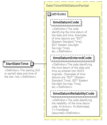 |
||||||||||||||||||||||||||||||
| namespace | http://water.usgs.gov/XML/NWIS/5.0 | ||||||||||||||||||||||||||||||
| type | DateTimeWithDatumPartial | ||||||||||||||||||||||||||||||
| properties |
|
||||||||||||||||||||||||||||||
| attributes |
|
||||||||||||||||||||||||||||||
| annotation |
|
||||||||||||||||||||||||||||||
| source | <xsd:element name="StartDateTime" type="DateTimeWithDatumPartial"> <xsd:annotation> <xsd:documentation> <Definition>The starting (full or partial) date and time of the site visit.</Definition> </xsd:documentation> </xsd:annotation> </xsd:element> |
element SiteVisit/EndDateTime
| diagram |  |
||||||||||||||||||||||||||||||
| namespace | http://water.usgs.gov/XML/NWIS/5.0 | ||||||||||||||||||||||||||||||
| type | DateTimeWithDatumPartial | ||||||||||||||||||||||||||||||
| properties |
|
||||||||||||||||||||||||||||||
| attributes |
|
||||||||||||||||||||||||||||||
| annotation |
|
||||||||||||||||||||||||||||||
| source | <xsd:element name="EndDateTime" type="DateTimeWithDatumPartial" minOccurs="0"> <xsd:annotation> <xsd:documentation> <Definition>The ending (full or partial) data and time of the site visit.</Definition> </xsd:documentation> </xsd:annotation> </xsd:element> |
element SiteVisit/PartyText
| diagram | 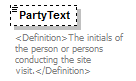 |
||||||||
| namespace | http://water.usgs.gov/XML/NWIS/5.0 | ||||||||
| type | xsd:string | ||||||||
| properties |
|
||||||||
| annotation |
|
||||||||
| source | <xsd:element name="PartyText" type="xsd:string" minOccurs="0"> <xsd:annotation> <xsd:documentation> <Definition>The initials of the person or persons conducting the site visit.</Definition> </xsd:documentation> </xsd:annotation> </xsd:element> |
element SiteVisit/CollectionAgencyCode
| diagram | 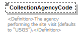 |
||||||||
| namespace | http://water.usgs.gov/XML/NWIS/5.0 | ||||||||
| type | xsd:token | ||||||||
| properties |
|
||||||||
| annotation |
|
||||||||
| source | <xsd:element name="CollectionAgencyCode" type="xsd:token" minOccurs="0"> <xsd:annotation> <xsd:documentation> <Definition>The agency performing the site visit (defaults to "USGS").</Definition> </xsd:documentation> </xsd:annotation> </xsd:element> |
element SiteVisit/WeatherDescription
| diagram |  |
||||||||
| namespace | http://water.usgs.gov/XML/NWIS/5.0 | ||||||||
| type | xsd:string | ||||||||
| properties |
|
||||||||
| annotation |
|
||||||||
| source | <xsd:element name="WeatherDescription" type="xsd:string" minOccurs="0"> <xsd:annotation> <xsd:documentation> <Definition>A textual description of the weather during the site visit.</Definition> </xsd:documentation> </xsd:annotation> </xsd:element> |
element SiteVisit/RecorderRecordRemovedIndicator
| diagram |  |
||||||||
| namespace | http://water.usgs.gov/XML/NWIS/5.0 | ||||||||
| type | xsd:boolean | ||||||||
| properties |
|
||||||||
| annotation |
|
||||||||
| source | <xsd:element name="RecorderRecordRemovedIndicator" type="xsd:boolean" minOccurs="0"> <xsd:annotation> <xsd:documentation> <Definition>Was a time-series recorder record removed during this site visit (true or false)?</Definition> </xsd:documentation> </xsd:annotation> </xsd:element> |
element SiteVisit/InstrumentBatteryVoltageMeasure
| diagram |  |
||||||||||||||||||||||||||||||||||||||||||||||
| namespace | http://water.usgs.gov/XML/NWIS/5.0 | ||||||||||||||||||||||||||||||||||||||||||||||
| type | IEEE754FloatValueType | ||||||||||||||||||||||||||||||||||||||||||||||
| properties |
|
||||||||||||||||||||||||||||||||||||||||||||||
| facets |
|
||||||||||||||||||||||||||||||||||||||||||||||
| attributes |
|
||||||||||||||||||||||||||||||||||||||||||||||
| annotation |
|
||||||||||||||||||||||||||||||||||||||||||||||
| source | <xsd:element name="InstrumentBatteryVoltageMeasure" type="IEEE754FloatValueType" minOccurs="0"> <xsd:annotation> <xsd:documentation> <Definition>The voltage of the instrumentation battery.</Definition> </xsd:documentation> </xsd:annotation> </xsd:element> |
element SiteVisit/WaterQualitySampleIndicator
| diagram |  |
||||||||
| namespace | http://water.usgs.gov/XML/NWIS/5.0 | ||||||||
| type | xsd:boolean | ||||||||
| properties |
|
||||||||
| annotation |
|
||||||||
| source | <xsd:element name="WaterQualitySampleIndicator" type="xsd:boolean" minOccurs="0"> <xsd:annotation> <xsd:documentation> <Definition>Were water quality samples taken for this site visit (true or false)?</Definition> </xsd:documentation> </xsd:annotation> </xsd:element> |
element SiteVisit/SedimentSampleIndicator
| diagram |  |
||||||||
| namespace | http://water.usgs.gov/XML/NWIS/5.0 | ||||||||
| type | xsd:boolean | ||||||||
| properties |
|
||||||||
| annotation |
|
||||||||
| source | <xsd:element name="SedimentSampleIndicator" type="xsd:boolean" minOccurs="0"> <xsd:annotation> <xsd:documentation> <Definition>Were sediment samples taken for this site visit (true or false)?</Definition> </xsd:documentation> </xsd:annotation> </xsd:element> |
element SiteVisit/BiologicalSampleIndicator
| diagram |  |
||||||||
| namespace | http://water.usgs.gov/XML/NWIS/5.0 | ||||||||
| type | xsd:boolean | ||||||||
| properties |
|
||||||||
| annotation |
|
||||||||
| source | <xsd:element name="BiologicalSampleIndicator" type="xsd:boolean" minOccurs="0"> <xsd:annotation> <xsd:documentation> <Definition>Were biological samples taken for this site visit (true or false)?</Definition> </xsd:documentation> </xsd:annotation> </xsd:element> |
element SiteVisit/OtherSampleIndicator
| diagram |  |
||||||||
| namespace | http://water.usgs.gov/XML/NWIS/5.0 | ||||||||
| type | xsd:boolean | ||||||||
| properties |
|
||||||||
| annotation |
|
||||||||
| source | <xsd:element name="OtherSampleIndicator" type="xsd:boolean" minOccurs="0"> <xsd:annotation> <xsd:documentation> <Definition>Were other samples taken for this site visit (true or false)?</Definition> </xsd:documentation> </xsd:annotation> </xsd:element> |
element SiteVisit/LevelsRunIndicator
| diagram |  |
||||||||
| namespace | http://water.usgs.gov/XML/NWIS/5.0 | ||||||||
| type | xsd:boolean | ||||||||
| properties |
|
||||||||
| annotation |
|
||||||||
| source | <xsd:element name="LevelsRunIndicator" type="xsd:boolean" minOccurs="0"> <xsd:annotation> <xsd:documentation> <Definition>Were levels run to verify gage measurement points and benchmarks (true or false)?</Definition> </xsd:documentation> </xsd:annotation> </xsd:element> |
element SiteVisit/GwWaterLevelsIndicator
| diagram |  |
||||||||
| namespace | http://water.usgs.gov/XML/NWIS/5.0 | ||||||||
| type | xsd:boolean | ||||||||
| properties |
|
||||||||
| annotation |
|
||||||||
| source | <xsd:element name="GwWaterLevelsIndicator" type="xsd:boolean" minOccurs="0"> <xsd:annotation> <xsd:documentation> <Definition>Were levels run to verify ground water well gage measurement points and benchmarks (true or false)?</Definition> </xsd:documentation> </xsd:annotation> </xsd:element> |
element SiteVisit/SafetyInspectionPerformedIndicator
| diagram |  |
||||||||
| namespace | http://water.usgs.gov/XML/NWIS/5.0 | ||||||||
| type | xsd:boolean | ||||||||
| properties |
|
||||||||
| annotation |
|
||||||||
| source | <xsd:element name="SafetyInspectionPerformedIndicator" type="xsd:boolean" minOccurs="0"> <xsd:annotation> <xsd:documentation> <Definition>Was a safety inspection performed at the site (true or false)?</Definition> </xsd:documentation> </xsd:annotation> </xsd:element> |
element SiteVisit/Comment
| diagram |  |
||||||||
| namespace | http://water.usgs.gov/XML/NWIS/5.0 | ||||||||
| type | xsd:string | ||||||||
| properties |
|
||||||||
| annotation |
|
||||||||
| source | <xsd:element name="Comment" type="xsd:string" minOccurs="0"> <xsd:annotation> <xsd:documentation> <Definition>Comments about the site visit.</Definition> </xsd:documentation> </xsd:annotation> </xsd:element> |
element SiteVisit/DischargeMeasurementStatus
| diagram |  |
||||||||
| namespace | http://water.usgs.gov/XML/NWIS/5.0 | ||||||||
| type | xsd:string | ||||||||
| properties |
|
||||||||
| annotation |
|
||||||||
| source | <xsd:element name="DischargeMeasurementStatus" type="xsd:string" minOccurs="0"> <xsd:annotation> <xsd:documentation> <Definition> </Definition> </xsd:documentation> </xsd:annotation> </xsd:element> |
element SiteVisit/EnvironmentalMeasurementsStatus
| diagram |  |
||||||||
| namespace | http://water.usgs.gov/XML/NWIS/5.0 | ||||||||
| type | xsd:string | ||||||||
| properties |
|
||||||||
| annotation |
|
||||||||
| source | <xsd:element name="EnvironmentalMeasurementsStatus" type="xsd:string" minOccurs="0"> <xsd:annotation> <xsd:documentation> <Definition> </Definition> </xsd:documentation> </xsd:annotation> </xsd:element> |
element SiteVisit/StreamFlowControlInspectionStatus
| diagram |  |
||||||||
| namespace | http://water.usgs.gov/XML/NWIS/5.0 | ||||||||
| type | xsd:string | ||||||||
| properties |
|
||||||||
| annotation |
|
||||||||
| source | <xsd:element name="StreamFlowControlInspectionStatus" type="xsd:string" minOccurs="0"> <xsd:annotation> <xsd:documentation> <Definition> </Definition> </xsd:documentation> </xsd:annotation> </xsd:element> |
element SiteVisit/SensorInspectionStatus
| diagram |  |
||||||||
| namespace | http://water.usgs.gov/XML/NWIS/5.0 | ||||||||
| type | xsd:string | ||||||||
| properties |
|
||||||||
| annotation |
|
||||||||
| source | <xsd:element name="SensorInspectionStatus" type="xsd:string" minOccurs="0"> <xsd:annotation> <xsd:documentation> <Definition> </Definition> </xsd:documentation> </xsd:annotation> </xsd:element> |
element SiteVisit/StreamZeroFlowInspectionStatus
| diagram |  |
||||||||
| namespace | http://water.usgs.gov/XML/NWIS/5.0 | ||||||||
| type | xsd:string | ||||||||
| properties |
|
||||||||
| annotation |
|
||||||||
| source | <xsd:element name="StreamZeroFlowInspectionStatus" type="xsd:string" minOccurs="0"> <xsd:annotation> <xsd:documentation> <Definition> </Definition> </xsd:documentation> </xsd:annotation> </xsd:element> |
element SiteVisit/HighWaterMarkObservationStatus
| diagram |  |
||||||||
| namespace | http://water.usgs.gov/XML/NWIS/5.0 | ||||||||
| type | xsd:string | ||||||||
| properties |
|
||||||||
| annotation |
|
||||||||
| source | <xsd:element name="HighWaterMarkObservationStatus" type="xsd:string" minOccurs="0"> <xsd:annotation> <xsd:documentation> <Definition> </Definition> </xsd:documentation> </xsd:annotation> </xsd:element> |
element SiteVisit/StillingWellInspectionStatus
| diagram |  |
||||||||
| namespace | http://water.usgs.gov/XML/NWIS/5.0 | ||||||||
| type | xsd:string | ||||||||
| properties |
|
||||||||
| annotation |
|
||||||||
| source | <xsd:element name="StillingWellInspectionStatus" type="xsd:string" minOccurs="0"> <xsd:annotation> <xsd:documentation> <Definition> </Definition> </xsd:documentation> </xsd:annotation> </xsd:element> |
element SiteVisit/MiscSiteVisitInfoStatus
| diagram |  |
||||||||
| namespace | http://water.usgs.gov/XML/NWIS/5.0 | ||||||||
| type | xsd:string | ||||||||
| properties |
|
||||||||
| annotation |
|
||||||||
| source | <xsd:element name="MiscSiteVisitInfoStatus" type="xsd:string" minOccurs="0"> <xsd:annotation> <xsd:documentation> <Definition> </Definition> </xsd:documentation> </xsd:annotation> </xsd:element> |
element SiteVisitDescription
| diagram | 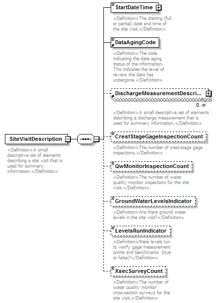 |
||
| namespace | http://water.usgs.gov/XML/NWIS/5.0 | ||
| properties |
|
||
| children | StartDateTime DataAgingCode DischargeMeasurementDescription CrestStageGageInspectionCount QwMonitorInspectionCount GroundWaterLevelsIndicator LevelsRunIndicator XsecSurveyCount | ||
| used by |
|
||
| annotation |
|
||
| source | <xsd:element name="SiteVisitDescription"> <xsd:annotation> <xsd:documentation> <Definition>A small descriptive set of elements describing a site visit that is used for summary information.</Definition> </xsd:documentation> </xsd:annotation> <xsd:complexType> <xsd:sequence> <xsd:element name="StartDateTime" type="DateTimeWithDatumPartial"> <xsd:annotation> <xsd:documentation> <Definition>The starting (full or partial) date and time of the site visit.</Definition> </xsd:documentation> </xsd:annotation> </xsd:element> <xsd:element ref="DataAgingCode"/> <xsd:element ref="DischargeMeasurementDescription" minOccurs="0" maxOccurs="unbounded"/> <xsd:element name="CrestStageGageInspectionCount" type="xsd:integer" minOccurs="0"> <xsd:annotation> <xsd:documentation> <Definition>The number of crest-stage gage inspections.</Definition> </xsd:documentation> </xsd:annotation> </xsd:element> <xsd:element name="QwMonitorInspectionCount" type="xsd:integer" minOccurs="0"> <xsd:annotation> <xsd:documentation> <Definition>The number of water quality monitor inspections for the site visit.</Definition> </xsd:documentation> </xsd:annotation> </xsd:element> <xsd:element name="GroundWaterLevelsIndicator" type="xsd:boolean" minOccurs="0"> <xsd:annotation> <xsd:documentation> <Definition>Are there ground water levels in the site visit?</Definition> </xsd:documentation> </xsd:annotation> </xsd:element> <xsd:element name="LevelsRunIndicator" type="xsd:boolean" minOccurs="0"> <xsd:annotation> <xsd:documentation> <Definition>Were levels run to verify gage measurement points and benchmarks (true or false)?</Definition> </xsd:documentation> </xsd:annotation> </xsd:element> <xsd:element name="XsecSurveyCount" type="xsd:integer" minOccurs="0"> <xsd:annotation> <xsd:documentation> <Definition>The number of water quality monitor cross-section surveys for the site visit.</Definition> </xsd:documentation> </xsd:annotation> </xsd:element> </xsd:sequence> </xsd:complexType> </xsd:element> |
element SiteVisitDescription/StartDateTime
| diagram |  |
||||||||||||||||||||||||||||||
| namespace | http://water.usgs.gov/XML/NWIS/5.0 | ||||||||||||||||||||||||||||||
| type | DateTimeWithDatumPartial | ||||||||||||||||||||||||||||||
| properties |
|
||||||||||||||||||||||||||||||
| attributes |
|
||||||||||||||||||||||||||||||
| annotation |
|
||||||||||||||||||||||||||||||
| source | <xsd:element name="StartDateTime" type="DateTimeWithDatumPartial"> <xsd:annotation> <xsd:documentation> <Definition>The starting (full or partial) date and time of the site visit.</Definition> </xsd:documentation> </xsd:annotation> </xsd:element> |
element SiteVisitDescription/CrestStageGageInspectionCount
| diagram | 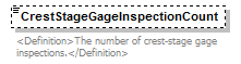 |
||||||||
| namespace | http://water.usgs.gov/XML/NWIS/5.0 | ||||||||
| type | xsd:integer | ||||||||
| properties |
|
||||||||
| annotation |
|
||||||||
| source | <xsd:element name="CrestStageGageInspectionCount" type="xsd:integer" minOccurs="0"> <xsd:annotation> <xsd:documentation> <Definition>The number of crest-stage gage inspections.</Definition> </xsd:documentation> </xsd:annotation> </xsd:element> |
element SiteVisitDescription/QwMonitorInspectionCount
| diagram | 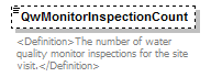 |
||||||||
| namespace | http://water.usgs.gov/XML/NWIS/5.0 | ||||||||
| type | xsd:integer | ||||||||
| properties |
|
||||||||
| annotation |
|
||||||||
| source | <xsd:element name="QwMonitorInspectionCount" type="xsd:integer" minOccurs="0"> <xsd:annotation> <xsd:documentation> <Definition>The number of water quality monitor inspections for the site visit.</Definition> </xsd:documentation> </xsd:annotation> </xsd:element> |
element SiteVisitDescription/GroundWaterLevelsIndicator
| diagram | 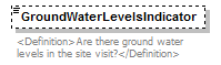 |
||||||||
| namespace | http://water.usgs.gov/XML/NWIS/5.0 | ||||||||
| type | xsd:boolean | ||||||||
| properties |
|
||||||||
| annotation |
|
||||||||
| source | <xsd:element name="GroundWaterLevelsIndicator" type="xsd:boolean" minOccurs="0"> <xsd:annotation> <xsd:documentation> <Definition>Are there ground water levels in the site visit?</Definition> </xsd:documentation> </xsd:annotation> </xsd:element> |
element SiteVisitDescription/LevelsRunIndicator
| diagram | 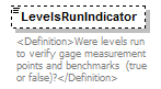 |
||||||||
| namespace | http://water.usgs.gov/XML/NWIS/5.0 | ||||||||
| type | xsd:boolean | ||||||||
| properties |
|
||||||||
| annotation |
|
||||||||
| source | <xsd:element name="LevelsRunIndicator" type="xsd:boolean" minOccurs="0"> <xsd:annotation> <xsd:documentation> <Definition>Were levels run to verify gage measurement points and benchmarks (true or false)?</Definition> </xsd:documentation> </xsd:annotation> </xsd:element> |
element SiteVisitDescription/XsecSurveyCount
| diagram | 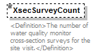 |
||||||||
| namespace | http://water.usgs.gov/XML/NWIS/5.0 | ||||||||
| type | xsd:integer | ||||||||
| properties |
|
||||||||
| annotation |
|
||||||||
| source | <xsd:element name="XsecSurveyCount" type="xsd:integer" minOccurs="0"> <xsd:annotation> <xsd:documentation> <Definition>The number of water quality monitor cross-section surveys for the site visit.</Definition> </xsd:documentation> </xsd:annotation> </xsd:element> |
complexType TimeZoneType
| diagram | 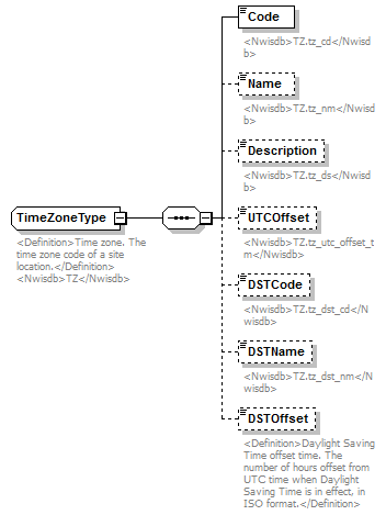 |
||||
| namespace | http://water.usgs.gov/XML/NWIS/5.0 | ||||
| type | extension of AreaType | ||||
| properties |
|
||||
| children | Code Name Description UTCOffset DSTCode DSTName DSTOffset | ||||
| used by |
|
||||
| annotation |
|
||||
| source | <xsd:complexType name="TimeZoneType" abstract="false"> <xsd:annotation> <xsd:documentation source="http://wwwnwis.er.usgs.gov/nwisdocs4_6/gw/gwcoding_Sect2-1.pdf"> <Definition>Time zone. The time zone code of a site location.</Definition> <Nwisdb>TZ</Nwisdb> </xsd:documentation> </xsd:annotation> <xsd:complexContent> <xsd:extension base="AreaType"> <xsd:sequence> <xsd:element name="Code"> <xsd:annotation> <xsd:documentation> <Nwisdb>TZ.tz_cd</Nwisdb> </xsd:documentation> </xsd:annotation> <xsd:simpleType> <xsd:restriction base="xsd:token"> <xsd:minLength value="1"/> <xsd:maxLength value="6"/> </xsd:restriction> </xsd:simpleType> </xsd:element> <xsd:element name="Name" minOccurs="0"> <xsd:annotation> <xsd:documentation> <Nwisdb>TZ.tz_nm</Nwisdb> </xsd:documentation> </xsd:annotation> <xsd:simpleType> <xsd:restriction base="xsd:token"> <xsd:minLength value="1"/> <xsd:maxLength value="32"/> </xsd:restriction> </xsd:simpleType> </xsd:element> <xsd:element name="Description" minOccurs="0"> <xsd:annotation> <xsd:documentation> <Nwisdb>TZ.tz_ds</Nwisdb> </xsd:documentation> </xsd:annotation> <xsd:simpleType> <xsd:restriction base="xsd:token"> <xsd:minLength value="1"/> <xsd:maxLength value="255"/> </xsd:restriction> </xsd:simpleType> </xsd:element> <xsd:element name="UTCOffset" type="xsd:duration" minOccurs="0"> <xsd:annotation> <xsd:documentation> <Nwisdb>TZ.tz_utc_offset_tm</Nwisdb> </xsd:documentation> </xsd:annotation> </xsd:element> <xsd:element name="DSTCode" minOccurs="0"> <xsd:annotation> <xsd:documentation> <Nwisdb>TZ.tz_dst_cd</Nwisdb> </xsd:documentation> </xsd:annotation> <xsd:simpleType> <xsd:restriction base="xsd:token"> <xsd:minLength value="1"/> <xsd:maxLength value="6"/> </xsd:restriction> </xsd:simpleType> </xsd:element> <xsd:element name="DSTName" minOccurs="0"> <xsd:annotation> <xsd:documentation> <Nwisdb>TZ.tz_dst_nm</Nwisdb> </xsd:documentation> </xsd:annotation> <xsd:simpleType> <xsd:restriction base="xsd:token"> <xsd:minLength value="1"/> <xsd:maxLength value="64"/> </xsd:restriction> </xsd:simpleType> </xsd:element> <xsd:element name="DSTOffset" type="xsd:duration" minOccurs="0"> <xsd:annotation> <xsd:documentation> <Definition>Daylight Saving Time offset time. The number of hours offset from UTC time when Daylight Saving Time is in effect, in ISO format.</Definition> </xsd:documentation> </xsd:annotation> </xsd:element> </xsd:sequence> </xsd:extension> </xsd:complexContent> </xsd:complexType> |
element TimeZoneType/Code
| diagram |  |
|||||||||
| namespace | http://water.usgs.gov/XML/NWIS/5.0 | |||||||||
| type | restriction of xsd:token | |||||||||
| properties |
|
|||||||||
| facets |
|
|||||||||
| annotation |
|
|||||||||
| source | <xsd:element name="Code"> <xsd:annotation> <xsd:documentation> <Nwisdb>TZ.tz_cd</Nwisdb> </xsd:documentation> </xsd:annotation> <xsd:simpleType> <xsd:restriction base="xsd:token"> <xsd:minLength value="1"/> <xsd:maxLength value="6"/> </xsd:restriction> </xsd:simpleType> </xsd:element> |
element TimeZoneType/Name
| diagram |  |
|||||||||
| namespace | http://water.usgs.gov/XML/NWIS/5.0 | |||||||||
| type | restriction of xsd:token | |||||||||
| properties |
|
|||||||||
| facets |
|
|||||||||
| annotation |
|
|||||||||
| source | <xsd:element name="Name" minOccurs="0"> <xsd:annotation> <xsd:documentation> <Nwisdb>TZ.tz_nm</Nwisdb> </xsd:documentation> </xsd:annotation> <xsd:simpleType> <xsd:restriction base="xsd:token"> <xsd:minLength value="1"/> <xsd:maxLength value="32"/> </xsd:restriction> </xsd:simpleType> </xsd:element> |
element TimeZoneType/Description
| diagram |  |
|||||||||
| namespace | http://water.usgs.gov/XML/NWIS/5.0 | |||||||||
| type | restriction of xsd:token | |||||||||
| properties |
|
|||||||||
| facets |
|
|||||||||
| annotation |
|
|||||||||
| source | <xsd:element name="Description" minOccurs="0"> <xsd:annotation> <xsd:documentation> <Nwisdb>TZ.tz_ds</Nwisdb> </xsd:documentation> </xsd:annotation> <xsd:simpleType> <xsd:restriction base="xsd:token"> <xsd:minLength value="1"/> <xsd:maxLength value="255"/> </xsd:restriction> </xsd:simpleType> </xsd:element> |
element TimeZoneType/UTCOffset
| diagram |  |
||||||||
| namespace | http://water.usgs.gov/XML/NWIS/5.0 | ||||||||
| type | xsd:duration | ||||||||
| properties |
|
||||||||
| annotation |
|
||||||||
| source | <xsd:element name="UTCOffset" type="xsd:duration" minOccurs="0"> <xsd:annotation> <xsd:documentation> <Nwisdb>TZ.tz_utc_offset_tm</Nwisdb> </xsd:documentation> </xsd:annotation> </xsd:element> |
element TimeZoneType/DSTCode
| diagram |  |
|||||||||
| namespace | http://water.usgs.gov/XML/NWIS/5.0 | |||||||||
| type | restriction of xsd:token | |||||||||
| properties |
|
|||||||||
| facets |
|
|||||||||
| annotation |
|
|||||||||
| source | <xsd:element name="DSTCode" minOccurs="0"> <xsd:annotation> <xsd:documentation> <Nwisdb>TZ.tz_dst_cd</Nwisdb> </xsd:documentation> </xsd:annotation> <xsd:simpleType> <xsd:restriction base="xsd:token"> <xsd:minLength value="1"/> <xsd:maxLength value="6"/> </xsd:restriction> </xsd:simpleType> </xsd:element> |
element TimeZoneType/DSTName
| diagram | 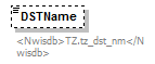 |
|||||||||
| namespace | http://water.usgs.gov/XML/NWIS/5.0 | |||||||||
| type | restriction of xsd:token | |||||||||
| properties |
|
|||||||||
| facets |
|
|||||||||
| annotation |
|
|||||||||
| source | <xsd:element name="DSTName" minOccurs="0"> <xsd:annotation> <xsd:documentation> <Nwisdb>TZ.tz_dst_nm</Nwisdb> </xsd:documentation> </xsd:annotation> <xsd:simpleType> <xsd:restriction base="xsd:token"> <xsd:minLength value="1"/> <xsd:maxLength value="64"/> </xsd:restriction> </xsd:simpleType> </xsd:element> |
element TimeZoneType/DSTOffset
| diagram | 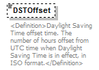 |
||||||||
| namespace | http://water.usgs.gov/XML/NWIS/5.0 | ||||||||
| type | xsd:duration | ||||||||
| properties |
|
||||||||
| annotation |
|
||||||||
| source | <xsd:element name="DSTOffset" type="xsd:duration" minOccurs="0"> <xsd:annotation> <xsd:documentation> <Definition>Daylight Saving Time offset time. The number of hours offset from UTC time when Daylight Saving Time is in effect, in ISO format.</Definition> </xsd:documentation> </xsd:annotation> </xsd:element> |
element Organization
| diagram | 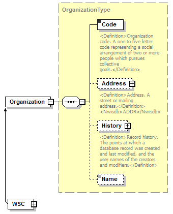 |
||
| namespace | http://water.usgs.gov/XML/NWIS/5.0 | ||
| type | OrganizationType | ||
| properties |
|
||
| children | Code Address History Name | ||
| source | <xsd:element name="Organization" type="OrganizationType"/> |
complexType OrganizationType
| diagram | 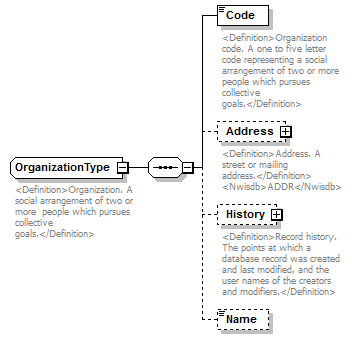 |
||||
| namespace | http://water.usgs.gov/XML/NWIS/5.0 | ||||
| properties |
|
||||
| children | Code Address History Name | ||||
| used by |
|
||||
| annotation |
|
||||
| source | <xsd:complexType name="OrganizationType" abstract="false"> <xsd:annotation> <xsd:documentation source="http://en.wikipedia.org/wiki/Organization"> <Definition>Organization. A social arrangement of two or more people which pursues collective goals.</Definition> </xsd:documentation> </xsd:annotation> <xsd:sequence> <xsd:element name="Code" type="xsd:token"> <xsd:annotation> <xsd:documentation> <Definition>Organization code. A one to five letter code representing a social arrangement of two or more people which pursues collective goals.</Definition> </xsd:documentation> </xsd:annotation> </xsd:element> <xsd:element name="Address" type="AddressType" minOccurs="0"> <xsd:annotation> <xsd:documentation> <Definition>Address. A street or mailing address.</Definition> <Nwisdb>ADDR</Nwisdb> </xsd:documentation> </xsd:annotation> </xsd:element> <xsd:element name="History" type="RecordHistoryType" minOccurs="0"> <xsd:annotation> <xsd:documentation> <Definition>Record history. The points at which a database record was created and last modified, and the user names of the creators and modifiers.</Definition> </xsd:documentation> </xsd:annotation> </xsd:element> <xsd:element name="Name" type="xsd:token" minOccurs="0"> <xsd:annotation> <xsd:documentation/> </xsd:annotation> </xsd:element> </xsd:sequence> </xsd:complexType> |
element OrganizationType/Code
| diagram | 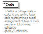 |
||||
| namespace | http://water.usgs.gov/XML/NWIS/5.0 | ||||
| type | xsd:token | ||||
| properties |
|
||||
| annotation |
|
||||
| source | <xsd:element name="Code" type="xsd:token"> <xsd:annotation> <xsd:documentation> <Definition>Organization code. A one to five letter code representing a social arrangement of two or more people which pursues collective goals.</Definition> </xsd:documentation> </xsd:annotation> </xsd:element> |
element OrganizationType/Address
| diagram | 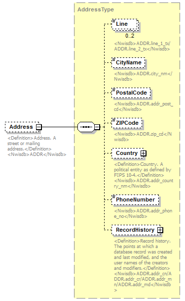 |
||||||||
| namespace | http://water.usgs.gov/XML/NWIS/5.0 | ||||||||
| type | AddressType | ||||||||
| properties |
|
||||||||
| children | Line CityName PostalCode ZIPCode Country PhoneNumber RecordHistory | ||||||||
| annotation |
|
||||||||
| source | <xsd:element name="Address" type="AddressType" minOccurs="0"> <xsd:annotation> <xsd:documentation> <Definition>Address. A street or mailing address.</Definition> <Nwisdb>ADDR</Nwisdb> </xsd:documentation> </xsd:annotation> </xsd:element> |
element OrganizationType/History
| diagram | 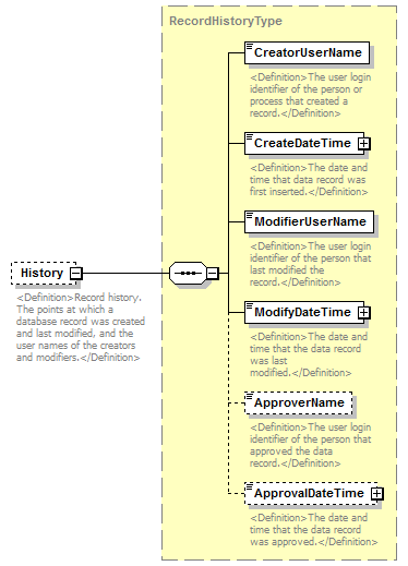 |
||||||||
| namespace | http://water.usgs.gov/XML/NWIS/5.0 | ||||||||
| type | RecordHistoryType | ||||||||
| properties |
|
||||||||
| children | CreatorUserName CreateDateTime ModifierUserName ModifyDateTime ApproverName ApprovalDateTime | ||||||||
| annotation |
|
||||||||
| source | <xsd:element name="History" type="RecordHistoryType" minOccurs="0"> <xsd:annotation> <xsd:documentation> <Definition>Record history. The points at which a database record was created and last modified, and the user names of the creators and modifiers.</Definition> </xsd:documentation> </xsd:annotation> </xsd:element> |
element OrganizationType/Name
| diagram |  |
||||||||
| namespace | http://water.usgs.gov/XML/NWIS/5.0 | ||||||||
| type | xsd:token | ||||||||
| properties |
|
||||||||
| source | <xsd:element name="Name" type="xsd:token" minOccurs="0"> <xsd:annotation> <xsd:documentation/> </xsd:annotation> </xsd:element> |
element SensorType
| diagram | 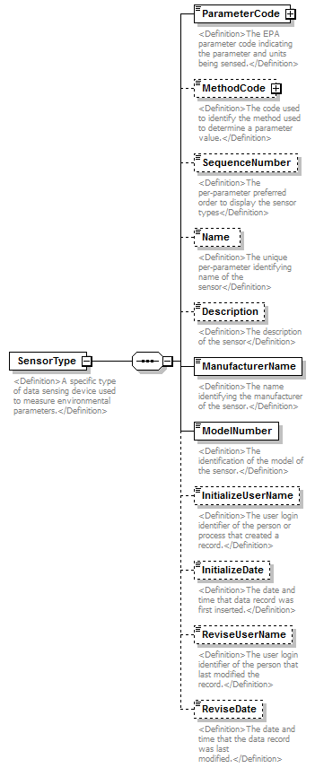 |
||||
| namespace | http://water.usgs.gov/XML/NWIS/5.0 | ||||
| properties |
|
||||
| children | ParameterCode MethodCode SequenceNumber Name Description ManufacturerName ModelNumber InitializeUserName InitializeDate ReviseUserName ReviseDate | ||||
| used by |
|
||||
| annotation |
|
||||
| source | <xsd:element name="SensorType"> <xsd:annotation> <xsd:documentation> <Definition>A specific type of data sensing device used to measure environmental parameters.</Definition> </xsd:documentation> </xsd:annotation> <xsd:complexType> <xsd:sequence> <xsd:element name="ParameterCode" type="ReferenceListCodeType"> <xsd:annotation> <xsd:documentation> <Definition>The EPA parameter code indicating the parameter and units being sensed.</Definition> </xsd:documentation> </xsd:annotation> </xsd:element> <xsd:element name="MethodCode" type="ReferenceListCodeType" minOccurs="0"> <xsd:annotation> <xsd:documentation> <Definition>The code used to identify the method used to determine a parameter value.</Definition> </xsd:documentation> </xsd:annotation> </xsd:element> <xsd:element name="SequenceNumber" type="xsd:integer" minOccurs="0"> <xsd:annotation> <xsd:documentation> <Definition>The per-parameter preferred order to display the sensor types</Definition> </xsd:documentation> </xsd:annotation> </xsd:element> <xsd:element name="Name" type="xsd:string" minOccurs="0"> <xsd:annotation> <xsd:documentation> <Definition>The unique per-parameter identifying name of the sensor</Definition> </xsd:documentation> </xsd:annotation> </xsd:element> <xsd:element name="Description" type="xsd:string" minOccurs="0"> <xsd:annotation> <xsd:documentation> <Definition>The description of the sensor</Definition> </xsd:documentation> </xsd:annotation> </xsd:element> <xsd:element name="ManufacturerName" type="xsd:string"> <xsd:annotation> <xsd:documentation> <Definition>The name identifying the manufacturer of the sensor.</Definition> </xsd:documentation> </xsd:annotation> </xsd:element> <xsd:element name="ModelNumber" type="xsd:string"> <xsd:annotation> <xsd:documentation> <Definition>The identification of the model of the sensor.</Definition> </xsd:documentation> </xsd:annotation> </xsd:element> <xsd:element name="InitializeUserName" minOccurs="0"> <xsd:annotation> <xsd:documentation> <Definition>The user login identifier of the person or process that created a record.</Definition> </xsd:documentation> </xsd:annotation> <xsd:simpleType> <xsd:restriction base="xsd:token"> <xsd:minLength value="1"/> <xsd:maxLength value="8"/> </xsd:restriction> </xsd:simpleType> </xsd:element> <xsd:element name="InitializeDate" type="xsd:date" minOccurs="0"> <xsd:annotation> <xsd:documentation> <Definition>The date and time that data record was first inserted.</Definition> </xsd:documentation> </xsd:annotation> </xsd:element> <xsd:element name="ReviseUserName" minOccurs="0"> <xsd:annotation> <xsd:documentation> <Definition>The user login identifier of the person that last modified the record.</Definition> </xsd:documentation> </xsd:annotation> <xsd:simpleType> <xsd:restriction base="xsd:token"> <xsd:minLength value="1"/> <xsd:maxLength value="8"/> </xsd:restriction> </xsd:simpleType> </xsd:element> <xsd:element name="ReviseDate" type="xsd:date" minOccurs="0"> <xsd:annotation> <xsd:documentation> <Definition>The date and time that the data record was last modified.</Definition> </xsd:documentation> </xsd:annotation> </xsd:element> </xsd:sequence> </xsd:complexType> </xsd:element> |
element SensorType/ParameterCode
| diagram |  |
||||||||||||||||||||||
| namespace | http://water.usgs.gov/XML/NWIS/5.0 | ||||||||||||||||||||||
| type | ReferenceListCodeType | ||||||||||||||||||||||
| properties |
|
||||||||||||||||||||||
| attributes |
|
||||||||||||||||||||||
| annotation |
|
||||||||||||||||||||||
| source | <xsd:element name="ParameterCode" type="ReferenceListCodeType"> <xsd:annotation> <xsd:documentation> <Definition>The EPA parameter code indicating the parameter and units being sensed.</Definition> </xsd:documentation> </xsd:annotation> </xsd:element> |
element SensorType/MethodCode
| diagram | 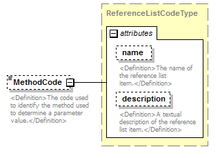 |
||||||||||||||||||||||
| namespace | http://water.usgs.gov/XML/NWIS/5.0 | ||||||||||||||||||||||
| type | ReferenceListCodeType | ||||||||||||||||||||||
| properties |
|
||||||||||||||||||||||
| attributes |
|
||||||||||||||||||||||
| annotation |
|
||||||||||||||||||||||
| source | <xsd:element name="MethodCode" type="ReferenceListCodeType" minOccurs="0"> <xsd:annotation> <xsd:documentation> <Definition>The code used to identify the method used to determine a parameter value.</Definition> </xsd:documentation> </xsd:annotation> </xsd:element> |
element SensorType/SequenceNumber
| diagram | 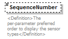 |
||||||||
| namespace | http://water.usgs.gov/XML/NWIS/5.0 | ||||||||
| type | xsd:integer | ||||||||
| properties |
|
||||||||
| annotation |
|
||||||||
| source | <xsd:element name="SequenceNumber" type="xsd:integer" minOccurs="0"> <xsd:annotation> <xsd:documentation> <Definition>The per-parameter preferred order to display the sensor types</Definition> </xsd:documentation> </xsd:annotation> </xsd:element> |
element SensorType/Name
| diagram | 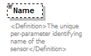 |
||||||||
| namespace | http://water.usgs.gov/XML/NWIS/5.0 | ||||||||
| type | xsd:string | ||||||||
| properties |
|
||||||||
| annotation |
|
||||||||
| source | <xsd:element name="Name" type="xsd:string" minOccurs="0"> <xsd:annotation> <xsd:documentation> <Definition>The unique per-parameter identifying name of the sensor</Definition> </xsd:documentation> </xsd:annotation> </xsd:element> |
element SensorType/Description
| diagram | 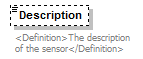 |
||||||||
| namespace | http://water.usgs.gov/XML/NWIS/5.0 | ||||||||
| type | xsd:string | ||||||||
| properties |
|
||||||||
| annotation |
|
||||||||
| source | <xsd:element name="Description" type="xsd:string" minOccurs="0"> <xsd:annotation> <xsd:documentation> <Definition>The description of the sensor</Definition> </xsd:documentation> </xsd:annotation> </xsd:element> |
element SensorType/ManufacturerName
| diagram | 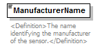 |
||||
| namespace | http://water.usgs.gov/XML/NWIS/5.0 | ||||
| type | xsd:string | ||||
| properties |
|
||||
| annotation |
|
||||
| source | <xsd:element name="ManufacturerName" type="xsd:string"> <xsd:annotation> <xsd:documentation> <Definition>The name identifying the manufacturer of the sensor.</Definition> </xsd:documentation> </xsd:annotation> </xsd:element> |
element SensorType/ModelNumber
| diagram | 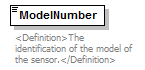 |
||||
| namespace | http://water.usgs.gov/XML/NWIS/5.0 | ||||
| type | xsd:string | ||||
| properties |
|
||||
| annotation |
|
||||
| source | <xsd:element name="ModelNumber" type="xsd:string"> <xsd:annotation> <xsd:documentation> <Definition>The identification of the model of the sensor.</Definition> </xsd:documentation> </xsd:annotation> </xsd:element> |
element SensorType/InitializeUserName
| diagram | 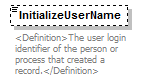 |
|||||||||
| namespace | http://water.usgs.gov/XML/NWIS/5.0 | |||||||||
| type | restriction of xsd:token | |||||||||
| properties |
|
|||||||||
| facets |
|
|||||||||
| annotation |
|
|||||||||
| source | <xsd:element name="InitializeUserName" minOccurs="0"> <xsd:annotation> <xsd:documentation> <Definition>The user login identifier of the person or process that created a record.</Definition> </xsd:documentation> </xsd:annotation> <xsd:simpleType> <xsd:restriction base="xsd:token"> <xsd:minLength value="1"/> <xsd:maxLength value="8"/> </xsd:restriction> </xsd:simpleType> </xsd:element> |
element SensorType/InitializeDate
| diagram | 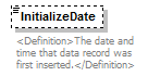 |
||||||||
| namespace | http://water.usgs.gov/XML/NWIS/5.0 | ||||||||
| type | xsd:date | ||||||||
| properties |
|
||||||||
| annotation |
|
||||||||
| source | <xsd:element name="InitializeDate" type="xsd:date" minOccurs="0"> <xsd:annotation> <xsd:documentation> <Definition>The date and time that data record was first inserted.</Definition> </xsd:documentation> </xsd:annotation> </xsd:element> |
element SensorType/ReviseUserName
| diagram | 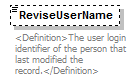 |
|||||||||
| namespace | http://water.usgs.gov/XML/NWIS/5.0 | |||||||||
| type | restriction of xsd:token | |||||||||
| properties |
|
|||||||||
| facets |
|
|||||||||
| annotation |
|
|||||||||
| source | <xsd:element name="ReviseUserName" minOccurs="0"> <xsd:annotation> <xsd:documentation> <Definition>The user login identifier of the person that last modified the record.</Definition> </xsd:documentation> </xsd:annotation> <xsd:simpleType> <xsd:restriction base="xsd:token"> <xsd:minLength value="1"/> <xsd:maxLength value="8"/> </xsd:restriction> </xsd:simpleType> </xsd:element> |
element SensorType/ReviseDate
| diagram | 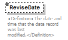 |
||||||||
| namespace | http://water.usgs.gov/XML/NWIS/5.0 | ||||||||
| type | xsd:date | ||||||||
| properties |
|
||||||||
| annotation |
|
||||||||
| source | <xsd:element name="ReviseDate" type="xsd:date" minOccurs="0"> <xsd:annotation> <xsd:documentation> <Definition>The date and time that the data record was last modified.</Definition> </xsd:documentation> </xsd:annotation> </xsd:element> |
group HistoryGroup
| diagram | 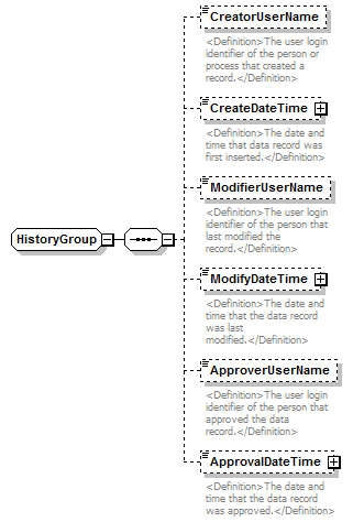 |
||||
| namespace | http://water.usgs.gov/XML/NWIS/5.0 | ||||
| children | CreatorUserName CreateDateTime ModifierUserName ModifyDateTime ApproverUserName ApprovalDateTime | ||||
| used by |
|
||||
| source | <xsd:group name="HistoryGroup"> <xsd:sequence> <xsd:element name="CreatorUserName" minOccurs="0"> <xsd:annotation> <xsd:documentation> <Definition>The user login identifier of the person or process that created a record.</Definition> </xsd:documentation> </xsd:annotation> <xsd:simpleType> <xsd:restriction base="xsd:token"> <xsd:minLength value="1"/> <xsd:maxLength value="8"/> </xsd:restriction> </xsd:simpleType> </xsd:element> <xsd:element name="CreateDateTime" type="DateTimeWithDatum" minOccurs="0"> <xsd:annotation> <xsd:documentation> <Definition>The date and time that data record was first inserted.</Definition> </xsd:documentation> </xsd:annotation> </xsd:element> <xsd:element name="ModifierUserName" minOccurs="0"> <xsd:annotation> <xsd:documentation> <Definition>The user login identifier of the person that last modified the record.</Definition> </xsd:documentation> </xsd:annotation> <xsd:simpleType> <xsd:restriction base="xsd:token"> <xsd:minLength value="1"/> <xsd:maxLength value="8"/> </xsd:restriction> </xsd:simpleType> </xsd:element> <xsd:element name="ModifyDateTime" type="DateTimeWithDatum" minOccurs="0"> <xsd:annotation> <xsd:documentation> <Definition>The date and time that the data record was last modified.</Definition> </xsd:documentation> </xsd:annotation> </xsd:element> <xsd:element name="ApproverUserName" type="xsd:token" minOccurs="0" maxOccurs="1"> <xsd:annotation> <xsd:documentation> <Definition>The user login identifier of the person that approved the data record.</Definition> </xsd:documentation> </xsd:annotation> </xsd:element> <xsd:element name="ApprovalDateTime" type="DateTimeWithDatum" minOccurs="0" maxOccurs="1"> <xsd:annotation> <xsd:documentation> <Definition>The date and time that the data record was approved.</Definition> </xsd:documentation> </xsd:annotation> </xsd:element> </xsd:sequence> </xsd:group> |
element HistoryGroup/CreatorUserName
| diagram | 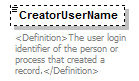 |
|||||||||
| namespace | http://water.usgs.gov/XML/NWIS/5.0 | |||||||||
| type | restriction of xsd:token | |||||||||
| properties |
|
|||||||||
| facets |
|
|||||||||
| annotation |
|
|||||||||
| source | <xsd:element name="CreatorUserName" minOccurs="0"> <xsd:annotation> <xsd:documentation> <Definition>The user login identifier of the person or process that created a record.</Definition> </xsd:documentation> </xsd:annotation> <xsd:simpleType> <xsd:restriction base="xsd:token"> <xsd:minLength value="1"/> <xsd:maxLength value="8"/> </xsd:restriction> </xsd:simpleType> </xsd:element> |
element HistoryGroup/CreateDateTime
| diagram |  |
||||||||||||||||||||||||||||||
| namespace | http://water.usgs.gov/XML/NWIS/5.0 | ||||||||||||||||||||||||||||||
| type | DateTimeWithDatum | ||||||||||||||||||||||||||||||
| properties |
|
||||||||||||||||||||||||||||||
| attributes |
|
||||||||||||||||||||||||||||||
| annotation |
|
||||||||||||||||||||||||||||||
| source | <xsd:element name="CreateDateTime" type="DateTimeWithDatum" minOccurs="0"> <xsd:annotation> <xsd:documentation> <Definition>The date and time that data record was first inserted.</Definition> </xsd:documentation> </xsd:annotation> </xsd:element> |
element HistoryGroup/ModifierUserName
| diagram | 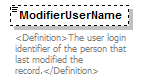 |
|||||||||
| namespace | http://water.usgs.gov/XML/NWIS/5.0 | |||||||||
| type | restriction of xsd:token | |||||||||
| properties |
|
|||||||||
| facets |
|
|||||||||
| annotation |
|
|||||||||
| source | <xsd:element name="ModifierUserName" minOccurs="0"> <xsd:annotation> <xsd:documentation> <Definition>The user login identifier of the person that last modified the record.</Definition> </xsd:documentation> </xsd:annotation> <xsd:simpleType> <xsd:restriction base="xsd:token"> <xsd:minLength value="1"/> <xsd:maxLength value="8"/> </xsd:restriction> </xsd:simpleType> </xsd:element> |
element HistoryGroup/ModifyDateTime
| diagram |  |
||||||||||||||||||||||||||||||
| namespace | http://water.usgs.gov/XML/NWIS/5.0 | ||||||||||||||||||||||||||||||
| type | DateTimeWithDatum | ||||||||||||||||||||||||||||||
| properties |
|
||||||||||||||||||||||||||||||
| attributes |
|
||||||||||||||||||||||||||||||
| annotation |
|
||||||||||||||||||||||||||||||
| source | <xsd:element name="ModifyDateTime" type="DateTimeWithDatum" minOccurs="0"> <xsd:annotation> <xsd:documentation> <Definition>The date and time that the data record was last modified.</Definition> </xsd:documentation> </xsd:annotation> </xsd:element> |
element HistoryGroup/ApproverUserName
| diagram | 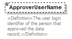 |
||||||||
| namespace | http://water.usgs.gov/XML/NWIS/5.0 | ||||||||
| type | xsd:token | ||||||||
| properties |
|
||||||||
| annotation |
|
||||||||
| source | <xsd:element name="ApproverUserName" type="xsd:token" minOccurs="0" maxOccurs="1"> <xsd:annotation> <xsd:documentation> <Definition>The user login identifier of the person that approved the data record.</Definition> </xsd:documentation> </xsd:annotation> </xsd:element> |
element HistoryGroup/ApprovalDateTime
| diagram |  |
||||||||||||||||||||||||||||||
| namespace | http://water.usgs.gov/XML/NWIS/5.0 | ||||||||||||||||||||||||||||||
| type | DateTimeWithDatum | ||||||||||||||||||||||||||||||
| properties |
|
||||||||||||||||||||||||||||||
| attributes |
|
||||||||||||||||||||||||||||||
| annotation |
|
||||||||||||||||||||||||||||||
| source | <xsd:element name="ApprovalDateTime" type="DateTimeWithDatum" minOccurs="0" maxOccurs="1"> <xsd:annotation> <xsd:documentation> <Definition>The date and time that the data record was approved.</Definition> </xsd:documentation> </xsd:annotation> </xsd:element> |
complexType MechanicalVelocitySensorInspectionType
| diagram | 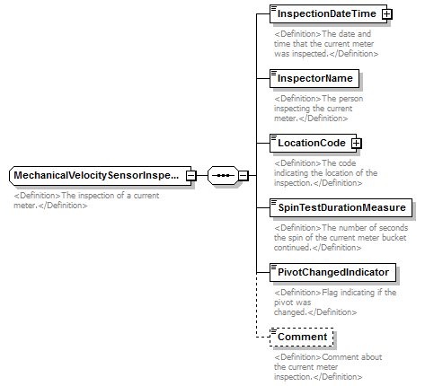 |
||
| namespace | http://water.usgs.gov/XML/NWIS/5.0 | ||
| properties |
|
||
| children | InspectionDateTime InspectorName LocationCode SpinTestDurationMeasure PivotChangedIndicator Comment | ||
| used by |
|
||
| annotation |
|
||
| source | <xsd:complexType name="MechanicalVelocitySensorInspectionType" abstract="false"> <xsd:annotation> <xsd:documentation> <Definition>The inspection of a current meter.</Definition> </xsd:documentation> </xsd:annotation> <xsd:sequence> <xsd:element name="InspectionDateTime" type="DateTimeWithDatum"> <xsd:annotation> <xsd:documentation> <Definition>The date and time that the current meter was inspected.</Definition> </xsd:documentation> </xsd:annotation> </xsd:element> <xsd:element name="InspectorName" type="xsd:string"> <xsd:annotation> <xsd:documentation> <Definition>The person inspecting the current meter.</Definition> </xsd:documentation> </xsd:annotation> </xsd:element> <xsd:element name="LocationCode" type="ReferenceListCodeType"> <xsd:annotation> <xsd:documentation> <Definition>The code indicating the location of the inspection.</Definition> </xsd:documentation> </xsd:annotation> </xsd:element> <xsd:element name="SpinTestDurationMeasure" type="xsd:nonNegativeInteger"> <xsd:annotation> <xsd:documentation> <Definition>The number of seconds the spin of the current meter bucket continued.</Definition> </xsd:documentation> </xsd:annotation> </xsd:element> <xsd:element name="PivotChangedIndicator" type="xsd:boolean"> <xsd:annotation> <xsd:documentation> <Definition>Flag indicating if the pivot was changed.</Definition> </xsd:documentation> </xsd:annotation> </xsd:element> <xsd:element name="Comment" type="xsd:string" minOccurs="0"> <xsd:annotation> <xsd:documentation> <Definition>Comment about the current meter inspection.</Definition> </xsd:documentation> </xsd:annotation> </xsd:element> </xsd:sequence> </xsd:complexType> |
element MechanicalVelocitySensorInspectionType/InspectionDateTime
| diagram | 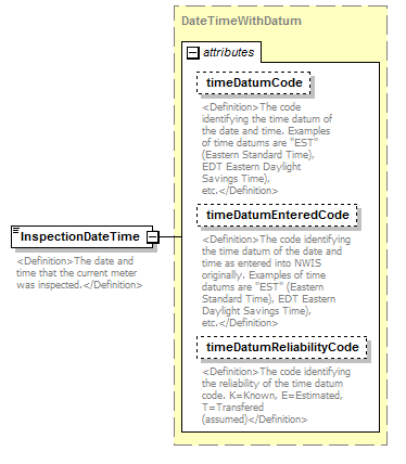 |
||||||||||||||||||||||||||||||
| namespace | http://water.usgs.gov/XML/NWIS/5.0 | ||||||||||||||||||||||||||||||
| type | DateTimeWithDatum | ||||||||||||||||||||||||||||||
| properties |
|
||||||||||||||||||||||||||||||
| attributes |
|
||||||||||||||||||||||||||||||
| annotation |
|
||||||||||||||||||||||||||||||
| source | <xsd:element name="InspectionDateTime" type="DateTimeWithDatum"> <xsd:annotation> <xsd:documentation> <Definition>The date and time that the current meter was inspected.</Definition> </xsd:documentation> </xsd:annotation> </xsd:element> |
element MechanicalVelocitySensorInspectionType/InspectorName
| diagram |  |
||||
| namespace | http://water.usgs.gov/XML/NWIS/5.0 | ||||
| type | xsd:string | ||||
| properties |
|
||||
| annotation |
|
||||
| source | <xsd:element name="InspectorName" type="xsd:string"> <xsd:annotation> <xsd:documentation> <Definition>The person inspecting the current meter.</Definition> </xsd:documentation> </xsd:annotation> </xsd:element> |
element MechanicalVelocitySensorInspectionType/LocationCode
| diagram | 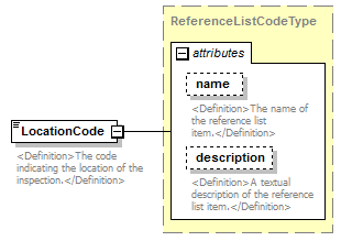 |
||||||||||||||||||||||
| namespace | http://water.usgs.gov/XML/NWIS/5.0 | ||||||||||||||||||||||
| type | ReferenceListCodeType | ||||||||||||||||||||||
| properties |
|
||||||||||||||||||||||
| attributes |
|
||||||||||||||||||||||
| annotation |
|
||||||||||||||||||||||
| source | <xsd:element name="LocationCode" type="ReferenceListCodeType"> <xsd:annotation> <xsd:documentation> <Definition>The code indicating the location of the inspection.</Definition> </xsd:documentation> </xsd:annotation> </xsd:element> |
element MechanicalVelocitySensorInspectionType/SpinTestDurationMeasure
| diagram |  |
||||
| namespace | http://water.usgs.gov/XML/NWIS/5.0 | ||||
| type | xsd:nonNegativeInteger | ||||
| properties |
|
||||
| annotation |
|
||||
| source | <xsd:element name="SpinTestDurationMeasure" type="xsd:nonNegativeInteger"> <xsd:annotation> <xsd:documentation> <Definition>The number of seconds the spin of the current meter bucket continued.</Definition> </xsd:documentation> </xsd:annotation> </xsd:element> |
element MechanicalVelocitySensorInspectionType/PivotChangedIndicator
| diagram |  |
||||
| namespace | http://water.usgs.gov/XML/NWIS/5.0 | ||||
| type | xsd:boolean | ||||
| properties |
|
||||
| annotation |
|
||||
| source | <xsd:element name="PivotChangedIndicator" type="xsd:boolean"> <xsd:annotation> <xsd:documentation> <Definition>Flag indicating if the pivot was changed.</Definition> </xsd:documentation> </xsd:annotation> </xsd:element> |
element MechanicalVelocitySensorInspectionType/Comment
| diagram | 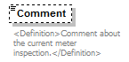 |
||||||||
| namespace | http://water.usgs.gov/XML/NWIS/5.0 | ||||||||
| type | xsd:string | ||||||||
| properties |
|
||||||||
| annotation |
|
||||||||
| source | <xsd:element name="Comment" type="xsd:string" minOccurs="0"> <xsd:annotation> <xsd:documentation> <Definition>Comment about the current meter inspection.</Definition> </xsd:documentation> </xsd:annotation> </xsd:element> |
group SensorGroup
| diagram | 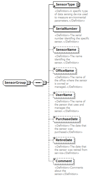 |
||
| namespace | http://water.usgs.gov/XML/NWIS/5.0 | ||
| children | SensorType SerialNumber SensorName OfficeName UserName PurchaseDate RetireDate Comment | ||
| used by |
|
||
| source | <xsd:group name="SensorGroup"> <xsd:sequence> <xsd:element ref="SensorType"/> <xsd:element name="SerialNumber" type="xsd:string"> <xsd:annotation> <xsd:documentation> <Definition>The serial number identifing the specific sensor.</Definition> </xsd:documentation> </xsd:annotation> </xsd:element> <xsd:element name="SensorName" type="xsd:string" minOccurs="0"> <xsd:annotation> <xsd:documentation> <Definition>The name identifing the sensor.</Definition> </xsd:documentation> </xsd:annotation> </xsd:element> <xsd:element name="OfficeName" type="xsd:string" minOccurs="0"> <xsd:annotation> <xsd:documentation> <Definition>The name of the office where the sensor is owned or managed.</Definition> </xsd:documentation> </xsd:annotation> </xsd:element> <xsd:element name="UserName" type="xsd:string" minOccurs="0"> <xsd:annotation> <xsd:documentation> <Definition>The name of the person that uses and manages the sensor.</Definition> </xsd:documentation> </xsd:annotation> </xsd:element> <xsd:element name="PurchaseDate" type="xsd:date" minOccurs="0"> <xsd:annotation> <xsd:documentation> <Definition>The date that the sensor was purchased</Definition> </xsd:documentation> </xsd:annotation> </xsd:element> <xsd:element name="RetireDate" type="xsd:date" minOccurs="0"> <xsd:annotation> <xsd:documentation> <Definition>The date that the sensor was retired from service</Definition> </xsd:documentation> </xsd:annotation> </xsd:element> <xsd:element name="Comment" type="xsd:string" minOccurs="0"> <xsd:annotation> <xsd:documentation> <Definition>Comments about the sensor</Definition> </xsd:documentation> </xsd:annotation> </xsd:element> </xsd:sequence> </xsd:group> |
element SensorGroup/SerialNumber
| diagram |  |
||||
| namespace | http://water.usgs.gov/XML/NWIS/5.0 | ||||
| type | xsd:string | ||||
| properties |
|
||||
| annotation |
|
||||
| source | <xsd:element name="SerialNumber" type="xsd:string"> <xsd:annotation> <xsd:documentation> <Definition>The serial number identifing the specific sensor.</Definition> </xsd:documentation> </xsd:annotation> </xsd:element> |
element SensorGroup/SensorName
| diagram |  |
||||||||
| namespace | http://water.usgs.gov/XML/NWIS/5.0 | ||||||||
| type | xsd:string | ||||||||
| properties |
|
||||||||
| annotation |
|
||||||||
| source | <xsd:element name="SensorName" type="xsd:string" minOccurs="0"> <xsd:annotation> <xsd:documentation> <Definition>The name identifing the sensor.</Definition> </xsd:documentation> </xsd:annotation> </xsd:element> |
element SensorGroup/OfficeName
| diagram |  |
||||||||
| namespace | http://water.usgs.gov/XML/NWIS/5.0 | ||||||||
| type | xsd:string | ||||||||
| properties |
|
||||||||
| annotation |
|
||||||||
| source | <xsd:element name="OfficeName" type="xsd:string" minOccurs="0"> <xsd:annotation> <xsd:documentation> <Definition>The name of the office where the sensor is owned or managed.</Definition> </xsd:documentation> </xsd:annotation> </xsd:element> |
element SensorGroup/UserName
| diagram |  |
||||||||
| namespace | http://water.usgs.gov/XML/NWIS/5.0 | ||||||||
| type | xsd:string | ||||||||
| properties |
|
||||||||
| annotation |
|
||||||||
| source | <xsd:element name="UserName" type="xsd:string" minOccurs="0"> <xsd:annotation> <xsd:documentation> <Definition>The name of the person that uses and manages the sensor.</Definition> </xsd:documentation> </xsd:annotation> </xsd:element> |
element SensorGroup/PurchaseDate
| diagram |  |
||||||||
| namespace | http://water.usgs.gov/XML/NWIS/5.0 | ||||||||
| type | xsd:date | ||||||||
| properties |
|
||||||||
| annotation |
|
||||||||
| source | <xsd:element name="PurchaseDate" type="xsd:date" minOccurs="0"> <xsd:annotation> <xsd:documentation> <Definition>The date that the sensor was purchased</Definition> </xsd:documentation> </xsd:annotation> </xsd:element> |
element SensorGroup/RetireDate
| diagram |  |
||||||||
| namespace | http://water.usgs.gov/XML/NWIS/5.0 | ||||||||
| type | xsd:date | ||||||||
| properties |
|
||||||||
| annotation |
|
||||||||
| source | <xsd:element name="RetireDate" type="xsd:date" minOccurs="0"> <xsd:annotation> <xsd:documentation> <Definition>The date that the sensor was retired from service</Definition> </xsd:documentation> </xsd:annotation> </xsd:element> |
element SensorGroup/Comment
| diagram |  |
||||||||
| namespace | http://water.usgs.gov/XML/NWIS/5.0 | ||||||||
| type | xsd:string | ||||||||
| properties |
|
||||||||
| annotation |
|
||||||||
| source | <xsd:element name="Comment" type="xsd:string" minOccurs="0"> <xsd:annotation> <xsd:documentation> <Definition>Comments about the sensor</Definition> </xsd:documentation> </xsd:annotation> </xsd:element> |
complexType ReferenceListCodeType
| diagram | 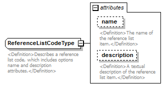 |
||||||||||||||||||||||
| namespace | http://water.usgs.gov/XML/NWIS/5.0 | ||||||||||||||||||||||
| type | extension of xsd:token | ||||||||||||||||||||||
| properties |
|
||||||||||||||||||||||
| used by |
|
||||||||||||||||||||||
| attributes |
|
||||||||||||||||||||||
| annotation |
|
||||||||||||||||||||||
| source | <xsd:complexType name="ReferenceListCodeType"> <xsd:annotation> <xsd:documentation> <Definition>Describes a reference list code, which includes options name and description attributes.</Definition> </xsd:documentation> </xsd:annotation> <xsd:simpleContent> <xsd:extension base="xsd:token"> <xsd:attribute name="name" type="xsd:string" use="optional"> <xsd:annotation> <xsd:documentation> <Definition>The name of the reference list item.</Definition> </xsd:documentation> </xsd:annotation> </xsd:attribute> <xsd:attribute name="description" type="xsd:string" use="optional"> <xsd:annotation> <xsd:documentation> <Definition>A textual description of the reference list item.</Definition> </xsd:documentation> </xsd:annotation> </xsd:attribute> </xsd:extension> </xsd:simpleContent> </xsd:complexType> |
attribute ReferenceListCodeType/@name
| type | xsd:string | ||||
| properties |
|
||||
| annotation |
|
||||
| source | <xsd:attribute name="name" type="xsd:string" use="optional"> <xsd:annotation> <xsd:documentation> <Definition>The name of the reference list item.</Definition> </xsd:documentation> </xsd:annotation> </xsd:attribute> |
attribute ReferenceListCodeType/@description
| type | xsd:string | ||||
| properties |
|
||||
| annotation |
|
||||
| source | <xsd:attribute name="description" type="xsd:string" use="optional"> <xsd:annotation> <xsd:documentation> <Definition>A textual description of the reference list item.</Definition> </xsd:documentation> </xsd:annotation> </xsd:attribute> |
element EquipmentType
| diagram | 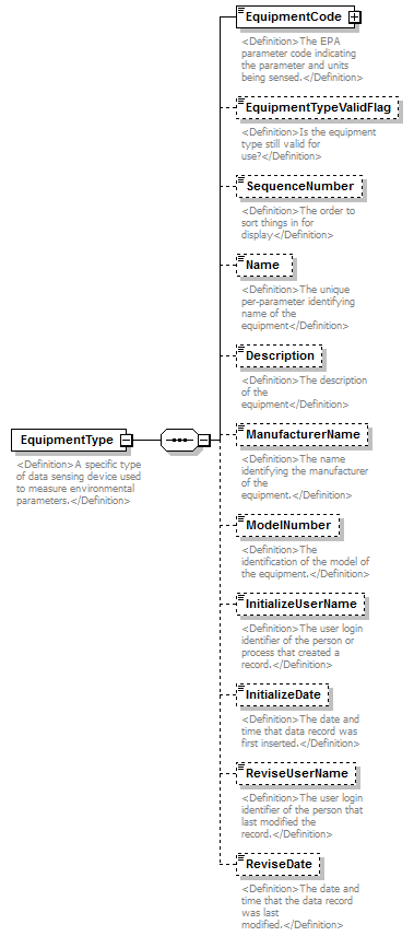 |
||
| namespace | http://water.usgs.gov/XML/NWIS/5.0 | ||
| properties |
|
||
| children | EquipmentCode EquipmentTypeValidFlag SequenceNumber Name Description ManufacturerName ModelNumber InitializeUserName InitializeDate ReviseUserName ReviseDate | ||
| used by |
|
||
| annotation |
|
||
| source | <xsd:element name="EquipmentType"> <xsd:annotation> <xsd:documentation> <Definition>A specific type of data sensing device used to measure environmental parameters.</Definition> </xsd:documentation> </xsd:annotation> <xsd:complexType> <xsd:sequence> <xsd:element name="EquipmentCode" type="ReferenceListCodeType"> <xsd:annotation> <xsd:documentation> <Definition>The EPA parameter code indicating the parameter and units being sensed.</Definition> </xsd:documentation> </xsd:annotation> </xsd:element> <xsd:element name="EquipmentTypeValidFlag" type="xsd:boolean" minOccurs="0"> <xsd:annotation> <xsd:documentation> <Definition>Is the equipment type still valid for use?</Definition> </xsd:documentation> </xsd:annotation> </xsd:element> <xsd:element name="SequenceNumber" type="xsd:integer" minOccurs="0"> <xsd:annotation> <xsd:documentation> <Definition>The order to sort things in for display</Definition> </xsd:documentation> </xsd:annotation> </xsd:element> <xsd:element name="Name" type="xsd:string" minOccurs="0"> <xsd:annotation> <xsd:documentation> <Definition>The unique per-parameter identifying name of the equipment</Definition> </xsd:documentation> </xsd:annotation> </xsd:element> <xsd:element name="Description" type="xsd:string" minOccurs="0"> <xsd:annotation> <xsd:documentation> <Definition>The description of the equipment</Definition> </xsd:documentation> </xsd:annotation> </xsd:element> <xsd:element name="ManufacturerName" type="xsd:string" minOccurs="0"> <xsd:annotation> <xsd:documentation> <Definition>The name identifying the manufacturer of the equipment.</Definition> </xsd:documentation> </xsd:annotation> </xsd:element> <xsd:element name="ModelNumber" type="xsd:string" minOccurs="0"> <xsd:annotation> <xsd:documentation> <Definition>The identification of the model of the equipment.</Definition> </xsd:documentation> </xsd:annotation> </xsd:element> <xsd:element name="InitializeUserName" minOccurs="0"> <xsd:annotation> <xsd:documentation> <Definition>The user login identifier of the person or process that created a record.</Definition> </xsd:documentation> </xsd:annotation> <xsd:simpleType> <xsd:restriction base="xsd:token"> <xsd:minLength value="1"/> <xsd:maxLength value="8"/> </xsd:restriction> </xsd:simpleType> </xsd:element> <xsd:element name="InitializeDate" type="xsd:date" minOccurs="0"> <xsd:annotation> <xsd:documentation> <Definition>The date and time that data record was first inserted.</Definition> </xsd:documentation> </xsd:annotation> </xsd:element> <xsd:element name="ReviseUserName" minOccurs="0"> <xsd:annotation> <xsd:documentation> <Definition>The user login identifier of the person that last modified the record.</Definition> </xsd:documentation> </xsd:annotation> <xsd:simpleType> <xsd:restriction base="xsd:token"> <xsd:minLength value="1"/> <xsd:maxLength value="8"/> </xsd:restriction> </xsd:simpleType> </xsd:element> <xsd:element name="ReviseDate" type="xsd:date" minOccurs="0"> <xsd:annotation> <xsd:documentation> <Definition>The date and time that the data record was last modified.</Definition> </xsd:documentation> </xsd:annotation> </xsd:element> </xsd:sequence> </xsd:complexType> </xsd:element> |
element EquipmentType/EquipmentCode
| diagram | 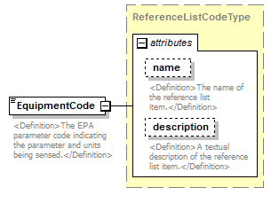 |
||||||||||||||||||||||
| namespace | http://water.usgs.gov/XML/NWIS/5.0 | ||||||||||||||||||||||
| type | ReferenceListCodeType | ||||||||||||||||||||||
| properties |
|
||||||||||||||||||||||
| attributes |
|
||||||||||||||||||||||
| annotation |
|
||||||||||||||||||||||
| source | <xsd:element name="EquipmentCode" type="ReferenceListCodeType"> <xsd:annotation> <xsd:documentation> <Definition>The EPA parameter code indicating the parameter and units being sensed.</Definition> </xsd:documentation> </xsd:annotation> </xsd:element> |
element EquipmentType/EquipmentTypeValidFlag
| diagram | 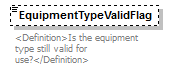 |
||||||||
| namespace | http://water.usgs.gov/XML/NWIS/5.0 | ||||||||
| type | xsd:boolean | ||||||||
| properties |
|
||||||||
| annotation |
|
||||||||
| source | <xsd:element name="EquipmentTypeValidFlag" type="xsd:boolean" minOccurs="0"> <xsd:annotation> <xsd:documentation> <Definition>Is the equipment type still valid for use?</Definition> </xsd:documentation> </xsd:annotation> </xsd:element> |
element EquipmentType/SequenceNumber
| diagram | 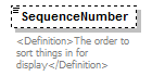 |
||||||||
| namespace | http://water.usgs.gov/XML/NWIS/5.0 | ||||||||
| type | xsd:integer | ||||||||
| properties |
|
||||||||
| annotation |
|
||||||||
| source | <xsd:element name="SequenceNumber" type="xsd:integer" minOccurs="0"> <xsd:annotation> <xsd:documentation> <Definition>The order to sort things in for display</Definition> </xsd:documentation> </xsd:annotation> </xsd:element> |
element EquipmentType/Name
| diagram | 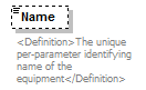 |
||||||||
| namespace | http://water.usgs.gov/XML/NWIS/5.0 | ||||||||
| type | xsd:string | ||||||||
| properties |
|
||||||||
| annotation |
|
||||||||
| source | <xsd:element name="Name" type="xsd:string" minOccurs="0"> <xsd:annotation> <xsd:documentation> <Definition>The unique per-parameter identifying name of the equipment</Definition> </xsd:documentation> </xsd:annotation> </xsd:element> |
element EquipmentType/Description
| diagram | 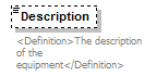 |
||||||||
| namespace | http://water.usgs.gov/XML/NWIS/5.0 | ||||||||
| type | xsd:string | ||||||||
| properties |
|
||||||||
| annotation |
|
||||||||
| source | <xsd:element name="Description" type="xsd:string" minOccurs="0"> <xsd:annotation> <xsd:documentation> <Definition>The description of the equipment</Definition> </xsd:documentation> </xsd:annotation> </xsd:element> |
element EquipmentType/ManufacturerName
| diagram | 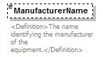 |
||||||||
| namespace | http://water.usgs.gov/XML/NWIS/5.0 | ||||||||
| type | xsd:string | ||||||||
| properties |
|
||||||||
| annotation |
|
||||||||
| source | <xsd:element name="ManufacturerName" type="xsd:string" minOccurs="0"> <xsd:annotation> <xsd:documentation> <Definition>The name identifying the manufacturer of the equipment.</Definition> </xsd:documentation> </xsd:annotation> </xsd:element> |
element EquipmentType/ModelNumber
| diagram | 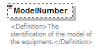 |
||||||||
| namespace | http://water.usgs.gov/XML/NWIS/5.0 | ||||||||
| type | xsd:string | ||||||||
| properties |
|
||||||||
| annotation |
|
||||||||
| source | <xsd:element name="ModelNumber" type="xsd:string" minOccurs="0"> <xsd:annotation> <xsd:documentation> <Definition>The identification of the model of the equipment.</Definition> </xsd:documentation> </xsd:annotation> </xsd:element> |
element EquipmentType/InitializeUserName
| diagram |  |
|||||||||
| namespace | http://water.usgs.gov/XML/NWIS/5.0 | |||||||||
| type | restriction of xsd:token | |||||||||
| properties |
|
|||||||||
| facets |
|
|||||||||
| annotation |
|
|||||||||
| source | <xsd:element name="InitializeUserName" minOccurs="0"> <xsd:annotation> <xsd:documentation> <Definition>The user login identifier of the person or process that created a record.</Definition> </xsd:documentation> </xsd:annotation> <xsd:simpleType> <xsd:restriction base="xsd:token"> <xsd:minLength value="1"/> <xsd:maxLength value="8"/> </xsd:restriction> </xsd:simpleType> </xsd:element> |
element EquipmentType/InitializeDate
| diagram |  |
||||||||
| namespace | http://water.usgs.gov/XML/NWIS/5.0 | ||||||||
| type | xsd:date | ||||||||
| properties |
|
||||||||
| annotation |
|
||||||||
| source | <xsd:element name="InitializeDate" type="xsd:date" minOccurs="0"> <xsd:annotation> <xsd:documentation> <Definition>The date and time that data record was first inserted.</Definition> </xsd:documentation> </xsd:annotation> </xsd:element> |
element EquipmentType/ReviseUserName
| diagram |  |
|||||||||
| namespace | http://water.usgs.gov/XML/NWIS/5.0 | |||||||||
| type | restriction of xsd:token | |||||||||
| properties |
|
|||||||||
| facets |
|
|||||||||
| annotation |
|
|||||||||
| source | <xsd:element name="ReviseUserName" minOccurs="0"> <xsd:annotation> <xsd:documentation> <Definition>The user login identifier of the person that last modified the record.</Definition> </xsd:documentation> </xsd:annotation> <xsd:simpleType> <xsd:restriction base="xsd:token"> <xsd:minLength value="1"/> <xsd:maxLength value="8"/> </xsd:restriction> </xsd:simpleType> </xsd:element> |
element EquipmentType/ReviseDate
| diagram |  |
||||||||
| namespace | http://water.usgs.gov/XML/NWIS/5.0 | ||||||||
| type | xsd:date | ||||||||
| properties |
|
||||||||
| annotation |
|
||||||||
| source | <xsd:element name="ReviseDate" type="xsd:date" minOccurs="0"> <xsd:annotation> <xsd:documentation> <Definition>The date and time that the data record was last modified.</Definition> </xsd:documentation> </xsd:annotation> </xsd:element> |
complexType EquipmentSensor
| diagram | 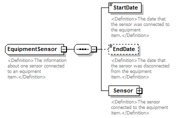 |
||
| namespace | http://water.usgs.gov/XML/NWIS/5.0 | ||
| children | StartDate EndDate Sensor | ||
| used by |
|
||
| annotation |
|
||
| source | <xsd:complexType name="EquipmentSensor"> <xsd:annotation> <xsd:documentation> <Definition>The information about one sensor connected to an equipment item.</Definition> </xsd:documentation> </xsd:annotation> <xsd:sequence> <xsd:element name="StartDate" type="xsd:date"> <xsd:annotation> <xsd:documentation> <Definition>The date that the sensor was connected to the equipment item.</Definition> </xsd:documentation> </xsd:annotation> </xsd:element> <xsd:element name="EndDate" type="xsd:date" minOccurs="0"> <xsd:annotation> <xsd:documentation> <Definition>The date that the sensor was disconnected from the equipment item.</Definition> </xsd:documentation> </xsd:annotation> </xsd:element> <xsd:element name="Sensor" type="Sensor"> <xsd:annotation> <xsd:documentation> <Definition>The sensor connected to the equipment item.</Definition> </xsd:documentation> </xsd:annotation> </xsd:element> </xsd:sequence> </xsd:complexType> |
element EquipmentSensor/StartDate
| diagram | 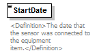 |
||||
| namespace | http://water.usgs.gov/XML/NWIS/5.0 | ||||
| type | xsd:date | ||||
| properties |
|
||||
| annotation |
|
||||
| source | <xsd:element name="StartDate" type="xsd:date"> <xsd:annotation> <xsd:documentation> <Definition>The date that the sensor was connected to the equipment item.</Definition> </xsd:documentation> </xsd:annotation> </xsd:element> |
element EquipmentSensor/EndDate
| diagram | 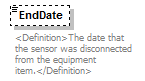 |
||||||||
| namespace | http://water.usgs.gov/XML/NWIS/5.0 | ||||||||
| type | xsd:date | ||||||||
| properties |
|
||||||||
| annotation |
|
||||||||
| source | <xsd:element name="EndDate" type="xsd:date" minOccurs="0"> <xsd:annotation> <xsd:documentation> <Definition>The date that the sensor was disconnected from the equipment item.</Definition> </xsd:documentation> </xsd:annotation> </xsd:element> |
element EquipmentSensor/Sensor
| diagram | 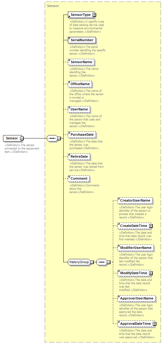 |
||||
| namespace | http://water.usgs.gov/XML/NWIS/5.0 | ||||
| type | Sensor | ||||
| properties |
|
||||
| children | SensorType SerialNumber SensorName OfficeName UserName PurchaseDate RetireDate Comment CreatorUserName CreateDateTime ModifierUserName ModifyDateTime ApproverUserName ApprovalDateTime | ||||
| annotation |
|
||||
| source | <xsd:element name="Sensor" type="Sensor"> <xsd:annotation> <xsd:documentation> <Definition>The sensor connected to the equipment item.</Definition> </xsd:documentation> </xsd:annotation> </xsd:element> |
element DriftCheckConductance
| diagram | 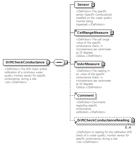 |
||
| namespace | http://water.usgs.gov/XML/NWIS/5.0 | ||
| properties |
|
||
| children | Sensor CellRangeMeasure InAirMeasure Comment DriftCheckConductanceReading | ||
| used by |
|
||
| annotation |
|
||
| source | <xsd:element name="DriftCheckConductance"> <xsd:annotation> <xsd:documentation> <Definition>The drift check and/or calibration of a continous water quality monitor sensor for specific conductance, during a site visit.</Definition> </xsd:documentation> </xsd:annotation> <xsd:complexType> <xsd:sequence> <xsd:element name="Sensor" type="Sensor"> <xsd:annotation> <xsd:documentation> <Definition>The specific sensor (specific Conductance) installed on the water quality monitor being inspected.</Definition> </xsd:documentation> </xsd:annotation> </xsd:element> <xsd:element name="CellRangeMeasure" type="IEEE754FloatValueType"> <xsd:annotation> <xsd:documentation> <Definition>The cell range value of the specific conductance check, in microsiemens per centimeter at 25 degrees Celsius.</Definition> </xsd:documentation> </xsd:annotation> </xsd:element> <xsd:element name="InAirMeasure" type="IEEE754FloatValueType"> <xsd:annotation> <xsd:documentation> <Definition>The reading in air value of the specific conductance check, in microsiemens per centimeter at 25 degrees Celsius.</Definition> </xsd:documentation> </xsd:annotation> </xsd:element> <xsd:element name="Comment" type="xsd:string" minOccurs="0"> <xsd:annotation> <xsd:documentation> <Definition>Comments regarding specific conductance calibration.</Definition> </xsd:documentation> </xsd:annotation> </xsd:element> <xsd:element ref="DriftCheckConductanceReading" minOccurs="0" maxOccurs="unbounded"/> </xsd:sequence> </xsd:complexType> </xsd:element> |
element DriftCheckConductance/Sensor
| diagram |  |
||||
| namespace | http://water.usgs.gov/XML/NWIS/5.0 | ||||
| type | Sensor | ||||
| properties |
|
||||
| children | SensorType SerialNumber SensorName OfficeName UserName PurchaseDate RetireDate Comment CreatorUserName CreateDateTime ModifierUserName ModifyDateTime ApproverUserName ApprovalDateTime | ||||
| annotation |
|
||||
| source | <xsd:element name="Sensor" type="Sensor"> <xsd:annotation> <xsd:documentation> <Definition>The specific sensor (specific Conductance) installed on the water quality monitor being inspected.</Definition> </xsd:documentation> </xsd:annotation> </xsd:element> |
element DriftCheckConductance/CellRangeMeasure
| diagram | 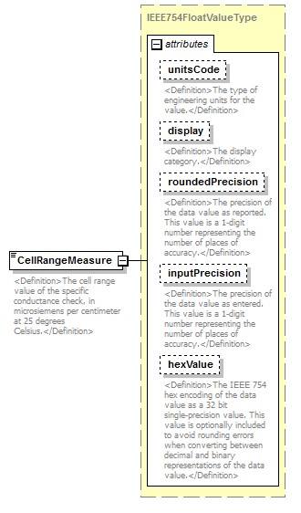 |
||||||||||||||||||||||||||||||||||||||||||||||
| namespace | http://water.usgs.gov/XML/NWIS/5.0 | ||||||||||||||||||||||||||||||||||||||||||||||
| type | IEEE754FloatValueType | ||||||||||||||||||||||||||||||||||||||||||||||
| properties |
|
||||||||||||||||||||||||||||||||||||||||||||||
| facets |
|
||||||||||||||||||||||||||||||||||||||||||||||
| attributes |
|
||||||||||||||||||||||||||||||||||||||||||||||
| annotation |
|
||||||||||||||||||||||||||||||||||||||||||||||
| source | <xsd:element name="CellRangeMeasure" type="IEEE754FloatValueType"> <xsd:annotation> <xsd:documentation> <Definition>The cell range value of the specific conductance check, in microsiemens per centimeter at 25 degrees Celsius.</Definition> </xsd:documentation> </xsd:annotation> </xsd:element> |
element DriftCheckConductance/InAirMeasure
| diagram | 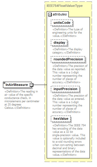 |
||||||||||||||||||||||||||||||||||||||||||||||
| namespace | http://water.usgs.gov/XML/NWIS/5.0 | ||||||||||||||||||||||||||||||||||||||||||||||
| type | IEEE754FloatValueType | ||||||||||||||||||||||||||||||||||||||||||||||
| properties |
|
||||||||||||||||||||||||||||||||||||||||||||||
| facets |
|
||||||||||||||||||||||||||||||||||||||||||||||
| attributes |
|
||||||||||||||||||||||||||||||||||||||||||||||
| annotation |
|
||||||||||||||||||||||||||||||||||||||||||||||
| source | <xsd:element name="InAirMeasure" type="IEEE754FloatValueType"> <xsd:annotation> <xsd:documentation> <Definition>The reading in air value of the specific conductance check, in microsiemens per centimeter at 25 degrees Celsius.</Definition> </xsd:documentation> </xsd:annotation> </xsd:element> |
element DriftCheckConductance/Comment
| diagram | 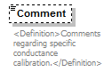 |
||||||||
| namespace | http://water.usgs.gov/XML/NWIS/5.0 | ||||||||
| type | xsd:string | ||||||||
| properties |
|
||||||||
| annotation |
|
||||||||
| source | <xsd:element name="Comment" type="xsd:string" minOccurs="0"> <xsd:annotation> <xsd:documentation> <Definition>Comments regarding specific conductance calibration.</Definition> </xsd:documentation> </xsd:annotation> </xsd:element> |
element DriftCheckDissolvedOxygen
| diagram | 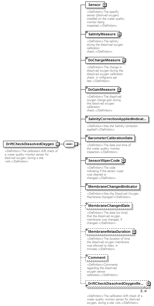 |
||
| namespace | http://water.usgs.gov/XML/NWIS/5.0 | ||
| properties |
|
||
| children | Sensor SalinityMeasure DoChargeMeasure DoGainMeasure SalinityCorrectionAppliedIndicator BarometerCalibrationDate SensorWiperCode MembraneChangedIndicator MembraneChangedDate MembraneRelaxDuration Comment DriftCheckDissolvedOxygenReading | ||
| used by |
|
||
| annotation |
|
||
| source | <xsd:element name="DriftCheckDissolvedOxygen"> <xsd:annotation> <xsd:documentation> <Definition>The calibration drift check of a water quality monitor sensor for disolved oxygen, during a site visit.</Definition> </xsd:documentation> </xsd:annotation> <xsd:complexType> <xsd:sequence> <xsd:element name="Sensor" type="Sensor"> <xsd:annotation> <xsd:documentation> <Definition>The specific sensor (disolved oxygen) installed on the water quality monitor being inspected.</Definition> </xsd:documentation> </xsd:annotation> </xsd:element> <xsd:element name="SalinityMeasure" type="IEEE754FloatValueType"> <xsd:annotation> <xsd:documentation> <Definition>The salinity during the dissolved oxygen calibration check.</Definition> </xsd:documentation> </xsd:annotation> </xsd:element> <xsd:element name="DoChargeMeasure" type="IEEE754FloatValueType"> <xsd:annotation> <xsd:documentation> <Definition>The change in dissolved oxygen during the dissolved oxygen calibration check, in milligrams per liter.</Definition> </xsd:documentation> </xsd:annotation> </xsd:element> <xsd:element name="DoGainMeasure" type="IEEE754FloatValueType"> <xsd:annotation> <xsd:documentation> <Definition>The dissolved oxygen charge gain during the dissolved oxygen calibration check.</Definition> </xsd:documentation> </xsd:annotation> </xsd:element> <xsd:element name="SalinityCorrectionAppliedIndicator" type="xsd:boolean"> <xsd:annotation> <xsd:documentation> <Definition>Was the Salinity correction applied?</Definition> </xsd:documentation> </xsd:annotation> </xsd:element> <xsd:element name="BarometerCalibrationDate" type="xsd:date"> <xsd:annotation> <xsd:documentation> <Definition>The date and time of the water quality monitor inspection.</Definition> </xsd:documentation> </xsd:annotation> </xsd:element> <xsd:element name="SensorWiperCode" type="ReferenceListCodeType"> <xsd:annotation> <xsd:documentation> <Definition>The code indicating if the sensor wiper was cleaned or changed.</Definition> </xsd:documentation> </xsd:annotation> </xsd:element> <xsd:element name="MembraneChangedIndicator" type="xsd:boolean"> <xsd:annotation> <xsd:documentation> <Definition>Was the Dissolved Oxygen Membrane changed?</Definition> </xsd:documentation> </xsd:annotation> </xsd:element> <xsd:element name="MembraneChangedDate" type="xsd:date" minOccurs="0"> <xsd:annotation> <xsd:documentation> <Definition>The date (no time) that the dissolved oxygen membrane was changed, if changed.</Definition> </xsd:documentation> </xsd:annotation> </xsd:element> <xsd:element name="MembraneRelaxDuration" type="IEEE754FloatValueType" minOccurs="0"> <xsd:annotation> <xsd:documentation> <Definition>The duration of time the dissolved oxygen membrane was allowed to relax, in minutes.</Definition> </xsd:documentation> </xsd:annotation> </xsd:element> <xsd:element name="Comment" type="xsd:string" minOccurs="0"> <xsd:annotation> <xsd:documentation> <Definition>Comments regarding the dissolved oxygen sensor calibration.</Definition> </xsd:documentation> </xsd:annotation> </xsd:element> <xsd:element ref="DriftCheckDissolvedOxygenReading" minOccurs="0" maxOccurs="unbounded"/> </xsd:sequence> </xsd:complexType> </xsd:element> |
element DriftCheckDissolvedOxygen/Sensor
| diagram | 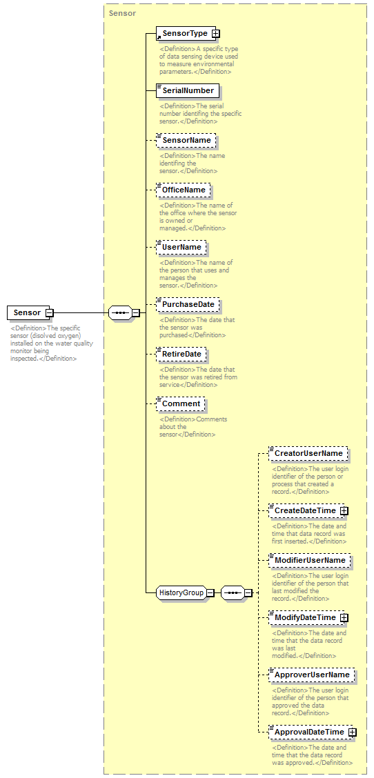 |
||||
| namespace | http://water.usgs.gov/XML/NWIS/5.0 | ||||
| type | Sensor | ||||
| properties |
|
||||
| children | SensorType SerialNumber SensorName OfficeName UserName PurchaseDate RetireDate Comment CreatorUserName CreateDateTime ModifierUserName ModifyDateTime ApproverUserName ApprovalDateTime | ||||
| annotation |
|
||||
| source | <xsd:element name="Sensor" type="Sensor"> <xsd:annotation> <xsd:documentation> <Definition>The specific sensor (disolved oxygen) installed on the water quality monitor being inspected.</Definition> </xsd:documentation> </xsd:annotation> </xsd:element> |
element DriftCheckDissolvedOxygen/SalinityMeasure
| diagram | 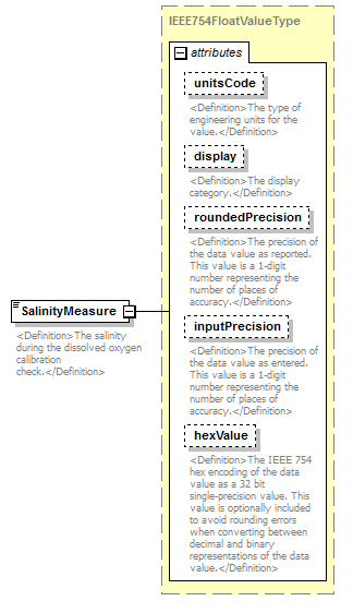 |
||||||||||||||||||||||||||||||||||||||||||||||
| namespace | http://water.usgs.gov/XML/NWIS/5.0 | ||||||||||||||||||||||||||||||||||||||||||||||
| type | IEEE754FloatValueType | ||||||||||||||||||||||||||||||||||||||||||||||
| properties |
|
||||||||||||||||||||||||||||||||||||||||||||||
| facets |
|
||||||||||||||||||||||||||||||||||||||||||||||
| attributes |
|
||||||||||||||||||||||||||||||||||||||||||||||
| annotation |
|
||||||||||||||||||||||||||||||||||||||||||||||
| source | <xsd:element name="SalinityMeasure" type="IEEE754FloatValueType"> <xsd:annotation> <xsd:documentation> <Definition>The salinity during the dissolved oxygen calibration check.</Definition> </xsd:documentation> </xsd:annotation> </xsd:element> |
element DriftCheckDissolvedOxygen/DoChargeMeasure
| diagram | 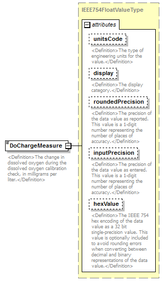 |
||||||||||||||||||||||||||||||||||||||||||||||
| namespace | http://water.usgs.gov/XML/NWIS/5.0 | ||||||||||||||||||||||||||||||||||||||||||||||
| type | IEEE754FloatValueType | ||||||||||||||||||||||||||||||||||||||||||||||
| properties |
|
||||||||||||||||||||||||||||||||||||||||||||||
| facets |
|
||||||||||||||||||||||||||||||||||||||||||||||
| attributes |
|
||||||||||||||||||||||||||||||||||||||||||||||
| annotation |
|
||||||||||||||||||||||||||||||||||||||||||||||
| source | <xsd:element name="DoChargeMeasure" type="IEEE754FloatValueType"> <xsd:annotation> <xsd:documentation> <Definition>The change in dissolved oxygen during the dissolved oxygen calibration check, in milligrams per liter.</Definition> </xsd:documentation> </xsd:annotation> </xsd:element> |
element DriftCheckDissolvedOxygen/DoGainMeasure
| diagram | 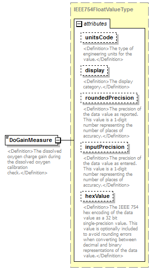 |
||||||||||||||||||||||||||||||||||||||||||||||
| namespace | http://water.usgs.gov/XML/NWIS/5.0 | ||||||||||||||||||||||||||||||||||||||||||||||
| type | IEEE754FloatValueType | ||||||||||||||||||||||||||||||||||||||||||||||
| properties |
|
||||||||||||||||||||||||||||||||||||||||||||||
| facets |
|
||||||||||||||||||||||||||||||||||||||||||||||
| attributes |
|
||||||||||||||||||||||||||||||||||||||||||||||
| annotation |
|
||||||||||||||||||||||||||||||||||||||||||||||
| source | <xsd:element name="DoGainMeasure" type="IEEE754FloatValueType"> <xsd:annotation> <xsd:documentation> <Definition>The dissolved oxygen charge gain during the dissolved oxygen calibration check.</Definition> </xsd:documentation> </xsd:annotation> </xsd:element> |
element DriftCheckDissolvedOxygen/SalinityCorrectionAppliedIndicator
| diagram |  |
||||
| namespace | http://water.usgs.gov/XML/NWIS/5.0 | ||||
| type | xsd:boolean | ||||
| properties |
|
||||
| annotation |
|
||||
| source | <xsd:element name="SalinityCorrectionAppliedIndicator" type="xsd:boolean"> <xsd:annotation> <xsd:documentation> <Definition>Was the Salinity correction applied?</Definition> </xsd:documentation> </xsd:annotation> </xsd:element> |
element DriftCheckDissolvedOxygen/BarometerCalibrationDate
| diagram |  |
||||
| namespace | http://water.usgs.gov/XML/NWIS/5.0 | ||||
| type | xsd:date | ||||
| properties |
|
||||
| annotation |
|
||||
| source | <xsd:element name="BarometerCalibrationDate" type="xsd:date"> <xsd:annotation> <xsd:documentation> <Definition>The date and time of the water quality monitor inspection.</Definition> </xsd:documentation> </xsd:annotation> </xsd:element> |
element DriftCheckDissolvedOxygen/SensorWiperCode
| diagram | 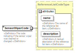 |
||||||||||||||||||||||
| namespace | http://water.usgs.gov/XML/NWIS/5.0 | ||||||||||||||||||||||
| type | ReferenceListCodeType | ||||||||||||||||||||||
| properties |
|
||||||||||||||||||||||
| attributes |
|
||||||||||||||||||||||
| annotation |
|
||||||||||||||||||||||
| source | <xsd:element name="SensorWiperCode" type="ReferenceListCodeType"> <xsd:annotation> <xsd:documentation> <Definition>The code indicating if the sensor wiper was cleaned or changed.</Definition> </xsd:documentation> </xsd:annotation> </xsd:element> |
element DriftCheckDissolvedOxygen/MembraneChangedIndicator
| diagram |  |
||||
| namespace | http://water.usgs.gov/XML/NWIS/5.0 | ||||
| type | xsd:boolean | ||||
| properties |
|
||||
| annotation |
|
||||
| source | <xsd:element name="MembraneChangedIndicator" type="xsd:boolean"> <xsd:annotation> <xsd:documentation> <Definition>Was the Dissolved Oxygen Membrane changed?</Definition> </xsd:documentation> </xsd:annotation> </xsd:element> |
element DriftCheckDissolvedOxygen/MembraneChangedDate
| diagram | 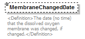 |
||||||||
| namespace | http://water.usgs.gov/XML/NWIS/5.0 | ||||||||
| type | xsd:date | ||||||||
| properties |
|
||||||||
| annotation |
|
||||||||
| source | <xsd:element name="MembraneChangedDate" type="xsd:date" minOccurs="0"> <xsd:annotation> <xsd:documentation> <Definition>The date (no time) that the dissolved oxygen membrane was changed, if changed.</Definition> </xsd:documentation> </xsd:annotation> </xsd:element> |
element DriftCheckDissolvedOxygen/MembraneRelaxDuration
| diagram |  |
||||||||||||||||||||||||||||||||||||||||||||||
| namespace | http://water.usgs.gov/XML/NWIS/5.0 | ||||||||||||||||||||||||||||||||||||||||||||||
| type | IEEE754FloatValueType | ||||||||||||||||||||||||||||||||||||||||||||||
| properties |
|
||||||||||||||||||||||||||||||||||||||||||||||
| facets |
|
||||||||||||||||||||||||||||||||||||||||||||||
| attributes |
|
||||||||||||||||||||||||||||||||||||||||||||||
| annotation |
|
||||||||||||||||||||||||||||||||||||||||||||||
| source | <xsd:element name="MembraneRelaxDuration" type="IEEE754FloatValueType" minOccurs="0"> <xsd:annotation> <xsd:documentation> <Definition>The duration of time the dissolved oxygen membrane was allowed to relax, in minutes.</Definition> </xsd:documentation> </xsd:annotation> </xsd:element> |
element DriftCheckDissolvedOxygen/Comment
| diagram |  |
||||||||
| namespace | http://water.usgs.gov/XML/NWIS/5.0 | ||||||||
| type | xsd:string | ||||||||
| properties |
|
||||||||
| annotation |
|
||||||||
| source | <xsd:element name="Comment" type="xsd:string" minOccurs="0"> <xsd:annotation> <xsd:documentation> <Definition>Comments regarding the dissolved oxygen sensor calibration.</Definition> </xsd:documentation> </xsd:annotation> </xsd:element> |
element DriftCheckPh
| diagram | 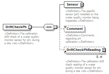 |
||
| namespace | http://water.usgs.gov/XML/NWIS/5.0 | ||
| properties |
|
||
| children | Sensor Comment DriftCheckPhReading | ||
| used by |
|
||
| annotation |
|
||
| source | <xsd:element name="DriftCheckPh"> <xsd:annotation> <xsd:documentation> <Definition>The calibration drift check of a water quality monitor sensor for pH, during a site visit.</Definition> </xsd:documentation> </xsd:annotation> <xsd:complexType> <xsd:sequence> <xsd:element name="Sensor" type="Sensor"> <xsd:annotation> <xsd:documentation> <Definition>The specific sensor (pH) installed on the water quality monitor being inspected.</Definition> </xsd:documentation> </xsd:annotation> </xsd:element> <xsd:element name="Comment" type="xsd:string" minOccurs="0"> <xsd:annotation> <xsd:documentation> <Definition>Comments regarding pH calibration.</Definition> </xsd:documentation> </xsd:annotation> </xsd:element> <xsd:element ref="DriftCheckPhReading" minOccurs="0" maxOccurs="unbounded"/> </xsd:sequence> </xsd:complexType> </xsd:element> |
element DriftCheckPh/Sensor
| diagram | 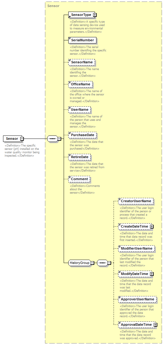 |
||||
| namespace | http://water.usgs.gov/XML/NWIS/5.0 | ||||
| type | Sensor | ||||
| properties |
|
||||
| children | SensorType SerialNumber SensorName OfficeName UserName PurchaseDate RetireDate Comment CreatorUserName CreateDateTime ModifierUserName ModifyDateTime ApproverUserName ApprovalDateTime | ||||
| annotation |
|
||||
| source | <xsd:element name="Sensor" type="Sensor"> <xsd:annotation> <xsd:documentation> <Definition>The specific sensor (pH) installed on the water quality monitor being inspected.</Definition> </xsd:documentation> </xsd:annotation> </xsd:element> |
element DriftCheckPh/Comment
| diagram | 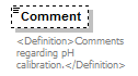 |
||||||||
| namespace | http://water.usgs.gov/XML/NWIS/5.0 | ||||||||
| type | xsd:string | ||||||||
| properties |
|
||||||||
| annotation |
|
||||||||
| source | <xsd:element name="Comment" type="xsd:string" minOccurs="0"> <xsd:annotation> <xsd:documentation> <Definition>Comments regarding pH calibration.</Definition> </xsd:documentation> </xsd:annotation> </xsd:element> |
element DriftCheckTurbidity
| diagram | 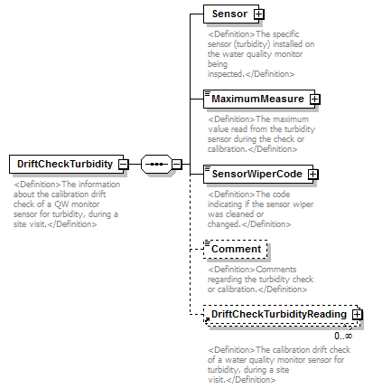 |
||
| namespace | http://water.usgs.gov/XML/NWIS/5.0 | ||
| properties |
|
||
| children | Sensor MaximumMeasure SensorWiperCode Comment DriftCheckTurbidityReading | ||
| used by |
|
||
| annotation |
|
||
| source | <xsd:element name="DriftCheckTurbidity"> <xsd:annotation> <xsd:documentation> <Definition>The information about the calibration drift check of a QW monitor sensor for turbidity, during a site visit.</Definition> </xsd:documentation> </xsd:annotation> <xsd:complexType> <xsd:sequence> <xsd:element name="Sensor" type="Sensor"> <xsd:annotation> <xsd:documentation> <Definition>The specific sensor (turbidity) installed on the water quality monitor being inspected.</Definition> </xsd:documentation> </xsd:annotation> </xsd:element> <xsd:element name="MaximumMeasure" type="IEEE754UncertaintyFloatValueType"> <xsd:annotation> <xsd:documentation> <Definition>The maximum value read from the turbidity sensor during the check or calibration.</Definition> </xsd:documentation> </xsd:annotation> </xsd:element> <xsd:element name="SensorWiperCode" type="ReferenceListCodeType"> <xsd:annotation> <xsd:documentation> <Definition>The code indicating if the sensor wiper was cleaned or changed.</Definition> </xsd:documentation> </xsd:annotation> </xsd:element> <xsd:element name="Comment" type="xsd:string" minOccurs="0"> <xsd:annotation> <xsd:documentation> <Definition>Comments regarding the turbidity check or calibration.</Definition> </xsd:documentation> </xsd:annotation> </xsd:element> <xsd:element ref="DriftCheckTurbidityReading" minOccurs="0" maxOccurs="unbounded"/> </xsd:sequence> </xsd:complexType> </xsd:element> |
element DriftCheckTurbidity/Sensor
| diagram |  |
||||
| namespace | http://water.usgs.gov/XML/NWIS/5.0 | ||||
| type | Sensor | ||||
| properties |
|
||||
| children | SensorType SerialNumber SensorName OfficeName UserName PurchaseDate RetireDate Comment CreatorUserName CreateDateTime ModifierUserName ModifyDateTime ApproverUserName ApprovalDateTime | ||||
| annotation |
|
||||
| source | <xsd:element name="Sensor" type="Sensor"> <xsd:annotation> <xsd:documentation> <Definition>The specific sensor (turbidity) installed on the water quality monitor being inspected.</Definition> </xsd:documentation> </xsd:annotation> </xsd:element> |
element DriftCheckTurbidity/MaximumMeasure
| diagram |  |
||||||||||||||||||||||||||||||||||||||||||||||||||||||||||||||
| namespace | http://water.usgs.gov/XML/NWIS/5.0 | ||||||||||||||||||||||||||||||||||||||||||||||||||||||||||||||
| type | IEEE754UncertaintyFloatValueType | ||||||||||||||||||||||||||||||||||||||||||||||||||||||||||||||
| properties |
|
||||||||||||||||||||||||||||||||||||||||||||||||||||||||||||||
| facets |
|
||||||||||||||||||||||||||||||||||||||||||||||||||||||||||||||
| attributes |
|
||||||||||||||||||||||||||||||||||||||||||||||||||||||||||||||
| annotation |
|
||||||||||||||||||||||||||||||||||||||||||||||||||||||||||||||
| source | <xsd:element name="MaximumMeasure" type="IEEE754UncertaintyFloatValueType"> <xsd:annotation> <xsd:documentation> <Definition>The maximum value read from the turbidity sensor during the check or calibration.</Definition> </xsd:documentation> </xsd:annotation> </xsd:element> |
element DriftCheckTurbidity/SensorWiperCode
| diagram |  |
||||||||||||||||||||||
| namespace | http://water.usgs.gov/XML/NWIS/5.0 | ||||||||||||||||||||||
| type | ReferenceListCodeType | ||||||||||||||||||||||
| properties |
|
||||||||||||||||||||||
| attributes |
|
||||||||||||||||||||||
| annotation |
|
||||||||||||||||||||||
| source | <xsd:element name="SensorWiperCode" type="ReferenceListCodeType"> <xsd:annotation> <xsd:documentation> <Definition>The code indicating if the sensor wiper was cleaned or changed.</Definition> </xsd:documentation> </xsd:annotation> </xsd:element> |
element DriftCheckTurbidity/Comment
| diagram |  |
||||||||
| namespace | http://water.usgs.gov/XML/NWIS/5.0 | ||||||||
| type | xsd:string | ||||||||
| properties |
|
||||||||
| annotation |
|
||||||||
| source | <xsd:element name="Comment" type="xsd:string" minOccurs="0"> <xsd:annotation> <xsd:documentation> <Definition>Comments regarding the turbidity check or calibration.</Definition> </xsd:documentation> </xsd:annotation> </xsd:element> |
element DriftCheckWaterTemperature
| diagram | 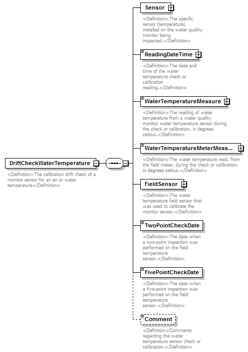 |
||
| namespace | http://water.usgs.gov/XML/NWIS/5.0 | ||
| properties |
|
||
| children | Sensor ReadingDateTime WaterTemperatureMeasure WaterTemperatureMeterMeasure FieldSensor TwoPointCheckDate FivePointCheckDate Comment | ||
| used by |
|
||
| annotation |
|
||
| source | <xsd:element name="DriftCheckWaterTemperature"> <xsd:annotation> <xsd:documentation> <Definition>The calibration drift check of a monitor sensor for an air or water temperature</Definition> </xsd:documentation> </xsd:annotation> <xsd:complexType> <xsd:sequence> <xsd:element name="Sensor" type="Sensor"> <xsd:annotation> <xsd:documentation> <Definition>The specific sensor (temperature) installed on the water quality monitor being inspected.</Definition> </xsd:documentation> </xsd:annotation> </xsd:element> <xsd:element name="ReadingDateTime" type="DateTimeWithDatum"> <xsd:annotation> <xsd:documentation> <Definition>The date and time of the water temperature check or calibration reading.</Definition> </xsd:documentation> </xsd:annotation> </xsd:element> <xsd:element name="WaterTemperatureMeasure" type="IEEE754UncertaintyFloatValueType"> <xsd:annotation> <xsd:documentation> <Definition>The reading of water temperature from a water quality monitor water temperature sensor during the check or calibration, in degrees celsius.</Definition> </xsd:documentation> </xsd:annotation> </xsd:element> <xsd:element name="WaterTemperatureMeterMeasure" type="IEEE754UncertaintyFloatValueType"> <xsd:annotation> <xsd:documentation> <Definition>The water temperature read, from the field meter, during the check or calibration, in degrees celsius.</Definition> </xsd:documentation> </xsd:annotation> </xsd:element> <xsd:element name="FieldSensor" type="Sensor"> <xsd:annotation> <xsd:documentation> <Definition>The water temperature field sensor that was used to calibrate the monitor sensor.</Definition> </xsd:documentation> </xsd:annotation> </xsd:element> <xsd:element name="TwoPointCheckDate" type="xsd:date"> <xsd:annotation> <xsd:documentation> <Definition>The date when a two-point inspection was performed on the field temperature sensor.</Definition> </xsd:documentation> </xsd:annotation> </xsd:element> <xsd:element name="FivePointCheckDate" type="xsd:date"> <xsd:annotation> <xsd:documentation> <Definition>The date when a five-point inspection was performed on the field temperature sensor.</Definition> </xsd:documentation> </xsd:annotation> </xsd:element> <xsd:element name="Comment" type="xsd:string" minOccurs="0"> <xsd:annotation> <xsd:documentation> <Definition>Comments regarding the water temperature sensor check or calibration.</Definition> </xsd:documentation> </xsd:annotation> </xsd:element> </xsd:sequence> </xsd:complexType> </xsd:element> |
element DriftCheckWaterTemperature/Sensor
| diagram |  |
||||
| namespace | http://water.usgs.gov/XML/NWIS/5.0 | ||||
| type | Sensor | ||||
| properties |
|
||||
| children | SensorType SerialNumber SensorName OfficeName UserName PurchaseDate RetireDate Comment CreatorUserName CreateDateTime ModifierUserName ModifyDateTime ApproverUserName ApprovalDateTime | ||||
| annotation |
|
||||
| source | <xsd:element name="Sensor" type="Sensor"> <xsd:annotation> <xsd:documentation> <Definition>The specific sensor (temperature) installed on the water quality monitor being inspected.</Definition> </xsd:documentation> </xsd:annotation> </xsd:element> |
element DriftCheckWaterTemperature/ReadingDateTime
| diagram |  |
||||||||||||||||||||||||||||||
| namespace | http://water.usgs.gov/XML/NWIS/5.0 | ||||||||||||||||||||||||||||||
| type | DateTimeWithDatum | ||||||||||||||||||||||||||||||
| properties |
|
||||||||||||||||||||||||||||||
| attributes |
|
||||||||||||||||||||||||||||||
| annotation |
|
||||||||||||||||||||||||||||||
| source | <xsd:element name="ReadingDateTime" type="DateTimeWithDatum"> <xsd:annotation> <xsd:documentation> <Definition>The date and time of the water temperature check or calibration reading.</Definition> </xsd:documentation> </xsd:annotation> </xsd:element> |
element DriftCheckWaterTemperature/WaterTemperatureMeasure
| diagram | 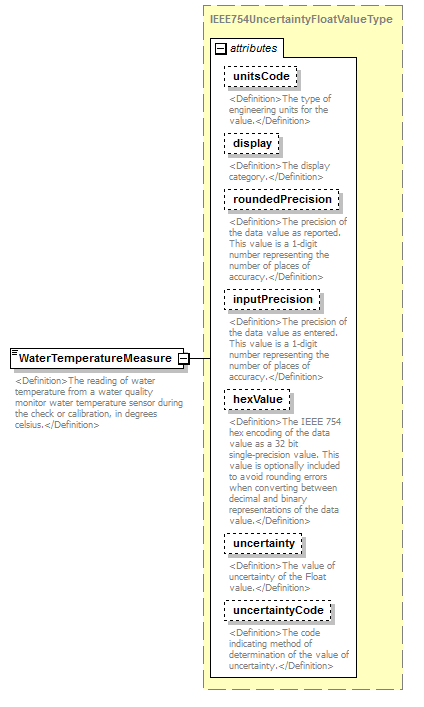 |
||||||||||||||||||||||||||||||||||||||||||||||||||||||||||||||
| namespace | http://water.usgs.gov/XML/NWIS/5.0 | ||||||||||||||||||||||||||||||||||||||||||||||||||||||||||||||
| type | IEEE754UncertaintyFloatValueType | ||||||||||||||||||||||||||||||||||||||||||||||||||||||||||||||
| properties |
|
||||||||||||||||||||||||||||||||||||||||||||||||||||||||||||||
| facets |
|
||||||||||||||||||||||||||||||||||||||||||||||||||||||||||||||
| attributes |
|
||||||||||||||||||||||||||||||||||||||||||||||||||||||||||||||
| annotation |
|
||||||||||||||||||||||||||||||||||||||||||||||||||||||||||||||
| source | <xsd:element name="WaterTemperatureMeasure" type="IEEE754UncertaintyFloatValueType"> <xsd:annotation> <xsd:documentation> <Definition>The reading of water temperature from a water quality monitor water temperature sensor during the check or calibration, in degrees celsius.</Definition> </xsd:documentation> </xsd:annotation> </xsd:element> |
element DriftCheckWaterTemperature/WaterTemperatureMeterMeasure
| diagram |  |
||||||||||||||||||||||||||||||||||||||||||||||||||||||||||||||
| namespace | http://water.usgs.gov/XML/NWIS/5.0 | ||||||||||||||||||||||||||||||||||||||||||||||||||||||||||||||
| type | IEEE754UncertaintyFloatValueType | ||||||||||||||||||||||||||||||||||||||||||||||||||||||||||||||
| properties |
|
||||||||||||||||||||||||||||||||||||||||||||||||||||||||||||||
| facets |
|
||||||||||||||||||||||||||||||||||||||||||||||||||||||||||||||
| attributes |
|
||||||||||||||||||||||||||||||||||||||||||||||||||||||||||||||
| annotation |
|
||||||||||||||||||||||||||||||||||||||||||||||||||||||||||||||
| source | <xsd:element name="WaterTemperatureMeterMeasure" type="IEEE754UncertaintyFloatValueType"> <xsd:annotation> <xsd:documentation> <Definition>The water temperature read, from the field meter, during the check or calibration, in degrees celsius.</Definition> </xsd:documentation> </xsd:annotation> </xsd:element> |
element DriftCheckWaterTemperature/FieldSensor
| diagram | 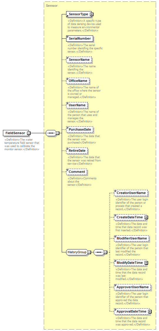 |
||||
| namespace | http://water.usgs.gov/XML/NWIS/5.0 | ||||
| type | Sensor | ||||
| properties |
|
||||
| children | SensorType SerialNumber SensorName OfficeName UserName PurchaseDate RetireDate Comment CreatorUserName CreateDateTime ModifierUserName ModifyDateTime ApproverUserName ApprovalDateTime | ||||
| annotation |
|
||||
| source | <xsd:element name="FieldSensor" type="Sensor"> <xsd:annotation> <xsd:documentation> <Definition>The water temperature field sensor that was used to calibrate the monitor sensor.</Definition> </xsd:documentation> </xsd:annotation> </xsd:element> |
element DriftCheckWaterTemperature/TwoPointCheckDate
| diagram |  |
||||
| namespace | http://water.usgs.gov/XML/NWIS/5.0 | ||||
| type | xsd:date | ||||
| properties |
|
||||
| annotation |
|
||||
| source | <xsd:element name="TwoPointCheckDate" type="xsd:date"> <xsd:annotation> <xsd:documentation> <Definition>The date when a two-point inspection was performed on the field temperature sensor.</Definition> </xsd:documentation> </xsd:annotation> </xsd:element> |
element DriftCheckWaterTemperature/FivePointCheckDate
| diagram |  |
||||
| namespace | http://water.usgs.gov/XML/NWIS/5.0 | ||||
| type | xsd:date | ||||
| properties |
|
||||
| annotation |
|
||||
| source | <xsd:element name="FivePointCheckDate" type="xsd:date"> <xsd:annotation> <xsd:documentation> <Definition>The date when a five-point inspection was performed on the field temperature sensor.</Definition> </xsd:documentation> </xsd:annotation> </xsd:element> |
element DriftCheckWaterTemperature/Comment
| diagram |  |
||||||||
| namespace | http://water.usgs.gov/XML/NWIS/5.0 | ||||||||
| type | xsd:string | ||||||||
| properties |
|
||||||||
| annotation |
|
||||||||
| source | <xsd:element name="Comment" type="xsd:string" minOccurs="0"> <xsd:annotation> <xsd:documentation> <Definition>Comments regarding the water temperature sensor check or calibration.</Definition> </xsd:documentation> </xsd:annotation> </xsd:element> |
element MonitorCheckReadingSet
| diagram | 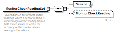 |
||
| namespace | http://water.usgs.gov/XML/NWIS/5.0 | ||
| properties |
|
||
| children | Sensor MonitorCheckReading | ||
| used by |
|
||
| annotation |
|
||
| source | <xsd:element name="MonitorCheckReadingSet"> <xsd:annotation> <xsd:documentation> <Definition>A set of three check readings where a sensor reading is checked against the reading from a field meter sensor to verify the accuracy of the monitor sensor reading.</Definition> </xsd:documentation> </xsd:annotation> <xsd:complexType> <xsd:sequence> <xsd:element name="Sensor" type="Sensor"/> <xsd:element name="MonitorCheckReading" minOccurs="0" maxOccurs="3"/> </xsd:sequence> </xsd:complexType> </xsd:element> |
element MonitorCheckReadingSet/Sensor
| diagram | 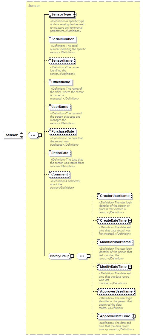 |
||||
| namespace | http://water.usgs.gov/XML/NWIS/5.0 | ||||
| type | Sensor | ||||
| properties |
|
||||
| children | SensorType SerialNumber SensorName OfficeName UserName PurchaseDate RetireDate Comment CreatorUserName CreateDateTime ModifierUserName ModifyDateTime ApproverUserName ApprovalDateTime | ||||
| source | <xsd:element name="Sensor" type="Sensor"/> |
element MonitorCheckReadingSet/MonitorCheckReading
| diagram | 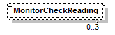 |
||||||
| namespace | http://water.usgs.gov/XML/NWIS/5.0 | ||||||
| properties |
|
||||||
| source | <xsd:element name="MonitorCheckReading" minOccurs="0" maxOccurs="3"/> |
complexType SexagesimalLatitudeType
| diagram | 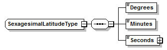 |
||
| namespace | http://water.usgs.gov/XML/NWIS/5.0 | ||
| children | Degrees Minutes Seconds | ||
| used by |
|
||
| source | <xsd:complexType name="SexagesimalLatitudeType"> <xsd:sequence> <xsd:element name="Degrees" type="LatitudeDegreesType"/> <xsd:element name="Minutes" type="MinutesType"/> <xsd:element name="Seconds" type="IEEE754FloatValueType"/> </xsd:sequence> </xsd:complexType> |
element SexagesimalLatitudeType/Degrees
| diagram |  |
|||||||||
| namespace | http://water.usgs.gov/XML/NWIS/5.0 | |||||||||
| type | LatitudeDegreesType | |||||||||
| properties |
|
|||||||||
| facets |
|
|||||||||
| source | <xsd:element name="Degrees" type="LatitudeDegreesType"/> |
element SexagesimalLatitudeType/Minutes
| diagram |  |
|||||||||
| namespace | http://water.usgs.gov/XML/NWIS/5.0 | |||||||||
| type | MinutesType | |||||||||
| properties |
|
|||||||||
| facets |
|
|||||||||
| source | <xsd:element name="Minutes" type="MinutesType"/> |
element SexagesimalLatitudeType/Seconds
| diagram | 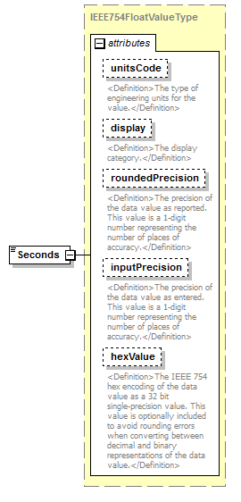 |
||||||||||||||||||||||||||||||||||||||||||||||
| namespace | http://water.usgs.gov/XML/NWIS/5.0 | ||||||||||||||||||||||||||||||||||||||||||||||
| type | IEEE754FloatValueType | ||||||||||||||||||||||||||||||||||||||||||||||
| properties |
|
||||||||||||||||||||||||||||||||||||||||||||||
| facets |
|
||||||||||||||||||||||||||||||||||||||||||||||
| attributes |
|
||||||||||||||||||||||||||||||||||||||||||||||
| source | <xsd:element name="Seconds" type="IEEE754FloatValueType"/> |
complexType SexagesimalLongitudeType
| diagram | 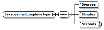 |
||
| namespace | http://water.usgs.gov/XML/NWIS/5.0 | ||
| children | Degrees Minutes Seconds | ||
| used by |
|
||
| source | <xsd:complexType name="SexagesimalLongitudeType"> <xsd:sequence> <xsd:element name="Degrees" type="LongitudeDegreesType"/> <xsd:element name="Minutes" type="MinutesType"/> <xsd:element name="Seconds" type="IEEE754FloatValueType"/> </xsd:sequence> </xsd:complexType> |
element SexagesimalLongitudeType/Degrees
| diagram |  |
|||||||||
| namespace | http://water.usgs.gov/XML/NWIS/5.0 | |||||||||
| type | LongitudeDegreesType | |||||||||
| properties |
|
|||||||||
| facets |
|
|||||||||
| source | <xsd:element name="Degrees" type="LongitudeDegreesType"/> |
element SexagesimalLongitudeType/Minutes
| diagram |  |
|||||||||
| namespace | http://water.usgs.gov/XML/NWIS/5.0 | |||||||||
| type | MinutesType | |||||||||
| properties |
|
|||||||||
| facets |
|
|||||||||
| source | <xsd:element name="Minutes" type="MinutesType"/> |
element SexagesimalLongitudeType/Seconds
| diagram |  |
||||||||||||||||||||||||||||||||||||||||||||||
| namespace | http://water.usgs.gov/XML/NWIS/5.0 | ||||||||||||||||||||||||||||||||||||||||||||||
| type | IEEE754FloatValueType | ||||||||||||||||||||||||||||||||||||||||||||||
| properties |
|
||||||||||||||||||||||||||||||||||||||||||||||
| facets |
|
||||||||||||||||||||||||||||||||||||||||||||||
| attributes |
|
||||||||||||||||||||||||||||||||||||||||||||||
| source | <xsd:element name="Seconds" type="IEEE754FloatValueType"/> |
simpleType LatitudeDegreesType
| namespace | http://water.usgs.gov/XML/NWIS/5.0 | |||||||||
| type | restriction of xsd:int | |||||||||
| properties |
|
|||||||||
| used by |
|
|||||||||
| facets |
|
|||||||||
| annotation |
|
|||||||||
| source | <xsd:simpleType name="LatitudeDegreesType"> <xsd:annotation> <xsd:documentation> The latitude degrees is valid between -90 and 90, with the sign indicating N or S(-). Note that the sign of the degree applies to both Minutes and Seconds values as well. </xsd:documentation> </xsd:annotation> <xsd:restriction base="xsd:int"> <xsd:minInclusive value="-90"/> <xsd:maxInclusive value="90"/> </xsd:restriction> </xsd:simpleType> |
simpleType LongitudeDegreesType
| namespace | http://water.usgs.gov/XML/NWIS/5.0 | |||||||||
| type | restriction of xsd:int | |||||||||
| properties |
|
|||||||||
| used by |
|
|||||||||
| facets |
|
|||||||||
| annotation |
|
|||||||||
| source | <xsd:simpleType name="LongitudeDegreesType"> <xsd:annotation> <xsd:documentation> The longitude degrees is valid between -180 and 180, with the sign indicating E or W(-). Note that the sign of the degree applies to both Minutes and Seconds values as well. </xsd:documentation> </xsd:annotation> <xsd:restriction base="xsd:int"> <xsd:minInclusive value="-180"/> <xsd:maxInclusive value="180"/> </xsd:restriction> </xsd:simpleType> |
simpleType MinutesType
| namespace | http://water.usgs.gov/XML/NWIS/5.0 | |||||||||
| type | restriction of xsd:int | |||||||||
| properties |
|
|||||||||
| used by |
|
|||||||||
| facets |
|
|||||||||
| source | <xsd:simpleType name="MinutesType"> <xsd:restriction base="xsd:int"> <xsd:minInclusive value="0"/> <xsd:maxInclusive value="60"/> </xsd:restriction> </xsd:simpleType> |
element DataDescriptor
| diagram | 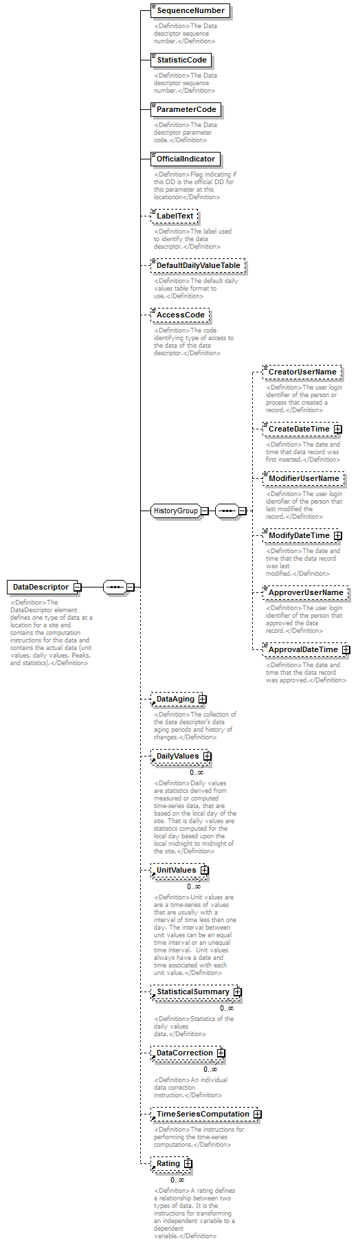 |
||
| namespace | http://water.usgs.gov/XML/NWIS/5.0 | ||
| properties |
|
||
| children | SequenceNumber StatisticCode ParameterCode OfficialIndicator LabelText DefaultDailyValueTable AccessCode CreatorUserName CreateDateTime ModifierUserName ModifyDateTime ApproverUserName ApprovalDateTime DataAging DailyValues UnitValues StatisticalSummary DataCorrection TimeSeriesComputation Rating | ||
| used by |
|
||
| annotation |
|
||
| source | <xsd:element name="DataDescriptor"> <xsd:annotation> <xsd:documentation> <Definition>The DataDescriptor element defines one type of data at a location for a site and contains the computation instructions for this data and contains the actual data (unit values, daily values, Peaks, and statistics).</Definition> </xsd:documentation> </xsd:annotation> <xsd:complexType> <xsd:sequence> <xsd:element name="SequenceNumber" type="xsd:string"> <xsd:annotation> <xsd:documentation> <Definition>The Data descriptor sequence number.</Definition> </xsd:documentation> </xsd:annotation> </xsd:element> <xsd:element name="StatisticCode" type="xsd:string"> <xsd:annotation> <xsd:documentation> <Definition>The Data descriptor sequence number.</Definition> </xsd:documentation> </xsd:annotation> </xsd:element> <xsd:element name="ParameterCode" type="xsd:string"> <xsd:annotation> <xsd:documentation> <Definition>The Data descriptor parameter code.</Definition> </xsd:documentation> </xsd:annotation> </xsd:element> <xsd:element name="OfficialIndicator" type="xsd:boolean"> <xsd:annotation> <xsd:documentation> <Definition>Flag indicating if this DD is the official DD for this parameter at this locationon</Definition> </xsd:documentation> </xsd:annotation> </xsd:element> <xsd:element name="LabelText" type="xsd:string" minOccurs="0"> <xsd:annotation> <xsd:documentation> <Definition>The label used to identify the data descriptor.</Definition> </xsd:documentation> </xsd:annotation> </xsd:element> <xsd:element name="DefaultDailyValueTable" type="xsd:string" minOccurs="0"> <xsd:annotation> <xsd:documentation> <Definition>The default daily values table format to use.</Definition> </xsd:documentation> </xsd:annotation> </xsd:element> <xsd:element name="AccessCode" type="xsd:string" minOccurs="0"> <xsd:annotation> <xsd:documentation> <Definition>The code identifying type of access to the data of this data descriptor.</Definition> </xsd:documentation> </xsd:annotation> </xsd:element> <xsd:group ref="HistoryGroup"/> <xsd:element ref="DataAging" minOccurs="0"/> <xsd:element ref="DailyValues" minOccurs="0" maxOccurs="unbounded"/> <xsd:element ref="UnitValues" minOccurs="0" maxOccurs="unbounded"/> <xsd:element ref="StatisticalSummary" minOccurs="0" maxOccurs="unbounded"/> <xsd:element ref="DataCorrection" minOccurs="0" maxOccurs="unbounded"/> <xsd:element ref="TimeSeriesComputation" minOccurs="0"/> <xsd:element ref="Rating" minOccurs="0" maxOccurs="unbounded"/> </xsd:sequence> </xsd:complexType> </xsd:element> |
element DataDescriptor/SequenceNumber
| diagram |  |
||||
| namespace | http://water.usgs.gov/XML/NWIS/5.0 | ||||
| type | xsd:string | ||||
| properties |
|
||||
| annotation |
|
||||
| source | <xsd:element name="SequenceNumber" type="xsd:string"> <xsd:annotation> <xsd:documentation> <Definition>The Data descriptor sequence number.</Definition> </xsd:documentation> </xsd:annotation> </xsd:element> |
element DataDescriptor/StatisticCode
| diagram |  |
||||
| namespace | http://water.usgs.gov/XML/NWIS/5.0 | ||||
| type | xsd:string | ||||
| properties |
|
||||
| used by |
|
||||
| annotation |
|
||||
| source | <xsd:element name="StatisticCode" type="xsd:string"> <xsd:annotation> <xsd:documentation> <Definition>The Data descriptor sequence number.</Definition> </xsd:documentation> </xsd:annotation> </xsd:element> |
element DataDescriptor/ParameterCode
| diagram |  |
||||
| namespace | http://water.usgs.gov/XML/NWIS/5.0 | ||||
| type | xsd:string | ||||
| properties |
|
||||
| annotation |
|
||||
| source | <xsd:element name="ParameterCode" type="xsd:string"> <xsd:annotation> <xsd:documentation> <Definition>The Data descriptor parameter code.</Definition> </xsd:documentation> </xsd:annotation> </xsd:element> |
element DataDescriptor/OfficialIndicator
| diagram |  |
||||
| namespace | http://water.usgs.gov/XML/NWIS/5.0 | ||||
| type | xsd:boolean | ||||
| properties |
|
||||
| annotation |
|
||||
| source | <xsd:element name="OfficialIndicator" type="xsd:boolean"> <xsd:annotation> <xsd:documentation> <Definition>Flag indicating if this DD is the official DD for this parameter at this locationon</Definition> </xsd:documentation> </xsd:annotation> </xsd:element> |
element DataDescriptor/LabelText
| diagram |  |
||||||||
| namespace | http://water.usgs.gov/XML/NWIS/5.0 | ||||||||
| type | xsd:string | ||||||||
| properties |
|
||||||||
| annotation |
|
||||||||
| source | <xsd:element name="LabelText" type="xsd:string" minOccurs="0"> <xsd:annotation> <xsd:documentation> <Definition>The label used to identify the data descriptor.</Definition> </xsd:documentation> </xsd:annotation> </xsd:element> |
element DataDescriptor/DefaultDailyValueTable
| diagram | 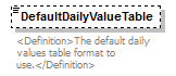 |
||||||||
| namespace | http://water.usgs.gov/XML/NWIS/5.0 | ||||||||
| type | xsd:string | ||||||||
| properties |
|
||||||||
| annotation |
|
||||||||
| source | <xsd:element name="DefaultDailyValueTable" type="xsd:string" minOccurs="0"> <xsd:annotation> <xsd:documentation> <Definition>The default daily values table format to use.</Definition> </xsd:documentation> </xsd:annotation> </xsd:element> |
element DataDescriptor/AccessCode
| diagram | 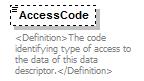 |
||||||||
| namespace | http://water.usgs.gov/XML/NWIS/5.0 | ||||||||
| type | xsd:string | ||||||||
| properties |
|
||||||||
| annotation |
|
||||||||
| source | <xsd:element name="AccessCode" type="xsd:string" minOccurs="0"> <xsd:annotation> <xsd:documentation> <Definition>The code identifying type of access to the data of this data descriptor.</Definition> </xsd:documentation> </xsd:annotation> </xsd:element> |
complexType UnitValuesTransportCode
| diagram | 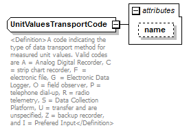 |
||||||||||||
| namespace | http://water.usgs.gov/XML/NWIS/5.0 | ||||||||||||
| type | extension of TransportCodeContents | ||||||||||||
| properties |
|
||||||||||||
| used by |
|
||||||||||||
| attributes |
|
||||||||||||
| annotation |
|
||||||||||||
| source | <xsd:complexType name="UnitValuesTransportCode"> <xsd:annotation> <xsd:documentation> <Definition>A code indicating the type of data transport method for measured unit values. Valid codes are A = Analog Digital Recorder, C = strip chart recorder, F = electronic file, G = Electronic Data Logger, O = field observer, P = telephone dial-up, R = radio telemetry, S = Data Collection Platform, U = transfer and are unspecified, Z = backup recorder, and I = Prefered Input</Definition> </xsd:documentation> </xsd:annotation> <xsd:simpleContent> <xsd:extension base="TransportCodeContents"> <xsd:attribute name="name" type="xsd:string" use="optional"/> </xsd:extension> </xsd:simpleContent> </xsd:complexType> |
attribute UnitValuesTransportCode/@name
| type | xsd:string | ||||
| properties |
|
||||
| source | <xsd:attribute name="name" type="xsd:string" use="optional"/> |
simpleType TransportCodeContents
| namespace | http://water.usgs.gov/XML/NWIS/5.0 | ||
| type | list of (restriction of string1) | ||
| used by |
|
||
| source | <xsd:simpleType name="TransportCodeContents"> <xsd:list> <xsd:simpleType> <xsd:restriction base="string1"> <xsd:enumeration value="A"/> <xsd:enumeration value="C"/> <xsd:enumeration value="F"/> <xsd:enumeration value="G"/> <xsd:enumeration value="O"/> <xsd:enumeration value="P"/> <xsd:enumeration value="R"/> <xsd:enumeration value="S"/> <xsd:enumeration value="U"/> <xsd:enumeration value="Z"/> <xsd:enumeration value="I"/> </xsd:restriction> </xsd:simpleType> </xsd:list> </xsd:simpleType> |
element StatisticCode
| diagram | 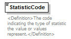 |
||
| namespace | http://water.usgs.gov/XML/NWIS/5.0 | ||
| type | xsd:NMTOKEN | ||
| properties |
|
||
| used by |
|
||
| annotation |
|
||
| source | <xsd:element name="StatisticCode" type="xsd:NMTOKEN"> <xsd:annotation> <xsd:documentation> <Definition>The code indicating the type of statistic the value or values represent.</Definition> </xsd:documentation> </xsd:annotation> </xsd:element> |
element GageMeasurementPoint
| diagram | 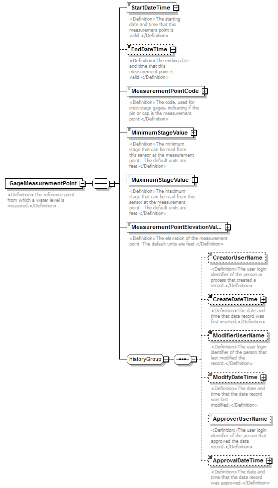 |
||
| namespace | http://water.usgs.gov/XML/NWIS/5.0 | ||
| properties |
|
||
| children | StartDateTime EndDateTime MeasurementPointCode MinimumStageValue MaximumStageValue MeasurementPointElevationValue CreatorUserName CreateDateTime ModifierUserName ModifyDateTime ApproverUserName ApprovalDateTime | ||
| used by |
|
||
| annotation |
|
||
| source | <xsd:element name="GageMeasurementPoint"> <xsd:annotation> <xsd:documentation> <Definition>The reference point from which a water level is measured.</Definition> </xsd:documentation> </xsd:annotation> <xsd:complexType> <xsd:sequence> <xsd:element name="StartDateTime" type="DateTimeWithDatum"> <xsd:annotation> <xsd:documentation> <Definition>The starting date and time that this measurement point is valid.</Definition> </xsd:documentation> </xsd:annotation> </xsd:element> <xsd:element name="EndDateTime" type="DateTimeWithDatum" minOccurs="0"> <xsd:annotation> <xsd:documentation> <Definition>The ending date and time that this measurement point is valid.</Definition> </xsd:documentation> </xsd:annotation> </xsd:element> <xsd:element name="MeasurementPointCode" type="ReferenceListCodeType"> <xsd:annotation> <xsd:documentation> <Definition>The code, used for crest-stage gages, indicating if the pin or cap is the measurement point.</Definition> </xsd:documentation> </xsd:annotation> </xsd:element> <xsd:element name="MinimumStageValue" type="IEEE754FloatValueType"> <xsd:annotation> <xsd:documentation> <Definition>The minimum stage that can be read from this sensor at the measurement point. The default units are feet.</Definition> </xsd:documentation> </xsd:annotation> </xsd:element> <xsd:element name="MaximumStageValue" type="IEEE754FloatValueType"> <xsd:annotation> <xsd:documentation> <Definition>The maximum stage that can be read from this sensor at the measurement point. The default units are feet.</Definition> </xsd:documentation> </xsd:annotation> </xsd:element> <xsd:element name="MeasurementPointElevationValue" type="IEEE754FloatValueType"> <xsd:annotation> <xsd:documentation> <Definition>The elevation of the measurement point. The default units are feet.</Definition> </xsd:documentation> </xsd:annotation> </xsd:element> <xsd:group ref="HistoryGroup"/> </xsd:sequence> </xsd:complexType> </xsd:element> |
element GageMeasurementPoint/StartDateTime
| diagram | 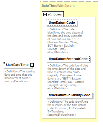 |
||||||||||||||||||||||||||||||
| namespace | http://water.usgs.gov/XML/NWIS/5.0 | ||||||||||||||||||||||||||||||
| type | DateTimeWithDatum | ||||||||||||||||||||||||||||||
| properties |
|
||||||||||||||||||||||||||||||
| attributes |
|
||||||||||||||||||||||||||||||
| annotation |
|
||||||||||||||||||||||||||||||
| source | <xsd:element name="StartDateTime" type="DateTimeWithDatum"> <xsd:annotation> <xsd:documentation> <Definition>The starting date and time that this measurement point is valid.</Definition> </xsd:documentation> </xsd:annotation> </xsd:element> |
element GageMeasurementPoint/EndDateTime
| diagram | 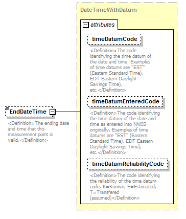 |
||||||||||||||||||||||||||||||
| namespace | http://water.usgs.gov/XML/NWIS/5.0 | ||||||||||||||||||||||||||||||
| type | DateTimeWithDatum | ||||||||||||||||||||||||||||||
| properties |
|
||||||||||||||||||||||||||||||
| attributes |
|
||||||||||||||||||||||||||||||
| annotation |
|
||||||||||||||||||||||||||||||
| source | <xsd:element name="EndDateTime" type="DateTimeWithDatum" minOccurs="0"> <xsd:annotation> <xsd:documentation> <Definition>The ending date and time that this measurement point is valid.</Definition> </xsd:documentation> </xsd:annotation> </xsd:element> |
element GageMeasurementPoint/MeasurementPointCode
| diagram | 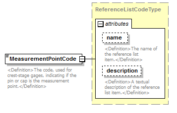 |
||||||||||||||||||||||
| namespace | http://water.usgs.gov/XML/NWIS/5.0 | ||||||||||||||||||||||
| type | ReferenceListCodeType | ||||||||||||||||||||||
| properties |
|
||||||||||||||||||||||
| attributes |
|
||||||||||||||||||||||
| annotation |
|
||||||||||||||||||||||
| source | <xsd:element name="MeasurementPointCode" type="ReferenceListCodeType"> <xsd:annotation> <xsd:documentation> <Definition>The code, used for crest-stage gages, indicating if the pin or cap is the measurement point.</Definition> </xsd:documentation> </xsd:annotation> </xsd:element> |
element GageMeasurementPoint/MinimumStageValue
| diagram |  |
||||||||||||||||||||||||||||||||||||||||||||||
| namespace | http://water.usgs.gov/XML/NWIS/5.0 | ||||||||||||||||||||||||||||||||||||||||||||||
| type | IEEE754FloatValueType | ||||||||||||||||||||||||||||||||||||||||||||||
| properties |
|
||||||||||||||||||||||||||||||||||||||||||||||
| facets |
|
||||||||||||||||||||||||||||||||||||||||||||||
| attributes |
|
||||||||||||||||||||||||||||||||||||||||||||||
| annotation |
|
||||||||||||||||||||||||||||||||||||||||||||||
| source | <xsd:element name="MinimumStageValue" type="IEEE754FloatValueType"> <xsd:annotation> <xsd:documentation> <Definition>The minimum stage that can be read from this sensor at the measurement point. The default units are feet.</Definition> </xsd:documentation> </xsd:annotation> </xsd:element> |
element GageMeasurementPoint/MaximumStageValue
| diagram |  |
||||||||||||||||||||||||||||||||||||||||||||||
| namespace | http://water.usgs.gov/XML/NWIS/5.0 | ||||||||||||||||||||||||||||||||||||||||||||||
| type | IEEE754FloatValueType | ||||||||||||||||||||||||||||||||||||||||||||||
| properties |
|
||||||||||||||||||||||||||||||||||||||||||||||
| facets |
|
||||||||||||||||||||||||||||||||||||||||||||||
| attributes |
|
||||||||||||||||||||||||||||||||||||||||||||||
| annotation |
|
||||||||||||||||||||||||||||||||||||||||||||||
| source | <xsd:element name="MaximumStageValue" type="IEEE754FloatValueType"> <xsd:annotation> <xsd:documentation> <Definition>The maximum stage that can be read from this sensor at the measurement point. The default units are feet.</Definition> </xsd:documentation> </xsd:annotation> </xsd:element> |
element GageMeasurementPoint/MeasurementPointElevationValue
| diagram |  |
||||||||||||||||||||||||||||||||||||||||||||||
| namespace | http://water.usgs.gov/XML/NWIS/5.0 | ||||||||||||||||||||||||||||||||||||||||||||||
| type | IEEE754FloatValueType | ||||||||||||||||||||||||||||||||||||||||||||||
| properties |
|
||||||||||||||||||||||||||||||||||||||||||||||
| facets |
|
||||||||||||||||||||||||||||||||||||||||||||||
| attributes |
|
||||||||||||||||||||||||||||||||||||||||||||||
| annotation |
|
||||||||||||||||||||||||||||||||||||||||||||||
| source | <xsd:element name="MeasurementPointElevationValue" type="IEEE754FloatValueType"> <xsd:annotation> <xsd:documentation> <Definition>The elevation of the measurement point. The default units are feet.</Definition> </xsd:documentation> </xsd:annotation> </xsd:element> |
element DischargeMeasurement
| diagram | 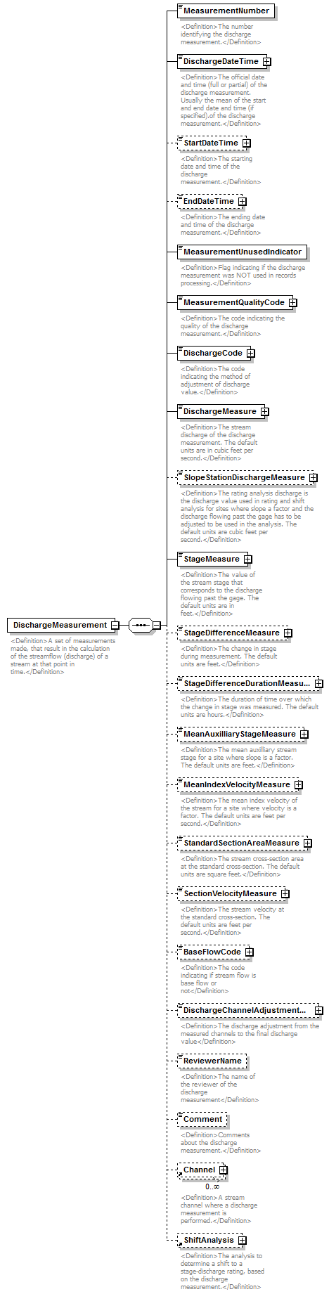 |
||
| namespace | http://water.usgs.gov/XML/NWIS/5.0 | ||
| properties |
|
||
| children | MeasurementNumber DischargeDateTime StartDateTime EndDateTime MeasurementUnusedIndicator MeasurementQualityCode DischargeCode DischargeMeasure SlopeStationDischargeMeasure StageMeasure StageDifferenceMeasure StageDifferenceDurationMeasure MeanAuxilliaryStageMeasure MeanIndexVelocityMeasure StandardSectionAreaMeasure SectionVelocityMeasure BaseFlowCode DischargeChannelAdjustmentMeasure ReviewerName Comment Channel ShiftAnalysis | ||
| used by |
|
||
| annotation |
|
||
| source | <xsd:element name="DischargeMeasurement"> <xsd:annotation> <xsd:documentation> <Definition>A set of measurements made, that result in the calculation of the streamflow (discharge) of a stream at that point in time.</Definition> </xsd:documentation> </xsd:annotation> <xsd:complexType> <xsd:sequence> <xsd:element name="MeasurementNumber" type="xsd:NMTOKEN"> <xsd:annotation> <xsd:documentation> <Definition>The number identifying the discharge measurement.</Definition> </xsd:documentation> </xsd:annotation> </xsd:element> <xsd:element name="DischargeDateTime" type="DateTimeWithDatumPartial"> <xsd:annotation> <xsd:documentation> <Definition>The official date and time (full or partial) of the discharge measurement. Usually the mean of the start and end date and time (if specified).of the discharge measurement.</Definition> </xsd:documentation> </xsd:annotation> </xsd:element> <xsd:element name="StartDateTime" type="DateTimeWithDatum" minOccurs="0"> <xsd:annotation> <xsd:documentation> <Definition>The starting date and time of the discharge measurement.</Definition> </xsd:documentation> </xsd:annotation> </xsd:element> <xsd:element name="EndDateTime" type="DateTimeWithDatum" minOccurs="0"> <xsd:annotation> <xsd:documentation> <Definition>The ending date and time of the discharge measurement.</Definition> </xsd:documentation> </xsd:annotation> </xsd:element> <xsd:element name="MeasurementUnusedIndicator" type="xsd:boolean"> <xsd:annotation> <xsd:documentation> <Definition>Flag indicating if the discharge measurement was NOT used in records processing.</Definition> </xsd:documentation> </xsd:annotation> </xsd:element> <xsd:element name="MeasurementQualityCode" type="ReferenceListCodeType"> <xsd:annotation> <xsd:documentation> <Definition>The code indicating the quality of the discharge measurement.</Definition> </xsd:documentation> </xsd:annotation> </xsd:element> <xsd:element name="DischargeCode" type="ReferenceListCodeType"> <xsd:annotation> <xsd:documentation> <Definition>The code indicating the method of adjustment of discharge value.</Definition> </xsd:documentation> </xsd:annotation> </xsd:element> <xsd:element name="DischargeMeasure" type="IEEE754UncertaintyFloatValueType"> <xsd:annotation> <xsd:documentation> <Definition>The stream discharge of the discharge measurement. The default units are in cubic feet per second.</Definition> </xsd:documentation> </xsd:annotation> </xsd:element> <xsd:element name="SlopeStationDischargeMeasure" type="IEEE754FloatValueType" minOccurs="0"> <xsd:annotation> <xsd:documentation> <Definition>The rating analysis discharge is the discharge value used in rating and shift analysis for sites where slope a factor and the discharge flowing past the gage has to be adjusted to be used in the analysis. The default units are cubic feet per second.</Definition> </xsd:documentation> </xsd:annotation> </xsd:element> <xsd:element name="StageMeasure" type="IEEE754FloatValueType"> <xsd:annotation> <xsd:documentation> <Definition>The value of the stream stage that corresponds to the discharge flowing past the gage. The default units are in feet.</Definition> </xsd:documentation> </xsd:annotation> </xsd:element> <xsd:element name="StageDifferenceMeasure" type="IEEE754FloatValueType" minOccurs="0"> <xsd:annotation> <xsd:documentation> <Definition>The change in stage during measurement. The default units are feet.</Definition> </xsd:documentation> </xsd:annotation> </xsd:element> <xsd:element name="StageDifferenceDurationMeasure" type="IEEE754FloatValueType" minOccurs="0"> <xsd:annotation> <xsd:documentation> <Definition>The duration of time over which the change in stage was measured. The default units are hours.</Definition> </xsd:documentation> </xsd:annotation> </xsd:element> <xsd:element name="MeanAuxilliaryStageMeasure" type="IEEE754FloatValueType" minOccurs="0"> <xsd:annotation> <xsd:documentation> <Definition>The mean auxilliary stream stage for a site where slope is a factor. The default units are feet.</Definition> </xsd:documentation> </xsd:annotation> </xsd:element> <xsd:element name="MeanIndexVelocityMeasure" type="IEEE754FloatValueType" minOccurs="0"> <xsd:annotation> <xsd:documentation> <Definition>The mean index velocity of the stream for a site where velocity is a factor. The default units are feet per second.</Definition> </xsd:documentation> </xsd:annotation> </xsd:element> <xsd:element name="StandardSectionAreaMeasure" type="IEEE754FloatValueType" minOccurs="0"> <xsd:annotation> <xsd:documentation> <Definition>The stream cross-section area at the standard cross-section. The default units are square feet.</Definition> </xsd:documentation> </xsd:annotation> </xsd:element> <xsd:element name="SectionVelocityMeasure" type="IEEE754FloatValueType" minOccurs="0"> <xsd:annotation> <xsd:documentation> <Definition>The stream velocity at the standard cross-section. The default units are feet per second.</Definition> </xsd:documentation> </xsd:annotation> </xsd:element> <xsd:element name="BaseFlowCode" type="ReferenceListCodeType" minOccurs="0"> <xsd:annotation> <xsd:documentation> <Definition>The code indicating if stream flow is base flow or not</Definition> </xsd:documentation> </xsd:annotation> </xsd:element> <xsd:element name="DischargeChannelAdjustmentMeasure" type="IEEE754FloatValueType" minOccurs="0"> <xsd:annotation> <xsd:documentation> <Definition>The discharge adjustment from the measured channels to the final discharge value</Definition> </xsd:documentation> </xsd:annotation> </xsd:element> <xsd:element name="ReviewerName" type="xsd:string" minOccurs="0"> <xsd:annotation> <xsd:documentation> <Definition>The name of the reviewer of the discharge measurement</Definition> </xsd:documentation> </xsd:annotation> </xsd:element> <xsd:element name="Comment" type="xsd:string" minOccurs="0"> <xsd:annotation> <xsd:documentation> <Definition>Comments about the discharge measurement.</Definition> </xsd:documentation> </xsd:annotation> </xsd:element> <xsd:element ref="Channel" minOccurs="0" maxOccurs="unbounded"/> <xsd:element ref="ShiftAnalysis" minOccurs="0"> <xsd:annotation> <xsd:documentation> <Definition>The analysis to determine a shift to a stage-discharge rating, based on the discharge measurement.</Definition> </xsd:documentation> </xsd:annotation> </xsd:element> </xsd:sequence> </xsd:complexType> </xsd:element> |
element DischargeMeasurement/MeasurementNumber
| diagram | 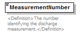 |
||||
| namespace | http://water.usgs.gov/XML/NWIS/5.0 | ||||
| type | xsd:NMTOKEN | ||||
| properties |
|
||||
| annotation |
|
||||
| source | <xsd:element name="MeasurementNumber" type="xsd:NMTOKEN"> <xsd:annotation> <xsd:documentation> <Definition>The number identifying the discharge measurement.</Definition> </xsd:documentation> </xsd:annotation> </xsd:element> |
element DischargeMeasurement/DischargeDateTime
| diagram | 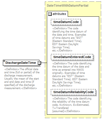 |
||||||||||||||||||||||||||||||
| namespace | http://water.usgs.gov/XML/NWIS/5.0 | ||||||||||||||||||||||||||||||
| type | DateTimeWithDatumPartial | ||||||||||||||||||||||||||||||
| properties |
|
||||||||||||||||||||||||||||||
| attributes |
|
||||||||||||||||||||||||||||||
| annotation |
|
||||||||||||||||||||||||||||||
| source | <xsd:element name="DischargeDateTime" type="DateTimeWithDatumPartial"> <xsd:annotation> <xsd:documentation> <Definition>The official date and time (full or partial) of the discharge measurement. Usually the mean of the start and end date and time (if specified).of the discharge measurement.</Definition> </xsd:documentation> </xsd:annotation> </xsd:element> |
element DischargeMeasurement/StartDateTime
| diagram | 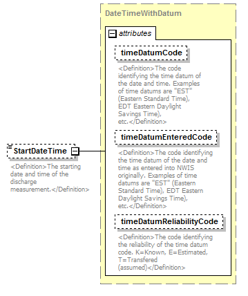 |
||||||||||||||||||||||||||||||
| namespace | http://water.usgs.gov/XML/NWIS/5.0 | ||||||||||||||||||||||||||||||
| type | DateTimeWithDatum | ||||||||||||||||||||||||||||||
| properties |
|
||||||||||||||||||||||||||||||
| attributes |
|
||||||||||||||||||||||||||||||
| annotation |
|
||||||||||||||||||||||||||||||
| source | <xsd:element name="StartDateTime" type="DateTimeWithDatum" minOccurs="0"> <xsd:annotation> <xsd:documentation> <Definition>The starting date and time of the discharge measurement.</Definition> </xsd:documentation> </xsd:annotation> </xsd:element> |
element DischargeMeasurement/EndDateTime
| diagram |  |
||||||||||||||||||||||||||||||
| namespace | http://water.usgs.gov/XML/NWIS/5.0 | ||||||||||||||||||||||||||||||
| type | DateTimeWithDatum | ||||||||||||||||||||||||||||||
| properties |
|
||||||||||||||||||||||||||||||
| attributes |
|
||||||||||||||||||||||||||||||
| annotation |
|
||||||||||||||||||||||||||||||
| source | <xsd:element name="EndDateTime" type="DateTimeWithDatum" minOccurs="0"> <xsd:annotation> <xsd:documentation> <Definition>The ending date and time of the discharge measurement.</Definition> </xsd:documentation> </xsd:annotation> </xsd:element> |
element DischargeMeasurement/MeasurementUnusedIndicator
| diagram |  |
||||
| namespace | http://water.usgs.gov/XML/NWIS/5.0 | ||||
| type | xsd:boolean | ||||
| properties |
|
||||
| annotation |
|
||||
| source | <xsd:element name="MeasurementUnusedIndicator" type="xsd:boolean"> <xsd:annotation> <xsd:documentation> <Definition>Flag indicating if the discharge measurement was NOT used in records processing.</Definition> </xsd:documentation> </xsd:annotation> </xsd:element> |
element DischargeMeasurement/MeasurementQualityCode
| diagram | 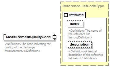 |
||||||||||||||||||||||
| namespace | http://water.usgs.gov/XML/NWIS/5.0 | ||||||||||||||||||||||
| type | ReferenceListCodeType | ||||||||||||||||||||||
| properties |
|
||||||||||||||||||||||
| attributes |
|
||||||||||||||||||||||
| annotation |
|
||||||||||||||||||||||
| source | <xsd:element name="MeasurementQualityCode" type="ReferenceListCodeType"> <xsd:annotation> <xsd:documentation> <Definition>The code indicating the quality of the discharge measurement.</Definition> </xsd:documentation> </xsd:annotation> </xsd:element> |
element DischargeMeasurement/DischargeCode
| diagram | 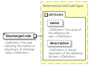 |
||||||||||||||||||||||
| namespace | http://water.usgs.gov/XML/NWIS/5.0 | ||||||||||||||||||||||
| type | ReferenceListCodeType | ||||||||||||||||||||||
| properties |
|
||||||||||||||||||||||
| attributes |
|
||||||||||||||||||||||
| annotation |
|
||||||||||||||||||||||
| source | <xsd:element name="DischargeCode" type="ReferenceListCodeType"> <xsd:annotation> <xsd:documentation> <Definition>The code indicating the method of adjustment of discharge value.</Definition> </xsd:documentation> </xsd:annotation> </xsd:element> |
element DischargeMeasurement/DischargeMeasure
| diagram | 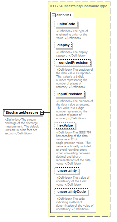 |
||||||||||||||||||||||||||||||||||||||||||||||||||||||||||||||
| namespace | http://water.usgs.gov/XML/NWIS/5.0 | ||||||||||||||||||||||||||||||||||||||||||||||||||||||||||||||
| type | IEEE754UncertaintyFloatValueType | ||||||||||||||||||||||||||||||||||||||||||||||||||||||||||||||
| properties |
|
||||||||||||||||||||||||||||||||||||||||||||||||||||||||||||||
| facets |
|
||||||||||||||||||||||||||||||||||||||||||||||||||||||||||||||
| attributes |
|
||||||||||||||||||||||||||||||||||||||||||||||||||||||||||||||
| annotation |
|
||||||||||||||||||||||||||||||||||||||||||||||||||||||||||||||
| source | <xsd:element name="DischargeMeasure" type="IEEE754UncertaintyFloatValueType"> <xsd:annotation> <xsd:documentation> <Definition>The stream discharge of the discharge measurement. The default units are in cubic feet per second.</Definition> </xsd:documentation> </xsd:annotation> </xsd:element> |
element DischargeMeasurement/SlopeStationDischargeMeasure
| diagram | 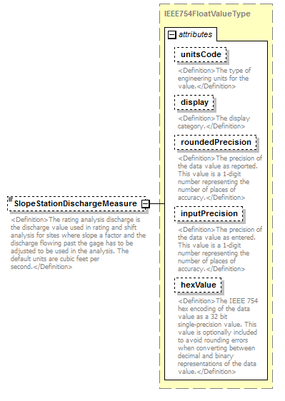 |
||||||||||||||||||||||||||||||||||||||||||||||
| namespace | http://water.usgs.gov/XML/NWIS/5.0 | ||||||||||||||||||||||||||||||||||||||||||||||
| type | IEEE754FloatValueType | ||||||||||||||||||||||||||||||||||||||||||||||
| properties |
|
||||||||||||||||||||||||||||||||||||||||||||||
| facets |
|
||||||||||||||||||||||||||||||||||||||||||||||
| attributes |
|
||||||||||||||||||||||||||||||||||||||||||||||
| annotation |
|
||||||||||||||||||||||||||||||||||||||||||||||
| source | <xsd:element name="SlopeStationDischargeMeasure" type="IEEE754FloatValueType" minOccurs="0"> <xsd:annotation> <xsd:documentation> <Definition>The rating analysis discharge is the discharge value used in rating and shift analysis for sites where slope a factor and the discharge flowing past the gage has to be adjusted to be used in the analysis. The default units are cubic feet per second.</Definition> </xsd:documentation> </xsd:annotation> </xsd:element> |
element DischargeMeasurement/StageMeasure
| diagram |  |
||||||||||||||||||||||||||||||||||||||||||||||
| namespace | http://water.usgs.gov/XML/NWIS/5.0 | ||||||||||||||||||||||||||||||||||||||||||||||
| type | IEEE754FloatValueType | ||||||||||||||||||||||||||||||||||||||||||||||
| properties |
|
||||||||||||||||||||||||||||||||||||||||||||||
| facets |
|
||||||||||||||||||||||||||||||||||||||||||||||
| attributes |
|
||||||||||||||||||||||||||||||||||||||||||||||
| annotation |
|
||||||||||||||||||||||||||||||||||||||||||||||
| source | <xsd:element name="StageMeasure" type="IEEE754FloatValueType"> <xsd:annotation> <xsd:documentation> <Definition>The value of the stream stage that corresponds to the discharge flowing past the gage. The default units are in feet.</Definition> </xsd:documentation> </xsd:annotation> </xsd:element> |
element DischargeMeasurement/StageDifferenceMeasure
| diagram | 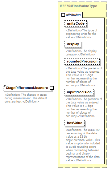 |
||||||||||||||||||||||||||||||||||||||||||||||
| namespace | http://water.usgs.gov/XML/NWIS/5.0 | ||||||||||||||||||||||||||||||||||||||||||||||
| type | IEEE754FloatValueType | ||||||||||||||||||||||||||||||||||||||||||||||
| properties |
|
||||||||||||||||||||||||||||||||||||||||||||||
| facets |
|
||||||||||||||||||||||||||||||||||||||||||||||
| attributes |
|
||||||||||||||||||||||||||||||||||||||||||||||
| annotation |
|
||||||||||||||||||||||||||||||||||||||||||||||
| source | <xsd:element name="StageDifferenceMeasure" type="IEEE754FloatValueType" minOccurs="0"> <xsd:annotation> <xsd:documentation> <Definition>The change in stage during measurement. The default units are feet.</Definition> </xsd:documentation> </xsd:annotation> </xsd:element> |
element DischargeMeasurement/StageDifferenceDurationMeasure
| diagram |  |
||||||||||||||||||||||||||||||||||||||||||||||
| namespace | http://water.usgs.gov/XML/NWIS/5.0 | ||||||||||||||||||||||||||||||||||||||||||||||
| type | IEEE754FloatValueType | ||||||||||||||||||||||||||||||||||||||||||||||
| properties |
|
||||||||||||||||||||||||||||||||||||||||||||||
| facets |
|
||||||||||||||||||||||||||||||||||||||||||||||
| attributes |
|
||||||||||||||||||||||||||||||||||||||||||||||
| annotation |
|
||||||||||||||||||||||||||||||||||||||||||||||
| source | <xsd:element name="StageDifferenceDurationMeasure" type="IEEE754FloatValueType" minOccurs="0"> <xsd:annotation> <xsd:documentation> <Definition>The duration of time over which the change in stage was measured. The default units are hours.</Definition> </xsd:documentation> </xsd:annotation> </xsd:element> |
element DischargeMeasurement/MeanAuxilliaryStageMeasure
| diagram | 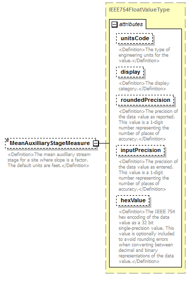 |
||||||||||||||||||||||||||||||||||||||||||||||
| namespace | http://water.usgs.gov/XML/NWIS/5.0 | ||||||||||||||||||||||||||||||||||||||||||||||
| type | IEEE754FloatValueType | ||||||||||||||||||||||||||||||||||||||||||||||
| properties |
|
||||||||||||||||||||||||||||||||||||||||||||||
| facets |
|
||||||||||||||||||||||||||||||||||||||||||||||
| attributes |
|
||||||||||||||||||||||||||||||||||||||||||||||
| annotation |
|
||||||||||||||||||||||||||||||||||||||||||||||
| source | <xsd:element name="MeanAuxilliaryStageMeasure" type="IEEE754FloatValueType" minOccurs="0"> <xsd:annotation> <xsd:documentation> <Definition>The mean auxilliary stream stage for a site where slope is a factor. The default units are feet.</Definition> </xsd:documentation> </xsd:annotation> </xsd:element> |
element DischargeMeasurement/MeanIndexVelocityMeasure
| diagram |  |
||||||||||||||||||||||||||||||||||||||||||||||
| namespace | http://water.usgs.gov/XML/NWIS/5.0 | ||||||||||||||||||||||||||||||||||||||||||||||
| type | IEEE754FloatValueType | ||||||||||||||||||||||||||||||||||||||||||||||
| properties |
|
||||||||||||||||||||||||||||||||||||||||||||||
| facets |
|
||||||||||||||||||||||||||||||||||||||||||||||
| attributes |
|
||||||||||||||||||||||||||||||||||||||||||||||
| annotation |
|
||||||||||||||||||||||||||||||||||||||||||||||
| source | <xsd:element name="MeanIndexVelocityMeasure" type="IEEE754FloatValueType" minOccurs="0"> <xsd:annotation> <xsd:documentation> <Definition>The mean index velocity of the stream for a site where velocity is a factor. The default units are feet per second.</Definition> </xsd:documentation> </xsd:annotation> </xsd:element> |
element DischargeMeasurement/StandardSectionAreaMeasure
| diagram |  |
||||||||||||||||||||||||||||||||||||||||||||||
| namespace | http://water.usgs.gov/XML/NWIS/5.0 | ||||||||||||||||||||||||||||||||||||||||||||||
| type | IEEE754FloatValueType | ||||||||||||||||||||||||||||||||||||||||||||||
| properties |
|
||||||||||||||||||||||||||||||||||||||||||||||
| facets |
|
||||||||||||||||||||||||||||||||||||||||||||||
| attributes |
|
||||||||||||||||||||||||||||||||||||||||||||||
| annotation |
|
||||||||||||||||||||||||||||||||||||||||||||||
| source | <xsd:element name="StandardSectionAreaMeasure" type="IEEE754FloatValueType" minOccurs="0"> <xsd:annotation> <xsd:documentation> <Definition>The stream cross-section area at the standard cross-section. The default units are square feet.</Definition> </xsd:documentation> </xsd:annotation> </xsd:element> |
element DischargeMeasurement/SectionVelocityMeasure
| diagram | 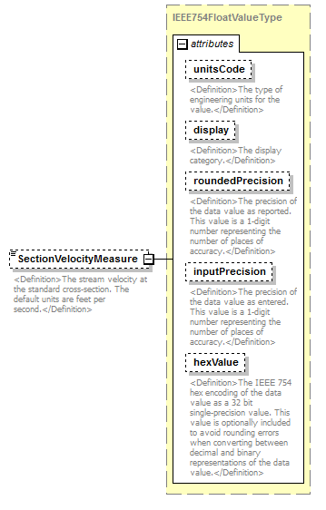 |
||||||||||||||||||||||||||||||||||||||||||||||
| namespace | http://water.usgs.gov/XML/NWIS/5.0 | ||||||||||||||||||||||||||||||||||||||||||||||
| type | IEEE754FloatValueType | ||||||||||||||||||||||||||||||||||||||||||||||
| properties |
|
||||||||||||||||||||||||||||||||||||||||||||||
| facets |
|
||||||||||||||||||||||||||||||||||||||||||||||
| attributes |
|
||||||||||||||||||||||||||||||||||||||||||||||
| annotation |
|
||||||||||||||||||||||||||||||||||||||||||||||
| source | <xsd:element name="SectionVelocityMeasure" type="IEEE754FloatValueType" minOccurs="0"> <xsd:annotation> <xsd:documentation> <Definition>The stream velocity at the standard cross-section. The default units are feet per second.</Definition> </xsd:documentation> </xsd:annotation> </xsd:element> |
element DischargeMeasurement/BaseFlowCode
| diagram | 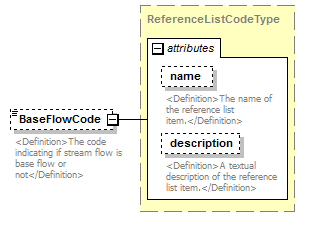 |
||||||||||||||||||||||
| namespace | http://water.usgs.gov/XML/NWIS/5.0 | ||||||||||||||||||||||
| type | ReferenceListCodeType | ||||||||||||||||||||||
| properties |
|
||||||||||||||||||||||
| attributes |
|
||||||||||||||||||||||
| annotation |
|
||||||||||||||||||||||
| source | <xsd:element name="BaseFlowCode" type="ReferenceListCodeType" minOccurs="0"> <xsd:annotation> <xsd:documentation> <Definition>The code indicating if stream flow is base flow or not</Definition> </xsd:documentation> </xsd:annotation> </xsd:element> |
element DischargeMeasurement/DischargeChannelAdjustmentMeasure
| diagram | 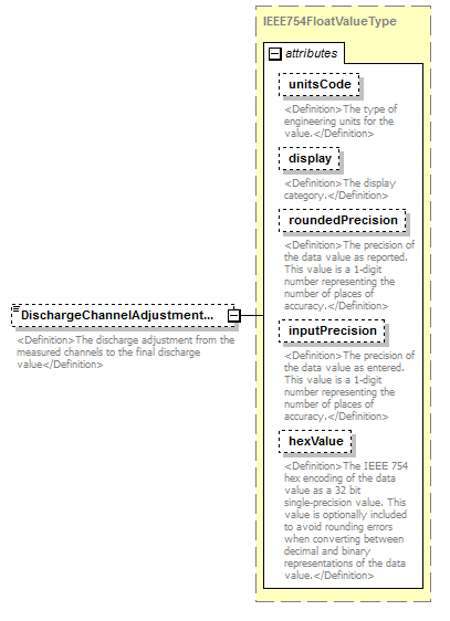 |
||||||||||||||||||||||||||||||||||||||||||||||
| namespace | http://water.usgs.gov/XML/NWIS/5.0 | ||||||||||||||||||||||||||||||||||||||||||||||
| type | IEEE754FloatValueType | ||||||||||||||||||||||||||||||||||||||||||||||
| properties |
|
||||||||||||||||||||||||||||||||||||||||||||||
| facets |
|
||||||||||||||||||||||||||||||||||||||||||||||
| attributes |
|
||||||||||||||||||||||||||||||||||||||||||||||
| annotation |
|
||||||||||||||||||||||||||||||||||||||||||||||
| source | <xsd:element name="DischargeChannelAdjustmentMeasure" type="IEEE754FloatValueType" minOccurs="0"> <xsd:annotation> <xsd:documentation> <Definition>The discharge adjustment from the measured channels to the final discharge value</Definition> </xsd:documentation> </xsd:annotation> </xsd:element> |
element DischargeMeasurement/ReviewerName
| diagram | 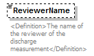 |
||||||||
| namespace | http://water.usgs.gov/XML/NWIS/5.0 | ||||||||
| type | xsd:string | ||||||||
| properties |
|
||||||||
| annotation |
|
||||||||
| source | <xsd:element name="ReviewerName" type="xsd:string" minOccurs="0"> <xsd:annotation> <xsd:documentation> <Definition>The name of the reviewer of the discharge measurement</Definition> </xsd:documentation> </xsd:annotation> </xsd:element> |
element DischargeMeasurement/Comment
| diagram | 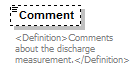 |
||||||||
| namespace | http://water.usgs.gov/XML/NWIS/5.0 | ||||||||
| type | xsd:string | ||||||||
| properties |
|
||||||||
| annotation |
|
||||||||
| source | <xsd:element name="Comment" type="xsd:string" minOccurs="0"> <xsd:annotation> <xsd:documentation> <Definition>Comments about the discharge measurement.</Definition> </xsd:documentation> </xsd:annotation> </xsd:element> |
element EnvironmentalMeasurementList
| diagram | 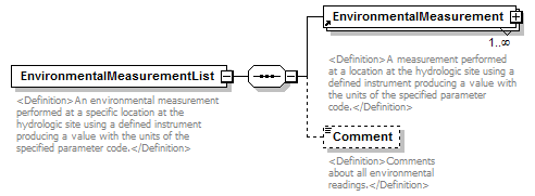 |
||
| namespace | http://water.usgs.gov/XML/NWIS/5.0 | ||
| properties |
|
||
| children | EnvironmentalMeasurement Comment | ||
| used by |
|
||
| annotation |
|
||
| source | <xsd:element name="EnvironmentalMeasurementList"> <xsd:annotation> <xsd:documentation> <Definition>An environmental measurement performed at a specific location at the hydrologic site using a defined instrument producing a value with the units of the specified parameter code.</Definition> </xsd:documentation> </xsd:annotation> <xsd:complexType> <xsd:sequence> <xsd:element ref="EnvironmentalMeasurement" maxOccurs="unbounded"/> <xsd:element name="Comment" type="xsd:string" minOccurs="0"> <xsd:annotation> <xsd:documentation> <Definition>Comments about all environmental readings.</Definition> </xsd:documentation> </xsd:annotation> </xsd:element> </xsd:sequence> </xsd:complexType> </xsd:element> |
element EnvironmentalMeasurementList/Comment
| diagram | 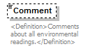 |
||||||||
| namespace | http://water.usgs.gov/XML/NWIS/5.0 | ||||||||
| type | xsd:string | ||||||||
| properties |
|
||||||||
| annotation |
|
||||||||
| source | <xsd:element name="Comment" type="xsd:string" minOccurs="0"> <xsd:annotation> <xsd:documentation> <Definition>Comments about all environmental readings.</Definition> </xsd:documentation> </xsd:annotation> </xsd:element> |
element HighWaterMarkObservation
| diagram | 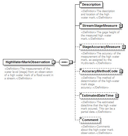 |
||
| namespace | http://water.usgs.gov/XML/NWIS/5.0 | ||
| properties |
|
||
| children | Description StreamStageMeasure StageAccuracyMeasure AccuracyMethodCode EstimatedDateTime Comment | ||
| used by |
|
||
| annotation |
|
||
| source | <xsd:element name="HighWaterMarkObservation"> <xsd:annotation> <xsd:documentation> <Definition>The measurement of the water level (stage) from an observation of a high water mark of a flood event in a stream.</Definition> </xsd:documentation> </xsd:annotation> <xsd:complexType> <xsd:sequence> <xsd:element name="Description" type="xsd:string"> <xsd:annotation> <xsd:documentation> <Definition>The description and location of the high water mark.</Definition> </xsd:documentation> </xsd:annotation> </xsd:element> <xsd:element name="StreamStageMeasure" type="IEEE754FloatValueType"> <xsd:annotation> <xsd:documentation> <Definition>The gage height of the measured high water mark.</Definition> </xsd:documentation> </xsd:annotation> </xsd:element> <xsd:element name="StageAccuracyMeasure" type="IEEE754FloatValueType" minOccurs="0"> <xsd:annotation> <xsd:documentation> <Definition>The accuracy of the measurement of the high water mark, as assigned by the Hydro-tech.</Definition> </xsd:documentation> </xsd:annotation> </xsd:element> <xsd:element name="AccuracyMethodCode" type="ReferenceListCodeType" minOccurs="0"> <xsd:annotation> <xsd:documentation> <Definition>The method of determination of the high-water mark stage accuracy.</Definition> </xsd:documentation> </xsd:annotation> </xsd:element> <xsd:element name="EstimatedDateTime" type="DateTimeWithDatumPartial" minOccurs="0"> <xsd:annotation> <xsd:documentation> <Definition>The estimated date/time that the high water mark occured. This can be a partial date.</Definition> </xsd:documentation> </xsd:annotation> </xsd:element> <xsd:element name="Comment" type="xsd:string" minOccurs="0"> <xsd:annotation> <xsd:documentation> <Definition>Comments about the high-water mark observation.</Definition> </xsd:documentation> </xsd:annotation> </xsd:element> </xsd:sequence> </xsd:complexType> </xsd:element> |
element HighWaterMarkObservation/Description
| diagram |  |
||||
| namespace | http://water.usgs.gov/XML/NWIS/5.0 | ||||
| type | xsd:string | ||||
| properties |
|
||||
| annotation |
|
||||
| source | <xsd:element name="Description" type="xsd:string"> <xsd:annotation> <xsd:documentation> <Definition>The description and location of the high water mark.</Definition> </xsd:documentation> </xsd:annotation> </xsd:element> |
element HighWaterMarkObservation/StreamStageMeasure
| diagram |  |
||||||||||||||||||||||||||||||||||||||||||||||
| namespace | http://water.usgs.gov/XML/NWIS/5.0 | ||||||||||||||||||||||||||||||||||||||||||||||
| type | IEEE754FloatValueType | ||||||||||||||||||||||||||||||||||||||||||||||
| properties |
|
||||||||||||||||||||||||||||||||||||||||||||||
| facets |
|
||||||||||||||||||||||||||||||||||||||||||||||
| attributes |
|
||||||||||||||||||||||||||||||||||||||||||||||
| annotation |
|
||||||||||||||||||||||||||||||||||||||||||||||
| source | <xsd:element name="StreamStageMeasure" type="IEEE754FloatValueType"> <xsd:annotation> <xsd:documentation> <Definition>The gage height of the measured high water mark.</Definition> </xsd:documentation> </xsd:annotation> </xsd:element> |
element HighWaterMarkObservation/StageAccuracyMeasure
| diagram | 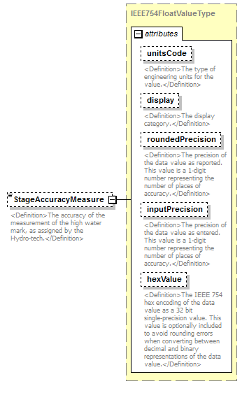 |
||||||||||||||||||||||||||||||||||||||||||||||
| namespace | http://water.usgs.gov/XML/NWIS/5.0 | ||||||||||||||||||||||||||||||||||||||||||||||
| type | IEEE754FloatValueType | ||||||||||||||||||||||||||||||||||||||||||||||
| properties |
|
||||||||||||||||||||||||||||||||||||||||||||||
| facets |
|
||||||||||||||||||||||||||||||||||||||||||||||
| attributes |
|
||||||||||||||||||||||||||||||||||||||||||||||
| annotation |
|
||||||||||||||||||||||||||||||||||||||||||||||
| source | <xsd:element name="StageAccuracyMeasure" type="IEEE754FloatValueType" minOccurs="0"> <xsd:annotation> <xsd:documentation> <Definition>The accuracy of the measurement of the high water mark, as assigned by the Hydro-tech.</Definition> </xsd:documentation> </xsd:annotation> </xsd:element> |
element HighWaterMarkObservation/AccuracyMethodCode
| diagram |  |
||||||||||||||||||||||
| namespace | http://water.usgs.gov/XML/NWIS/5.0 | ||||||||||||||||||||||
| type | ReferenceListCodeType | ||||||||||||||||||||||
| properties |
|
||||||||||||||||||||||
| attributes |
|
||||||||||||||||||||||
| annotation |
|
||||||||||||||||||||||
| source | <xsd:element name="AccuracyMethodCode" type="ReferenceListCodeType" minOccurs="0"> <xsd:annotation> <xsd:documentation> <Definition>The method of determination of the high-water mark stage accuracy.</Definition> </xsd:documentation> </xsd:annotation> </xsd:element> |
element HighWaterMarkObservation/EstimatedDateTime
| diagram |  |
||||||||||||||||||||||||||||||
| namespace | http://water.usgs.gov/XML/NWIS/5.0 | ||||||||||||||||||||||||||||||
| type | DateTimeWithDatumPartial | ||||||||||||||||||||||||||||||
| properties |
|
||||||||||||||||||||||||||||||
| attributes |
|
||||||||||||||||||||||||||||||
| annotation |
|
||||||||||||||||||||||||||||||
| source | <xsd:element name="EstimatedDateTime" type="DateTimeWithDatumPartial" minOccurs="0"> <xsd:annotation> <xsd:documentation> <Definition>The estimated date/time that the high water mark occured. This can be a partial date.</Definition> </xsd:documentation> </xsd:annotation> </xsd:element> |
element HighWaterMarkObservation/Comment
| diagram | 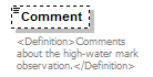 |
||||||||
| namespace | http://water.usgs.gov/XML/NWIS/5.0 | ||||||||
| type | xsd:string | ||||||||
| properties |
|
||||||||
| annotation |
|
||||||||
| source | <xsd:element name="Comment" type="xsd:string" minOccurs="0"> <xsd:annotation> <xsd:documentation> <Definition>Comments about the high-water mark observation.</Definition> </xsd:documentation> </xsd:annotation> </xsd:element> |
element StreamFlowControlInspection
| diagram | 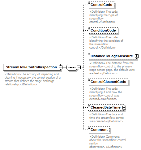 |
||
| namespace | http://water.usgs.gov/XML/NWIS/5.0 | ||
| properties |
|
||
| children | ControlCode ConditionCode DistanceToGageMeasure ControlCleanedCode CleanedDateTime Comment | ||
| used by |
|
||
| annotation |
|
||
| source | <xsd:element name="StreamFlowControlInspection"> <xsd:annotation> <xsd:documentation> <Definition>The activity of inspecting and cleaning if necessary the control section of a stream that defines the stage-discharge relationship.</Definition> </xsd:documentation> </xsd:annotation> <xsd:complexType> <xsd:sequence> <xsd:element name="ControlCode" type="xsd:string" minOccurs="0"> <xsd:annotation> <xsd:documentation> <Definition>The code identifying the type of streamflow control.</Definition> </xsd:documentation> </xsd:annotation> </xsd:element> <xsd:element name="ConditionCode" type="xsd:string" minOccurs="0"> <xsd:annotation> <xsd:documentation> <Definition>The code identifying the condition of the streamflow control.</Definition> </xsd:documentation> </xsd:annotation> </xsd:element> <xsd:element name="DistanceToGageMeasure" type="IEEE754FloatValueType" minOccurs="0"> <xsd:annotation> <xsd:documentation> <Definition>The distance from the streamflow control to the primary stage sensor gage, the default units are feet.</Definition> </xsd:documentation> </xsd:annotation> </xsd:element> <xsd:element name="ControlCleanedCode" type="xsd:string" minOccurs="0"> <xsd:annotation> <xsd:documentation> <Definition>The code identifying if and how the streamflow control was cleaned.</Definition> </xsd:documentation> </xsd:annotation> </xsd:element> <xsd:element name="CleanedDateTime" type="DateTimeWithDatum" minOccurs="0"> <xsd:annotation> <xsd:documentation> <Definition>The date and time the streamflow control was cleaned.</Definition> </xsd:documentation> </xsd:annotation> </xsd:element> <xsd:element name="Comment" type="xsd:string" minOccurs="0"> <xsd:annotation> <xsd:documentation> <Definition>Comments about the streamflow control section observation.</Definition> </xsd:documentation> </xsd:annotation> </xsd:element> </xsd:sequence> </xsd:complexType> </xsd:element> |
element StreamFlowControlInspection/ControlCode
| diagram | 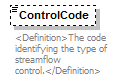 |
||||||||
| namespace | http://water.usgs.gov/XML/NWIS/5.0 | ||||||||
| type | xsd:string | ||||||||
| properties |
|
||||||||
| annotation |
|
||||||||
| source | <xsd:element name="ControlCode" type="xsd:string" minOccurs="0"> <xsd:annotation> <xsd:documentation> <Definition>The code identifying the type of streamflow control.</Definition> </xsd:documentation> </xsd:annotation> </xsd:element> |
element StreamFlowControlInspection/ConditionCode
| diagram | 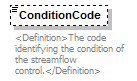 |
||||||||
| namespace | http://water.usgs.gov/XML/NWIS/5.0 | ||||||||
| type | xsd:string | ||||||||
| properties |
|
||||||||
| annotation |
|
||||||||
| source | <xsd:element name="ConditionCode" type="xsd:string" minOccurs="0"> <xsd:annotation> <xsd:documentation> <Definition>The code identifying the condition of the streamflow control.</Definition> </xsd:documentation> </xsd:annotation> </xsd:element> |
element StreamFlowControlInspection/DistanceToGageMeasure
| diagram |  |
||||||||||||||||||||||||||||||||||||||||||||||
| namespace | http://water.usgs.gov/XML/NWIS/5.0 | ||||||||||||||||||||||||||||||||||||||||||||||
| type | IEEE754FloatValueType | ||||||||||||||||||||||||||||||||||||||||||||||
| properties |
|
||||||||||||||||||||||||||||||||||||||||||||||
| facets |
|
||||||||||||||||||||||||||||||||||||||||||||||
| attributes |
|
||||||||||||||||||||||||||||||||||||||||||||||
| annotation |
|
||||||||||||||||||||||||||||||||||||||||||||||
| source | <xsd:element name="DistanceToGageMeasure" type="IEEE754FloatValueType" minOccurs="0"> <xsd:annotation> <xsd:documentation> <Definition>The distance from the streamflow control to the primary stage sensor gage, the default units are feet.</Definition> </xsd:documentation> </xsd:annotation> </xsd:element> |
element StreamFlowControlInspection/ControlCleanedCode
| diagram |  |
||||||||
| namespace | http://water.usgs.gov/XML/NWIS/5.0 | ||||||||
| type | xsd:string | ||||||||
| properties |
|
||||||||
| annotation |
|
||||||||
| source | <xsd:element name="ControlCleanedCode" type="xsd:string" minOccurs="0"> <xsd:annotation> <xsd:documentation> <Definition>The code identifying if and how the streamflow control was cleaned.</Definition> </xsd:documentation> </xsd:annotation> </xsd:element> |
element StreamFlowControlInspection/CleanedDateTime
| diagram |  |
||||||||||||||||||||||||||||||
| namespace | http://water.usgs.gov/XML/NWIS/5.0 | ||||||||||||||||||||||||||||||
| type | DateTimeWithDatum | ||||||||||||||||||||||||||||||
| properties |
|
||||||||||||||||||||||||||||||
| attributes |
|
||||||||||||||||||||||||||||||
| annotation |
|
||||||||||||||||||||||||||||||
| source | <xsd:element name="CleanedDateTime" type="DateTimeWithDatum" minOccurs="0"> <xsd:annotation> <xsd:documentation> <Definition>The date and time the streamflow control was cleaned.</Definition> </xsd:documentation> </xsd:annotation> </xsd:element> |
element StreamFlowControlInspection/Comment
| diagram |  |
||||||||
| namespace | http://water.usgs.gov/XML/NWIS/5.0 | ||||||||
| type | xsd:string | ||||||||
| properties |
|
||||||||
| annotation |
|
||||||||
| source | <xsd:element name="Comment" type="xsd:string" minOccurs="0"> <xsd:annotation> <xsd:documentation> <Definition>Comments about the streamflow control section observation.</Definition> </xsd:documentation> </xsd:annotation> </xsd:element> |
element StreamZeroFlowInspection
| diagram | 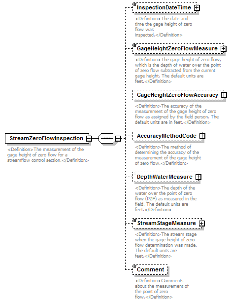 |
||
| namespace | http://water.usgs.gov/XML/NWIS/5.0 | ||
| properties |
|
||
| children | InspectionDateTime GageHeightZeroFlowMeasure GageHeightZeroFlowAccuracy AccuracyMethodCode DepthWaterMeasure StreamStageMeasure Comment | ||
| used by |
|
||
| annotation |
|
||
| source | <xsd:element name="StreamZeroFlowInspection"> <xsd:annotation> <xsd:documentation> <Definition>The measurement of the gage height of zero flow for a streamflow control section.</Definition> </xsd:documentation> </xsd:annotation> <xsd:complexType> <xsd:sequence> <xsd:element name="InspectionDateTime" type="DateTimeWithDatum" minOccurs="0"> <xsd:annotation> <xsd:documentation> <Definition>The date and time the gage height of zero flow was inspected.</Definition> </xsd:documentation> </xsd:annotation> </xsd:element> <xsd:element name="GageHeightZeroFlowMeasure" type="IEEE754FloatValueType" minOccurs="0"> <xsd:annotation> <xsd:documentation> <Definition>The gage height of zero flow, which is the depth of water over the point of zero flow subtracted from the current gage height. The default units are feet.</Definition> </xsd:documentation> </xsd:annotation> </xsd:element> <xsd:element name="GageHeightZeroFlowAccuracy" type="IEEE754FloatValueType" minOccurs="0"> <xsd:annotation> <xsd:documentation> <Definition>The accuracy of the measurement of the gage height of zero flow as assigned by the field person. The default units are in feet.</Definition> </xsd:documentation> </xsd:annotation> </xsd:element> <xsd:element name="AccuracyMethodCode" type="ReferenceListCodeType" minOccurs="0"> <xsd:annotation> <xsd:documentation> <Definition>The method of determining the accuracy of the measurement of the gage height of zero flow.</Definition> </xsd:documentation> </xsd:annotation> </xsd:element> <xsd:element name="DepthWaterMeasure" type="IEEE754FloatValueType" minOccurs="0"> <xsd:annotation> <xsd:documentation> <Definition>The depth of the water over the point of zero flow (PZF) as measured in the field. The default units are feet.</Definition> </xsd:documentation> </xsd:annotation> </xsd:element> <xsd:element name="StreamStageMeasure" type="IEEE754FloatValueType" minOccurs="0"> <xsd:annotation> <xsd:documentation> <Definition>The stream stage when the gage height of zero flow determination was made. The default units are feet.</Definition> </xsd:documentation> </xsd:annotation> </xsd:element> <xsd:element name="Comment" type="xsd:string" minOccurs="0"> <xsd:annotation> <xsd:documentation> <Definition>Comments about the measurement of the point of zero flow.</Definition> </xsd:documentation> </xsd:annotation> </xsd:element> </xsd:sequence> </xsd:complexType> </xsd:element> |
element StreamZeroFlowInspection/InspectionDateTime
| diagram |  |
||||||||||||||||||||||||||||||
| namespace | http://water.usgs.gov/XML/NWIS/5.0 | ||||||||||||||||||||||||||||||
| type | DateTimeWithDatum | ||||||||||||||||||||||||||||||
| properties |
|
||||||||||||||||||||||||||||||
| attributes |
|
||||||||||||||||||||||||||||||
| annotation |
|
||||||||||||||||||||||||||||||
| source | <xsd:element name="InspectionDateTime" type="DateTimeWithDatum" minOccurs="0"> <xsd:annotation> <xsd:documentation> <Definition>The date and time the gage height of zero flow was inspected.</Definition> </xsd:documentation> </xsd:annotation> </xsd:element> |
element StreamZeroFlowInspection/GageHeightZeroFlowMeasure
| diagram | 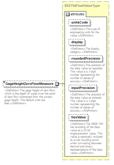 |
||||||||||||||||||||||||||||||||||||||||||||||
| namespace | http://water.usgs.gov/XML/NWIS/5.0 | ||||||||||||||||||||||||||||||||||||||||||||||
| type | IEEE754FloatValueType | ||||||||||||||||||||||||||||||||||||||||||||||
| properties |
|
||||||||||||||||||||||||||||||||||||||||||||||
| facets |
|
||||||||||||||||||||||||||||||||||||||||||||||
| attributes |
|
||||||||||||||||||||||||||||||||||||||||||||||
| annotation |
|
||||||||||||||||||||||||||||||||||||||||||||||
| source | <xsd:element name="GageHeightZeroFlowMeasure" type="IEEE754FloatValueType" minOccurs="0"> <xsd:annotation> <xsd:documentation> <Definition>The gage height of zero flow, which is the depth of water over the point of zero flow subtracted from the current gage height. The default units are feet.</Definition> </xsd:documentation> </xsd:annotation> </xsd:element> |
element StreamZeroFlowInspection/GageHeightZeroFlowAccuracy
| diagram | 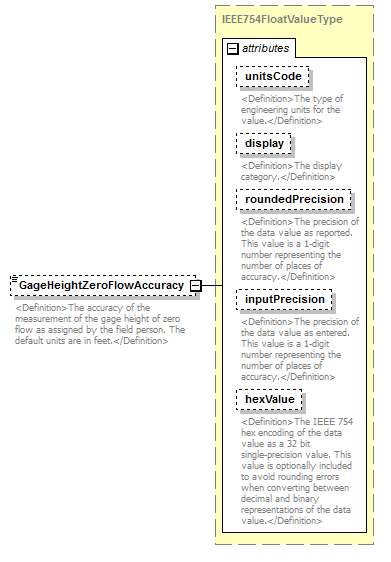 |
||||||||||||||||||||||||||||||||||||||||||||||
| namespace | http://water.usgs.gov/XML/NWIS/5.0 | ||||||||||||||||||||||||||||||||||||||||||||||
| type | IEEE754FloatValueType | ||||||||||||||||||||||||||||||||||||||||||||||
| properties |
|
||||||||||||||||||||||||||||||||||||||||||||||
| facets |
|
||||||||||||||||||||||||||||||||||||||||||||||
| attributes |
|
||||||||||||||||||||||||||||||||||||||||||||||
| annotation |
|
||||||||||||||||||||||||||||||||||||||||||||||
| source | <xsd:element name="GageHeightZeroFlowAccuracy" type="IEEE754FloatValueType" minOccurs="0"> <xsd:annotation> <xsd:documentation> <Definition>The accuracy of the measurement of the gage height of zero flow as assigned by the field person. The default units are in feet.</Definition> </xsd:documentation> </xsd:annotation> </xsd:element> |
element StreamZeroFlowInspection/AccuracyMethodCode
| diagram | 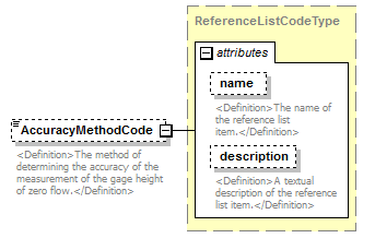 |
||||||||||||||||||||||
| namespace | http://water.usgs.gov/XML/NWIS/5.0 | ||||||||||||||||||||||
| type | ReferenceListCodeType | ||||||||||||||||||||||
| properties |
|
||||||||||||||||||||||
| attributes |
|
||||||||||||||||||||||
| annotation |
|
||||||||||||||||||||||
| source | <xsd:element name="AccuracyMethodCode" type="ReferenceListCodeType" minOccurs="0"> <xsd:annotation> <xsd:documentation> <Definition>The method of determining the accuracy of the measurement of the gage height of zero flow.</Definition> </xsd:documentation> </xsd:annotation> </xsd:element> |
element StreamZeroFlowInspection/DepthWaterMeasure
| diagram |  |
||||||||||||||||||||||||||||||||||||||||||||||
| namespace | http://water.usgs.gov/XML/NWIS/5.0 | ||||||||||||||||||||||||||||||||||||||||||||||
| type | IEEE754FloatValueType | ||||||||||||||||||||||||||||||||||||||||||||||
| properties |
|
||||||||||||||||||||||||||||||||||||||||||||||
| facets |
|
||||||||||||||||||||||||||||||||||||||||||||||
| attributes |
|
||||||||||||||||||||||||||||||||||||||||||||||
| annotation |
|
||||||||||||||||||||||||||||||||||||||||||||||
| source | <xsd:element name="DepthWaterMeasure" type="IEEE754FloatValueType" minOccurs="0"> <xsd:annotation> <xsd:documentation> <Definition>The depth of the water over the point of zero flow (PZF) as measured in the field. The default units are feet.</Definition> </xsd:documentation> </xsd:annotation> </xsd:element> |
element StreamZeroFlowInspection/StreamStageMeasure
| diagram | 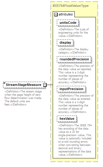 |
||||||||||||||||||||||||||||||||||||||||||||||
| namespace | http://water.usgs.gov/XML/NWIS/5.0 | ||||||||||||||||||||||||||||||||||||||||||||||
| type | IEEE754FloatValueType | ||||||||||||||||||||||||||||||||||||||||||||||
| properties |
|
||||||||||||||||||||||||||||||||||||||||||||||
| facets |
|
||||||||||||||||||||||||||||||||||||||||||||||
| attributes |
|
||||||||||||||||||||||||||||||||||||||||||||||
| annotation |
|
||||||||||||||||||||||||||||||||||||||||||||||
| source | <xsd:element name="StreamStageMeasure" type="IEEE754FloatValueType" minOccurs="0"> <xsd:annotation> <xsd:documentation> <Definition>The stream stage when the gage height of zero flow determination was made. The default units are feet.</Definition> </xsd:documentation> </xsd:annotation> </xsd:element> |
element StreamZeroFlowInspection/Comment
| diagram |  |
||||||||
| namespace | http://water.usgs.gov/XML/NWIS/5.0 | ||||||||
| type | xsd:string | ||||||||
| properties |
|
||||||||
| annotation |
|
||||||||
| source | <xsd:element name="Comment" type="xsd:string" minOccurs="0"> <xsd:annotation> <xsd:documentation> <Definition>Comments about the measurement of the point of zero flow.</Definition> </xsd:documentation> </xsd:annotation> </xsd:element> |
element StillingWellInspection
| diagram | 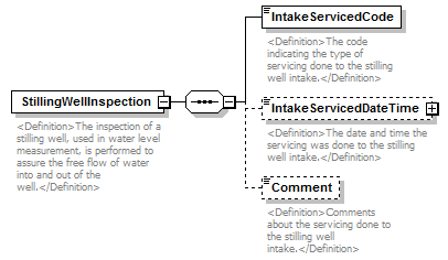 |
||
| namespace | http://water.usgs.gov/XML/NWIS/5.0 | ||
| properties |
|
||
| children | IntakeServicedCode IntakeServicedDateTime Comment | ||
| used by |
|
||
| annotation |
|
||
| source | <xsd:element name="StillingWellInspection"> <xsd:annotation> <xsd:documentation> <Definition>The inspection of a stilling well, used in water level measurement, is performed to assure the free flow of water into and out of the well.</Definition> </xsd:documentation> </xsd:annotation> <xsd:complexType> <xsd:sequence> <xsd:element name="IntakeServicedCode" type="xsd:string"> <xsd:annotation> <xsd:documentation> <Definition>The code indicating the type of servicing done to the stilling well intake.</Definition> </xsd:documentation> </xsd:annotation> </xsd:element> <xsd:element name="IntakeServicedDateTime" type="DateTimeWithDatum" minOccurs="0"> <xsd:annotation> <xsd:documentation> <Definition>The date and time the servicing was done to the stilling well intake.</Definition> </xsd:documentation> </xsd:annotation> </xsd:element> <xsd:element name="Comment" type="xsd:string" minOccurs="0"> <xsd:annotation> <xsd:documentation> <Definition>Comments about the servicing done to the stilling well intake.</Definition> </xsd:documentation> </xsd:annotation> </xsd:element> </xsd:sequence> </xsd:complexType> </xsd:element> |
element StillingWellInspection/IntakeServicedCode
| diagram | 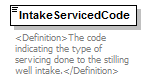 |
||||
| namespace | http://water.usgs.gov/XML/NWIS/5.0 | ||||
| type | xsd:string | ||||
| properties |
|
||||
| annotation |
|
||||
| source | <xsd:element name="IntakeServicedCode" type="xsd:string"> <xsd:annotation> <xsd:documentation> <Definition>The code indicating the type of servicing done to the stilling well intake.</Definition> </xsd:documentation> </xsd:annotation> </xsd:element> |
element StillingWellInspection/IntakeServicedDateTime
| diagram | 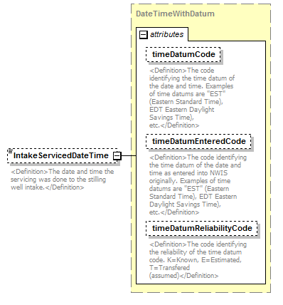 |
||||||||||||||||||||||||||||||
| namespace | http://water.usgs.gov/XML/NWIS/5.0 | ||||||||||||||||||||||||||||||
| type | DateTimeWithDatum | ||||||||||||||||||||||||||||||
| properties |
|
||||||||||||||||||||||||||||||
| attributes |
|
||||||||||||||||||||||||||||||
| annotation |
|
||||||||||||||||||||||||||||||
| source | <xsd:element name="IntakeServicedDateTime" type="DateTimeWithDatum" minOccurs="0"> <xsd:annotation> <xsd:documentation> <Definition>The date and time the servicing was done to the stilling well intake.</Definition> </xsd:documentation> </xsd:annotation> </xsd:element> |
element StillingWellInspection/Comment
| diagram | 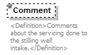 |
||||||||
| namespace | http://water.usgs.gov/XML/NWIS/5.0 | ||||||||
| type | xsd:string | ||||||||
| properties |
|
||||||||
| annotation |
|
||||||||
| source | <xsd:element name="Comment" type="xsd:string" minOccurs="0"> <xsd:annotation> <xsd:documentation> <Definition>Comments about the servicing done to the stilling well intake.</Definition> </xsd:documentation> </xsd:annotation> </xsd:element> |
element SensorInspection
| diagram | 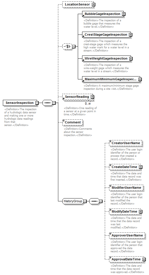 |
||
| namespace | http://water.usgs.gov/XML/NWIS/5.0 | ||
| properties |
|
||
| children | LocationSensor BubbleGageInspection CrestStageGageInspection WireWeightGageInspection MaximumMinimumGageInspection SensorReading Comment CreatorUserName CreateDateTime ModifierUserName ModifyDateTime ApproverUserName ApprovalDateTime | ||
| used by |
|
||
| annotation |
|
||
| source | <xsd:element name="SensorInspection"> <xsd:annotation> <xsd:documentation> <Definition>The inspection of a hydrologic data sensor and making one or more hydrologic data readings from that sensor.</Definition> </xsd:documentation> </xsd:annotation> <xsd:complexType> <xsd:sequence> <xsd:element name="LocationSensor" type="LocationSensor" minOccurs="0"/> <xsd:choice minOccurs="0"> <xsd:element ref="BubbleGageInspection"/> <xsd:element ref="CrestStageGageInspection"/> <xsd:element ref="WireWeightGageInspection"/> <xsd:element ref="MaximumMinimumGageInspection"/> </xsd:choice> <xsd:element ref="SensorReading" minOccurs="0" maxOccurs="unbounded"/> <xsd:element name="Comment" type="xsd:string" minOccurs="0"> <xsd:annotation> <xsd:documentation> <Definition>Comments about the sensor inspection.</Definition> </xsd:documentation> </xsd:annotation> </xsd:element> <xsd:group ref="HistoryGroup"/> </xsd:sequence> </xsd:complexType> </xsd:element> |
element SensorInspection/LocationSensor
| diagram |  |
||||||||
| namespace | http://water.usgs.gov/XML/NWIS/5.0 | ||||||||
| type | LocationSensor | ||||||||
| properties |
|
||||||||
| children | Location Sensor StartDateTime EndDateTime PrimarySensorIndicator PrimaryRecorderIndicator StillingWellIndicator GageMeasurementPoint CreatorUserName CreateDateTime ModifierUserName ModifyDateTime ApproverUserName ApprovalDateTime | ||||||||
| source | <xsd:element name="LocationSensor" type="LocationSensor" minOccurs="0"/> |
element SensorInspection/Comment
| diagram |  |
||||||||
| namespace | http://water.usgs.gov/XML/NWIS/5.0 | ||||||||
| type | xsd:string | ||||||||
| properties |
|
||||||||
| annotation |
|
||||||||
| source | <xsd:element name="Comment" type="xsd:string" minOccurs="0"> <xsd:annotation> <xsd:documentation> <Definition>Comments about the sensor inspection.</Definition> </xsd:documentation> </xsd:annotation> </xsd:element> |
element CrossSectionSurvey
| diagram | 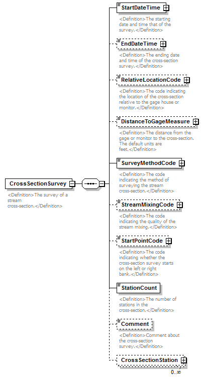 |
||
| namespace | http://water.usgs.gov/XML/NWIS/5.0 | ||
| properties |
|
||
| children | StartDateTime EndDateTime RelativeLocationCode DistanceToGageMeasure SurveyMethodCode StreamMixingCode StartPointCode StationCount Comment CrossSectionStation | ||
| used by |
|
||
| annotation |
|
||
| source | <xsd:element name="CrossSectionSurvey"> <xsd:annotation> <xsd:documentation> <Definition>The survey of a stream cross-section.</Definition> </xsd:documentation> </xsd:annotation> <xsd:complexType> <xsd:sequence> <xsd:element name="StartDateTime" type="DateTimeWithDatum"> <xsd:annotation> <xsd:documentation> <Definition>The starting date and time that of the survey.</Definition> </xsd:documentation> </xsd:annotation> </xsd:element> <xsd:element name="EndDateTime" type="DateTimeWithDatum" minOccurs="0"> <xsd:annotation> <xsd:documentation> <Definition>The ending date and time of the cross-section survey.</Definition> </xsd:documentation> </xsd:annotation> </xsd:element> <xsd:element name="RelativeLocationCode" type="ReferenceListCodeType" minOccurs="0"> <xsd:annotation> <xsd:documentation> <Definition>The code indicating the location of the cross-section relative to the gage house or monitor.</Definition> </xsd:documentation> </xsd:annotation> </xsd:element> <xsd:element name="DistanceToGageMeasure" type="IEEE754UncertaintyFloatValueType" minOccurs="0"> <xsd:annotation> <xsd:documentation> <Definition>The distance from the gage or monitor to the cross-section. The default units are feet.</Definition> </xsd:documentation> </xsd:annotation> </xsd:element> <xsd:element name="SurveyMethodCode" type="ReferenceListCodeType"> <xsd:annotation> <xsd:documentation> <Definition>The code indicating the method of surveying the stream cross-section.</Definition> </xsd:documentation> </xsd:annotation> </xsd:element> <xsd:element name="StreamMixingCode" type="ReferenceListCodeType" minOccurs="0"> <xsd:annotation> <xsd:documentation> <Definition>The code indicating the quality of the stream mixing.</Definition> </xsd:documentation> </xsd:annotation> </xsd:element> <xsd:element name="StartPointCode" type="ReferenceListCodeType" minOccurs="0"> <xsd:annotation> <xsd:documentation> <Definition>The code indicating whether the cross-section survey starts on the left or right bank.</Definition> </xsd:documentation> </xsd:annotation> </xsd:element> <xsd:element name="StationCount" type="xsd:integer"> <xsd:annotation> <xsd:documentation> <Definition>The number of stations in the cross-section.</Definition> </xsd:documentation> </xsd:annotation> </xsd:element> <xsd:element name="Comment" type="xsd:string" minOccurs="0"> <xsd:annotation> <xsd:documentation> <Definition>Comment about the cross-section survey.</Definition> </xsd:documentation> </xsd:annotation> </xsd:element> <xsd:element name="CrossSectionStation" type="CrossSectionStationType" minOccurs="0" maxOccurs="unbounded"/> </xsd:sequence> </xsd:complexType> </xsd:element> |
element CrossSectionSurvey/StartDateTime
| diagram | 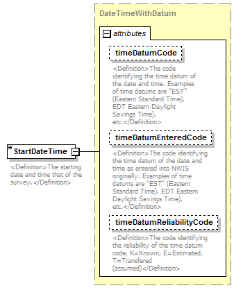 |
||||||||||||||||||||||||||||||
| namespace | http://water.usgs.gov/XML/NWIS/5.0 | ||||||||||||||||||||||||||||||
| type | DateTimeWithDatum | ||||||||||||||||||||||||||||||
| properties |
|
||||||||||||||||||||||||||||||
| attributes |
|
||||||||||||||||||||||||||||||
| annotation |
|
||||||||||||||||||||||||||||||
| source | <xsd:element name="StartDateTime" type="DateTimeWithDatum"> <xsd:annotation> <xsd:documentation> <Definition>The starting date and time that of the survey.</Definition> </xsd:documentation> </xsd:annotation> </xsd:element> |
element CrossSectionSurvey/EndDateTime
| diagram | 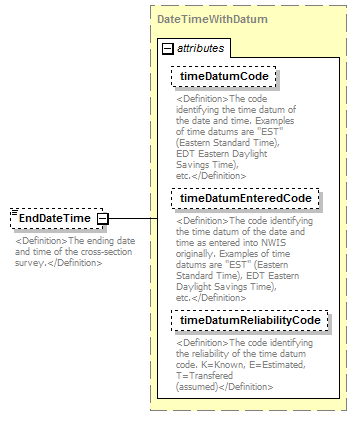 |
||||||||||||||||||||||||||||||
| namespace | http://water.usgs.gov/XML/NWIS/5.0 | ||||||||||||||||||||||||||||||
| type | DateTimeWithDatum | ||||||||||||||||||||||||||||||
| properties |
|
||||||||||||||||||||||||||||||
| attributes |
|
||||||||||||||||||||||||||||||
| annotation |
|
||||||||||||||||||||||||||||||
| source | <xsd:element name="EndDateTime" type="DateTimeWithDatum" minOccurs="0"> <xsd:annotation> <xsd:documentation> <Definition>The ending date and time of the cross-section survey.</Definition> </xsd:documentation> </xsd:annotation> </xsd:element> |
element CrossSectionSurvey/RelativeLocationCode
| diagram |  |
||||||||||||||||||||||
| namespace | http://water.usgs.gov/XML/NWIS/5.0 | ||||||||||||||||||||||
| type | ReferenceListCodeType | ||||||||||||||||||||||
| properties |
|
||||||||||||||||||||||
| attributes |
|
||||||||||||||||||||||
| annotation |
|
||||||||||||||||||||||
| source | <xsd:element name="RelativeLocationCode" type="ReferenceListCodeType" minOccurs="0"> <xsd:annotation> <xsd:documentation> <Definition>The code indicating the location of the cross-section relative to the gage house or monitor.</Definition> </xsd:documentation> </xsd:annotation> </xsd:element> |
element CrossSectionSurvey/DistanceToGageMeasure
| diagram | 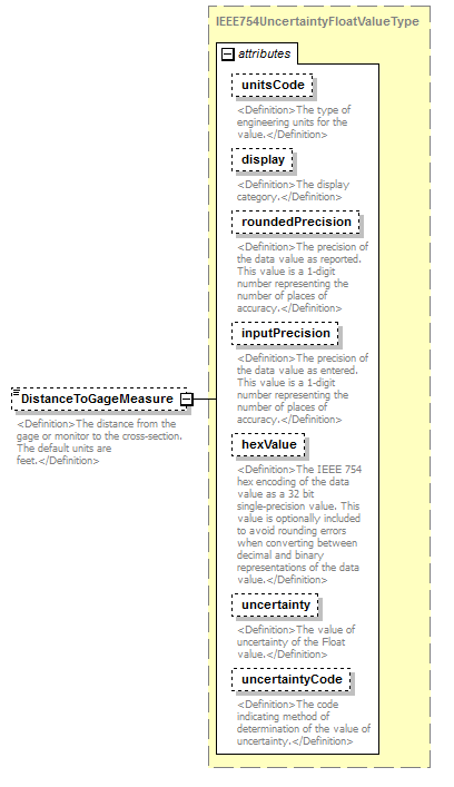 |
||||||||||||||||||||||||||||||||||||||||||||||||||||||||||||||
| namespace | http://water.usgs.gov/XML/NWIS/5.0 | ||||||||||||||||||||||||||||||||||||||||||||||||||||||||||||||
| type | IEEE754UncertaintyFloatValueType | ||||||||||||||||||||||||||||||||||||||||||||||||||||||||||||||
| properties |
|
||||||||||||||||||||||||||||||||||||||||||||||||||||||||||||||
| facets |
|
||||||||||||||||||||||||||||||||||||||||||||||||||||||||||||||
| attributes |
|
||||||||||||||||||||||||||||||||||||||||||||||||||||||||||||||
| annotation |
|
||||||||||||||||||||||||||||||||||||||||||||||||||||||||||||||
| source | <xsd:element name="DistanceToGageMeasure" type="IEEE754UncertaintyFloatValueType" minOccurs="0"> <xsd:annotation> <xsd:documentation> <Definition>The distance from the gage or monitor to the cross-section. The default units are feet.</Definition> </xsd:documentation> </xsd:annotation> </xsd:element> |
element CrossSectionSurvey/SurveyMethodCode
| diagram |  |
||||||||||||||||||||||
| namespace | http://water.usgs.gov/XML/NWIS/5.0 | ||||||||||||||||||||||
| type | ReferenceListCodeType | ||||||||||||||||||||||
| properties |
|
||||||||||||||||||||||
| attributes |
|
||||||||||||||||||||||
| annotation |
|
||||||||||||||||||||||
| source | <xsd:element name="SurveyMethodCode" type="ReferenceListCodeType"> <xsd:annotation> <xsd:documentation> <Definition>The code indicating the method of surveying the stream cross-section.</Definition> </xsd:documentation> </xsd:annotation> </xsd:element> |
element CrossSectionSurvey/StreamMixingCode
| diagram |  |
||||||||||||||||||||||
| namespace | http://water.usgs.gov/XML/NWIS/5.0 | ||||||||||||||||||||||
| type | ReferenceListCodeType | ||||||||||||||||||||||
| properties |
|
||||||||||||||||||||||
| attributes |
|
||||||||||||||||||||||
| annotation |
|
||||||||||||||||||||||
| source | <xsd:element name="StreamMixingCode" type="ReferenceListCodeType" minOccurs="0"> <xsd:annotation> <xsd:documentation> <Definition>The code indicating the quality of the stream mixing.</Definition> </xsd:documentation> </xsd:annotation> </xsd:element> |
element CrossSectionSurvey/StartPointCode
| diagram |  |
||||||||||||||||||||||
| namespace | http://water.usgs.gov/XML/NWIS/5.0 | ||||||||||||||||||||||
| type | ReferenceListCodeType | ||||||||||||||||||||||
| properties |
|
||||||||||||||||||||||
| attributes |
|
||||||||||||||||||||||
| annotation |
|
||||||||||||||||||||||
| source | <xsd:element name="StartPointCode" type="ReferenceListCodeType" minOccurs="0"> <xsd:annotation> <xsd:documentation> <Definition>The code indicating whether the cross-section survey starts on the left or right bank.</Definition> </xsd:documentation> </xsd:annotation> </xsd:element> |
element CrossSectionSurvey/StationCount
| diagram |  |
||||
| namespace | http://water.usgs.gov/XML/NWIS/5.0 | ||||
| type | xsd:integer | ||||
| properties |
|
||||
| annotation |
|
||||
| source | <xsd:element name="StationCount" type="xsd:integer"> <xsd:annotation> <xsd:documentation> <Definition>The number of stations in the cross-section.</Definition> </xsd:documentation> </xsd:annotation> </xsd:element> |
element CrossSectionSurvey/Comment
| diagram |  |
||||||||
| namespace | http://water.usgs.gov/XML/NWIS/5.0 | ||||||||
| type | xsd:string | ||||||||
| properties |
|
||||||||
| annotation |
|
||||||||
| source | <xsd:element name="Comment" type="xsd:string" minOccurs="0"> <xsd:annotation> <xsd:documentation> <Definition>Comment about the cross-section survey.</Definition> </xsd:documentation> </xsd:annotation> </xsd:element> |
element CrossSectionSurvey/CrossSectionStation
| diagram | 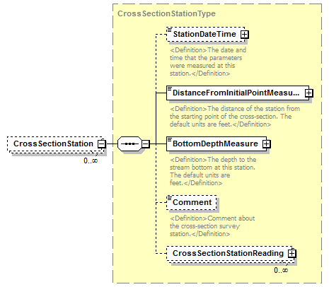 |
||||||||
| namespace | http://water.usgs.gov/XML/NWIS/5.0 | ||||||||
| type | CrossSectionStationType | ||||||||
| properties |
|
||||||||
| children | StationDateTime DistanceFromInitialPointMeasure BottomDepthMeasure Comment CrossSectionStationReading | ||||||||
| source | <xsd:element name="CrossSectionStation" type="CrossSectionStationType" minOccurs="0" maxOccurs="unbounded"/> |
complexType DateTimeWithDatumPartial
| diagram | 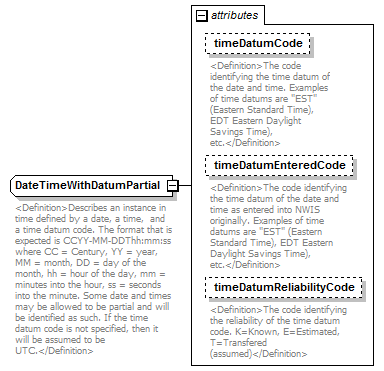 |
||||||||||||||||||||||||||||||
| namespace | http://water.usgs.gov/XML/NWIS/5.0 | ||||||||||||||||||||||||||||||
| type | extension of xsd:string | ||||||||||||||||||||||||||||||
| properties |
|
||||||||||||||||||||||||||||||
| used by |
|
||||||||||||||||||||||||||||||
| attributes |
|
||||||||||||||||||||||||||||||
| annotation |
|
||||||||||||||||||||||||||||||
| source | <xsd:complexType name="DateTimeWithDatumPartial"> <xsd:annotation> <xsd:documentation> <Definition>Describes an instance in time defined by a date, a time, and a time datum code. The format that is expected is CCYY-MM-DDThh:mm:ss where CC = Century, YY = year, MM = month, DD = day of the month, hh = hour of the day, mm = minutes into the hour, ss = seconds into the minute. Some date and times may be allowed to be partial and will be identified as such. If the time datum code is not specified, then it will be assumed to be UTC.</Definition> </xsd:documentation> </xsd:annotation> <xsd:simpleContent> <xsd:extension base="xsd:string"> <xsd:attribute name="timeDatumCode" type="xsd:NMTOKEN" use="optional"> <xsd:annotation> <xsd:documentation> <Definition>The code identifying the time datum of the date and time. Examples of time datums are "EST" (Eastern Standard Time), EDT Eastern Daylight Savings Time), etc.</Definition> </xsd:documentation> </xsd:annotation> </xsd:attribute> <xsd:attribute name="timeDatumEnteredCode" type="xsd:NMTOKEN" use="optional"> <xsd:annotation> <xsd:documentation> <Definition>The code identifying the time datum of the date and time as entered into NWIS originally. Examples of time datums are "EST" (Eastern Standard Time), EDT Eastern Daylight Savings Time), etc.</Definition> </xsd:documentation> </xsd:annotation> </xsd:attribute> <xsd:attribute name="timeDatumReliabilityCode" use="optional"> <xsd:annotation> <xsd:documentation> <Definition>The code identifying the reliability of the time datum code. K=Known, E=Estimated, T=Transfered (assumed)</Definition> </xsd:documentation> </xsd:annotation> <xsd:simpleType> <xsd:restriction base="xsd:token"> <xsd:enumeration value="K"/> <xsd:enumeration value="E"/> <xsd:enumeration value="T"/> </xsd:restriction> </xsd:simpleType> </xsd:attribute> </xsd:extension> </xsd:simpleContent> </xsd:complexType> |
attribute DateTimeWithDatumPartial/@timeDatumCode
| type | xsd:NMTOKEN | ||||
| properties |
|
||||
| annotation |
|
||||
| source | <xsd:attribute name="timeDatumCode" type="xsd:NMTOKEN" use="optional"> <xsd:annotation> <xsd:documentation> <Definition>The code identifying the time datum of the date and time. Examples of time datums are "EST" (Eastern Standard Time), EDT Eastern Daylight Savings Time), etc.</Definition> </xsd:documentation> </xsd:annotation> </xsd:attribute> |
attribute DateTimeWithDatumPartial/@timeDatumEnteredCode
| type | xsd:NMTOKEN | ||||
| properties |
|
||||
| annotation |
|
||||
| source | <xsd:attribute name="timeDatumEnteredCode" type="xsd:NMTOKEN" use="optional"> <xsd:annotation> <xsd:documentation> <Definition>The code identifying the time datum of the date and time as entered into NWIS originally. Examples of time datums are "EST" (Eastern Standard Time), EDT Eastern Daylight Savings Time), etc.</Definition> </xsd:documentation> </xsd:annotation> </xsd:attribute> |
attribute DateTimeWithDatumPartial/@timeDatumReliabilityCode
| type | restriction of xsd:token | ||||||||||||
| properties |
|
||||||||||||
| facets |
|
||||||||||||
| annotation |
|
||||||||||||
| source | <xsd:attribute name="timeDatumReliabilityCode" use="optional"> <xsd:annotation> <xsd:documentation> <Definition>The code identifying the reliability of the time datum code. K=Known, E=Estimated, T=Transfered (assumed)</Definition> </xsd:documentation> </xsd:annotation> <xsd:simpleType> <xsd:restriction base="xsd:token"> <xsd:enumeration value="K"/> <xsd:enumeration value="E"/> <xsd:enumeration value="T"/> </xsd:restriction> </xsd:simpleType> </xsd:attribute> |
element DischargeMeasurementDescription
| diagram | 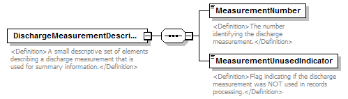 |
||
| namespace | http://water.usgs.gov/XML/NWIS/5.0 | ||
| properties |
|
||
| children | MeasurementNumber MeasurementUnusedIndicator | ||
| used by |
|
||
| annotation |
|
||
| source | <xsd:element name="DischargeMeasurementDescription"> <xsd:annotation> <xsd:documentation> <Definition>A small descriptive set of elements describing a discharge measurement that is used for summary information.</Definition> </xsd:documentation> </xsd:annotation> <xsd:complexType> <xsd:sequence> <xsd:element name="MeasurementNumber" type="xsd:NMTOKEN"> <xsd:annotation> <xsd:documentation> <Definition>The number identifying the discharge measurement.</Definition> </xsd:documentation> </xsd:annotation> </xsd:element> <xsd:element name="MeasurementUnusedIndicator" type="xsd:boolean"> <xsd:annotation> <xsd:documentation> <Definition>Flag indicating if the discharge measurement was NOT used in records processing.</Definition> </xsd:documentation> </xsd:annotation> </xsd:element> </xsd:sequence> </xsd:complexType> </xsd:element> |
element DischargeMeasurementDescription/MeasurementNumber
| diagram |  |
||||
| namespace | http://water.usgs.gov/XML/NWIS/5.0 | ||||
| type | xsd:NMTOKEN | ||||
| properties |
|
||||
| annotation |
|
||||
| source | <xsd:element name="MeasurementNumber" type="xsd:NMTOKEN"> <xsd:annotation> <xsd:documentation> <Definition>The number identifying the discharge measurement.</Definition> </xsd:documentation> </xsd:annotation> </xsd:element> |
element DischargeMeasurementDescription/MeasurementUnusedIndicator
| diagram | 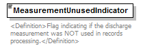 |
||||
| namespace | http://water.usgs.gov/XML/NWIS/5.0 | ||||
| type | xsd:boolean | ||||
| properties |
|
||||
| annotation |
|
||||
| source | <xsd:element name="MeasurementUnusedIndicator" type="xsd:boolean"> <xsd:annotation> <xsd:documentation> <Definition>Flag indicating if the discharge measurement was NOT used in records processing.</Definition> </xsd:documentation> </xsd:annotation> </xsd:element> |
complexType AddressType
| diagram | 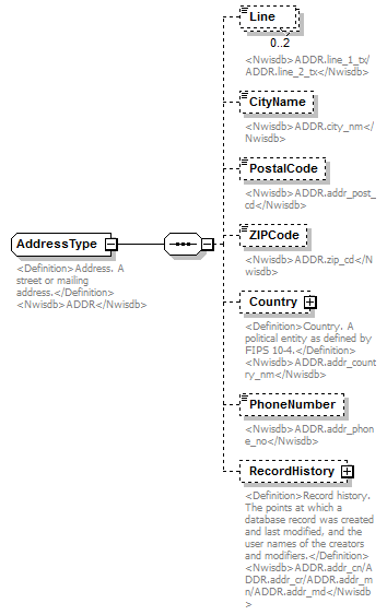 |
||
| namespace | http://water.usgs.gov/XML/NWIS/5.0 | ||
| properties |
|
||
| children | Line CityName PostalCode ZIPCode Country PhoneNumber RecordHistory | ||
| used by |
|
||
| annotation |
|
||
| source | <xsd:complexType name="AddressType" abstract="false"> <xsd:annotation> <xsd:documentation> <Definition>Address. A street or mailing address.</Definition> <Nwisdb>ADDR</Nwisdb> </xsd:documentation> </xsd:annotation> <xsd:sequence> <xsd:element name="Line" type="xsd:token" minOccurs="0" maxOccurs="2"> <xsd:annotation> <xsd:documentation> <Nwisdb>ADDR.line_1_tx/ADDR.line_2_tx</Nwisdb> </xsd:documentation> </xsd:annotation> </xsd:element> <xsd:element name="CityName" type="xsd:token" minOccurs="0" maxOccurs="1"> <xsd:annotation> <xsd:documentation> <Nwisdb>ADDR.city_nm</Nwisdb> </xsd:documentation> </xsd:annotation> </xsd:element> <xsd:element name="PostalCode" type="xsd:token" minOccurs="0" maxOccurs="1"> <xsd:annotation> <xsd:documentation> <Nwisdb>ADDR.addr_post_cd</Nwisdb> </xsd:documentation> </xsd:annotation> </xsd:element> <xsd:element name="ZIPCode" type="xsd:token" minOccurs="0" maxOccurs="1"> <xsd:annotation> <xsd:documentation> <Nwisdb>ADDR.zip_cd</Nwisdb> </xsd:documentation> </xsd:annotation> </xsd:element> <xsd:element name="Country" type="CountryType" minOccurs="0" maxOccurs="1"> <xsd:annotation> <xsd:documentation> <Definition>Country. A political entity as defined by FIPS 10-4.</Definition> <Nwisdb>ADDR.addr_country_nm</Nwisdb> </xsd:documentation> </xsd:annotation> </xsd:element> <xsd:element name="PhoneNumber" type="xsd:token" minOccurs="0" maxOccurs="1"> <xsd:annotation> <xsd:documentation> <Nwisdb>ADDR.addr_phone_no</Nwisdb> </xsd:documentation> </xsd:annotation> </xsd:element> <xsd:element name="RecordHistory" type="RecordHistoryType" minOccurs="0" maxOccurs="1"> <xsd:annotation> <xsd:documentation> <Definition>Record history. The points at which a database record was created and last modified, and the user names of the creators and modifiers.</Definition> <Nwisdb>ADDR.addr_cn/ADDR.addr_cr/ADDR.addr_mn/ADDR.addr_md</Nwisdb> </xsd:documentation> </xsd:annotation> </xsd:element> </xsd:sequence> </xsd:complexType> |
element AddressType/Line
| diagram |  |
||||||||
| namespace | http://water.usgs.gov/XML/NWIS/5.0 | ||||||||
| type | xsd:token | ||||||||
| properties |
|
||||||||
| annotation |
|
||||||||
| source | <xsd:element name="Line" type="xsd:token" minOccurs="0" maxOccurs="2"> <xsd:annotation> <xsd:documentation> <Nwisdb>ADDR.line_1_tx/ADDR.line_2_tx</Nwisdb> </xsd:documentation> </xsd:annotation> </xsd:element> |
element AddressType/CityName
| diagram | 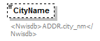 |
||||||||
| namespace | http://water.usgs.gov/XML/NWIS/5.0 | ||||||||
| type | xsd:token | ||||||||
| properties |
|
||||||||
| annotation |
|
||||||||
| source | <xsd:element name="CityName" type="xsd:token" minOccurs="0" maxOccurs="1"> <xsd:annotation> <xsd:documentation> <Nwisdb>ADDR.city_nm</Nwisdb> </xsd:documentation> </xsd:annotation> </xsd:element> |
element AddressType/PostalCode
| diagram | 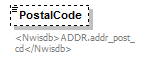 |
||||||||
| namespace | http://water.usgs.gov/XML/NWIS/5.0 | ||||||||
| type | xsd:token | ||||||||
| properties |
|
||||||||
| annotation |
|
||||||||
| source | <xsd:element name="PostalCode" type="xsd:token" minOccurs="0" maxOccurs="1"> <xsd:annotation> <xsd:documentation> <Nwisdb>ADDR.addr_post_cd</Nwisdb> </xsd:documentation> </xsd:annotation> </xsd:element> |
element AddressType/ZIPCode
| diagram | 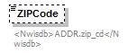 |
||||||||
| namespace | http://water.usgs.gov/XML/NWIS/5.0 | ||||||||
| type | xsd:token | ||||||||
| properties |
|
||||||||
| annotation |
|
||||||||
| source | <xsd:element name="ZIPCode" type="xsd:token" minOccurs="0" maxOccurs="1"> <xsd:annotation> <xsd:documentation> <Nwisdb>ADDR.zip_cd</Nwisdb> </xsd:documentation> </xsd:annotation> </xsd:element> |
element AddressType/Country
| diagram | 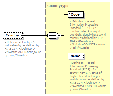 |
||||||||
| namespace | http://water.usgs.gov/XML/NWIS/5.0 | ||||||||
| type | CountryType | ||||||||
| properties |
|
||||||||
| children | Code Name | ||||||||
| annotation |
|
||||||||
| source | <xsd:element name="Country" type="CountryType" minOccurs="0" maxOccurs="1"> <xsd:annotation> <xsd:documentation> <Definition>Country. A political entity as defined by FIPS 10-4.</Definition> <Nwisdb>ADDR.addr_country_nm</Nwisdb> </xsd:documentation> </xsd:annotation> </xsd:element> |
element AddressType/PhoneNumber
| diagram | 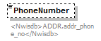 |
||||||||
| namespace | http://water.usgs.gov/XML/NWIS/5.0 | ||||||||
| type | xsd:token | ||||||||
| properties |
|
||||||||
| annotation |
|
||||||||
| source | <xsd:element name="PhoneNumber" type="xsd:token" minOccurs="0" maxOccurs="1"> <xsd:annotation> <xsd:documentation> <Nwisdb>ADDR.addr_phone_no</Nwisdb> </xsd:documentation> </xsd:annotation> </xsd:element> |
element AddressType/RecordHistory
| diagram | 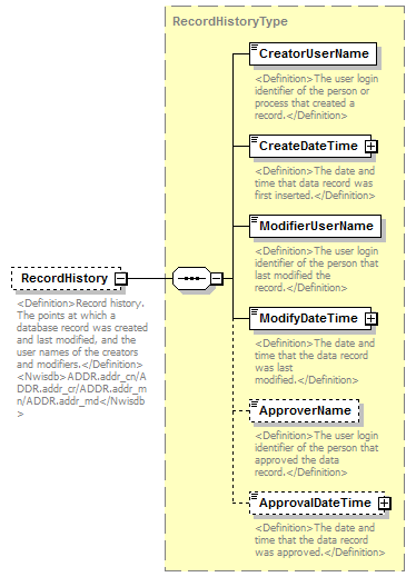 |
||||||||
| namespace | http://water.usgs.gov/XML/NWIS/5.0 | ||||||||
| type | RecordHistoryType | ||||||||
| properties |
|
||||||||
| children | CreatorUserName CreateDateTime ModifierUserName ModifyDateTime ApproverName ApprovalDateTime | ||||||||
| annotation |
|
||||||||
| source | <xsd:element name="RecordHistory" type="RecordHistoryType" minOccurs="0" maxOccurs="1"> <xsd:annotation> <xsd:documentation> <Definition>Record history. The points at which a database record was created and last modified, and the user names of the creators and modifiers.</Definition> <Nwisdb>ADDR.addr_cn/ADDR.addr_cr/ADDR.addr_mn/ADDR.addr_md</Nwisdb> </xsd:documentation> </xsd:annotation> </xsd:element> |
element TimeDuration
| diagram |  |
||||||
| namespace | http://water.usgs.gov/XML/NWIS/5.0 | ||||||
| type | TimeDurationType | ||||||
| properties |
|
||||||
| facets |
|
||||||
| source | <xsd:element name="TimeDuration" type="TimeDurationType"/> |
simpleType TimeDurationType
| namespace | http://water.usgs.gov/XML/NWIS/5.0 | ||||||
| type | restriction of xsd:string | ||||||
| properties |
|
||||||
| used by |
|
||||||
| facets |
|
||||||
| source | <xsd:simpleType name="TimeDurationType"> <xsd:annotation> <xsd:documentation/> </xsd:annotation> <xsd:restriction base="xsd:string"> <xsd:pattern value="[0-9][0-9]:[0-9][0-9]"/> </xsd:restriction> </xsd:simpleType> |
element DriftCheckDissolvedOxygenReading
| diagram | 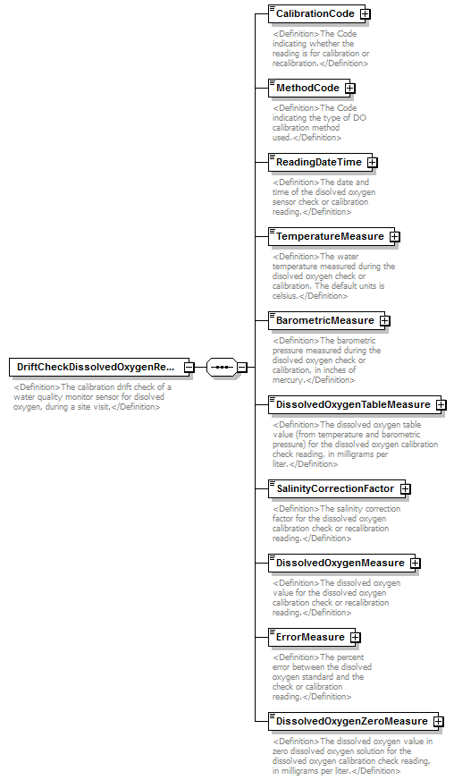 |
||
| namespace | http://water.usgs.gov/XML/NWIS/5.0 | ||
| properties |
|
||
| children | CalibrationCode MethodCode ReadingDateTime TemperatureMeasure BarometricMeasure DissolvedOxygenTableMeasure SalinityCorrectionFactor DissolvedOxygenMeasure ErrorMeasure DissolvedOxygenZeroMeasure | ||
| used by |
|
||
| annotation |
|
||
| source | <xsd:element name="DriftCheckDissolvedOxygenReading"> <xsd:annotation> <xsd:documentation> <Definition>The calibration drift check of a water quality monitor sensor for disolved oxygen, during a site visit.</Definition> </xsd:documentation> </xsd:annotation> <xsd:complexType> <xsd:sequence> <xsd:element name="CalibrationCode" type="ReferenceListCodeType"> <xsd:annotation> <xsd:documentation> <Definition>The Code indicating whether the reading is for calibration or recalibration.</Definition> </xsd:documentation> </xsd:annotation> </xsd:element> <xsd:element name="MethodCode" type="ReferenceListCodeType"> <xsd:annotation> <xsd:documentation> <Definition>The Code indicating the type of DO calibration method used.</Definition> </xsd:documentation> </xsd:annotation> </xsd:element> <xsd:element name="ReadingDateTime" type="DateTimeWithDatum"> <xsd:annotation> <xsd:documentation> <Definition>The date and time of the disolved oxygen sensor check or calibration reading.</Definition> </xsd:documentation> </xsd:annotation> </xsd:element> <xsd:element name="TemperatureMeasure" type="IEEE754UncertaintyFloatValueType"> <xsd:annotation> <xsd:documentation> <Definition>The water temperature measured during the disolved oxygen check or calibration. The default units is celsius.</Definition> </xsd:documentation> </xsd:annotation> </xsd:element> <xsd:element name="BarometricMeasure" type="IEEE754UncertaintyFloatValueType"> <xsd:annotation> <xsd:documentation> <Definition>The barometric pressure measured during the disolved oxygen check or calibration, in inches of mercury.</Definition> </xsd:documentation> </xsd:annotation> </xsd:element> <xsd:element name="DissolvedOxygenTableMeasure" type="IEEE754FloatValueType"> <xsd:annotation> <xsd:documentation> <Definition>The dissolved oxygen table value (from temperature and barometric pressure) for the dissolved oxygen calibration check reading, in milligrams per liter.</Definition> </xsd:documentation> </xsd:annotation> </xsd:element> <xsd:element name="SalinityCorrectionFactor" type="IEEE754FloatValueType"> <xsd:annotation> <xsd:documentation> <Definition>The salinity correction factor for the dissolved oxygen calibration check or recalibration reading.</Definition> </xsd:documentation> </xsd:annotation> </xsd:element> <xsd:element name="DissolvedOxygenMeasure" type="IEEE754UncertaintyFloatValueType"> <xsd:annotation> <xsd:documentation> <Definition>The dissolved oxygen value for the dissolved oxygen calibration check or recalibration reading.</Definition> </xsd:documentation> </xsd:annotation> </xsd:element> <xsd:element name="ErrorMeasure" type="IEEE754FloatValueType"> <xsd:annotation> <xsd:documentation> <Definition>The percent error between the disolved oxygen standard and the check or calibration reading.</Definition> </xsd:documentation> </xsd:annotation> </xsd:element> <xsd:element name="DissolvedOxygenZeroMeasure" type="IEEE754UncertaintyFloatValueType"> <xsd:annotation> <xsd:documentation> <Definition>The dissolved oxygen value in zero dissolved oxygen solution for the dissolved oxygen calibration check reading, in milligrams per liter.</Definition> </xsd:documentation> </xsd:annotation> </xsd:element> </xsd:sequence> </xsd:complexType> </xsd:element> |
element DriftCheckDissolvedOxygenReading/CalibrationCode
| diagram | 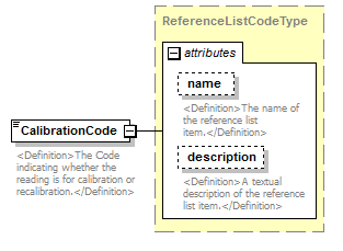 |
||||||||||||||||||||||
| namespace | http://water.usgs.gov/XML/NWIS/5.0 | ||||||||||||||||||||||
| type | ReferenceListCodeType | ||||||||||||||||||||||
| properties |
|
||||||||||||||||||||||
| attributes |
|
||||||||||||||||||||||
| annotation |
|
||||||||||||||||||||||
| source | <xsd:element name="CalibrationCode" type="ReferenceListCodeType"> <xsd:annotation> <xsd:documentation> <Definition>The Code indicating whether the reading is for calibration or recalibration.</Definition> </xsd:documentation> </xsd:annotation> </xsd:element> |
element DriftCheckDissolvedOxygenReading/MethodCode
| diagram |  |
||||||||||||||||||||||
| namespace | http://water.usgs.gov/XML/NWIS/5.0 | ||||||||||||||||||||||
| type | ReferenceListCodeType | ||||||||||||||||||||||
| properties |
|
||||||||||||||||||||||
| attributes |
|
||||||||||||||||||||||
| annotation |
|
||||||||||||||||||||||
| source | <xsd:element name="MethodCode" type="ReferenceListCodeType"> <xsd:annotation> <xsd:documentation> <Definition>The Code indicating the type of DO calibration method used.</Definition> </xsd:documentation> </xsd:annotation> </xsd:element> |
element DriftCheckDissolvedOxygenReading/ReadingDateTime
| diagram | 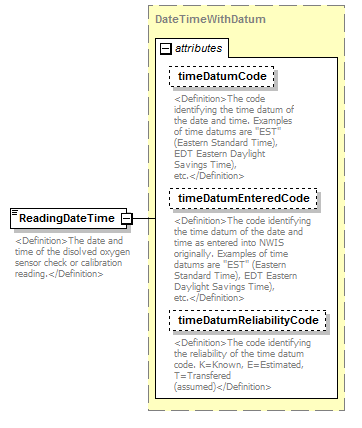 |
||||||||||||||||||||||||||||||
| namespace | http://water.usgs.gov/XML/NWIS/5.0 | ||||||||||||||||||||||||||||||
| type | DateTimeWithDatum | ||||||||||||||||||||||||||||||
| properties |
|
||||||||||||||||||||||||||||||
| attributes |
|
||||||||||||||||||||||||||||||
| annotation |
|
||||||||||||||||||||||||||||||
| source | <xsd:element name="ReadingDateTime" type="DateTimeWithDatum"> <xsd:annotation> <xsd:documentation> <Definition>The date and time of the disolved oxygen sensor check or calibration reading.</Definition> </xsd:documentation> </xsd:annotation> </xsd:element> |
element DriftCheckDissolvedOxygenReading/TemperatureMeasure
| diagram |  |
||||||||||||||||||||||||||||||||||||||||||||||||||||||||||||||
| namespace | http://water.usgs.gov/XML/NWIS/5.0 | ||||||||||||||||||||||||||||||||||||||||||||||||||||||||||||||
| type | IEEE754UncertaintyFloatValueType | ||||||||||||||||||||||||||||||||||||||||||||||||||||||||||||||
| properties |
|
||||||||||||||||||||||||||||||||||||||||||||||||||||||||||||||
| facets |
|
||||||||||||||||||||||||||||||||||||||||||||||||||||||||||||||
| attributes |
|
||||||||||||||||||||||||||||||||||||||||||||||||||||||||||||||
| annotation |
|
||||||||||||||||||||||||||||||||||||||||||||||||||||||||||||||
| source | <xsd:element name="TemperatureMeasure" type="IEEE754UncertaintyFloatValueType"> <xsd:annotation> <xsd:documentation> <Definition>The water temperature measured during the disolved oxygen check or calibration. The default units is celsius.</Definition> </xsd:documentation> </xsd:annotation> </xsd:element> |
element DriftCheckDissolvedOxygenReading/BarometricMeasure
| diagram |  |
||||||||||||||||||||||||||||||||||||||||||||||||||||||||||||||
| namespace | http://water.usgs.gov/XML/NWIS/5.0 | ||||||||||||||||||||||||||||||||||||||||||||||||||||||||||||||
| type | IEEE754UncertaintyFloatValueType | ||||||||||||||||||||||||||||||||||||||||||||||||||||||||||||||
| properties |
|
||||||||||||||||||||||||||||||||||||||||||||||||||||||||||||||
| facets |
|
||||||||||||||||||||||||||||||||||||||||||||||||||||||||||||||
| attributes |
|
||||||||||||||||||||||||||||||||||||||||||||||||||||||||||||||
| annotation |
|
||||||||||||||||||||||||||||||||||||||||||||||||||||||||||||||
| source | <xsd:element name="BarometricMeasure" type="IEEE754UncertaintyFloatValueType"> <xsd:annotation> <xsd:documentation> <Definition>The barometric pressure measured during the disolved oxygen check or calibration, in inches of mercury.</Definition> </xsd:documentation> </xsd:annotation> </xsd:element> |
element DriftCheckDissolvedOxygenReading/DissolvedOxygenTableMeasure
| diagram | 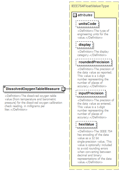 |
||||||||||||||||||||||||||||||||||||||||||||||
| namespace | http://water.usgs.gov/XML/NWIS/5.0 | ||||||||||||||||||||||||||||||||||||||||||||||
| type | IEEE754FloatValueType | ||||||||||||||||||||||||||||||||||||||||||||||
| properties |
|
||||||||||||||||||||||||||||||||||||||||||||||
| facets |
|
||||||||||||||||||||||||||||||||||||||||||||||
| attributes |
|
||||||||||||||||||||||||||||||||||||||||||||||
| annotation |
|
||||||||||||||||||||||||||||||||||||||||||||||
| source | <xsd:element name="DissolvedOxygenTableMeasure" type="IEEE754FloatValueType"> <xsd:annotation> <xsd:documentation> <Definition>The dissolved oxygen table value (from temperature and barometric pressure) for the dissolved oxygen calibration check reading, in milligrams per liter.</Definition> </xsd:documentation> </xsd:annotation> </xsd:element> |
element DriftCheckDissolvedOxygenReading/SalinityCorrectionFactor
| diagram |  |
||||||||||||||||||||||||||||||||||||||||||||||
| namespace | http://water.usgs.gov/XML/NWIS/5.0 | ||||||||||||||||||||||||||||||||||||||||||||||
| type | IEEE754FloatValueType | ||||||||||||||||||||||||||||||||||||||||||||||
| properties |
|
||||||||||||||||||||||||||||||||||||||||||||||
| facets |
|
||||||||||||||||||||||||||||||||||||||||||||||
| attributes |
|
||||||||||||||||||||||||||||||||||||||||||||||
| annotation |
|
||||||||||||||||||||||||||||||||||||||||||||||
| source | <xsd:element name="SalinityCorrectionFactor" type="IEEE754FloatValueType"> <xsd:annotation> <xsd:documentation> <Definition>The salinity correction factor for the dissolved oxygen calibration check or recalibration reading.</Definition> </xsd:documentation> </xsd:annotation> </xsd:element> |
element DriftCheckDissolvedOxygenReading/DissolvedOxygenMeasure
| diagram | 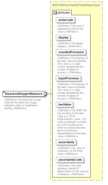 |
||||||||||||||||||||||||||||||||||||||||||||||||||||||||||||||
| namespace | http://water.usgs.gov/XML/NWIS/5.0 | ||||||||||||||||||||||||||||||||||||||||||||||||||||||||||||||
| type | IEEE754UncertaintyFloatValueType | ||||||||||||||||||||||||||||||||||||||||||||||||||||||||||||||
| properties |
|
||||||||||||||||||||||||||||||||||||||||||||||||||||||||||||||
| facets |
|
||||||||||||||||||||||||||||||||||||||||||||||||||||||||||||||
| attributes |
|
||||||||||||||||||||||||||||||||||||||||||||||||||||||||||||||
| annotation |
|
||||||||||||||||||||||||||||||||||||||||||||||||||||||||||||||
| source | <xsd:element name="DissolvedOxygenMeasure" type="IEEE754UncertaintyFloatValueType"> <xsd:annotation> <xsd:documentation> <Definition>The dissolved oxygen value for the dissolved oxygen calibration check or recalibration reading.</Definition> </xsd:documentation> </xsd:annotation> </xsd:element> |
element DriftCheckDissolvedOxygenReading/ErrorMeasure
| diagram |  |
||||||||||||||||||||||||||||||||||||||||||||||
| namespace | http://water.usgs.gov/XML/NWIS/5.0 | ||||||||||||||||||||||||||||||||||||||||||||||
| type | IEEE754FloatValueType | ||||||||||||||||||||||||||||||||||||||||||||||
| properties |
|
||||||||||||||||||||||||||||||||||||||||||||||
| facets |
|
||||||||||||||||||||||||||||||||||||||||||||||
| attributes |
|
||||||||||||||||||||||||||||||||||||||||||||||
| annotation |
|
||||||||||||||||||||||||||||||||||||||||||||||
| source | <xsd:element name="ErrorMeasure" type="IEEE754FloatValueType"> <xsd:annotation> <xsd:documentation> <Definition>The percent error between the disolved oxygen standard and the check or calibration reading.</Definition> </xsd:documentation> </xsd:annotation> </xsd:element> |
element DriftCheckDissolvedOxygenReading/DissolvedOxygenZeroMeasure
| diagram |  |
||||||||||||||||||||||||||||||||||||||||||||||||||||||||||||||
| namespace | http://water.usgs.gov/XML/NWIS/5.0 | ||||||||||||||||||||||||||||||||||||||||||||||||||||||||||||||
| type | IEEE754UncertaintyFloatValueType | ||||||||||||||||||||||||||||||||||||||||||||||||||||||||||||||
| properties |
|
||||||||||||||||||||||||||||||||||||||||||||||||||||||||||||||
| facets |
|
||||||||||||||||||||||||||||||||||||||||||||||||||||||||||||||
| attributes |
|
||||||||||||||||||||||||||||||||||||||||||||||||||||||||||||||
| annotation |
|
||||||||||||||||||||||||||||||||||||||||||||||||||||||||||||||
| source | <xsd:element name="DissolvedOxygenZeroMeasure" type="IEEE754UncertaintyFloatValueType"> <xsd:annotation> <xsd:documentation> <Definition>The dissolved oxygen value in zero dissolved oxygen solution for the dissolved oxygen calibration check reading, in milligrams per liter.</Definition> </xsd:documentation> </xsd:annotation> </xsd:element> |
element DriftCheckConductanceReading
| diagram | 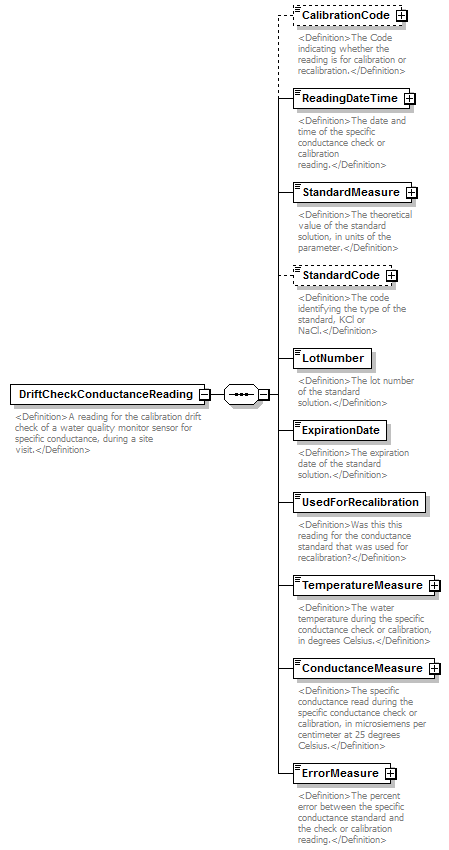 |
||
| namespace | http://water.usgs.gov/XML/NWIS/5.0 | ||
| properties |
|
||
| children | CalibrationCode ReadingDateTime StandardMeasure StandardCode LotNumber ExpirationDate UsedForRecalibration TemperatureMeasure ConductanceMeasure ErrorMeasure | ||
| used by |
|
||
| annotation |
|
||
| source | <xsd:element name="DriftCheckConductanceReading"> <xsd:annotation> <xsd:documentation> <Definition>A reading for the calibration drift check of a water quality monitor sensor for specific conductance, during a site visit.</Definition> </xsd:documentation> </xsd:annotation> <xsd:complexType> <xsd:sequence> <xsd:element name="CalibrationCode" type="ReferenceListCodeType" minOccurs="0"> <xsd:annotation> <xsd:documentation> <Definition>The Code indicating whether the reading is for calibration or recalibration.</Definition> </xsd:documentation> </xsd:annotation> </xsd:element> <xsd:element name="ReadingDateTime" type="DateTimeWithDatum"> <xsd:annotation> <xsd:documentation> <Definition>The date and time of the specific conductance check or calibration reading.</Definition> </xsd:documentation> </xsd:annotation> </xsd:element> <xsd:element name="StandardMeasure" type="IEEE754UncertaintyFloatValueType"> <xsd:annotation> <xsd:documentation> <Definition>The theoretical value of the standard solution, in units of the parameter.</Definition> </xsd:documentation> </xsd:annotation> </xsd:element> <xsd:element name="StandardCode" type="ReferenceListCodeType" minOccurs="0"> <xsd:annotation> <xsd:documentation> <Definition>The code identifying the type of the standard, KCl or NaCl.</Definition> </xsd:documentation> </xsd:annotation> </xsd:element> <xsd:element name="LotNumber" type="xsd:string"> <xsd:annotation> <xsd:documentation> <Definition>The lot number of the standard solution.</Definition> </xsd:documentation> </xsd:annotation> </xsd:element> <xsd:element name="ExpirationDate" type="xsd:date"> <xsd:annotation> <xsd:documentation> <Definition>The expiration date of the standard solution.</Definition> </xsd:documentation> </xsd:annotation> </xsd:element> <xsd:element name="UsedForRecalibration" type="xsd:boolean"> <xsd:annotation> <xsd:documentation> <Definition>Was this this reading for the conductance standard that was used for recalibration?</Definition> </xsd:documentation> </xsd:annotation> </xsd:element> <xsd:element name="TemperatureMeasure" type="IEEE754FloatValueType"> <xsd:annotation> <xsd:documentation> <Definition>The water temperature during the specific conductance check or calibration, in degrees Celsius.</Definition> </xsd:documentation> </xsd:annotation> </xsd:element> <xsd:element name="ConductanceMeasure" type="IEEE754FloatValueType"> <xsd:annotation> <xsd:documentation> <Definition>The specific conductance read during the specific conductance check or calibration, in microsiemens per centimeter at 25 degrees Celsius.</Definition> </xsd:documentation> </xsd:annotation> </xsd:element> <xsd:element name="ErrorMeasure" type="IEEE754FloatValueType"> <xsd:annotation> <xsd:documentation> <Definition>The percent error between the specific conductance standard and the check or calibration reading.</Definition> </xsd:documentation> </xsd:annotation> </xsd:element> </xsd:sequence> </xsd:complexType> </xsd:element> |
element DriftCheckConductanceReading/CalibrationCode
| diagram |  |
||||||||||||||||||||||
| namespace | http://water.usgs.gov/XML/NWIS/5.0 | ||||||||||||||||||||||
| type | ReferenceListCodeType | ||||||||||||||||||||||
| properties |
|
||||||||||||||||||||||
| attributes |
|
||||||||||||||||||||||
| annotation |
|
||||||||||||||||||||||
| source | <xsd:element name="CalibrationCode" type="ReferenceListCodeType" minOccurs="0"> <xsd:annotation> <xsd:documentation> <Definition>The Code indicating whether the reading is for calibration or recalibration.</Definition> </xsd:documentation> </xsd:annotation> </xsd:element> |
element DriftCheckConductanceReading/ReadingDateTime
| diagram | 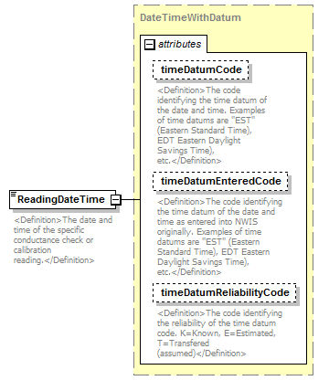 |
||||||||||||||||||||||||||||||
| namespace | http://water.usgs.gov/XML/NWIS/5.0 | ||||||||||||||||||||||||||||||
| type | DateTimeWithDatum | ||||||||||||||||||||||||||||||
| properties |
|
||||||||||||||||||||||||||||||
| attributes |
|
||||||||||||||||||||||||||||||
| annotation |
|
||||||||||||||||||||||||||||||
| source | <xsd:element name="ReadingDateTime" type="DateTimeWithDatum"> <xsd:annotation> <xsd:documentation> <Definition>The date and time of the specific conductance check or calibration reading.</Definition> </xsd:documentation> </xsd:annotation> </xsd:element> |
element DriftCheckConductanceReading/StandardMeasure
| diagram |  |
||||||||||||||||||||||||||||||||||||||||||||||||||||||||||||||
| namespace | http://water.usgs.gov/XML/NWIS/5.0 | ||||||||||||||||||||||||||||||||||||||||||||||||||||||||||||||
| type | IEEE754UncertaintyFloatValueType | ||||||||||||||||||||||||||||||||||||||||||||||||||||||||||||||
| properties |
|
||||||||||||||||||||||||||||||||||||||||||||||||||||||||||||||
| facets |
|
||||||||||||||||||||||||||||||||||||||||||||||||||||||||||||||
| attributes |
|
||||||||||||||||||||||||||||||||||||||||||||||||||||||||||||||
| annotation |
|
||||||||||||||||||||||||||||||||||||||||||||||||||||||||||||||
| source | <xsd:element name="StandardMeasure" type="IEEE754UncertaintyFloatValueType"> <xsd:annotation> <xsd:documentation> <Definition>The theoretical value of the standard solution, in units of the parameter.</Definition> </xsd:documentation> </xsd:annotation> </xsd:element> |
element DriftCheckConductanceReading/StandardCode
| diagram |  |
||||||||||||||||||||||
| namespace | http://water.usgs.gov/XML/NWIS/5.0 | ||||||||||||||||||||||
| type | ReferenceListCodeType | ||||||||||||||||||||||
| properties |
|
||||||||||||||||||||||
| attributes |
|
||||||||||||||||||||||
| annotation |
|
||||||||||||||||||||||
| source | <xsd:element name="StandardCode" type="ReferenceListCodeType" minOccurs="0"> <xsd:annotation> <xsd:documentation> <Definition>The code identifying the type of the standard, KCl or NaCl.</Definition> </xsd:documentation> </xsd:annotation> </xsd:element> |
element DriftCheckConductanceReading/LotNumber
| diagram | 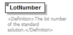 |
||||
| namespace | http://water.usgs.gov/XML/NWIS/5.0 | ||||
| type | xsd:string | ||||
| properties |
|
||||
| annotation |
|
||||
| source | <xsd:element name="LotNumber" type="xsd:string"> <xsd:annotation> <xsd:documentation> <Definition>The lot number of the standard solution.</Definition> </xsd:documentation> </xsd:annotation> </xsd:element> |
element DriftCheckConductanceReading/ExpirationDate
| diagram |  |
||||
| namespace | http://water.usgs.gov/XML/NWIS/5.0 | ||||
| type | xsd:date | ||||
| properties |
|
||||
| annotation |
|
||||
| source | <xsd:element name="ExpirationDate" type="xsd:date"> <xsd:annotation> <xsd:documentation> <Definition>The expiration date of the standard solution.</Definition> </xsd:documentation> </xsd:annotation> </xsd:element> |
element DriftCheckConductanceReading/UsedForRecalibration
| diagram | 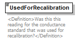 |
||||
| namespace | http://water.usgs.gov/XML/NWIS/5.0 | ||||
| type | xsd:boolean | ||||
| properties |
|
||||
| annotation |
|
||||
| source | <xsd:element name="UsedForRecalibration" type="xsd:boolean"> <xsd:annotation> <xsd:documentation> <Definition>Was this this reading for the conductance standard that was used for recalibration?</Definition> </xsd:documentation> </xsd:annotation> </xsd:element> |
element DriftCheckConductanceReading/TemperatureMeasure
| diagram | 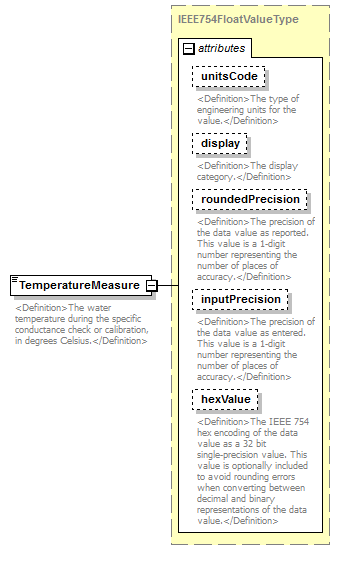 |
||||||||||||||||||||||||||||||||||||||||||||||
| namespace | http://water.usgs.gov/XML/NWIS/5.0 | ||||||||||||||||||||||||||||||||||||||||||||||
| type | IEEE754FloatValueType | ||||||||||||||||||||||||||||||||||||||||||||||
| properties |
|
||||||||||||||||||||||||||||||||||||||||||||||
| facets |
|
||||||||||||||||||||||||||||||||||||||||||||||
| attributes |
|
||||||||||||||||||||||||||||||||||||||||||||||
| annotation |
|
||||||||||||||||||||||||||||||||||||||||||||||
| source | <xsd:element name="TemperatureMeasure" type="IEEE754FloatValueType"> <xsd:annotation> <xsd:documentation> <Definition>The water temperature during the specific conductance check or calibration, in degrees Celsius.</Definition> </xsd:documentation> </xsd:annotation> </xsd:element> |
element DriftCheckConductanceReading/ConductanceMeasure
| diagram |  |
||||||||||||||||||||||||||||||||||||||||||||||
| namespace | http://water.usgs.gov/XML/NWIS/5.0 | ||||||||||||||||||||||||||||||||||||||||||||||
| type | IEEE754FloatValueType | ||||||||||||||||||||||||||||||||||||||||||||||
| properties |
|
||||||||||||||||||||||||||||||||||||||||||||||
| facets |
|
||||||||||||||||||||||||||||||||||||||||||||||
| attributes |
|
||||||||||||||||||||||||||||||||||||||||||||||
| annotation |
|
||||||||||||||||||||||||||||||||||||||||||||||
| source | <xsd:element name="ConductanceMeasure" type="IEEE754FloatValueType"> <xsd:annotation> <xsd:documentation> <Definition>The specific conductance read during the specific conductance check or calibration, in microsiemens per centimeter at 25 degrees Celsius.</Definition> </xsd:documentation> </xsd:annotation> </xsd:element> |
element DriftCheckConductanceReading/ErrorMeasure
| diagram |  |
||||||||||||||||||||||||||||||||||||||||||||||
| namespace | http://water.usgs.gov/XML/NWIS/5.0 | ||||||||||||||||||||||||||||||||||||||||||||||
| type | IEEE754FloatValueType | ||||||||||||||||||||||||||||||||||||||||||||||
| properties |
|
||||||||||||||||||||||||||||||||||||||||||||||
| facets |
|
||||||||||||||||||||||||||||||||||||||||||||||
| attributes |
|
||||||||||||||||||||||||||||||||||||||||||||||
| annotation |
|
||||||||||||||||||||||||||||||||||||||||||||||
| source | <xsd:element name="ErrorMeasure" type="IEEE754FloatValueType"> <xsd:annotation> <xsd:documentation> <Definition>The percent error between the specific conductance standard and the check or calibration reading.</Definition> </xsd:documentation> </xsd:annotation> </xsd:element> |
element DriftCheckPhReading
| diagram | 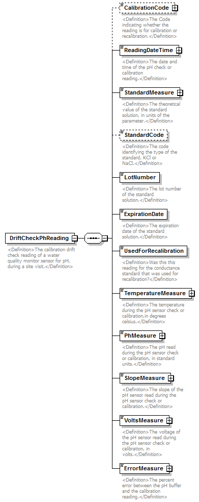 |
||
| namespace | http://water.usgs.gov/XML/NWIS/5.0 | ||
| properties |
|
||
| children | CalibrationCode ReadingDateTime StandardMeasure StandardCode LotNumber ExpirationDate UsedForRecalibration TemperatureMeasure PhMeasure SlopeMeasure VoltsMeasure ErrorMeasure | ||
| used by |
|
||
| annotation |
|
||
| source | <xsd:element name="DriftCheckPhReading"> <xsd:annotation> <xsd:documentation> <Definition>The calibration drift check reading of a water quality monitor sensor for pH, during a site visit.</Definition> </xsd:documentation> </xsd:annotation> <xsd:complexType> <xsd:sequence> <xsd:element name="CalibrationCode" type="ReferenceListCodeType" minOccurs="0"> <xsd:annotation> <xsd:documentation> <Definition>The Code indicating whether the reading is for calibration or recalibration.</Definition> </xsd:documentation> </xsd:annotation> </xsd:element> <xsd:element name="ReadingDateTime" type="DateTimeWithDatum"> <xsd:annotation> <xsd:documentation> <Definition>The date and time of the pH check or calibration reading.</Definition> </xsd:documentation> </xsd:annotation> </xsd:element> <xsd:element name="StandardMeasure" type="IEEE754UncertaintyFloatValueType"> <xsd:annotation> <xsd:documentation> <Definition>The theoretical value of the standard solution, in units of the parameter.</Definition> </xsd:documentation> </xsd:annotation> </xsd:element> <xsd:element name="StandardCode" type="xsd:token" minOccurs="0"> <xsd:annotation> <xsd:documentation> <Definition>The code identifying the type of the standard, KCl or NaCl.</Definition> </xsd:documentation> </xsd:annotation> </xsd:element> <xsd:element name="LotNumber" type="xsd:string"> <xsd:annotation> <xsd:documentation> <Definition>The lot number of the standard solution.</Definition> </xsd:documentation> </xsd:annotation> </xsd:element> <xsd:element name="ExpirationDate" type="xsd:date"> <xsd:annotation> <xsd:documentation> <Definition>The expiration date of the standard solution.</Definition> </xsd:documentation> </xsd:annotation> </xsd:element> <xsd:element name="UsedForRecalibration" type="xsd:boolean"> <xsd:annotation> <xsd:documentation> <Definition>Was this this reading for the conductance standard that was used for recalibration?</Definition> </xsd:documentation> </xsd:annotation> </xsd:element> <xsd:element name="TemperatureMeasure" type="IEEE754UncertaintyFloatValueType"> <xsd:annotation> <xsd:documentation> <Definition>The temperature during the pH sensor check or calibration,in degrees celsius.</Definition> </xsd:documentation> </xsd:annotation> </xsd:element> <xsd:element name="PhMeasure" type="IEEE754UncertaintyFloatValueType"> <xsd:annotation> <xsd:documentation> <Definition>The pH read during the pH sensor check or calibration, in standard units.</Definition> </xsd:documentation> </xsd:annotation> </xsd:element> <xsd:element name="SlopeMeasure" type="IEEE754FloatValueType"> <xsd:annotation> <xsd:documentation> <Definition>The slope of the pH sensor read during the pH sensor check or calibration.</Definition> </xsd:documentation> </xsd:annotation> </xsd:element> <xsd:element name="VoltsMeasure" type="IEEE754FloatValueType"> <xsd:annotation> <xsd:documentation> <Definition>The voltage of the pH sensor read during the pH sensor check or calibration, in volts.</Definition> </xsd:documentation> </xsd:annotation> </xsd:element> <xsd:element name="ErrorMeasure" type="IEEE754FloatValueType"> <xsd:annotation> <xsd:documentation> <Definition>The percent error between the pH buffer and the calibration reading.</Definition> </xsd:documentation> </xsd:annotation> </xsd:element> </xsd:sequence> </xsd:complexType> </xsd:element> |
element DriftCheckPhReading/CalibrationCode
| diagram |  |
||||||||||||||||||||||
| namespace | http://water.usgs.gov/XML/NWIS/5.0 | ||||||||||||||||||||||
| type | ReferenceListCodeType | ||||||||||||||||||||||
| properties |
|
||||||||||||||||||||||
| attributes |
|
||||||||||||||||||||||
| annotation |
|
||||||||||||||||||||||
| source | <xsd:element name="CalibrationCode" type="ReferenceListCodeType" minOccurs="0"> <xsd:annotation> <xsd:documentation> <Definition>The Code indicating whether the reading is for calibration or recalibration.</Definition> </xsd:documentation> </xsd:annotation> </xsd:element> |
element DriftCheckPhReading/ReadingDateTime
| diagram | 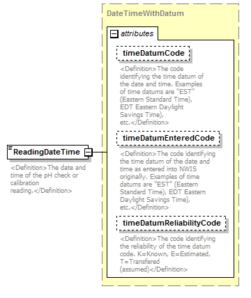 |
||||||||||||||||||||||||||||||
| namespace | http://water.usgs.gov/XML/NWIS/5.0 | ||||||||||||||||||||||||||||||
| type | DateTimeWithDatum | ||||||||||||||||||||||||||||||
| properties |
|
||||||||||||||||||||||||||||||
| attributes |
|
||||||||||||||||||||||||||||||
| annotation |
|
||||||||||||||||||||||||||||||
| source | <xsd:element name="ReadingDateTime" type="DateTimeWithDatum"> <xsd:annotation> <xsd:documentation> <Definition>The date and time of the pH check or calibration reading.</Definition> </xsd:documentation> </xsd:annotation> </xsd:element> |
element DriftCheckPhReading/StandardMeasure
| diagram | 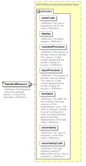 |
||||||||||||||||||||||||||||||||||||||||||||||||||||||||||||||
| namespace | http://water.usgs.gov/XML/NWIS/5.0 | ||||||||||||||||||||||||||||||||||||||||||||||||||||||||||||||
| type | IEEE754UncertaintyFloatValueType | ||||||||||||||||||||||||||||||||||||||||||||||||||||||||||||||
| properties |
|
||||||||||||||||||||||||||||||||||||||||||||||||||||||||||||||
| facets |
|
||||||||||||||||||||||||||||||||||||||||||||||||||||||||||||||
| attributes |
|
||||||||||||||||||||||||||||||||||||||||||||||||||||||||||||||
| annotation |
|
||||||||||||||||||||||||||||||||||||||||||||||||||||||||||||||
| source | <xsd:element name="StandardMeasure" type="IEEE754UncertaintyFloatValueType"> <xsd:annotation> <xsd:documentation> <Definition>The theoretical value of the standard solution, in units of the parameter.</Definition> </xsd:documentation> </xsd:annotation> </xsd:element> |
element DriftCheckPhReading/StandardCode
| diagram | 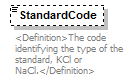 |
||||||||
| namespace | http://water.usgs.gov/XML/NWIS/5.0 | ||||||||
| type | xsd:token | ||||||||
| properties |
|
||||||||
| annotation |
|
||||||||
| source | <xsd:element name="StandardCode" type="xsd:token" minOccurs="0"> <xsd:annotation> <xsd:documentation> <Definition>The code identifying the type of the standard, KCl or NaCl.</Definition> </xsd:documentation> </xsd:annotation> </xsd:element> |
element DriftCheckPhReading/LotNumber
| diagram |  |
||||
| namespace | http://water.usgs.gov/XML/NWIS/5.0 | ||||
| type | xsd:string | ||||
| properties |
|
||||
| annotation |
|
||||
| source | <xsd:element name="LotNumber" type="xsd:string"> <xsd:annotation> <xsd:documentation> <Definition>The lot number of the standard solution.</Definition> </xsd:documentation> </xsd:annotation> </xsd:element> |
element DriftCheckPhReading/ExpirationDate
| diagram |  |
||||
| namespace | http://water.usgs.gov/XML/NWIS/5.0 | ||||
| type | xsd:date | ||||
| properties |
|
||||
| annotation |
|
||||
| source | <xsd:element name="ExpirationDate" type="xsd:date"> <xsd:annotation> <xsd:documentation> <Definition>The expiration date of the standard solution.</Definition> </xsd:documentation> </xsd:annotation> </xsd:element> |
element DriftCheckPhReading/UsedForRecalibration
| diagram |  |
||||
| namespace | http://water.usgs.gov/XML/NWIS/5.0 | ||||
| type | xsd:boolean | ||||
| properties |
|
||||
| annotation |
|
||||
| source | <xsd:element name="UsedForRecalibration" type="xsd:boolean"> <xsd:annotation> <xsd:documentation> <Definition>Was this this reading for the conductance standard that was used for recalibration?</Definition> </xsd:documentation> </xsd:annotation> </xsd:element> |
element DriftCheckPhReading/TemperatureMeasure
| diagram |  |
||||||||||||||||||||||||||||||||||||||||||||||||||||||||||||||
| namespace | http://water.usgs.gov/XML/NWIS/5.0 | ||||||||||||||||||||||||||||||||||||||||||||||||||||||||||||||
| type | IEEE754UncertaintyFloatValueType | ||||||||||||||||||||||||||||||||||||||||||||||||||||||||||||||
| properties |
|
||||||||||||||||||||||||||||||||||||||||||||||||||||||||||||||
| facets |
|
||||||||||||||||||||||||||||||||||||||||||||||||||||||||||||||
| attributes |
|
||||||||||||||||||||||||||||||||||||||||||||||||||||||||||||||
| annotation |
|
||||||||||||||||||||||||||||||||||||||||||||||||||||||||||||||
| source | <xsd:element name="TemperatureMeasure" type="IEEE754UncertaintyFloatValueType"> <xsd:annotation> <xsd:documentation> <Definition>The temperature during the pH sensor check or calibration,in degrees celsius.</Definition> </xsd:documentation> </xsd:annotation> </xsd:element> |
element DriftCheckPhReading/PhMeasure
| diagram | 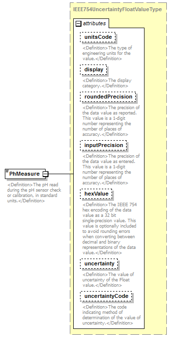 |
||||||||||||||||||||||||||||||||||||||||||||||||||||||||||||||
| namespace | http://water.usgs.gov/XML/NWIS/5.0 | ||||||||||||||||||||||||||||||||||||||||||||||||||||||||||||||
| type | IEEE754UncertaintyFloatValueType | ||||||||||||||||||||||||||||||||||||||||||||||||||||||||||||||
| properties |
|
||||||||||||||||||||||||||||||||||||||||||||||||||||||||||||||
| facets |
|
||||||||||||||||||||||||||||||||||||||||||||||||||||||||||||||
| attributes |
|
||||||||||||||||||||||||||||||||||||||||||||||||||||||||||||||
| annotation |
|
||||||||||||||||||||||||||||||||||||||||||||||||||||||||||||||
| source | <xsd:element name="PhMeasure" type="IEEE754UncertaintyFloatValueType"> <xsd:annotation> <xsd:documentation> <Definition>The pH read during the pH sensor check or calibration, in standard units.</Definition> </xsd:documentation> </xsd:annotation> </xsd:element> |
element DriftCheckPhReading/SlopeMeasure
| diagram |  |
||||||||||||||||||||||||||||||||||||||||||||||
| namespace | http://water.usgs.gov/XML/NWIS/5.0 | ||||||||||||||||||||||||||||||||||||||||||||||
| type | IEEE754FloatValueType | ||||||||||||||||||||||||||||||||||||||||||||||
| properties |
|
||||||||||||||||||||||||||||||||||||||||||||||
| facets |
|
||||||||||||||||||||||||||||||||||||||||||||||
| attributes |
|
||||||||||||||||||||||||||||||||||||||||||||||
| annotation |
|
||||||||||||||||||||||||||||||||||||||||||||||
| source | <xsd:element name="SlopeMeasure" type="IEEE754FloatValueType"> <xsd:annotation> <xsd:documentation> <Definition>The slope of the pH sensor read during the pH sensor check or calibration.</Definition> </xsd:documentation> </xsd:annotation> </xsd:element> |
element DriftCheckPhReading/VoltsMeasure
| diagram |  |
||||||||||||||||||||||||||||||||||||||||||||||
| namespace | http://water.usgs.gov/XML/NWIS/5.0 | ||||||||||||||||||||||||||||||||||||||||||||||
| type | IEEE754FloatValueType | ||||||||||||||||||||||||||||||||||||||||||||||
| properties |
|
||||||||||||||||||||||||||||||||||||||||||||||
| facets |
|
||||||||||||||||||||||||||||||||||||||||||||||
| attributes |
|
||||||||||||||||||||||||||||||||||||||||||||||
| annotation |
|
||||||||||||||||||||||||||||||||||||||||||||||
| source | <xsd:element name="VoltsMeasure" type="IEEE754FloatValueType"> <xsd:annotation> <xsd:documentation> <Definition>The voltage of the pH sensor read during the pH sensor check or calibration, in volts.</Definition> </xsd:documentation> </xsd:annotation> </xsd:element> |
element DriftCheckPhReading/ErrorMeasure
| diagram |  |
||||||||||||||||||||||||||||||||||||||||||||||
| namespace | http://water.usgs.gov/XML/NWIS/5.0 | ||||||||||||||||||||||||||||||||||||||||||||||
| type | IEEE754FloatValueType | ||||||||||||||||||||||||||||||||||||||||||||||
| properties |
|
||||||||||||||||||||||||||||||||||||||||||||||
| facets |
|
||||||||||||||||||||||||||||||||||||||||||||||
| attributes |
|
||||||||||||||||||||||||||||||||||||||||||||||
| annotation |
|
||||||||||||||||||||||||||||||||||||||||||||||
| source | <xsd:element name="ErrorMeasure" type="IEEE754FloatValueType"> <xsd:annotation> <xsd:documentation> <Definition>The percent error between the pH buffer and the calibration reading.</Definition> </xsd:documentation> </xsd:annotation> </xsd:element> |
element DriftCheckTurbidityReading
| diagram | 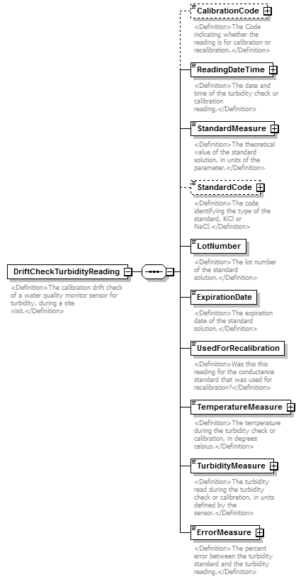 |
||
| namespace | http://water.usgs.gov/XML/NWIS/5.0 | ||
| properties |
|
||
| children | CalibrationCode ReadingDateTime StandardMeasure StandardCode LotNumber ExpirationDate UsedForRecalibration TemperatureMeasure TurbidityMeasure ErrorMeasure | ||
| used by |
|
||
| annotation |
|
||
| source | <xsd:element name="DriftCheckTurbidityReading"> <xsd:annotation> <xsd:documentation> <Definition>The calibration drift check of a water quality monitor sensor for turbidity, during a site visit.</Definition> </xsd:documentation> </xsd:annotation> <xsd:complexType> <xsd:sequence> <xsd:element name="CalibrationCode" type="ReferenceListCodeType" minOccurs="0"> <xsd:annotation> <xsd:documentation> <Definition>The Code indicating whether the reading is for calibration or recalibration.</Definition> </xsd:documentation> </xsd:annotation> </xsd:element> <xsd:element name="ReadingDateTime" type="DateTimeWithDatum"> <xsd:annotation> <xsd:documentation> <Definition>The date and time of the turbidity check or calibration reading.</Definition> </xsd:documentation> </xsd:annotation> </xsd:element> <xsd:element name="StandardMeasure" type="IEEE754UncertaintyFloatValueType"> <xsd:annotation> <xsd:documentation> <Definition>The theoretical value of the standard solution, in units of the parameter.</Definition> </xsd:documentation> </xsd:annotation> </xsd:element> <xsd:element name="StandardCode" type="ReferenceListCodeType" minOccurs="0"> <xsd:annotation> <xsd:documentation> <Definition>The code identifying the type of the standard, KCl or NaCl.</Definition> </xsd:documentation> </xsd:annotation> </xsd:element> <xsd:element name="LotNumber" type="xsd:string"> <xsd:annotation> <xsd:documentation> <Definition>The lot number of the standard solution.</Definition> </xsd:documentation> </xsd:annotation> </xsd:element> <xsd:element name="ExpirationDate" type="xsd:date"> <xsd:annotation> <xsd:documentation> <Definition>The expiration date of the standard solution.</Definition> </xsd:documentation> </xsd:annotation> </xsd:element> <xsd:element name="UsedForRecalibration" type="xsd:boolean"> <xsd:annotation> <xsd:documentation> <Definition>Was this this reading for the conductance standard that was used for recalibration?</Definition> </xsd:documentation> </xsd:annotation> </xsd:element> <xsd:element name="TemperatureMeasure" type="IEEE754FloatValueType"> <xsd:annotation> <xsd:documentation> <Definition>The temperature during the turbidity check or calibration, in degrees celsius.</Definition> </xsd:documentation> </xsd:annotation> </xsd:element> <xsd:element name="TurbidityMeasure" type="IEEE754FloatValueType"> <xsd:annotation> <xsd:documentation> <Definition>The turbidity read during the turbidity check or calibration, in units defined by the sensor.</Definition> </xsd:documentation> </xsd:annotation> </xsd:element> <xsd:element name="ErrorMeasure" type="IEEE754FloatValueType"> <xsd:annotation> <xsd:documentation> <Definition>The percent error between the turbidity standard and the turbidity reading.</Definition> </xsd:documentation> </xsd:annotation> </xsd:element> </xsd:sequence> </xsd:complexType> </xsd:element> |
element DriftCheckTurbidityReading/CalibrationCode
| diagram |  |
||||||||||||||||||||||
| namespace | http://water.usgs.gov/XML/NWIS/5.0 | ||||||||||||||||||||||
| type | ReferenceListCodeType | ||||||||||||||||||||||
| properties |
|
||||||||||||||||||||||
| attributes |
|
||||||||||||||||||||||
| annotation |
|
||||||||||||||||||||||
| source | <xsd:element name="CalibrationCode" type="ReferenceListCodeType" minOccurs="0"> <xsd:annotation> <xsd:documentation> <Definition>The Code indicating whether the reading is for calibration or recalibration.</Definition> </xsd:documentation> </xsd:annotation> </xsd:element> |
element DriftCheckTurbidityReading/ReadingDateTime
| diagram |  |
||||||||||||||||||||||||||||||
| namespace | http://water.usgs.gov/XML/NWIS/5.0 | ||||||||||||||||||||||||||||||
| type | DateTimeWithDatum | ||||||||||||||||||||||||||||||
| properties |
|
||||||||||||||||||||||||||||||
| attributes |
|
||||||||||||||||||||||||||||||
| annotation |
|
||||||||||||||||||||||||||||||
| source | <xsd:element name="ReadingDateTime" type="DateTimeWithDatum"> <xsd:annotation> <xsd:documentation> <Definition>The date and time of the turbidity check or calibration reading.</Definition> </xsd:documentation> </xsd:annotation> </xsd:element> |
element DriftCheckTurbidityReading/StandardMeasure
| diagram |  |
||||||||||||||||||||||||||||||||||||||||||||||||||||||||||||||
| namespace | http://water.usgs.gov/XML/NWIS/5.0 | ||||||||||||||||||||||||||||||||||||||||||||||||||||||||||||||
| type | IEEE754UncertaintyFloatValueType | ||||||||||||||||||||||||||||||||||||||||||||||||||||||||||||||
| properties |
|
||||||||||||||||||||||||||||||||||||||||||||||||||||||||||||||
| facets |
|
||||||||||||||||||||||||||||||||||||||||||||||||||||||||||||||
| attributes |
|
||||||||||||||||||||||||||||||||||||||||||||||||||||||||||||||
| annotation |
|
||||||||||||||||||||||||||||||||||||||||||||||||||||||||||||||
| source | <xsd:element name="StandardMeasure" type="IEEE754UncertaintyFloatValueType"> <xsd:annotation> <xsd:documentation> <Definition>The theoretical value of the standard solution, in units of the parameter.</Definition> </xsd:documentation> </xsd:annotation> </xsd:element> |
element DriftCheckTurbidityReading/StandardCode
| diagram |  |
||||||||||||||||||||||
| namespace | http://water.usgs.gov/XML/NWIS/5.0 | ||||||||||||||||||||||
| type | ReferenceListCodeType | ||||||||||||||||||||||
| properties |
|
||||||||||||||||||||||
| attributes |
|
||||||||||||||||||||||
| annotation |
|
||||||||||||||||||||||
| source | <xsd:element name="StandardCode" type="ReferenceListCodeType" minOccurs="0"> <xsd:annotation> <xsd:documentation> <Definition>The code identifying the type of the standard, KCl or NaCl.</Definition> </xsd:documentation> </xsd:annotation> </xsd:element> |
element DriftCheckTurbidityReading/LotNumber
| diagram | 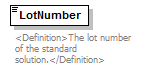 |
||||
| namespace | http://water.usgs.gov/XML/NWIS/5.0 | ||||
| type | xsd:string | ||||
| properties |
|
||||
| annotation |
|
||||
| source | <xsd:element name="LotNumber" type="xsd:string"> <xsd:annotation> <xsd:documentation> <Definition>The lot number of the standard solution.</Definition> </xsd:documentation> </xsd:annotation> </xsd:element> |
element DriftCheckTurbidityReading/ExpirationDate
| diagram | 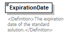 |
||||
| namespace | http://water.usgs.gov/XML/NWIS/5.0 | ||||
| type | xsd:date | ||||
| properties |
|
||||
| annotation |
|
||||
| source | <xsd:element name="ExpirationDate" type="xsd:date"> <xsd:annotation> <xsd:documentation> <Definition>The expiration date of the standard solution.</Definition> </xsd:documentation> </xsd:annotation> </xsd:element> |
element DriftCheckTurbidityReading/UsedForRecalibration
| diagram |  |
||||
| namespace | http://water.usgs.gov/XML/NWIS/5.0 | ||||
| type | xsd:boolean | ||||
| properties |
|
||||
| annotation |
|
||||
| source | <xsd:element name="UsedForRecalibration" type="xsd:boolean"> <xsd:annotation> <xsd:documentation> <Definition>Was this this reading for the conductance standard that was used for recalibration?</Definition> </xsd:documentation> </xsd:annotation> </xsd:element> |
element DriftCheckTurbidityReading/TemperatureMeasure
| diagram |  |
||||||||||||||||||||||||||||||||||||||||||||||
| namespace | http://water.usgs.gov/XML/NWIS/5.0 | ||||||||||||||||||||||||||||||||||||||||||||||
| type | IEEE754FloatValueType | ||||||||||||||||||||||||||||||||||||||||||||||
| properties |
|
||||||||||||||||||||||||||||||||||||||||||||||
| facets |
|
||||||||||||||||||||||||||||||||||||||||||||||
| attributes |
|
||||||||||||||||||||||||||||||||||||||||||||||
| annotation |
|
||||||||||||||||||||||||||||||||||||||||||||||
| source | <xsd:element name="TemperatureMeasure" type="IEEE754FloatValueType"> <xsd:annotation> <xsd:documentation> <Definition>The temperature during the turbidity check or calibration, in degrees celsius.</Definition> </xsd:documentation> </xsd:annotation> </xsd:element> |
element DriftCheckTurbidityReading/TurbidityMeasure
| diagram |  |
||||||||||||||||||||||||||||||||||||||||||||||
| namespace | http://water.usgs.gov/XML/NWIS/5.0 | ||||||||||||||||||||||||||||||||||||||||||||||
| type | IEEE754FloatValueType | ||||||||||||||||||||||||||||||||||||||||||||||
| properties |
|
||||||||||||||||||||||||||||||||||||||||||||||
| facets |
|
||||||||||||||||||||||||||||||||||||||||||||||
| attributes |
|
||||||||||||||||||||||||||||||||||||||||||||||
| annotation |
|
||||||||||||||||||||||||||||||||||||||||||||||
| source | <xsd:element name="TurbidityMeasure" type="IEEE754FloatValueType"> <xsd:annotation> <xsd:documentation> <Definition>The turbidity read during the turbidity check or calibration, in units defined by the sensor.</Definition> </xsd:documentation> </xsd:annotation> </xsd:element> |
element DriftCheckTurbidityReading/ErrorMeasure
| diagram |  |
||||||||||||||||||||||||||||||||||||||||||||||
| namespace | http://water.usgs.gov/XML/NWIS/5.0 | ||||||||||||||||||||||||||||||||||||||||||||||
| type | IEEE754FloatValueType | ||||||||||||||||||||||||||||||||||||||||||||||
| properties |
|
||||||||||||||||||||||||||||||||||||||||||||||
| facets |
|
||||||||||||||||||||||||||||||||||||||||||||||
| attributes |
|
||||||||||||||||||||||||||||||||||||||||||||||
| annotation |
|
||||||||||||||||||||||||||||||||||||||||||||||
| source | <xsd:element name="ErrorMeasure" type="IEEE754FloatValueType"> <xsd:annotation> <xsd:documentation> <Definition>The percent error between the turbidity standard and the turbidity reading.</Definition> </xsd:documentation> </xsd:annotation> </xsd:element> |
complexType IEEE754UncertaintyFloatValueType
| diagram | 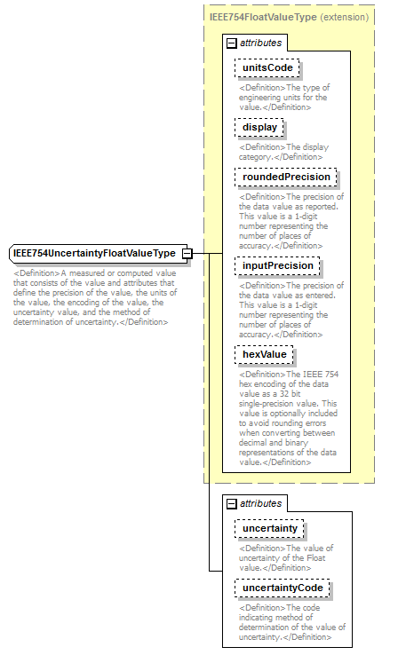 |
||||||||||||||||||||||||||||||||||||||||||||||||||||||||||||||
| namespace | http://water.usgs.gov/XML/NWIS/5.0 | ||||||||||||||||||||||||||||||||||||||||||||||||||||||||||||||
| type | extension of IEEE754FloatValueType | ||||||||||||||||||||||||||||||||||||||||||||||||||||||||||||||
| properties |
|
||||||||||||||||||||||||||||||||||||||||||||||||||||||||||||||
| used by |
|
||||||||||||||||||||||||||||||||||||||||||||||||||||||||||||||
| facets |
|
||||||||||||||||||||||||||||||||||||||||||||||||||||||||||||||
| attributes |
|
||||||||||||||||||||||||||||||||||||||||||||||||||||||||||||||
| annotation |
|
||||||||||||||||||||||||||||||||||||||||||||||||||||||||||||||
| source | <xsd:complexType name="IEEE754UncertaintyFloatValueType" abstract="false"> <xsd:annotation> <xsd:documentation> <Definition>A measured or computed value that consists of the value and attributes that define the precision of the value, the units of the value, the encoding of the value, the uncertainty value, and the method of determination of uncertainty.</Definition> </xsd:documentation> </xsd:annotation> <xsd:simpleContent> <xsd:extension base="IEEE754FloatValueType"> <xsd:attribute name="uncertainty" type="xsd:string" use="optional"> <xsd:annotation> <xsd:documentation> <Definition>The value of uncertainty of the Float value.</Definition> </xsd:documentation> </xsd:annotation> </xsd:attribute> <xsd:attribute name="uncertaintyCode" type="xsd:string" use="optional"> <xsd:annotation> <xsd:documentation> <Definition>The code indicating method of determination of the value of uncertainty.</Definition> </xsd:documentation> </xsd:annotation> </xsd:attribute> </xsd:extension> </xsd:simpleContent> </xsd:complexType> |
attribute IEEE754UncertaintyFloatValueType/@uncertainty
| type | xsd:string | ||||
| properties |
|
||||
| annotation |
|
||||
| source | <xsd:attribute name="uncertainty" type="xsd:string" use="optional"> <xsd:annotation> <xsd:documentation> <Definition>The value of uncertainty of the Float value.</Definition> </xsd:documentation> </xsd:annotation> </xsd:attribute> |
attribute IEEE754UncertaintyFloatValueType/@uncertaintyCode
| type | xsd:string | ||||
| properties |
|
||||
| annotation |
|
||||
| source | <xsd:attribute name="uncertaintyCode" type="xsd:string" use="optional"> <xsd:annotation> <xsd:documentation> <Definition>The code indicating method of determination of the value of uncertainty.</Definition> </xsd:documentation> </xsd:annotation> </xsd:attribute> |
element MonitorCheckReading
| diagram | 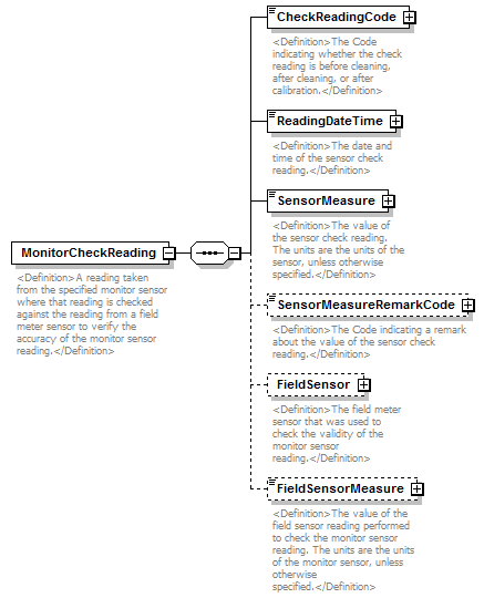 |
||
| namespace | http://water.usgs.gov/XML/NWIS/5.0 | ||
| properties |
|
||
| children | CheckReadingCode ReadingDateTime SensorMeasure SensorMeasureRemarkCode FieldSensor FieldSensorMeasure | ||
| annotation |
|
||
| source | <xsd:element name="MonitorCheckReading"> <xsd:annotation> <xsd:documentation> <Definition>A reading taken from the specified monitor sensor where that reading is checked against the reading from a field meter sensor to verify the accuracy of the monitor sensor reading.</Definition> </xsd:documentation> </xsd:annotation> <xsd:complexType> <xsd:sequence> <xsd:element name="CheckReadingCode" type="ReferenceListCodeType"> <xsd:annotation> <xsd:documentation> <Definition>The Code indicating whether the check reading is before cleaning, after cleaning, or after calibration.</Definition> </xsd:documentation> </xsd:annotation> </xsd:element> <xsd:element name="ReadingDateTime" type="DateTimeWithDatum"> <xsd:annotation> <xsd:documentation> <Definition>The date and time of the sensor check reading.</Definition> </xsd:documentation> </xsd:annotation> </xsd:element> <xsd:element name="SensorMeasure" type="IEEE754FloatValueType"> <xsd:annotation> <xsd:documentation> <Definition>The value of the sensor check reading. The units are the units of the sensor, unless otherwise specified.</Definition> </xsd:documentation> </xsd:annotation> </xsd:element> <xsd:element name="SensorMeasureRemarkCode" type="ReferenceListCodeType" minOccurs="0"> <xsd:annotation> <xsd:documentation> <Definition>The Code indicating a remark about the value of the sensor check reading.</Definition> </xsd:documentation> </xsd:annotation> </xsd:element> <xsd:element name="FieldSensor" type="Sensor" minOccurs="0"> <xsd:annotation> <xsd:documentation> <Definition>The field meter sensor that was used to check the validity of the monitor sensor reading.</Definition> </xsd:documentation> </xsd:annotation> </xsd:element> <xsd:element name="FieldSensorMeasure" type="IEEE754FloatValueType" minOccurs="0"> <xsd:annotation> <xsd:documentation> <Definition>The value of the field sensor reading performed to check the monitor sensor reading. The units are the units of the monitor sensor, unless otherwise specified.</Definition> </xsd:documentation> </xsd:annotation> </xsd:element> </xsd:sequence> </xsd:complexType> </xsd:element> |
element MonitorCheckReading/CheckReadingCode
| diagram | 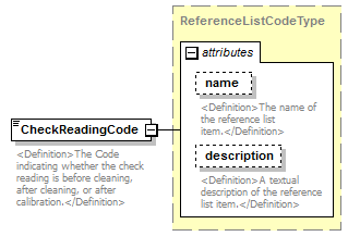 |
||||||||||||||||||||||
| namespace | http://water.usgs.gov/XML/NWIS/5.0 | ||||||||||||||||||||||
| type | ReferenceListCodeType | ||||||||||||||||||||||
| properties |
|
||||||||||||||||||||||
| attributes |
|
||||||||||||||||||||||
| annotation |
|
||||||||||||||||||||||
| source | <xsd:element name="CheckReadingCode" type="ReferenceListCodeType"> <xsd:annotation> <xsd:documentation> <Definition>The Code indicating whether the check reading is before cleaning, after cleaning, or after calibration.</Definition> </xsd:documentation> </xsd:annotation> </xsd:element> |
element MonitorCheckReading/ReadingDateTime
| diagram | 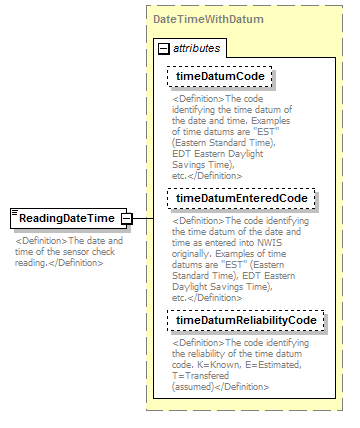 |
||||||||||||||||||||||||||||||
| namespace | http://water.usgs.gov/XML/NWIS/5.0 | ||||||||||||||||||||||||||||||
| type | DateTimeWithDatum | ||||||||||||||||||||||||||||||
| properties |
|
||||||||||||||||||||||||||||||
| attributes |
|
||||||||||||||||||||||||||||||
| annotation |
|
||||||||||||||||||||||||||||||
| source | <xsd:element name="ReadingDateTime" type="DateTimeWithDatum"> <xsd:annotation> <xsd:documentation> <Definition>The date and time of the sensor check reading.</Definition> </xsd:documentation> </xsd:annotation> </xsd:element> |
element MonitorCheckReading/SensorMeasure
| diagram | 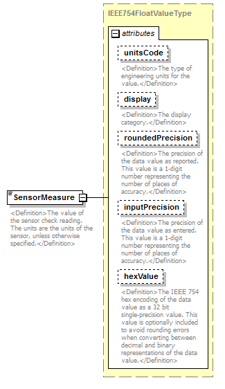 |
||||||||||||||||||||||||||||||||||||||||||||||
| namespace | http://water.usgs.gov/XML/NWIS/5.0 | ||||||||||||||||||||||||||||||||||||||||||||||
| type | IEEE754FloatValueType | ||||||||||||||||||||||||||||||||||||||||||||||
| properties |
|
||||||||||||||||||||||||||||||||||||||||||||||
| facets |
|
||||||||||||||||||||||||||||||||||||||||||||||
| attributes |
|
||||||||||||||||||||||||||||||||||||||||||||||
| annotation |
|
||||||||||||||||||||||||||||||||||||||||||||||
| source | <xsd:element name="SensorMeasure" type="IEEE754FloatValueType"> <xsd:annotation> <xsd:documentation> <Definition>The value of the sensor check reading. The units are the units of the sensor, unless otherwise specified.</Definition> </xsd:documentation> </xsd:annotation> </xsd:element> |
element MonitorCheckReading/SensorMeasureRemarkCode
| diagram | 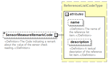 |
||||||||||||||||||||||
| namespace | http://water.usgs.gov/XML/NWIS/5.0 | ||||||||||||||||||||||
| type | ReferenceListCodeType | ||||||||||||||||||||||
| properties |
|
||||||||||||||||||||||
| attributes |
|
||||||||||||||||||||||
| annotation |
|
||||||||||||||||||||||
| source | <xsd:element name="SensorMeasureRemarkCode" type="ReferenceListCodeType" minOccurs="0"> <xsd:annotation> <xsd:documentation> <Definition>The Code indicating a remark about the value of the sensor check reading.</Definition> </xsd:documentation> </xsd:annotation> </xsd:element> |
element MonitorCheckReading/FieldSensor
| diagram |  |
||||||||
| namespace | http://water.usgs.gov/XML/NWIS/5.0 | ||||||||
| type | Sensor | ||||||||
| properties |
|
||||||||
| children | SensorType SerialNumber SensorName OfficeName UserName PurchaseDate RetireDate Comment CreatorUserName CreateDateTime ModifierUserName ModifyDateTime ApproverUserName ApprovalDateTime | ||||||||
| annotation |
|
||||||||
| source | <xsd:element name="FieldSensor" type="Sensor" minOccurs="0"> <xsd:annotation> <xsd:documentation> <Definition>The field meter sensor that was used to check the validity of the monitor sensor reading.</Definition> </xsd:documentation> </xsd:annotation> </xsd:element> |
element MonitorCheckReading/FieldSensorMeasure
| diagram | 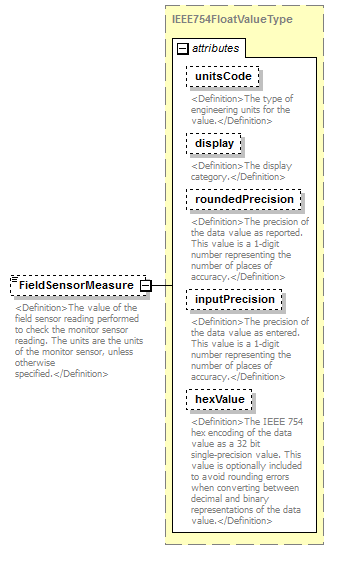 |
||||||||||||||||||||||||||||||||||||||||||||||
| namespace | http://water.usgs.gov/XML/NWIS/5.0 | ||||||||||||||||||||||||||||||||||||||||||||||
| type | IEEE754FloatValueType | ||||||||||||||||||||||||||||||||||||||||||||||
| properties |
|
||||||||||||||||||||||||||||||||||||||||||||||
| facets |
|
||||||||||||||||||||||||||||||||||||||||||||||
| attributes |
|
||||||||||||||||||||||||||||||||||||||||||||||
| annotation |
|
||||||||||||||||||||||||||||||||||||||||||||||
| source | <xsd:element name="FieldSensorMeasure" type="IEEE754FloatValueType" minOccurs="0"> <xsd:annotation> <xsd:documentation> <Definition>The value of the field sensor reading performed to check the monitor sensor reading. The units are the units of the monitor sensor, unless otherwise specified.</Definition> </xsd:documentation> </xsd:annotation> </xsd:element> |
element DailyValueComputation
| diagram | 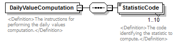 |
||
| namespace | http://water.usgs.gov/XML/NWIS/5.0 | ||
| properties |
|
||
| children | StatisticCode | ||
| used by |
|
||
| annotation |
|
||
| source | <xsd:element name="DailyValueComputation"> <xsd:annotation> <xsd:documentation> <Definition>The instructions for performing the daily values computation.</Definition> </xsd:documentation> </xsd:annotation> <xsd:complexType> <xsd:sequence> <xsd:element name="StatisticCode" type="xsd:NMTOKEN" maxOccurs="10"> <xsd:annotation> <xsd:documentation> <Definition>The code identifying the statistic to compute.</Definition> </xsd:documentation> </xsd:annotation> </xsd:element> </xsd:sequence> </xsd:complexType> </xsd:element> |
element DailyValueComputation/StatisticCode
| diagram | 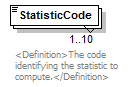 |
||||||||
| namespace | http://water.usgs.gov/XML/NWIS/5.0 | ||||||||
| type | xsd:NMTOKEN | ||||||||
| properties |
|
||||||||
| used by |
|
||||||||
| annotation |
|
||||||||
| source | <xsd:element name="StatisticCode" type="xsd:NMTOKEN" maxOccurs="10"> <xsd:annotation> <xsd:documentation> <Definition>The code identifying the statistic to compute.</Definition> </xsd:documentation> </xsd:annotation> </xsd:element> |
element GeneralComputation
| diagram | 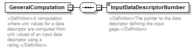 |
||
| namespace | http://water.usgs.gov/XML/NWIS/5.0 | ||
| properties |
|
||
| children | InputDataDescriptorNumber | ||
| used by |
|
||
| annotation |
|
||
| source | <xsd:element name="GeneralComputation"> <xsd:annotation> <xsd:documentation> <Definition>A computation where unit values for a data descriptor are computed from unit values of an input data descriptor using a rating.</Definition> </xsd:documentation> </xsd:annotation> <xsd:complexType> <xsd:sequence> <xsd:element name="InputDataDescriptorNumber" type="xsd:integer"> <xsd:annotation> <xsd:documentation> <Definition>The pointer to the data descriptor defining the input gage.</Definition> </xsd:documentation> </xsd:annotation> </xsd:element> </xsd:sequence> </xsd:complexType> </xsd:element> |
element GeneralComputation/InputDataDescriptorNumber
| diagram | 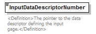 |
||||
| namespace | http://water.usgs.gov/XML/NWIS/5.0 | ||||
| type | xsd:integer | ||||
| properties |
|
||||
| annotation |
|
||||
| source | <xsd:element name="InputDataDescriptorNumber" type="xsd:integer"> <xsd:annotation> <xsd:documentation> <Definition>The pointer to the data descriptor defining the input gage.</Definition> </xsd:documentation> </xsd:annotation> </xsd:element> |
element NoComputation
| diagram | 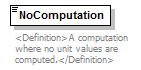 |
||
| namespace | http://water.usgs.gov/XML/NWIS/5.0 | ||
| used by |
|
||
| annotation |
|
||
| source | <xsd:element name="NoComputation"> <xsd:annotation> <xsd:documentation> <Definition>A computation where no unit values are computed.</Definition> </xsd:documentation> </xsd:annotation> </xsd:element> |
element RainfallComputation
| diagram | 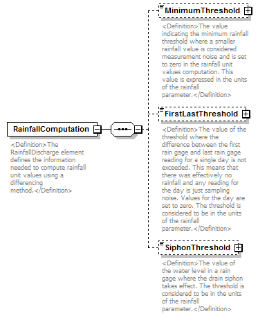 |
||
| namespace | http://water.usgs.gov/XML/NWIS/5.0 | ||
| properties |
|
||
| children | MinimumThreshold FirstLastThreshold SiphonThreshold | ||
| used by |
|
||
| annotation |
|
||
| source | <xsd:element name="RainfallComputation"> <xsd:annotation> <xsd:documentation> <Definition>The RainfallDischarge element defines the information needed to compute rainfall unit values using a differencing method.</Definition> </xsd:documentation> </xsd:annotation> <xsd:complexType> <xsd:sequence> <xsd:element name="MinimumThreshold" type="IEEE754FloatValueType" minOccurs="0"> <xsd:annotation> <xsd:documentation> <Definition>The value indicating the minimum rainfall threshold where a smaller rainfall value is considered measurement noise and is set to zero in the rainfall unit values computation. This value is expressed in the units of the rainfall parameter.</Definition> </xsd:documentation> </xsd:annotation> </xsd:element> <xsd:element name="FirstLastThreshold" type="IEEE754FloatValueType" minOccurs="0"> <xsd:annotation> <xsd:documentation> <Definition>The value of the threshold where the difference between the first rain gage and last rain gage reading for a single day is not exceeded. This means that there was effectively no rainfall and any reading for the day is just sampling noise. Values for the day are set to zero. The threshold is considered to be in the units of the rainfall parameter.</Definition> </xsd:documentation> </xsd:annotation> </xsd:element> <xsd:element name="SiphonThreshold" type="IEEE754FloatValueType" minOccurs="0"> <xsd:annotation> <xsd:documentation> <Definition>The value of the water level in a rain gage where the drain siphon takes effect. The threshold is considered to be in the units of the rainfall parameter.</Definition> </xsd:documentation> </xsd:annotation> </xsd:element> </xsd:sequence> </xsd:complexType> </xsd:element> |
element RainfallComputation/MinimumThreshold
| diagram | 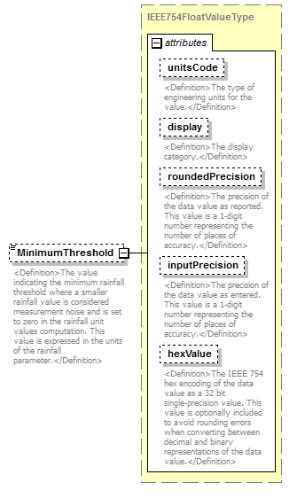 |
||||||||||||||||||||||||||||||||||||||||||||||
| namespace | http://water.usgs.gov/XML/NWIS/5.0 | ||||||||||||||||||||||||||||||||||||||||||||||
| type | IEEE754FloatValueType | ||||||||||||||||||||||||||||||||||||||||||||||
| properties |
|
||||||||||||||||||||||||||||||||||||||||||||||
| facets |
|
||||||||||||||||||||||||||||||||||||||||||||||
| attributes |
|
||||||||||||||||||||||||||||||||||||||||||||||
| annotation |
|
||||||||||||||||||||||||||||||||||||||||||||||
| source | <xsd:element name="MinimumThreshold" type="IEEE754FloatValueType" minOccurs="0"> <xsd:annotation> <xsd:documentation> <Definition>The value indicating the minimum rainfall threshold where a smaller rainfall value is considered measurement noise and is set to zero in the rainfall unit values computation. This value is expressed in the units of the rainfall parameter.</Definition> </xsd:documentation> </xsd:annotation> </xsd:element> |
element RainfallComputation/FirstLastThreshold
| diagram | 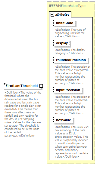 |
||||||||||||||||||||||||||||||||||||||||||||||
| namespace | http://water.usgs.gov/XML/NWIS/5.0 | ||||||||||||||||||||||||||||||||||||||||||||||
| type | IEEE754FloatValueType | ||||||||||||||||||||||||||||||||||||||||||||||
| properties |
|
||||||||||||||||||||||||||||||||||||||||||||||
| facets |
|
||||||||||||||||||||||||||||||||||||||||||||||
| attributes |
|
||||||||||||||||||||||||||||||||||||||||||||||
| annotation |
|
||||||||||||||||||||||||||||||||||||||||||||||
| source | <xsd:element name="FirstLastThreshold" type="IEEE754FloatValueType" minOccurs="0"> <xsd:annotation> <xsd:documentation> <Definition>The value of the threshold where the difference between the first rain gage and last rain gage reading for a single day is not exceeded. This means that there was effectively no rainfall and any reading for the day is just sampling noise. Values for the day are set to zero. The threshold is considered to be in the units of the rainfall parameter.</Definition> </xsd:documentation> </xsd:annotation> </xsd:element> |
element RainfallComputation/SiphonThreshold
| diagram | 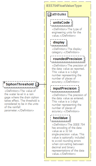 |
||||||||||||||||||||||||||||||||||||||||||||||
| namespace | http://water.usgs.gov/XML/NWIS/5.0 | ||||||||||||||||||||||||||||||||||||||||||||||
| type | IEEE754FloatValueType | ||||||||||||||||||||||||||||||||||||||||||||||
| properties |
|
||||||||||||||||||||||||||||||||||||||||||||||
| facets |
|
||||||||||||||||||||||||||||||||||||||||||||||
| attributes |
|
||||||||||||||||||||||||||||||||||||||||||||||
| annotation |
|
||||||||||||||||||||||||||||||||||||||||||||||
| source | <xsd:element name="SiphonThreshold" type="IEEE754FloatValueType" minOccurs="0"> <xsd:annotation> <xsd:documentation> <Definition>The value of the water level in a rain gage where the drain siphon takes effect. The threshold is considered to be in the units of the rainfall parameter.</Definition> </xsd:documentation> </xsd:annotation> </xsd:element> |
element SlopeDischargeComputation
| diagram | 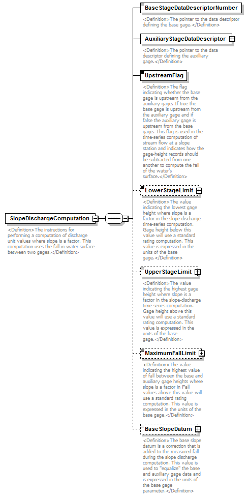 |
||
| namespace | http://water.usgs.gov/XML/NWIS/5.0 | ||
| properties |
|
||
| children | BaseStageDataDescriptorNumber AuxiliaryStageDataDescriptor UpstreamFlag LowerStageLimit UpperStageLimit MaximumFallLimit BaseSlopeDatum | ||
| used by |
|
||
| annotation |
|
||
| source | <xsd:element name="SlopeDischargeComputation"> <xsd:annotation> <xsd:documentation> <Definition>The instructions for performing a computation of discharge unit values where slope is a factor. This computation uses the fall in water surface between two gages.</Definition> </xsd:documentation> </xsd:annotation> <xsd:complexType> <xsd:sequence> <xsd:element name="BaseStageDataDescriptorNumber" type="xsd:integer"> <xsd:annotation> <xsd:documentation> <Definition>The pointer to the data descriptor defining the base gage.</Definition> </xsd:documentation> </xsd:annotation> </xsd:element> <xsd:element name="AuxiliaryStageDataDescriptor"> <xsd:annotation> <xsd:documentation> <Definition>The pointer to the data descriptor defining the auxilliary gage.</Definition> </xsd:documentation> </xsd:annotation> <xsd:complexType> <xsd:sequence> <xsd:element ref="SiteIdentifier" minOccurs="0" maxOccurs="3"/> <xsd:element name="DataDescriptorNumber" type="xsd:integer"/> </xsd:sequence> </xsd:complexType> </xsd:element> <xsd:element name="UpstreamFlag" type="xsd:boolean"> <xsd:annotation> <xsd:documentation> <Definition>The flag indicating whether the base gage is upstream from the auxiliary gage. If true the base gage is upstream from the auxiliary gage and if false the auxiliary gage is upstream from the base gage. This flag is used in the time-series computation of stream flow at a slope station and indicates how the gage-height records should be subtracted from one another to compute the fall of the water's surface.</Definition> </xsd:documentation> </xsd:annotation> </xsd:element> <xsd:element name="LowerStageLimit" type="IEEE754FloatValueType" minOccurs="0"> <xsd:annotation> <xsd:documentation> <Definition>The value indicating the lowest gage height where slope is a factor in the slope-discharge time-series computation. Gage height below this value will use a standard rating computation. This value is expressed in the units of the base gage.</Definition> </xsd:documentation> </xsd:annotation> </xsd:element> <xsd:element name="UpperStageLimit" type="IEEE754FloatValueType" minOccurs="0"> <xsd:annotation> <xsd:documentation> <Definition>The value indicating the highest gage height where slope is a factor in the slope-discharge time-series computation. Gage height above this value will use a standard rating computation. This value is expressed in the units of the base gage.</Definition> </xsd:documentation> </xsd:annotation> </xsd:element> <xsd:element name="MaximumFallLimit" type="IEEE754FloatValueType" minOccurs="0"> <xsd:annotation> <xsd:documentation> <Definition>The value indicating the highest value of fall between the base and auxiliary gage heights where slope is a factor in Fall values above this value will use a standard rating computation. This value is expressed in the units of the base gage.</Definition> </xsd:documentation> </xsd:annotation> </xsd:element> <xsd:element name="BaseSlopeDatum" type="IEEE754FloatValueType" minOccurs="0"> <xsd:annotation> <xsd:documentation> <Definition>The base slope datum is a correction that is added to the measured fall during the slope discharge computation. This value is used to "equalize" the base and auxiliary gage data and is expressed in the units of the base gage parameter.</Definition> </xsd:documentation> </xsd:annotation> </xsd:element> </xsd:sequence> </xsd:complexType> </xsd:element> |
element SlopeDischargeComputation/BaseStageDataDescriptorNumber
| diagram |  |
||||
| namespace | http://water.usgs.gov/XML/NWIS/5.0 | ||||
| type | xsd:integer | ||||
| properties |
|
||||
| annotation |
|
||||
| source | <xsd:element name="BaseStageDataDescriptorNumber" type="xsd:integer"> <xsd:annotation> <xsd:documentation> <Definition>The pointer to the data descriptor defining the base gage.</Definition> </xsd:documentation> </xsd:annotation> </xsd:element> |
element SlopeDischargeComputation/AuxiliaryStageDataDescriptor
| diagram | 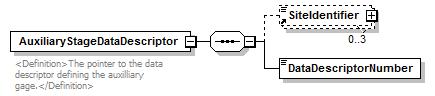 |
||||
| namespace | http://water.usgs.gov/XML/NWIS/5.0 | ||||
| properties |
|
||||
| children | SiteIdentifier DataDescriptorNumber | ||||
| annotation |
|
||||
| source | <xsd:element name="AuxiliaryStageDataDescriptor"> <xsd:annotation> <xsd:documentation> <Definition>The pointer to the data descriptor defining the auxilliary gage.</Definition> </xsd:documentation> </xsd:annotation> <xsd:complexType> <xsd:sequence> <xsd:element ref="SiteIdentifier" minOccurs="0" maxOccurs="3"/> <xsd:element name="DataDescriptorNumber" type="xsd:integer"/> </xsd:sequence> </xsd:complexType> </xsd:element> |
element SlopeDischargeComputation/AuxiliaryStageDataDescriptor/DataDescriptorNumber
| diagram |  |
||||
| namespace | http://water.usgs.gov/XML/NWIS/5.0 | ||||
| type | xsd:integer | ||||
| properties |
|
||||
| source | <xsd:element name="DataDescriptorNumber" type="xsd:integer"/> |
element SlopeDischargeComputation/UpstreamFlag
| diagram | 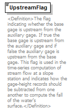 |
||||
| namespace | http://water.usgs.gov/XML/NWIS/5.0 | ||||
| type | xsd:boolean | ||||
| properties |
|
||||
| annotation |
|
||||
| source | <xsd:element name="UpstreamFlag" type="xsd:boolean"> <xsd:annotation> <xsd:documentation> <Definition>The flag indicating whether the base gage is upstream from the auxiliary gage. If true the base gage is upstream from the auxiliary gage and if false the auxiliary gage is upstream from the base gage. This flag is used in the time-series computation of stream flow at a slope station and indicates how the gage-height records should be subtracted from one another to compute the fall of the water's surface.</Definition> </xsd:documentation> </xsd:annotation> </xsd:element> |
element SlopeDischargeComputation/LowerStageLimit
| diagram |  |
||||||||||||||||||||||||||||||||||||||||||||||
| namespace | http://water.usgs.gov/XML/NWIS/5.0 | ||||||||||||||||||||||||||||||||||||||||||||||
| type | IEEE754FloatValueType | ||||||||||||||||||||||||||||||||||||||||||||||
| properties |
|
||||||||||||||||||||||||||||||||||||||||||||||
| facets |
|
||||||||||||||||||||||||||||||||||||||||||||||
| attributes |
|
||||||||||||||||||||||||||||||||||||||||||||||
| annotation |
|
||||||||||||||||||||||||||||||||||||||||||||||
| source | <xsd:element name="LowerStageLimit" type="IEEE754FloatValueType" minOccurs="0"> <xsd:annotation> <xsd:documentation> <Definition>The value indicating the lowest gage height where slope is a factor in the slope-discharge time-series computation. Gage height below this value will use a standard rating computation. This value is expressed in the units of the base gage.</Definition> </xsd:documentation> </xsd:annotation> </xsd:element> |
element SlopeDischargeComputation/UpperStageLimit
| diagram | 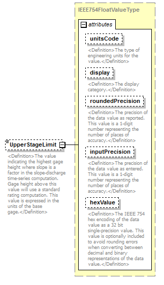 |
||||||||||||||||||||||||||||||||||||||||||||||
| namespace | http://water.usgs.gov/XML/NWIS/5.0 | ||||||||||||||||||||||||||||||||||||||||||||||
| type | IEEE754FloatValueType | ||||||||||||||||||||||||||||||||||||||||||||||
| properties |
|
||||||||||||||||||||||||||||||||||||||||||||||
| facets |
|
||||||||||||||||||||||||||||||||||||||||||||||
| attributes |
|
||||||||||||||||||||||||||||||||||||||||||||||
| annotation |
|
||||||||||||||||||||||||||||||||||||||||||||||
| source | <xsd:element name="UpperStageLimit" type="IEEE754FloatValueType" minOccurs="0"> <xsd:annotation> <xsd:documentation> <Definition>The value indicating the highest gage height where slope is a factor in the slope-discharge time-series computation. Gage height above this value will use a standard rating computation. This value is expressed in the units of the base gage.</Definition> </xsd:documentation> </xsd:annotation> </xsd:element> |
element SlopeDischargeComputation/MaximumFallLimit
| diagram | 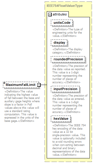 |
||||||||||||||||||||||||||||||||||||||||||||||
| namespace | http://water.usgs.gov/XML/NWIS/5.0 | ||||||||||||||||||||||||||||||||||||||||||||||
| type | IEEE754FloatValueType | ||||||||||||||||||||||||||||||||||||||||||||||
| properties |
|
||||||||||||||||||||||||||||||||||||||||||||||
| facets |
|
||||||||||||||||||||||||||||||||||||||||||||||
| attributes |
|
||||||||||||||||||||||||||||||||||||||||||||||
| annotation |
|
||||||||||||||||||||||||||||||||||||||||||||||
| source | <xsd:element name="MaximumFallLimit" type="IEEE754FloatValueType" minOccurs="0"> <xsd:annotation> <xsd:documentation> <Definition>The value indicating the highest value of fall between the base and auxiliary gage heights where slope is a factor in Fall values above this value will use a standard rating computation. This value is expressed in the units of the base gage.</Definition> </xsd:documentation> </xsd:annotation> </xsd:element> |
element SlopeDischargeComputation/BaseSlopeDatum
| diagram | 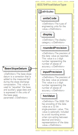 |
||||||||||||||||||||||||||||||||||||||||||||||
| namespace | http://water.usgs.gov/XML/NWIS/5.0 | ||||||||||||||||||||||||||||||||||||||||||||||
| type | IEEE754FloatValueType | ||||||||||||||||||||||||||||||||||||||||||||||
| properties |
|
||||||||||||||||||||||||||||||||||||||||||||||
| facets |
|
||||||||||||||||||||||||||||||||||||||||||||||
| attributes |
|
||||||||||||||||||||||||||||||||||||||||||||||
| annotation |
|
||||||||||||||||||||||||||||||||||||||||||||||
| source | <xsd:element name="BaseSlopeDatum" type="IEEE754FloatValueType" minOccurs="0"> <xsd:annotation> <xsd:documentation> <Definition>The base slope datum is a correction that is added to the measured fall during the slope discharge computation. This value is used to "equalize" the base and auxiliary gage data and is expressed in the units of the base gage parameter.</Definition> </xsd:documentation> </xsd:annotation> </xsd:element> |
element StageDischargeComputation
| diagram | 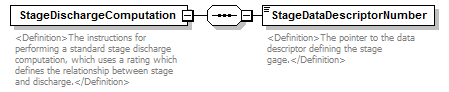 |
||
| namespace | http://water.usgs.gov/XML/NWIS/5.0 | ||
| properties |
|
||
| children | StageDataDescriptorNumber | ||
| used by |
|
||
| annotation |
|
||
| source | <xsd:element name="StageDischargeComputation"> <xsd:annotation> <xsd:documentation> <Definition>The instructions for performing a standard stage discharge computation, which uses a rating which defines the relationship between stage and discharge.</Definition> </xsd:documentation> </xsd:annotation> <xsd:complexType> <xsd:sequence> <xsd:element name="StageDataDescriptorNumber" type="xsd:integer"> <xsd:annotation> <xsd:documentation> <Definition>The pointer to the data descriptor defining the stage gage.</Definition> </xsd:documentation> </xsd:annotation> </xsd:element> </xsd:sequence> </xsd:complexType> </xsd:element> |
element StageDischargeComputation/StageDataDescriptorNumber
| diagram | 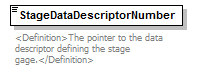 |
||||
| namespace | http://water.usgs.gov/XML/NWIS/5.0 | ||||
| type | xsd:integer | ||||
| properties |
|
||||
| annotation |
|
||||
| source | <xsd:element name="StageDataDescriptorNumber" type="xsd:integer"> <xsd:annotation> <xsd:documentation> <Definition>The pointer to the data descriptor defining the stage gage.</Definition> </xsd:documentation> </xsd:annotation> </xsd:element> |
element TimeSeriesComputation
| diagram | 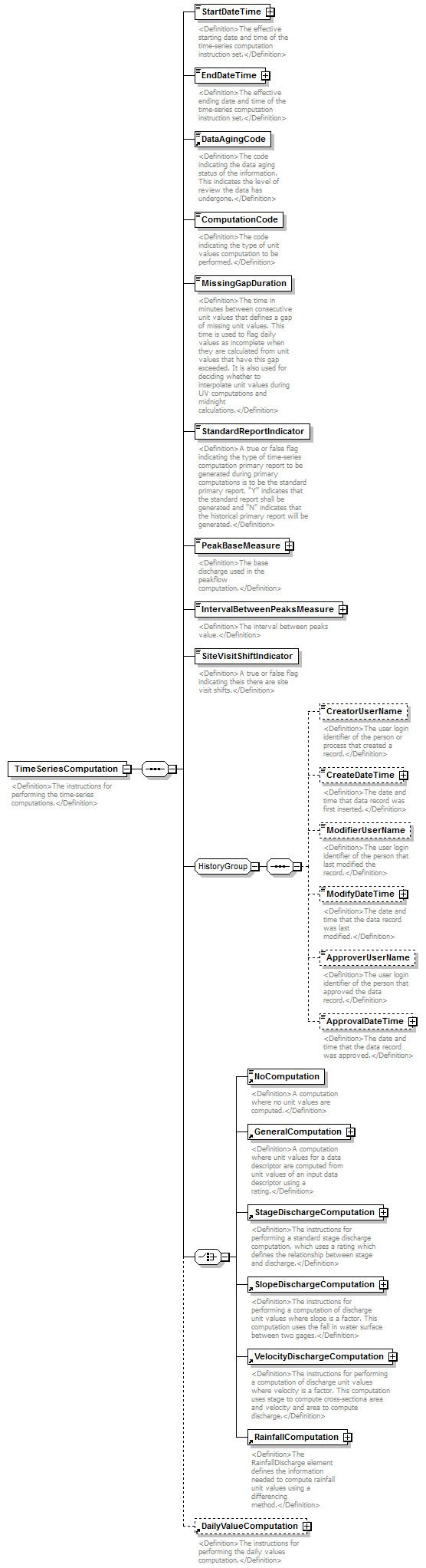 |
||
| namespace | http://water.usgs.gov/XML/NWIS/5.0 | ||
| properties |
|
||
| children | StartDateTime EndDateTime DataAgingCode ComputationCode MissingGapDuration StandardReportIndicator PeakBaseMeasure IntervalBetweenPeaksMeasure SiteVisitShiftIndicator CreatorUserName CreateDateTime ModifierUserName ModifyDateTime ApproverUserName ApprovalDateTime NoComputation GeneralComputation StageDischargeComputation SlopeDischargeComputation VelocityDischargeComputation RainfallComputation DailyValueComputation | ||
| used by |
|
||
| annotation |
|
||
| source | <xsd:element name="TimeSeriesComputation"> <xsd:annotation> <xsd:documentation> <Definition>The instructions for performing the time-series computations.</Definition> </xsd:documentation> </xsd:annotation> <xsd:complexType> <xsd:sequence> <xsd:element name="StartDateTime" type="DateTimeWithDatum"> <xsd:annotation> <xsd:documentation> <Definition>The effective starting date and time of the time-series computation instruction set.</Definition> </xsd:documentation> </xsd:annotation> </xsd:element> <xsd:element name="EndDateTime" type="DateTimeWithDatum"> <xsd:annotation> <xsd:documentation> <Definition>The effective ending date and time of the time-series computation instruction set.</Definition> </xsd:documentation> </xsd:annotation> </xsd:element> <xsd:element ref="DataAgingCode"/> <xsd:element name="ComputationCode" type="xsd:NMTOKEN"> <xsd:annotation> <xsd:documentation> <Definition>The code indicating the type of unit values computation to be performed.</Definition> </xsd:documentation> </xsd:annotation> </xsd:element> <xsd:element name="MissingGapDuration" type="xsd:positiveInteger"> <xsd:annotation> <xsd:documentation> <Definition>The time in minutes between consecutive unit values that defines a gap of missing unit values. This time is used to flag daily values as incomplete when they are calculated from unit values that have this gap exceeded. It is also used for deciding whether to interpolate unit values during UV computations and midnight calculations.</Definition> </xsd:documentation> </xsd:annotation> </xsd:element> <xsd:element name="StandardReportIndicator" type="xsd:boolean"> <xsd:annotation> <xsd:documentation> <Definition>A true or false flag indicating the type of time-series computation primary report to be generated during primary computations is to be the standard primary report. "Y" indicates that the standard report shall be generated and "N" indicates that the historical primary report will be generated.</Definition> </xsd:documentation> </xsd:annotation> </xsd:element> <xsd:element name="PeakBaseMeasure" type="IEEE754FloatValueType"> <xsd:annotation> <xsd:documentation> <Definition>The base discharge used in the peakflow computation.</Definition> </xsd:documentation> </xsd:annotation> </xsd:element> <xsd:element name="IntervalBetweenPeaksMeasure" type="IEEE754FloatValueType"> <xsd:annotation> <xsd:documentation> <Definition>The interval between peaks value.</Definition> </xsd:documentation> </xsd:annotation> </xsd:element> <xsd:element name="SiteVisitShiftIndicator" type="xsd:boolean"> <xsd:annotation> <xsd:documentation> <Definition>A true or false flag indicating theis there are site visit shifts.</Definition> </xsd:documentation> </xsd:annotation> </xsd:element> <xsd:group ref="HistoryGroup"/> <xsd:choice> <xsd:element ref="NoComputation"/> <xsd:element ref="GeneralComputation"/> <xsd:element ref="StageDischargeComputation"/> <xsd:element ref="SlopeDischargeComputation"/> <xsd:element ref="VelocityDischargeComputation"/> <xsd:element ref="RainfallComputation"/> </xsd:choice> <xsd:element ref="DailyValueComputation" minOccurs="0"/> </xsd:sequence> </xsd:complexType> </xsd:element> |
element TimeSeriesComputation/StartDateTime
| diagram | 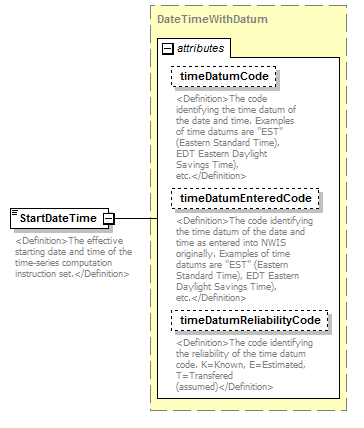 |
||||||||||||||||||||||||||||||
| namespace | http://water.usgs.gov/XML/NWIS/5.0 | ||||||||||||||||||||||||||||||
| type | DateTimeWithDatum | ||||||||||||||||||||||||||||||
| properties |
|
||||||||||||||||||||||||||||||
| attributes |
|
||||||||||||||||||||||||||||||
| annotation |
|
||||||||||||||||||||||||||||||
| source | <xsd:element name="StartDateTime" type="DateTimeWithDatum"> <xsd:annotation> <xsd:documentation> <Definition>The effective starting date and time of the time-series computation instruction set.</Definition> </xsd:documentation> </xsd:annotation> </xsd:element> |
element TimeSeriesComputation/EndDateTime
| diagram | 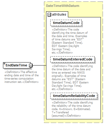 |
||||||||||||||||||||||||||||||
| namespace | http://water.usgs.gov/XML/NWIS/5.0 | ||||||||||||||||||||||||||||||
| type | DateTimeWithDatum | ||||||||||||||||||||||||||||||
| properties |
|
||||||||||||||||||||||||||||||
| attributes |
|
||||||||||||||||||||||||||||||
| annotation |
|
||||||||||||||||||||||||||||||
| source | <xsd:element name="EndDateTime" type="DateTimeWithDatum"> <xsd:annotation> <xsd:documentation> <Definition>The effective ending date and time of the time-series computation instruction set.</Definition> </xsd:documentation> </xsd:annotation> </xsd:element> |
element TimeSeriesComputation/ComputationCode
| diagram | 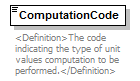 |
||||
| namespace | http://water.usgs.gov/XML/NWIS/5.0 | ||||
| type | xsd:NMTOKEN | ||||
| properties |
|
||||
| annotation |
|
||||
| source | <xsd:element name="ComputationCode" type="xsd:NMTOKEN"> <xsd:annotation> <xsd:documentation> <Definition>The code indicating the type of unit values computation to be performed.</Definition> </xsd:documentation> </xsd:annotation> </xsd:element> |
element TimeSeriesComputation/MissingGapDuration
| diagram | 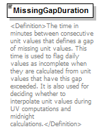 |
||||
| namespace | http://water.usgs.gov/XML/NWIS/5.0 | ||||
| type | xsd:positiveInteger | ||||
| properties |
|
||||
| annotation |
|
||||
| source | <xsd:element name="MissingGapDuration" type="xsd:positiveInteger"> <xsd:annotation> <xsd:documentation> <Definition>The time in minutes between consecutive unit values that defines a gap of missing unit values. This time is used to flag daily values as incomplete when they are calculated from unit values that have this gap exceeded. It is also used for deciding whether to interpolate unit values during UV computations and midnight calculations.</Definition> </xsd:documentation> </xsd:annotation> </xsd:element> |
element TimeSeriesComputation/StandardReportIndicator
| diagram | 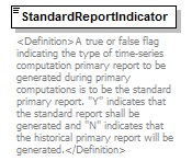 |
||||
| namespace | http://water.usgs.gov/XML/NWIS/5.0 | ||||
| type | xsd:boolean | ||||
| properties |
|
||||
| annotation |
|
||||
| source | <xsd:element name="StandardReportIndicator" type="xsd:boolean"> <xsd:annotation> <xsd:documentation> <Definition>A true or false flag indicating the type of time-series computation primary report to be generated during primary computations is to be the standard primary report. "Y" indicates that the standard report shall be generated and "N" indicates that the historical primary report will be generated.</Definition> </xsd:documentation> </xsd:annotation> </xsd:element> |
element TimeSeriesComputation/PeakBaseMeasure
| diagram | 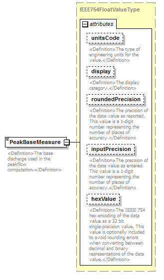 |
||||||||||||||||||||||||||||||||||||||||||||||
| namespace | http://water.usgs.gov/XML/NWIS/5.0 | ||||||||||||||||||||||||||||||||||||||||||||||
| type | IEEE754FloatValueType | ||||||||||||||||||||||||||||||||||||||||||||||
| properties |
|
||||||||||||||||||||||||||||||||||||||||||||||
| facets |
|
||||||||||||||||||||||||||||||||||||||||||||||
| attributes |
|
||||||||||||||||||||||||||||||||||||||||||||||
| annotation |
|
||||||||||||||||||||||||||||||||||||||||||||||
| source | <xsd:element name="PeakBaseMeasure" type="IEEE754FloatValueType"> <xsd:annotation> <xsd:documentation> <Definition>The base discharge used in the peakflow computation.</Definition> </xsd:documentation> </xsd:annotation> </xsd:element> |
element TimeSeriesComputation/IntervalBetweenPeaksMeasure
| diagram | 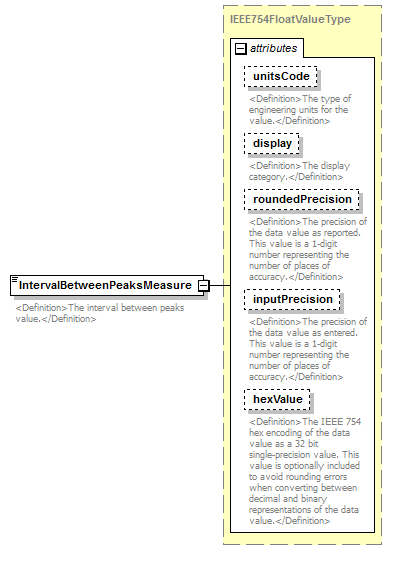 |
||||||||||||||||||||||||||||||||||||||||||||||
| namespace | http://water.usgs.gov/XML/NWIS/5.0 | ||||||||||||||||||||||||||||||||||||||||||||||
| type | IEEE754FloatValueType | ||||||||||||||||||||||||||||||||||||||||||||||
| properties |
|
||||||||||||||||||||||||||||||||||||||||||||||
| facets |
|
||||||||||||||||||||||||||||||||||||||||||||||
| attributes |
|
||||||||||||||||||||||||||||||||||||||||||||||
| annotation |
|
||||||||||||||||||||||||||||||||||||||||||||||
| source | <xsd:element name="IntervalBetweenPeaksMeasure" type="IEEE754FloatValueType"> <xsd:annotation> <xsd:documentation> <Definition>The interval between peaks value.</Definition> </xsd:documentation> </xsd:annotation> </xsd:element> |
element TimeSeriesComputation/SiteVisitShiftIndicator
| diagram | 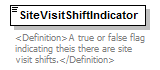 |
||||
| namespace | http://water.usgs.gov/XML/NWIS/5.0 | ||||
| type | xsd:boolean | ||||
| properties |
|
||||
| annotation |
|
||||
| source | <xsd:element name="SiteVisitShiftIndicator" type="xsd:boolean"> <xsd:annotation> <xsd:documentation> <Definition>A true or false flag indicating theis there are site visit shifts.</Definition> </xsd:documentation> </xsd:annotation> </xsd:element> |
element UnitValueComputation
| diagram | 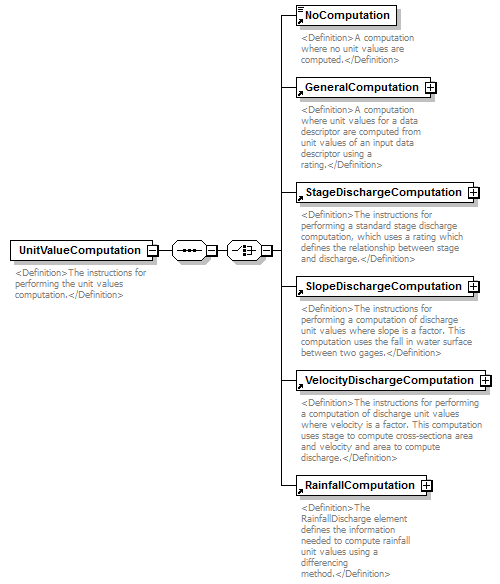 |
||
| namespace | http://water.usgs.gov/XML/NWIS/5.0 | ||
| properties |
|
||
| children | NoComputation GeneralComputation StageDischargeComputation SlopeDischargeComputation VelocityDischargeComputation RainfallComputation | ||
| annotation |
|
||
| source | <xsd:element name="UnitValueComputation"> <xsd:annotation> <xsd:documentation> <Definition>The instructions for performing the unit values computation.</Definition> </xsd:documentation> </xsd:annotation> <xsd:complexType> <xsd:sequence> <xsd:choice> <xsd:element ref="NoComputation"/> <xsd:element ref="GeneralComputation"/> <xsd:element ref="StageDischargeComputation"/> <xsd:element ref="SlopeDischargeComputation"/> <xsd:element ref="VelocityDischargeComputation"/> <xsd:element ref="RainfallComputation"/> </xsd:choice> </xsd:sequence> </xsd:complexType> </xsd:element> |
element VelocityDischargeComputation
| diagram | 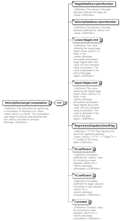 |
||
| namespace | http://water.usgs.gov/XML/NWIS/5.0 | ||
| properties |
|
||
| children | StageDataDescriptorNumber VelocityDataDescriptorNumber LowerStageLimit UpperStageLimit RegressionEquationUsedFlag XCoefficient YCoefficient Constant | ||
| used by |
|
||
| annotation |
|
||
| source | <xsd:element name="VelocityDischargeComputation"> <xsd:annotation> <xsd:documentation> <Definition>The instructions for performing a computation of discharge unit values where velocity is a factor. This computation uses stage to compute cross-sectiona area and velocity and area to compute discharge.</Definition> </xsd:documentation> </xsd:annotation> <xsd:complexType> <xsd:sequence> <xsd:element name="StageDataDescriptorNumber" type="xsd:integer"> <xsd:annotation> <xsd:documentation> <Definition>The pointer to the data descriptor defining the stage unit values.</Definition> </xsd:documentation> </xsd:annotation> </xsd:element> <xsd:element name="VelocityDataDescriptorNumber" type="xsd:integer"> <xsd:annotation> <xsd:documentation> <Definition>The pointer to the data descriptor defining the velocity unit values.</Definition> </xsd:documentation> </xsd:annotation> </xsd:element> <xsd:element name="LowerStageLimit" type="IEEE754FloatValueType" minOccurs="0"> <xsd:annotation> <xsd:documentation> <Definition>The value indicating the lowest gage height where velocity is a factor in the velocity-discharge time-series computation. Gage heights below this value will use a standard rating computation. This value is expressed in the units of the gage height.</Definition> </xsd:documentation> </xsd:annotation> </xsd:element> <xsd:element name="UpperStageLimit" type="IEEE754FloatValueType" minOccurs="0"> <xsd:annotation> <xsd:documentation> <Definition>The value indicating the highest gage height where velocity is a factor in the velocity-discharge time-series computation. Gage heights above this value will use a standard rating computation. This value is expressed in the units of the gage height.</Definition> </xsd:documentation> </xsd:annotation> </xsd:element> <xsd:element name="RegressionEquationUsedFlag" type="xsd:boolean"> <xsd:annotation> <xsd:documentation> <Definition>"Y"/"N" Flag indicating the use of the regression equation "mean_velocity = X*Vi + Y*Stage*Vi + C" instead of the rating table.</Definition> </xsd:documentation> </xsd:annotation> </xsd:element> <xsd:element name="XCoefficient" type="IEEE754FloatValueType" minOccurs="0"> <xsd:annotation> <xsd:documentation> <Definition>Correlation coefficient for velocity value for computing a mean adjusted velocity for a velocity-discharge computation.</Definition> </xsd:documentation> </xsd:annotation> </xsd:element> <xsd:element name="YCoefficient" type="IEEE754FloatValueType" minOccurs="0"> <xsd:annotation> <xsd:documentation> <Definition>Correlation coefficient for stage value for computing a mean adjusted velocity for a velocity-discharge computation.</Definition> </xsd:documentation> </xsd:annotation> </xsd:element> <xsd:element name="Constant" type="IEEE754FloatValueType" minOccurs="0"> <xsd:annotation> <xsd:documentation> <Definition>Constant value for computing a mean adjusted velocity for a velocity-discharge computation.</Definition> </xsd:documentation> </xsd:annotation> </xsd:element> </xsd:sequence> </xsd:complexType> </xsd:element> |
element VelocityDischargeComputation/StageDataDescriptorNumber
| diagram |  |
||||
| namespace | http://water.usgs.gov/XML/NWIS/5.0 | ||||
| type | xsd:integer | ||||
| properties |
|
||||
| annotation |
|
||||
| source | <xsd:element name="StageDataDescriptorNumber" type="xsd:integer"> <xsd:annotation> <xsd:documentation> <Definition>The pointer to the data descriptor defining the stage unit values.</Definition> </xsd:documentation> </xsd:annotation> </xsd:element> |
element VelocityDischargeComputation/VelocityDataDescriptorNumber
| diagram | 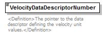 |
||||
| namespace | http://water.usgs.gov/XML/NWIS/5.0 | ||||
| type | xsd:integer | ||||
| properties |
|
||||
| annotation |
|
||||
| source | <xsd:element name="VelocityDataDescriptorNumber" type="xsd:integer"> <xsd:annotation> <xsd:documentation> <Definition>The pointer to the data descriptor defining the velocity unit values.</Definition> </xsd:documentation> </xsd:annotation> </xsd:element> |
element VelocityDischargeComputation/LowerStageLimit
| diagram | 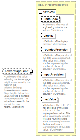 |
||||||||||||||||||||||||||||||||||||||||||||||
| namespace | http://water.usgs.gov/XML/NWIS/5.0 | ||||||||||||||||||||||||||||||||||||||||||||||
| type | IEEE754FloatValueType | ||||||||||||||||||||||||||||||||||||||||||||||
| properties |
|
||||||||||||||||||||||||||||||||||||||||||||||
| facets |
|
||||||||||||||||||||||||||||||||||||||||||||||
| attributes |
|
||||||||||||||||||||||||||||||||||||||||||||||
| annotation |
|
||||||||||||||||||||||||||||||||||||||||||||||
| source | <xsd:element name="LowerStageLimit" type="IEEE754FloatValueType" minOccurs="0"> <xsd:annotation> <xsd:documentation> <Definition>The value indicating the lowest gage height where velocity is a factor in the velocity-discharge time-series computation. Gage heights below this value will use a standard rating computation. This value is expressed in the units of the gage height.</Definition> </xsd:documentation> </xsd:annotation> </xsd:element> |
element VelocityDischargeComputation/UpperStageLimit
| diagram | 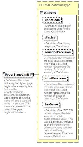 |
||||||||||||||||||||||||||||||||||||||||||||||
| namespace | http://water.usgs.gov/XML/NWIS/5.0 | ||||||||||||||||||||||||||||||||||||||||||||||
| type | IEEE754FloatValueType | ||||||||||||||||||||||||||||||||||||||||||||||
| properties |
|
||||||||||||||||||||||||||||||||||||||||||||||
| facets |
|
||||||||||||||||||||||||||||||||||||||||||||||
| attributes |
|
||||||||||||||||||||||||||||||||||||||||||||||
| annotation |
|
||||||||||||||||||||||||||||||||||||||||||||||
| source | <xsd:element name="UpperStageLimit" type="IEEE754FloatValueType" minOccurs="0"> <xsd:annotation> <xsd:documentation> <Definition>The value indicating the highest gage height where velocity is a factor in the velocity-discharge time-series computation. Gage heights above this value will use a standard rating computation. This value is expressed in the units of the gage height.</Definition> </xsd:documentation> </xsd:annotation> </xsd:element> |
element VelocityDischargeComputation/RegressionEquationUsedFlag
| diagram |  |
||||
| namespace | http://water.usgs.gov/XML/NWIS/5.0 | ||||
| type | xsd:boolean | ||||
| properties |
|
||||
| annotation |
|
||||
| source | <xsd:element name="RegressionEquationUsedFlag" type="xsd:boolean"> <xsd:annotation> <xsd:documentation> <Definition>"Y"/"N" Flag indicating the use of the regression equation "mean_velocity = X*Vi + Y*Stage*Vi + C" instead of the rating table.</Definition> </xsd:documentation> </xsd:annotation> </xsd:element> |
element VelocityDischargeComputation/XCoefficient
| diagram |  |
||||||||||||||||||||||||||||||||||||||||||||||
| namespace | http://water.usgs.gov/XML/NWIS/5.0 | ||||||||||||||||||||||||||||||||||||||||||||||
| type | IEEE754FloatValueType | ||||||||||||||||||||||||||||||||||||||||||||||
| properties |
|
||||||||||||||||||||||||||||||||||||||||||||||
| facets |
|
||||||||||||||||||||||||||||||||||||||||||||||
| attributes |
|
||||||||||||||||||||||||||||||||||||||||||||||
| annotation |
|
||||||||||||||||||||||||||||||||||||||||||||||
| source | <xsd:element name="XCoefficient" type="IEEE754FloatValueType" minOccurs="0"> <xsd:annotation> <xsd:documentation> <Definition>Correlation coefficient for velocity value for computing a mean adjusted velocity for a velocity-discharge computation.</Definition> </xsd:documentation> </xsd:annotation> </xsd:element> |
element VelocityDischargeComputation/YCoefficient
| diagram |  |
||||||||||||||||||||||||||||||||||||||||||||||
| namespace | http://water.usgs.gov/XML/NWIS/5.0 | ||||||||||||||||||||||||||||||||||||||||||||||
| type | IEEE754FloatValueType | ||||||||||||||||||||||||||||||||||||||||||||||
| properties |
|
||||||||||||||||||||||||||||||||||||||||||||||
| facets |
|
||||||||||||||||||||||||||||||||||||||||||||||
| attributes |
|
||||||||||||||||||||||||||||||||||||||||||||||
| annotation |
|
||||||||||||||||||||||||||||||||||||||||||||||
| source | <xsd:element name="YCoefficient" type="IEEE754FloatValueType" minOccurs="0"> <xsd:annotation> <xsd:documentation> <Definition>Correlation coefficient for stage value for computing a mean adjusted velocity for a velocity-discharge computation.</Definition> </xsd:documentation> </xsd:annotation> </xsd:element> |
element VelocityDischargeComputation/Constant
| diagram | 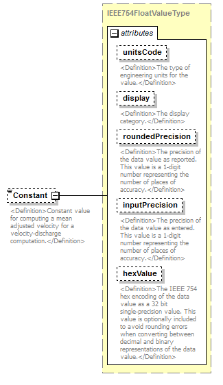 |
||||||||||||||||||||||||||||||||||||||||||||||
| namespace | http://water.usgs.gov/XML/NWIS/5.0 | ||||||||||||||||||||||||||||||||||||||||||||||
| type | IEEE754FloatValueType | ||||||||||||||||||||||||||||||||||||||||||||||
| properties |
|
||||||||||||||||||||||||||||||||||||||||||||||
| facets |
|
||||||||||||||||||||||||||||||||||||||||||||||
| attributes |
|
||||||||||||||||||||||||||||||||||||||||||||||
| annotation |
|
||||||||||||||||||||||||||||||||||||||||||||||
| source | <xsd:element name="Constant" type="IEEE754FloatValueType" minOccurs="0"> <xsd:annotation> <xsd:documentation> <Definition>Constant value for computing a mean adjusted velocity for a velocity-discharge computation.</Definition> </xsd:documentation> </xsd:annotation> </xsd:element> |
element Rating
| diagram | 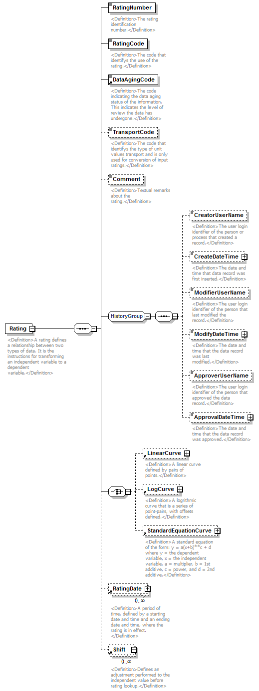 |
||
| namespace | http://water.usgs.gov/XML/NWIS/5.0 | ||
| properties |
|
||
| children | RatingNumber RatingCode DataAgingCode TransportCode Comment CreatorUserName CreateDateTime ModifierUserName ModifyDateTime ApproverUserName ApprovalDateTime LinearCurve LogCurve StandardEquationCurve RatingDate Shift | ||
| used by |
|
||
| annotation |
|
||
| source | <xsd:element name="Rating"> <xsd:annotation> <xsd:documentation> <Definition>A rating defines a relationship between two types of data. It is the instructions for transforming an independent variable to a dependent variable.</Definition> </xsd:documentation> </xsd:annotation> <xsd:complexType> <xsd:sequence> <xsd:element name="RatingNumber" type="xsd:string"> <xsd:annotation> <xsd:documentation> <Definition>The rating identification number.</Definition> </xsd:documentation> </xsd:annotation> </xsd:element> <xsd:element name="RatingCode" type="xsd:string"> <xsd:annotation> <xsd:documentation> <Definition>The code that identifys the use of the rating.</Definition> </xsd:documentation> </xsd:annotation> </xsd:element> <xsd:element ref="DataAgingCode"/> <xsd:element name="TransportCode" type="xsd:string" minOccurs="0"> <xsd:annotation> <xsd:documentation> <Definition>The code that identifys the type of unit values transport and is only used for conversion of input ratings.</Definition> </xsd:documentation> </xsd:annotation> </xsd:element> <xsd:element name="Comment" type="xsd:string" minOccurs="0"> <xsd:annotation> <xsd:documentation> <Definition>Textual remarks about the rating.</Definition> </xsd:documentation> </xsd:annotation> </xsd:element> <xsd:group ref="HistoryGroup"/> <xsd:choice> <xsd:element ref="LinearCurve" minOccurs="0"/> <xsd:element ref="LogCurve" minOccurs="0"/> <xsd:element ref="StandardEquationCurve" minOccurs="0"/> </xsd:choice> <xsd:element ref="RatingDate" minOccurs="0" maxOccurs="unbounded"/> <xsd:element ref="Shift" minOccurs="0" maxOccurs="unbounded"/> </xsd:sequence> </xsd:complexType> </xsd:element> |
element Rating/RatingNumber
| diagram |  |
||||
| namespace | http://water.usgs.gov/XML/NWIS/5.0 | ||||
| type | xsd:string | ||||
| properties |
|
||||
| annotation |
|
||||
| source | <xsd:element name="RatingNumber" type="xsd:string"> <xsd:annotation> <xsd:documentation> <Definition>The rating identification number.</Definition> </xsd:documentation> </xsd:annotation> </xsd:element> |
element Rating/RatingCode
| diagram |  |
||||
| namespace | http://water.usgs.gov/XML/NWIS/5.0 | ||||
| type | xsd:string | ||||
| properties |
|
||||
| annotation |
|
||||
| source | <xsd:element name="RatingCode" type="xsd:string"> <xsd:annotation> <xsd:documentation> <Definition>The code that identifys the use of the rating.</Definition> </xsd:documentation> </xsd:annotation> </xsd:element> |
element Rating/TransportCode
| diagram | 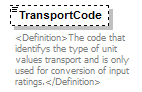 |
||||||||
| namespace | http://water.usgs.gov/XML/NWIS/5.0 | ||||||||
| type | xsd:string | ||||||||
| properties |
|
||||||||
| annotation |
|
||||||||
| source | <xsd:element name="TransportCode" type="xsd:string" minOccurs="0"> <xsd:annotation> <xsd:documentation> <Definition>The code that identifys the type of unit values transport and is only used for conversion of input ratings.</Definition> </xsd:documentation> </xsd:annotation> </xsd:element> |
element Rating/Comment
| diagram |  |
||||||||
| namespace | http://water.usgs.gov/XML/NWIS/5.0 | ||||||||
| type | xsd:string | ||||||||
| properties |
|
||||||||
| annotation |
|
||||||||
| source | <xsd:element name="Comment" type="xsd:string" minOccurs="0"> <xsd:annotation> <xsd:documentation> <Definition>Textual remarks about the rating.</Definition> </xsd:documentation> </xsd:annotation> </xsd:element> |
element UnitValues
| diagram | 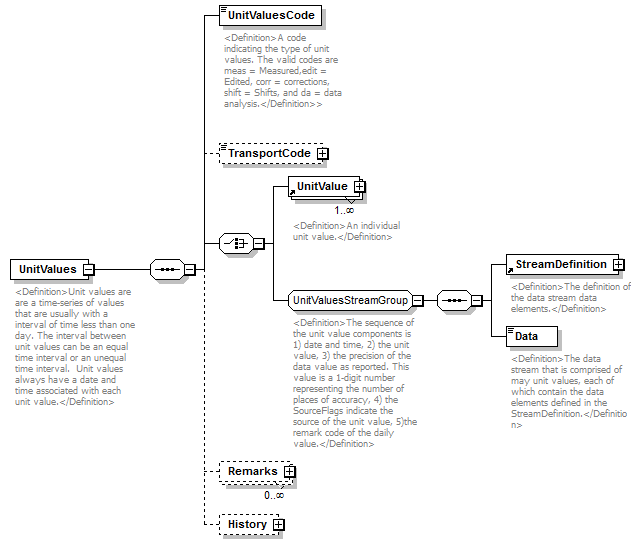 |
||
| namespace | http://water.usgs.gov/XML/NWIS/5.0 | ||
| properties |
|
||
| children | UnitValuesCode TransportCode UnitValue StreamDefinition Data Remarks History | ||
| used by |
|
||
| annotation |
|
||
| source | <xsd:element name="UnitValues"> <xsd:annotation> <xsd:documentation> <Definition>Unit values are are a time-series of values that are usually with a interval of time less than one day. The interval between unit values can be an equal time interval or an unequal time interval. Unit values always have a date and time associated with each unit value.</Definition> </xsd:documentation> </xsd:annotation> <xsd:complexType> <xsd:sequence> <xsd:element name="UnitValuesCode" type="xsd:string"> <xsd:annotation> <xsd:documentation> <Definition>A code indicating the type of unit values. The valid codes are meas = Measured,edit = Edited, corr = corrections, shift = Shifts, and da = data analysis.</Definition>> </xsd:documentation> </xsd:annotation> </xsd:element> <xsd:element name="TransportCode" type="UnitValuesTransportCode" minOccurs="0"/> <xsd:choice> <xsd:element ref="UnitValue" maxOccurs="unbounded"/> <xsd:group ref="UnitValuesStreamGroup"/> </xsd:choice> <xsd:element name="Remarks" type="UnitValuesRemarks" minOccurs="0" maxOccurs="unbounded"/> <xsd:element name="History" type="RecordHistoryType" minOccurs="0"/> </xsd:sequence> </xsd:complexType> </xsd:element> |
element UnitValues/UnitValuesCode
| diagram | 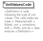 |
||||
| namespace | http://water.usgs.gov/XML/NWIS/5.0 | ||||
| type | xsd:string | ||||
| properties |
|
||||
| annotation |
|
||||
| source | <xsd:element name="UnitValuesCode" type="xsd:string"> <xsd:annotation> <xsd:documentation> <Definition>A code indicating the type of unit values. The valid codes are meas = Measured,edit = Edited, corr = corrections, shift = Shifts, and da = data analysis.</Definition>> </xsd:documentation> </xsd:annotation> </xsd:element> |
element UnitValues/TransportCode
| diagram | 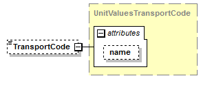 |
||||||||||||
| namespace | http://water.usgs.gov/XML/NWIS/5.0 | ||||||||||||
| type | UnitValuesTransportCode | ||||||||||||
| properties |
|
||||||||||||
| attributes |
|
||||||||||||
| source | <xsd:element name="TransportCode" type="UnitValuesTransportCode" minOccurs="0"/> |
element UnitValues/Remarks
| diagram | 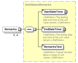 |
||||||||
| namespace | http://water.usgs.gov/XML/NWIS/5.0 | ||||||||
| type | UnitValuesRemarks | ||||||||
| properties |
|
||||||||
| children | StartDateTime EndDateTime RemarksText | ||||||||
| source | <xsd:element name="Remarks" type="UnitValuesRemarks" minOccurs="0" maxOccurs="unbounded"/> |
element UnitValues/History
| diagram | 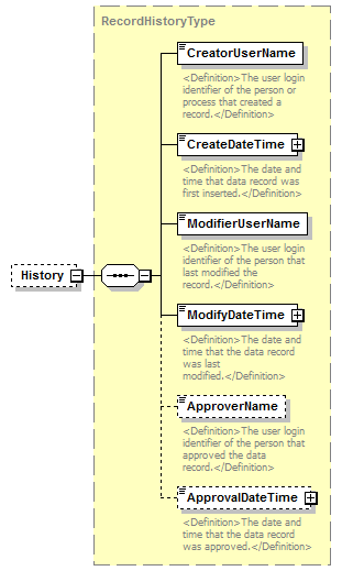 |
||||||||
| namespace | http://water.usgs.gov/XML/NWIS/5.0 | ||||||||
| type | RecordHistoryType | ||||||||
| properties |
|
||||||||
| children | CreatorUserName CreateDateTime ModifierUserName ModifyDateTime ApproverName ApprovalDateTime | ||||||||
| source | <xsd:element name="History" type="RecordHistoryType" minOccurs="0"/> |
element DailyValues
| diagram | 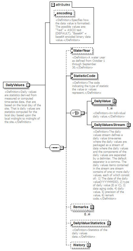 |
||||||||||||||
| namespace | http://water.usgs.gov/XML/NWIS/5.0 | ||||||||||||||
| properties |
|
||||||||||||||
| children | WaterYear StatisticCode DailyValue DailyValuesStream Remarks DailyValueStatistics History | ||||||||||||||
| used by |
|
||||||||||||||
| attributes |
|
||||||||||||||
| annotation |
|
||||||||||||||
| source | <xsd:element name="DailyValues"> <xsd:annotation> <xsd:documentation> <Definition>Daily values are statistics derived from measured or computed time-series data, that are based on the local day of the site. That is daily values are statistics computed for the local day based upon the local midnight to midnight of the site.</Definition> </xsd:documentation> </xsd:annotation> <xsd:complexType> <xsd:sequence> <xsd:element ref="WaterYear" minOccurs="0"/> <xsd:element ref="StatisticCode"/> <xsd:choice> <xsd:element ref="DailyValue" maxOccurs="unbounded"/> <xsd:element ref="DailyValuesStream"/> </xsd:choice> <xsd:element name="Remarks" type="DailyValuesRemarks" minOccurs="0" maxOccurs="unbounded"/> <xsd:element ref="DailyValueStatistics" minOccurs="0"/> <xsd:element name="History" type="RecordHistoryType" minOccurs="0"/> </xsd:sequence> <xsd:attribute ref="encoding"/> </xsd:complexType> </xsd:element> |
element DailyValues/Remarks
| diagram | 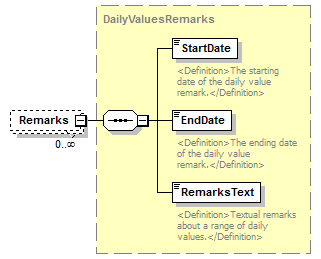 |
||||||||
| namespace | http://water.usgs.gov/XML/NWIS/5.0 | ||||||||
| type | DailyValuesRemarks | ||||||||
| properties |
|
||||||||
| children | StartDate EndDate RemarksText | ||||||||
| source | <xsd:element name="Remarks" type="DailyValuesRemarks" minOccurs="0" maxOccurs="unbounded"/> |
element DailyValues/History
| diagram |  |
||||||||
| namespace | http://water.usgs.gov/XML/NWIS/5.0 | ||||||||
| type | RecordHistoryType | ||||||||
| properties |
|
||||||||
| children | CreatorUserName CreateDateTime ModifierUserName ModifyDateTime ApproverName ApprovalDateTime | ||||||||
| source | <xsd:element name="History" type="RecordHistoryType" minOccurs="0"/> |
element DataAging
| diagram | 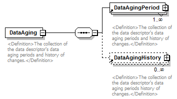 |
||
| namespace | http://water.usgs.gov/XML/NWIS/5.0 | ||
| properties |
|
||
| children | DataAgingPeriod DataAgingHistory | ||
| used by |
|
||
| annotation |
|
||
| source | <xsd:element name="DataAging"> <xsd:annotation> <xsd:documentation> <Definition>The collection of the data descriptor's data aging periods and history of changes.</Definition> </xsd:documentation> </xsd:annotation> <xsd:complexType> <xsd:sequence> <xsd:element ref="DataAgingPeriod" maxOccurs="unbounded"/> <xsd:element ref="DataAgingHistory" minOccurs="0" maxOccurs="unbounded"/> </xsd:sequence> </xsd:complexType> </xsd:element> |
element DataCorrection
| diagram | 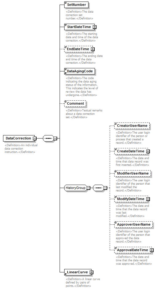 |
||
| namespace | http://water.usgs.gov/XML/NWIS/5.0 | ||
| properties |
|
||
| children | SetNumber StartDateTime EndDateTime DataAgingCode Comment CreatorUserName CreateDateTime ModifierUserName ModifyDateTime ApproverUserName ApprovalDateTime LinearCurve | ||
| used by |
|
||
| annotation |
|
||
| source | <xsd:element name="DataCorrection"> <xsd:annotation> <xsd:documentation> <Definition>An individual data correction instruction.</Definition> </xsd:documentation> </xsd:annotation> <xsd:complexType> <xsd:sequence> <xsd:element name="SetNumber" type="xsd:integer"> <xsd:annotation> <xsd:documentation> <Definition>The data correction set number.</Definition> </xsd:documentation> </xsd:annotation> </xsd:element> <xsd:element name="StartDateTime" type="DateTimeWithDatum"> <xsd:annotation> <xsd:documentation> <Definition>The starting date and time of the data correction.</Definition> </xsd:documentation> </xsd:annotation> </xsd:element> <xsd:element name="EndDateTime" type="DateTimeWithDatum" minOccurs="0"> <xsd:annotation> <xsd:documentation> <Definition>The ending date and time of the data correction.</Definition> </xsd:documentation> </xsd:annotation> </xsd:element> <xsd:element ref="DataAgingCode"/> <xsd:element name="Comment" type="xsd:string" minOccurs="0"> <xsd:annotation> <xsd:documentation> <Definition>Textual remarks about a data correction set.</Definition> </xsd:documentation> </xsd:annotation> </xsd:element> <xsd:group ref="HistoryGroup"/> <xsd:element ref="LinearCurve"/> </xsd:sequence> </xsd:complexType> </xsd:element> |
element DataCorrection/SetNumber
| diagram |  |
||||
| namespace | http://water.usgs.gov/XML/NWIS/5.0 | ||||
| type | xsd:integer | ||||
| properties |
|
||||
| annotation |
|
||||
| source | <xsd:element name="SetNumber" type="xsd:integer"> <xsd:annotation> <xsd:documentation> <Definition>The data correction set number.</Definition> </xsd:documentation> </xsd:annotation> </xsd:element> |
element DataCorrection/StartDateTime
| diagram |  |
||||||||||||||||||||||||||||||
| namespace | http://water.usgs.gov/XML/NWIS/5.0 | ||||||||||||||||||||||||||||||
| type | DateTimeWithDatum | ||||||||||||||||||||||||||||||
| properties |
|
||||||||||||||||||||||||||||||
| attributes |
|
||||||||||||||||||||||||||||||
| annotation |
|
||||||||||||||||||||||||||||||
| source | <xsd:element name="StartDateTime" type="DateTimeWithDatum"> <xsd:annotation> <xsd:documentation> <Definition>The starting date and time of the data correction.</Definition> </xsd:documentation> </xsd:annotation> </xsd:element> |
element DataCorrection/EndDateTime
| diagram |  |
||||||||||||||||||||||||||||||
| namespace | http://water.usgs.gov/XML/NWIS/5.0 | ||||||||||||||||||||||||||||||
| type | DateTimeWithDatum | ||||||||||||||||||||||||||||||
| properties |
|
||||||||||||||||||||||||||||||
| attributes |
|
||||||||||||||||||||||||||||||
| annotation |
|
||||||||||||||||||||||||||||||
| source | <xsd:element name="EndDateTime" type="DateTimeWithDatum" minOccurs="0"> <xsd:annotation> <xsd:documentation> <Definition>The ending date and time of the data correction.</Definition> </xsd:documentation> </xsd:annotation> </xsd:element> |
element DataCorrection/Comment
| diagram |  |
||||||||
| namespace | http://water.usgs.gov/XML/NWIS/5.0 | ||||||||
| type | xsd:string | ||||||||
| properties |
|
||||||||
| annotation |
|
||||||||
| source | <xsd:element name="Comment" type="xsd:string" minOccurs="0"> <xsd:annotation> <xsd:documentation> <Definition>Textual remarks about a data correction set.</Definition> </xsd:documentation> </xsd:annotation> </xsd:element> |
element StatisticalSummary
| diagram | 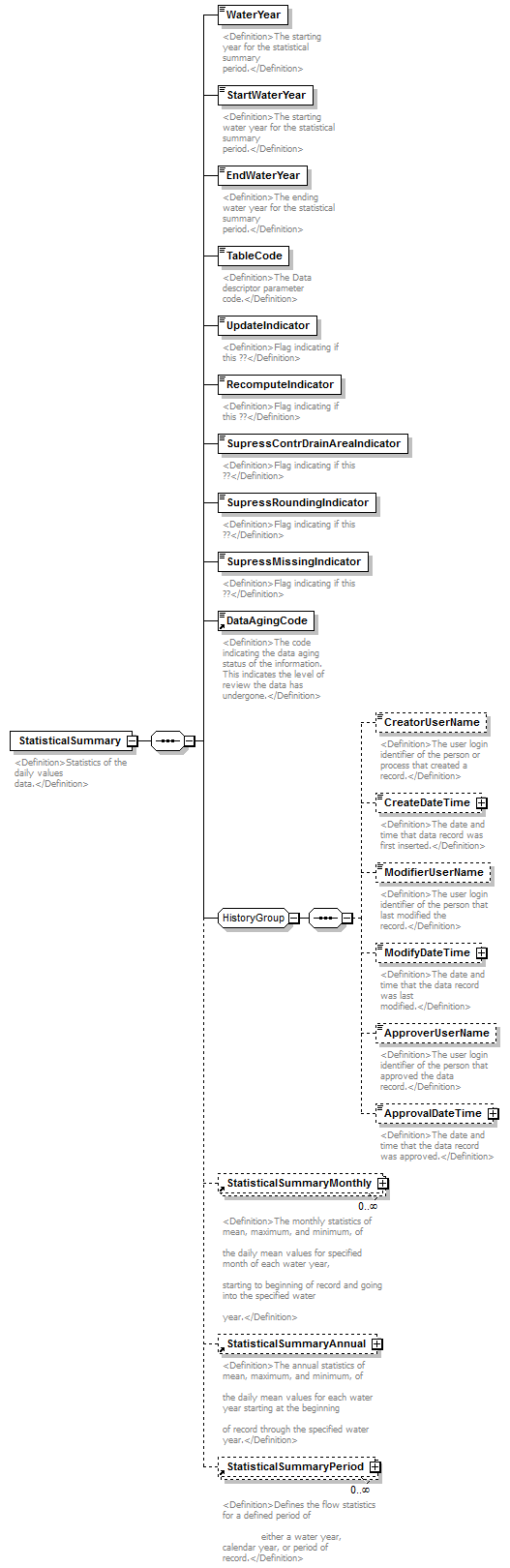 |
||
| namespace | http://water.usgs.gov/XML/NWIS/5.0 | ||
| properties |
|
||
| children | WaterYear StartWaterYear EndWaterYear TableCode UpdateIndicator RecomputeIndicator SupressContrDrainAreaIndicator SupressRoundingIndicator SupressMissingIndicator DataAgingCode CreatorUserName CreateDateTime ModifierUserName ModifyDateTime ApproverUserName ApprovalDateTime StatisticalSummaryMonthly StatisticalSummaryAnnual StatisticalSummaryPeriod | ||
| used by |
|
||
| annotation |
|
||
| source | <xsd:element name="StatisticalSummary"> <xsd:annotation> <xsd:documentation> <Definition>Statistics of the daily values data.</Definition> </xsd:documentation> </xsd:annotation> <xsd:complexType> <xsd:sequence> <xsd:element name="WaterYear" type="xsd:positiveInteger"> <xsd:annotation> <xsd:documentation> <Definition>The starting year for the statistical summary period.</Definition> </xsd:documentation> </xsd:annotation> </xsd:element> <xsd:element name="StartWaterYear" type="xsd:positiveInteger"> <xsd:annotation> <xsd:documentation> <Definition>The starting water year for the statistical summary period.</Definition> </xsd:documentation> </xsd:annotation> </xsd:element> <xsd:element name="EndWaterYear" type="xsd:positiveInteger"> <xsd:annotation> <xsd:documentation> <Definition>The ending water year for the statistical summary period.</Definition> </xsd:documentation> </xsd:annotation> </xsd:element> <xsd:element name="TableCode" type="xsd:string"> <xsd:annotation> <xsd:documentation> <Definition>The Data descriptor parameter code.</Definition> </xsd:documentation> </xsd:annotation> </xsd:element> <xsd:element name="UpdateIndicator" type="xsd:boolean"> <xsd:annotation> <xsd:documentation> <Definition>Flag indicating if this ??</Definition> </xsd:documentation> </xsd:annotation> </xsd:element> <xsd:element name="RecomputeIndicator" type="xsd:boolean"> <xsd:annotation> <xsd:documentation> <Definition>Flag indicating if this ??</Definition> </xsd:documentation> </xsd:annotation> </xsd:element> <xsd:element name="SupressContrDrainAreaIndicator" type="xsd:boolean"> <xsd:annotation> <xsd:documentation> <Definition>Flag indicating if this ??</Definition> </xsd:documentation> </xsd:annotation> </xsd:element> <xsd:element name="SupressRoundingIndicator" type="xsd:boolean"> <xsd:annotation> <xsd:documentation> <Definition>Flag indicating if this ??</Definition> </xsd:documentation> </xsd:annotation> </xsd:element> <xsd:element name="SupressMissingIndicator" type="xsd:boolean"> <xsd:annotation> <xsd:documentation> <Definition>Flag indicating if this ??</Definition> </xsd:documentation> </xsd:annotation> </xsd:element> <xsd:element ref="DataAgingCode"/> <xsd:group ref="HistoryGroup"/> <xsd:element ref="StatisticalSummaryMonthly" minOccurs="0" maxOccurs="unbounded"/> <xsd:element ref="StatisticalSummaryAnnual" minOccurs="0"/> <xsd:element ref="StatisticalSummaryPeriod" minOccurs="0" maxOccurs="unbounded"/> </xsd:sequence> </xsd:complexType> </xsd:element> |
element StatisticalSummary/WaterYear
| diagram | 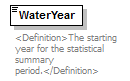 |
||||
| namespace | http://water.usgs.gov/XML/NWIS/5.0 | ||||
| type | xsd:positiveInteger | ||||
| properties |
|
||||
| used by |
|
||||
| annotation |
|
||||
| source | <xsd:element name="WaterYear" type="xsd:positiveInteger"> <xsd:annotation> <xsd:documentation> <Definition>The starting year for the statistical summary period.</Definition> </xsd:documentation> </xsd:annotation> </xsd:element> |
element StatisticalSummary/StartWaterYear
| diagram | 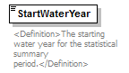 |
||||
| namespace | http://water.usgs.gov/XML/NWIS/5.0 | ||||
| type | xsd:positiveInteger | ||||
| properties |
|
||||
| annotation |
|
||||
| source | <xsd:element name="StartWaterYear" type="xsd:positiveInteger"> <xsd:annotation> <xsd:documentation> <Definition>The starting water year for the statistical summary period.</Definition> </xsd:documentation> </xsd:annotation> </xsd:element> |
element StatisticalSummary/EndWaterYear
| diagram |  |
||||
| namespace | http://water.usgs.gov/XML/NWIS/5.0 | ||||
| type | xsd:positiveInteger | ||||
| properties |
|
||||
| annotation |
|
||||
| source | <xsd:element name="EndWaterYear" type="xsd:positiveInteger"> <xsd:annotation> <xsd:documentation> <Definition>The ending water year for the statistical summary period.</Definition> </xsd:documentation> </xsd:annotation> </xsd:element> |
element StatisticalSummary/TableCode
| diagram | 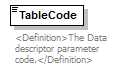 |
||||
| namespace | http://water.usgs.gov/XML/NWIS/5.0 | ||||
| type | xsd:string | ||||
| properties |
|
||||
| annotation |
|
||||
| source | <xsd:element name="TableCode" type="xsd:string"> <xsd:annotation> <xsd:documentation> <Definition>The Data descriptor parameter code.</Definition> </xsd:documentation> </xsd:annotation> </xsd:element> |
element StatisticalSummary/UpdateIndicator
| diagram | 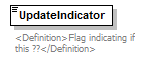 |
||||
| namespace | http://water.usgs.gov/XML/NWIS/5.0 | ||||
| type | xsd:boolean | ||||
| properties |
|
||||
| annotation |
|
||||
| source | <xsd:element name="UpdateIndicator" type="xsd:boolean"> <xsd:annotation> <xsd:documentation> <Definition>Flag indicating if this ??</Definition> </xsd:documentation> </xsd:annotation> </xsd:element> |
element StatisticalSummary/RecomputeIndicator
| diagram | 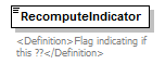 |
||||
| namespace | http://water.usgs.gov/XML/NWIS/5.0 | ||||
| type | xsd:boolean | ||||
| properties |
|
||||
| annotation |
|
||||
| source | <xsd:element name="RecomputeIndicator" type="xsd:boolean"> <xsd:annotation> <xsd:documentation> <Definition>Flag indicating if this ??</Definition> </xsd:documentation> </xsd:annotation> </xsd:element> |
element StatisticalSummary/SupressContrDrainAreaIndicator
| diagram | 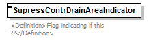 |
||||
| namespace | http://water.usgs.gov/XML/NWIS/5.0 | ||||
| type | xsd:boolean | ||||
| properties |
|
||||
| annotation |
|
||||
| source | <xsd:element name="SupressContrDrainAreaIndicator" type="xsd:boolean"> <xsd:annotation> <xsd:documentation> <Definition>Flag indicating if this ??</Definition> </xsd:documentation> </xsd:annotation> </xsd:element> |
element StatisticalSummary/SupressRoundingIndicator
| diagram |  |
||||
| namespace | http://water.usgs.gov/XML/NWIS/5.0 | ||||
| type | xsd:boolean | ||||
| properties |
|
||||
| annotation |
|
||||
| source | <xsd:element name="SupressRoundingIndicator" type="xsd:boolean"> <xsd:annotation> <xsd:documentation> <Definition>Flag indicating if this ??</Definition> </xsd:documentation> </xsd:annotation> </xsd:element> |
element StatisticalSummary/SupressMissingIndicator
| diagram |  |
||||
| namespace | http://water.usgs.gov/XML/NWIS/5.0 | ||||
| type | xsd:boolean | ||||
| properties |
|
||||
| annotation |
|
||||
| source | <xsd:element name="SupressMissingIndicator" type="xsd:boolean"> <xsd:annotation> <xsd:documentation> <Definition>Flag indicating if this ??</Definition> </xsd:documentation> </xsd:annotation> </xsd:element> |
element Channel
| diagram | 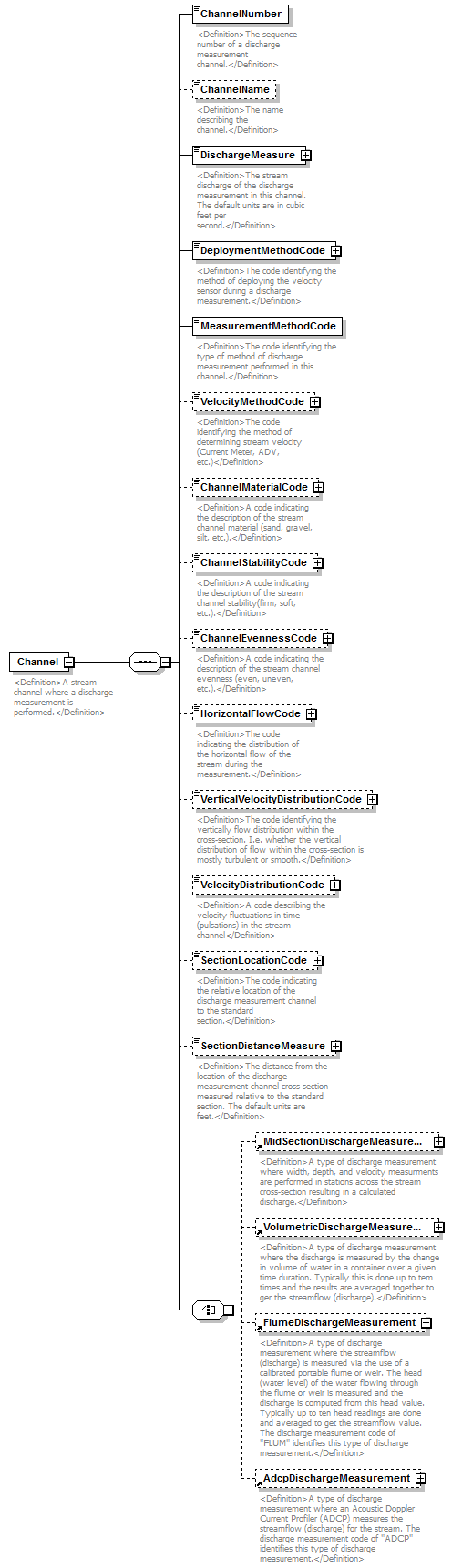 |
||
| namespace | http://water.usgs.gov/XML/NWIS/5.0 | ||
| properties |
|
||
| children | ChannelNumber ChannelName DischargeMeasure DeploymentMethodCode MeasurementMethodCode VelocityMethodCode ChannelMaterialCode ChannelStabilityCode ChannelEvennessCode HorizontalFlowCode VerticalVelocityDistributionCode VelocityDistributionCode SectionLocationCode SectionDistanceMeasure MidSectionDischargeMeasurement VolumetricDischargeMeasurement FlumeDischargeMeasurement AdcpDischargeMeasurement | ||
| used by |
|
||
| annotation |
|
||
| source | <xsd:element name="Channel"> <xsd:annotation> <xsd:documentation> <Definition>A stream channel where a discharge measurement is performed.</Definition> </xsd:documentation> </xsd:annotation> <xsd:complexType> <xsd:sequence> <xsd:element name="ChannelNumber" type="xsd:integer"> <xsd:annotation> <xsd:documentation> <Definition>The sequence number of a discharge measurement channel.</Definition> </xsd:documentation> </xsd:annotation> </xsd:element> <xsd:element name="ChannelName" type="xsd:string" minOccurs="0"> <xsd:annotation> <xsd:documentation> <Definition>The name describing the channel.</Definition> </xsd:documentation> </xsd:annotation> </xsd:element> <xsd:element name="DischargeMeasure" type="IEEE754UncertaintyFloatValueType"> <xsd:annotation> <xsd:documentation> <Definition>The stream discharge of the discharge measurement in this channel. The default units are in cubic feet per second.</Definition> </xsd:documentation> </xsd:annotation> </xsd:element> <xsd:element name="DeploymentMethodCode" type="ReferenceListCodeType"> <xsd:annotation> <xsd:documentation> <Definition>The code identifying the method of deploying the velocity sensor during a discharge measurement.</Definition> </xsd:documentation> </xsd:annotation> </xsd:element> <xsd:element name="MeasurementMethodCode" type="xsd:string"> <xsd:annotation> <xsd:documentation> <Definition>The code identifying the type of method of discharge measurement performed in this channel.</Definition> </xsd:documentation> </xsd:annotation> </xsd:element> <xsd:element name="VelocityMethodCode" type="ReferenceListCodeType" minOccurs="0"> <xsd:annotation> <xsd:documentation> <Definition>The code identifying the method of determining stream velocity (Current Meter, ADV, etc.)</Definition> </xsd:documentation> </xsd:annotation> </xsd:element> <xsd:element name="ChannelMaterialCode" type="ReferenceListCodeType" minOccurs="0"> <xsd:annotation> <xsd:documentation> <Definition>A code indicating the description of the stream channel material (sand, gravel, silt, etc.).</Definition> </xsd:documentation> </xsd:annotation> </xsd:element> <xsd:element name="ChannelStabilityCode" type="ReferenceListCodeType" minOccurs="0"> <xsd:annotation> <xsd:documentation> <Definition>A code indicating the description of the stream channel stability(firm, soft, etc.).</Definition> </xsd:documentation> </xsd:annotation> </xsd:element> <xsd:element name="ChannelEvennessCode" type="ReferenceListCodeType" minOccurs="0"> <xsd:annotation> <xsd:documentation> <Definition>A code indicating the description of the stream channel evenness (even, uneven, etc.).</Definition> </xsd:documentation> </xsd:annotation> </xsd:element> <xsd:element name="HorizontalFlowCode" type="ReferenceListCodeType" minOccurs="0"> <xsd:annotation> <xsd:documentation> <Definition>The code indicating the distribution of the horizontal flow of the stream during the measurement.</Definition> </xsd:documentation> </xsd:annotation> </xsd:element> <xsd:element name="VerticalVelocityDistributionCode" type="ReferenceListCodeType" minOccurs="0"> <xsd:annotation> <xsd:documentation> <Definition>The code identifying the vertically flow distribution within the cross-section. I.e. whether the vertical distribution of flow within the cross-section is mostly turbulent or smooth.</Definition> </xsd:documentation> </xsd:annotation> </xsd:element> <xsd:element name="VelocityDistributionCode" type="ReferenceListCodeType" minOccurs="0"> <xsd:annotation> <xsd:documentation> <Definition>A code describing the velocity fluctuations in time (pulsations) in the stream channel</Definition> </xsd:documentation> </xsd:annotation> </xsd:element> <xsd:element name="SectionLocationCode" type="ReferenceListCodeType" minOccurs="0"> <xsd:annotation> <xsd:documentation> <Definition>The code indicating the relative location of the discharge measurement channel to the standard section.</Definition> </xsd:documentation> </xsd:annotation> </xsd:element> <xsd:element name="SectionDistanceMeasure" type="IEEE754FloatValueType" minOccurs="0"> <xsd:annotation> <xsd:documentation> <Definition>The distance from the location of the discharge measurement channel cross-section measured relative to the standard section. The default units are feet.</Definition> </xsd:documentation> </xsd:annotation> </xsd:element> <xsd:choice> <xsd:element ref="MidSectionDischargeMeasurement" minOccurs="0"/> <xsd:element ref="VolumetricDischargeMeasurement" minOccurs="0"/> <xsd:element ref="FlumeDischargeMeasurement" minOccurs="0"/> <xsd:element ref="AdcpDischargeMeasurement" minOccurs="0"/> </xsd:choice> </xsd:sequence> </xsd:complexType> </xsd:element> |
element Channel/ChannelNumber
| diagram |  |
||||
| namespace | http://water.usgs.gov/XML/NWIS/5.0 | ||||
| type | xsd:integer | ||||
| properties |
|
||||
| annotation |
|
||||
| source | <xsd:element name="ChannelNumber" type="xsd:integer"> <xsd:annotation> <xsd:documentation> <Definition>The sequence number of a discharge measurement channel.</Definition> </xsd:documentation> </xsd:annotation> </xsd:element> |
element Channel/ChannelName
| diagram | 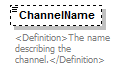 |
||||||||
| namespace | http://water.usgs.gov/XML/NWIS/5.0 | ||||||||
| type | xsd:string | ||||||||
| properties |
|
||||||||
| annotation |
|
||||||||
| source | <xsd:element name="ChannelName" type="xsd:string" minOccurs="0"> <xsd:annotation> <xsd:documentation> <Definition>The name describing the channel.</Definition> </xsd:documentation> </xsd:annotation> </xsd:element> |
element Channel/DischargeMeasure
| diagram |  |
||||||||||||||||||||||||||||||||||||||||||||||||||||||||||||||
| namespace | http://water.usgs.gov/XML/NWIS/5.0 | ||||||||||||||||||||||||||||||||||||||||||||||||||||||||||||||
| type | IEEE754UncertaintyFloatValueType | ||||||||||||||||||||||||||||||||||||||||||||||||||||||||||||||
| properties |
|
||||||||||||||||||||||||||||||||||||||||||||||||||||||||||||||
| facets |
|
||||||||||||||||||||||||||||||||||||||||||||||||||||||||||||||
| attributes |
|
||||||||||||||||||||||||||||||||||||||||||||||||||||||||||||||
| annotation |
|
||||||||||||||||||||||||||||||||||||||||||||||||||||||||||||||
| source | <xsd:element name="DischargeMeasure" type="IEEE754UncertaintyFloatValueType"> <xsd:annotation> <xsd:documentation> <Definition>The stream discharge of the discharge measurement in this channel. The default units are in cubic feet per second.</Definition> </xsd:documentation> </xsd:annotation> </xsd:element> |
element Channel/DeploymentMethodCode
| diagram | 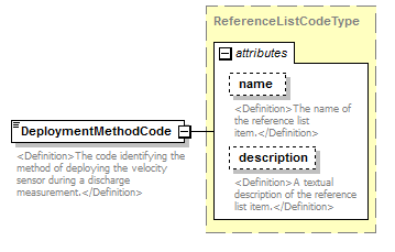 |
||||||||||||||||||||||
| namespace | http://water.usgs.gov/XML/NWIS/5.0 | ||||||||||||||||||||||
| type | ReferenceListCodeType | ||||||||||||||||||||||
| properties |
|
||||||||||||||||||||||
| attributes |
|
||||||||||||||||||||||
| annotation |
|
||||||||||||||||||||||
| source | <xsd:element name="DeploymentMethodCode" type="ReferenceListCodeType"> <xsd:annotation> <xsd:documentation> <Definition>The code identifying the method of deploying the velocity sensor during a discharge measurement.</Definition> </xsd:documentation> </xsd:annotation> </xsd:element> |
element Channel/MeasurementMethodCode
| diagram | 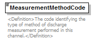 |
||||
| namespace | http://water.usgs.gov/XML/NWIS/5.0 | ||||
| type | xsd:string | ||||
| properties |
|
||||
| annotation |
|
||||
| source | <xsd:element name="MeasurementMethodCode" type="xsd:string"> <xsd:annotation> <xsd:documentation> <Definition>The code identifying the type of method of discharge measurement performed in this channel.</Definition> </xsd:documentation> </xsd:annotation> </xsd:element> |
element Channel/VelocityMethodCode
| diagram | 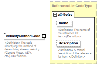 |
||||||||||||||||||||||
| namespace | http://water.usgs.gov/XML/NWIS/5.0 | ||||||||||||||||||||||
| type | ReferenceListCodeType | ||||||||||||||||||||||
| properties |
|
||||||||||||||||||||||
| attributes |
|
||||||||||||||||||||||
| annotation |
|
||||||||||||||||||||||
| source | <xsd:element name="VelocityMethodCode" type="ReferenceListCodeType" minOccurs="0"> <xsd:annotation> <xsd:documentation> <Definition>The code identifying the method of determining stream velocity (Current Meter, ADV, etc.)</Definition> </xsd:documentation> </xsd:annotation> </xsd:element> |
element Channel/ChannelMaterialCode
| diagram |  |
||||||||||||||||||||||
| namespace | http://water.usgs.gov/XML/NWIS/5.0 | ||||||||||||||||||||||
| type | ReferenceListCodeType | ||||||||||||||||||||||
| properties |
|
||||||||||||||||||||||
| attributes |
|
||||||||||||||||||||||
| annotation |
|
||||||||||||||||||||||
| source | <xsd:element name="ChannelMaterialCode" type="ReferenceListCodeType" minOccurs="0"> <xsd:annotation> <xsd:documentation> <Definition>A code indicating the description of the stream channel material (sand, gravel, silt, etc.).</Definition> </xsd:documentation> </xsd:annotation> </xsd:element> |
element Channel/ChannelStabilityCode
| diagram |  |
||||||||||||||||||||||
| namespace | http://water.usgs.gov/XML/NWIS/5.0 | ||||||||||||||||||||||
| type | ReferenceListCodeType | ||||||||||||||||||||||
| properties |
|
||||||||||||||||||||||
| attributes |
|
||||||||||||||||||||||
| annotation |
|
||||||||||||||||||||||
| source | <xsd:element name="ChannelStabilityCode" type="ReferenceListCodeType" minOccurs="0"> <xsd:annotation> <xsd:documentation> <Definition>A code indicating the description of the stream channel stability(firm, soft, etc.).</Definition> </xsd:documentation> </xsd:annotation> </xsd:element> |
element Channel/ChannelEvennessCode
| diagram |  |
||||||||||||||||||||||
| namespace | http://water.usgs.gov/XML/NWIS/5.0 | ||||||||||||||||||||||
| type | ReferenceListCodeType | ||||||||||||||||||||||
| properties |
|
||||||||||||||||||||||
| attributes |
|
||||||||||||||||||||||
| annotation |
|
||||||||||||||||||||||
| source | <xsd:element name="ChannelEvennessCode" type="ReferenceListCodeType" minOccurs="0"> <xsd:annotation> <xsd:documentation> <Definition>A code indicating the description of the stream channel evenness (even, uneven, etc.).</Definition> </xsd:documentation> </xsd:annotation> </xsd:element> |
element Channel/HorizontalFlowCode
| diagram | 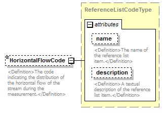 |
||||||||||||||||||||||
| namespace | http://water.usgs.gov/XML/NWIS/5.0 | ||||||||||||||||||||||
| type | ReferenceListCodeType | ||||||||||||||||||||||
| properties |
|
||||||||||||||||||||||
| attributes |
|
||||||||||||||||||||||
| annotation |
|
||||||||||||||||||||||
| source | <xsd:element name="HorizontalFlowCode" type="ReferenceListCodeType" minOccurs="0"> <xsd:annotation> <xsd:documentation> <Definition>The code indicating the distribution of the horizontal flow of the stream during the measurement.</Definition> </xsd:documentation> </xsd:annotation> </xsd:element> |
element Channel/VerticalVelocityDistributionCode
| diagram | 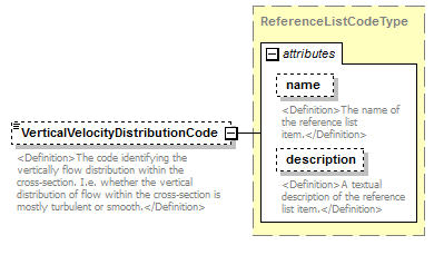 |
||||||||||||||||||||||
| namespace | http://water.usgs.gov/XML/NWIS/5.0 | ||||||||||||||||||||||
| type | ReferenceListCodeType | ||||||||||||||||||||||
| properties |
|
||||||||||||||||||||||
| attributes |
|
||||||||||||||||||||||
| annotation |
|
||||||||||||||||||||||
| source | <xsd:element name="VerticalVelocityDistributionCode" type="ReferenceListCodeType" minOccurs="0"> <xsd:annotation> <xsd:documentation> <Definition>The code identifying the vertically flow distribution within the cross-section. I.e. whether the vertical distribution of flow within the cross-section is mostly turbulent or smooth.</Definition> </xsd:documentation> </xsd:annotation> </xsd:element> |
element Channel/VelocityDistributionCode
| diagram | 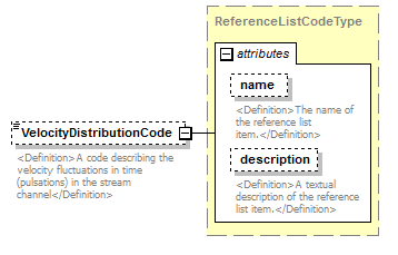 |
||||||||||||||||||||||
| namespace | http://water.usgs.gov/XML/NWIS/5.0 | ||||||||||||||||||||||
| type | ReferenceListCodeType | ||||||||||||||||||||||
| properties |
|
||||||||||||||||||||||
| attributes |
|
||||||||||||||||||||||
| annotation |
|
||||||||||||||||||||||
| source | <xsd:element name="VelocityDistributionCode" type="ReferenceListCodeType" minOccurs="0"> <xsd:annotation> <xsd:documentation> <Definition>A code describing the velocity fluctuations in time (pulsations) in the stream channel</Definition> </xsd:documentation> </xsd:annotation> </xsd:element> |
element Channel/SectionLocationCode
| diagram | 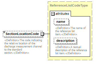 |
||||||||||||||||||||||
| namespace | http://water.usgs.gov/XML/NWIS/5.0 | ||||||||||||||||||||||
| type | ReferenceListCodeType | ||||||||||||||||||||||
| properties |
|
||||||||||||||||||||||
| attributes |
|
||||||||||||||||||||||
| annotation |
|
||||||||||||||||||||||
| source | <xsd:element name="SectionLocationCode" type="ReferenceListCodeType" minOccurs="0"> <xsd:annotation> <xsd:documentation> <Definition>The code indicating the relative location of the discharge measurement channel to the standard section.</Definition> </xsd:documentation> </xsd:annotation> </xsd:element> |
element Channel/SectionDistanceMeasure
| diagram | 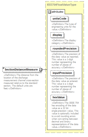 |
||||||||||||||||||||||||||||||||||||||||||||||
| namespace | http://water.usgs.gov/XML/NWIS/5.0 | ||||||||||||||||||||||||||||||||||||||||||||||
| type | IEEE754FloatValueType | ||||||||||||||||||||||||||||||||||||||||||||||
| properties |
|
||||||||||||||||||||||||||||||||||||||||||||||
| facets |
|
||||||||||||||||||||||||||||||||||||||||||||||
| attributes |
|
||||||||||||||||||||||||||||||||||||||||||||||
| annotation |
|
||||||||||||||||||||||||||||||||||||||||||||||
| source | <xsd:element name="SectionDistanceMeasure" type="IEEE754FloatValueType" minOccurs="0"> <xsd:annotation> <xsd:documentation> <Definition>The distance from the location of the discharge measurement channel cross-section measured relative to the standard section. The default units are feet.</Definition> </xsd:documentation> </xsd:annotation> </xsd:element> |
element MidSectionDischargeMeasurement
| diagram | 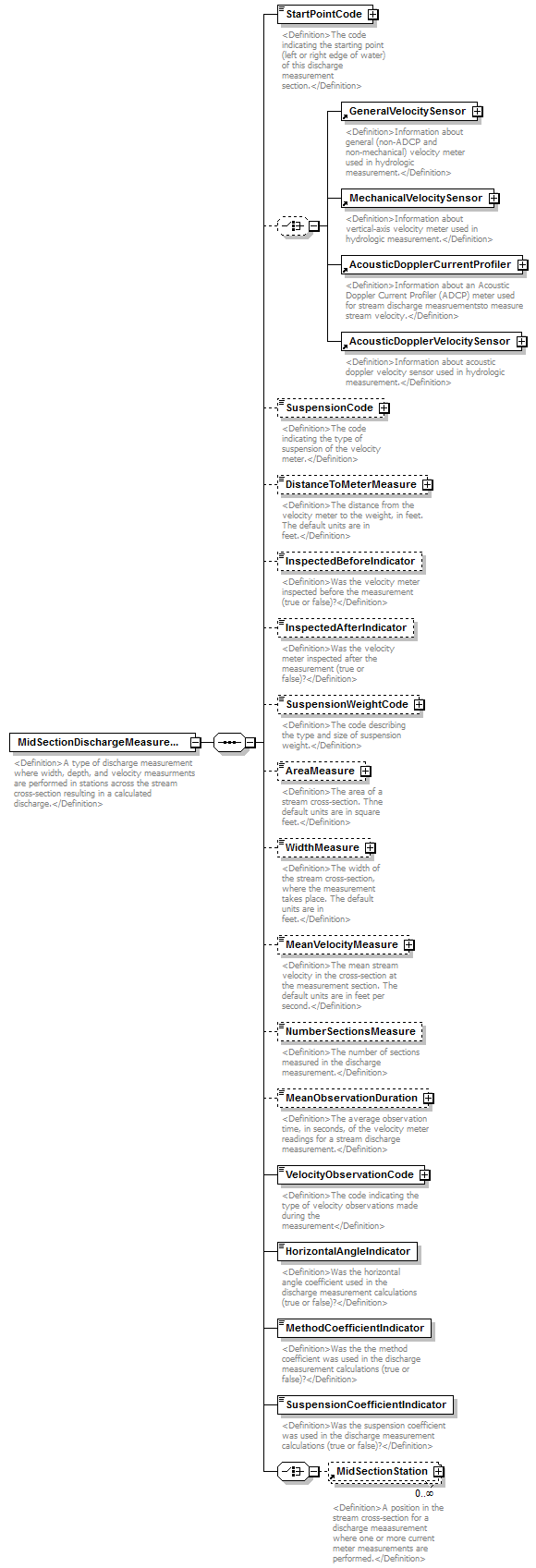 |
||
| namespace | http://water.usgs.gov/XML/NWIS/5.0 | ||
| properties |
|
||
| children | StartPointCode GeneralVelocitySensor MechanicalVelocitySensor AcousticDopplerCurrentProfiler AcousticDopplerVelocitySensor SuspensionCode DistanceToMeterMeasure InspectedBeforeIndicator InspectedAfterIndicator SuspensionWeightCode AreaMeasure WidthMeasure MeanVelocityMeasure NumberSectionsMeasure MeanObservationDuration VelocityObservationCode HorizontalAngleIndicator MethodCoefficientIndicator SuspensionCoefficientIndicator MidSectionStation | ||
| used by |
|
||
| annotation |
|
||
| source | <xsd:element name="MidSectionDischargeMeasurement"> <xsd:annotation> <xsd:documentation> <Definition>A type of discharge measurement where width, depth, and velocity measurments are performed in stations across the stream cross-section resulting in a calculated discharge.</Definition> </xsd:documentation> </xsd:annotation> <xsd:complexType> <xsd:sequence> <xsd:element name="StartPointCode" type="ReferenceListCodeType"> <xsd:annotation> <xsd:documentation> <Definition>The code indicating the starting point (left or right edge of water) of this discharge measurement section.</Definition> </xsd:documentation> </xsd:annotation> </xsd:element> <xsd:choice minOccurs="0"> <xsd:element ref="GeneralVelocitySensor"/> <xsd:element ref="MechanicalVelocitySensor"/> <xsd:element ref="AcousticDopplerCurrentProfiler"/> <xsd:element ref="AcousticDopplerVelocitySensor"/> </xsd:choice> <xsd:element name="SuspensionCode" type="ReferenceListCodeType" minOccurs="0"> <xsd:annotation> <xsd:documentation> <Definition>The code indicating the type of suspension of the velocity meter.</Definition> </xsd:documentation> </xsd:annotation> </xsd:element> <xsd:element name="DistanceToMeterMeasure" type="IEEE754FloatValueType" minOccurs="0"> <xsd:annotation> <xsd:documentation> <Definition>The distance from the velocity meter to the weight, in feet. The default units are in feet.</Definition> </xsd:documentation> </xsd:annotation> </xsd:element> <xsd:element name="InspectedBeforeIndicator" type="xsd:boolean" minOccurs="0"> <xsd:annotation> <xsd:documentation> <Definition>Was the velocity meter inspected before the measurement (true or false)?</Definition> </xsd:documentation> </xsd:annotation> </xsd:element> <xsd:element name="InspectedAfterIndicator" type="xsd:boolean" minOccurs="0"> <xsd:annotation> <xsd:documentation> <Definition>Was the velocity meter inspected after the measurement (true or false)?</Definition> </xsd:documentation> </xsd:annotation> </xsd:element> <xsd:element name="SuspensionWeightCode" type="ReferenceListCodeType" minOccurs="0"> <xsd:annotation> <xsd:documentation> <Definition>The code describing the type and size of suspension weight.</Definition> </xsd:documentation> </xsd:annotation> </xsd:element> <xsd:element name="AreaMeasure" type="IEEE754FloatValueType" minOccurs="0"> <xsd:annotation> <xsd:documentation> <Definition>The area of a stream cross-section. Thne default units are in square feet.</Definition> </xsd:documentation> </xsd:annotation> </xsd:element> <xsd:element name="WidthMeasure" type="IEEE754FloatValueType" minOccurs="0"> <xsd:annotation> <xsd:documentation> <Definition>The width of the stream cross-section, where the measurement takes place. The default units are in feet.</Definition> </xsd:documentation> </xsd:annotation> </xsd:element> <xsd:element name="MeanVelocityMeasure" type="IEEE754FloatValueType" minOccurs="0"> <xsd:annotation> <xsd:documentation> <Definition>The mean stream velocity in the cross-section at the measurement section. The default units are in feet per second.</Definition> </xsd:documentation> </xsd:annotation> </xsd:element> <xsd:element name="NumberSectionsMeasure" type="xsd:nonNegativeInteger" minOccurs="0"> <xsd:annotation> <xsd:documentation> <Definition>The number of sections measured in the discharge measurement.</Definition> </xsd:documentation> </xsd:annotation> </xsd:element> <xsd:element name="MeanObservationDuration" type="IEEE754FloatValueType" minOccurs="0"> <xsd:annotation> <xsd:documentation> <Definition>The average observation time, in seconds, of the velocity meter readings for a stream discharge measurement.</Definition> </xsd:documentation> </xsd:annotation> </xsd:element> <xsd:element name="VelocityObservationCode" type="ReferenceListCodeType"> <xsd:annotation> <xsd:documentation> <Definition>The code indicating the type of velocity observations made during the measurement</Definition> </xsd:documentation> </xsd:annotation> </xsd:element> <xsd:element name="HorizontalAngleIndicator" type="xsd:boolean"> <xsd:annotation> <xsd:documentation> <Definition>Was the horizontal angle coefficient used in the discharge measurement calculations (true or false)?</Definition> </xsd:documentation> </xsd:annotation> </xsd:element> <xsd:element name="MethodCoefficientIndicator" type="xsd:boolean"> <xsd:annotation> <xsd:documentation> <Definition>Was the the method coefficient was used in the discharge measurement calculations (true or false)?</Definition> </xsd:documentation> </xsd:annotation> </xsd:element> <xsd:element name="SuspensionCoefficientIndicator" type="xsd:boolean"> <xsd:annotation> <xsd:documentation> <Definition>Was the suspension coefficient was used in the discharge measurement calculations (true or false)?</Definition> </xsd:documentation> </xsd:annotation> </xsd:element> <xsd:choice> <xsd:element ref="MidSectionStation" minOccurs="0" maxOccurs="unbounded"/> </xsd:choice> </xsd:sequence> </xsd:complexType> </xsd:element> |
element MidSectionDischargeMeasurement/StartPointCode
| diagram |  |
||||||||||||||||||||||
| namespace | http://water.usgs.gov/XML/NWIS/5.0 | ||||||||||||||||||||||
| type | ReferenceListCodeType | ||||||||||||||||||||||
| properties |
|
||||||||||||||||||||||
| attributes |
|
||||||||||||||||||||||
| annotation |
|
||||||||||||||||||||||
| source | <xsd:element name="StartPointCode" type="ReferenceListCodeType"> <xsd:annotation> <xsd:documentation> <Definition>The code indicating the starting point (left or right edge of water) of this discharge measurement section.</Definition> </xsd:documentation> </xsd:annotation> </xsd:element> |
element MidSectionDischargeMeasurement/SuspensionCode
| diagram | 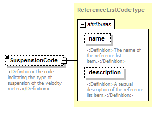 |
||||||||||||||||||||||
| namespace | http://water.usgs.gov/XML/NWIS/5.0 | ||||||||||||||||||||||
| type | ReferenceListCodeType | ||||||||||||||||||||||
| properties |
|
||||||||||||||||||||||
| attributes |
|
||||||||||||||||||||||
| annotation |
|
||||||||||||||||||||||
| source | <xsd:element name="SuspensionCode" type="ReferenceListCodeType" minOccurs="0"> <xsd:annotation> <xsd:documentation> <Definition>The code indicating the type of suspension of the velocity meter.</Definition> </xsd:documentation> </xsd:annotation> </xsd:element> |
element MidSectionDischargeMeasurement/DistanceToMeterMeasure
| diagram | 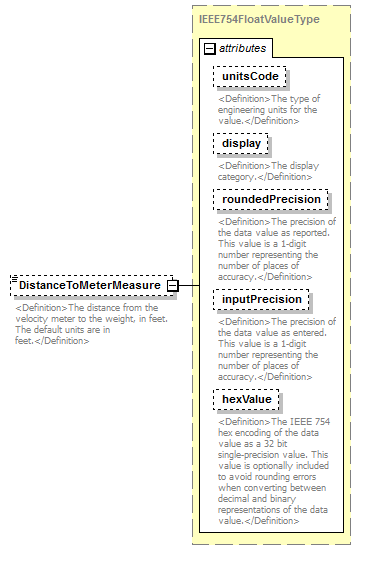 |
||||||||||||||||||||||||||||||||||||||||||||||
| namespace | http://water.usgs.gov/XML/NWIS/5.0 | ||||||||||||||||||||||||||||||||||||||||||||||
| type | IEEE754FloatValueType | ||||||||||||||||||||||||||||||||||||||||||||||
| properties |
|
||||||||||||||||||||||||||||||||||||||||||||||
| facets |
|
||||||||||||||||||||||||||||||||||||||||||||||
| attributes |
|
||||||||||||||||||||||||||||||||||||||||||||||
| annotation |
|
||||||||||||||||||||||||||||||||||||||||||||||
| source | <xsd:element name="DistanceToMeterMeasure" type="IEEE754FloatValueType" minOccurs="0"> <xsd:annotation> <xsd:documentation> <Definition>The distance from the velocity meter to the weight, in feet. The default units are in feet.</Definition> </xsd:documentation> </xsd:annotation> </xsd:element> |
element MidSectionDischargeMeasurement/InspectedBeforeIndicator
| diagram | 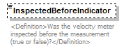 |
||||||||
| namespace | http://water.usgs.gov/XML/NWIS/5.0 | ||||||||
| type | xsd:boolean | ||||||||
| properties |
|
||||||||
| annotation |
|
||||||||
| source | <xsd:element name="InspectedBeforeIndicator" type="xsd:boolean" minOccurs="0"> <xsd:annotation> <xsd:documentation> <Definition>Was the velocity meter inspected before the measurement (true or false)?</Definition> </xsd:documentation> </xsd:annotation> </xsd:element> |
element MidSectionDischargeMeasurement/InspectedAfterIndicator
| diagram | 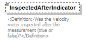 |
||||||||
| namespace | http://water.usgs.gov/XML/NWIS/5.0 | ||||||||
| type | xsd:boolean | ||||||||
| properties |
|
||||||||
| annotation |
|
||||||||
| source | <xsd:element name="InspectedAfterIndicator" type="xsd:boolean" minOccurs="0"> <xsd:annotation> <xsd:documentation> <Definition>Was the velocity meter inspected after the measurement (true or false)?</Definition> </xsd:documentation> </xsd:annotation> </xsd:element> |
element MidSectionDischargeMeasurement/SuspensionWeightCode
| diagram |  |
||||||||||||||||||||||
| namespace | http://water.usgs.gov/XML/NWIS/5.0 | ||||||||||||||||||||||
| type | ReferenceListCodeType | ||||||||||||||||||||||
| properties |
|
||||||||||||||||||||||
| attributes |
|
||||||||||||||||||||||
| annotation |
|
||||||||||||||||||||||
| source | <xsd:element name="SuspensionWeightCode" type="ReferenceListCodeType" minOccurs="0"> <xsd:annotation> <xsd:documentation> <Definition>The code describing the type and size of suspension weight.</Definition> </xsd:documentation> </xsd:annotation> </xsd:element> |
element MidSectionDischargeMeasurement/AreaMeasure
| diagram |  |
||||||||||||||||||||||||||||||||||||||||||||||
| namespace | http://water.usgs.gov/XML/NWIS/5.0 | ||||||||||||||||||||||||||||||||||||||||||||||
| type | IEEE754FloatValueType | ||||||||||||||||||||||||||||||||||||||||||||||
| properties |
|
||||||||||||||||||||||||||||||||||||||||||||||
| facets |
|
||||||||||||||||||||||||||||||||||||||||||||||
| attributes |
|
||||||||||||||||||||||||||||||||||||||||||||||
| annotation |
|
||||||||||||||||||||||||||||||||||||||||||||||
| source | <xsd:element name="AreaMeasure" type="IEEE754FloatValueType" minOccurs="0"> <xsd:annotation> <xsd:documentation> <Definition>The area of a stream cross-section. Thne default units are in square feet.</Definition> </xsd:documentation> </xsd:annotation> </xsd:element> |
element MidSectionDischargeMeasurement/WidthMeasure
| diagram | 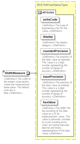 |
||||||||||||||||||||||||||||||||||||||||||||||
| namespace | http://water.usgs.gov/XML/NWIS/5.0 | ||||||||||||||||||||||||||||||||||||||||||||||
| type | IEEE754FloatValueType | ||||||||||||||||||||||||||||||||||||||||||||||
| properties |
|
||||||||||||||||||||||||||||||||||||||||||||||
| facets |
|
||||||||||||||||||||||||||||||||||||||||||||||
| attributes |
|
||||||||||||||||||||||||||||||||||||||||||||||
| annotation |
|
||||||||||||||||||||||||||||||||||||||||||||||
| source | <xsd:element name="WidthMeasure" type="IEEE754FloatValueType" minOccurs="0"> <xsd:annotation> <xsd:documentation> <Definition>The width of the stream cross-section, where the measurement takes place. The default units are in feet.</Definition> </xsd:documentation> </xsd:annotation> </xsd:element> |
element MidSectionDischargeMeasurement/MeanVelocityMeasure
| diagram | 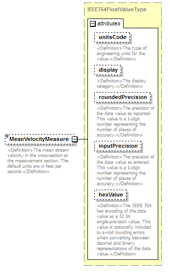 |
||||||||||||||||||||||||||||||||||||||||||||||
| namespace | http://water.usgs.gov/XML/NWIS/5.0 | ||||||||||||||||||||||||||||||||||||||||||||||
| type | IEEE754FloatValueType | ||||||||||||||||||||||||||||||||||||||||||||||
| properties |
|
||||||||||||||||||||||||||||||||||||||||||||||
| facets |
|
||||||||||||||||||||||||||||||||||||||||||||||
| attributes |
|
||||||||||||||||||||||||||||||||||||||||||||||
| annotation |
|
||||||||||||||||||||||||||||||||||||||||||||||
| source | <xsd:element name="MeanVelocityMeasure" type="IEEE754FloatValueType" minOccurs="0"> <xsd:annotation> <xsd:documentation> <Definition>The mean stream velocity in the cross-section at the measurement section. The default units are in feet per second.</Definition> </xsd:documentation> </xsd:annotation> </xsd:element> |
element MidSectionDischargeMeasurement/NumberSectionsMeasure
| diagram |  |
||||||||
| namespace | http://water.usgs.gov/XML/NWIS/5.0 | ||||||||
| type | xsd:nonNegativeInteger | ||||||||
| properties |
|
||||||||
| annotation |
|
||||||||
| source | <xsd:element name="NumberSectionsMeasure" type="xsd:nonNegativeInteger" minOccurs="0"> <xsd:annotation> <xsd:documentation> <Definition>The number of sections measured in the discharge measurement.</Definition> </xsd:documentation> </xsd:annotation> </xsd:element> |
element MidSectionDischargeMeasurement/MeanObservationDuration
| diagram |  |
||||||||||||||||||||||||||||||||||||||||||||||
| namespace | http://water.usgs.gov/XML/NWIS/5.0 | ||||||||||||||||||||||||||||||||||||||||||||||
| type | IEEE754FloatValueType | ||||||||||||||||||||||||||||||||||||||||||||||
| properties |
|
||||||||||||||||||||||||||||||||||||||||||||||
| facets |
|
||||||||||||||||||||||||||||||||||||||||||||||
| attributes |
|
||||||||||||||||||||||||||||||||||||||||||||||
| annotation |
|
||||||||||||||||||||||||||||||||||||||||||||||
| source | <xsd:element name="MeanObservationDuration" type="IEEE754FloatValueType" minOccurs="0"> <xsd:annotation> <xsd:documentation> <Definition>The average observation time, in seconds, of the velocity meter readings for a stream discharge measurement.</Definition> </xsd:documentation> </xsd:annotation> </xsd:element> |
element MidSectionDischargeMeasurement/VelocityObservationCode
| diagram |  |
||||||||||||||||||||||
| namespace | http://water.usgs.gov/XML/NWIS/5.0 | ||||||||||||||||||||||
| type | ReferenceListCodeType | ||||||||||||||||||||||
| properties |
|
||||||||||||||||||||||
| attributes |
|
||||||||||||||||||||||
| annotation |
|
||||||||||||||||||||||
| source | <xsd:element name="VelocityObservationCode" type="ReferenceListCodeType"> <xsd:annotation> <xsd:documentation> <Definition>The code indicating the type of velocity observations made during the measurement</Definition> </xsd:documentation> </xsd:annotation> </xsd:element> |
element MidSectionDischargeMeasurement/HorizontalAngleIndicator
| diagram |  |
||||
| namespace | http://water.usgs.gov/XML/NWIS/5.0 | ||||
| type | xsd:boolean | ||||
| properties |
|
||||
| annotation |
|
||||
| source | <xsd:element name="HorizontalAngleIndicator" type="xsd:boolean"> <xsd:annotation> <xsd:documentation> <Definition>Was the horizontal angle coefficient used in the discharge measurement calculations (true or false)?</Definition> </xsd:documentation> </xsd:annotation> </xsd:element> |
element MidSectionDischargeMeasurement/MethodCoefficientIndicator
| diagram |  |
||||
| namespace | http://water.usgs.gov/XML/NWIS/5.0 | ||||
| type | xsd:boolean | ||||
| properties |
|
||||
| annotation |
|
||||
| source | <xsd:element name="MethodCoefficientIndicator" type="xsd:boolean"> <xsd:annotation> <xsd:documentation> <Definition>Was the the method coefficient was used in the discharge measurement calculations (true or false)?</Definition> </xsd:documentation> </xsd:annotation> </xsd:element> |
element MidSectionDischargeMeasurement/SuspensionCoefficientIndicator
| diagram |  |
||||
| namespace | http://water.usgs.gov/XML/NWIS/5.0 | ||||
| type | xsd:boolean | ||||
| properties |
|
||||
| annotation |
|
||||
| source | <xsd:element name="SuspensionCoefficientIndicator" type="xsd:boolean"> <xsd:annotation> <xsd:documentation> <Definition>Was the suspension coefficient was used in the discharge measurement calculations (true or false)?</Definition> </xsd:documentation> </xsd:annotation> </xsd:element> |
element VolumetricDischargeMeasurement
| diagram | 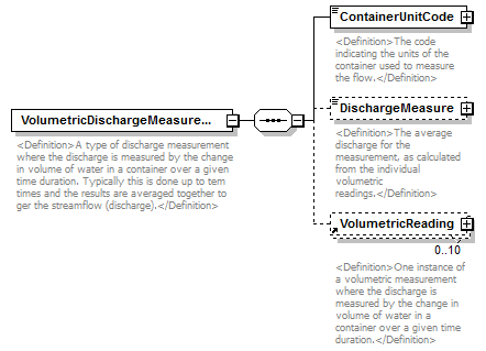 |
||
| namespace | http://water.usgs.gov/XML/NWIS/5.0 | ||
| properties |
|
||
| children | ContainerUnitCode DischargeMeasure VolumetricReading | ||
| used by |
|
||
| annotation |
|
||
| source | <xsd:element name="VolumetricDischargeMeasurement"> <xsd:annotation> <xsd:documentation> <Definition>A type of discharge measurement where the discharge is measured by the change in volume of water in a container over a given time duration. Typically this is done up to tem times and the results are averaged together to ger the streamflow (discharge).</Definition> </xsd:documentation> </xsd:annotation> <xsd:complexType> <xsd:sequence> <xsd:element name="ContainerUnitCode" type="ReferenceListCodeType"> <xsd:annotation> <xsd:documentation> <Definition>The code indicating the units of the container used to measure the flow.</Definition> </xsd:documentation> </xsd:annotation> </xsd:element> <xsd:element name="DischargeMeasure" type="IEEE754FloatValueType" minOccurs="0"> <xsd:annotation> <xsd:documentation> <Definition>The average discharge for the measurement, as calculated from the individual volumetric readings.</Definition> </xsd:documentation> </xsd:annotation> </xsd:element> <xsd:element ref="VolumetricReading" minOccurs="0" maxOccurs="10"/> </xsd:sequence> </xsd:complexType> </xsd:element> |
element VolumetricDischargeMeasurement/ContainerUnitCode
| diagram | 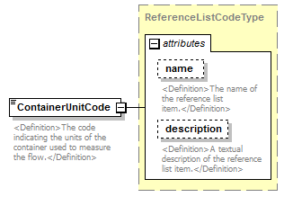 |
||||||||||||||||||||||
| namespace | http://water.usgs.gov/XML/NWIS/5.0 | ||||||||||||||||||||||
| type | ReferenceListCodeType | ||||||||||||||||||||||
| properties |
|
||||||||||||||||||||||
| attributes |
|
||||||||||||||||||||||
| annotation |
|
||||||||||||||||||||||
| source | <xsd:element name="ContainerUnitCode" type="ReferenceListCodeType"> <xsd:annotation> <xsd:documentation> <Definition>The code indicating the units of the container used to measure the flow.</Definition> </xsd:documentation> </xsd:annotation> </xsd:element> |
element VolumetricDischargeMeasurement/DischargeMeasure
| diagram | 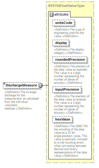 |
||||||||||||||||||||||||||||||||||||||||||||||
| namespace | http://water.usgs.gov/XML/NWIS/5.0 | ||||||||||||||||||||||||||||||||||||||||||||||
| type | IEEE754FloatValueType | ||||||||||||||||||||||||||||||||||||||||||||||
| properties |
|
||||||||||||||||||||||||||||||||||||||||||||||
| facets |
|
||||||||||||||||||||||||||||||||||||||||||||||
| attributes |
|
||||||||||||||||||||||||||||||||||||||||||||||
| annotation |
|
||||||||||||||||||||||||||||||||||||||||||||||
| source | <xsd:element name="DischargeMeasure" type="IEEE754FloatValueType" minOccurs="0"> <xsd:annotation> <xsd:documentation> <Definition>The average discharge for the measurement, as calculated from the individual volumetric readings.</Definition> </xsd:documentation> </xsd:annotation> </xsd:element> |
element FlumeDischargeMeasurement
| diagram | 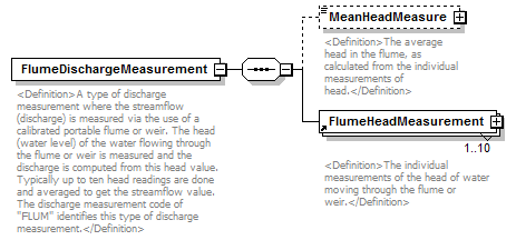 |
||
| namespace | http://water.usgs.gov/XML/NWIS/5.0 | ||
| properties |
|
||
| children | MeanHeadMeasure FlumeHeadMeasurement | ||
| used by |
|
||
| annotation |
|
||
| source | <xsd:element name="FlumeDischargeMeasurement"> <xsd:annotation> <xsd:documentation> <Definition>A type of discharge measurement where the streamflow (discharge) is measured via the use of a calibrated portable flume or weir. The head (water level) of the water flowing through the flume or weir is measured and the discharge is computed from this head value. Typically up to ten head readings are done and averaged to get the streamflow value. The discharge measurement code of "FLUM" identifies this type of discharge measurement.</Definition> </xsd:documentation> </xsd:annotation> <xsd:complexType> <xsd:sequence> <xsd:element name="MeanHeadMeasure" type="IEEE754FloatValueType" minOccurs="0"> <xsd:annotation> <xsd:documentation> <Definition>The average head in the flume, as calculated from the individual measurements of head.</Definition> </xsd:documentation> </xsd:annotation> </xsd:element> <xsd:element ref="FlumeHeadMeasurement" minOccurs="1" maxOccurs="10"> <xsd:annotation> <xsd:documentation> <Definition>The individual measurements of the head of water moving through the flume or weir.</Definition> </xsd:documentation> </xsd:annotation> </xsd:element> </xsd:sequence> </xsd:complexType> </xsd:element> |
element FlumeDischargeMeasurement/MeanHeadMeasure
| diagram |  |
||||||||||||||||||||||||||||||||||||||||||||||
| namespace | http://water.usgs.gov/XML/NWIS/5.0 | ||||||||||||||||||||||||||||||||||||||||||||||
| type | IEEE754FloatValueType | ||||||||||||||||||||||||||||||||||||||||||||||
| properties |
|
||||||||||||||||||||||||||||||||||||||||||||||
| facets |
|
||||||||||||||||||||||||||||||||||||||||||||||
| attributes |
|
||||||||||||||||||||||||||||||||||||||||||||||
| annotation |
|
||||||||||||||||||||||||||||||||||||||||||||||
| source | <xsd:element name="MeanHeadMeasure" type="IEEE754FloatValueType" minOccurs="0"> <xsd:annotation> <xsd:documentation> <Definition>The average head in the flume, as calculated from the individual measurements of head.</Definition> </xsd:documentation> </xsd:annotation> </xsd:element> |
element AdcpDischargeMeasurement
| diagram |  |
||
| namespace | http://water.usgs.gov/XML/NWIS/5.0 | ||
| properties |
|
||
| children | CompassCalibrationText DiagnosticTestText NavigationCode AreaComputationCode MagneticVariationAngle MagneticVariationCode ExternalDepthSounderIndicator BoatMotorUsedText AcousticDopplerCurrentProfiler FirmwareVersionText SoftwareVersionText SuspensionCode ADCPDepthMeasure DepthConsistentIndicator BlankingDistanceMeasure BlankingDistanceIndicator WaterModeCode WaterModeIndicator BottomModeCode BottomModeIndicator DepthCellSizeMeasure DepthCellSizeIndicator WaterPingsMeasure WaterPingsIndicator BottomPingsMeasure BottomPingsIndicator AmbiguityVelocityMeasure AmbiguityVelocityIndicator WidthMeasure AreaMeasure MeanDepthMeasure MaximumDepthMeasure MeanVelocityMeasure MaximumVelocityMeasure NumberEnsemblesMeasure NumberShoreEnsemblesMeasure MeanTopDischargeMeasure MeanMiddleDischargeMeasure MeanBottomDischargeMeasure MeanLeftDischargeMeasure MeanRightDischargeMeasure LeftEdgeCoefficient RightEdgeCoefficient DischargeCoefficient FlowMeasuredPercent TopEstimateMethodCode TopEstimateCoefficient BottomEstimateMethodCode BottomEstimateCoefficient WOCommandSetting AdcpTransect | ||
| used by |
|
||
| annotation |
|
||
| source | <xsd:element name="AdcpDischargeMeasurement"> <xsd:annotation> <xsd:documentation> <Definition>A type of discharge measurement where an Acoustic Doppler Current Profiler (ADCP) measures the streamflow (discharge) for the stream. The discharge measurement code of "ADCP" identifies this type of discharge measurement.</Definition> </xsd:documentation> </xsd:annotation> <xsd:complexType> <xsd:sequence> <xsd:element name="CompassCalibrationText" type="xsd:string" minOccurs="0"> <xsd:annotation> <xsd:documentation> <Definition>The results of compass calibrations made using the ADCP. Compass calibrations are required when using differential GPS (DPGS) as a substitute for bottom-tracking (acoustic measurements of boat speed).</Definition> </xsd:documentation> </xsd:annotation> </xsd:element> <xsd:element name="DiagnosticTestText" type="xsd:string" minOccurs="0"> <xsd:annotation> <xsd:documentation> <Definition>The results of the ADCP self diagnostic tests.</Definition> </xsd:documentation> </xsd:annotation> </xsd:element> <xsd:element name="NavigationCode" type="ReferenceListCodeType"> <xsd:annotation> <xsd:documentation> <Definition>The code indicating the movement and velocity of the boat.</Definition> </xsd:documentation> </xsd:annotation> </xsd:element> <xsd:element name="AreaComputationCode" type="ReferenceListCodeType"> <xsd:annotation> <xsd:documentation> <Definition>The code indicating the method of computing the area.</Definition> </xsd:documentation> </xsd:annotation> </xsd:element> <xsd:element name="MagneticVariationAngle" type="IEEE754FloatValueType"> <xsd:annotation> <xsd:documentation> <Definition>The angle between magnetic north and true north, in degrees.</Definition> </xsd:documentation> </xsd:annotation> </xsd:element> <xsd:element name="MagneticVariationCode" type="ReferenceListCodeType"> <xsd:annotation> <xsd:documentation> <Definition>The code indicating the method of determining the magnetic variation.</Definition> </xsd:documentation> </xsd:annotation> </xsd:element> <xsd:element name="ExternalDepthSounderIndicator" type="xsd:boolean"> <xsd:annotation> <xsd:documentation> <Definition>Flag indicating if an external depth sounder was used in the measurement.</Definition> </xsd:documentation> </xsd:annotation> </xsd:element> <xsd:element name="BoatMotorUsedText" type="xsd:string" minOccurs="0"> <xsd:annotation> <xsd:documentation> <Definition>The description of the boat and moter used in the measurement.</Definition> </xsd:documentation> </xsd:annotation> </xsd:element> <xsd:element ref="AcousticDopplerCurrentProfiler"/> <xsd:element name="FirmwareVersionText" type="xsd:string" minOccurs="0"> <xsd:annotation> <xsd:documentation> <Definition>The version of the embedded chip software in the Acoustic Doppler Current Profiler (ADCP).</Definition> </xsd:documentation> </xsd:annotation> </xsd:element> <xsd:element name="SoftwareVersionText" type="xsd:string" minOccurs="0"> <xsd:annotation> <xsd:documentation> <Definition>The version of the computer software used to compute the discharge and to configure the Acoustic Doppler Current Profiler (ADCP).</Definition> </xsd:documentation> </xsd:annotation> </xsd:element> <xsd:element name="SuspensionCode" type="ReferenceListCodeType" minOccurs="0"> <xsd:annotation> <xsd:documentation> <Definition>The code indicating the type of suspension of the velocity meter.</Definition> </xsd:documentation> </xsd:annotation> </xsd:element> <xsd:element name="ADCPDepthMeasure" type="IEEE754FloatValueType" minOccurs="0"> <xsd:annotation> <xsd:documentation> <Definition>The immersion depth of the Acoustic Doppler Current Profiler (ADCP) under the water surface as measured to the center of the transducer faces. The defaults units are feet.</Definition> </xsd:documentation> </xsd:annotation> </xsd:element> <xsd:element name="DepthConsistentIndicator" type="xsd:boolean" minOccurs="0"> <xsd:annotation> <xsd:documentation> <Definition>Is the depth of the Acoustic Doppler Current Profiler (ADCP) consistent for all transects?</Definition> </xsd:documentation> </xsd:annotation> </xsd:element> <xsd:element name="BlankingDistanceMeasure" type="IEEE754FloatValueType" minOccurs="0"> <xsd:annotation> <xsd:documentation> <Definition>The vertical distance from the Acoustic Doppler Current Profiler (ADCP) transducer face in which no velocity measurements are made. The blanking distance is usually set by the user to eliminate the chance of contamination of the velocity measurements due to ringing. The defaults units are feet.</Definition> </xsd:documentation> </xsd:annotation> </xsd:element> <xsd:element name="BlankingDistanceIndicator" type="xsd:boolean" minOccurs="0"> <xsd:annotation> <xsd:documentation> <Definition>Is the blanking distance of the Acoustic Doppler Current Profiler (ADCP) consistent for all transects?</Definition> </xsd:documentation> </xsd:annotation> </xsd:element> <xsd:element name="WaterModeCode" type="ReferenceListCodeType"> <xsd:annotation> <xsd:documentation> <Definition>The water mode is a number used with ADCP's made by RD Instruments to indicate the method used to collect water velocity profiles. The possible values are 1, 5, 8, 11, 12, 13, and Multiple.</Definition> </xsd:documentation> </xsd:annotation> </xsd:element> <xsd:element name="WaterModeIndicator" type="xsd:boolean" minOccurs="0"> <xsd:annotation> <xsd:documentation> <Definition>Is the water mode code of the Acoustic Doppler Current Profiler (ADCP) consistent for all transects?</Definition> </xsd:documentation> </xsd:annotation> </xsd:element> <xsd:element name="BottomModeCode" type="ReferenceListCodeType"> <xsd:annotation> <xsd:documentation> <Definition>Mode used for bottom tracking.</Definition> </xsd:documentation> </xsd:annotation> </xsd:element> <xsd:element name="BottomModeIndicator" type="xsd:boolean" minOccurs="0"> <xsd:annotation> <xsd:documentation> <Definition>Is the bottom mode of the ADCP constant for all transects?</Definition> </xsd:documentation> </xsd:annotation> </xsd:element> <xsd:element name="DepthCellSizeMeasure" type="IEEE754FloatValueType" minOccurs="0"> <xsd:annotation> <xsd:documentation> <Definition>The ADCP collects data over a variable number of depth cells. The vertical length of these cells (DepthCellSize) is specified using the WS command. Results of velocity measurements are reported for the center of individual depth cells.</Definition> </xsd:documentation> </xsd:annotation> </xsd:element> <xsd:element name="DepthCellSizeIndicator" type="xsd:boolean" minOccurs="0"> <xsd:annotation> <xsd:documentation> <Definition>Is the depth cell size of the Acoustic Doppler Current Profiler (ADCP) consistent for all transects?</Definition> </xsd:documentation> </xsd:annotation> </xsd:element> <xsd:element name="WaterPingsMeasure" type="xsd:positiveInteger" minOccurs="0"> <xsd:annotation> <xsd:documentation> <Definition>The water pings specifies the number of water velocity profile measurements that are averaged together to create one profile. This resulting profile (average of all water pings) is then transmitted to the computer for processing.</Definition> </xsd:documentation> </xsd:annotation> </xsd:element> <xsd:element name="WaterPingsIndicator" type="xsd:boolean" minOccurs="0"> <xsd:annotation> <xsd:documentation> <Definition>Is the number of water pings of the Acoustic Doppler Current Profiler (ADCP) consistent for all transects?</Definition> </xsd:documentation> </xsd:annotation> </xsd:element> <xsd:element name="BottomPingsMeasure" type="xsd:positiveInteger" minOccurs="0"> <xsd:annotation> <xsd:documentation> <Definition>The bottom pings specifies the number of bottom track velocity measurements that are averaged together to create a single measurement of boat velocity.</Definition> </xsd:documentation> </xsd:annotation> </xsd:element> <xsd:element name="BottomPingsIndicator" type="xsd:boolean" minOccurs="0"> <xsd:annotation> <xsd:documentation> <Definition>Is the number of bottom pings of the Acoustic Doppler Current Profiler (ADCP) consistent for all transects?</Definition> </xsd:documentation> </xsd:annotation> </xsd:element> <xsd:element name="AmbiguityVelocityMeasure" type="IEEE754FloatValueType" minOccurs="0"> <xsd:annotation> <xsd:documentation> <Definition>The ambiguity velocity in RDI profilers</Definition> </xsd:documentation> </xsd:annotation> </xsd:element> <xsd:element name="AmbiguityVelocityIndicator" type="xsd:boolean" minOccurs="0"> <xsd:annotation> <xsd:documentation> <Definition>Is the ambiguity velocity of the Acoustic Doppler Current Profiler (ADCP) consistent for all transects?</Definition> </xsd:documentation> </xsd:annotation> </xsd:element> <xsd:element name="WidthMeasure" type="IEEE754FloatValueType" minOccurs="0"> <xsd:annotation> <xsd:documentation> <Definition>The width of the measurement section. The default units are in feet.</Definition> </xsd:documentation> </xsd:annotation> </xsd:element> <xsd:element name="AreaMeasure" type="IEEE754FloatValueType" minOccurs="0"> <xsd:annotation> <xsd:documentation> <Definition>The cross-section are of the measurement. The default units are in square feet.</Definition> </xsd:documentation> </xsd:annotation> </xsd:element> <xsd:element name="MeanDepthMeasure" type="IEEE754FloatValueType" minOccurs="0"> <xsd:annotation> <xsd:documentation> <Definition>The mean depth is the weighted mean water depth for the measurement. The mean depth is weighted based on the distance between individual profiles (and depth measurements). The default units are in feet.</Definition> </xsd:documentation> </xsd:annotation> </xsd:element> <xsd:element name="MaximumDepthMeasure" type="IEEE754FloatValueType" minOccurs="0"> <xsd:annotation> <xsd:documentation> <Definition>The maximum depth measured for the discharge measurement. The default units are in feet.</Definition> </xsd:documentation> </xsd:annotation> </xsd:element> <xsd:element name="MeanVelocityMeasure" type="IEEE754FloatValueType" minOccurs="0"> <xsd:annotation> <xsd:documentation> <Definition>The average velocity of the stream during the measurement. The default units are in feet per second.</Definition> </xsd:documentation> </xsd:annotation> </xsd:element> <xsd:element name="MaximumVelocityMeasure" type="IEEE754FloatValueType" minOccurs="0"> <xsd:annotation> <xsd:documentation> <Definition>The maximum velocity of the stream during the measurement. The default units are in feet per second.</Definition> </xsd:documentation> </xsd:annotation> </xsd:element> <xsd:element name="NumberEnsemblesMeasure" type="xsd:positiveInteger" minOccurs="0"> <xsd:annotation> <xsd:documentation> <Definition>The average number of ensembles per transect.</Definition> </xsd:documentation> </xsd:annotation> </xsd:element> <xsd:element name="NumberShoreEnsemblesMeasure" type="xsd:positiveInteger" minOccurs="0"> <xsd:annotation> <xsd:documentation> <Definition>The number of near shore ensembles used to get the edge estimate.</Definition> </xsd:documentation> </xsd:annotation> </xsd:element> <xsd:element name="MeanTopDischargeMeasure" type="IEEE754FloatValueType" minOccurs="0"> <xsd:annotation> <xsd:documentation> <Definition>The average of the discharge estimated for the area near the surface using the extrapolation method specified by the user for all transects in the measurement. The default units are in cubic feet per second.</Definition> </xsd:documentation> </xsd:annotation> </xsd:element> <xsd:element name="MeanMiddleDischargeMeasure" type="IEEE754FloatValueType" minOccurs="0"> <xsd:annotation> <xsd:documentation> <Definition>The average of the discharge actually measured by the profiler for all transects in the measurement. The default units are in cubic feet per second.</Definition> </xsd:documentation> </xsd:annotation> </xsd:element> <xsd:element name="MeanBottomDischargeMeasure" type="IEEE754FloatValueType" minOccurs="0"> <xsd:annotation> <xsd:documentation> <Definition>The average of the discharge estimated for the area near the bed using the extrapolation method specified by the user for all transects in the measurement. The default units are in cubic feet per second.</Definition> </xsd:documentation> </xsd:annotation> </xsd:element> <xsd:element name="MeanLeftDischargeMeasure" type="IEEE754FloatValueType" minOccurs="0"> <xsd:annotation> <xsd:documentation> <Definition>The average of the discharge estimated for the area near the left edge of water for all transects in the measurement. The left discharge is computed using the distance to the shore, the mean depth and water velocity near the left edge, and a coefficient for the edge shape and roughness. The default units are in cubic feet per second.</Definition> </xsd:documentation> </xsd:annotation> </xsd:element> <xsd:element name="MeanRightDischargeMeasure" type="IEEE754FloatValueType" minOccurs="0"> <xsd:annotation> <xsd:documentation> <Definition>The average of the discharge estimated for the area near the right edge of water for all transects in the measurement. The right discharge is computed using the distance to the shore, the mean depth and water velocity near the left edge, and a coefficient for the edge shape and roughness. The default units are in cubic feet per second.</Definition> </xsd:documentation> </xsd:annotation> </xsd:element> <xsd:element name="LeftEdgeCoefficient" type="IEEE754FloatValueType" minOccurs="0"> <xsd:annotation> <xsd:documentation> <Definition>The coefficient which is used to account for the shape and roughness of the unmeasured area near the left shore. Typical values are .3535 for a triangular shaped section, and 0.91 for a vertical, smooth concrete wall.</Definition> </xsd:documentation> </xsd:annotation> </xsd:element> <xsd:element name="RightEdgeCoefficient" type="IEEE754FloatValueType" minOccurs="0"> <xsd:annotation> <xsd:documentation> <Definition>The coefficient which is used to account for the shape and roughness of the unmeasured area near the right shore. Typical values are .3535 for a triangular shaped section, and 0.91 for a vertical, smooth concrete wall.</Definition> </xsd:documentation> </xsd:annotation> </xsd:element> <xsd:element name="DischargeCoefficient" type="IEEE754FloatValueType" minOccurs="0"> <xsd:annotation> <xsd:documentation> <Definition>The standard deviation of the total discharges for all transects in the measurement divided by the mean discharge for all measurements. This parameter provides an standardized estimate of the variation of discharges in the measurement.</Definition> </xsd:documentation> </xsd:annotation> </xsd:element> <xsd:element name="FlowMeasuredPercent" type="IEEE754FloatValueType" minOccurs="0"> <xsd:annotation> <xsd:documentation> <Definition>The percent of the total discharge actually measured by the profiler. It is computed by taking the MeanMiddleDischarge divided by the MeanTotalDischarge and expressed in percent.</Definition> </xsd:documentation> </xsd:annotation> </xsd:element> <xsd:element name="TopEstimateMethodCode" type="ReferenceListCodeType"> <xsd:annotation> <xsd:documentation> <Definition>The code indicating the method of estimation of the top?.</Definition> </xsd:documentation> </xsd:annotation> </xsd:element> <xsd:element name="TopEstimateCoefficient" type="IEEE754FloatValueType" minOccurs="0"> <xsd:annotation> <xsd:documentation> <Definition>The Value of coefficient used in power function for top estimate.</Definition> </xsd:documentation> </xsd:annotation> </xsd:element> <xsd:element name="BottomEstimateMethodCode" type="ReferenceListCodeType"> <xsd:annotation> <xsd:documentation> <Definition>The code indicating the method of estimation of the bottom?.</Definition> </xsd:documentation> </xsd:annotation> </xsd:element> <xsd:element name="BottomEstimateCoefficient" type="IEEE754FloatValueType" minOccurs="0"> <xsd:annotation> <xsd:documentation> <Definition>The Value of coefficient used in power function for bottom estimate.</Definition> </xsd:documentation> </xsd:annotation> </xsd:element> <xsd:element name="WOCommandSetting" type="xsd:string" minOccurs="0"> <xsd:annotation> <xsd:documentation> <Definition>The setting of the WO command for water mode 12.</Definition> </xsd:documentation> </xsd:annotation> </xsd:element> <xsd:element ref="AdcpTransect" minOccurs="0" maxOccurs="unbounded"/> </xsd:sequence> </xsd:complexType> </xsd:element> |
element AdcpDischargeMeasurement/CompassCalibrationText
| diagram |  |
||||||||
| namespace | http://water.usgs.gov/XML/NWIS/5.0 | ||||||||
| type | xsd:string | ||||||||
| properties |
|
||||||||
| annotation |
|
||||||||
| source | <xsd:element name="CompassCalibrationText" type="xsd:string" minOccurs="0"> <xsd:annotation> <xsd:documentation> <Definition>The results of compass calibrations made using the ADCP. Compass calibrations are required when using differential GPS (DPGS) as a substitute for bottom-tracking (acoustic measurements of boat speed).</Definition> </xsd:documentation> </xsd:annotation> </xsd:element> |
element AdcpDischargeMeasurement/DiagnosticTestText
| diagram |  |
||||||||
| namespace | http://water.usgs.gov/XML/NWIS/5.0 | ||||||||
| type | xsd:string | ||||||||
| properties |
|
||||||||
| annotation |
|
||||||||
| source | <xsd:element name="DiagnosticTestText" type="xsd:string" minOccurs="0"> <xsd:annotation> <xsd:documentation> <Definition>The results of the ADCP self diagnostic tests.</Definition> </xsd:documentation> </xsd:annotation> </xsd:element> |
element AdcpDischargeMeasurement/NavigationCode
| diagram | 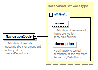 |
||||||||||||||||||||||
| namespace | http://water.usgs.gov/XML/NWIS/5.0 | ||||||||||||||||||||||
| type | ReferenceListCodeType | ||||||||||||||||||||||
| properties |
|
||||||||||||||||||||||
| attributes |
|
||||||||||||||||||||||
| annotation |
|
||||||||||||||||||||||
| source | <xsd:element name="NavigationCode" type="ReferenceListCodeType"> <xsd:annotation> <xsd:documentation> <Definition>The code indicating the movement and velocity of the boat.</Definition> </xsd:documentation> </xsd:annotation> </xsd:element> |
element AdcpDischargeMeasurement/AreaComputationCode
| diagram |  |
||||||||||||||||||||||
| namespace | http://water.usgs.gov/XML/NWIS/5.0 | ||||||||||||||||||||||
| type | ReferenceListCodeType | ||||||||||||||||||||||
| properties |
|
||||||||||||||||||||||
| attributes |
|
||||||||||||||||||||||
| annotation |
|
||||||||||||||||||||||
| source | <xsd:element name="AreaComputationCode" type="ReferenceListCodeType"> <xsd:annotation> <xsd:documentation> <Definition>The code indicating the method of computing the area.</Definition> </xsd:documentation> </xsd:annotation> </xsd:element> |
element AdcpDischargeMeasurement/MagneticVariationAngle
| diagram |  |
||||||||||||||||||||||||||||||||||||||||||||||
| namespace | http://water.usgs.gov/XML/NWIS/5.0 | ||||||||||||||||||||||||||||||||||||||||||||||
| type | IEEE754FloatValueType | ||||||||||||||||||||||||||||||||||||||||||||||
| properties |
|
||||||||||||||||||||||||||||||||||||||||||||||
| facets |
|
||||||||||||||||||||||||||||||||||||||||||||||
| attributes |
|
||||||||||||||||||||||||||||||||||||||||||||||
| annotation |
|
||||||||||||||||||||||||||||||||||||||||||||||
| source | <xsd:element name="MagneticVariationAngle" type="IEEE754FloatValueType"> <xsd:annotation> <xsd:documentation> <Definition>The angle between magnetic north and true north, in degrees.</Definition> </xsd:documentation> </xsd:annotation> </xsd:element> |
element AdcpDischargeMeasurement/MagneticVariationCode
| diagram |  |
||||||||||||||||||||||
| namespace | http://water.usgs.gov/XML/NWIS/5.0 | ||||||||||||||||||||||
| type | ReferenceListCodeType | ||||||||||||||||||||||
| properties |
|
||||||||||||||||||||||
| attributes |
|
||||||||||||||||||||||
| annotation |
|
||||||||||||||||||||||
| source | <xsd:element name="MagneticVariationCode" type="ReferenceListCodeType"> <xsd:annotation> <xsd:documentation> <Definition>The code indicating the method of determining the magnetic variation.</Definition> </xsd:documentation> </xsd:annotation> </xsd:element> |
element AdcpDischargeMeasurement/ExternalDepthSounderIndicator
| diagram |  |
||||
| namespace | http://water.usgs.gov/XML/NWIS/5.0 | ||||
| type | xsd:boolean | ||||
| properties |
|
||||
| annotation |
|
||||
| source | <xsd:element name="ExternalDepthSounderIndicator" type="xsd:boolean"> <xsd:annotation> <xsd:documentation> <Definition>Flag indicating if an external depth sounder was used in the measurement.</Definition> </xsd:documentation> </xsd:annotation> </xsd:element> |
element AdcpDischargeMeasurement/BoatMotorUsedText
| diagram |  |
||||||||
| namespace | http://water.usgs.gov/XML/NWIS/5.0 | ||||||||
| type | xsd:string | ||||||||
| properties |
|
||||||||
| annotation |
|
||||||||
| source | <xsd:element name="BoatMotorUsedText" type="xsd:string" minOccurs="0"> <xsd:annotation> <xsd:documentation> <Definition>The description of the boat and moter used in the measurement.</Definition> </xsd:documentation> </xsd:annotation> </xsd:element> |
element AdcpDischargeMeasurement/FirmwareVersionText
| diagram |  |
||||||||
| namespace | http://water.usgs.gov/XML/NWIS/5.0 | ||||||||
| type | xsd:string | ||||||||
| properties |
|
||||||||
| annotation |
|
||||||||
| source | <xsd:element name="FirmwareVersionText" type="xsd:string" minOccurs="0"> <xsd:annotation> <xsd:documentation> <Definition>The version of the embedded chip software in the Acoustic Doppler Current Profiler (ADCP).</Definition> </xsd:documentation> </xsd:annotation> </xsd:element> |
element AdcpDischargeMeasurement/SoftwareVersionText
| diagram |  |
||||||||
| namespace | http://water.usgs.gov/XML/NWIS/5.0 | ||||||||
| type | xsd:string | ||||||||
| properties |
|
||||||||
| annotation |
|
||||||||
| source | <xsd:element name="SoftwareVersionText" type="xsd:string" minOccurs="0"> <xsd:annotation> <xsd:documentation> <Definition>The version of the computer software used to compute the discharge and to configure the Acoustic Doppler Current Profiler (ADCP).</Definition> </xsd:documentation> </xsd:annotation> </xsd:element> |
element AdcpDischargeMeasurement/SuspensionCode
| diagram |  |
||||||||||||||||||||||
| namespace | http://water.usgs.gov/XML/NWIS/5.0 | ||||||||||||||||||||||
| type | ReferenceListCodeType | ||||||||||||||||||||||
| properties |
|
||||||||||||||||||||||
| attributes |
|
||||||||||||||||||||||
| annotation |
|
||||||||||||||||||||||
| source | <xsd:element name="SuspensionCode" type="ReferenceListCodeType" minOccurs="0"> <xsd:annotation> <xsd:documentation> <Definition>The code indicating the type of suspension of the velocity meter.</Definition> </xsd:documentation> </xsd:annotation> </xsd:element> |
element AdcpDischargeMeasurement/ADCPDepthMeasure
| diagram |  |
||||||||||||||||||||||||||||||||||||||||||||||
| namespace | http://water.usgs.gov/XML/NWIS/5.0 | ||||||||||||||||||||||||||||||||||||||||||||||
| type | IEEE754FloatValueType | ||||||||||||||||||||||||||||||||||||||||||||||
| properties |
|
||||||||||||||||||||||||||||||||||||||||||||||
| facets |
|
||||||||||||||||||||||||||||||||||||||||||||||
| attributes |
|
||||||||||||||||||||||||||||||||||||||||||||||
| annotation |
|
||||||||||||||||||||||||||||||||||||||||||||||
| source | <xsd:element name="ADCPDepthMeasure" type="IEEE754FloatValueType" minOccurs="0"> <xsd:annotation> <xsd:documentation> <Definition>The immersion depth of the Acoustic Doppler Current Profiler (ADCP) under the water surface as measured to the center of the transducer faces. The defaults units are feet.</Definition> </xsd:documentation> </xsd:annotation> </xsd:element> |
element AdcpDischargeMeasurement/DepthConsistentIndicator
| diagram | 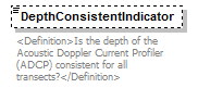 |
||||||||
| namespace | http://water.usgs.gov/XML/NWIS/5.0 | ||||||||
| type | xsd:boolean | ||||||||
| properties |
|
||||||||
| annotation |
|
||||||||
| source | <xsd:element name="DepthConsistentIndicator" type="xsd:boolean" minOccurs="0"> <xsd:annotation> <xsd:documentation> <Definition>Is the depth of the Acoustic Doppler Current Profiler (ADCP) consistent for all transects?</Definition> </xsd:documentation> </xsd:annotation> </xsd:element> |
element AdcpDischargeMeasurement/BlankingDistanceMeasure
| diagram | 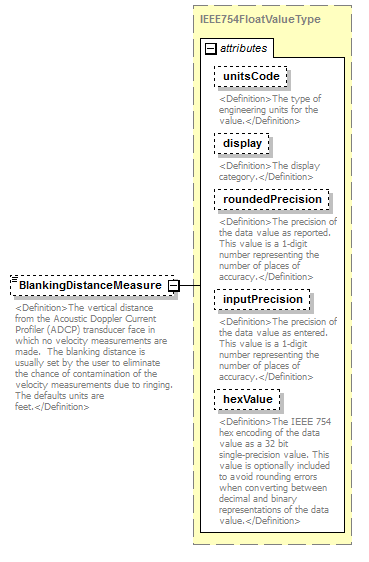 |
||||||||||||||||||||||||||||||||||||||||||||||
| namespace | http://water.usgs.gov/XML/NWIS/5.0 | ||||||||||||||||||||||||||||||||||||||||||||||
| type | IEEE754FloatValueType | ||||||||||||||||||||||||||||||||||||||||||||||
| properties |
|
||||||||||||||||||||||||||||||||||||||||||||||
| facets |
|
||||||||||||||||||||||||||||||||||||||||||||||
| attributes |
|
||||||||||||||||||||||||||||||||||||||||||||||
| annotation |
|
||||||||||||||||||||||||||||||||||||||||||||||
| source | <xsd:element name="BlankingDistanceMeasure" type="IEEE754FloatValueType" minOccurs="0"> <xsd:annotation> <xsd:documentation> <Definition>The vertical distance from the Acoustic Doppler Current Profiler (ADCP) transducer face in which no velocity measurements are made. The blanking distance is usually set by the user to eliminate the chance of contamination of the velocity measurements due to ringing. The defaults units are feet.</Definition> </xsd:documentation> </xsd:annotation> </xsd:element> |
element AdcpDischargeMeasurement/BlankingDistanceIndicator
| diagram | 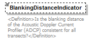 |
||||||||
| namespace | http://water.usgs.gov/XML/NWIS/5.0 | ||||||||
| type | xsd:boolean | ||||||||
| properties |
|
||||||||
| annotation |
|
||||||||
| source | <xsd:element name="BlankingDistanceIndicator" type="xsd:boolean" minOccurs="0"> <xsd:annotation> <xsd:documentation> <Definition>Is the blanking distance of the Acoustic Doppler Current Profiler (ADCP) consistent for all transects?</Definition> </xsd:documentation> </xsd:annotation> </xsd:element> |
element AdcpDischargeMeasurement/WaterModeCode
| diagram |  |
||||||||||||||||||||||
| namespace | http://water.usgs.gov/XML/NWIS/5.0 | ||||||||||||||||||||||
| type | ReferenceListCodeType | ||||||||||||||||||||||
| properties |
|
||||||||||||||||||||||
| attributes |
|
||||||||||||||||||||||
| annotation |
|
||||||||||||||||||||||
| source | <xsd:element name="WaterModeCode" type="ReferenceListCodeType"> <xsd:annotation> <xsd:documentation> <Definition>The water mode is a number used with ADCP's made by RD Instruments to indicate the method used to collect water velocity profiles. The possible values are 1, 5, 8, 11, 12, 13, and Multiple.</Definition> </xsd:documentation> </xsd:annotation> </xsd:element> |
element AdcpDischargeMeasurement/WaterModeIndicator
| diagram | 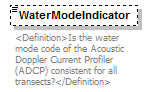 |
||||||||
| namespace | http://water.usgs.gov/XML/NWIS/5.0 | ||||||||
| type | xsd:boolean | ||||||||
| properties |
|
||||||||
| annotation |
|
||||||||
| source | <xsd:element name="WaterModeIndicator" type="xsd:boolean" minOccurs="0"> <xsd:annotation> <xsd:documentation> <Definition>Is the water mode code of the Acoustic Doppler Current Profiler (ADCP) consistent for all transects?</Definition> </xsd:documentation> </xsd:annotation> </xsd:element> |
element AdcpDischargeMeasurement/BottomModeCode
| diagram | 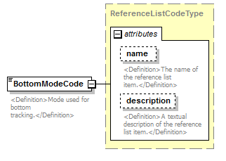 |
||||||||||||||||||||||
| namespace | http://water.usgs.gov/XML/NWIS/5.0 | ||||||||||||||||||||||
| type | ReferenceListCodeType | ||||||||||||||||||||||
| properties |
|
||||||||||||||||||||||
| attributes |
|
||||||||||||||||||||||
| annotation |
|
||||||||||||||||||||||
| source | <xsd:element name="BottomModeCode" type="ReferenceListCodeType"> <xsd:annotation> <xsd:documentation> <Definition>Mode used for bottom tracking.</Definition> </xsd:documentation> </xsd:annotation> </xsd:element> |
element AdcpDischargeMeasurement/BottomModeIndicator
| diagram | 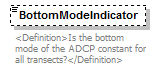 |
||||||||
| namespace | http://water.usgs.gov/XML/NWIS/5.0 | ||||||||
| type | xsd:boolean | ||||||||
| properties |
|
||||||||
| annotation |
|
||||||||
| source | <xsd:element name="BottomModeIndicator" type="xsd:boolean" minOccurs="0"> <xsd:annotation> <xsd:documentation> <Definition>Is the bottom mode of the ADCP constant for all transects?</Definition> </xsd:documentation> </xsd:annotation> </xsd:element> |
element AdcpDischargeMeasurement/DepthCellSizeMeasure
| diagram | 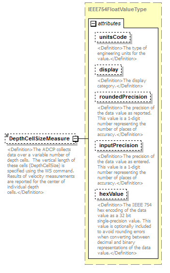 |
||||||||||||||||||||||||||||||||||||||||||||||
| namespace | http://water.usgs.gov/XML/NWIS/5.0 | ||||||||||||||||||||||||||||||||||||||||||||||
| type | IEEE754FloatValueType | ||||||||||||||||||||||||||||||||||||||||||||||
| properties |
|
||||||||||||||||||||||||||||||||||||||||||||||
| facets |
|
||||||||||||||||||||||||||||||||||||||||||||||
| attributes |
|
||||||||||||||||||||||||||||||||||||||||||||||
| annotation |
|
||||||||||||||||||||||||||||||||||||||||||||||
| source | <xsd:element name="DepthCellSizeMeasure" type="IEEE754FloatValueType" minOccurs="0"> <xsd:annotation> <xsd:documentation> <Definition>The ADCP collects data over a variable number of depth cells. The vertical length of these cells (DepthCellSize) is specified using the WS command. Results of velocity measurements are reported for the center of individual depth cells.</Definition> </xsd:documentation> </xsd:annotation> </xsd:element> |
element AdcpDischargeMeasurement/DepthCellSizeIndicator
| diagram | 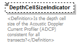 |
||||||||
| namespace | http://water.usgs.gov/XML/NWIS/5.0 | ||||||||
| type | xsd:boolean | ||||||||
| properties |
|
||||||||
| annotation |
|
||||||||
| source | <xsd:element name="DepthCellSizeIndicator" type="xsd:boolean" minOccurs="0"> <xsd:annotation> <xsd:documentation> <Definition>Is the depth cell size of the Acoustic Doppler Current Profiler (ADCP) consistent for all transects?</Definition> </xsd:documentation> </xsd:annotation> </xsd:element> |
element AdcpDischargeMeasurement/WaterPingsMeasure
| diagram |  |
||||||||
| namespace | http://water.usgs.gov/XML/NWIS/5.0 | ||||||||
| type | xsd:positiveInteger | ||||||||
| properties |
|
||||||||
| annotation |
|
||||||||
| source | <xsd:element name="WaterPingsMeasure" type="xsd:positiveInteger" minOccurs="0"> <xsd:annotation> <xsd:documentation> <Definition>The water pings specifies the number of water velocity profile measurements that are averaged together to create one profile. This resulting profile (average of all water pings) is then transmitted to the computer for processing.</Definition> </xsd:documentation> </xsd:annotation> </xsd:element> |
element AdcpDischargeMeasurement/WaterPingsIndicator
| diagram |  |
||||||||
| namespace | http://water.usgs.gov/XML/NWIS/5.0 | ||||||||
| type | xsd:boolean | ||||||||
| properties |
|
||||||||
| annotation |
|
||||||||
| source | <xsd:element name="WaterPingsIndicator" type="xsd:boolean" minOccurs="0"> <xsd:annotation> <xsd:documentation> <Definition>Is the number of water pings of the Acoustic Doppler Current Profiler (ADCP) consistent for all transects?</Definition> </xsd:documentation> </xsd:annotation> </xsd:element> |
element AdcpDischargeMeasurement/BottomPingsMeasure
| diagram |  |
||||||||
| namespace | http://water.usgs.gov/XML/NWIS/5.0 | ||||||||
| type | xsd:positiveInteger | ||||||||
| properties |
|
||||||||
| annotation |
|
||||||||
| source | <xsd:element name="BottomPingsMeasure" type="xsd:positiveInteger" minOccurs="0"> <xsd:annotation> <xsd:documentation> <Definition>The bottom pings specifies the number of bottom track velocity measurements that are averaged together to create a single measurement of boat velocity.</Definition> </xsd:documentation> </xsd:annotation> </xsd:element> |
element AdcpDischargeMeasurement/BottomPingsIndicator
| diagram |  |
||||||||
| namespace | http://water.usgs.gov/XML/NWIS/5.0 | ||||||||
| type | xsd:boolean | ||||||||
| properties |
|
||||||||
| annotation |
|
||||||||
| source | <xsd:element name="BottomPingsIndicator" type="xsd:boolean" minOccurs="0"> <xsd:annotation> <xsd:documentation> <Definition>Is the number of bottom pings of the Acoustic Doppler Current Profiler (ADCP) consistent for all transects?</Definition> </xsd:documentation> </xsd:annotation> </xsd:element> |
element AdcpDischargeMeasurement/AmbiguityVelocityMeasure
| diagram | 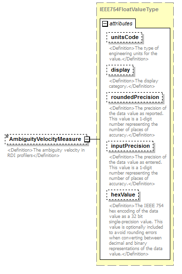 |
||||||||||||||||||||||||||||||||||||||||||||||
| namespace | http://water.usgs.gov/XML/NWIS/5.0 | ||||||||||||||||||||||||||||||||||||||||||||||
| type | IEEE754FloatValueType | ||||||||||||||||||||||||||||||||||||||||||||||
| properties |
|
||||||||||||||||||||||||||||||||||||||||||||||
| facets |
|
||||||||||||||||||||||||||||||||||||||||||||||
| attributes |
|
||||||||||||||||||||||||||||||||||||||||||||||
| annotation |
|
||||||||||||||||||||||||||||||||||||||||||||||
| source | <xsd:element name="AmbiguityVelocityMeasure" type="IEEE754FloatValueType" minOccurs="0"> <xsd:annotation> <xsd:documentation> <Definition>The ambiguity velocity in RDI profilers</Definition> </xsd:documentation> </xsd:annotation> </xsd:element> |
element AdcpDischargeMeasurement/AmbiguityVelocityIndicator
| diagram | 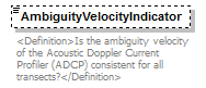 |
||||||||
| namespace | http://water.usgs.gov/XML/NWIS/5.0 | ||||||||
| type | xsd:boolean | ||||||||
| properties |
|
||||||||
| annotation |
|
||||||||
| source | <xsd:element name="AmbiguityVelocityIndicator" type="xsd:boolean" minOccurs="0"> <xsd:annotation> <xsd:documentation> <Definition>Is the ambiguity velocity of the Acoustic Doppler Current Profiler (ADCP) consistent for all transects?</Definition> </xsd:documentation> </xsd:annotation> </xsd:element> |
element AdcpDischargeMeasurement/WidthMeasure
| diagram | 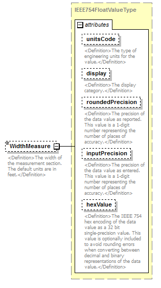 |
||||||||||||||||||||||||||||||||||||||||||||||
| namespace | http://water.usgs.gov/XML/NWIS/5.0 | ||||||||||||||||||||||||||||||||||||||||||||||
| type | IEEE754FloatValueType | ||||||||||||||||||||||||||||||||||||||||||||||
| properties |
|
||||||||||||||||||||||||||||||||||||||||||||||
| facets |
|
||||||||||||||||||||||||||||||||||||||||||||||
| attributes |
|
||||||||||||||||||||||||||||||||||||||||||||||
| annotation |
|
||||||||||||||||||||||||||||||||||||||||||||||
| source | <xsd:element name="WidthMeasure" type="IEEE754FloatValueType" minOccurs="0"> <xsd:annotation> <xsd:documentation> <Definition>The width of the measurement section. The default units are in feet.</Definition> </xsd:documentation> </xsd:annotation> </xsd:element> |
element AdcpDischargeMeasurement/AreaMeasure
| diagram | 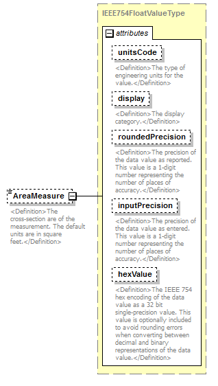 |
||||||||||||||||||||||||||||||||||||||||||||||
| namespace | http://water.usgs.gov/XML/NWIS/5.0 | ||||||||||||||||||||||||||||||||||||||||||||||
| type | IEEE754FloatValueType | ||||||||||||||||||||||||||||||||||||||||||||||
| properties |
|
||||||||||||||||||||||||||||||||||||||||||||||
| facets |
|
||||||||||||||||||||||||||||||||||||||||||||||
| attributes |
|
||||||||||||||||||||||||||||||||||||||||||||||
| annotation |
|
||||||||||||||||||||||||||||||||||||||||||||||
| source | <xsd:element name="AreaMeasure" type="IEEE754FloatValueType" minOccurs="0"> <xsd:annotation> <xsd:documentation> <Definition>The cross-section are of the measurement. The default units are in square feet.</Definition> </xsd:documentation> </xsd:annotation> </xsd:element> |
element AdcpDischargeMeasurement/MeanDepthMeasure
| diagram |  |
||||||||||||||||||||||||||||||||||||||||||||||
| namespace | http://water.usgs.gov/XML/NWIS/5.0 | ||||||||||||||||||||||||||||||||||||||||||||||
| type | IEEE754FloatValueType | ||||||||||||||||||||||||||||||||||||||||||||||
| properties |
|
||||||||||||||||||||||||||||||||||||||||||||||
| facets |
|
||||||||||||||||||||||||||||||||||||||||||||||
| attributes |
|
||||||||||||||||||||||||||||||||||||||||||||||
| annotation |
|
||||||||||||||||||||||||||||||||||||||||||||||
| source | <xsd:element name="MeanDepthMeasure" type="IEEE754FloatValueType" minOccurs="0"> <xsd:annotation> <xsd:documentation> <Definition>The mean depth is the weighted mean water depth for the measurement. The mean depth is weighted based on the distance between individual profiles (and depth measurements). The default units are in feet.</Definition> </xsd:documentation> </xsd:annotation> </xsd:element> |
element AdcpDischargeMeasurement/MaximumDepthMeasure
| diagram |  |
||||||||||||||||||||||||||||||||||||||||||||||
| namespace | http://water.usgs.gov/XML/NWIS/5.0 | ||||||||||||||||||||||||||||||||||||||||||||||
| type | IEEE754FloatValueType | ||||||||||||||||||||||||||||||||||||||||||||||
| properties |
|
||||||||||||||||||||||||||||||||||||||||||||||
| facets |
|
||||||||||||||||||||||||||||||||||||||||||||||
| attributes |
|
||||||||||||||||||||||||||||||||||||||||||||||
| annotation |
|
||||||||||||||||||||||||||||||||||||||||||||||
| source | <xsd:element name="MaximumDepthMeasure" type="IEEE754FloatValueType" minOccurs="0"> <xsd:annotation> <xsd:documentation> <Definition>The maximum depth measured for the discharge measurement. The default units are in feet.</Definition> </xsd:documentation> </xsd:annotation> </xsd:element> |
element AdcpDischargeMeasurement/MeanVelocityMeasure
| diagram | 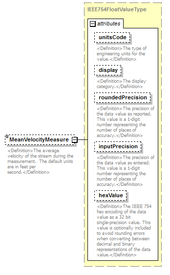 |
||||||||||||||||||||||||||||||||||||||||||||||
| namespace | http://water.usgs.gov/XML/NWIS/5.0 | ||||||||||||||||||||||||||||||||||||||||||||||
| type | IEEE754FloatValueType | ||||||||||||||||||||||||||||||||||||||||||||||
| properties |
|
||||||||||||||||||||||||||||||||||||||||||||||
| facets |
|
||||||||||||||||||||||||||||||||||||||||||||||
| attributes |
|
||||||||||||||||||||||||||||||||||||||||||||||
| annotation |
|
||||||||||||||||||||||||||||||||||||||||||||||
| source | <xsd:element name="MeanVelocityMeasure" type="IEEE754FloatValueType" minOccurs="0"> <xsd:annotation> <xsd:documentation> <Definition>The average velocity of the stream during the measurement. The default units are in feet per second.</Definition> </xsd:documentation> </xsd:annotation> </xsd:element> |
element AdcpDischargeMeasurement/MaximumVelocityMeasure
| diagram |  |
||||||||||||||||||||||||||||||||||||||||||||||
| namespace | http://water.usgs.gov/XML/NWIS/5.0 | ||||||||||||||||||||||||||||||||||||||||||||||
| type | IEEE754FloatValueType | ||||||||||||||||||||||||||||||||||||||||||||||
| properties |
|
||||||||||||||||||||||||||||||||||||||||||||||
| facets |
|
||||||||||||||||||||||||||||||||||||||||||||||
| attributes |
|
||||||||||||||||||||||||||||||||||||||||||||||
| annotation |
|
||||||||||||||||||||||||||||||||||||||||||||||
| source | <xsd:element name="MaximumVelocityMeasure" type="IEEE754FloatValueType" minOccurs="0"> <xsd:annotation> <xsd:documentation> <Definition>The maximum velocity of the stream during the measurement. The default units are in feet per second.</Definition> </xsd:documentation> </xsd:annotation> </xsd:element> |
element AdcpDischargeMeasurement/NumberEnsemblesMeasure
| diagram | 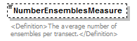 |
||||||||
| namespace | http://water.usgs.gov/XML/NWIS/5.0 | ||||||||
| type | xsd:positiveInteger | ||||||||
| properties |
|
||||||||
| annotation |
|
||||||||
| source | <xsd:element name="NumberEnsemblesMeasure" type="xsd:positiveInteger" minOccurs="0"> <xsd:annotation> <xsd:documentation> <Definition>The average number of ensembles per transect.</Definition> </xsd:documentation> </xsd:annotation> </xsd:element> |
element AdcpDischargeMeasurement/NumberShoreEnsemblesMeasure
| diagram | 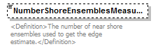 |
||||||||
| namespace | http://water.usgs.gov/XML/NWIS/5.0 | ||||||||
| type | xsd:positiveInteger | ||||||||
| properties |
|
||||||||
| annotation |
|
||||||||
| source | <xsd:element name="NumberShoreEnsemblesMeasure" type="xsd:positiveInteger" minOccurs="0"> <xsd:annotation> <xsd:documentation> <Definition>The number of near shore ensembles used to get the edge estimate.</Definition> </xsd:documentation> </xsd:annotation> </xsd:element> |
element AdcpDischargeMeasurement/MeanTopDischargeMeasure
| diagram | 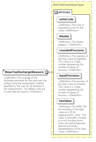 |
||||||||||||||||||||||||||||||||||||||||||||||
| namespace | http://water.usgs.gov/XML/NWIS/5.0 | ||||||||||||||||||||||||||||||||||||||||||||||
| type | IEEE754FloatValueType | ||||||||||||||||||||||||||||||||||||||||||||||
| properties |
|
||||||||||||||||||||||||||||||||||||||||||||||
| facets |
|
||||||||||||||||||||||||||||||||||||||||||||||
| attributes |
|
||||||||||||||||||||||||||||||||||||||||||||||
| annotation |
|
||||||||||||||||||||||||||||||||||||||||||||||
| source | <xsd:element name="MeanTopDischargeMeasure" type="IEEE754FloatValueType" minOccurs="0"> <xsd:annotation> <xsd:documentation> <Definition>The average of the discharge estimated for the area near the surface using the extrapolation method specified by the user for all transects in the measurement. The default units are in cubic feet per second.</Definition> </xsd:documentation> </xsd:annotation> </xsd:element> |
element AdcpDischargeMeasurement/MeanMiddleDischargeMeasure
| diagram | 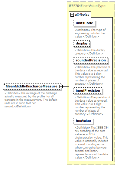 |
||||||||||||||||||||||||||||||||||||||||||||||
| namespace | http://water.usgs.gov/XML/NWIS/5.0 | ||||||||||||||||||||||||||||||||||||||||||||||
| type | IEEE754FloatValueType | ||||||||||||||||||||||||||||||||||||||||||||||
| properties |
|
||||||||||||||||||||||||||||||||||||||||||||||
| facets |
|
||||||||||||||||||||||||||||||||||||||||||||||
| attributes |
|
||||||||||||||||||||||||||||||||||||||||||||||
| annotation |
|
||||||||||||||||||||||||||||||||||||||||||||||
| source | <xsd:element name="MeanMiddleDischargeMeasure" type="IEEE754FloatValueType" minOccurs="0"> <xsd:annotation> <xsd:documentation> <Definition>The average of the discharge actually measured by the profiler for all transects in the measurement. The default units are in cubic feet per second.</Definition> </xsd:documentation> </xsd:annotation> </xsd:element> |
element AdcpDischargeMeasurement/MeanBottomDischargeMeasure
| diagram | 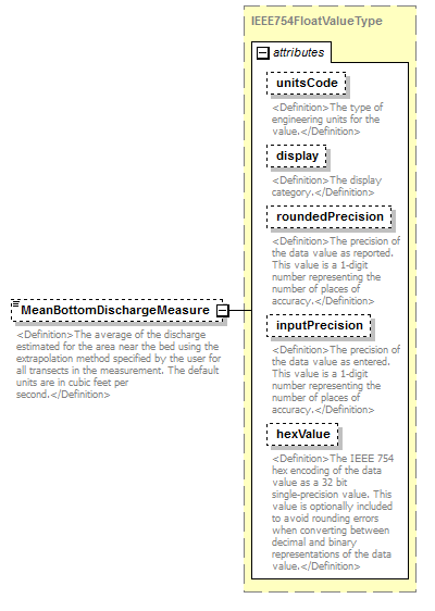 |
||||||||||||||||||||||||||||||||||||||||||||||
| namespace | http://water.usgs.gov/XML/NWIS/5.0 | ||||||||||||||||||||||||||||||||||||||||||||||
| type | IEEE754FloatValueType | ||||||||||||||||||||||||||||||||||||||||||||||
| properties |
|
||||||||||||||||||||||||||||||||||||||||||||||
| facets |
|
||||||||||||||||||||||||||||||||||||||||||||||
| attributes |
|
||||||||||||||||||||||||||||||||||||||||||||||
| annotation |
|
||||||||||||||||||||||||||||||||||||||||||||||
| source | <xsd:element name="MeanBottomDischargeMeasure" type="IEEE754FloatValueType" minOccurs="0"> <xsd:annotation> <xsd:documentation> <Definition>The average of the discharge estimated for the area near the bed using the extrapolation method specified by the user for all transects in the measurement. The default units are in cubic feet per second.</Definition> </xsd:documentation> </xsd:annotation> </xsd:element> |
element AdcpDischargeMeasurement/MeanLeftDischargeMeasure
| diagram | 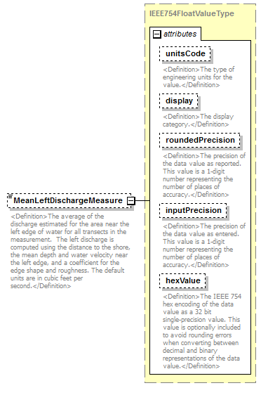 |
||||||||||||||||||||||||||||||||||||||||||||||
| namespace | http://water.usgs.gov/XML/NWIS/5.0 | ||||||||||||||||||||||||||||||||||||||||||||||
| type | IEEE754FloatValueType | ||||||||||||||||||||||||||||||||||||||||||||||
| properties |
|
||||||||||||||||||||||||||||||||||||||||||||||
| facets |
|
||||||||||||||||||||||||||||||||||||||||||||||
| attributes |
|
||||||||||||||||||||||||||||||||||||||||||||||
| annotation |
|
||||||||||||||||||||||||||||||||||||||||||||||
| source | <xsd:element name="MeanLeftDischargeMeasure" type="IEEE754FloatValueType" minOccurs="0"> <xsd:annotation> <xsd:documentation> <Definition>The average of the discharge estimated for the area near the left edge of water for all transects in the measurement. The left discharge is computed using the distance to the shore, the mean depth and water velocity near the left edge, and a coefficient for the edge shape and roughness. The default units are in cubic feet per second.</Definition> </xsd:documentation> </xsd:annotation> </xsd:element> |
element AdcpDischargeMeasurement/MeanRightDischargeMeasure
| diagram | 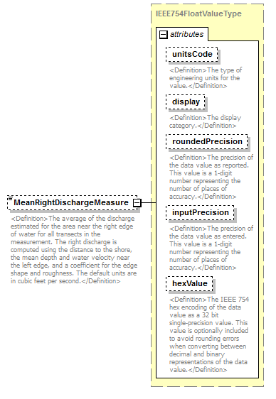 |
||||||||||||||||||||||||||||||||||||||||||||||
| namespace | http://water.usgs.gov/XML/NWIS/5.0 | ||||||||||||||||||||||||||||||||||||||||||||||
| type | IEEE754FloatValueType | ||||||||||||||||||||||||||||||||||||||||||||||
| properties |
|
||||||||||||||||||||||||||||||||||||||||||||||
| facets |
|
||||||||||||||||||||||||||||||||||||||||||||||
| attributes |
|
||||||||||||||||||||||||||||||||||||||||||||||
| annotation |
|
||||||||||||||||||||||||||||||||||||||||||||||
| source | <xsd:element name="MeanRightDischargeMeasure" type="IEEE754FloatValueType" minOccurs="0"> <xsd:annotation> <xsd:documentation> <Definition>The average of the discharge estimated for the area near the right edge of water for all transects in the measurement. The right discharge is computed using the distance to the shore, the mean depth and water velocity near the left edge, and a coefficient for the edge shape and roughness. The default units are in cubic feet per second.</Definition> </xsd:documentation> </xsd:annotation> </xsd:element> |
element AdcpDischargeMeasurement/LeftEdgeCoefficient
| diagram | 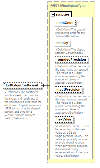 |
||||||||||||||||||||||||||||||||||||||||||||||
| namespace | http://water.usgs.gov/XML/NWIS/5.0 | ||||||||||||||||||||||||||||||||||||||||||||||
| type | IEEE754FloatValueType | ||||||||||||||||||||||||||||||||||||||||||||||
| properties |
|
||||||||||||||||||||||||||||||||||||||||||||||
| facets |
|
||||||||||||||||||||||||||||||||||||||||||||||
| attributes |
|
||||||||||||||||||||||||||||||||||||||||||||||
| annotation |
|
||||||||||||||||||||||||||||||||||||||||||||||
| source | <xsd:element name="LeftEdgeCoefficient" type="IEEE754FloatValueType" minOccurs="0"> <xsd:annotation> <xsd:documentation> <Definition>The coefficient which is used to account for the shape and roughness of the unmeasured area near the left shore. Typical values are .3535 for a triangular shaped section, and 0.91 for a vertical, smooth concrete wall.</Definition> </xsd:documentation> </xsd:annotation> </xsd:element> |
element AdcpDischargeMeasurement/RightEdgeCoefficient
| diagram |  |
||||||||||||||||||||||||||||||||||||||||||||||
| namespace | http://water.usgs.gov/XML/NWIS/5.0 | ||||||||||||||||||||||||||||||||||||||||||||||
| type | IEEE754FloatValueType | ||||||||||||||||||||||||||||||||||||||||||||||
| properties |
|
||||||||||||||||||||||||||||||||||||||||||||||
| facets |
|
||||||||||||||||||||||||||||||||||||||||||||||
| attributes |
|
||||||||||||||||||||||||||||||||||||||||||||||
| annotation |
|
||||||||||||||||||||||||||||||||||||||||||||||
| source | <xsd:element name="RightEdgeCoefficient" type="IEEE754FloatValueType" minOccurs="0"> <xsd:annotation> <xsd:documentation> <Definition>The coefficient which is used to account for the shape and roughness of the unmeasured area near the right shore. Typical values are .3535 for a triangular shaped section, and 0.91 for a vertical, smooth concrete wall.</Definition> </xsd:documentation> </xsd:annotation> </xsd:element> |
element AdcpDischargeMeasurement/DischargeCoefficient
| diagram |  |
||||||||||||||||||||||||||||||||||||||||||||||
| namespace | http://water.usgs.gov/XML/NWIS/5.0 | ||||||||||||||||||||||||||||||||||||||||||||||
| type | IEEE754FloatValueType | ||||||||||||||||||||||||||||||||||||||||||||||
| properties |
|
||||||||||||||||||||||||||||||||||||||||||||||
| facets |
|
||||||||||||||||||||||||||||||||||||||||||||||
| attributes |
|
||||||||||||||||||||||||||||||||||||||||||||||
| annotation |
|
||||||||||||||||||||||||||||||||||||||||||||||
| source | <xsd:element name="DischargeCoefficient" type="IEEE754FloatValueType" minOccurs="0"> <xsd:annotation> <xsd:documentation> <Definition>The standard deviation of the total discharges for all transects in the measurement divided by the mean discharge for all measurements. This parameter provides an standardized estimate of the variation of discharges in the measurement.</Definition> </xsd:documentation> </xsd:annotation> </xsd:element> |
element AdcpDischargeMeasurement/FlowMeasuredPercent
| diagram | 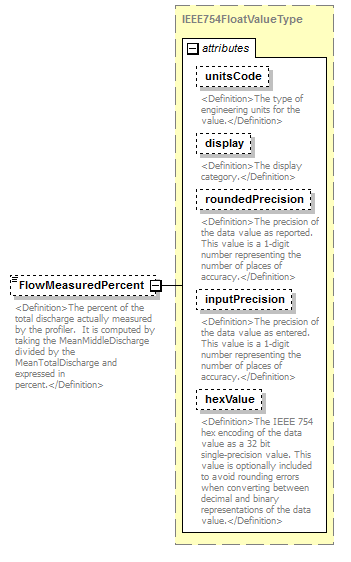 |
||||||||||||||||||||||||||||||||||||||||||||||
| namespace | http://water.usgs.gov/XML/NWIS/5.0 | ||||||||||||||||||||||||||||||||||||||||||||||
| type | IEEE754FloatValueType | ||||||||||||||||||||||||||||||||||||||||||||||
| properties |
|
||||||||||||||||||||||||||||||||||||||||||||||
| facets |
|
||||||||||||||||||||||||||||||||||||||||||||||
| attributes |
|
||||||||||||||||||||||||||||||||||||||||||||||
| annotation |
|
||||||||||||||||||||||||||||||||||||||||||||||
| source | <xsd:element name="FlowMeasuredPercent" type="IEEE754FloatValueType" minOccurs="0"> <xsd:annotation> <xsd:documentation> <Definition>The percent of the total discharge actually measured by the profiler. It is computed by taking the MeanMiddleDischarge divided by the MeanTotalDischarge and expressed in percent.</Definition> </xsd:documentation> </xsd:annotation> </xsd:element> |
element AdcpDischargeMeasurement/TopEstimateMethodCode
| diagram |  |
||||||||||||||||||||||
| namespace | http://water.usgs.gov/XML/NWIS/5.0 | ||||||||||||||||||||||
| type | ReferenceListCodeType | ||||||||||||||||||||||
| properties |
|
||||||||||||||||||||||
| attributes |
|
||||||||||||||||||||||
| annotation |
|
||||||||||||||||||||||
| source | <xsd:element name="TopEstimateMethodCode" type="ReferenceListCodeType"> <xsd:annotation> <xsd:documentation> <Definition>The code indicating the method of estimation of the top?.</Definition> </xsd:documentation> </xsd:annotation> </xsd:element> |
element AdcpDischargeMeasurement/TopEstimateCoefficient
| diagram | 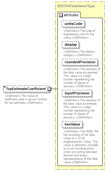 |
||||||||||||||||||||||||||||||||||||||||||||||
| namespace | http://water.usgs.gov/XML/NWIS/5.0 | ||||||||||||||||||||||||||||||||||||||||||||||
| type | IEEE754FloatValueType | ||||||||||||||||||||||||||||||||||||||||||||||
| properties |
|
||||||||||||||||||||||||||||||||||||||||||||||
| facets |
|
||||||||||||||||||||||||||||||||||||||||||||||
| attributes |
|
||||||||||||||||||||||||||||||||||||||||||||||
| annotation |
|
||||||||||||||||||||||||||||||||||||||||||||||
| source | <xsd:element name="TopEstimateCoefficient" type="IEEE754FloatValueType" minOccurs="0"> <xsd:annotation> <xsd:documentation> <Definition>The Value of coefficient used in power function for top estimate.</Definition> </xsd:documentation> </xsd:annotation> </xsd:element> |
element AdcpDischargeMeasurement/BottomEstimateMethodCode
| diagram |  |
||||||||||||||||||||||
| namespace | http://water.usgs.gov/XML/NWIS/5.0 | ||||||||||||||||||||||
| type | ReferenceListCodeType | ||||||||||||||||||||||
| properties |
|
||||||||||||||||||||||
| attributes |
|
||||||||||||||||||||||
| annotation |
|
||||||||||||||||||||||
| source | <xsd:element name="BottomEstimateMethodCode" type="ReferenceListCodeType"> <xsd:annotation> <xsd:documentation> <Definition>The code indicating the method of estimation of the bottom?.</Definition> </xsd:documentation> </xsd:annotation> </xsd:element> |
element AdcpDischargeMeasurement/BottomEstimateCoefficient
| diagram |  |
||||||||||||||||||||||||||||||||||||||||||||||
| namespace | http://water.usgs.gov/XML/NWIS/5.0 | ||||||||||||||||||||||||||||||||||||||||||||||
| type | IEEE754FloatValueType | ||||||||||||||||||||||||||||||||||||||||||||||
| properties |
|
||||||||||||||||||||||||||||||||||||||||||||||
| facets |
|
||||||||||||||||||||||||||||||||||||||||||||||
| attributes |
|
||||||||||||||||||||||||||||||||||||||||||||||
| annotation |
|
||||||||||||||||||||||||||||||||||||||||||||||
| source | <xsd:element name="BottomEstimateCoefficient" type="IEEE754FloatValueType" minOccurs="0"> <xsd:annotation> <xsd:documentation> <Definition>The Value of coefficient used in power function for bottom estimate.</Definition> </xsd:documentation> </xsd:annotation> </xsd:element> |
element AdcpDischargeMeasurement/WOCommandSetting
| diagram |  |
||||||||
| namespace | http://water.usgs.gov/XML/NWIS/5.0 | ||||||||
| type | xsd:string | ||||||||
| properties |
|
||||||||
| annotation |
|
||||||||
| source | <xsd:element name="WOCommandSetting" type="xsd:string" minOccurs="0"> <xsd:annotation> <xsd:documentation> <Definition>The setting of the WO command for water mode 12.</Definition> </xsd:documentation> </xsd:annotation> </xsd:element> |
element ShiftAnalysis
| diagram | 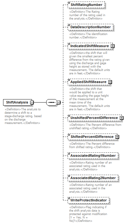 |
||
| namespace | http://water.usgs.gov/XML/NWIS/5.0 | ||
| properties |
|
||
| children | ShiftRatingNumber DataDescriptionNumber IndicatedShiftMeasure AppliedShiftMeasure UnshiftedPercentDifference ShiftedPercentDifference AssociatedRating1Number AssociatedRating2Number WriteProtectIndicator | ||
| used by |
|
||
| annotation |
|
||
| source | <xsd:element name="ShiftAnalysis"> <xsd:annotation> <xsd:documentation> <Definition>The analysis to determine a shift to a stage-discharge rating, based on the discharge measurement.</Definition> </xsd:documentation> </xsd:annotation> <xsd:complexType> <xsd:sequence> <xsd:element name="ShiftRatingNumber" type="xsd:string" minOccurs="0"> <xsd:annotation> <xsd:documentation> <Definition>The Rating number of the rating used in the analysis.</Definition> </xsd:documentation> </xsd:annotation> </xsd:element> <xsd:element name="DataDescriptionNumber" type="xsd:string" minOccurs="0"> <xsd:annotation> <xsd:documentation> <Definition>The identification number.</Definition> </xsd:documentation> </xsd:annotation> </xsd:element> <xsd:element name="IndicatedShiftMeasure" type="IEEE754FloatValueType" minOccurs="0"> <xsd:annotation> <xsd:documentation> <Definition>the shift that will given the smallest percent difference from the rating given using the discharge and gage height as stored with the measurement. The default units are in feet.</Definition> </xsd:documentation> </xsd:annotation> </xsd:element> <xsd:element name="AppliedShiftMeasure" type="IEEE754FloatValueType" minOccurs="0"> <xsd:annotation> <xsd:documentation> <Definition>the shift that would be applied to a unit value equaling the gage height of the measurement at the mean time of the measurement. The default units are in feet.</Definition> </xsd:documentation> </xsd:annotation> </xsd:element> <xsd:element name="UnshiftedPercentDifference" type="IEEE754FloatValueType" minOccurs="0"> <xsd:annotation> <xsd:documentation> <Definition>The Percent difference from unshifted rating.</Definition> </xsd:documentation> </xsd:annotation> </xsd:element> <xsd:element name="ShiftedPercentDifference" type="IEEE754FloatValueType" minOccurs="0"> <xsd:annotation> <xsd:documentation> <Definition>The Percent difference from shifted rating.</Definition> </xsd:documentation> </xsd:annotation> </xsd:element> <xsd:element name="AssociatedRating1Number" type="xsd:string" minOccurs="0"> <xsd:annotation> <xsd:documentation> <Definition>Rating number of an associated rating used in the analysis.</Definition> </xsd:documentation> </xsd:annotation> </xsd:element> <xsd:element name="AssociatedRating2Number" type="xsd:string" minOccurs="0"> <xsd:annotation> <xsd:documentation> <Definition>Rating number of an associated rating used in the analysis.</Definition> </xsd:documentation> </xsd:annotation> </xsd:element> <xsd:element name="WriteProtectIndicator" type="xsd:boolean" minOccurs="0"> <xsd:annotation> <xsd:documentation> <Definition>Flag indicating if the shift analysis data is protected against modification (Y = Yes, N = No)?</Definition> </xsd:documentation> </xsd:annotation> </xsd:element> </xsd:sequence> </xsd:complexType> </xsd:element> |
element ShiftAnalysis/ShiftRatingNumber
| diagram | 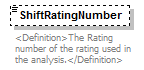 |
||||||||
| namespace | http://water.usgs.gov/XML/NWIS/5.0 | ||||||||
| type | xsd:string | ||||||||
| properties |
|
||||||||
| annotation |
|
||||||||
| source | <xsd:element name="ShiftRatingNumber" type="xsd:string" minOccurs="0"> <xsd:annotation> <xsd:documentation> <Definition>The Rating number of the rating used in the analysis.</Definition> </xsd:documentation> </xsd:annotation> </xsd:element> |
element ShiftAnalysis/DataDescriptionNumber
| diagram | 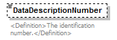 |
||||||||
| namespace | http://water.usgs.gov/XML/NWIS/5.0 | ||||||||
| type | xsd:string | ||||||||
| properties |
|
||||||||
| annotation |
|
||||||||
| source | <xsd:element name="DataDescriptionNumber" type="xsd:string" minOccurs="0"> <xsd:annotation> <xsd:documentation> <Definition>The identification number.</Definition> </xsd:documentation> </xsd:annotation> </xsd:element> |
element ShiftAnalysis/IndicatedShiftMeasure
| diagram |  |
||||||||||||||||||||||||||||||||||||||||||||||
| namespace | http://water.usgs.gov/XML/NWIS/5.0 | ||||||||||||||||||||||||||||||||||||||||||||||
| type | IEEE754FloatValueType | ||||||||||||||||||||||||||||||||||||||||||||||
| properties |
|
||||||||||||||||||||||||||||||||||||||||||||||
| facets |
|
||||||||||||||||||||||||||||||||||||||||||||||
| attributes |
|
||||||||||||||||||||||||||||||||||||||||||||||
| annotation |
|
||||||||||||||||||||||||||||||||||||||||||||||
| source | <xsd:element name="IndicatedShiftMeasure" type="IEEE754FloatValueType" minOccurs="0"> <xsd:annotation> <xsd:documentation> <Definition>the shift that will given the smallest percent difference from the rating given using the discharge and gage height as stored with the measurement. The default units are in feet.</Definition> </xsd:documentation> </xsd:annotation> </xsd:element> |
element ShiftAnalysis/AppliedShiftMeasure
| diagram |  |
||||||||||||||||||||||||||||||||||||||||||||||
| namespace | http://water.usgs.gov/XML/NWIS/5.0 | ||||||||||||||||||||||||||||||||||||||||||||||
| type | IEEE754FloatValueType | ||||||||||||||||||||||||||||||||||||||||||||||
| properties |
|
||||||||||||||||||||||||||||||||||||||||||||||
| facets |
|
||||||||||||||||||||||||||||||||||||||||||||||
| attributes |
|
||||||||||||||||||||||||||||||||||||||||||||||
| annotation |
|
||||||||||||||||||||||||||||||||||||||||||||||
| source | <xsd:element name="AppliedShiftMeasure" type="IEEE754FloatValueType" minOccurs="0"> <xsd:annotation> <xsd:documentation> <Definition>the shift that would be applied to a unit value equaling the gage height of the measurement at the mean time of the measurement. The default units are in feet.</Definition> </xsd:documentation> </xsd:annotation> </xsd:element> |
element ShiftAnalysis/UnshiftedPercentDifference
| diagram |  |
||||||||||||||||||||||||||||||||||||||||||||||
| namespace | http://water.usgs.gov/XML/NWIS/5.0 | ||||||||||||||||||||||||||||||||||||||||||||||
| type | IEEE754FloatValueType | ||||||||||||||||||||||||||||||||||||||||||||||
| properties |
|
||||||||||||||||||||||||||||||||||||||||||||||
| facets |
|
||||||||||||||||||||||||||||||||||||||||||||||
| attributes |
|
||||||||||||||||||||||||||||||||||||||||||||||
| annotation |
|
||||||||||||||||||||||||||||||||||||||||||||||
| source | <xsd:element name="UnshiftedPercentDifference" type="IEEE754FloatValueType" minOccurs="0"> <xsd:annotation> <xsd:documentation> <Definition>The Percent difference from unshifted rating.</Definition> </xsd:documentation> </xsd:annotation> </xsd:element> |
element ShiftAnalysis/ShiftedPercentDifference
| diagram |  |
||||||||||||||||||||||||||||||||||||||||||||||
| namespace | http://water.usgs.gov/XML/NWIS/5.0 | ||||||||||||||||||||||||||||||||||||||||||||||
| type | IEEE754FloatValueType | ||||||||||||||||||||||||||||||||||||||||||||||
| properties |
|
||||||||||||||||||||||||||||||||||||||||||||||
| facets |
|
||||||||||||||||||||||||||||||||||||||||||||||
| attributes |
|
||||||||||||||||||||||||||||||||||||||||||||||
| annotation |
|
||||||||||||||||||||||||||||||||||||||||||||||
| source | <xsd:element name="ShiftedPercentDifference" type="IEEE754FloatValueType" minOccurs="0"> <xsd:annotation> <xsd:documentation> <Definition>The Percent difference from shifted rating.</Definition> </xsd:documentation> </xsd:annotation> </xsd:element> |
element ShiftAnalysis/AssociatedRating1Number
| diagram | 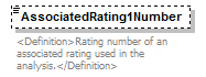 |
||||||||
| namespace | http://water.usgs.gov/XML/NWIS/5.0 | ||||||||
| type | xsd:string | ||||||||
| properties |
|
||||||||
| annotation |
|
||||||||
| source | <xsd:element name="AssociatedRating1Number" type="xsd:string" minOccurs="0"> <xsd:annotation> <xsd:documentation> <Definition>Rating number of an associated rating used in the analysis.</Definition> </xsd:documentation> </xsd:annotation> </xsd:element> |
element ShiftAnalysis/AssociatedRating2Number
| diagram |  |
||||||||
| namespace | http://water.usgs.gov/XML/NWIS/5.0 | ||||||||
| type | xsd:string | ||||||||
| properties |
|
||||||||
| annotation |
|
||||||||
| source | <xsd:element name="AssociatedRating2Number" type="xsd:string" minOccurs="0"> <xsd:annotation> <xsd:documentation> <Definition>Rating number of an associated rating used in the analysis.</Definition> </xsd:documentation> </xsd:annotation> </xsd:element> |
element ShiftAnalysis/WriteProtectIndicator
| diagram |  |
||||||||
| namespace | http://water.usgs.gov/XML/NWIS/5.0 | ||||||||
| type | xsd:boolean | ||||||||
| properties |
|
||||||||
| annotation |
|
||||||||
| source | <xsd:element name="WriteProtectIndicator" type="xsd:boolean" minOccurs="0"> <xsd:annotation> <xsd:documentation> <Definition>Flag indicating if the shift analysis data is protected against modification (Y = Yes, N = No)?</Definition> </xsd:documentation> </xsd:annotation> </xsd:element> |
element EnvironmentalMeasurement
| diagram | 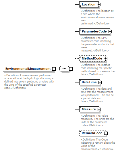 |
||
| namespace | http://water.usgs.gov/XML/NWIS/5.0 | ||
| properties |
|
||
| children | Location ParameterCode MethodCode DateTime Measure RemarkCode | ||
| used by |
|
||
| annotation |
|
||
| source | <xsd:element name="EnvironmentalMeasurement"> <xsd:annotation> <xsd:documentation> <Definition>A measurement performed at a location at the hydrologic site using a defined instrument producing a value with the units of the specified parameter code.</Definition> </xsd:documentation> </xsd:annotation> <xsd:complexType> <xsd:sequence> <xsd:element ref="Location"> <xsd:annotation> <xsd:documentation> <Definition>The location at a site where the environmental measurement was performed.</Definition> </xsd:documentation> </xsd:annotation> </xsd:element> <xsd:element name="ParameterCode" type="ReferenceListCodeType"> <xsd:annotation> <xsd:documentation> <Definition>The EPA parameter code indicating the parameter and units that were measured.</Definition> </xsd:documentation> </xsd:annotation> </xsd:element> <xsd:element name="MethodCode" type="ReferenceListCodeType" minOccurs="0"> <xsd:annotation> <xsd:documentation> <Definition>The method code indicating the specific method used to measure the data.</Definition> </xsd:documentation> </xsd:annotation> </xsd:element> <xsd:element name="DateTime" type="DateTimeWithDatumPartial"> <xsd:annotation> <xsd:documentation> <Definition>The date and time that the measurement was performed. This can be a partial date and time.</Definition> </xsd:documentation> </xsd:annotation> </xsd:element> <xsd:element name="Measure" type="IEEE754FloatValueType"> <xsd:annotation> <xsd:documentation> <Definition>The value measured. The units are the units of the parameter code.</Definition> </xsd:documentation> </xsd:annotation> </xsd:element> <xsd:element name="RemarkCode" type="ReferenceListCodeType" minOccurs="0"> <xsd:annotation> <xsd:documentation> <Definition>The Code indicating a remark about the value of the measurement.</Definition> </xsd:documentation> </xsd:annotation> </xsd:element> </xsd:sequence> </xsd:complexType> </xsd:element> |
element EnvironmentalMeasurement/ParameterCode
| diagram | 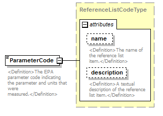 |
||||||||||||||||||||||
| namespace | http://water.usgs.gov/XML/NWIS/5.0 | ||||||||||||||||||||||
| type | ReferenceListCodeType | ||||||||||||||||||||||
| properties |
|
||||||||||||||||||||||
| attributes |
|
||||||||||||||||||||||
| annotation |
|
||||||||||||||||||||||
| source | <xsd:element name="ParameterCode" type="ReferenceListCodeType"> <xsd:annotation> <xsd:documentation> <Definition>The EPA parameter code indicating the parameter and units that were measured.</Definition> </xsd:documentation> </xsd:annotation> </xsd:element> |
element EnvironmentalMeasurement/MethodCode
| diagram |  |
||||||||||||||||||||||
| namespace | http://water.usgs.gov/XML/NWIS/5.0 | ||||||||||||||||||||||
| type | ReferenceListCodeType | ||||||||||||||||||||||
| properties |
|
||||||||||||||||||||||
| attributes |
|
||||||||||||||||||||||
| annotation |
|
||||||||||||||||||||||
| source | <xsd:element name="MethodCode" type="ReferenceListCodeType" minOccurs="0"> <xsd:annotation> <xsd:documentation> <Definition>The method code indicating the specific method used to measure the data.</Definition> </xsd:documentation> </xsd:annotation> </xsd:element> |
element EnvironmentalMeasurement/DateTime
| diagram | 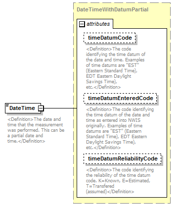 |
||||||||||||||||||||||||||||||
| namespace | http://water.usgs.gov/XML/NWIS/5.0 | ||||||||||||||||||||||||||||||
| type | DateTimeWithDatumPartial | ||||||||||||||||||||||||||||||
| properties |
|
||||||||||||||||||||||||||||||
| attributes |
|
||||||||||||||||||||||||||||||
| annotation |
|
||||||||||||||||||||||||||||||
| source | <xsd:element name="DateTime" type="DateTimeWithDatumPartial"> <xsd:annotation> <xsd:documentation> <Definition>The date and time that the measurement was performed. This can be a partial date and time.</Definition> </xsd:documentation> </xsd:annotation> </xsd:element> |
element EnvironmentalMeasurement/Measure
| diagram | 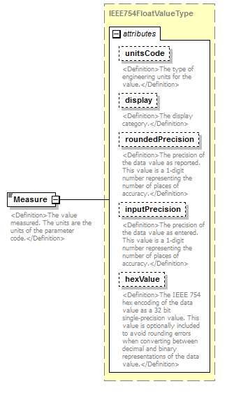 |
||||||||||||||||||||||||||||||||||||||||||||||
| namespace | http://water.usgs.gov/XML/NWIS/5.0 | ||||||||||||||||||||||||||||||||||||||||||||||
| type | IEEE754FloatValueType | ||||||||||||||||||||||||||||||||||||||||||||||
| properties |
|
||||||||||||||||||||||||||||||||||||||||||||||
| facets |
|
||||||||||||||||||||||||||||||||||||||||||||||
| attributes |
|
||||||||||||||||||||||||||||||||||||||||||||||
| annotation |
|
||||||||||||||||||||||||||||||||||||||||||||||
| source | <xsd:element name="Measure" type="IEEE754FloatValueType"> <xsd:annotation> <xsd:documentation> <Definition>The value measured. The units are the units of the parameter code.</Definition> </xsd:documentation> </xsd:annotation> </xsd:element> |
element EnvironmentalMeasurement/RemarkCode
| diagram |  |
||||||||||||||||||||||
| namespace | http://water.usgs.gov/XML/NWIS/5.0 | ||||||||||||||||||||||
| type | ReferenceListCodeType | ||||||||||||||||||||||
| properties |
|
||||||||||||||||||||||
| attributes |
|
||||||||||||||||||||||
| annotation |
|
||||||||||||||||||||||
| source | <xsd:element name="RemarkCode" type="ReferenceListCodeType" minOccurs="0"> <xsd:annotation> <xsd:documentation> <Definition>The Code indicating a remark about the value of the measurement.</Definition> </xsd:documentation> </xsd:annotation> </xsd:element> |
element BubbleGageInspection
| diagram | 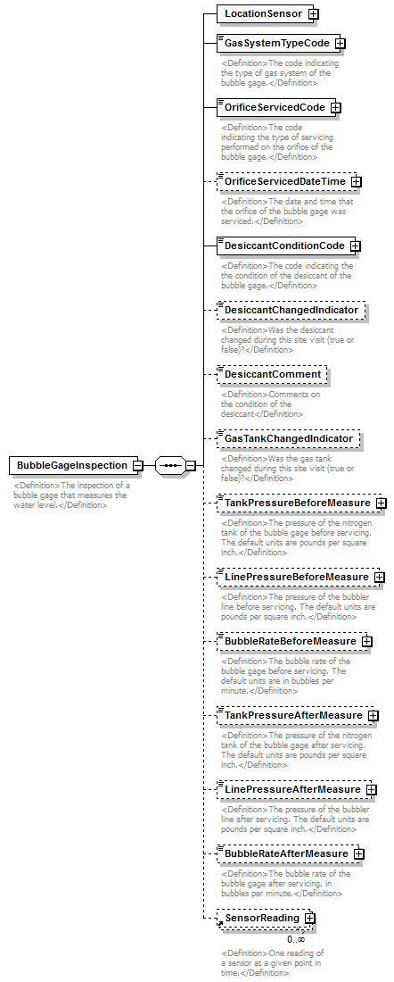 |
||
| namespace | http://water.usgs.gov/XML/NWIS/5.0 | ||
| properties |
|
||
| children | LocationSensor GasSystemTypeCode OrificeServicedCode OrificeServicedDateTime DesiccantConditionCode DesiccantChangedIndicator DesiccantComment GasTankChangedIndicator TankPressureBeforeMeasure LinePressureBeforeMeasure BubbleRateBeforeMeasure TankPressureAfterMeasure LinePressureAfterMeasure BubbleRateAfterMeasure SensorReading | ||
| used by |
|
||
| annotation |
|
||
| source | <xsd:element name="BubbleGageInspection"> <xsd:annotation> <xsd:documentation> <Definition>The inspection of a bubble gage that measures the water level.</Definition> </xsd:documentation> </xsd:annotation> <xsd:complexType> <xsd:sequence> <xsd:element name="LocationSensor" type="LocationSensor"/> <xsd:element name="GasSystemTypeCode" type="ReferenceListCodeType"> <xsd:annotation> <xsd:documentation> <Definition>The code indicating the type of gas system of the bubble gage.</Definition> </xsd:documentation> </xsd:annotation> </xsd:element> <xsd:element name="OrificeServicedCode" type="ReferenceListCodeType"> <xsd:annotation> <xsd:documentation> <Definition>The code indicating the type of servicing performed on the orifice of the bubble gage.</Definition> </xsd:documentation> </xsd:annotation> </xsd:element> <xsd:element name="OrificeServicedDateTime" type="DateTimeWithDatum" minOccurs="0"> <xsd:annotation> <xsd:documentation> <Definition>The date and time that the orifice of the bubble gage was serviced.</Definition> </xsd:documentation> </xsd:annotation> </xsd:element> <xsd:element name="DesiccantConditionCode" type="ReferenceListCodeType"> <xsd:annotation> <xsd:documentation> <Definition>The code indicating the the condition of the desiccant of the bubble gage.</Definition> </xsd:documentation> </xsd:annotation> </xsd:element> <xsd:element name="DesiccantChangedIndicator" type="xsd:boolean" minOccurs="0"> <xsd:annotation> <xsd:documentation> <Definition>Was the desiccant changed during this site visit (true or false)?</Definition> </xsd:documentation> </xsd:annotation> </xsd:element> <xsd:element name="DesiccantComment" type="xsd:string" minOccurs="0"> <xsd:annotation> <xsd:documentation> <Definition>Comments on the condition of the desiccant</Definition> </xsd:documentation> </xsd:annotation> </xsd:element> <xsd:element name="GasTankChangedIndicator" type="xsd:boolean" minOccurs="0"> <xsd:annotation> <xsd:documentation> <Definition>Was the gas tank changed during this site visit (true or false)?</Definition> </xsd:documentation> </xsd:annotation> </xsd:element> <xsd:element name="TankPressureBeforeMeasure" type="IEEE754FloatValueType" minOccurs="0"> <xsd:annotation> <xsd:documentation> <Definition>The pressure of the nitrogen tank of the bubble gage before servicing. The default units are pounds per square inch.</Definition> </xsd:documentation> </xsd:annotation> </xsd:element> <xsd:element name="LinePressureBeforeMeasure" type="IEEE754FloatValueType" minOccurs="0"> <xsd:annotation> <xsd:documentation> <Definition>The pressure of the bubbler line before servicing. The default units are pounds per square inch.</Definition> </xsd:documentation> </xsd:annotation> </xsd:element> <xsd:element name="BubbleRateBeforeMeasure" type="IEEE754FloatValueType" minOccurs="0"> <xsd:annotation> <xsd:documentation> <Definition>The bubble rate of the bubble gage before servicing. The default units are in bubbles per minute.</Definition> </xsd:documentation> </xsd:annotation> </xsd:element> <xsd:element name="TankPressureAfterMeasure" type="IEEE754FloatValueType" minOccurs="0"> <xsd:annotation> <xsd:documentation> <Definition>The pressure of the nitrogen tank of the bubble gage after servicing. The default units are pounds per square inch.</Definition> </xsd:documentation> </xsd:annotation> </xsd:element> <xsd:element name="LinePressureAfterMeasure" type="IEEE754FloatValueType" minOccurs="0"> <xsd:annotation> <xsd:documentation> <Definition>The pressure of the bubbler line after servicing. The default units are pounds per square inch.</Definition> </xsd:documentation> </xsd:annotation> </xsd:element> <xsd:element name="BubbleRateAfterMeasure" type="IEEE754FloatValueType" minOccurs="0"> <xsd:annotation> <xsd:documentation> <Definition>The bubble rate of the bubble gage after servicing, in bubbles per minute.</Definition> </xsd:documentation> </xsd:annotation> </xsd:element> <xsd:element ref="SensorReading" minOccurs="0" maxOccurs="unbounded"/> </xsd:sequence> </xsd:complexType> </xsd:element> |
element BubbleGageInspection/LocationSensor
| diagram |  |
||||
| namespace | http://water.usgs.gov/XML/NWIS/5.0 | ||||
| type | LocationSensor | ||||
| properties |
|
||||
| children | Location Sensor StartDateTime EndDateTime PrimarySensorIndicator PrimaryRecorderIndicator StillingWellIndicator GageMeasurementPoint CreatorUserName CreateDateTime ModifierUserName ModifyDateTime ApproverUserName ApprovalDateTime | ||||
| source | <xsd:element name="LocationSensor" type="LocationSensor"/> |
element BubbleGageInspection/GasSystemTypeCode
| diagram | 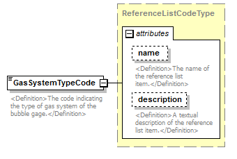 |
||||||||||||||||||||||
| namespace | http://water.usgs.gov/XML/NWIS/5.0 | ||||||||||||||||||||||
| type | ReferenceListCodeType | ||||||||||||||||||||||
| properties |
|
||||||||||||||||||||||
| attributes |
|
||||||||||||||||||||||
| annotation |
|
||||||||||||||||||||||
| source | <xsd:element name="GasSystemTypeCode" type="ReferenceListCodeType"> <xsd:annotation> <xsd:documentation> <Definition>The code indicating the type of gas system of the bubble gage.</Definition> </xsd:documentation> </xsd:annotation> </xsd:element> |
element BubbleGageInspection/OrificeServicedCode
| diagram | 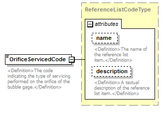 |
||||||||||||||||||||||
| namespace | http://water.usgs.gov/XML/NWIS/5.0 | ||||||||||||||||||||||
| type | ReferenceListCodeType | ||||||||||||||||||||||
| properties |
|
||||||||||||||||||||||
| attributes |
|
||||||||||||||||||||||
| annotation |
|
||||||||||||||||||||||
| source | <xsd:element name="OrificeServicedCode" type="ReferenceListCodeType"> <xsd:annotation> <xsd:documentation> <Definition>The code indicating the type of servicing performed on the orifice of the bubble gage.</Definition> </xsd:documentation> </xsd:annotation> </xsd:element> |
element BubbleGageInspection/OrificeServicedDateTime
| diagram | 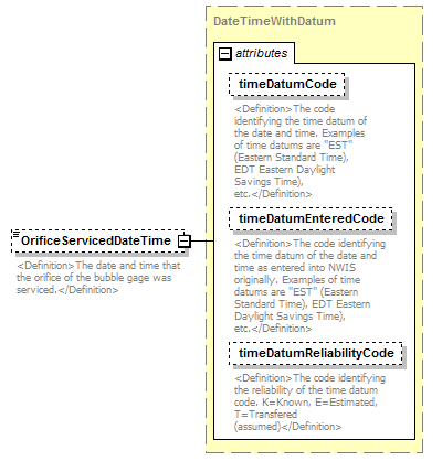 |
||||||||||||||||||||||||||||||
| namespace | http://water.usgs.gov/XML/NWIS/5.0 | ||||||||||||||||||||||||||||||
| type | DateTimeWithDatum | ||||||||||||||||||||||||||||||
| properties |
|
||||||||||||||||||||||||||||||
| attributes |
|
||||||||||||||||||||||||||||||
| annotation |
|
||||||||||||||||||||||||||||||
| source | <xsd:element name="OrificeServicedDateTime" type="DateTimeWithDatum" minOccurs="0"> <xsd:annotation> <xsd:documentation> <Definition>The date and time that the orifice of the bubble gage was serviced.</Definition> </xsd:documentation> </xsd:annotation> </xsd:element> |
element BubbleGageInspection/DesiccantConditionCode
| diagram |  |
||||||||||||||||||||||
| namespace | http://water.usgs.gov/XML/NWIS/5.0 | ||||||||||||||||||||||
| type | ReferenceListCodeType | ||||||||||||||||||||||
| properties |
|
||||||||||||||||||||||
| attributes |
|
||||||||||||||||||||||
| annotation |
|
||||||||||||||||||||||
| source | <xsd:element name="DesiccantConditionCode" type="ReferenceListCodeType"> <xsd:annotation> <xsd:documentation> <Definition>The code indicating the the condition of the desiccant of the bubble gage.</Definition> </xsd:documentation> </xsd:annotation> </xsd:element> |
element BubbleGageInspection/DesiccantChangedIndicator
| diagram |  |
||||||||
| namespace | http://water.usgs.gov/XML/NWIS/5.0 | ||||||||
| type | xsd:boolean | ||||||||
| properties |
|
||||||||
| annotation |
|
||||||||
| source | <xsd:element name="DesiccantChangedIndicator" type="xsd:boolean" minOccurs="0"> <xsd:annotation> <xsd:documentation> <Definition>Was the desiccant changed during this site visit (true or false)?</Definition> </xsd:documentation> </xsd:annotation> </xsd:element> |
element BubbleGageInspection/DesiccantComment
| diagram |  |
||||||||
| namespace | http://water.usgs.gov/XML/NWIS/5.0 | ||||||||
| type | xsd:string | ||||||||
| properties |
|
||||||||
| annotation |
|
||||||||
| source | <xsd:element name="DesiccantComment" type="xsd:string" minOccurs="0"> <xsd:annotation> <xsd:documentation> <Definition>Comments on the condition of the desiccant</Definition> </xsd:documentation> </xsd:annotation> </xsd:element> |
element BubbleGageInspection/GasTankChangedIndicator
| diagram | 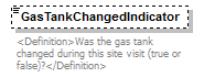 |
||||||||
| namespace | http://water.usgs.gov/XML/NWIS/5.0 | ||||||||
| type | xsd:boolean | ||||||||
| properties |
|
||||||||
| annotation |
|
||||||||
| source | <xsd:element name="GasTankChangedIndicator" type="xsd:boolean" minOccurs="0"> <xsd:annotation> <xsd:documentation> <Definition>Was the gas tank changed during this site visit (true or false)?</Definition> </xsd:documentation> </xsd:annotation> </xsd:element> |
element BubbleGageInspection/TankPressureBeforeMeasure
| diagram |  |
||||||||||||||||||||||||||||||||||||||||||||||
| namespace | http://water.usgs.gov/XML/NWIS/5.0 | ||||||||||||||||||||||||||||||||||||||||||||||
| type | IEEE754FloatValueType | ||||||||||||||||||||||||||||||||||||||||||||||
| properties |
|
||||||||||||||||||||||||||||||||||||||||||||||
| facets |
|
||||||||||||||||||||||||||||||||||||||||||||||
| attributes |
|
||||||||||||||||||||||||||||||||||||||||||||||
| annotation |
|
||||||||||||||||||||||||||||||||||||||||||||||
| source | <xsd:element name="TankPressureBeforeMeasure" type="IEEE754FloatValueType" minOccurs="0"> <xsd:annotation> <xsd:documentation> <Definition>The pressure of the nitrogen tank of the bubble gage before servicing. The default units are pounds per square inch.</Definition> </xsd:documentation> </xsd:annotation> </xsd:element> |
element BubbleGageInspection/LinePressureBeforeMeasure
| diagram |  |
||||||||||||||||||||||||||||||||||||||||||||||
| namespace | http://water.usgs.gov/XML/NWIS/5.0 | ||||||||||||||||||||||||||||||||||||||||||||||
| type | IEEE754FloatValueType | ||||||||||||||||||||||||||||||||||||||||||||||
| properties |
|
||||||||||||||||||||||||||||||||||||||||||||||
| facets |
|
||||||||||||||||||||||||||||||||||||||||||||||
| attributes |
|
||||||||||||||||||||||||||||||||||||||||||||||
| annotation |
|
||||||||||||||||||||||||||||||||||||||||||||||
| source | <xsd:element name="LinePressureBeforeMeasure" type="IEEE754FloatValueType" minOccurs="0"> <xsd:annotation> <xsd:documentation> <Definition>The pressure of the bubbler line before servicing. The default units are pounds per square inch.</Definition> </xsd:documentation> </xsd:annotation> </xsd:element> |
element BubbleGageInspection/BubbleRateBeforeMeasure
| diagram |  |
||||||||||||||||||||||||||||||||||||||||||||||
| namespace | http://water.usgs.gov/XML/NWIS/5.0 | ||||||||||||||||||||||||||||||||||||||||||||||
| type | IEEE754FloatValueType | ||||||||||||||||||||||||||||||||||||||||||||||
| properties |
|
||||||||||||||||||||||||||||||||||||||||||||||
| facets |
|
||||||||||||||||||||||||||||||||||||||||||||||
| attributes |
|
||||||||||||||||||||||||||||||||||||||||||||||
| annotation |
|
||||||||||||||||||||||||||||||||||||||||||||||
| source | <xsd:element name="BubbleRateBeforeMeasure" type="IEEE754FloatValueType" minOccurs="0"> <xsd:annotation> <xsd:documentation> <Definition>The bubble rate of the bubble gage before servicing. The default units are in bubbles per minute.</Definition> </xsd:documentation> </xsd:annotation> </xsd:element> |
element BubbleGageInspection/TankPressureAfterMeasure
| diagram | 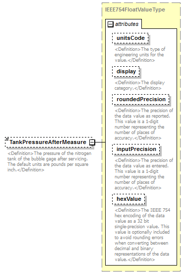 |
||||||||||||||||||||||||||||||||||||||||||||||
| namespace | http://water.usgs.gov/XML/NWIS/5.0 | ||||||||||||||||||||||||||||||||||||||||||||||
| type | IEEE754FloatValueType | ||||||||||||||||||||||||||||||||||||||||||||||
| properties |
|
||||||||||||||||||||||||||||||||||||||||||||||
| facets |
|
||||||||||||||||||||||||||||||||||||||||||||||
| attributes |
|
||||||||||||||||||||||||||||||||||||||||||||||
| annotation |
|
||||||||||||||||||||||||||||||||||||||||||||||
| source | <xsd:element name="TankPressureAfterMeasure" type="IEEE754FloatValueType" minOccurs="0"> <xsd:annotation> <xsd:documentation> <Definition>The pressure of the nitrogen tank of the bubble gage after servicing. The default units are pounds per square inch.</Definition> </xsd:documentation> </xsd:annotation> </xsd:element> |
element BubbleGageInspection/LinePressureAfterMeasure
| diagram | 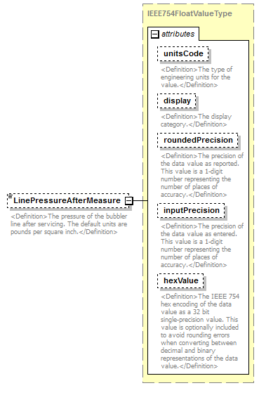 |
||||||||||||||||||||||||||||||||||||||||||||||
| namespace | http://water.usgs.gov/XML/NWIS/5.0 | ||||||||||||||||||||||||||||||||||||||||||||||
| type | IEEE754FloatValueType | ||||||||||||||||||||||||||||||||||||||||||||||
| properties |
|
||||||||||||||||||||||||||||||||||||||||||||||
| facets |
|
||||||||||||||||||||||||||||||||||||||||||||||
| attributes |
|
||||||||||||||||||||||||||||||||||||||||||||||
| annotation |
|
||||||||||||||||||||||||||||||||||||||||||||||
| source | <xsd:element name="LinePressureAfterMeasure" type="IEEE754FloatValueType" minOccurs="0"> <xsd:annotation> <xsd:documentation> <Definition>The pressure of the bubbler line after servicing. The default units are pounds per square inch.</Definition> </xsd:documentation> </xsd:annotation> </xsd:element> |
element BubbleGageInspection/BubbleRateAfterMeasure
| diagram |  |
||||||||||||||||||||||||||||||||||||||||||||||
| namespace | http://water.usgs.gov/XML/NWIS/5.0 | ||||||||||||||||||||||||||||||||||||||||||||||
| type | IEEE754FloatValueType | ||||||||||||||||||||||||||||||||||||||||||||||
| properties |
|
||||||||||||||||||||||||||||||||||||||||||||||
| facets |
|
||||||||||||||||||||||||||||||||||||||||||||||
| attributes |
|
||||||||||||||||||||||||||||||||||||||||||||||
| annotation |
|
||||||||||||||||||||||||||||||||||||||||||||||
| source | <xsd:element name="BubbleRateAfterMeasure" type="IEEE754FloatValueType" minOccurs="0"> <xsd:annotation> <xsd:documentation> <Definition>The bubble rate of the bubble gage after servicing, in bubbles per minute.</Definition> </xsd:documentation> </xsd:annotation> </xsd:element> |
element CrestStageGageInspection
| diagram | 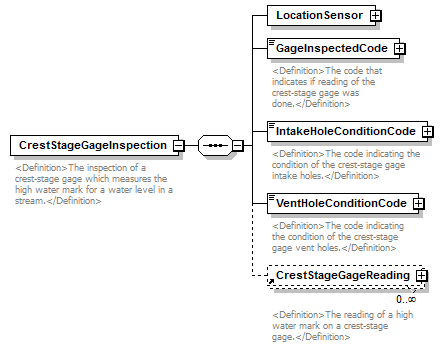 |
||
| namespace | http://water.usgs.gov/XML/NWIS/5.0 | ||
| properties |
|
||
| children | LocationSensor GageInspectedCode IntakeHoleConditionCode VentHoleConditionCode CrestStageGageReading | ||
| used by |
|
||
| annotation |
|
||
| source | <xsd:element name="CrestStageGageInspection"> <xsd:annotation> <xsd:documentation> <Definition>The inspection of a crest-stage gage which measures the high water mark for a water level in a stream.</Definition> </xsd:documentation> </xsd:annotation> <xsd:complexType> <xsd:sequence> <xsd:element name="LocationSensor" type="LocationSensor"/> <xsd:element name="GageInspectedCode" type="ReferenceListCodeType"> <xsd:annotation> <xsd:documentation> <Definition>The code that indicates if reading of the crest-stage gage was done.</Definition> </xsd:documentation> </xsd:annotation> </xsd:element> <xsd:element name="IntakeHoleConditionCode" type="ReferenceListCodeType"> <xsd:annotation> <xsd:documentation> <Definition>The code indicating the condition of the crest-stage gage intake holes.</Definition> </xsd:documentation> </xsd:annotation> </xsd:element> <xsd:element name="VentHoleConditionCode" type="ReferenceListCodeType"> <xsd:annotation> <xsd:documentation> <Definition>The code indicating the condition of the crest-stage gage vent holes.</Definition> </xsd:documentation> </xsd:annotation> </xsd:element> <xsd:element ref="CrestStageGageReading" minOccurs="0" maxOccurs="unbounded"/> </xsd:sequence> </xsd:complexType> </xsd:element> |
element CrestStageGageInspection/LocationSensor
| diagram |  |
||||
| namespace | http://water.usgs.gov/XML/NWIS/5.0 | ||||
| type | LocationSensor | ||||
| properties |
|
||||
| children | Location Sensor StartDateTime EndDateTime PrimarySensorIndicator PrimaryRecorderIndicator StillingWellIndicator GageMeasurementPoint CreatorUserName CreateDateTime ModifierUserName ModifyDateTime ApproverUserName ApprovalDateTime | ||||
| source | <xsd:element name="LocationSensor" type="LocationSensor"/> |
element CrestStageGageInspection/GageInspectedCode
| diagram | 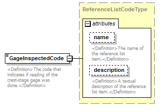 |
||||||||||||||||||||||
| namespace | http://water.usgs.gov/XML/NWIS/5.0 | ||||||||||||||||||||||
| type | ReferenceListCodeType | ||||||||||||||||||||||
| properties |
|
||||||||||||||||||||||
| attributes |
|
||||||||||||||||||||||
| annotation |
|
||||||||||||||||||||||
| source | <xsd:element name="GageInspectedCode" type="ReferenceListCodeType"> <xsd:annotation> <xsd:documentation> <Definition>The code that indicates if reading of the crest-stage gage was done.</Definition> </xsd:documentation> </xsd:annotation> </xsd:element> |
element CrestStageGageInspection/IntakeHoleConditionCode
| diagram |  |
||||||||||||||||||||||
| namespace | http://water.usgs.gov/XML/NWIS/5.0 | ||||||||||||||||||||||
| type | ReferenceListCodeType | ||||||||||||||||||||||
| properties |
|
||||||||||||||||||||||
| attributes |
|
||||||||||||||||||||||
| annotation |
|
||||||||||||||||||||||
| source | <xsd:element name="IntakeHoleConditionCode" type="ReferenceListCodeType"> <xsd:annotation> <xsd:documentation> <Definition>The code indicating the condition of the crest-stage gage intake holes.</Definition> </xsd:documentation> </xsd:annotation> </xsd:element> |
element CrestStageGageInspection/VentHoleConditionCode
| diagram |  |
||||||||||||||||||||||
| namespace | http://water.usgs.gov/XML/NWIS/5.0 | ||||||||||||||||||||||
| type | ReferenceListCodeType | ||||||||||||||||||||||
| properties |
|
||||||||||||||||||||||
| attributes |
|
||||||||||||||||||||||
| annotation |
|
||||||||||||||||||||||
| source | <xsd:element name="VentHoleConditionCode" type="ReferenceListCodeType"> <xsd:annotation> <xsd:documentation> <Definition>The code indicating the condition of the crest-stage gage vent holes.</Definition> </xsd:documentation> </xsd:annotation> </xsd:element> |
element WireWeightGageInspection
| diagram | 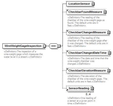 |
||
| namespace | http://water.usgs.gov/XML/NWIS/5.0 | ||
| properties |
|
||
| children | LocationSensor CheckbarFoundMeasure CheckbarChangedMeasure CheckbarChangedDateTime CheckbarElevationMeasure SensorReading | ||
| used by |
|
||
| annotation |
|
||
| source | <xsd:element name="WireWeightGageInspection"> <xsd:annotation> <xsd:documentation> <Definition>The inspection of a wire-weight gage which measures the water level in a stream.</Definition> </xsd:documentation> </xsd:annotation> <xsd:complexType> <xsd:sequence> <xsd:element name="LocationSensor" type="LocationSensor"/> <xsd:element name="CheckbarFoundMeasure" type="IEEE754FloatValueType" minOccurs="0"> <xsd:annotation> <xsd:documentation> <Definition>The reading of the checkbar of the wire-weight gage as found. The default units are in feet.</Definition> </xsd:documentation> </xsd:annotation> </xsd:element> <xsd:element name="CheckbarChangedMeasure" type="IEEE754FloatValueType" minOccurs="0"> <xsd:annotation> <xsd:documentation> <Definition>The reading of the checkbar of the wire-weight gage after it was changed. The default units are in feet.</Definition> </xsd:documentation> </xsd:annotation> </xsd:element> <xsd:element name="CheckbarChangedDateTime" type="DateTimeWithDatum" minOccurs="0"> <xsd:annotation> <xsd:documentation> <Definition>The date and time that the wire-weight checkbar was changed.</Definition> </xsd:documentation> </xsd:annotation> </xsd:element> <xsd:element name="CheckbarElevationMeasure" type="IEEE754FloatValueType" minOccurs="0"> <xsd:annotation> <xsd:documentation> <Definition>The elevation of the checkbar of the wire-weight gage. The default units are in feet.</Definition> </xsd:documentation> </xsd:annotation> </xsd:element> <xsd:element ref="SensorReading" minOccurs="0" maxOccurs="unbounded"/> </xsd:sequence> </xsd:complexType> </xsd:element> |
element WireWeightGageInspection/LocationSensor
| diagram | 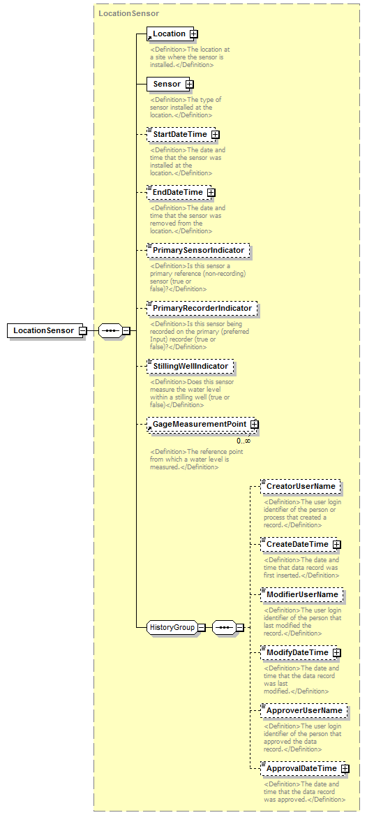 |
||||
| namespace | http://water.usgs.gov/XML/NWIS/5.0 | ||||
| type | LocationSensor | ||||
| properties |
|
||||
| children | Location Sensor StartDateTime EndDateTime PrimarySensorIndicator PrimaryRecorderIndicator StillingWellIndicator GageMeasurementPoint CreatorUserName CreateDateTime ModifierUserName ModifyDateTime ApproverUserName ApprovalDateTime | ||||
| source | <xsd:element name="LocationSensor" type="LocationSensor"/> |
element WireWeightGageInspection/CheckbarFoundMeasure
| diagram |  |
||||||||||||||||||||||||||||||||||||||||||||||
| namespace | http://water.usgs.gov/XML/NWIS/5.0 | ||||||||||||||||||||||||||||||||||||||||||||||
| type | IEEE754FloatValueType | ||||||||||||||||||||||||||||||||||||||||||||||
| properties |
|
||||||||||||||||||||||||||||||||||||||||||||||
| facets |
|
||||||||||||||||||||||||||||||||||||||||||||||
| attributes |
|
||||||||||||||||||||||||||||||||||||||||||||||
| annotation |
|
||||||||||||||||||||||||||||||||||||||||||||||
| source | <xsd:element name="CheckbarFoundMeasure" type="IEEE754FloatValueType" minOccurs="0"> <xsd:annotation> <xsd:documentation> <Definition>The reading of the checkbar of the wire-weight gage as found. The default units are in feet.</Definition> </xsd:documentation> </xsd:annotation> </xsd:element> |
element WireWeightGageInspection/CheckbarChangedMeasure
| diagram | 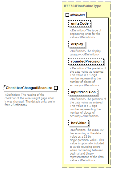 |
||||||||||||||||||||||||||||||||||||||||||||||
| namespace | http://water.usgs.gov/XML/NWIS/5.0 | ||||||||||||||||||||||||||||||||||||||||||||||
| type | IEEE754FloatValueType | ||||||||||||||||||||||||||||||||||||||||||||||
| properties |
|
||||||||||||||||||||||||||||||||||||||||||||||
| facets |
|
||||||||||||||||||||||||||||||||||||||||||||||
| attributes |
|
||||||||||||||||||||||||||||||||||||||||||||||
| annotation |
|
||||||||||||||||||||||||||||||||||||||||||||||
| source | <xsd:element name="CheckbarChangedMeasure" type="IEEE754FloatValueType" minOccurs="0"> <xsd:annotation> <xsd:documentation> <Definition>The reading of the checkbar of the wire-weight gage after it was changed. The default units are in feet.</Definition> </xsd:documentation> </xsd:annotation> </xsd:element> |
element WireWeightGageInspection/CheckbarChangedDateTime
| diagram | 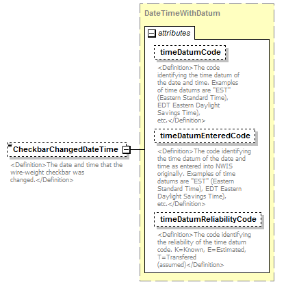 |
||||||||||||||||||||||||||||||
| namespace | http://water.usgs.gov/XML/NWIS/5.0 | ||||||||||||||||||||||||||||||
| type | DateTimeWithDatum | ||||||||||||||||||||||||||||||
| properties |
|
||||||||||||||||||||||||||||||
| attributes |
|
||||||||||||||||||||||||||||||
| annotation |
|
||||||||||||||||||||||||||||||
| source | <xsd:element name="CheckbarChangedDateTime" type="DateTimeWithDatum" minOccurs="0"> <xsd:annotation> <xsd:documentation> <Definition>The date and time that the wire-weight checkbar was changed.</Definition> </xsd:documentation> </xsd:annotation> </xsd:element> |
element WireWeightGageInspection/CheckbarElevationMeasure
| diagram |  |
||||||||||||||||||||||||||||||||||||||||||||||
| namespace | http://water.usgs.gov/XML/NWIS/5.0 | ||||||||||||||||||||||||||||||||||||||||||||||
| type | IEEE754FloatValueType | ||||||||||||||||||||||||||||||||||||||||||||||
| properties |
|
||||||||||||||||||||||||||||||||||||||||||||||
| facets |
|
||||||||||||||||||||||||||||||||||||||||||||||
| attributes |
|
||||||||||||||||||||||||||||||||||||||||||||||
| annotation |
|
||||||||||||||||||||||||||||||||||||||||||||||
| source | <xsd:element name="CheckbarElevationMeasure" type="IEEE754FloatValueType" minOccurs="0"> <xsd:annotation> <xsd:documentation> <Definition>The elevation of the checkbar of the wire-weight gage. The default units are in feet.</Definition> </xsd:documentation> </xsd:annotation> </xsd:element> |
element MaximumMinimumGageInspection
| diagram | 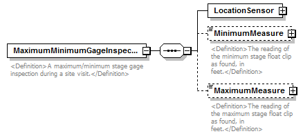 |
||
| namespace | http://water.usgs.gov/XML/NWIS/5.0 | ||
| properties |
|
||
| children | LocationSensor MinimumMeasure MaximumMeasure | ||
| used by |
|
||
| annotation |
|
||
| source | <xsd:element name="MaximumMinimumGageInspection"> <xsd:annotation> <xsd:documentation> <Definition>A maximum/minimum stage gage inspection during a site visit.</Definition> </xsd:documentation> </xsd:annotation> <xsd:complexType> <xsd:sequence> <xsd:element name="LocationSensor" type="LocationSensor"/> <xsd:element name="MinimumMeasure" type="IEEE754FloatValueType" minOccurs="0"> <xsd:annotation> <xsd:documentation> <Definition>The reading of the minimum stage float clip as found, in feet.</Definition> </xsd:documentation> </xsd:annotation> </xsd:element> <xsd:element name="MaximumMeasure" type="IEEE754FloatValueType" minOccurs="0"> <xsd:annotation> <xsd:documentation> <Definition>The reading of the maximum stage float clip as found, in feet.</Definition> </xsd:documentation> </xsd:annotation> </xsd:element> </xsd:sequence> </xsd:complexType> </xsd:element> |
element MaximumMinimumGageInspection/LocationSensor
| diagram |  |
||||
| namespace | http://water.usgs.gov/XML/NWIS/5.0 | ||||
| type | LocationSensor | ||||
| properties |
|
||||
| children | Location Sensor StartDateTime EndDateTime PrimarySensorIndicator PrimaryRecorderIndicator StillingWellIndicator GageMeasurementPoint CreatorUserName CreateDateTime ModifierUserName ModifyDateTime ApproverUserName ApprovalDateTime | ||||
| source | <xsd:element name="LocationSensor" type="LocationSensor"/> |
element MaximumMinimumGageInspection/MinimumMeasure
| diagram | 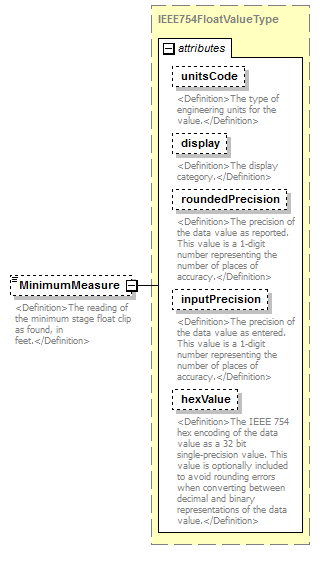 |
||||||||||||||||||||||||||||||||||||||||||||||
| namespace | http://water.usgs.gov/XML/NWIS/5.0 | ||||||||||||||||||||||||||||||||||||||||||||||
| type | IEEE754FloatValueType | ||||||||||||||||||||||||||||||||||||||||||||||
| properties |
|
||||||||||||||||||||||||||||||||||||||||||||||
| facets |
|
||||||||||||||||||||||||||||||||||||||||||||||
| attributes |
|
||||||||||||||||||||||||||||||||||||||||||||||
| annotation |
|
||||||||||||||||||||||||||||||||||||||||||||||
| source | <xsd:element name="MinimumMeasure" type="IEEE754FloatValueType" minOccurs="0"> <xsd:annotation> <xsd:documentation> <Definition>The reading of the minimum stage float clip as found, in feet.</Definition> </xsd:documentation> </xsd:annotation> </xsd:element> |
element MaximumMinimumGageInspection/MaximumMeasure
| diagram | 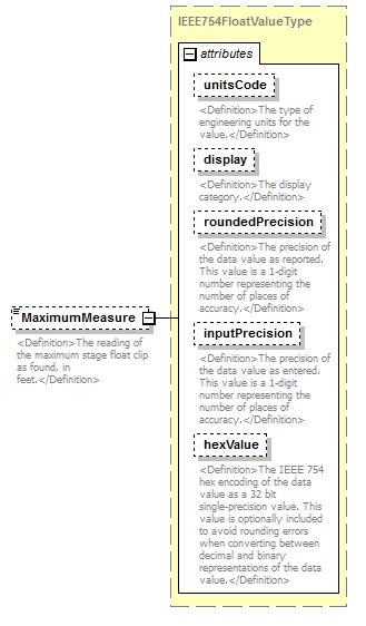 |
||||||||||||||||||||||||||||||||||||||||||||||
| namespace | http://water.usgs.gov/XML/NWIS/5.0 | ||||||||||||||||||||||||||||||||||||||||||||||
| type | IEEE754FloatValueType | ||||||||||||||||||||||||||||||||||||||||||||||
| properties |
|
||||||||||||||||||||||||||||||||||||||||||||||
| facets |
|
||||||||||||||||||||||||||||||||||||||||||||||
| attributes |
|
||||||||||||||||||||||||||||||||||||||||||||||
| annotation |
|
||||||||||||||||||||||||||||||||||||||||||||||
| source | <xsd:element name="MaximumMeasure" type="IEEE754FloatValueType" minOccurs="0"> <xsd:annotation> <xsd:documentation> <Definition>The reading of the maximum stage float clip as found, in feet.</Definition> </xsd:documentation> </xsd:annotation> </xsd:element> |
element SensorReading
| diagram | 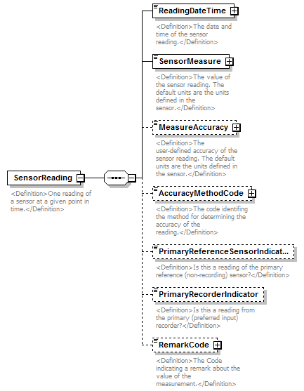 |
||
| namespace | http://water.usgs.gov/XML/NWIS/5.0 | ||
| properties |
|
||
| children | ReadingDateTime SensorMeasure MeasureAccuracy AccuracyMethodCode PrimaryReferenceSensorIndicator PrimaryRecorderIndicator RemarkCode | ||
| used by |
|
||
| annotation |
|
||
| source | <xsd:element name="SensorReading"> <xsd:annotation> <xsd:documentation> <Definition>One reading of a sensor at a given point in time.</Definition> </xsd:documentation> </xsd:annotation> <xsd:complexType> <xsd:sequence> <xsd:element name="ReadingDateTime" type="DateTimeWithDatumPartial"> <xsd:annotation> <xsd:documentation> <Definition>The date and time of the sensor reading.</Definition> </xsd:documentation> </xsd:annotation> </xsd:element> <xsd:element name="SensorMeasure" type="IEEE754FloatValueType"> <xsd:annotation> <xsd:documentation> <Definition>The value of the sensor reading. The default units are the units defined in the sensor.</Definition> </xsd:documentation> </xsd:annotation> </xsd:element> <xsd:element name="MeasureAccuracy" type="IEEE754FloatValueType" minOccurs="0"> <xsd:annotation> <xsd:documentation> <Definition>The user-defined accuracy of the sensor reading. The default units are the units defined in the sensor.</Definition> </xsd:documentation> </xsd:annotation> </xsd:element> <xsd:element name="AccuracyMethodCode" type="ReferenceListCodeType" minOccurs="0"> <xsd:annotation> <xsd:documentation> <Definition>The code identifing the method for determining the accuracy of the reading.</Definition> </xsd:documentation> </xsd:annotation> </xsd:element> <xsd:element name="PrimaryReferenceSensorIndicator" type="xsd:boolean" minOccurs="0"> <xsd:annotation> <xsd:documentation> <Definition>Is this a reading of the primary reference (non-recording) sensor?</Definition> </xsd:documentation> </xsd:annotation> </xsd:element> <xsd:element name="PrimaryRecorderIndicator" type="xsd:boolean" minOccurs="0"> <xsd:annotation> <xsd:documentation> <Definition>Is this a reading from the primary (preferred input) recorder?</Definition> </xsd:documentation> </xsd:annotation> </xsd:element> <xsd:element name="RemarkCode" type="ReferenceListCodeType" minOccurs="0"> <xsd:annotation> <xsd:documentation> <Definition>The Code indicating a remark about the value of the measurement.</Definition> </xsd:documentation> </xsd:annotation> </xsd:element> </xsd:sequence> </xsd:complexType> </xsd:element> |
element SensorReading/ReadingDateTime
| diagram | 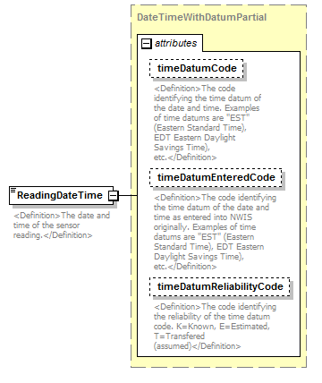 |
||||||||||||||||||||||||||||||
| namespace | http://water.usgs.gov/XML/NWIS/5.0 | ||||||||||||||||||||||||||||||
| type | DateTimeWithDatumPartial | ||||||||||||||||||||||||||||||
| properties |
|
||||||||||||||||||||||||||||||
| attributes |
|
||||||||||||||||||||||||||||||
| annotation |
|
||||||||||||||||||||||||||||||
| source | <xsd:element name="ReadingDateTime" type="DateTimeWithDatumPartial"> <xsd:annotation> <xsd:documentation> <Definition>The date and time of the sensor reading.</Definition> </xsd:documentation> </xsd:annotation> </xsd:element> |
element SensorReading/SensorMeasure
| diagram | 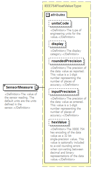 |
||||||||||||||||||||||||||||||||||||||||||||||
| namespace | http://water.usgs.gov/XML/NWIS/5.0 | ||||||||||||||||||||||||||||||||||||||||||||||
| type | IEEE754FloatValueType | ||||||||||||||||||||||||||||||||||||||||||||||
| properties |
|
||||||||||||||||||||||||||||||||||||||||||||||
| facets |
|
||||||||||||||||||||||||||||||||||||||||||||||
| attributes |
|
||||||||||||||||||||||||||||||||||||||||||||||
| annotation |
|
||||||||||||||||||||||||||||||||||||||||||||||
| source | <xsd:element name="SensorMeasure" type="IEEE754FloatValueType"> <xsd:annotation> <xsd:documentation> <Definition>The value of the sensor reading. The default units are the units defined in the sensor.</Definition> </xsd:documentation> </xsd:annotation> </xsd:element> |
element SensorReading/MeasureAccuracy
| diagram | 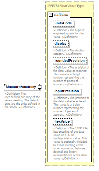 |
||||||||||||||||||||||||||||||||||||||||||||||
| namespace | http://water.usgs.gov/XML/NWIS/5.0 | ||||||||||||||||||||||||||||||||||||||||||||||
| type | IEEE754FloatValueType | ||||||||||||||||||||||||||||||||||||||||||||||
| properties |
|
||||||||||||||||||||||||||||||||||||||||||||||
| facets |
|
||||||||||||||||||||||||||||||||||||||||||||||
| attributes |
|
||||||||||||||||||||||||||||||||||||||||||||||
| annotation |
|
||||||||||||||||||||||||||||||||||||||||||||||
| source | <xsd:element name="MeasureAccuracy" type="IEEE754FloatValueType" minOccurs="0"> <xsd:annotation> <xsd:documentation> <Definition>The user-defined accuracy of the sensor reading. The default units are the units defined in the sensor.</Definition> </xsd:documentation> </xsd:annotation> </xsd:element> |
element SensorReading/AccuracyMethodCode
| diagram | 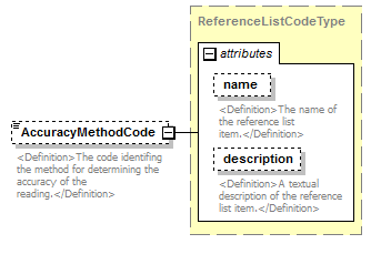 |
||||||||||||||||||||||
| namespace | http://water.usgs.gov/XML/NWIS/5.0 | ||||||||||||||||||||||
| type | ReferenceListCodeType | ||||||||||||||||||||||
| properties |
|
||||||||||||||||||||||
| attributes |
|
||||||||||||||||||||||
| annotation |
|
||||||||||||||||||||||
| source | <xsd:element name="AccuracyMethodCode" type="ReferenceListCodeType" minOccurs="0"> <xsd:annotation> <xsd:documentation> <Definition>The code identifing the method for determining the accuracy of the reading.</Definition> </xsd:documentation> </xsd:annotation> </xsd:element> |
element SensorReading/PrimaryReferenceSensorIndicator
| diagram | 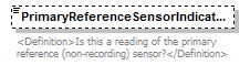 |
||||||||
| namespace | http://water.usgs.gov/XML/NWIS/5.0 | ||||||||
| type | xsd:boolean | ||||||||
| properties |
|
||||||||
| annotation |
|
||||||||
| source | <xsd:element name="PrimaryReferenceSensorIndicator" type="xsd:boolean" minOccurs="0"> <xsd:annotation> <xsd:documentation> <Definition>Is this a reading of the primary reference (non-recording) sensor?</Definition> </xsd:documentation> </xsd:annotation> </xsd:element> |
element SensorReading/PrimaryRecorderIndicator
| diagram | 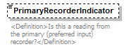 |
||||||||
| namespace | http://water.usgs.gov/XML/NWIS/5.0 | ||||||||
| type | xsd:boolean | ||||||||
| properties |
|
||||||||
| annotation |
|
||||||||
| source | <xsd:element name="PrimaryRecorderIndicator" type="xsd:boolean" minOccurs="0"> <xsd:annotation> <xsd:documentation> <Definition>Is this a reading from the primary (preferred input) recorder?</Definition> </xsd:documentation> </xsd:annotation> </xsd:element> |
element SensorReading/RemarkCode
| diagram | 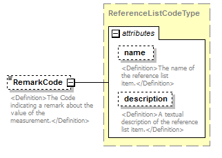 |
||||||||||||||||||||||
| namespace | http://water.usgs.gov/XML/NWIS/5.0 | ||||||||||||||||||||||
| type | ReferenceListCodeType | ||||||||||||||||||||||
| properties |
|
||||||||||||||||||||||
| attributes |
|
||||||||||||||||||||||
| annotation |
|
||||||||||||||||||||||
| source | <xsd:element name="RemarkCode" type="ReferenceListCodeType" minOccurs="0"> <xsd:annotation> <xsd:documentation> <Definition>The Code indicating a remark about the value of the measurement.</Definition> </xsd:documentation> </xsd:annotation> </xsd:element> |
complexType CrossSectionStationType
| diagram | 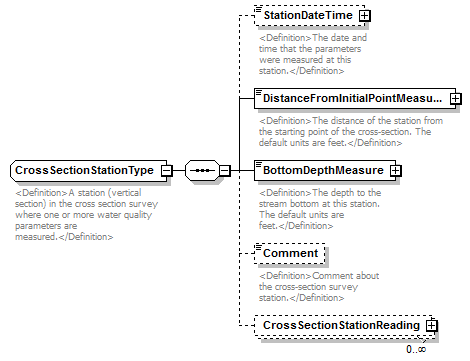 |
||
| namespace | http://water.usgs.gov/XML/NWIS/5.0 | ||
| properties |
|
||
| children | StationDateTime DistanceFromInitialPointMeasure BottomDepthMeasure Comment CrossSectionStationReading | ||
| used by |
|
||
| annotation |
|
||
| source | <xsd:complexType name="CrossSectionStationType" abstract="false"> <xsd:annotation> <xsd:documentation> <Definition>A station (vertical section) in the cross section survey where one or more water quality parameters are measured.</Definition> </xsd:documentation> </xsd:annotation> <xsd:sequence> <xsd:element name="StationDateTime" type="DateTimeWithDatum" minOccurs="0"> <xsd:annotation> <xsd:documentation> <Definition>The date and time that the parameters were measured at this station.</Definition> </xsd:documentation> </xsd:annotation> </xsd:element> <xsd:element name="DistanceFromInitialPointMeasure" type="IEEE754UncertaintyFloatValueType"> <xsd:annotation> <xsd:documentation> <Definition>The distance of the station from the starting point of the cross-section. The default units are feet.</Definition> </xsd:documentation> </xsd:annotation> </xsd:element> <xsd:element name="BottomDepthMeasure" type="IEEE754UncertaintyFloatValueType"> <xsd:annotation> <xsd:documentation> <Definition>The depth to the stream bottom at this station. The default units are feet.</Definition> </xsd:documentation> </xsd:annotation> </xsd:element> <xsd:element name="Comment" type="xsd:string" minOccurs="0"> <xsd:annotation> <xsd:documentation> <Definition>Comment about the cross-section survey station.</Definition> </xsd:documentation> </xsd:annotation> </xsd:element> <xsd:element name="CrossSectionStationReading" type="CrossSectionStationReadingType" minOccurs="0" maxOccurs="unbounded"/> </xsd:sequence> </xsd:complexType> |
element CrossSectionStationType/StationDateTime
| diagram | 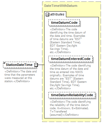 |
||||||||||||||||||||||||||||||
| namespace | http://water.usgs.gov/XML/NWIS/5.0 | ||||||||||||||||||||||||||||||
| type | DateTimeWithDatum | ||||||||||||||||||||||||||||||
| properties |
|
||||||||||||||||||||||||||||||
| attributes |
|
||||||||||||||||||||||||||||||
| annotation |
|
||||||||||||||||||||||||||||||
| source | <xsd:element name="StationDateTime" type="DateTimeWithDatum" minOccurs="0"> <xsd:annotation> <xsd:documentation> <Definition>The date and time that the parameters were measured at this station.</Definition> </xsd:documentation> </xsd:annotation> </xsd:element> |
element CrossSectionStationType/DistanceFromInitialPointMeasure
| diagram | 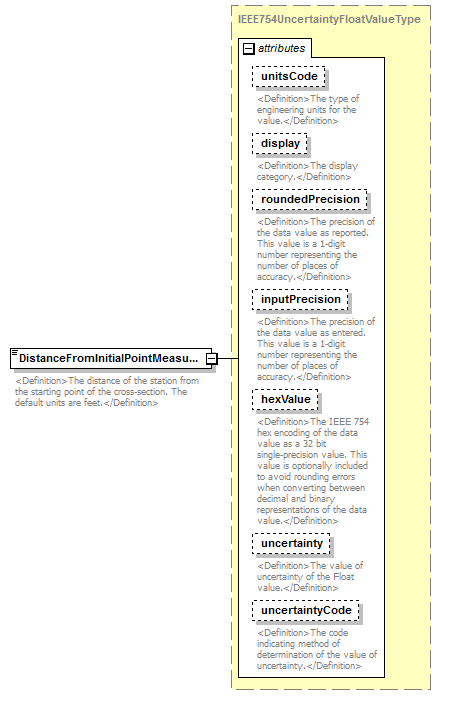 |
||||||||||||||||||||||||||||||||||||||||||||||||||||||||||||||
| namespace | http://water.usgs.gov/XML/NWIS/5.0 | ||||||||||||||||||||||||||||||||||||||||||||||||||||||||||||||
| type | IEEE754UncertaintyFloatValueType | ||||||||||||||||||||||||||||||||||||||||||||||||||||||||||||||
| properties |
|
||||||||||||||||||||||||||||||||||||||||||||||||||||||||||||||
| facets |
|
||||||||||||||||||||||||||||||||||||||||||||||||||||||||||||||
| attributes |
|
||||||||||||||||||||||||||||||||||||||||||||||||||||||||||||||
| annotation |
|
||||||||||||||||||||||||||||||||||||||||||||||||||||||||||||||
| source | <xsd:element name="DistanceFromInitialPointMeasure" type="IEEE754UncertaintyFloatValueType"> <xsd:annotation> <xsd:documentation> <Definition>The distance of the station from the starting point of the cross-section. The default units are feet.</Definition> </xsd:documentation> </xsd:annotation> </xsd:element> |
element CrossSectionStationType/BottomDepthMeasure
| diagram | 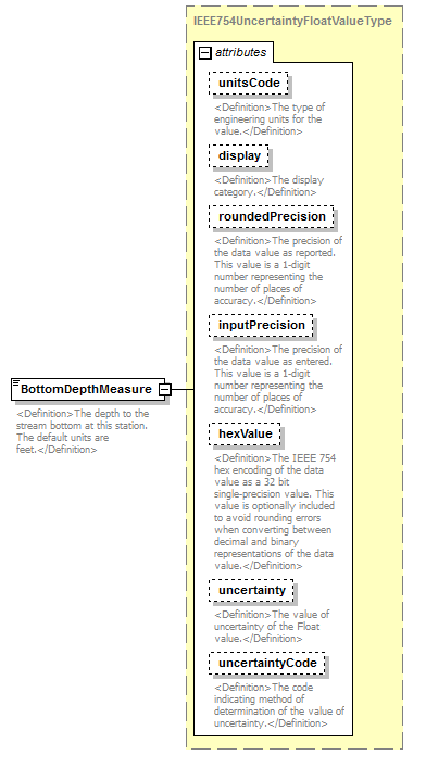 |
||||||||||||||||||||||||||||||||||||||||||||||||||||||||||||||
| namespace | http://water.usgs.gov/XML/NWIS/5.0 | ||||||||||||||||||||||||||||||||||||||||||||||||||||||||||||||
| type | IEEE754UncertaintyFloatValueType | ||||||||||||||||||||||||||||||||||||||||||||||||||||||||||||||
| properties |
|
||||||||||||||||||||||||||||||||||||||||||||||||||||||||||||||
| facets |
|
||||||||||||||||||||||||||||||||||||||||||||||||||||||||||||||
| attributes |
|
||||||||||||||||||||||||||||||||||||||||||||||||||||||||||||||
| annotation |
|
||||||||||||||||||||||||||||||||||||||||||||||||||||||||||||||
| source | <xsd:element name="BottomDepthMeasure" type="IEEE754UncertaintyFloatValueType"> <xsd:annotation> <xsd:documentation> <Definition>The depth to the stream bottom at this station. The default units are feet.</Definition> </xsd:documentation> </xsd:annotation> </xsd:element> |
element CrossSectionStationType/Comment
| diagram | 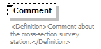 |
||||||||
| namespace | http://water.usgs.gov/XML/NWIS/5.0 | ||||||||
| type | xsd:string | ||||||||
| properties |
|
||||||||
| annotation |
|
||||||||
| source | <xsd:element name="Comment" type="xsd:string" minOccurs="0"> <xsd:annotation> <xsd:documentation> <Definition>Comment about the cross-section survey station.</Definition> </xsd:documentation> </xsd:annotation> </xsd:element> |
element CrossSectionStationType/CrossSectionStationReading
| diagram | 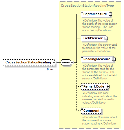 |
||||||||
| namespace | http://water.usgs.gov/XML/NWIS/5.0 | ||||||||
| type | CrossSectionStationReadingType | ||||||||
| properties |
|
||||||||
| children | DepthMeasure FieldSensor ReadingMeasure RemarkCode Comment | ||||||||
| source | <xsd:element name="CrossSectionStationReading" type="CrossSectionStationReadingType" minOccurs="0" maxOccurs="unbounded"/> |
element Shift
| diagram | 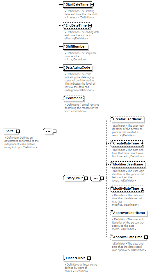 |
||
| namespace | http://water.usgs.gov/XML/NWIS/5.0 | ||
| properties |
|
||
| children | StartDateTime EndDateTime ShiftNumber DataAgingCode Comment CreatorUserName CreateDateTime ModifierUserName ModifyDateTime ApproverUserName ApprovalDateTime LinearCurve | ||
| used by |
|
||
| annotation |
|
||
| source | <xsd:element name="Shift"> <xsd:annotation> <xsd:documentation> <Definition>Defines an adjustment performed to the independent value before rating lookup.</Definition> </xsd:documentation> </xsd:annotation> <xsd:complexType> <xsd:sequence> <xsd:element name="StartDateTime" type="DateTimeWithDatum"> <xsd:annotation> <xsd:documentation> <Definition>The starting date and time that the shift is in effect.</Definition> </xsd:documentation> </xsd:annotation> </xsd:element> <xsd:element name="EndDateTime" type="DateTimeWithDatum" minOccurs="0"> <xsd:annotation> <xsd:documentation> <Definition>The ending date and time the shift is in effect.</Definition> </xsd:documentation> </xsd:annotation> </xsd:element> <xsd:element name="ShiftNumber" type="xsd:integer"> <xsd:annotation> <xsd:documentation> <Definition>The sequence number of a shift.</Definition> </xsd:documentation> </xsd:annotation> </xsd:element> <xsd:element ref="DataAgingCode"/> <xsd:element name="Comment" type="xsd:string" minOccurs="0"> <xsd:annotation> <xsd:documentation> <Definition>Textual remarks describing the reason for the shift.</Definition> </xsd:documentation> </xsd:annotation> </xsd:element> <xsd:group ref="HistoryGroup"/> <xsd:element ref="LinearCurve"/> </xsd:sequence> </xsd:complexType> </xsd:element> |
element Shift/StartDateTime
| diagram | 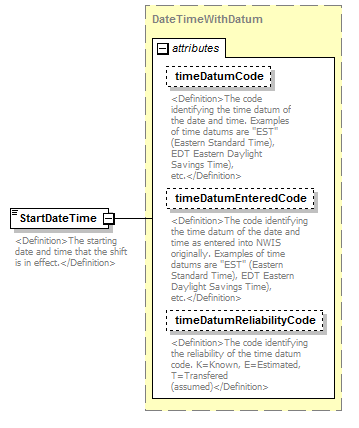 |
||||||||||||||||||||||||||||||
| namespace | http://water.usgs.gov/XML/NWIS/5.0 | ||||||||||||||||||||||||||||||
| type | DateTimeWithDatum | ||||||||||||||||||||||||||||||
| properties |
|
||||||||||||||||||||||||||||||
| attributes |
|
||||||||||||||||||||||||||||||
| annotation |
|
||||||||||||||||||||||||||||||
| source | <xsd:element name="StartDateTime" type="DateTimeWithDatum"> <xsd:annotation> <xsd:documentation> <Definition>The starting date and time that the shift is in effect.</Definition> </xsd:documentation> </xsd:annotation> </xsd:element> |
element Shift/EndDateTime
| diagram | 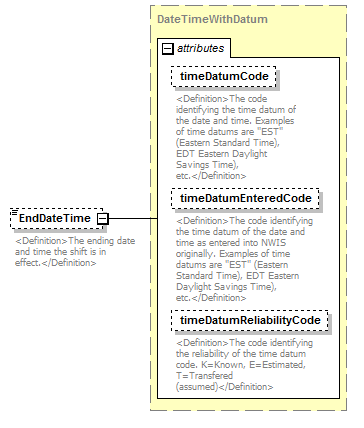 |
||||||||||||||||||||||||||||||
| namespace | http://water.usgs.gov/XML/NWIS/5.0 | ||||||||||||||||||||||||||||||
| type | DateTimeWithDatum | ||||||||||||||||||||||||||||||
| properties |
|
||||||||||||||||||||||||||||||
| attributes |
|
||||||||||||||||||||||||||||||
| annotation |
|
||||||||||||||||||||||||||||||
| source | <xsd:element name="EndDateTime" type="DateTimeWithDatum" minOccurs="0"> <xsd:annotation> <xsd:documentation> <Definition>The ending date and time the shift is in effect.</Definition> </xsd:documentation> </xsd:annotation> </xsd:element> |
element Shift/ShiftNumber
| diagram |  |
||||
| namespace | http://water.usgs.gov/XML/NWIS/5.0 | ||||
| type | xsd:integer | ||||
| properties |
|
||||
| annotation |
|
||||
| source | <xsd:element name="ShiftNumber" type="xsd:integer"> <xsd:annotation> <xsd:documentation> <Definition>The sequence number of a shift.</Definition> </xsd:documentation> </xsd:annotation> </xsd:element> |
element Shift/Comment
| diagram |  |
||||||||
| namespace | http://water.usgs.gov/XML/NWIS/5.0 | ||||||||
| type | xsd:string | ||||||||
| properties |
|
||||||||
| annotation |
|
||||||||
| source | <xsd:element name="Comment" type="xsd:string" minOccurs="0"> <xsd:annotation> <xsd:documentation> <Definition>Textual remarks describing the reason for the shift.</Definition> </xsd:documentation> </xsd:annotation> </xsd:element> |
element RatingDate
| diagram | 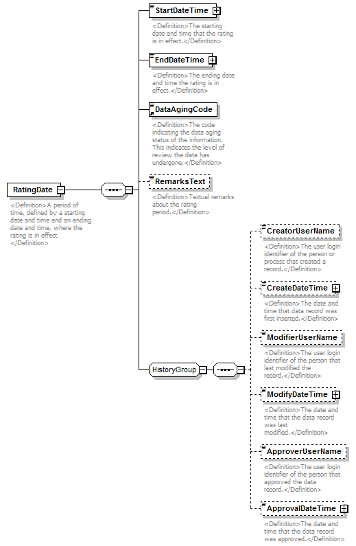 |
||
| namespace | http://water.usgs.gov/XML/NWIS/5.0 | ||
| properties |
|
||
| children | StartDateTime EndDateTime DataAgingCode RemarksText CreatorUserName CreateDateTime ModifierUserName ModifyDateTime ApproverUserName ApprovalDateTime | ||
| used by |
|
||
| annotation |
|
||
| source | <xsd:element name="RatingDate"> <xsd:annotation> <xsd:documentation> <Definition>A period of time, defined by a starting date and time and an ending date and time, where the rating is in effect. </Definition> </xsd:documentation> </xsd:annotation> <xsd:complexType> <xsd:sequence> <xsd:element name="StartDateTime" type="DateTimeWithDatum"> <xsd:annotation> <xsd:documentation> <Definition>The starting date and time that the rating is in effect.</Definition> </xsd:documentation> </xsd:annotation> </xsd:element> <xsd:element name="EndDateTime" type="DateTimeWithDatum"> <xsd:annotation> <xsd:documentation> <Definition>The ending date and time the rating is in effect.</Definition> </xsd:documentation> </xsd:annotation> </xsd:element> <xsd:element ref="DataAgingCode"/> <xsd:element name="RemarksText" type="xsd:string" minOccurs="0"> <xsd:annotation> <xsd:documentation> <Definition>Textual remarks about the rating period.</Definition> </xsd:documentation> </xsd:annotation> </xsd:element> <xsd:group ref="HistoryGroup"/> </xsd:sequence> </xsd:complexType> </xsd:element> |
element RatingDate/StartDateTime
| diagram | 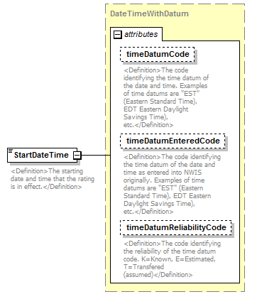 |
||||||||||||||||||||||||||||||
| namespace | http://water.usgs.gov/XML/NWIS/5.0 | ||||||||||||||||||||||||||||||
| type | DateTimeWithDatum | ||||||||||||||||||||||||||||||
| properties |
|
||||||||||||||||||||||||||||||
| attributes |
|
||||||||||||||||||||||||||||||
| annotation |
|
||||||||||||||||||||||||||||||
| source | <xsd:element name="StartDateTime" type="DateTimeWithDatum"> <xsd:annotation> <xsd:documentation> <Definition>The starting date and time that the rating is in effect.</Definition> </xsd:documentation> </xsd:annotation> </xsd:element> |
element RatingDate/EndDateTime
| diagram | 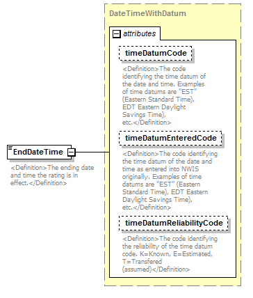 |
||||||||||||||||||||||||||||||
| namespace | http://water.usgs.gov/XML/NWIS/5.0 | ||||||||||||||||||||||||||||||
| type | DateTimeWithDatum | ||||||||||||||||||||||||||||||
| properties |
|
||||||||||||||||||||||||||||||
| attributes |
|
||||||||||||||||||||||||||||||
| annotation |
|
||||||||||||||||||||||||||||||
| source | <xsd:element name="EndDateTime" type="DateTimeWithDatum"> <xsd:annotation> <xsd:documentation> <Definition>The ending date and time the rating is in effect.</Definition> </xsd:documentation> </xsd:annotation> </xsd:element> |
element RatingDate/RemarksText
| diagram |  |
||||||||
| namespace | http://water.usgs.gov/XML/NWIS/5.0 | ||||||||
| type | xsd:string | ||||||||
| properties |
|
||||||||
| annotation |
|
||||||||
| source | <xsd:element name="RemarksText" type="xsd:string" minOccurs="0"> <xsd:annotation> <xsd:documentation> <Definition>Textual remarks about the rating period.</Definition> </xsd:documentation> </xsd:annotation> </xsd:element> |
element LinearCurve
| diagram |  |
||
| namespace | http://water.usgs.gov/XML/NWIS/5.0 | ||
| properties |
|
||
| children | ExpandCode PointPair | ||
| used by |
|
||
| annotation |
|
||
| source | <xsd:element name="LinearCurve"> <xsd:annotation> <xsd:documentation> <Definition>A linear curve defined by pairs of points.</Definition> </xsd:documentation> </xsd:annotation> <xsd:complexType> <xsd:sequence> <xsd:element ref="ExpandCode"/> <xsd:element ref="PointPair" maxOccurs="unbounded"/> </xsd:sequence> </xsd:complexType> </xsd:element> |
element LogCurve
| diagram | 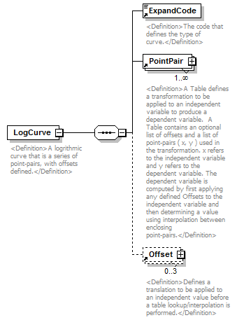 |
||
| namespace | http://water.usgs.gov/XML/NWIS/5.0 | ||
| properties |
|
||
| children | ExpandCode PointPair Offset | ||
| used by |
|
||
| annotation |
|
||
| source | <xsd:element name="LogCurve"> <xsd:annotation> <xsd:documentation> <Definition>A logrithmic curve that is a series of point-pairs, with offsets defined.</Definition> </xsd:documentation> </xsd:annotation> <xsd:complexType> <xsd:sequence> <xsd:element ref="ExpandCode"/> <xsd:element ref="PointPair" maxOccurs="unbounded"/> <xsd:element ref="Offset" minOccurs="0" maxOccurs="3"/> </xsd:sequence> </xsd:complexType> </xsd:element> |
element StandardEquationCurve
| diagram | 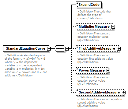 |
||
| namespace | http://water.usgs.gov/XML/NWIS/5.0 | ||
| properties |
|
||
| children | ExpandCode MultiplierMeasure FirstAdditiveMeasure PowerMeasure SecondAdditiveMeasure | ||
| used by |
|
||
| annotation |
|
||
| source | <xsd:element name="StandardEquationCurve"> <xsd:annotation> <xsd:documentation> <Definition>A standard equation of the form: y = a(x+b)**c + d where y = the dependent variable, x = the independent variable, a = multiplier, b = 1st additive, c = power, and d = 2nd additive.</Definition> </xsd:documentation> </xsd:annotation> <xsd:complexType> <xsd:sequence> <xsd:element ref="ExpandCode"/> <xsd:element name="MultiplierMeasure" type="IEEE754FloatValueType" minOccurs="0"> <xsd:annotation> <xsd:documentation> <Definition>The standard equation multiplier value (a).</Definition> </xsd:documentation> </xsd:annotation> </xsd:element> <xsd:element name="FirstAdditiveMeasure" type="IEEE754FloatValueType" minOccurs="0"> <xsd:annotation> <xsd:documentation> <Definition>The standard equation first additive value (b).</Definition> </xsd:documentation> </xsd:annotation> </xsd:element> <xsd:element name="PowerMeasure" type="IEEE754FloatValueType" minOccurs="0"> <xsd:annotation> <xsd:documentation> <Definition>The standard equation power value (c).</Definition> </xsd:documentation> </xsd:annotation> </xsd:element> <xsd:element name="SecondAdditiveMeasure" type="IEEE754FloatValueType" minOccurs="0"> <xsd:annotation> <xsd:documentation> <Definition>The standard equation second additive value (d).</Definition> </xsd:documentation> </xsd:annotation> </xsd:element> </xsd:sequence> </xsd:complexType> </xsd:element> |
element StandardEquationCurve/MultiplierMeasure
| diagram | 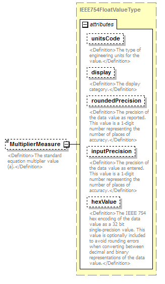 |
||||||||||||||||||||||||||||||||||||||||||||||
| namespace | http://water.usgs.gov/XML/NWIS/5.0 | ||||||||||||||||||||||||||||||||||||||||||||||
| type | IEEE754FloatValueType | ||||||||||||||||||||||||||||||||||||||||||||||
| properties |
|
||||||||||||||||||||||||||||||||||||||||||||||
| facets |
|
||||||||||||||||||||||||||||||||||||||||||||||
| attributes |
|
||||||||||||||||||||||||||||||||||||||||||||||
| annotation |
|
||||||||||||||||||||||||||||||||||||||||||||||
| source | <xsd:element name="MultiplierMeasure" type="IEEE754FloatValueType" minOccurs="0"> <xsd:annotation> <xsd:documentation> <Definition>The standard equation multiplier value (a).</Definition> </xsd:documentation> </xsd:annotation> </xsd:element> |
element StandardEquationCurve/FirstAdditiveMeasure
| diagram | 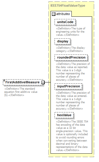 |
||||||||||||||||||||||||||||||||||||||||||||||
| namespace | http://water.usgs.gov/XML/NWIS/5.0 | ||||||||||||||||||||||||||||||||||||||||||||||
| type | IEEE754FloatValueType | ||||||||||||||||||||||||||||||||||||||||||||||
| properties |
|
||||||||||||||||||||||||||||||||||||||||||||||
| facets |
|
||||||||||||||||||||||||||||||||||||||||||||||
| attributes |
|
||||||||||||||||||||||||||||||||||||||||||||||
| annotation |
|
||||||||||||||||||||||||||||||||||||||||||||||
| source | <xsd:element name="FirstAdditiveMeasure" type="IEEE754FloatValueType" minOccurs="0"> <xsd:annotation> <xsd:documentation> <Definition>The standard equation first additive value (b).</Definition> </xsd:documentation> </xsd:annotation> </xsd:element> |
element StandardEquationCurve/PowerMeasure
| diagram | 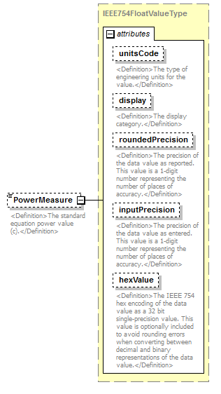 |
||||||||||||||||||||||||||||||||||||||||||||||
| namespace | http://water.usgs.gov/XML/NWIS/5.0 | ||||||||||||||||||||||||||||||||||||||||||||||
| type | IEEE754FloatValueType | ||||||||||||||||||||||||||||||||||||||||||||||
| properties |
|
||||||||||||||||||||||||||||||||||||||||||||||
| facets |
|
||||||||||||||||||||||||||||||||||||||||||||||
| attributes |
|
||||||||||||||||||||||||||||||||||||||||||||||
| annotation |
|
||||||||||||||||||||||||||||||||||||||||||||||
| source | <xsd:element name="PowerMeasure" type="IEEE754FloatValueType" minOccurs="0"> <xsd:annotation> <xsd:documentation> <Definition>The standard equation power value (c).</Definition> </xsd:documentation> </xsd:annotation> </xsd:element> |
element StandardEquationCurve/SecondAdditiveMeasure
| diagram |  |
||||||||||||||||||||||||||||||||||||||||||||||
| namespace | http://water.usgs.gov/XML/NWIS/5.0 | ||||||||||||||||||||||||||||||||||||||||||||||
| type | IEEE754FloatValueType | ||||||||||||||||||||||||||||||||||||||||||||||
| properties |
|
||||||||||||||||||||||||||||||||||||||||||||||
| facets |
|
||||||||||||||||||||||||||||||||||||||||||||||
| attributes |
|
||||||||||||||||||||||||||||||||||||||||||||||
| annotation |
|
||||||||||||||||||||||||||||||||||||||||||||||
| source | <xsd:element name="SecondAdditiveMeasure" type="IEEE754FloatValueType" minOccurs="0"> <xsd:annotation> <xsd:documentation> <Definition>The standard equation second additive value (d).</Definition> </xsd:documentation> </xsd:annotation> </xsd:element> |
element UnitValue
| diagram | 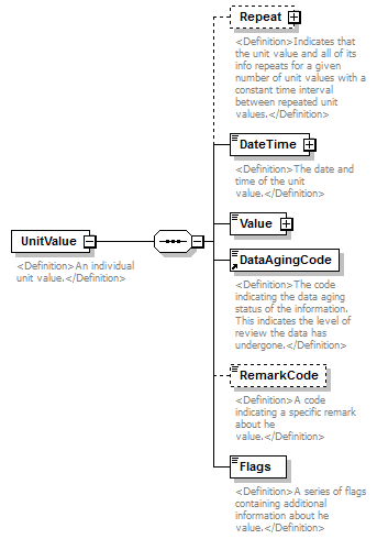 |
||
| namespace | http://water.usgs.gov/XML/NWIS/5.0 | ||
| properties |
|
||
| children | Repeat DateTime Value DataAgingCode RemarkCode Flags | ||
| used by |
|
||
| annotation |
|
||
| source | <xsd:element name="UnitValue"> <xsd:annotation> <xsd:documentation> <Definition>An individual unit value.</Definition> </xsd:documentation> </xsd:annotation> <xsd:complexType> <xsd:sequence> <xsd:element name="Repeat" minOccurs="0"> <xsd:annotation> <xsd:documentation> <Definition>Indicates that the unit value and all of its info repeats for a given number of unit values with a constant time interval between repeated unit values.</Definition> </xsd:documentation> </xsd:annotation> <xsd:complexType> <xsd:attribute name="count" type="xsd:integer" use="required"> <xsd:annotation> <xsd:documentation> <Definition>The count of consecutive unit values.</Definition> </xsd:documentation> </xsd:annotation> </xsd:attribute> <xsd:attribute name="interval" type="string16" use="required"> <xsd:annotation> <xsd:documentation> <Definition>The time interval between the consecutive unit values, in the format HH:MM:SS.</Definition> </xsd:documentation> </xsd:annotation> </xsd:attribute> </xsd:complexType> </xsd:element> <xsd:element name="DateTime" type="DateTimeWithDatum"> <xsd:annotation> <xsd:documentation> <Definition>The date and time of the unit value.</Definition> </xsd:documentation> </xsd:annotation> </xsd:element> <xsd:element name="Value" type="IEEE754FloatValueType" nillable="true"/> <xsd:element ref="DataAgingCode"/> <xsd:element name="RemarkCode" type="string1" minOccurs="0"> <xsd:annotation> <xsd:documentation> <Definition>A code indicating a specific remark about he value.</Definition> </xsd:documentation> </xsd:annotation> </xsd:element> <xsd:element name="Flags" type="string16"> <xsd:annotation> <xsd:documentation> <Definition>A series of flags containing additional information about he value.</Definition> </xsd:documentation> </xsd:annotation> </xsd:element> </xsd:sequence> </xsd:complexType> </xsd:element> |
element UnitValue/Repeat
| diagram | 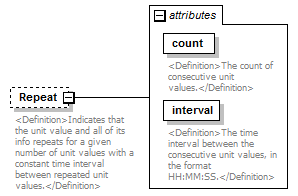 |
||||||||||||||||||||||
| namespace | http://water.usgs.gov/XML/NWIS/5.0 | ||||||||||||||||||||||
| properties |
|
||||||||||||||||||||||
| attributes |
|
||||||||||||||||||||||
| annotation |
|
||||||||||||||||||||||
| source | <xsd:element name="Repeat" minOccurs="0"> <xsd:annotation> <xsd:documentation> <Definition>Indicates that the unit value and all of its info repeats for a given number of unit values with a constant time interval between repeated unit values.</Definition> </xsd:documentation> </xsd:annotation> <xsd:complexType> <xsd:attribute name="count" type="xsd:integer" use="required"> <xsd:annotation> <xsd:documentation> <Definition>The count of consecutive unit values.</Definition> </xsd:documentation> </xsd:annotation> </xsd:attribute> <xsd:attribute name="interval" type="string16" use="required"> <xsd:annotation> <xsd:documentation> <Definition>The time interval between the consecutive unit values, in the format HH:MM:SS.</Definition> </xsd:documentation> </xsd:annotation> </xsd:attribute> </xsd:complexType> </xsd:element> |
attribute UnitValue/Repeat/@count
| type | xsd:integer | ||||
| properties |
|
||||
| annotation |
|
||||
| source | <xsd:attribute name="count" type="xsd:integer" use="required"> <xsd:annotation> <xsd:documentation> <Definition>The count of consecutive unit values.</Definition> </xsd:documentation> </xsd:annotation> </xsd:attribute> |
attribute UnitValue/Repeat/@interval
| type | string16 | ||||||
| properties |
|
||||||
| facets |
|
||||||
| annotation |
|
||||||
| source | <xsd:attribute name="interval" type="string16" use="required"> <xsd:annotation> <xsd:documentation> <Definition>The time interval between the consecutive unit values, in the format HH:MM:SS.</Definition> </xsd:documentation> </xsd:annotation> </xsd:attribute> |
element UnitValue/DateTime
| diagram | 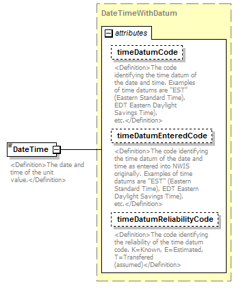 |
||||||||||||||||||||||||||||||
| namespace | http://water.usgs.gov/XML/NWIS/5.0 | ||||||||||||||||||||||||||||||
| type | DateTimeWithDatum | ||||||||||||||||||||||||||||||
| properties |
|
||||||||||||||||||||||||||||||
| attributes |
|
||||||||||||||||||||||||||||||
| annotation |
|
||||||||||||||||||||||||||||||
| source | <xsd:element name="DateTime" type="DateTimeWithDatum"> <xsd:annotation> <xsd:documentation> <Definition>The date and time of the unit value.</Definition> </xsd:documentation> </xsd:annotation> </xsd:element> |
element UnitValue/Value
| diagram | 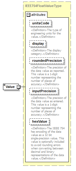 |
||||||||||||||||||||||||||||||||||||||||||||||
| namespace | http://water.usgs.gov/XML/NWIS/5.0 | ||||||||||||||||||||||||||||||||||||||||||||||
| type | IEEE754FloatValueType | ||||||||||||||||||||||||||||||||||||||||||||||
| properties |
|
||||||||||||||||||||||||||||||||||||||||||||||
| facets |
|
||||||||||||||||||||||||||||||||||||||||||||||
| attributes |
|
||||||||||||||||||||||||||||||||||||||||||||||
| source | <xsd:element name="Value" type="IEEE754FloatValueType" nillable="true"/> |
element UnitValue/RemarkCode
| diagram | 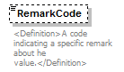 |
||||||||
| namespace | http://water.usgs.gov/XML/NWIS/5.0 | ||||||||
| type | string1 | ||||||||
| properties |
|
||||||||
| facets |
|
||||||||
| annotation |
|
||||||||
| source | <xsd:element name="RemarkCode" type="string1" minOccurs="0"> <xsd:annotation> <xsd:documentation> <Definition>A code indicating a specific remark about he value.</Definition> </xsd:documentation> </xsd:annotation> </xsd:element> |
element UnitValue/Flags
| diagram | 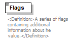 |
||||||
| namespace | http://water.usgs.gov/XML/NWIS/5.0 | ||||||
| type | string16 | ||||||
| properties |
|
||||||
| facets |
|
||||||
| annotation |
|
||||||
| source | <xsd:element name="Flags" type="string16"> <xsd:annotation> <xsd:documentation> <Definition>A series of flags containing additional information about he value.</Definition> </xsd:documentation> </xsd:annotation> </xsd:element> |
group UnitValuesStreamGroup
| diagram | 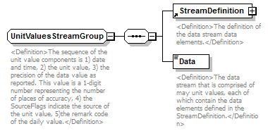 |
||
| namespace | http://water.usgs.gov/XML/NWIS/5.0 | ||
| children | StreamDefinition Data | ||
| used by |
|
||
| annotation |
|
||
| source | <xsd:group name="UnitValuesStreamGroup"> <xsd:annotation> <xsd:documentation> <Definition>The sequence of the unit value components is 1) date and time, 2) the unit value, 3) the precision of the data value as reported. This value is a 1-digit number representing the number of places of accuracy, 4) the SourceFlags indicate the source of the unit value, 5)the remark code of the daily value.</Definition> </xsd:documentation> </xsd:annotation> <xsd:sequence> <xsd:element ref="StreamDefinition"> <xsd:annotation> <xsd:documentation> <Definition>The definition of the data stream data elements.</Definition> </xsd:documentation> </xsd:annotation> </xsd:element> <xsd:element name="Data" type="xsd:string"> <xsd:annotation> <xsd:documentation> <Definition>The data stream that is comprised of may unit values, each of which contain the data elements defined in the StreamDefinition.</Definition> </xsd:documentation> </xsd:annotation> </xsd:element> </xsd:sequence> </xsd:group> |
element UnitValuesStreamGroup/Data
| diagram | 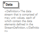 |
||||
| namespace | http://water.usgs.gov/XML/NWIS/5.0 | ||||
| type | xsd:string | ||||
| properties |
|
||||
| annotation |
|
||||
| source | <xsd:element name="Data" type="xsd:string"> <xsd:annotation> <xsd:documentation> <Definition>The data stream that is comprised of may unit values, each of which contain the data elements defined in the StreamDefinition.</Definition> </xsd:documentation> </xsd:annotation> </xsd:element> |
complexType UnitValuesRemarks
| diagram | 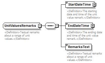 |
||
| namespace | http://water.usgs.gov/XML/NWIS/5.0 | ||
| children | StartDateTime EndDateTime RemarksText | ||
| used by |
|
||
| annotation |
|
||
| source | <xsd:complexType name="UnitValuesRemarks"> <xsd:annotation> <xsd:documentation> <Definition>Textual remarks about a range of unit values.</Definition> </xsd:documentation> </xsd:annotation> <xsd:sequence> <xsd:element name="StartDateTime" type="DateTimeWithDatum"> <xsd:annotation> <xsd:documentation> <Definition>The starting date and time of the unit value remark.</Definition> </xsd:documentation> </xsd:annotation> </xsd:element> <xsd:element name="EndDateTime" type="DateTimeWithDatum"> <xsd:annotation> <xsd:documentation> <Definition>The ending date and time of the unit value remark.</Definition> </xsd:documentation> </xsd:annotation> </xsd:element> <xsd:element name="RemarksText" type="xsd:string"> <xsd:annotation> <xsd:documentation> <Definition>Textual remarks about a range of unit values.</Definition> </xsd:documentation> </xsd:annotation> </xsd:element> </xsd:sequence> </xsd:complexType> |
element UnitValuesRemarks/StartDateTime
| diagram | 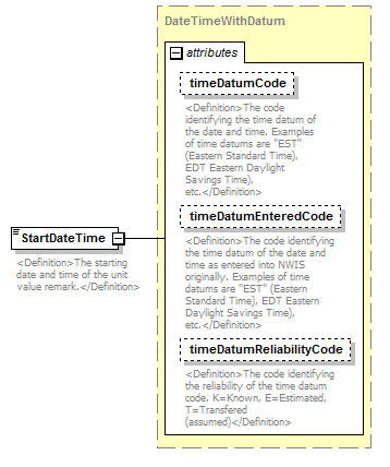 |
||||||||||||||||||||||||||||||
| namespace | http://water.usgs.gov/XML/NWIS/5.0 | ||||||||||||||||||||||||||||||
| type | DateTimeWithDatum | ||||||||||||||||||||||||||||||
| properties |
|
||||||||||||||||||||||||||||||
| attributes |
|
||||||||||||||||||||||||||||||
| annotation |
|
||||||||||||||||||||||||||||||
| source | <xsd:element name="StartDateTime" type="DateTimeWithDatum"> <xsd:annotation> <xsd:documentation> <Definition>The starting date and time of the unit value remark.</Definition> </xsd:documentation> </xsd:annotation> </xsd:element> |
element UnitValuesRemarks/EndDateTime
| diagram | 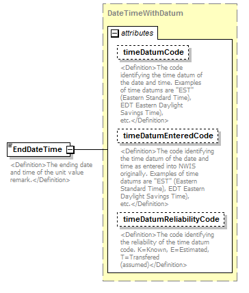 |
||||||||||||||||||||||||||||||
| namespace | http://water.usgs.gov/XML/NWIS/5.0 | ||||||||||||||||||||||||||||||
| type | DateTimeWithDatum | ||||||||||||||||||||||||||||||
| properties |
|
||||||||||||||||||||||||||||||
| attributes |
|
||||||||||||||||||||||||||||||
| annotation |
|
||||||||||||||||||||||||||||||
| source | <xsd:element name="EndDateTime" type="DateTimeWithDatum"> <xsd:annotation> <xsd:documentation> <Definition>The ending date and time of the unit value remark.</Definition> </xsd:documentation> </xsd:annotation> </xsd:element> |
element UnitValuesRemarks/RemarksText
| diagram | 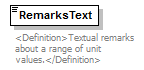 |
||||
| namespace | http://water.usgs.gov/XML/NWIS/5.0 | ||||
| type | xsd:string | ||||
| properties |
|
||||
| annotation |
|
||||
| source | <xsd:element name="RemarksText" type="xsd:string"> <xsd:annotation> <xsd:documentation> <Definition>Textual remarks about a range of unit values.</Definition> </xsd:documentation> </xsd:annotation> </xsd:element> |
element WaterYear
| diagram | 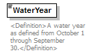 |
||
| namespace | http://water.usgs.gov/XML/NWIS/5.0 | ||
| type | xsd:positiveInteger | ||
| properties |
|
||
| used by |
|
||
| annotation |
|
||
| source | <xsd:element name="WaterYear" type="xsd:positiveInteger"> <xsd:annotation> <xsd:documentation> <Definition>A water year as defined from October 1 through September 30.</Definition> </xsd:documentation> </xsd:annotation> </xsd:element> |
element DailyValue
| diagram | 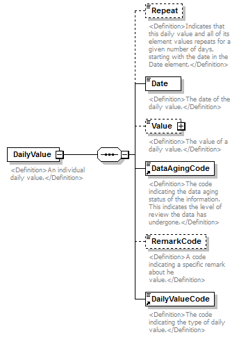 |
||
| namespace | http://water.usgs.gov/XML/NWIS/5.0 | ||
| properties |
|
||
| children | Repeat Date Value DataAgingCode RemarkCode DailyValueCode | ||
| used by |
|
||
| annotation |
|
||
| source | <xsd:element name="DailyValue"> <xsd:annotation> <xsd:documentation> <Definition>An individual daily value.</Definition> </xsd:documentation> </xsd:annotation> <xsd:complexType> <xsd:sequence> <xsd:element name="Repeat" type="xsd:integer" minOccurs="0"> <xsd:annotation> <xsd:documentation> <Definition>Indicates that this daily value and all of its element values repeats for a given number of days, starting with the date in the Date element.</Definition> </xsd:documentation> </xsd:annotation> </xsd:element> <xsd:element name="Date" type="xsd:date"> <xsd:annotation> <xsd:documentation> <Definition>The date of the daily value.</Definition> </xsd:documentation> </xsd:annotation> </xsd:element> <xsd:element name="Value" type="IEEE754FloatValueType" nillable="true" minOccurs="0"> <xsd:annotation> <xsd:documentation> <Definition>The value of a daily value.</Definition> </xsd:documentation> </xsd:annotation> </xsd:element> <xsd:element ref="DataAgingCode"/> <xsd:element name="RemarkCode" type="string1" minOccurs="0"> <xsd:annotation> <xsd:documentation> <Definition>A code indicating a specific remark about he value.</Definition> </xsd:documentation> </xsd:annotation> </xsd:element> <xsd:element ref="DailyValueCode"/> </xsd:sequence> </xsd:complexType> </xsd:element> |
element DailyValue/Repeat
| diagram | 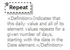 |
||||||||
| namespace | http://water.usgs.gov/XML/NWIS/5.0 | ||||||||
| type | xsd:integer | ||||||||
| properties |
|
||||||||
| annotation |
|
||||||||
| source | <xsd:element name="Repeat" type="xsd:integer" minOccurs="0"> <xsd:annotation> <xsd:documentation> <Definition>Indicates that this daily value and all of its element values repeats for a given number of days, starting with the date in the Date element.</Definition> </xsd:documentation> </xsd:annotation> </xsd:element> |
element DailyValue/Date
| diagram |  |
||||
| namespace | http://water.usgs.gov/XML/NWIS/5.0 | ||||
| type | xsd:date | ||||
| properties |
|
||||
| annotation |
|
||||
| source | <xsd:element name="Date" type="xsd:date"> <xsd:annotation> <xsd:documentation> <Definition>The date of the daily value.</Definition> </xsd:documentation> </xsd:annotation> </xsd:element> |
element DailyValue/Value
| diagram | 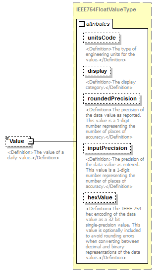 |
||||||||||||||||||||||||||||||||||||||||||||||
| namespace | http://water.usgs.gov/XML/NWIS/5.0 | ||||||||||||||||||||||||||||||||||||||||||||||
| type | IEEE754FloatValueType | ||||||||||||||||||||||||||||||||||||||||||||||
| properties |
|
||||||||||||||||||||||||||||||||||||||||||||||
| facets |
|
||||||||||||||||||||||||||||||||||||||||||||||
| attributes |
|
||||||||||||||||||||||||||||||||||||||||||||||
| annotation |
|
||||||||||||||||||||||||||||||||||||||||||||||
| source | <xsd:element name="Value" type="IEEE754FloatValueType" nillable="true" minOccurs="0"> <xsd:annotation> <xsd:documentation> <Definition>The value of a daily value.</Definition> </xsd:documentation> </xsd:annotation> </xsd:element> |
element DailyValue/RemarkCode
| diagram |  |
||||||||
| namespace | http://water.usgs.gov/XML/NWIS/5.0 | ||||||||
| type | string1 | ||||||||
| properties |
|
||||||||
| facets |
|
||||||||
| annotation |
|
||||||||
| source | <xsd:element name="RemarkCode" type="string1" minOccurs="0"> <xsd:annotation> <xsd:documentation> <Definition>A code indicating a specific remark about he value.</Definition> </xsd:documentation> </xsd:annotation> </xsd:element> |
element DailyValuesStream
| diagram | 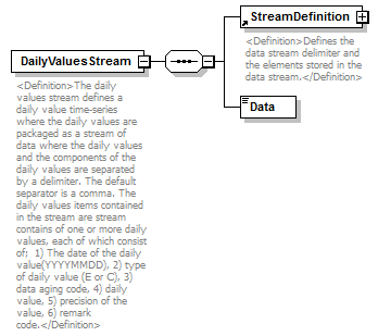 |
||
| namespace | http://water.usgs.gov/XML/NWIS/5.0 | ||
| properties |
|
||
| children | StreamDefinition Data | ||
| used by |
|
||
| annotation |
|
||
| source | <xsd:element name="DailyValuesStream"> <xsd:annotation> <xsd:documentation> <Definition>The daily values stream defines a daily value time-series where the daily values are packaged as a stream of data where the daily values and the components of the daily values are separated by a delimiter. The default separator is a comma. The daily values items contained in the stream are stream contains of one or more daily values, each of which consist of; 1) The date of the daily value(YYYYMMDD), 2) type of daily value (E or C), 3) data aging code, 4) daily value, 5) precision of the value, 6) remark code.</Definition> </xsd:documentation> </xsd:annotation> <xsd:complexType> <xsd:sequence> <xsd:element ref="StreamDefinition"/> <xsd:element name="Data" type="xsd:string"/> </xsd:sequence> </xsd:complexType> </xsd:element> |
element DailyValuesStream/Data
| diagram |  |
||||
| namespace | http://water.usgs.gov/XML/NWIS/5.0 | ||||
| type | xsd:string | ||||
| properties |
|
||||
| source | <xsd:element name="Data" type="xsd:string"/> |
complexType DailyValuesRemarks
| diagram | 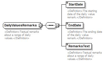 |
||
| namespace | http://water.usgs.gov/XML/NWIS/5.0 | ||
| children | StartDate EndDate RemarksText | ||
| used by |
|
||
| annotation |
|
||
| source | <xsd:complexType name="DailyValuesRemarks"> <xsd:annotation> <xsd:documentation> <Definition>Textual remarks about a range of daily values.</Definition> </xsd:documentation> </xsd:annotation> <xsd:sequence> <xsd:element name="StartDate" type="xsd:date"> <xsd:annotation> <xsd:documentation> <Definition>The starting date of the daily value remark.</Definition> </xsd:documentation> </xsd:annotation> </xsd:element> <xsd:element name="EndDate" type="xsd:date"> <xsd:annotation> <xsd:documentation> <Definition>The ending date of the daily value remark.</Definition> </xsd:documentation> </xsd:annotation> </xsd:element> <xsd:element name="RemarksText" type="xsd:string"> <xsd:annotation> <xsd:documentation> <Definition>Textual remarks about a range of daily values.</Definition> </xsd:documentation> </xsd:annotation> </xsd:element> </xsd:sequence> </xsd:complexType> |
element DailyValuesRemarks/StartDate
| diagram |  |
||||
| namespace | http://water.usgs.gov/XML/NWIS/5.0 | ||||
| type | xsd:date | ||||
| properties |
|
||||
| annotation |
|
||||
| source | <xsd:element name="StartDate" type="xsd:date"> <xsd:annotation> <xsd:documentation> <Definition>The starting date of the daily value remark.</Definition> </xsd:documentation> </xsd:annotation> </xsd:element> |
element DailyValuesRemarks/EndDate
| diagram | 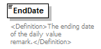 |
||||
| namespace | http://water.usgs.gov/XML/NWIS/5.0 | ||||
| type | xsd:date | ||||
| properties |
|
||||
| annotation |
|
||||
| source | <xsd:element name="EndDate" type="xsd:date"> <xsd:annotation> <xsd:documentation> <Definition>The ending date of the daily value remark.</Definition> </xsd:documentation> </xsd:annotation> </xsd:element> |
element DailyValuesRemarks/RemarksText
| diagram |  |
||||
| namespace | http://water.usgs.gov/XML/NWIS/5.0 | ||||
| type | xsd:string | ||||
| properties |
|
||||
| annotation |
|
||||
| source | <xsd:element name="RemarksText" type="xsd:string"> <xsd:annotation> <xsd:documentation> <Definition>Textual remarks about a range of daily values.</Definition> </xsd:documentation> </xsd:annotation> </xsd:element> |
element AnnualMaximum
| diagram |  |
||||||||||||||||||||||||||||||||||||||||||||||
| namespace | http://water.usgs.gov/XML/NWIS/5.0 | ||||||||||||||||||||||||||||||||||||||||||||||
| type | IEEE754FloatValueType | ||||||||||||||||||||||||||||||||||||||||||||||
| properties |
|
||||||||||||||||||||||||||||||||||||||||||||||
| used by |
|
||||||||||||||||||||||||||||||||||||||||||||||
| facets |
|
||||||||||||||||||||||||||||||||||||||||||||||
| attributes |
|
||||||||||||||||||||||||||||||||||||||||||||||
| annotation |
|
||||||||||||||||||||||||||||||||||||||||||||||
| source | <xsd:element name="AnnualMaximum" type="IEEE754FloatValueType"> <xsd:annotation> <xsd:documentation> <Definition>The maximum of all of the daily values for the water year.</Definition> </xsd:documentation> </xsd:annotation> </xsd:element> |
element AnnualMean
| diagram |  |
||||||||||||||||||||||||||||||||||||||||||||||
| namespace | http://water.usgs.gov/XML/NWIS/5.0 | ||||||||||||||||||||||||||||||||||||||||||||||
| type | IEEE754FloatValueType | ||||||||||||||||||||||||||||||||||||||||||||||
| properties |
|
||||||||||||||||||||||||||||||||||||||||||||||
| used by |
|
||||||||||||||||||||||||||||||||||||||||||||||
| facets |
|
||||||||||||||||||||||||||||||||||||||||||||||
| attributes |
|
||||||||||||||||||||||||||||||||||||||||||||||
| annotation |
|
||||||||||||||||||||||||||||||||||||||||||||||
| source | <xsd:element name="AnnualMean" type="IEEE754FloatValueType"> <xsd:annotation> <xsd:documentation> <Definition>The mean of all of the daily values for the water year.</Definition> </xsd:documentation> </xsd:annotation> </xsd:element> |
element AnnualMinimum
| diagram |  |
||||||||||||||||||||||||||||||||||||||||||||||
| namespace | http://water.usgs.gov/XML/NWIS/5.0 | ||||||||||||||||||||||||||||||||||||||||||||||
| type | IEEE754FloatValueType | ||||||||||||||||||||||||||||||||||||||||||||||
| properties |
|
||||||||||||||||||||||||||||||||||||||||||||||
| used by |
|
||||||||||||||||||||||||||||||||||||||||||||||
| facets |
|
||||||||||||||||||||||||||||||||||||||||||||||
| attributes |
|
||||||||||||||||||||||||||||||||||||||||||||||
| annotation |
|
||||||||||||||||||||||||||||||||||||||||||||||
| source | <xsd:element name="AnnualMinimum" type="IEEE754FloatValueType"> <xsd:annotation> <xsd:documentation> <Definition>The minimum of all of the daily values for the water year.</Definition> </xsd:documentation> </xsd:annotation> </xsd:element> |
element AnnualStatistics
| diagram | 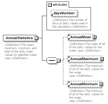 |
||||||||||||||
| namespace | http://water.usgs.gov/XML/NWIS/5.0 | ||||||||||||||
| properties |
|
||||||||||||||
| children | AnnualMean AnnualMaximum AnnualMinimum | ||||||||||||||
| used by |
|
||||||||||||||
| attributes |
|
||||||||||||||
| annotation |
|
||||||||||||||
| source | <xsd:element name="AnnualStatistics"> <xsd:annotation> <xsd:documentation> <Definition>The mean, maximum, minimum, and total of the daily mean values for specified water year.</Definition> </xsd:documentation> </xsd:annotation> <xsd:complexType> <xsd:sequence> <xsd:element ref="AnnualMean" minOccurs="0"/> <xsd:element ref="AnnualMaximum" minOccurs="0"/> <xsd:element ref="AnnualMinimum" minOccurs="0"/> </xsd:sequence> <xsd:attribute ref="daysNumber"/> </xsd:complexType> </xsd:element> |
element AnnualSummaryMaximum
| diagram |  |
||||||||||||||||||||||||||||||||||||||||||||||
| namespace | http://water.usgs.gov/XML/NWIS/5.0 | ||||||||||||||||||||||||||||||||||||||||||||||
| type | IEEE754FloatValueType | ||||||||||||||||||||||||||||||||||||||||||||||
| properties |
|
||||||||||||||||||||||||||||||||||||||||||||||
| used by |
|
||||||||||||||||||||||||||||||||||||||||||||||
| facets |
|
||||||||||||||||||||||||||||||||||||||||||||||
| attributes |
|
||||||||||||||||||||||||||||||||||||||||||||||
| annotation |
|
||||||||||||||||||||||||||||||||||||||||||||||
| source | <xsd:element name="AnnualSummaryMaximum" type="IEEE754FloatValueType"> <xsd:annotation> <xsd:documentation> <Definition>The maximum of the daily values for the specified water year.</Definition> </xsd:documentation> </xsd:annotation> </xsd:element> |
element AnnualSummaryMean
| diagram |  |
||||||||||||||||||||||||||||||||||||||||||||||
| namespace | http://water.usgs.gov/XML/NWIS/5.0 | ||||||||||||||||||||||||||||||||||||||||||||||
| type | IEEE754FloatValueType | ||||||||||||||||||||||||||||||||||||||||||||||
| properties |
|
||||||||||||||||||||||||||||||||||||||||||||||
| used by |
|
||||||||||||||||||||||||||||||||||||||||||||||
| facets |
|
||||||||||||||||||||||||||||||||||||||||||||||
| attributes |
|
||||||||||||||||||||||||||||||||||||||||||||||
| annotation |
|
||||||||||||||||||||||||||||||||||||||||||||||
| source | <xsd:element name="AnnualSummaryMean" type="IEEE754FloatValueType"> <xsd:annotation> <xsd:documentation> <Definition>The mean of the daily values for the specified water year.</Definition> </xsd:documentation> </xsd:annotation> </xsd:element> |
element AnnualSummaryMinimum
| diagram |  |
||||||||||||||||||||||||||||||||||||||||||||||
| namespace | http://water.usgs.gov/XML/NWIS/5.0 | ||||||||||||||||||||||||||||||||||||||||||||||
| type | IEEE754FloatValueType | ||||||||||||||||||||||||||||||||||||||||||||||
| properties |
|
||||||||||||||||||||||||||||||||||||||||||||||
| used by |
|
||||||||||||||||||||||||||||||||||||||||||||||
| facets |
|
||||||||||||||||||||||||||||||||||||||||||||||
| attributes |
|
||||||||||||||||||||||||||||||||||||||||||||||
| annotation |
|
||||||||||||||||||||||||||||||||||||||||||||||
| source | <xsd:element name="AnnualSummaryMinimum" type="IEEE754FloatValueType"> <xsd:annotation> <xsd:documentation> <Definition>The minimum of the daily values for the specified water year.</Definition> </xsd:documentation> </xsd:annotation> </xsd:element> |
element AnnualSummaryStatistics
| diagram | 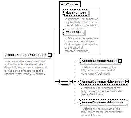 |
||||||||||||||||||||||
| namespace | http://water.usgs.gov/XML/NWIS/5.0 | ||||||||||||||||||||||
| properties |
|
||||||||||||||||||||||
| children | AnnualSummaryMean AnnualSummaryMaximum AnnualSummaryMinimum | ||||||||||||||||||||||
| used by |
|
||||||||||||||||||||||
| attributes |
|
||||||||||||||||||||||
| annotation |
|
||||||||||||||||||||||
| source | <xsd:element name="AnnualSummaryStatistics"> <xsd:annotation> <xsd:documentation> <Definition>The mean, maximum, and minimum of the annual means (from daily mean values) calculated for the period of record up to the specified water year.</Definition> </xsd:documentation> </xsd:annotation> <xsd:complexType> <xsd:sequence> <xsd:element ref="AnnualSummaryMean" minOccurs="0"/> <xsd:element ref="AnnualSummaryMaximum" minOccurs="0"/> <xsd:element ref="AnnualSummaryMinimum" minOccurs="0"/> </xsd:sequence> <xsd:attribute ref="daysNumber"/> <xsd:attribute name="waterYear" type="xsd:string"> <xsd:annotation> <xsd:documentation> <Definition>The water year to compute the summary statistics from the beginning of the period of record.</Definition> </xsd:documentation> </xsd:annotation> </xsd:attribute> </xsd:complexType> </xsd:element> |
attribute AnnualSummaryStatistics/@waterYear
| type | xsd:string | ||
| properties |
|
||
| annotation |
|
||
| source | <xsd:attribute name="waterYear" type="xsd:string"> <xsd:annotation> <xsd:documentation> <Definition>The water year to compute the summary statistics from the beginning of the period of record.</Definition> </xsd:documentation> </xsd:annotation> </xsd:attribute> |
element DailyFlow10Percentile
| diagram | 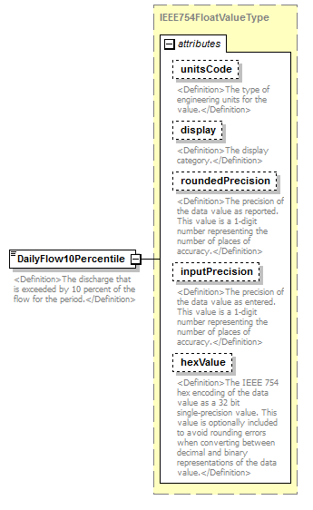 |
||||||||||||||||||||||||||||||||||||||||||||||
| namespace | http://water.usgs.gov/XML/NWIS/5.0 | ||||||||||||||||||||||||||||||||||||||||||||||
| type | IEEE754FloatValueType | ||||||||||||||||||||||||||||||||||||||||||||||
| properties |
|
||||||||||||||||||||||||||||||||||||||||||||||
| used by |
|
||||||||||||||||||||||||||||||||||||||||||||||
| facets |
|
||||||||||||||||||||||||||||||||||||||||||||||
| attributes |
|
||||||||||||||||||||||||||||||||||||||||||||||
| annotation |
|
||||||||||||||||||||||||||||||||||||||||||||||
| source | <xsd:element name="DailyFlow10Percentile" type="IEEE754FloatValueType"> <xsd:annotation> <xsd:documentation> <Definition>The discharge that is exceeded by 10 percent of the flow for the period.</Definition> </xsd:documentation> </xsd:annotation> </xsd:element> |
element DailyFlow50Percentile
| diagram | 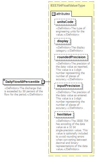 |
||||||||||||||||||||||||||||||||||||||||||||||
| namespace | http://water.usgs.gov/XML/NWIS/5.0 | ||||||||||||||||||||||||||||||||||||||||||||||
| type | IEEE754FloatValueType | ||||||||||||||||||||||||||||||||||||||||||||||
| properties |
|
||||||||||||||||||||||||||||||||||||||||||||||
| used by |
|
||||||||||||||||||||||||||||||||||||||||||||||
| facets |
|
||||||||||||||||||||||||||||||||||||||||||||||
| attributes |
|
||||||||||||||||||||||||||||||||||||||||||||||
| annotation |
|
||||||||||||||||||||||||||||||||||||||||||||||
| source | <xsd:element name="DailyFlow50Percentile" type="IEEE754FloatValueType"> <xsd:annotation> <xsd:documentation> <Definition>The discharge that is exceeded by 50 percent of the flow for the period.</Definition> </xsd:documentation> </xsd:annotation> </xsd:element> |
element DailyFlow90Percentile
| diagram |  |
||||||||||||||||||||||||||||||||||||||||||||||
| namespace | http://water.usgs.gov/XML/NWIS/5.0 | ||||||||||||||||||||||||||||||||||||||||||||||
| type | IEEE754FloatValueType | ||||||||||||||||||||||||||||||||||||||||||||||
| properties |
|
||||||||||||||||||||||||||||||||||||||||||||||
| used by |
|
||||||||||||||||||||||||||||||||||||||||||||||
| facets |
|
||||||||||||||||||||||||||||||||||||||||||||||
| attributes |
|
||||||||||||||||||||||||||||||||||||||||||||||
| annotation |
|
||||||||||||||||||||||||||||||||||||||||||||||
| source | <xsd:element name="DailyFlow90Percentile" type="IEEE754FloatValueType"> <xsd:annotation> <xsd:documentation> <Definition>The discharge that is exceeded by 90 percent of the flow for the period.</Definition> </xsd:documentation> </xsd:annotation> </xsd:element> |
element DailyValueStatistics
| diagram | 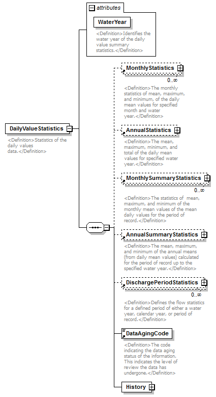 |
||||||||||||||
| namespace | http://water.usgs.gov/XML/NWIS/5.0 | ||||||||||||||
| properties |
|
||||||||||||||
| children | MonthlyStatistics AnnualStatistics MonthlySummaryStatistics AnnualSummaryStatistics DischargePeriodStatistics DataAgingCode History | ||||||||||||||
| used by |
|
||||||||||||||
| attributes |
|
||||||||||||||
| annotation |
|
||||||||||||||
| source | <xsd:element name="DailyValueStatistics"> <xsd:annotation> <xsd:documentation> <Definition>Statistics of the daily values data.</Definition> </xsd:documentation> </xsd:annotation> <xsd:complexType> <xsd:sequence> <xsd:element ref="MonthlyStatistics" minOccurs="0" maxOccurs="unbounded"/> <xsd:element ref="AnnualStatistics" minOccurs="0"/> <xsd:element ref="MonthlySummaryStatistics" minOccurs="0" maxOccurs="unbounded"/> <xsd:element ref="AnnualSummaryStatistics" minOccurs="0"/> <xsd:element ref="DischargePeriodStatistics" minOccurs="0" maxOccurs="unbounded"/> <xsd:element ref="DataAgingCode"/> <xsd:element name="History" type="RecordHistoryType"/> </xsd:sequence> <xsd:attribute name="WaterYear" type="xsd:string" use="required"> <xsd:annotation> <xsd:documentation> <Definition>Identifies the water year of the daily value summary statistics.</Definition> </xsd:documentation> </xsd:annotation> </xsd:attribute> </xsd:complexType> </xsd:element> |
attribute DailyValueStatistics/@WaterYear
| type | xsd:string | ||||
| properties |
|
||||
| annotation |
|
||||
| source | <xsd:attribute name="WaterYear" type="xsd:string" use="required"> <xsd:annotation> <xsd:documentation> <Definition>Identifies the water year of the daily value summary statistics.</Definition> </xsd:documentation> </xsd:annotation> </xsd:attribute> |
element DailyValueStatistics/History
| diagram | 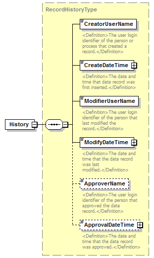 |
||||
| namespace | http://water.usgs.gov/XML/NWIS/5.0 | ||||
| type | RecordHistoryType | ||||
| properties |
|
||||
| children | CreatorUserName CreateDateTime ModifierUserName ModifyDateTime ApproverName ApprovalDateTime | ||||
| source | <xsd:element name="History" type="RecordHistoryType"/> |
element DischargePeriodStatistics
| diagram | 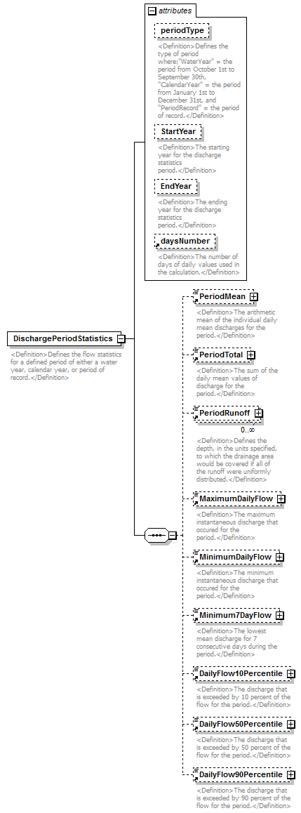 |
||||||||||||||||||||||||||||||||||||||
| namespace | http://water.usgs.gov/XML/NWIS/5.0 | ||||||||||||||||||||||||||||||||||||||
| properties |
|
||||||||||||||||||||||||||||||||||||||
| children | PeriodMean PeriodTotal PeriodRunoff MaximumDailyFlow MinimumDailyFlow Minimum7DayFlow DailyFlow10Percentile DailyFlow50Percentile DailyFlow90Percentile | ||||||||||||||||||||||||||||||||||||||
| used by |
|
||||||||||||||||||||||||||||||||||||||
| attributes |
|
||||||||||||||||||||||||||||||||||||||
| annotation |
|
||||||||||||||||||||||||||||||||||||||
| source | <xsd:element name="DischargePeriodStatistics"> <xsd:annotation> <xsd:documentation> <Definition>Defines the flow statistics for a defined period of either a water year, calendar year, or period of record.</Definition> </xsd:documentation> </xsd:annotation> <xsd:complexType> <xsd:sequence> <xsd:element ref="PeriodMean" minOccurs="0"/> <xsd:element ref="PeriodTotal" minOccurs="0"/> <xsd:element ref="PeriodRunoff" minOccurs="0" maxOccurs="unbounded"/> <xsd:element ref="MaximumDailyFlow" minOccurs="0"/> <xsd:element ref="MinimumDailyFlow" minOccurs="0"/> <xsd:element ref="Minimum7DayFlow" minOccurs="0"/> <xsd:element ref="DailyFlow10Percentile" minOccurs="0"/> <xsd:element ref="DailyFlow50Percentile" minOccurs="0"/> <xsd:element ref="DailyFlow90Percentile" minOccurs="0"/> </xsd:sequence> <xsd:attribute name="periodType" default="WaterYear"> <xsd:annotation> <xsd:documentation> <Definition>Defines the type of period where;"WaterYear" = the period from October 1st to September 30th, "CalendarYear" = the period from January 1st to December 31st, and "PeriodRecord" = the period of record.</Definition> </xsd:documentation> </xsd:annotation> <xsd:simpleType> <xsd:restriction base="xsd:NMTOKEN"> <xsd:enumeration value="WaterYear"/> <xsd:enumeration value="CalendarYear"/> <xsd:enumeration value="Period"/> </xsd:restriction> </xsd:simpleType> </xsd:attribute> <xsd:attribute name="StartYear" type="xsd:string"> <xsd:annotation> <xsd:documentation> <Definition>The starting year for the discharge statistics period.</Definition> </xsd:documentation> </xsd:annotation> </xsd:attribute> <xsd:attribute name="EndYear" type="xsd:string"> <xsd:annotation> <xsd:documentation> <Definition>The ending year for the discharge statistics period.</Definition> </xsd:documentation> </xsd:annotation> </xsd:attribute> <xsd:attribute ref="daysNumber"/> </xsd:complexType> </xsd:element> |
attribute DischargePeriodStatistics/@periodType
| type | restriction of xsd:NMTOKEN | ||||||||||||
| properties |
|
||||||||||||
| facets |
|
||||||||||||
| annotation |
|
||||||||||||
| source | <xsd:attribute name="periodType" default="WaterYear"> <xsd:annotation> <xsd:documentation> <Definition>Defines the type of period where;"WaterYear" = the period from October 1st to September 30th, "CalendarYear" = the period from January 1st to December 31st, and "PeriodRecord" = the period of record.</Definition> </xsd:documentation> </xsd:annotation> <xsd:simpleType> <xsd:restriction base="xsd:NMTOKEN"> <xsd:enumeration value="WaterYear"/> <xsd:enumeration value="CalendarYear"/> <xsd:enumeration value="Period"/> </xsd:restriction> </xsd:simpleType> </xsd:attribute> |
attribute DischargePeriodStatistics/@StartYear
| type | xsd:string | ||
| properties |
|
||
| annotation |
|
||
| source | <xsd:attribute name="StartYear" type="xsd:string"> <xsd:annotation> <xsd:documentation> <Definition>The starting year for the discharge statistics period.</Definition> </xsd:documentation> </xsd:annotation> </xsd:attribute> |
attribute DischargePeriodStatistics/@EndYear
| type | xsd:string | ||
| properties |
|
||
| annotation |
|
||
| source | <xsd:attribute name="EndYear" type="xsd:string"> <xsd:annotation> <xsd:documentation> <Definition>The ending year for the discharge statistics period.</Definition> </xsd:documentation> </xsd:annotation> </xsd:attribute> |
element MaximumDailyFlow
| diagram | 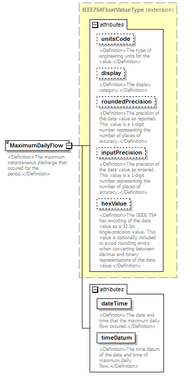 |
||||||||||||||||||||||||||||||||||||||||||||||||||||||||||||||
| namespace | http://water.usgs.gov/XML/NWIS/5.0 | ||||||||||||||||||||||||||||||||||||||||||||||||||||||||||||||
| type | extension of IEEE754FloatValueType | ||||||||||||||||||||||||||||||||||||||||||||||||||||||||||||||
| properties |
|
||||||||||||||||||||||||||||||||||||||||||||||||||||||||||||||
| used by |
|
||||||||||||||||||||||||||||||||||||||||||||||||||||||||||||||
| facets |
|
||||||||||||||||||||||||||||||||||||||||||||||||||||||||||||||
| attributes |
|
||||||||||||||||||||||||||||||||||||||||||||||||||||||||||||||
| annotation |
|
||||||||||||||||||||||||||||||||||||||||||||||||||||||||||||||
| source | <xsd:element name="MaximumDailyFlow"> <xsd:annotation> <xsd:documentation> <Definition>The maximum instantaneous discharge that occured for the period.</Definition> </xsd:documentation> </xsd:annotation> <xsd:complexType> <xsd:simpleContent> <xsd:extension base="IEEE754FloatValueType"> <xsd:attribute name="dateTime" type="xsd:string" use="required"> <xsd:annotation> <xsd:documentation> <Definition>The date and time that the maximum daily flow occured.</Definition> </xsd:documentation> </xsd:annotation> </xsd:attribute> <xsd:attribute name="timeDatum" type="xsd:string" use="required"> <xsd:annotation> <xsd:documentation> <Definition>The time datum of the date and time of maximum daily flow.</Definition> </xsd:documentation> </xsd:annotation> </xsd:attribute> </xsd:extension> </xsd:simpleContent> </xsd:complexType> </xsd:element> |
attribute MaximumDailyFlow/@dateTime
| type | xsd:string | ||||
| properties |
|
||||
| annotation |
|
||||
| source | <xsd:attribute name="dateTime" type="xsd:string" use="required"> <xsd:annotation> <xsd:documentation> <Definition>The date and time that the maximum daily flow occured.</Definition> </xsd:documentation> </xsd:annotation> </xsd:attribute> |
attribute MaximumDailyFlow/@timeDatum
| type | xsd:string | ||||
| properties |
|
||||
| annotation |
|
||||
| source | <xsd:attribute name="timeDatum" type="xsd:string" use="required"> <xsd:annotation> <xsd:documentation> <Definition>The time datum of the date and time of maximum daily flow.</Definition> </xsd:documentation> </xsd:annotation> </xsd:attribute> |
element MaximumInstantaneousFlow
| diagram | 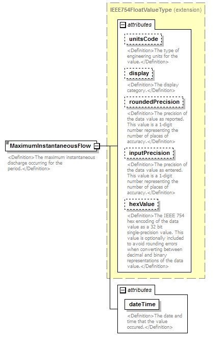 |
||||||||||||||||||||||||||||||||||||||||||||||||||||||
| namespace | http://water.usgs.gov/XML/NWIS/5.0 | ||||||||||||||||||||||||||||||||||||||||||||||||||||||
| type | extension of IEEE754FloatValueType | ||||||||||||||||||||||||||||||||||||||||||||||||||||||
| properties |
|
||||||||||||||||||||||||||||||||||||||||||||||||||||||
| facets |
|
||||||||||||||||||||||||||||||||||||||||||||||||||||||
| attributes |
|
||||||||||||||||||||||||||||||||||||||||||||||||||||||
| annotation |
|
||||||||||||||||||||||||||||||||||||||||||||||||||||||
| source | <xsd:element name="MaximumInstantaneousFlow"> <xsd:annotation> <xsd:documentation> <Definition>The maximum instantaneous discharge occurring for the period.</Definition> </xsd:documentation> </xsd:annotation> <xsd:complexType> <xsd:simpleContent> <xsd:extension base="IEEE754FloatValueType"> <xsd:attribute name="dateTime" type="xsd:string" use="required"> <xsd:annotation> <xsd:documentation> <Definition>The date and time that the value occured.</Definition> </xsd:documentation> </xsd:annotation> </xsd:attribute> </xsd:extension> </xsd:simpleContent> </xsd:complexType> </xsd:element> |
attribute MaximumInstantaneousFlow/@dateTime
| type | xsd:string | ||||
| properties |
|
||||
| annotation |
|
||||
| source | <xsd:attribute name="dateTime" type="xsd:string" use="required"> <xsd:annotation> <xsd:documentation> <Definition>The date and time that the value occured.</Definition> </xsd:documentation> </xsd:annotation> </xsd:attribute> |
element MaximumInstantaneousStage
| diagram | 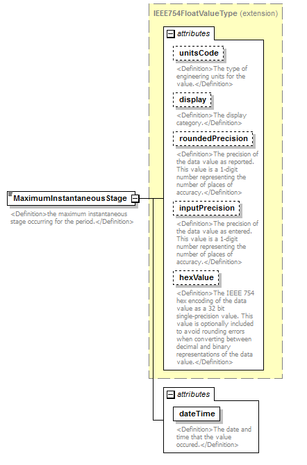 |
||||||||||||||||||||||||||||||||||||||||||||||||||||||
| namespace | http://water.usgs.gov/XML/NWIS/5.0 | ||||||||||||||||||||||||||||||||||||||||||||||||||||||
| type | extension of IEEE754FloatValueType | ||||||||||||||||||||||||||||||||||||||||||||||||||||||
| properties |
|
||||||||||||||||||||||||||||||||||||||||||||||||||||||
| facets |
|
||||||||||||||||||||||||||||||||||||||||||||||||||||||
| attributes |
|
||||||||||||||||||||||||||||||||||||||||||||||||||||||
| annotation |
|
||||||||||||||||||||||||||||||||||||||||||||||||||||||
| source | <xsd:element name="MaximumInstantaneousStage"> <xsd:annotation> <xsd:documentation> <Definition>the maximum instantaneous stage occurring for the period.</Definition> </xsd:documentation> </xsd:annotation> <xsd:complexType> <xsd:simpleContent> <xsd:extension base="IEEE754FloatValueType"> <xsd:attribute name="dateTime" type="xsd:string" use="required"> <xsd:annotation> <xsd:documentation> <Definition>The date and time that the value occured.</Definition> </xsd:documentation> </xsd:annotation> </xsd:attribute> </xsd:extension> </xsd:simpleContent> </xsd:complexType> </xsd:element> |
attribute MaximumInstantaneousStage/@dateTime
| type | xsd:string | ||||
| properties |
|
||||
| annotation |
|
||||
| source | <xsd:attribute name="dateTime" type="xsd:string" use="required"> <xsd:annotation> <xsd:documentation> <Definition>The date and time that the value occured.</Definition> </xsd:documentation> </xsd:annotation> </xsd:attribute> |
element Minimum7DayFlow
| diagram | 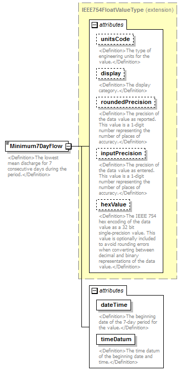 |
||||||||||||||||||||||||||||||||||||||||||||||||||||||||||||||
| namespace | http://water.usgs.gov/XML/NWIS/5.0 | ||||||||||||||||||||||||||||||||||||||||||||||||||||||||||||||
| type | extension of IEEE754FloatValueType | ||||||||||||||||||||||||||||||||||||||||||||||||||||||||||||||
| properties |
|
||||||||||||||||||||||||||||||||||||||||||||||||||||||||||||||
| used by |
|
||||||||||||||||||||||||||||||||||||||||||||||||||||||||||||||
| facets |
|
||||||||||||||||||||||||||||||||||||||||||||||||||||||||||||||
| attributes |
|
||||||||||||||||||||||||||||||||||||||||||||||||||||||||||||||
| annotation |
|
||||||||||||||||||||||||||||||||||||||||||||||||||||||||||||||
| source | <xsd:element name="Minimum7DayFlow"> <xsd:annotation> <xsd:documentation> <Definition>The lowest mean discharge for 7 consecutive days during the period.</Definition> </xsd:documentation> </xsd:annotation> <xsd:complexType> <xsd:simpleContent> <xsd:extension base="IEEE754FloatValueType"> <xsd:attribute name="dateTime" type="xsd:string" use="required"> <xsd:annotation> <xsd:documentation> <Definition>The beginning date of the 7-day period for the value.</Definition> </xsd:documentation> </xsd:annotation> </xsd:attribute> <xsd:attribute name="timeDatum" type="xsd:string" use="required"> <xsd:annotation> <xsd:documentation> <Definition>The time datum of the beginning date and time.</Definition> </xsd:documentation> </xsd:annotation> </xsd:attribute> </xsd:extension> </xsd:simpleContent> </xsd:complexType> </xsd:element> |
attribute Minimum7DayFlow/@dateTime
| type | xsd:string | ||||
| properties |
|
||||
| annotation |
|
||||
| source | <xsd:attribute name="dateTime" type="xsd:string" use="required"> <xsd:annotation> <xsd:documentation> <Definition>The beginning date of the 7-day period for the value.</Definition> </xsd:documentation> </xsd:annotation> </xsd:attribute> |
attribute Minimum7DayFlow/@timeDatum
| type | xsd:string | ||||
| properties |
|
||||
| annotation |
|
||||
| source | <xsd:attribute name="timeDatum" type="xsd:string" use="required"> <xsd:annotation> <xsd:documentation> <Definition>The time datum of the beginning date and time.</Definition> </xsd:documentation> </xsd:annotation> </xsd:attribute> |
element MinimumDailyFlow
| diagram | 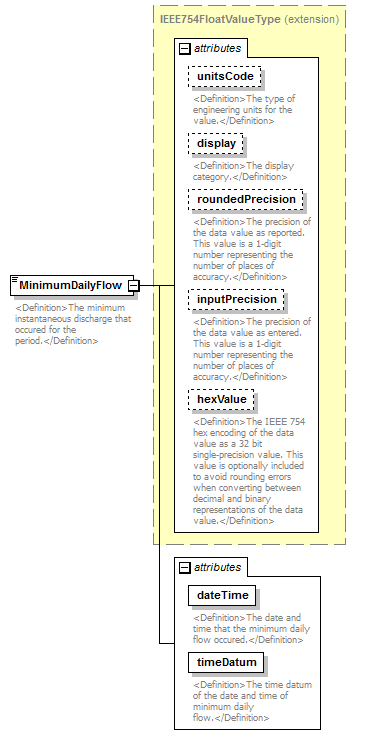 |
||||||||||||||||||||||||||||||||||||||||||||||||||||||||||||||
| namespace | http://water.usgs.gov/XML/NWIS/5.0 | ||||||||||||||||||||||||||||||||||||||||||||||||||||||||||||||
| type | extension of IEEE754FloatValueType | ||||||||||||||||||||||||||||||||||||||||||||||||||||||||||||||
| properties |
|
||||||||||||||||||||||||||||||||||||||||||||||||||||||||||||||
| used by |
|
||||||||||||||||||||||||||||||||||||||||||||||||||||||||||||||
| facets |
|
||||||||||||||||||||||||||||||||||||||||||||||||||||||||||||||
| attributes |
|
||||||||||||||||||||||||||||||||||||||||||||||||||||||||||||||
| annotation |
|
||||||||||||||||||||||||||||||||||||||||||||||||||||||||||||||
| source | <xsd:element name="MinimumDailyFlow"> <xsd:annotation> <xsd:documentation> <Definition>The minimum instantaneous discharge that occured for the period.</Definition> </xsd:documentation> </xsd:annotation> <xsd:complexType> <xsd:simpleContent> <xsd:extension base="IEEE754FloatValueType"> <xsd:attribute name="dateTime" type="xsd:string" use="required"> <xsd:annotation> <xsd:documentation> <Definition>The date and time that the minimum daily flow occured.</Definition> </xsd:documentation> </xsd:annotation> </xsd:attribute> <xsd:attribute name="timeDatum" type="xsd:string" use="required"> <xsd:annotation> <xsd:documentation> <Definition>The time datum of the date and time of minimum daily flow.</Definition> </xsd:documentation> </xsd:annotation> </xsd:attribute> </xsd:extension> </xsd:simpleContent> </xsd:complexType> </xsd:element> |
attribute MinimumDailyFlow/@dateTime
| type | xsd:string | ||||
| properties |
|
||||
| annotation |
|
||||
| source | <xsd:attribute name="dateTime" type="xsd:string" use="required"> <xsd:annotation> <xsd:documentation> <Definition>The date and time that the minimum daily flow occured.</Definition> </xsd:documentation> </xsd:annotation> </xsd:attribute> |
attribute MinimumDailyFlow/@timeDatum
| type | xsd:string | ||||
| properties |
|
||||
| annotation |
|
||||
| source | <xsd:attribute name="timeDatum" type="xsd:string" use="required"> <xsd:annotation> <xsd:documentation> <Definition>The time datum of the date and time of minimum daily flow.</Definition> </xsd:documentation> </xsd:annotation> </xsd:attribute> |
element MinimumInstantaneousFlow
| diagram | 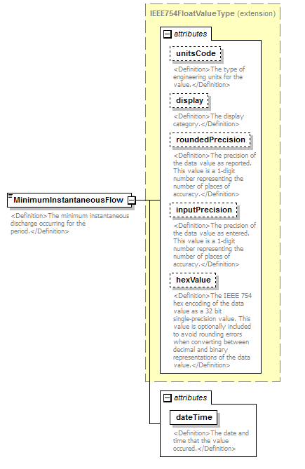 |
||||||||||||||||||||||||||||||||||||||||||||||||||||||
| namespace | http://water.usgs.gov/XML/NWIS/5.0 | ||||||||||||||||||||||||||||||||||||||||||||||||||||||
| type | extension of IEEE754FloatValueType | ||||||||||||||||||||||||||||||||||||||||||||||||||||||
| properties |
|
||||||||||||||||||||||||||||||||||||||||||||||||||||||
| facets |
|
||||||||||||||||||||||||||||||||||||||||||||||||||||||
| attributes |
|
||||||||||||||||||||||||||||||||||||||||||||||||||||||
| annotation |
|
||||||||||||||||||||||||||||||||||||||||||||||||||||||
| source | <xsd:element name="MinimumInstantaneousFlow"> <xsd:annotation> <xsd:documentation> <Definition>The minimum instantaneous discharge occurring for the period.</Definition> </xsd:documentation> </xsd:annotation> <xsd:complexType> <xsd:simpleContent> <xsd:extension base="IEEE754FloatValueType"> <xsd:attribute name="dateTime" type="xsd:string" use="required"> <xsd:annotation> <xsd:documentation> <Definition>The date and time that the value occured.</Definition> </xsd:documentation> </xsd:annotation> </xsd:attribute> </xsd:extension> </xsd:simpleContent> </xsd:complexType> </xsd:element> |
attribute MinimumInstantaneousFlow/@dateTime
| type | xsd:string | ||||
| properties |
|
||||
| annotation |
|
||||
| source | <xsd:attribute name="dateTime" type="xsd:string" use="required"> <xsd:annotation> <xsd:documentation> <Definition>The date and time that the value occured.</Definition> </xsd:documentation> </xsd:annotation> </xsd:attribute> |
element MonthlyMaximum
| diagram |  |
||||||||||||||||||||||||||||||||||||||||||||||
| namespace | http://water.usgs.gov/XML/NWIS/5.0 | ||||||||||||||||||||||||||||||||||||||||||||||
| type | IEEE754FloatValueType | ||||||||||||||||||||||||||||||||||||||||||||||
| properties |
|
||||||||||||||||||||||||||||||||||||||||||||||
| used by |
|
||||||||||||||||||||||||||||||||||||||||||||||
| facets |
|
||||||||||||||||||||||||||||||||||||||||||||||
| attributes |
|
||||||||||||||||||||||||||||||||||||||||||||||
| annotation |
|
||||||||||||||||||||||||||||||||||||||||||||||
| source | <xsd:element name="MonthlyMaximum" type="IEEE754FloatValueType"> <xsd:annotation> <xsd:documentation> <Definition>The maximum of the daily values for the specified month.</Definition> </xsd:documentation> </xsd:annotation> </xsd:element> |
element MonthlyMean
| diagram | 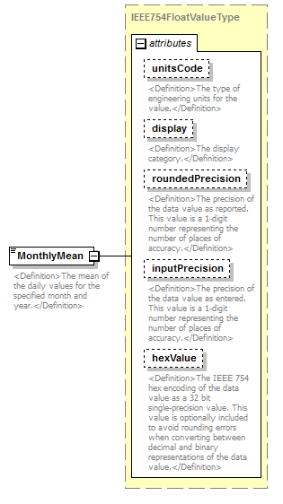 |
||||||||||||||||||||||||||||||||||||||||||||||
| namespace | http://water.usgs.gov/XML/NWIS/5.0 | ||||||||||||||||||||||||||||||||||||||||||||||
| type | IEEE754FloatValueType | ||||||||||||||||||||||||||||||||||||||||||||||
| properties |
|
||||||||||||||||||||||||||||||||||||||||||||||
| used by |
|
||||||||||||||||||||||||||||||||||||||||||||||
| facets |
|
||||||||||||||||||||||||||||||||||||||||||||||
| attributes |
|
||||||||||||||||||||||||||||||||||||||||||||||
| annotation |
|
||||||||||||||||||||||||||||||||||||||||||||||
| source | <xsd:element name="MonthlyMean" type="IEEE754FloatValueType"> <xsd:annotation> <xsd:documentation> <Definition>The mean of the daily values for the specified month and year.</Definition> </xsd:documentation> </xsd:annotation> </xsd:element> |
element MonthlyMinimum
| diagram |  |
||||||||||||||||||||||||||||||||||||||||||||||
| namespace | http://water.usgs.gov/XML/NWIS/5.0 | ||||||||||||||||||||||||||||||||||||||||||||||
| type | IEEE754FloatValueType | ||||||||||||||||||||||||||||||||||||||||||||||
| properties |
|
||||||||||||||||||||||||||||||||||||||||||||||
| used by |
|
||||||||||||||||||||||||||||||||||||||||||||||
| facets |
|
||||||||||||||||||||||||||||||||||||||||||||||
| attributes |
|
||||||||||||||||||||||||||||||||||||||||||||||
| annotation |
|
||||||||||||||||||||||||||||||||||||||||||||||
| source | <xsd:element name="MonthlyMinimum" type="IEEE754FloatValueType"> <xsd:annotation> <xsd:documentation> <Definition>The minimum of the daily values for the specified month.</Definition> </xsd:documentation> </xsd:annotation> </xsd:element> |
element MonthlyStatistics
| diagram | 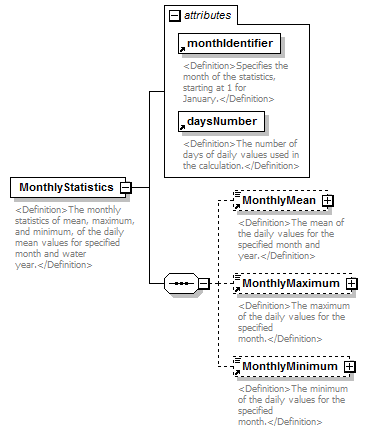 |
||||||||||||||||||||||
| namespace | http://water.usgs.gov/XML/NWIS/5.0 | ||||||||||||||||||||||
| properties |
|
||||||||||||||||||||||
| children | MonthlyMean MonthlyMaximum MonthlyMinimum | ||||||||||||||||||||||
| used by |
|
||||||||||||||||||||||
| attributes |
|
||||||||||||||||||||||
| annotation |
|
||||||||||||||||||||||
| source | <xsd:element name="MonthlyStatistics"> <xsd:annotation> <xsd:documentation> <Definition>The monthly statistics of mean, maximum, and minimum, of the daily mean values for specified month and water year.</Definition> </xsd:documentation> </xsd:annotation> <xsd:complexType> <xsd:sequence> <xsd:element ref="MonthlyMean" minOccurs="0"/> <xsd:element ref="MonthlyMaximum" minOccurs="0"/> <xsd:element ref="MonthlyMinimum" minOccurs="0"/> </xsd:sequence> <xsd:attribute ref="monthIdentifier" use="required"/> <xsd:attribute ref="daysNumber" use="required"/> </xsd:complexType> </xsd:element> |
element MonthlySummaryMaximum
| diagram | 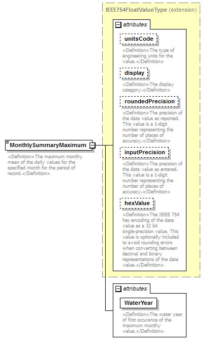 |
||||||||||||||||||||||||||||||||||||||||||||||||||||||
| namespace | http://water.usgs.gov/XML/NWIS/5.0 | ||||||||||||||||||||||||||||||||||||||||||||||||||||||
| type | extension of IEEE754FloatValueType | ||||||||||||||||||||||||||||||||||||||||||||||||||||||
| properties |
|
||||||||||||||||||||||||||||||||||||||||||||||||||||||
| used by |
|
||||||||||||||||||||||||||||||||||||||||||||||||||||||
| facets |
|
||||||||||||||||||||||||||||||||||||||||||||||||||||||
| attributes |
|
||||||||||||||||||||||||||||||||||||||||||||||||||||||
| annotation |
|
||||||||||||||||||||||||||||||||||||||||||||||||||||||
| source | <xsd:element name="MonthlySummaryMaximum"> <xsd:annotation> <xsd:documentation> <Definition>The maximum monthy mean of the daily values for the specified month for the period of record.</Definition> </xsd:documentation> </xsd:annotation> <xsd:complexType> <xsd:simpleContent> <xsd:extension base="IEEE754FloatValueType"> <xsd:attribute name="WaterYear" type="xsd:string" use="required"> <xsd:annotation> <xsd:documentation> <Definition>The water year of first occurance of the maximum monthy value.</Definition> </xsd:documentation> </xsd:annotation> </xsd:attribute> </xsd:extension> </xsd:simpleContent> </xsd:complexType> </xsd:element> |
attribute MonthlySummaryMaximum/@WaterYear
| type | xsd:string | ||||
| properties |
|
||||
| annotation |
|
||||
| source | <xsd:attribute name="WaterYear" type="xsd:string" use="required"> <xsd:annotation> <xsd:documentation> <Definition>The water year of first occurance of the maximum monthy value.</Definition> </xsd:documentation> </xsd:annotation> </xsd:attribute> |
element MonthlySummaryMean
| diagram | 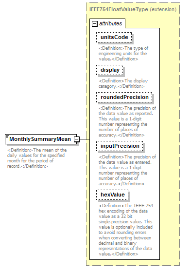 |
||||||||||||||||||||||||||||||||||||||||||||||
| namespace | http://water.usgs.gov/XML/NWIS/5.0 | ||||||||||||||||||||||||||||||||||||||||||||||
| type | extension of IEEE754FloatValueType | ||||||||||||||||||||||||||||||||||||||||||||||
| properties |
|
||||||||||||||||||||||||||||||||||||||||||||||
| used by |
|
||||||||||||||||||||||||||||||||||||||||||||||
| facets |
|
||||||||||||||||||||||||||||||||||||||||||||||
| attributes |
|
||||||||||||||||||||||||||||||||||||||||||||||
| annotation |
|
||||||||||||||||||||||||||||||||||||||||||||||
| source | <xsd:element name="MonthlySummaryMean"> <xsd:annotation> <xsd:documentation> <Definition>The mean of the daily values for the specified month for the period of record.</Definition> </xsd:documentation> </xsd:annotation> <xsd:complexType> <xsd:simpleContent> <xsd:extension base="IEEE754FloatValueType"/> </xsd:simpleContent> </xsd:complexType> </xsd:element> |
element MonthlySummaryMinimum
| diagram | 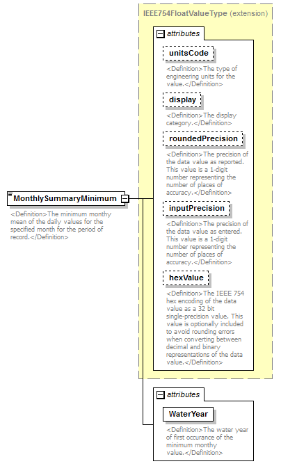 |
||||||||||||||||||||||||||||||||||||||||||||||||||||||
| namespace | http://water.usgs.gov/XML/NWIS/5.0 | ||||||||||||||||||||||||||||||||||||||||||||||||||||||
| type | extension of IEEE754FloatValueType | ||||||||||||||||||||||||||||||||||||||||||||||||||||||
| properties |
|
||||||||||||||||||||||||||||||||||||||||||||||||||||||
| used by |
|
||||||||||||||||||||||||||||||||||||||||||||||||||||||
| facets |
|
||||||||||||||||||||||||||||||||||||||||||||||||||||||
| attributes |
|
||||||||||||||||||||||||||||||||||||||||||||||||||||||
| annotation |
|
||||||||||||||||||||||||||||||||||||||||||||||||||||||
| source | <xsd:element name="MonthlySummaryMinimum"> <xsd:annotation> <xsd:documentation> <Definition>The minimum monthy mean of the daily values for the specified month for the period of record.</Definition> </xsd:documentation> </xsd:annotation> <xsd:complexType> <xsd:simpleContent> <xsd:extension base="IEEE754FloatValueType"> <xsd:attribute name="WaterYear" type="xsd:string" use="required"> <xsd:annotation> <xsd:documentation> <Definition>The water year of first occurance of the minimum monthy value.</Definition> </xsd:documentation> </xsd:annotation> </xsd:attribute> </xsd:extension> </xsd:simpleContent> </xsd:complexType> </xsd:element> |
attribute MonthlySummaryMinimum/@WaterYear
| type | xsd:string | ||||
| properties |
|
||||
| annotation |
|
||||
| source | <xsd:attribute name="WaterYear" type="xsd:string" use="required"> <xsd:annotation> <xsd:documentation> <Definition>The water year of first occurance of the minimum monthy value.</Definition> </xsd:documentation> </xsd:annotation> </xsd:attribute> |
element MonthlySummaryStatistics
| diagram | 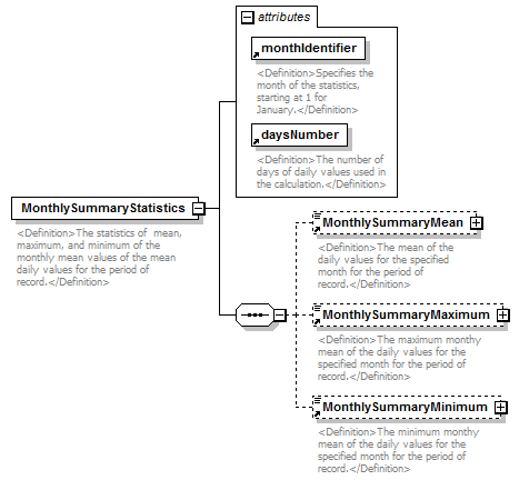 |
||||||||||||||||||||||
| namespace | http://water.usgs.gov/XML/NWIS/5.0 | ||||||||||||||||||||||
| properties |
|
||||||||||||||||||||||
| children | MonthlySummaryMean MonthlySummaryMaximum MonthlySummaryMinimum | ||||||||||||||||||||||
| used by |
|
||||||||||||||||||||||
| attributes |
|
||||||||||||||||||||||
| annotation |
|
||||||||||||||||||||||
| source | <xsd:element name="MonthlySummaryStatistics"> <xsd:annotation> <xsd:documentation> <Definition>The statistics of mean, maximum, and minimum of the monthly mean values of the mean daily values for the period of record.</Definition> </xsd:documentation> </xsd:annotation> <xsd:complexType> <xsd:sequence> <xsd:element ref="MonthlySummaryMean" minOccurs="0"/> <xsd:element ref="MonthlySummaryMaximum" minOccurs="0"/> <xsd:element ref="MonthlySummaryMinimum" minOccurs="0"/> </xsd:sequence> <xsd:attribute ref="monthIdentifier" use="required"/> <xsd:attribute ref="daysNumber" use="required"/> </xsd:complexType> </xsd:element> |
element PeriodMean
| diagram |  |
||||||||||||||||||||||||||||||||||||||||||||||
| namespace | http://water.usgs.gov/XML/NWIS/5.0 | ||||||||||||||||||||||||||||||||||||||||||||||
| type | IEEE754FloatValueType | ||||||||||||||||||||||||||||||||||||||||||||||
| properties |
|
||||||||||||||||||||||||||||||||||||||||||||||
| used by |
|
||||||||||||||||||||||||||||||||||||||||||||||
| facets |
|
||||||||||||||||||||||||||||||||||||||||||||||
| attributes |
|
||||||||||||||||||||||||||||||||||||||||||||||
| annotation |
|
||||||||||||||||||||||||||||||||||||||||||||||
| source | <xsd:element name="PeriodMean" type="IEEE754FloatValueType"> <xsd:annotation> <xsd:documentation> <Definition>The arithmetic mean of the individual daily mean discharges for the period.</Definition> </xsd:documentation> </xsd:annotation> </xsd:element> |
element PeriodRunoff
| diagram | 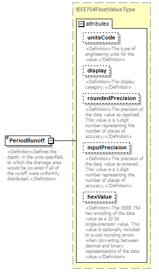 |
||||||||||||||||||||||||||||||||||||||||||||||
| namespace | http://water.usgs.gov/XML/NWIS/5.0 | ||||||||||||||||||||||||||||||||||||||||||||||
| type | IEEE754FloatValueType | ||||||||||||||||||||||||||||||||||||||||||||||
| properties |
|
||||||||||||||||||||||||||||||||||||||||||||||
| used by |
|
||||||||||||||||||||||||||||||||||||||||||||||
| facets |
|
||||||||||||||||||||||||||||||||||||||||||||||
| attributes |
|
||||||||||||||||||||||||||||||||||||||||||||||
| annotation |
|
||||||||||||||||||||||||||||||||||||||||||||||
| source | <xsd:element name="PeriodRunoff" type="IEEE754FloatValueType"> <xsd:annotation> <xsd:documentation> <Definition>Defines the depth, in the units specified, to which the drainage area would be covered if all of the runoff were uniformly distributed.</Definition> </xsd:documentation> </xsd:annotation> </xsd:element> |
element PeriodTotal
| diagram | 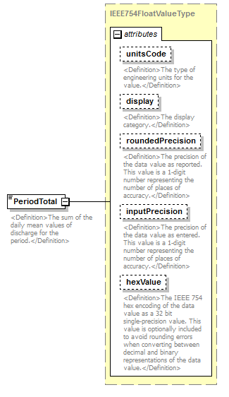 |
||||||||||||||||||||||||||||||||||||||||||||||
| namespace | http://water.usgs.gov/XML/NWIS/5.0 | ||||||||||||||||||||||||||||||||||||||||||||||
| type | IEEE754FloatValueType | ||||||||||||||||||||||||||||||||||||||||||||||
| properties |
|
||||||||||||||||||||||||||||||||||||||||||||||
| used by |
|
||||||||||||||||||||||||||||||||||||||||||||||
| facets |
|
||||||||||||||||||||||||||||||||||||||||||||||
| attributes |
|
||||||||||||||||||||||||||||||||||||||||||||||
| annotation |
|
||||||||||||||||||||||||||||||||||||||||||||||
| source | <xsd:element name="PeriodTotal" type="IEEE754FloatValueType"> <xsd:annotation> <xsd:documentation> <Definition>The sum of the daily mean values of discharge for the period.</Definition> </xsd:documentation> </xsd:annotation> </xsd:element> |
attribute daysNumber
| namespace | http://water.usgs.gov/XML/NWIS/5.0 | ||
| type | xsd:integer | ||
| used by |
|
||
| annotation |
|
||
| source | <xsd:attribute name="daysNumber" type="xsd:integer"> <xsd:annotation> <xsd:documentation> <Definition>The number of days of daily values used in the calculation.</Definition> </xsd:documentation> </xsd:annotation> </xsd:attribute> |
attribute monthIdentifier
| namespace | http://water.usgs.gov/XML/NWIS/5.0 | |||||||||||||||||||||||||||||||||||||||
| type | restriction of xsd:NMTOKEN | |||||||||||||||||||||||||||||||||||||||
| used by |
|
|||||||||||||||||||||||||||||||||||||||
| facets |
|
|||||||||||||||||||||||||||||||||||||||
| annotation |
|
|||||||||||||||||||||||||||||||||||||||
| source | <xsd:attribute name="monthIdentifier"> <xsd:annotation> <xsd:documentation> <Definition>Specifies the month of the statistics, starting at 1 for January.</Definition> </xsd:documentation> </xsd:annotation> <xsd:simpleType> <xsd:restriction base="xsd:NMTOKEN"> <xsd:enumeration value="1"/> <xsd:enumeration value="2"/> <xsd:enumeration value="3"/> <xsd:enumeration value="4"/> <xsd:enumeration value="5"/> <xsd:enumeration value="6"/> <xsd:enumeration value="7"/> <xsd:enumeration value="8"/> <xsd:enumeration value="9"/> <xsd:enumeration value="10"/> <xsd:enumeration value="11"/> <xsd:enumeration value="12"/> </xsd:restriction> </xsd:simpleType> </xsd:attribute> |
attribute encoding
| namespace | http://water.usgs.gov/XML/NWIS/5.0 | |||||||||
| type | restriction of xsd:NMTOKEN | |||||||||
| properties |
|
|||||||||
| used by |
|
|||||||||
| facets |
|
|||||||||
| annotation |
|
|||||||||
| source | <xsd:attribute name="encoding" default="Text"> <xsd:annotation> <xsd:documentation> <Definition>Specifies how the data value is formatted. The possible values are; "Text" = ASCII text (DEFAULT), "Base64" = base64 encoded binary data value.</Definition> </xsd:documentation> </xsd:annotation> <xsd:simpleType> <xsd:restriction base="xsd:NMTOKEN"> <xsd:enumeration value="Text"/> <xsd:enumeration value="Base64"/> </xsd:restriction> </xsd:simpleType> </xsd:attribute> |
element DataAgingPeriod
| diagram | 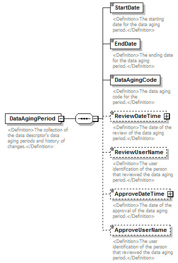 |
||
| namespace | http://water.usgs.gov/XML/NWIS/5.0 | ||
| properties |
|
||
| children | StartDate EndDate DataAgingCode ReviewDateTime ReviewUserName ApproveDateTime ApproveUserName | ||
| used by |
|
||
| annotation |
|
||
| source | <xsd:element name="DataAgingPeriod"> <xsd:annotation> <xsd:documentation> <Definition>The collection of the data descriptor's data aging periods and history of changes.</Definition> </xsd:documentation> </xsd:annotation> <xsd:complexType> <xsd:sequence> <xsd:element name="StartDate" type="xsd:date"> <xsd:annotation> <xsd:documentation> <Definition>The starting date for the data aging period.</Definition> </xsd:documentation> </xsd:annotation> </xsd:element> <xsd:element name="EndDate" type="xsd:date"> <xsd:annotation> <xsd:documentation> <Definition>The ending date for the data aging period.</Definition> </xsd:documentation> </xsd:annotation> </xsd:element> <xsd:element name="DataAgingCode" type="xsd:string"> <xsd:annotation> <xsd:documentation> <Definition>The data aging code for the period.</Definition> </xsd:documentation> </xsd:annotation> </xsd:element> <xsd:element name="ReviewDateTime" type="DateTimeWithDatum" minOccurs="0"> <xsd:annotation> <xsd:documentation> <Definition>The date of the review of the data aging period.</Definition> </xsd:documentation> </xsd:annotation> </xsd:element> <xsd:element name="ReviewUserName" type="xsd:string" minOccurs="0"> <xsd:annotation> <xsd:documentation> <Definition>The user identification of the person that reviewed the data aging period.</Definition> </xsd:documentation> </xsd:annotation> </xsd:element> <xsd:element name="ApproveDateTime" type="DateTimeWithDatum" minOccurs="0"> <xsd:annotation> <xsd:documentation> <Definition>The date of the approval of the data aging period.</Definition> </xsd:documentation> </xsd:annotation> </xsd:element> <xsd:element name="ApproveUserName" type="xsd:string" minOccurs="0"> <xsd:annotation> <xsd:documentation> <Definition>The user identification of the person that reviewed the data aging period.</Definition> </xsd:documentation> </xsd:annotation> </xsd:element> </xsd:sequence> </xsd:complexType> </xsd:element> |
element DataAgingPeriod/StartDate
| diagram | 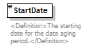 |
||||
| namespace | http://water.usgs.gov/XML/NWIS/5.0 | ||||
| type | xsd:date | ||||
| properties |
|
||||
| annotation |
|
||||
| source | <xsd:element name="StartDate" type="xsd:date"> <xsd:annotation> <xsd:documentation> <Definition>The starting date for the data aging period.</Definition> </xsd:documentation> </xsd:annotation> </xsd:element> |
element DataAgingPeriod/EndDate
| diagram | 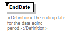 |
||||
| namespace | http://water.usgs.gov/XML/NWIS/5.0 | ||||
| type | xsd:date | ||||
| properties |
|
||||
| annotation |
|
||||
| source | <xsd:element name="EndDate" type="xsd:date"> <xsd:annotation> <xsd:documentation> <Definition>The ending date for the data aging period.</Definition> </xsd:documentation> </xsd:annotation> </xsd:element> |
element DataAgingPeriod/DataAgingCode
| diagram | 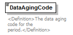 |
||||
| namespace | http://water.usgs.gov/XML/NWIS/5.0 | ||||
| type | xsd:string | ||||
| properties |
|
||||
| used by |
|
||||
| annotation |
|
||||
| source | <xsd:element name="DataAgingCode" type="xsd:string"> <xsd:annotation> <xsd:documentation> <Definition>The data aging code for the period.</Definition> </xsd:documentation> </xsd:annotation> </xsd:element> |
element DataAgingPeriod/ReviewDateTime
| diagram |  |
||||||||||||||||||||||||||||||
| namespace | http://water.usgs.gov/XML/NWIS/5.0 | ||||||||||||||||||||||||||||||
| type | DateTimeWithDatum | ||||||||||||||||||||||||||||||
| properties |
|
||||||||||||||||||||||||||||||
| attributes |
|
||||||||||||||||||||||||||||||
| annotation |
|
||||||||||||||||||||||||||||||
| source | <xsd:element name="ReviewDateTime" type="DateTimeWithDatum" minOccurs="0"> <xsd:annotation> <xsd:documentation> <Definition>The date of the review of the data aging period.</Definition> </xsd:documentation> </xsd:annotation> </xsd:element> |
element DataAgingPeriod/ReviewUserName
| diagram | 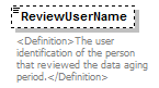 |
||||||||
| namespace | http://water.usgs.gov/XML/NWIS/5.0 | ||||||||
| type | xsd:string | ||||||||
| properties |
|
||||||||
| annotation |
|
||||||||
| source | <xsd:element name="ReviewUserName" type="xsd:string" minOccurs="0"> <xsd:annotation> <xsd:documentation> <Definition>The user identification of the person that reviewed the data aging period.</Definition> </xsd:documentation> </xsd:annotation> </xsd:element> |
element DataAgingPeriod/ApproveDateTime
| diagram |  |
||||||||||||||||||||||||||||||
| namespace | http://water.usgs.gov/XML/NWIS/5.0 | ||||||||||||||||||||||||||||||
| type | DateTimeWithDatum | ||||||||||||||||||||||||||||||
| properties |
|
||||||||||||||||||||||||||||||
| attributes |
|
||||||||||||||||||||||||||||||
| annotation |
|
||||||||||||||||||||||||||||||
| source | <xsd:element name="ApproveDateTime" type="DateTimeWithDatum" minOccurs="0"> <xsd:annotation> <xsd:documentation> <Definition>The date of the approval of the data aging period.</Definition> </xsd:documentation> </xsd:annotation> </xsd:element> |
element DataAgingPeriod/ApproveUserName
| diagram |  |
||||||||
| namespace | http://water.usgs.gov/XML/NWIS/5.0 | ||||||||
| type | xsd:string | ||||||||
| properties |
|
||||||||
| annotation |
|
||||||||
| source | <xsd:element name="ApproveUserName" type="xsd:string" minOccurs="0"> <xsd:annotation> <xsd:documentation> <Definition>The user identification of the person that reviewed the data aging period.</Definition> </xsd:documentation> </xsd:annotation> </xsd:element> |
element DataAgingHistory
| diagram | 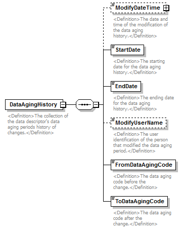 |
||
| namespace | http://water.usgs.gov/XML/NWIS/5.0 | ||
| properties |
|
||
| children | ModifyDateTime StartDate EndDate ModifyUserName FromDataAgingCode ToDataAgingCode | ||
| used by |
|
||
| annotation |
|
||
| source | <xsd:element name="DataAgingHistory"> <xsd:annotation> <xsd:documentation> <Definition>The collection of the data descriptor's data aging periods history of changes.</Definition> </xsd:documentation> </xsd:annotation> <xsd:complexType> <xsd:sequence> <xsd:element name="ModifyDateTime" type="DateTimeWithDatum" minOccurs="0"> <xsd:annotation> <xsd:documentation> <Definition>The date and time of the modification of the data aging history.</Definition> </xsd:documentation> </xsd:annotation> </xsd:element> <xsd:element name="StartDate" type="xsd:date"> <xsd:annotation> <xsd:documentation> <Definition>The starting date for the data aging history.</Definition> </xsd:documentation> </xsd:annotation> </xsd:element> <xsd:element name="EndDate" type="xsd:date"> <xsd:annotation> <xsd:documentation> <Definition>The ending date for the data aging history.</Definition> </xsd:documentation> </xsd:annotation> </xsd:element> <xsd:element name="ModifyUserName" type="xsd:string" minOccurs="0"> <xsd:annotation> <xsd:documentation> <Definition>The user identification of the person that modified the data aging period.</Definition> </xsd:documentation> </xsd:annotation> </xsd:element> <xsd:element name="FromDataAgingCode" type="xsd:string"> <xsd:annotation> <xsd:documentation> <Definition>The data aging code before the change.</Definition> </xsd:documentation> </xsd:annotation> </xsd:element> <xsd:element name="ToDataAgingCode" type="xsd:string"> <xsd:annotation> <xsd:documentation> <Definition>The data aging code after the change.</Definition> </xsd:documentation> </xsd:annotation> </xsd:element> </xsd:sequence> </xsd:complexType> </xsd:element> |
element DataAgingHistory/ModifyDateTime
| diagram |  |
||||||||||||||||||||||||||||||
| namespace | http://water.usgs.gov/XML/NWIS/5.0 | ||||||||||||||||||||||||||||||
| type | DateTimeWithDatum | ||||||||||||||||||||||||||||||
| properties |
|
||||||||||||||||||||||||||||||
| attributes |
|
||||||||||||||||||||||||||||||
| annotation |
|
||||||||||||||||||||||||||||||
| source | <xsd:element name="ModifyDateTime" type="DateTimeWithDatum" minOccurs="0"> <xsd:annotation> <xsd:documentation> <Definition>The date and time of the modification of the data aging history.</Definition> </xsd:documentation> </xsd:annotation> </xsd:element> |
element DataAgingHistory/StartDate
| diagram |  |
||||
| namespace | http://water.usgs.gov/XML/NWIS/5.0 | ||||
| type | xsd:date | ||||
| properties |
|
||||
| annotation |
|
||||
| source | <xsd:element name="StartDate" type="xsd:date"> <xsd:annotation> <xsd:documentation> <Definition>The starting date for the data aging history.</Definition> </xsd:documentation> </xsd:annotation> </xsd:element> |
element DataAgingHistory/EndDate
| diagram |  |
||||
| namespace | http://water.usgs.gov/XML/NWIS/5.0 | ||||
| type | xsd:date | ||||
| properties |
|
||||
| annotation |
|
||||
| source | <xsd:element name="EndDate" type="xsd:date"> <xsd:annotation> <xsd:documentation> <Definition>The ending date for the data aging history.</Definition> </xsd:documentation> </xsd:annotation> </xsd:element> |
element DataAgingHistory/ModifyUserName
| diagram |  |
||||||||
| namespace | http://water.usgs.gov/XML/NWIS/5.0 | ||||||||
| type | xsd:string | ||||||||
| properties |
|
||||||||
| annotation |
|
||||||||
| source | <xsd:element name="ModifyUserName" type="xsd:string" minOccurs="0"> <xsd:annotation> <xsd:documentation> <Definition>The user identification of the person that modified the data aging period.</Definition> </xsd:documentation> </xsd:annotation> </xsd:element> |
element DataAgingHistory/FromDataAgingCode
| diagram |  |
||||
| namespace | http://water.usgs.gov/XML/NWIS/5.0 | ||||
| type | xsd:string | ||||
| properties |
|
||||
| annotation |
|
||||
| source | <xsd:element name="FromDataAgingCode" type="xsd:string"> <xsd:annotation> <xsd:documentation> <Definition>The data aging code before the change.</Definition> </xsd:documentation> </xsd:annotation> </xsd:element> |
element DataAgingHistory/ToDataAgingCode
| diagram | 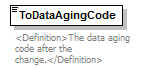 |
||||
| namespace | http://water.usgs.gov/XML/NWIS/5.0 | ||||
| type | xsd:string | ||||
| properties |
|
||||
| annotation |
|
||||
| source | <xsd:element name="ToDataAgingCode" type="xsd:string"> <xsd:annotation> <xsd:documentation> <Definition>The data aging code after the change.</Definition> </xsd:documentation> </xsd:annotation> </xsd:element> |
element StatisticalSummaryMonthly
| diagram | 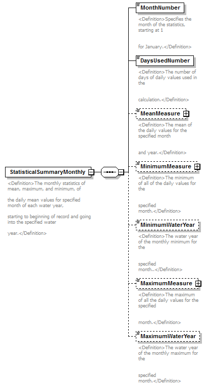 |
||
| namespace | http://water.usgs.gov/XML/NWIS/5.0 | ||
| properties |
|
||
| children | MonthNumber DaysUsedNumber MeanMeasure MinimumMeasure MinimumWaterYear MaximumMeasure MaximumWaterYear | ||
| used by |
|
||
| annotation |
|
||
| source | <xsd:element name="StatisticalSummaryMonthly"> <xsd:annotation> <xsd:documentation> <Definition>The monthly statistics of mean, maximum, and minimum, of the daily mean values for specified month of each water year, starting to beginning of record and going into the specified water year.</Definition> </xsd:documentation> </xsd:annotation> <xsd:complexType> <xsd:sequence> <xsd:element name="MonthNumber"> <xsd:annotation> <xsd:documentation> <Definition>Specifies the month of the statistics, starting at 1 for January.</Definition> </xsd:documentation> </xsd:annotation> <xsd:simpleType> <xsd:restriction base="xsd:NMTOKEN"> <xsd:enumeration value="1"/> <xsd:enumeration value="2"/> <xsd:enumeration value="3"/> <xsd:enumeration value="4"/> <xsd:enumeration value="5"/> <xsd:enumeration value="6"/> <xsd:enumeration value="7"/> <xsd:enumeration value="8"/> <xsd:enumeration value="9"/> <xsd:enumeration value="10"/> <xsd:enumeration value="11"/> <xsd:enumeration value="12"/> </xsd:restriction> </xsd:simpleType> </xsd:element> <xsd:element name="DaysUsedNumber" type="xsd:integer"> <xsd:annotation> <xsd:documentation> <Definition>The number of days of daily values used in the calculation.</Definition> </xsd:documentation> </xsd:annotation> </xsd:element> <xsd:element name="MeanMeasure" type="IEEE754FloatValueType" minOccurs="0"> <xsd:annotation> <xsd:documentation> <Definition>The mean of the daily values for the specified month and year.</Definition> </xsd:documentation> </xsd:annotation> </xsd:element> <xsd:element name="MinimumMeasure" type="IEEE754FloatValueType" minOccurs="0"> <xsd:annotation> <xsd:documentation> <Definition>The minimum of all of the daily values for the specified month.</Definition> </xsd:documentation> </xsd:annotation> </xsd:element> <xsd:element name="MinimumWaterYear" type="xsd:integer" minOccurs="0"> <xsd:annotation> <xsd:documentation> <Definition>The water year of the monthly minimum for the specified month..</Definition> </xsd:documentation> </xsd:annotation> </xsd:element> <xsd:element name="MaximumMeasure" type="IEEE754FloatValueType" minOccurs="0"> <xsd:annotation> <xsd:documentation> <Definition>The maximum of all the daily values for the specified month.</Definition> </xsd:documentation> </xsd:annotation> </xsd:element> <xsd:element name="MaximumWaterYear" type="xsd:integer" minOccurs="0"> <xsd:annotation> <xsd:documentation> <Definition>The water year of the monthly maximum for the specified month.</Definition> </xsd:documentation> </xsd:annotation> </xsd:element> </xsd:sequence> </xsd:complexType> </xsd:element> |
element StatisticalSummaryMonthly/MonthNumber
| diagram | 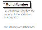 |
|||||||||||||||||||||||||||||||||||||||
| namespace | http://water.usgs.gov/XML/NWIS/5.0 | |||||||||||||||||||||||||||||||||||||||
| type | restriction of xsd:NMTOKEN | |||||||||||||||||||||||||||||||||||||||
| properties |
|
|||||||||||||||||||||||||||||||||||||||
| facets |
|
|||||||||||||||||||||||||||||||||||||||
| annotation |
|
|||||||||||||||||||||||||||||||||||||||
| source | <xsd:element name="MonthNumber"> <xsd:annotation> <xsd:documentation> <Definition>Specifies the month of the statistics, starting at 1 for January.</Definition> </xsd:documentation> </xsd:annotation> <xsd:simpleType> <xsd:restriction base="xsd:NMTOKEN"> <xsd:enumeration value="1"/> <xsd:enumeration value="2"/> <xsd:enumeration value="3"/> <xsd:enumeration value="4"/> <xsd:enumeration value="5"/> <xsd:enumeration value="6"/> <xsd:enumeration value="7"/> <xsd:enumeration value="8"/> <xsd:enumeration value="9"/> <xsd:enumeration value="10"/> <xsd:enumeration value="11"/> <xsd:enumeration value="12"/> </xsd:restriction> </xsd:simpleType> </xsd:element> |
element StatisticalSummaryMonthly/DaysUsedNumber
| diagram |  |
||||
| namespace | http://water.usgs.gov/XML/NWIS/5.0 | ||||
| type | xsd:integer | ||||
| properties |
|
||||
| annotation |
|
||||
| source | <xsd:element name="DaysUsedNumber" type="xsd:integer"> <xsd:annotation> <xsd:documentation> <Definition>The number of days of daily values used in the calculation.</Definition> </xsd:documentation> </xsd:annotation> </xsd:element> |
element StatisticalSummaryMonthly/MeanMeasure
| diagram | 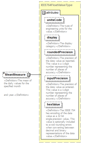 |
||||||||||||||||||||||||||||||||||||||||||||||
| namespace | http://water.usgs.gov/XML/NWIS/5.0 | ||||||||||||||||||||||||||||||||||||||||||||||
| type | IEEE754FloatValueType | ||||||||||||||||||||||||||||||||||||||||||||||
| properties |
|
||||||||||||||||||||||||||||||||||||||||||||||
| facets |
|
||||||||||||||||||||||||||||||||||||||||||||||
| attributes |
|
||||||||||||||||||||||||||||||||||||||||||||||
| annotation |
|
||||||||||||||||||||||||||||||||||||||||||||||
| source | <xsd:element name="MeanMeasure" type="IEEE754FloatValueType" minOccurs="0"> <xsd:annotation> <xsd:documentation> <Definition>The mean of the daily values for the specified month and year.</Definition> </xsd:documentation> </xsd:annotation> </xsd:element> |
element StatisticalSummaryMonthly/MinimumMeasure
| diagram | 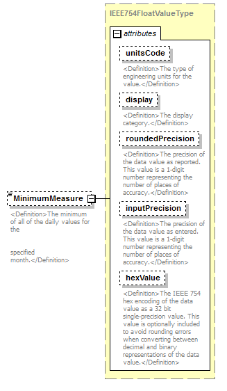 |
||||||||||||||||||||||||||||||||||||||||||||||
| namespace | http://water.usgs.gov/XML/NWIS/5.0 | ||||||||||||||||||||||||||||||||||||||||||||||
| type | IEEE754FloatValueType | ||||||||||||||||||||||||||||||||||||||||||||||
| properties |
|
||||||||||||||||||||||||||||||||||||||||||||||
| facets |
|
||||||||||||||||||||||||||||||||||||||||||||||
| attributes |
|
||||||||||||||||||||||||||||||||||||||||||||||
| annotation |
|
||||||||||||||||||||||||||||||||||||||||||||||
| source | <xsd:element name="MinimumMeasure" type="IEEE754FloatValueType" minOccurs="0"> <xsd:annotation> <xsd:documentation> <Definition>The minimum of all of the daily values for the specified month.</Definition> </xsd:documentation> </xsd:annotation> </xsd:element> |
element StatisticalSummaryMonthly/MinimumWaterYear
| diagram | 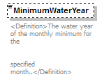 |
||||||||
| namespace | http://water.usgs.gov/XML/NWIS/5.0 | ||||||||
| type | xsd:integer | ||||||||
| properties |
|
||||||||
| annotation |
|
||||||||
| source | <xsd:element name="MinimumWaterYear" type="xsd:integer" minOccurs="0"> <xsd:annotation> <xsd:documentation> <Definition>The water year of the monthly minimum for the specified month..</Definition> </xsd:documentation> </xsd:annotation> </xsd:element> |
element StatisticalSummaryMonthly/MaximumMeasure
| diagram | 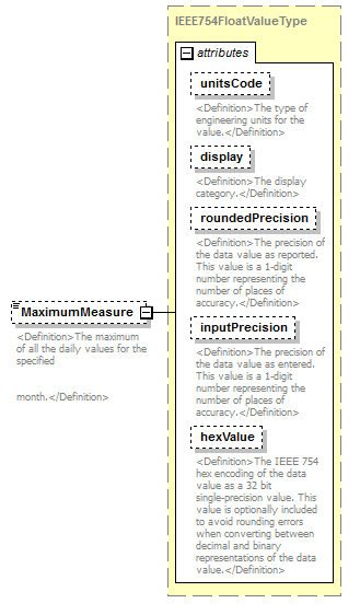 |
||||||||||||||||||||||||||||||||||||||||||||||
| namespace | http://water.usgs.gov/XML/NWIS/5.0 | ||||||||||||||||||||||||||||||||||||||||||||||
| type | IEEE754FloatValueType | ||||||||||||||||||||||||||||||||||||||||||||||
| properties |
|
||||||||||||||||||||||||||||||||||||||||||||||
| facets |
|
||||||||||||||||||||||||||||||||||||||||||||||
| attributes |
|
||||||||||||||||||||||||||||||||||||||||||||||
| annotation |
|
||||||||||||||||||||||||||||||||||||||||||||||
| source | <xsd:element name="MaximumMeasure" type="IEEE754FloatValueType" minOccurs="0"> <xsd:annotation> <xsd:documentation> <Definition>The maximum of all the daily values for the specified month.</Definition> </xsd:documentation> </xsd:annotation> </xsd:element> |
element StatisticalSummaryMonthly/MaximumWaterYear
| diagram | 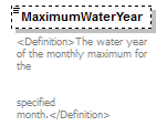 |
||||||||
| namespace | http://water.usgs.gov/XML/NWIS/5.0 | ||||||||
| type | xsd:integer | ||||||||
| properties |
|
||||||||
| annotation |
|
||||||||
| source | <xsd:element name="MaximumWaterYear" type="xsd:integer" minOccurs="0"> <xsd:annotation> <xsd:documentation> <Definition>The water year of the monthly maximum for the specified month.</Definition> </xsd:documentation> </xsd:annotation> </xsd:element> |
element StatisticalSummaryAnnual
| diagram | 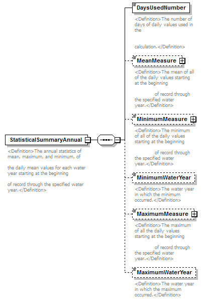 |
||
| namespace | http://water.usgs.gov/XML/NWIS/5.0 | ||
| properties |
|
||
| children | DaysUsedNumber MeanMeasure MinimumMeasure MinimumWaterYear MaximumMeasure MaximumWaterYear | ||
| used by |
|
||
| annotation |
|
||
| source | <xsd:element name="StatisticalSummaryAnnual"> <xsd:annotation> <xsd:documentation> <Definition>The annual statistics of mean, maximum, and minimum, of the daily mean values for each water year starting at the beginning of record through the specified water year.</Definition> </xsd:documentation> </xsd:annotation> <xsd:complexType> <xsd:sequence> <xsd:element name="DaysUsedNumber" type="xsd:integer"> <xsd:annotation> <xsd:documentation> <Definition>The number of days of daily values used in the calculation.</Definition> </xsd:documentation> </xsd:annotation> </xsd:element> <xsd:element name="MeanMeasure" type="IEEE754FloatValueType" minOccurs="0"> <xsd:annotation> <xsd:documentation> <Definition>The mean of all of the daily values starting at the beginning of record through the specified water year.</Definition> </xsd:documentation> </xsd:annotation> </xsd:element> <xsd:element name="MinimumMeasure" type="IEEE754FloatValueType" minOccurs="0"> <xsd:annotation> <xsd:documentation> <Definition>The minimum of all of the daily values starting at the beginning of record through the specified water year.</Definition> </xsd:documentation> </xsd:annotation> </xsd:element> <xsd:element name="MinimumWaterYear" type="xsd:positiveInteger" minOccurs="0"> <xsd:annotation> <xsd:documentation> <Definition>The water year in which the minimum occurred.</Definition> </xsd:documentation> </xsd:annotation> </xsd:element> <xsd:element name="MaximumMeasure" type="IEEE754FloatValueType" minOccurs="0"> <xsd:annotation> <xsd:documentation> <Definition>The maximum of all the daily values starting at the beginning of record through the specified water year.</Definition> </xsd:documentation> </xsd:annotation> </xsd:element> <xsd:element name="MaximumWaterYear" type="xsd:positiveInteger" minOccurs="0"> <xsd:annotation> <xsd:documentation> <Definition>The water year in which the maximum occurred.</Definition> </xsd:documentation> </xsd:annotation> </xsd:element> </xsd:sequence> </xsd:complexType> </xsd:element> |
element StatisticalSummaryAnnual/DaysUsedNumber
| diagram |  |
||||
| namespace | http://water.usgs.gov/XML/NWIS/5.0 | ||||
| type | xsd:integer | ||||
| properties |
|
||||
| annotation |
|
||||
| source | <xsd:element name="DaysUsedNumber" type="xsd:integer"> <xsd:annotation> <xsd:documentation> <Definition>The number of days of daily values used in the calculation.</Definition> </xsd:documentation> </xsd:annotation> </xsd:element> |
element StatisticalSummaryAnnual/MeanMeasure
| diagram | 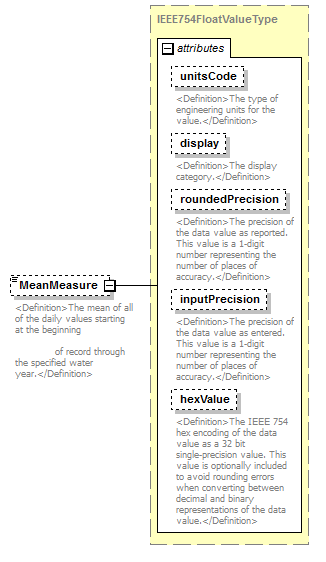 |
||||||||||||||||||||||||||||||||||||||||||||||
| namespace | http://water.usgs.gov/XML/NWIS/5.0 | ||||||||||||||||||||||||||||||||||||||||||||||
| type | IEEE754FloatValueType | ||||||||||||||||||||||||||||||||||||||||||||||
| properties |
|
||||||||||||||||||||||||||||||||||||||||||||||
| facets |
|
||||||||||||||||||||||||||||||||||||||||||||||
| attributes |
|
||||||||||||||||||||||||||||||||||||||||||||||
| annotation |
|
||||||||||||||||||||||||||||||||||||||||||||||
| source | <xsd:element name="MeanMeasure" type="IEEE754FloatValueType" minOccurs="0"> <xsd:annotation> <xsd:documentation> <Definition>The mean of all of the daily values starting at the beginning of record through the specified water year.</Definition> </xsd:documentation> </xsd:annotation> </xsd:element> |
element StatisticalSummaryAnnual/MinimumMeasure
| diagram | 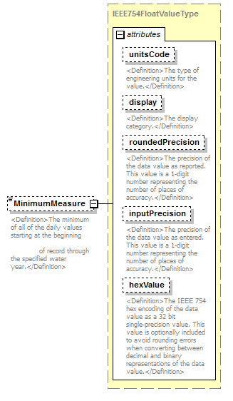 |
||||||||||||||||||||||||||||||||||||||||||||||
| namespace | http://water.usgs.gov/XML/NWIS/5.0 | ||||||||||||||||||||||||||||||||||||||||||||||
| type | IEEE754FloatValueType | ||||||||||||||||||||||||||||||||||||||||||||||
| properties |
|
||||||||||||||||||||||||||||||||||||||||||||||
| facets |
|
||||||||||||||||||||||||||||||||||||||||||||||
| attributes |
|
||||||||||||||||||||||||||||||||||||||||||||||
| annotation |
|
||||||||||||||||||||||||||||||||||||||||||||||
| source | <xsd:element name="MinimumMeasure" type="IEEE754FloatValueType" minOccurs="0"> <xsd:annotation> <xsd:documentation> <Definition>The minimum of all of the daily values starting at the beginning of record through the specified water year.</Definition> </xsd:documentation> </xsd:annotation> </xsd:element> |
element StatisticalSummaryAnnual/MinimumWaterYear
| diagram | 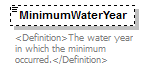 |
||||||||
| namespace | http://water.usgs.gov/XML/NWIS/5.0 | ||||||||
| type | xsd:positiveInteger | ||||||||
| properties |
|
||||||||
| annotation |
|
||||||||
| source | <xsd:element name="MinimumWaterYear" type="xsd:positiveInteger" minOccurs="0"> <xsd:annotation> <xsd:documentation> <Definition>The water year in which the minimum occurred.</Definition> </xsd:documentation> </xsd:annotation> </xsd:element> |
element StatisticalSummaryAnnual/MaximumMeasure
| diagram | 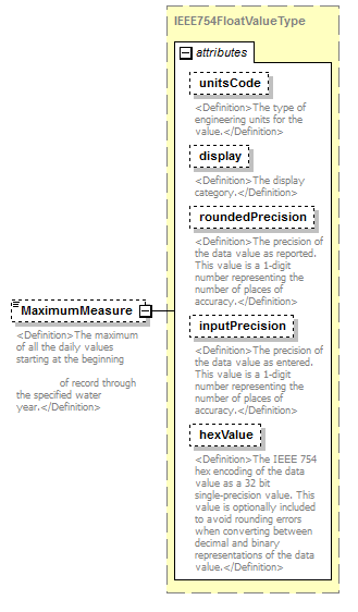 |
||||||||||||||||||||||||||||||||||||||||||||||
| namespace | http://water.usgs.gov/XML/NWIS/5.0 | ||||||||||||||||||||||||||||||||||||||||||||||
| type | IEEE754FloatValueType | ||||||||||||||||||||||||||||||||||||||||||||||
| properties |
|
||||||||||||||||||||||||||||||||||||||||||||||
| facets |
|
||||||||||||||||||||||||||||||||||||||||||||||
| attributes |
|
||||||||||||||||||||||||||||||||||||||||||||||
| annotation |
|
||||||||||||||||||||||||||||||||||||||||||||||
| source | <xsd:element name="MaximumMeasure" type="IEEE754FloatValueType" minOccurs="0"> <xsd:annotation> <xsd:documentation> <Definition>The maximum of all the daily values starting at the beginning of record through the specified water year.</Definition> </xsd:documentation> </xsd:annotation> </xsd:element> |
element StatisticalSummaryAnnual/MaximumWaterYear
| diagram | 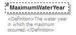 |
||||||||
| namespace | http://water.usgs.gov/XML/NWIS/5.0 | ||||||||
| type | xsd:positiveInteger | ||||||||
| properties |
|
||||||||
| annotation |
|
||||||||
| source | <xsd:element name="MaximumWaterYear" type="xsd:positiveInteger" minOccurs="0"> <xsd:annotation> <xsd:documentation> <Definition>The water year in which the maximum occurred.</Definition> </xsd:documentation> </xsd:annotation> </xsd:element> |
element StatisticalSummaryPeriod
| diagram | 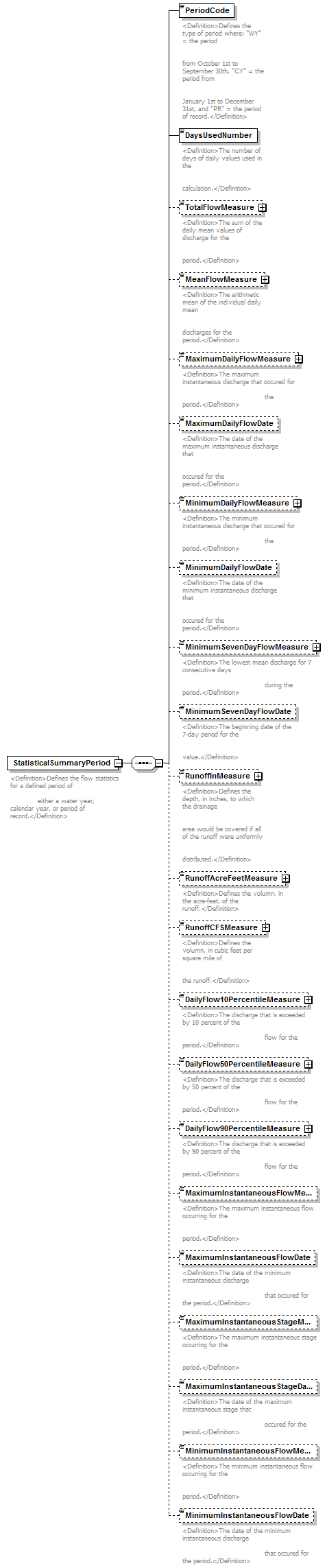 |
||
| namespace | http://water.usgs.gov/XML/NWIS/5.0 | ||
| properties |
|
||
| children | PeriodCode DaysUsedNumber TotalFlowMeasure MeanFlowMeasure MaximumDailyFlowMeasure MaximumDailyFlowDate MinimumDailyFlowMeasure MinimumDailyFlowDate MinimumSevenDayFlowMeasure MinimumSevenDayFlowDate RunoffInMeasure RunoffAcreFeetMeasure RunoffCFSMeasure DailyFlow10PercentileMeasure DailyFlow50PercentileMeasure DailyFlow90PercentileMeasure MaximumInstantaneousFlowMeasure MaximumInstantaneousFlowDate MaximumInstantaneousStageMeasure MaximumInstantaneousStageDate MinimumInstantaneousFlowMeasure MinimumInstantaneousFlowDate | ||
| used by |
|
||
| annotation |
|
||
| source | <xsd:element name="StatisticalSummaryPeriod"> <xsd:annotation> <xsd:documentation> <Definition>Defines the flow statistics for a defined period of either a water year, calendar year, or period of record.</Definition> </xsd:documentation> </xsd:annotation> <xsd:complexType> <xsd:sequence> <xsd:element name="PeriodCode"> <xsd:annotation> <xsd:documentation> <Definition>Defines the type of period where: "WY" = the period from October 1st to September 30th, "CY" = the period from January 1st to December 31st, and "PR" = the period of record.</Definition> </xsd:documentation> </xsd:annotation> <xsd:simpleType> <xsd:restriction base="xsd:NMTOKEN"> <xsd:enumeration value="WY"/> <xsd:enumeration value="CY"/> <xsd:enumeration value="PR"/> </xsd:restriction> </xsd:simpleType> </xsd:element> <xsd:element name="DaysUsedNumber" type="xsd:integer"> <xsd:annotation> <xsd:documentation> <Definition>The number of days of daily values used in the calculation.</Definition> </xsd:documentation> </xsd:annotation> </xsd:element> <xsd:element name="TotalFlowMeasure" type="IEEE754FloatValueType" minOccurs="0"> <xsd:annotation> <xsd:documentation> <Definition>The sum of the daily mean values of discharge for the period.</Definition> </xsd:documentation> </xsd:annotation> </xsd:element> <xsd:element name="MeanFlowMeasure" type="IEEE754FloatValueType" minOccurs="0"> <xsd:annotation> <xsd:documentation> <Definition>The arithmetic mean of the individual daily mean discharges for the period.</Definition> </xsd:documentation> </xsd:annotation> </xsd:element> <xsd:element name="MaximumDailyFlowMeasure" type="IEEE754FloatValueType" minOccurs="0"> <xsd:annotation> <xsd:documentation> <Definition>The maximum instantaneous discharge that occured for the period.</Definition> </xsd:documentation> </xsd:annotation> </xsd:element> <xsd:element name="MaximumDailyFlowDate" type="xsd:date" minOccurs="0"> <xsd:annotation> <xsd:documentation> <Definition>The date of the maximum instantaneous discharge that occured for the period.</Definition> </xsd:documentation> </xsd:annotation> </xsd:element> <xsd:element name="MinimumDailyFlowMeasure" type="IEEE754FloatValueType" minOccurs="0"> <xsd:annotation> <xsd:documentation> <Definition>The minimum instantaneous discharge that occured for the period.</Definition> </xsd:documentation> </xsd:annotation> </xsd:element> <xsd:element name="MinimumDailyFlowDate" type="xsd:date" minOccurs="0"> <xsd:annotation> <xsd:documentation> <Definition>The date of the minimum instantaneous discharge that occured for the period.</Definition> </xsd:documentation> </xsd:annotation> </xsd:element> <xsd:element name="MinimumSevenDayFlowMeasure" type="IEEE754FloatValueType" minOccurs="0"> <xsd:annotation> <xsd:documentation> <Definition>The lowest mean discharge for 7 consecutive days during the period.</Definition> </xsd:documentation> </xsd:annotation> </xsd:element> <xsd:element name="MinimumSevenDayFlowDate" type="xsd:date" minOccurs="0"> <xsd:annotation> <xsd:documentation> <Definition>The beginning date of the 7-day period for the value.</Definition> </xsd:documentation> </xsd:annotation> </xsd:element> <xsd:element name="RunoffInMeasure" type="IEEE754FloatValueType" minOccurs="0"> <xsd:annotation> <xsd:documentation> <Definition>Defines the depth, in inches, to which the drainage area would be covered if all of the runoff were uniformly distributed.</Definition> </xsd:documentation> </xsd:annotation> </xsd:element> <xsd:element name="RunoffAcreFeetMeasure" type="IEEE754FloatValueType" minOccurs="0"> <xsd:annotation> <xsd:documentation> <Definition>Defines the volumn, in the acre-feet, of the runoff.</Definition> </xsd:documentation> </xsd:annotation> </xsd:element> <xsd:element name="RunoffCFSMeasure" type="IEEE754FloatValueType" minOccurs="0"> <xsd:annotation> <xsd:documentation> <Definition>Defines the volumn, in cubic feet per square mile of the runoff.</Definition> </xsd:documentation> </xsd:annotation> </xsd:element> <xsd:element name="DailyFlow10PercentileMeasure" type="IEEE754FloatValueType" minOccurs="0"> <xsd:annotation> <xsd:documentation> <Definition>The discharge that is exceeded by 10 percent of the flow for the period.</Definition> </xsd:documentation> </xsd:annotation> </xsd:element> <xsd:element name="DailyFlow50PercentileMeasure" type="IEEE754FloatValueType" minOccurs="0"> <xsd:annotation> <xsd:documentation> <Definition>The discharge that is exceeded by 50 percent of the flow for the period.</Definition> </xsd:documentation> </xsd:annotation> </xsd:element> <xsd:element name="DailyFlow90PercentileMeasure" type="IEEE754FloatValueType" minOccurs="0"> <xsd:annotation> <xsd:documentation> <Definition>The discharge that is exceeded by 90 percent of the flow for the period.</Definition> </xsd:documentation> </xsd:annotation> </xsd:element> <xsd:element name="MaximumInstantaneousFlowMeasure" minOccurs="0"> <xsd:annotation> <xsd:documentation> <Definition>The maximum instantaneous flow occurring for the period.</Definition> </xsd:documentation> </xsd:annotation> </xsd:element> <xsd:element name="MaximumInstantaneousFlowDate" type="xsd:date" minOccurs="0"> <xsd:annotation> <xsd:documentation> <Definition>The date of the minimum instantaneous discharge that occured for the period.</Definition> </xsd:documentation> </xsd:annotation> </xsd:element> <xsd:element name="MaximumInstantaneousStageMeasure" minOccurs="0"> <xsd:annotation> <xsd:documentation> <Definition>The maximum instantaneous stage occurring for the period.</Definition> </xsd:documentation> </xsd:annotation> </xsd:element> <xsd:element name="MaximumInstantaneousStageDate" type="xsd:date" minOccurs="0"> <xsd:annotation> <xsd:documentation> <Definition>The date of the maximum instantaneous stage that occured for the period.</Definition> </xsd:documentation> </xsd:annotation> </xsd:element> <xsd:element name="MinimumInstantaneousFlowMeasure" minOccurs="0"> <xsd:annotation> <xsd:documentation> <Definition>The minimum instantaneous flow occurring for the period.</Definition> </xsd:documentation> </xsd:annotation> </xsd:element> <xsd:element name="MinimumInstantaneousFlowDate" type="xsd:date" minOccurs="0"> <xsd:annotation> <xsd:documentation> <Definition>The date of the minimum instantaneous discharge that occured for the period.</Definition> </xsd:documentation> </xsd:annotation> </xsd:element> </xsd:sequence> </xsd:complexType> </xsd:element> |
element StatisticalSummaryPeriod/PeriodCode
| diagram | 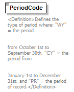 |
||||||||||||
| namespace | http://water.usgs.gov/XML/NWIS/5.0 | ||||||||||||
| type | restriction of xsd:NMTOKEN | ||||||||||||
| properties |
|
||||||||||||
| facets |
|
||||||||||||
| annotation |
|
||||||||||||
| source | <xsd:element name="PeriodCode"> <xsd:annotation> <xsd:documentation> <Definition>Defines the type of period where: "WY" = the period from October 1st to September 30th, "CY" = the period from January 1st to December 31st, and "PR" = the period of record.</Definition> </xsd:documentation> </xsd:annotation> <xsd:simpleType> <xsd:restriction base="xsd:NMTOKEN"> <xsd:enumeration value="WY"/> <xsd:enumeration value="CY"/> <xsd:enumeration value="PR"/> </xsd:restriction> </xsd:simpleType> </xsd:element> |
element StatisticalSummaryPeriod/DaysUsedNumber
| diagram | 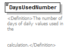 |
||||
| namespace | http://water.usgs.gov/XML/NWIS/5.0 | ||||
| type | xsd:integer | ||||
| properties |
|
||||
| annotation |
|
||||
| source | <xsd:element name="DaysUsedNumber" type="xsd:integer"> <xsd:annotation> <xsd:documentation> <Definition>The number of days of daily values used in the calculation.</Definition> </xsd:documentation> </xsd:annotation> </xsd:element> |
element StatisticalSummaryPeriod/TotalFlowMeasure
| diagram |  |
||||||||||||||||||||||||||||||||||||||||||||||
| namespace | http://water.usgs.gov/XML/NWIS/5.0 | ||||||||||||||||||||||||||||||||||||||||||||||
| type | IEEE754FloatValueType | ||||||||||||||||||||||||||||||||||||||||||||||
| properties |
|
||||||||||||||||||||||||||||||||||||||||||||||
| facets |
|
||||||||||||||||||||||||||||||||||||||||||||||
| attributes |
|
||||||||||||||||||||||||||||||||||||||||||||||
| annotation |
|
||||||||||||||||||||||||||||||||||||||||||||||
| source | <xsd:element name="TotalFlowMeasure" type="IEEE754FloatValueType" minOccurs="0"> <xsd:annotation> <xsd:documentation> <Definition>The sum of the daily mean values of discharge for the period.</Definition> </xsd:documentation> </xsd:annotation> </xsd:element> |
element StatisticalSummaryPeriod/MeanFlowMeasure
| diagram | 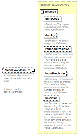 |
||||||||||||||||||||||||||||||||||||||||||||||
| namespace | http://water.usgs.gov/XML/NWIS/5.0 | ||||||||||||||||||||||||||||||||||||||||||||||
| type | IEEE754FloatValueType | ||||||||||||||||||||||||||||||||||||||||||||||
| properties |
|
||||||||||||||||||||||||||||||||||||||||||||||
| facets |
|
||||||||||||||||||||||||||||||||||||||||||||||
| attributes |
|
||||||||||||||||||||||||||||||||||||||||||||||
| annotation |
|
||||||||||||||||||||||||||||||||||||||||||||||
| source | <xsd:element name="MeanFlowMeasure" type="IEEE754FloatValueType" minOccurs="0"> <xsd:annotation> <xsd:documentation> <Definition>The arithmetic mean of the individual daily mean discharges for the period.</Definition> </xsd:documentation> </xsd:annotation> </xsd:element> |
element StatisticalSummaryPeriod/MaximumDailyFlowMeasure
| diagram |  |
||||||||||||||||||||||||||||||||||||||||||||||
| namespace | http://water.usgs.gov/XML/NWIS/5.0 | ||||||||||||||||||||||||||||||||||||||||||||||
| type | IEEE754FloatValueType | ||||||||||||||||||||||||||||||||||||||||||||||
| properties |
|
||||||||||||||||||||||||||||||||||||||||||||||
| facets |
|
||||||||||||||||||||||||||||||||||||||||||||||
| attributes |
|
||||||||||||||||||||||||||||||||||||||||||||||
| annotation |
|
||||||||||||||||||||||||||||||||||||||||||||||
| source | <xsd:element name="MaximumDailyFlowMeasure" type="IEEE754FloatValueType" minOccurs="0"> <xsd:annotation> <xsd:documentation> <Definition>The maximum instantaneous discharge that occured for the period.</Definition> </xsd:documentation> </xsd:annotation> </xsd:element> |
element StatisticalSummaryPeriod/MaximumDailyFlowDate
| diagram | 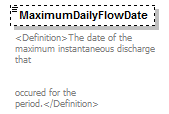 |
||||||||
| namespace | http://water.usgs.gov/XML/NWIS/5.0 | ||||||||
| type | xsd:date | ||||||||
| properties |
|
||||||||
| annotation |
|
||||||||
| source | <xsd:element name="MaximumDailyFlowDate" type="xsd:date" minOccurs="0"> <xsd:annotation> <xsd:documentation> <Definition>The date of the maximum instantaneous discharge that occured for the period.</Definition> </xsd:documentation> </xsd:annotation> </xsd:element> |
element StatisticalSummaryPeriod/MinimumDailyFlowMeasure
| diagram |  |
||||||||||||||||||||||||||||||||||||||||||||||
| namespace | http://water.usgs.gov/XML/NWIS/5.0 | ||||||||||||||||||||||||||||||||||||||||||||||
| type | IEEE754FloatValueType | ||||||||||||||||||||||||||||||||||||||||||||||
| properties |
|
||||||||||||||||||||||||||||||||||||||||||||||
| facets |
|
||||||||||||||||||||||||||||||||||||||||||||||
| attributes |
|
||||||||||||||||||||||||||||||||||||||||||||||
| annotation |
|
||||||||||||||||||||||||||||||||||||||||||||||
| source | <xsd:element name="MinimumDailyFlowMeasure" type="IEEE754FloatValueType" minOccurs="0"> <xsd:annotation> <xsd:documentation> <Definition>The minimum instantaneous discharge that occured for the period.</Definition> </xsd:documentation> </xsd:annotation> </xsd:element> |
element StatisticalSummaryPeriod/MinimumDailyFlowDate
| diagram | 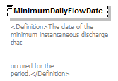 |
||||||||
| namespace | http://water.usgs.gov/XML/NWIS/5.0 | ||||||||
| type | xsd:date | ||||||||
| properties |
|
||||||||
| annotation |
|
||||||||
| source | <xsd:element name="MinimumDailyFlowDate" type="xsd:date" minOccurs="0"> <xsd:annotation> <xsd:documentation> <Definition>The date of the minimum instantaneous discharge that occured for the period.</Definition> </xsd:documentation> </xsd:annotation> </xsd:element> |
element StatisticalSummaryPeriod/MinimumSevenDayFlowMeasure
| diagram |  |
||||||||||||||||||||||||||||||||||||||||||||||
| namespace | http://water.usgs.gov/XML/NWIS/5.0 | ||||||||||||||||||||||||||||||||||||||||||||||
| type | IEEE754FloatValueType | ||||||||||||||||||||||||||||||||||||||||||||||
| properties |
|
||||||||||||||||||||||||||||||||||||||||||||||
| facets |
|
||||||||||||||||||||||||||||||||||||||||||||||
| attributes |
|
||||||||||||||||||||||||||||||||||||||||||||||
| annotation |
|
||||||||||||||||||||||||||||||||||||||||||||||
| source | <xsd:element name="MinimumSevenDayFlowMeasure" type="IEEE754FloatValueType" minOccurs="0"> <xsd:annotation> <xsd:documentation> <Definition>The lowest mean discharge for 7 consecutive days during the period.</Definition> </xsd:documentation> </xsd:annotation> </xsd:element> |
element StatisticalSummaryPeriod/MinimumSevenDayFlowDate
| diagram | 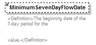 |
||||||||
| namespace | http://water.usgs.gov/XML/NWIS/5.0 | ||||||||
| type | xsd:date | ||||||||
| properties |
|
||||||||
| annotation |
|
||||||||
| source | <xsd:element name="MinimumSevenDayFlowDate" type="xsd:date" minOccurs="0"> <xsd:annotation> <xsd:documentation> <Definition>The beginning date of the 7-day period for the value.</Definition> </xsd:documentation> </xsd:annotation> </xsd:element> |
element StatisticalSummaryPeriod/RunoffInMeasure
| diagram | 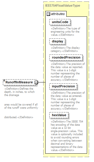 |
||||||||||||||||||||||||||||||||||||||||||||||
| namespace | http://water.usgs.gov/XML/NWIS/5.0 | ||||||||||||||||||||||||||||||||||||||||||||||
| type | IEEE754FloatValueType | ||||||||||||||||||||||||||||||||||||||||||||||
| properties |
|
||||||||||||||||||||||||||||||||||||||||||||||
| facets |
|
||||||||||||||||||||||||||||||||||||||||||||||
| attributes |
|
||||||||||||||||||||||||||||||||||||||||||||||
| annotation |
|
||||||||||||||||||||||||||||||||||||||||||||||
| source | <xsd:element name="RunoffInMeasure" type="IEEE754FloatValueType" minOccurs="0"> <xsd:annotation> <xsd:documentation> <Definition>Defines the depth, in inches, to which the drainage area would be covered if all of the runoff were uniformly distributed.</Definition> </xsd:documentation> </xsd:annotation> </xsd:element> |
element StatisticalSummaryPeriod/RunoffAcreFeetMeasure
| diagram |  |
||||||||||||||||||||||||||||||||||||||||||||||
| namespace | http://water.usgs.gov/XML/NWIS/5.0 | ||||||||||||||||||||||||||||||||||||||||||||||
| type | IEEE754FloatValueType | ||||||||||||||||||||||||||||||||||||||||||||||
| properties |
|
||||||||||||||||||||||||||||||||||||||||||||||
| facets |
|
||||||||||||||||||||||||||||||||||||||||||||||
| attributes |
|
||||||||||||||||||||||||||||||||||||||||||||||
| annotation |
|
||||||||||||||||||||||||||||||||||||||||||||||
| source | <xsd:element name="RunoffAcreFeetMeasure" type="IEEE754FloatValueType" minOccurs="0"> <xsd:annotation> <xsd:documentation> <Definition>Defines the volumn, in the acre-feet, of the runoff.</Definition> </xsd:documentation> </xsd:annotation> </xsd:element> |
element StatisticalSummaryPeriod/RunoffCFSMeasure
| diagram | 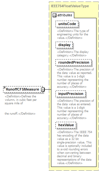 |
||||||||||||||||||||||||||||||||||||||||||||||
| namespace | http://water.usgs.gov/XML/NWIS/5.0 | ||||||||||||||||||||||||||||||||||||||||||||||
| type | IEEE754FloatValueType | ||||||||||||||||||||||||||||||||||||||||||||||
| properties |
|
||||||||||||||||||||||||||||||||||||||||||||||
| facets |
|
||||||||||||||||||||||||||||||||||||||||||||||
| attributes |
|
||||||||||||||||||||||||||||||||||||||||||||||
| annotation |
|
||||||||||||||||||||||||||||||||||||||||||||||
| source | <xsd:element name="RunoffCFSMeasure" type="IEEE754FloatValueType" minOccurs="0"> <xsd:annotation> <xsd:documentation> <Definition>Defines the volumn, in cubic feet per square mile of the runoff.</Definition> </xsd:documentation> </xsd:annotation> </xsd:element> |
element StatisticalSummaryPeriod/DailyFlow10PercentileMeasure
| diagram | 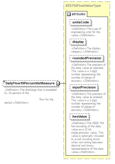 |
||||||||||||||||||||||||||||||||||||||||||||||
| namespace | http://water.usgs.gov/XML/NWIS/5.0 | ||||||||||||||||||||||||||||||||||||||||||||||
| type | IEEE754FloatValueType | ||||||||||||||||||||||||||||||||||||||||||||||
| properties |
|
||||||||||||||||||||||||||||||||||||||||||||||
| facets |
|
||||||||||||||||||||||||||||||||||||||||||||||
| attributes |
|
||||||||||||||||||||||||||||||||||||||||||||||
| annotation |
|
||||||||||||||||||||||||||||||||||||||||||||||
| source | <xsd:element name="DailyFlow10PercentileMeasure" type="IEEE754FloatValueType" minOccurs="0"> <xsd:annotation> <xsd:documentation> <Definition>The discharge that is exceeded by 10 percent of the flow for the period.</Definition> </xsd:documentation> </xsd:annotation> </xsd:element> |
element StatisticalSummaryPeriod/DailyFlow50PercentileMeasure
| diagram |  |
||||||||||||||||||||||||||||||||||||||||||||||
| namespace | http://water.usgs.gov/XML/NWIS/5.0 | ||||||||||||||||||||||||||||||||||||||||||||||
| type | IEEE754FloatValueType | ||||||||||||||||||||||||||||||||||||||||||||||
| properties |
|
||||||||||||||||||||||||||||||||||||||||||||||
| facets |
|
||||||||||||||||||||||||||||||||||||||||||||||
| attributes |
|
||||||||||||||||||||||||||||||||||||||||||||||
| annotation |
|
||||||||||||||||||||||||||||||||||||||||||||||
| source | <xsd:element name="DailyFlow50PercentileMeasure" type="IEEE754FloatValueType" minOccurs="0"> <xsd:annotation> <xsd:documentation> <Definition>The discharge that is exceeded by 50 percent of the flow for the period.</Definition> </xsd:documentation> </xsd:annotation> </xsd:element> |
element StatisticalSummaryPeriod/DailyFlow90PercentileMeasure
| diagram |  |
||||||||||||||||||||||||||||||||||||||||||||||
| namespace | http://water.usgs.gov/XML/NWIS/5.0 | ||||||||||||||||||||||||||||||||||||||||||||||
| type | IEEE754FloatValueType | ||||||||||||||||||||||||||||||||||||||||||||||
| properties |
|
||||||||||||||||||||||||||||||||||||||||||||||
| facets |
|
||||||||||||||||||||||||||||||||||||||||||||||
| attributes |
|
||||||||||||||||||||||||||||||||||||||||||||||
| annotation |
|
||||||||||||||||||||||||||||||||||||||||||||||
| source | <xsd:element name="DailyFlow90PercentileMeasure" type="IEEE754FloatValueType" minOccurs="0"> <xsd:annotation> <xsd:documentation> <Definition>The discharge that is exceeded by 90 percent of the flow for the period.</Definition> </xsd:documentation> </xsd:annotation> </xsd:element> |
element StatisticalSummaryPeriod/MaximumInstantaneousFlowMeasure
| diagram |  |
||||||
| namespace | http://water.usgs.gov/XML/NWIS/5.0 | ||||||
| properties |
|
||||||
| annotation |
|
||||||
| source | <xsd:element name="MaximumInstantaneousFlowMeasure" minOccurs="0"> <xsd:annotation> <xsd:documentation> <Definition>The maximum instantaneous flow occurring for the period.</Definition> </xsd:documentation> </xsd:annotation> </xsd:element> |
element StatisticalSummaryPeriod/MaximumInstantaneousFlowDate
| diagram |  |
||||||||
| namespace | http://water.usgs.gov/XML/NWIS/5.0 | ||||||||
| type | xsd:date | ||||||||
| properties |
|
||||||||
| annotation |
|
||||||||
| source | <xsd:element name="MaximumInstantaneousFlowDate" type="xsd:date" minOccurs="0"> <xsd:annotation> <xsd:documentation> <Definition>The date of the minimum instantaneous discharge that occured for the period.</Definition> </xsd:documentation> </xsd:annotation> </xsd:element> |
element StatisticalSummaryPeriod/MaximumInstantaneousStageMeasure
| diagram |  |
||||||
| namespace | http://water.usgs.gov/XML/NWIS/5.0 | ||||||
| properties |
|
||||||
| annotation |
|
||||||
| source | <xsd:element name="MaximumInstantaneousStageMeasure" minOccurs="0"> <xsd:annotation> <xsd:documentation> <Definition>The maximum instantaneous stage occurring for the period.</Definition> </xsd:documentation> </xsd:annotation> </xsd:element> |
element StatisticalSummaryPeriod/MaximumInstantaneousStageDate
| diagram |  |
||||||||
| namespace | http://water.usgs.gov/XML/NWIS/5.0 | ||||||||
| type | xsd:date | ||||||||
| properties |
|
||||||||
| annotation |
|
||||||||
| source | <xsd:element name="MaximumInstantaneousStageDate" type="xsd:date" minOccurs="0"> <xsd:annotation> <xsd:documentation> <Definition>The date of the maximum instantaneous stage that occured for the period.</Definition> </xsd:documentation> </xsd:annotation> </xsd:element> |
element StatisticalSummaryPeriod/MinimumInstantaneousFlowMeasure
| diagram |  |
||||||
| namespace | http://water.usgs.gov/XML/NWIS/5.0 | ||||||
| properties |
|
||||||
| annotation |
|
||||||
| source | <xsd:element name="MinimumInstantaneousFlowMeasure" minOccurs="0"> <xsd:annotation> <xsd:documentation> <Definition>The minimum instantaneous flow occurring for the period.</Definition> </xsd:documentation> </xsd:annotation> </xsd:element> |
element StatisticalSummaryPeriod/MinimumInstantaneousFlowDate
| diagram | 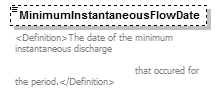 |
||||||||
| namespace | http://water.usgs.gov/XML/NWIS/5.0 | ||||||||
| type | xsd:date | ||||||||
| properties |
|
||||||||
| annotation |
|
||||||||
| source | <xsd:element name="MinimumInstantaneousFlowDate" type="xsd:date" minOccurs="0"> <xsd:annotation> <xsd:documentation> <Definition>The date of the minimum instantaneous discharge that occured for the period.</Definition> </xsd:documentation> </xsd:annotation> </xsd:element> |
element MidSectionStation
| diagram | 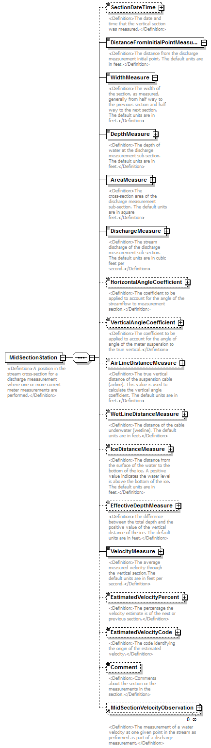 |
||
| namespace | http://water.usgs.gov/XML/NWIS/5.0 | ||
| properties |
|
||
| children | SectionDateTime DistanceFromInitialPointMeasure WidthMeasure DepthMeasure AreaMeasure DischargeMeasure HorizontalAngleCoefficient VerticalAngleCoefficient AirLineDistanceMeasure WetLineDistanceMeasure IceDistanceMeasure EffectiveDepthMeasure VelocityMeasure EstimatedVelocityPercent EstimatedVelocityCode Comment MidSectionVelocityObservation | ||
| used by |
|
||
| annotation |
|
||
| source | <xsd:element name="MidSectionStation"> <xsd:annotation> <xsd:documentation> <Definition>A position in the stream cross-section for a discharge meaasurement where one or more current meter measurements are performed.</Definition> </xsd:documentation> </xsd:annotation> <xsd:complexType> <xsd:sequence> <xsd:element name="SectionDateTime" type="DateTimeWithDatum" minOccurs="0"> <xsd:annotation> <xsd:documentation> <Definition>The date and time that the vertical section was measured.</Definition> </xsd:documentation> </xsd:annotation> </xsd:element> <xsd:element name="DistanceFromInitialPointMeasure" type="IEEE754UncertaintyFloatValueType"> <xsd:annotation> <xsd:documentation> <Definition>The distance from the discharge measurement initial point. The default units are in feet.</Definition> </xsd:documentation> </xsd:annotation> </xsd:element> <xsd:element name="WidthMeasure" type="IEEE754UncertaintyFloatValueType"> <xsd:annotation> <xsd:documentation> <Definition>The width of the section, as measured, generally from half way to the previous section and half way to the next section. The default units are in feet.</Definition> </xsd:documentation> </xsd:annotation> </xsd:element> <xsd:element name="DepthMeasure" type="IEEE754UncertaintyFloatValueType"> <xsd:annotation> <xsd:documentation> <Definition>The depth of water at the discharge measurement sub-section. The default units are in feet.</Definition> </xsd:documentation> </xsd:annotation> </xsd:element> <xsd:element name="AreaMeasure" type="IEEE754UncertaintyFloatValueType"> <xsd:annotation> <xsd:documentation> <Definition>The cross-section area of the discharge measurement sub-section. The default units are in square feet.</Definition> </xsd:documentation> </xsd:annotation> </xsd:element> <xsd:element name="DischargeMeasure" type="IEEE754UncertaintyFloatValueType"> <xsd:annotation> <xsd:documentation> <Definition>The stream discharge of the discharge measurement sub-section. The default units are in cubic feet per second.</Definition> </xsd:documentation> </xsd:annotation> </xsd:element> <xsd:element name="HorizontalAngleCoefficient" type="IEEE754UncertaintyFloatValueType" minOccurs="0"> <xsd:annotation> <xsd:documentation> <Definition>The coefficient to be applied to account for the angle of the streamflow to measurement section.</Definition> </xsd:documentation> </xsd:annotation> </xsd:element> <xsd:element name="VerticalAngleCoefficient" type="IEEE754UncertaintyFloatValueType" minOccurs="0"> <xsd:annotation> <xsd:documentation> <Definition>The coefficient to be applied to account for the angle of angle of the meter suspension to the true vertical.</Definition> </xsd:documentation> </xsd:annotation> </xsd:element> <xsd:element name="AirLineDistanceMeasure" type="IEEE754UncertaintyFloatValueType" minOccurs="0"> <xsd:annotation> <xsd:documentation> <Definition>The true vertical distance of the suspension cable (airline). This value is used to calculate the vertical angle coefficient. The default units are in feet.</Definition> </xsd:documentation> </xsd:annotation> </xsd:element> <xsd:element name="WetLineDistanceMeasure" type="IEEE754UncertaintyFloatValueType" minOccurs="0"> <xsd:annotation> <xsd:documentation> <Definition>The distance of the cable underwater (wetline). The default units are in feet.</Definition> </xsd:documentation> </xsd:annotation> </xsd:element> <xsd:element name="IceDistanceMeasure" type="IEEE754UncertaintyFloatValueType" minOccurs="0"> <xsd:annotation> <xsd:documentation> <Definition>The distance from the surface of the water to the bottom of the ice. A positive value indicates the water level is above the bottom of the ice. The default units are in feet.</Definition> </xsd:documentation> </xsd:annotation> </xsd:element> <xsd:element name="EffectiveDepthMeasure" type="IEEE754UncertaintyFloatValueType" minOccurs="0"> <xsd:annotation> <xsd:documentation> <Definition>The difference between the total depth and the positive value of the vertical distance of the ice. The default units are in feet.</Definition> </xsd:documentation> </xsd:annotation> </xsd:element> <xsd:element name="VelocityMeasure" type="IEEE754UncertaintyFloatValueType"> <xsd:annotation> <xsd:documentation> <Definition>The average measured velocity through the vertical section.The default units are in feet per second.</Definition> </xsd:documentation> </xsd:annotation> </xsd:element> <xsd:element name="EstimatedVelocityPercent" type="IEEE754FloatValueType" minOccurs="0"> <xsd:annotation> <xsd:documentation> <Definition>The percentage the velocity estimate is of the next or previous section.</Definition> </xsd:documentation> </xsd:annotation> </xsd:element> <xsd:element name="EstimatedVelocityCode" type="ReferenceListCodeType" minOccurs="0"> <xsd:annotation> <xsd:documentation> <Definition>The code identifying the origin of the estimated velocity.</Definition> </xsd:documentation> </xsd:annotation> </xsd:element> <xsd:element name="Comment" type="xsd:string" minOccurs="0"> <xsd:annotation> <xsd:documentation> <Definition>Comments about the section or the measurements in the section.</Definition> </xsd:documentation> </xsd:annotation> </xsd:element> <xsd:element ref="MidSectionVelocityObservation" minOccurs="0" maxOccurs="unbounded"/> </xsd:sequence> </xsd:complexType> </xsd:element> |
element MidSectionStation/SectionDateTime
| diagram |  |
||||||||||||||||||||||||||||||
| namespace | http://water.usgs.gov/XML/NWIS/5.0 | ||||||||||||||||||||||||||||||
| type | DateTimeWithDatum | ||||||||||||||||||||||||||||||
| properties |
|
||||||||||||||||||||||||||||||
| attributes |
|
||||||||||||||||||||||||||||||
| annotation |
|
||||||||||||||||||||||||||||||
| source | <xsd:element name="SectionDateTime" type="DateTimeWithDatum" minOccurs="0"> <xsd:annotation> <xsd:documentation> <Definition>The date and time that the vertical section was measured.</Definition> </xsd:documentation> </xsd:annotation> </xsd:element> |
element MidSectionStation/DistanceFromInitialPointMeasure
| diagram |  |
||||||||||||||||||||||||||||||||||||||||||||||||||||||||||||||
| namespace | http://water.usgs.gov/XML/NWIS/5.0 | ||||||||||||||||||||||||||||||||||||||||||||||||||||||||||||||
| type | IEEE754UncertaintyFloatValueType | ||||||||||||||||||||||||||||||||||||||||||||||||||||||||||||||
| properties |
|
||||||||||||||||||||||||||||||||||||||||||||||||||||||||||||||
| facets |
|
||||||||||||||||||||||||||||||||||||||||||||||||||||||||||||||
| attributes |
|
||||||||||||||||||||||||||||||||||||||||||||||||||||||||||||||
| annotation |
|
||||||||||||||||||||||||||||||||||||||||||||||||||||||||||||||
| source | <xsd:element name="DistanceFromInitialPointMeasure" type="IEEE754UncertaintyFloatValueType"> <xsd:annotation> <xsd:documentation> <Definition>The distance from the discharge measurement initial point. The default units are in feet.</Definition> </xsd:documentation> </xsd:annotation> </xsd:element> |
element MidSectionStation/WidthMeasure
| diagram | 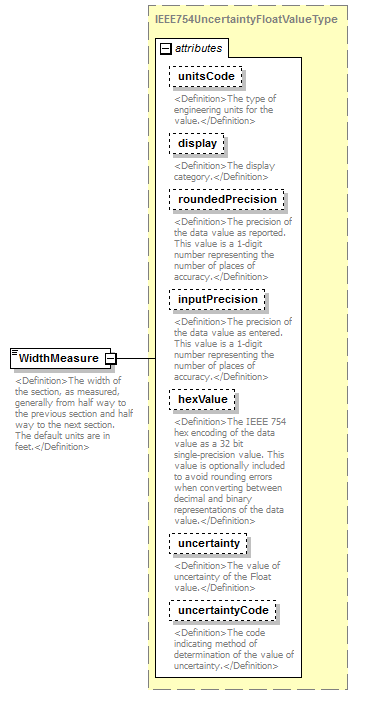 |
||||||||||||||||||||||||||||||||||||||||||||||||||||||||||||||
| namespace | http://water.usgs.gov/XML/NWIS/5.0 | ||||||||||||||||||||||||||||||||||||||||||||||||||||||||||||||
| type | IEEE754UncertaintyFloatValueType | ||||||||||||||||||||||||||||||||||||||||||||||||||||||||||||||
| properties |
|
||||||||||||||||||||||||||||||||||||||||||||||||||||||||||||||
| facets |
|
||||||||||||||||||||||||||||||||||||||||||||||||||||||||||||||
| attributes |
|
||||||||||||||||||||||||||||||||||||||||||||||||||||||||||||||
| annotation |
|
||||||||||||||||||||||||||||||||||||||||||||||||||||||||||||||
| source | <xsd:element name="WidthMeasure" type="IEEE754UncertaintyFloatValueType"> <xsd:annotation> <xsd:documentation> <Definition>The width of the section, as measured, generally from half way to the previous section and half way to the next section. The default units are in feet.</Definition> </xsd:documentation> </xsd:annotation> </xsd:element> |
element MidSectionStation/DepthMeasure
| diagram | 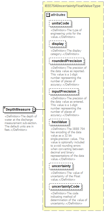 |
||||||||||||||||||||||||||||||||||||||||||||||||||||||||||||||
| namespace | http://water.usgs.gov/XML/NWIS/5.0 | ||||||||||||||||||||||||||||||||||||||||||||||||||||||||||||||
| type | IEEE754UncertaintyFloatValueType | ||||||||||||||||||||||||||||||||||||||||||||||||||||||||||||||
| properties |
|
||||||||||||||||||||||||||||||||||||||||||||||||||||||||||||||
| facets |
|
||||||||||||||||||||||||||||||||||||||||||||||||||||||||||||||
| attributes |
|
||||||||||||||||||||||||||||||||||||||||||||||||||||||||||||||
| annotation |
|
||||||||||||||||||||||||||||||||||||||||||||||||||||||||||||||
| source | <xsd:element name="DepthMeasure" type="IEEE754UncertaintyFloatValueType"> <xsd:annotation> <xsd:documentation> <Definition>The depth of water at the discharge measurement sub-section. The default units are in feet.</Definition> </xsd:documentation> </xsd:annotation> </xsd:element> |
element MidSectionStation/AreaMeasure
| diagram | 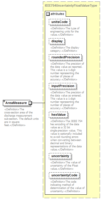 |
||||||||||||||||||||||||||||||||||||||||||||||||||||||||||||||
| namespace | http://water.usgs.gov/XML/NWIS/5.0 | ||||||||||||||||||||||||||||||||||||||||||||||||||||||||||||||
| type | IEEE754UncertaintyFloatValueType | ||||||||||||||||||||||||||||||||||||||||||||||||||||||||||||||
| properties |
|
||||||||||||||||||||||||||||||||||||||||||||||||||||||||||||||
| facets |
|
||||||||||||||||||||||||||||||||||||||||||||||||||||||||||||||
| attributes |
|
||||||||||||||||||||||||||||||||||||||||||||||||||||||||||||||
| annotation |
|
||||||||||||||||||||||||||||||||||||||||||||||||||||||||||||||
| source | <xsd:element name="AreaMeasure" type="IEEE754UncertaintyFloatValueType"> <xsd:annotation> <xsd:documentation> <Definition>The cross-section area of the discharge measurement sub-section. The default units are in square feet.</Definition> </xsd:documentation> </xsd:annotation> </xsd:element> |
element MidSectionStation/DischargeMeasure
| diagram | 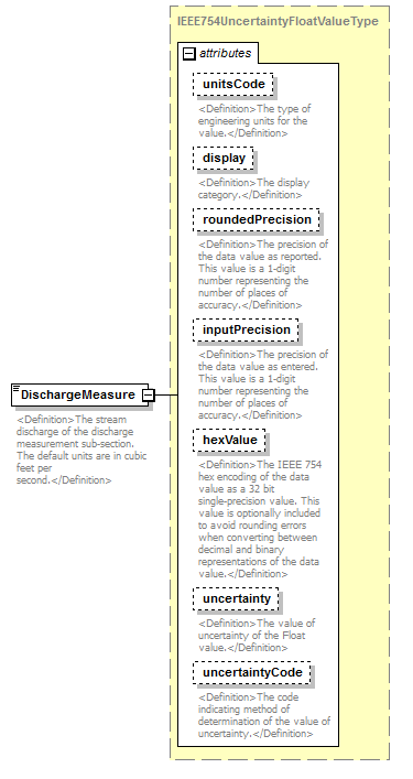 |
||||||||||||||||||||||||||||||||||||||||||||||||||||||||||||||
| namespace | http://water.usgs.gov/XML/NWIS/5.0 | ||||||||||||||||||||||||||||||||||||||||||||||||||||||||||||||
| type | IEEE754UncertaintyFloatValueType | ||||||||||||||||||||||||||||||||||||||||||||||||||||||||||||||
| properties |
|
||||||||||||||||||||||||||||||||||||||||||||||||||||||||||||||
| facets |
|
||||||||||||||||||||||||||||||||||||||||||||||||||||||||||||||
| attributes |
|
||||||||||||||||||||||||||||||||||||||||||||||||||||||||||||||
| annotation |
|
||||||||||||||||||||||||||||||||||||||||||||||||||||||||||||||
| source | <xsd:element name="DischargeMeasure" type="IEEE754UncertaintyFloatValueType"> <xsd:annotation> <xsd:documentation> <Definition>The stream discharge of the discharge measurement sub-section. The default units are in cubic feet per second.</Definition> </xsd:documentation> </xsd:annotation> </xsd:element> |
element MidSectionStation/HorizontalAngleCoefficient
| diagram | 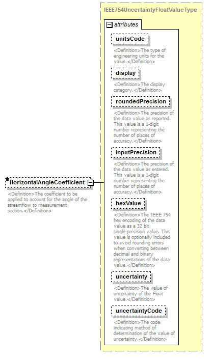 |
||||||||||||||||||||||||||||||||||||||||||||||||||||||||||||||
| namespace | http://water.usgs.gov/XML/NWIS/5.0 | ||||||||||||||||||||||||||||||||||||||||||||||||||||||||||||||
| type | IEEE754UncertaintyFloatValueType | ||||||||||||||||||||||||||||||||||||||||||||||||||||||||||||||
| properties |
|
||||||||||||||||||||||||||||||||||||||||||||||||||||||||||||||
| facets |
|
||||||||||||||||||||||||||||||||||||||||||||||||||||||||||||||
| attributes |
|
||||||||||||||||||||||||||||||||||||||||||||||||||||||||||||||
| annotation |
|
||||||||||||||||||||||||||||||||||||||||||||||||||||||||||||||
| source | <xsd:element name="HorizontalAngleCoefficient" type="IEEE754UncertaintyFloatValueType" minOccurs="0"> <xsd:annotation> <xsd:documentation> <Definition>The coefficient to be applied to account for the angle of the streamflow to measurement section.</Definition> </xsd:documentation> </xsd:annotation> </xsd:element> |
element MidSectionStation/VerticalAngleCoefficient
| diagram |  |
||||||||||||||||||||||||||||||||||||||||||||||||||||||||||||||
| namespace | http://water.usgs.gov/XML/NWIS/5.0 | ||||||||||||||||||||||||||||||||||||||||||||||||||||||||||||||
| type | IEEE754UncertaintyFloatValueType | ||||||||||||||||||||||||||||||||||||||||||||||||||||||||||||||
| properties |
|
||||||||||||||||||||||||||||||||||||||||||||||||||||||||||||||
| facets |
|
||||||||||||||||||||||||||||||||||||||||||||||||||||||||||||||
| attributes |
|
||||||||||||||||||||||||||||||||||||||||||||||||||||||||||||||
| annotation |
|
||||||||||||||||||||||||||||||||||||||||||||||||||||||||||||||
| source | <xsd:element name="VerticalAngleCoefficient" type="IEEE754UncertaintyFloatValueType" minOccurs="0"> <xsd:annotation> <xsd:documentation> <Definition>The coefficient to be applied to account for the angle of angle of the meter suspension to the true vertical.</Definition> </xsd:documentation> </xsd:annotation> </xsd:element> |
element MidSectionStation/AirLineDistanceMeasure
| diagram |  |
||||||||||||||||||||||||||||||||||||||||||||||||||||||||||||||
| namespace | http://water.usgs.gov/XML/NWIS/5.0 | ||||||||||||||||||||||||||||||||||||||||||||||||||||||||||||||
| type | IEEE754UncertaintyFloatValueType | ||||||||||||||||||||||||||||||||||||||||||||||||||||||||||||||
| properties |
|
||||||||||||||||||||||||||||||||||||||||||||||||||||||||||||||
| facets |
|
||||||||||||||||||||||||||||||||||||||||||||||||||||||||||||||
| attributes |
|
||||||||||||||||||||||||||||||||||||||||||||||||||||||||||||||
| annotation |
|
||||||||||||||||||||||||||||||||||||||||||||||||||||||||||||||
| source | <xsd:element name="AirLineDistanceMeasure" type="IEEE754UncertaintyFloatValueType" minOccurs="0"> <xsd:annotation> <xsd:documentation> <Definition>The true vertical distance of the suspension cable (airline). This value is used to calculate the vertical angle coefficient. The default units are in feet.</Definition> </xsd:documentation> </xsd:annotation> </xsd:element> |
element MidSectionStation/WetLineDistanceMeasure
| diagram | 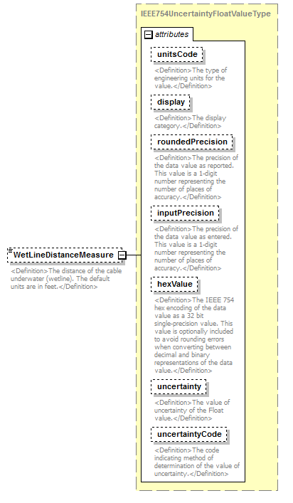 |
||||||||||||||||||||||||||||||||||||||||||||||||||||||||||||||
| namespace | http://water.usgs.gov/XML/NWIS/5.0 | ||||||||||||||||||||||||||||||||||||||||||||||||||||||||||||||
| type | IEEE754UncertaintyFloatValueType | ||||||||||||||||||||||||||||||||||||||||||||||||||||||||||||||
| properties |
|
||||||||||||||||||||||||||||||||||||||||||||||||||||||||||||||
| facets |
|
||||||||||||||||||||||||||||||||||||||||||||||||||||||||||||||
| attributes |
|
||||||||||||||||||||||||||||||||||||||||||||||||||||||||||||||
| annotation |
|
||||||||||||||||||||||||||||||||||||||||||||||||||||||||||||||
| source | <xsd:element name="WetLineDistanceMeasure" type="IEEE754UncertaintyFloatValueType" minOccurs="0"> <xsd:annotation> <xsd:documentation> <Definition>The distance of the cable underwater (wetline). The default units are in feet.</Definition> </xsd:documentation> </xsd:annotation> </xsd:element> |
element MidSectionStation/IceDistanceMeasure
| diagram | 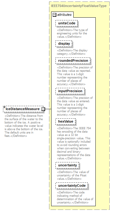 |
||||||||||||||||||||||||||||||||||||||||||||||||||||||||||||||
| namespace | http://water.usgs.gov/XML/NWIS/5.0 | ||||||||||||||||||||||||||||||||||||||||||||||||||||||||||||||
| type | IEEE754UncertaintyFloatValueType | ||||||||||||||||||||||||||||||||||||||||||||||||||||||||||||||
| properties |
|
||||||||||||||||||||||||||||||||||||||||||||||||||||||||||||||
| facets |
|
||||||||||||||||||||||||||||||||||||||||||||||||||||||||||||||
| attributes |
|
||||||||||||||||||||||||||||||||||||||||||||||||||||||||||||||
| annotation |
|
||||||||||||||||||||||||||||||||||||||||||||||||||||||||||||||
| source | <xsd:element name="IceDistanceMeasure" type="IEEE754UncertaintyFloatValueType" minOccurs="0"> <xsd:annotation> <xsd:documentation> <Definition>The distance from the surface of the water to the bottom of the ice. A positive value indicates the water level is above the bottom of the ice. The default units are in feet.</Definition> </xsd:documentation> </xsd:annotation> </xsd:element> |
element MidSectionStation/EffectiveDepthMeasure
| diagram | 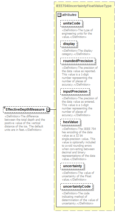 |
||||||||||||||||||||||||||||||||||||||||||||||||||||||||||||||
| namespace | http://water.usgs.gov/XML/NWIS/5.0 | ||||||||||||||||||||||||||||||||||||||||||||||||||||||||||||||
| type | IEEE754UncertaintyFloatValueType | ||||||||||||||||||||||||||||||||||||||||||||||||||||||||||||||
| properties |
|
||||||||||||||||||||||||||||||||||||||||||||||||||||||||||||||
| facets |
|
||||||||||||||||||||||||||||||||||||||||||||||||||||||||||||||
| attributes |
|
||||||||||||||||||||||||||||||||||||||||||||||||||||||||||||||
| annotation |
|
||||||||||||||||||||||||||||||||||||||||||||||||||||||||||||||
| source | <xsd:element name="EffectiveDepthMeasure" type="IEEE754UncertaintyFloatValueType" minOccurs="0"> <xsd:annotation> <xsd:documentation> <Definition>The difference between the total depth and the positive value of the vertical distance of the ice. The default units are in feet.</Definition> </xsd:documentation> </xsd:annotation> </xsd:element> |
element MidSectionStation/VelocityMeasure
| diagram | 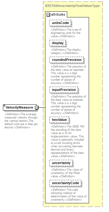 |
||||||||||||||||||||||||||||||||||||||||||||||||||||||||||||||
| namespace | http://water.usgs.gov/XML/NWIS/5.0 | ||||||||||||||||||||||||||||||||||||||||||||||||||||||||||||||
| type | IEEE754UncertaintyFloatValueType | ||||||||||||||||||||||||||||||||||||||||||||||||||||||||||||||
| properties |
|
||||||||||||||||||||||||||||||||||||||||||||||||||||||||||||||
| facets |
|
||||||||||||||||||||||||||||||||||||||||||||||||||||||||||||||
| attributes |
|
||||||||||||||||||||||||||||||||||||||||||||||||||||||||||||||
| annotation |
|
||||||||||||||||||||||||||||||||||||||||||||||||||||||||||||||
| source | <xsd:element name="VelocityMeasure" type="IEEE754UncertaintyFloatValueType"> <xsd:annotation> <xsd:documentation> <Definition>The average measured velocity through the vertical section.The default units are in feet per second.</Definition> </xsd:documentation> </xsd:annotation> </xsd:element> |
element MidSectionStation/EstimatedVelocityPercent
| diagram | 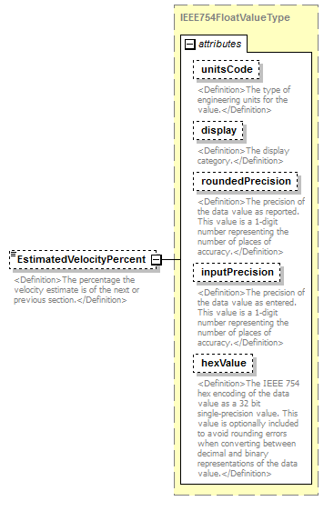 |
||||||||||||||||||||||||||||||||||||||||||||||
| namespace | http://water.usgs.gov/XML/NWIS/5.0 | ||||||||||||||||||||||||||||||||||||||||||||||
| type | IEEE754FloatValueType | ||||||||||||||||||||||||||||||||||||||||||||||
| properties |
|
||||||||||||||||||||||||||||||||||||||||||||||
| facets |
|
||||||||||||||||||||||||||||||||||||||||||||||
| attributes |
|
||||||||||||||||||||||||||||||||||||||||||||||
| annotation |
|
||||||||||||||||||||||||||||||||||||||||||||||
| source | <xsd:element name="EstimatedVelocityPercent" type="IEEE754FloatValueType" minOccurs="0"> <xsd:annotation> <xsd:documentation> <Definition>The percentage the velocity estimate is of the next or previous section.</Definition> </xsd:documentation> </xsd:annotation> </xsd:element> |
element MidSectionStation/EstimatedVelocityCode
| diagram | 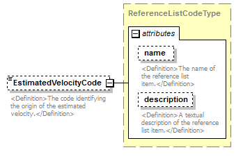 |
||||||||||||||||||||||
| namespace | http://water.usgs.gov/XML/NWIS/5.0 | ||||||||||||||||||||||
| type | ReferenceListCodeType | ||||||||||||||||||||||
| properties |
|
||||||||||||||||||||||
| attributes |
|
||||||||||||||||||||||
| annotation |
|
||||||||||||||||||||||
| source | <xsd:element name="EstimatedVelocityCode" type="ReferenceListCodeType" minOccurs="0"> <xsd:annotation> <xsd:documentation> <Definition>The code identifying the origin of the estimated velocity.</Definition> </xsd:documentation> </xsd:annotation> </xsd:element> |
element MidSectionStation/Comment
| diagram |  |
||||||||
| namespace | http://water.usgs.gov/XML/NWIS/5.0 | ||||||||
| type | xsd:string | ||||||||
| properties |
|
||||||||
| annotation |
|
||||||||
| source | <xsd:element name="Comment" type="xsd:string" minOccurs="0"> <xsd:annotation> <xsd:documentation> <Definition>Comments about the section or the measurements in the section.</Definition> </xsd:documentation> </xsd:annotation> </xsd:element> |
element VolumetricReading
| diagram | 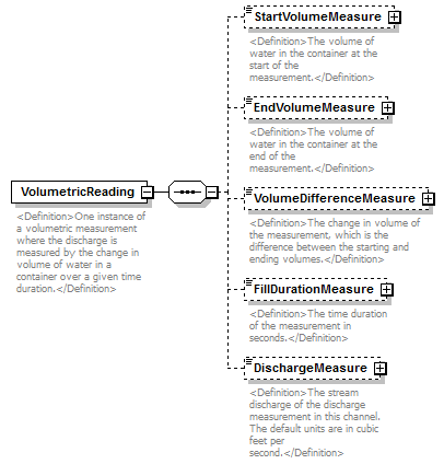 |
||
| namespace | http://water.usgs.gov/XML/NWIS/5.0 | ||
| properties |
|
||
| children | StartVolumeMeasure EndVolumeMeasure VolumeDifferenceMeasure FillDurationMeasure DischargeMeasure | ||
| used by |
|
||
| annotation |
|
||
| source | <xsd:element name="VolumetricReading"> <xsd:annotation> <xsd:documentation> <Definition>One instance of a volumetric measurement where the discharge is measured by the change in volume of water in a container over a given time duration.</Definition> </xsd:documentation> </xsd:annotation> <xsd:complexType> <xsd:sequence> <xsd:element name="StartVolumeMeasure" type="IEEE754FloatValueType" minOccurs="0"> <xsd:annotation> <xsd:documentation> <Definition>The volume of water in the container at the start of the measurement.</Definition> </xsd:documentation> </xsd:annotation> </xsd:element> <xsd:element name="EndVolumeMeasure" type="IEEE754FloatValueType" minOccurs="0"> <xsd:annotation> <xsd:documentation> <Definition>The volume of water in the container at the end of the measurement.</Definition> </xsd:documentation> </xsd:annotation> </xsd:element> <xsd:element name="VolumeDifferenceMeasure" type="IEEE754FloatValueType" minOccurs="0"> <xsd:annotation> <xsd:documentation> <Definition>The change in volume of the measurement, which is the difference between the starting and ending volumes.</Definition> </xsd:documentation> </xsd:annotation> </xsd:element> <xsd:element name="FillDurationMeasure" type="IEEE754FloatValueType" minOccurs="0"> <xsd:annotation> <xsd:documentation> <Definition>The time duration of the measurement in seconds.</Definition> </xsd:documentation> </xsd:annotation> </xsd:element> <xsd:element name="DischargeMeasure" type="IEEE754FloatValueType" minOccurs="0"> <xsd:annotation> <xsd:documentation> <Definition>The stream discharge of the discharge measurement in this channel. The default units are in cubic feet per second.</Definition> </xsd:documentation> </xsd:annotation> </xsd:element> </xsd:sequence> </xsd:complexType> </xsd:element> |
element VolumetricReading/StartVolumeMeasure
| diagram |  |
||||||||||||||||||||||||||||||||||||||||||||||
| namespace | http://water.usgs.gov/XML/NWIS/5.0 | ||||||||||||||||||||||||||||||||||||||||||||||
| type | IEEE754FloatValueType | ||||||||||||||||||||||||||||||||||||||||||||||
| properties |
|
||||||||||||||||||||||||||||||||||||||||||||||
| facets |
|
||||||||||||||||||||||||||||||||||||||||||||||
| attributes |
|
||||||||||||||||||||||||||||||||||||||||||||||
| annotation |
|
||||||||||||||||||||||||||||||||||||||||||||||
| source | <xsd:element name="StartVolumeMeasure" type="IEEE754FloatValueType" minOccurs="0"> <xsd:annotation> <xsd:documentation> <Definition>The volume of water in the container at the start of the measurement.</Definition> </xsd:documentation> </xsd:annotation> </xsd:element> |
element VolumetricReading/EndVolumeMeasure
| diagram |  |
||||||||||||||||||||||||||||||||||||||||||||||
| namespace | http://water.usgs.gov/XML/NWIS/5.0 | ||||||||||||||||||||||||||||||||||||||||||||||
| type | IEEE754FloatValueType | ||||||||||||||||||||||||||||||||||||||||||||||
| properties |
|
||||||||||||||||||||||||||||||||||||||||||||||
| facets |
|
||||||||||||||||||||||||||||||||||||||||||||||
| attributes |
|
||||||||||||||||||||||||||||||||||||||||||||||
| annotation |
|
||||||||||||||||||||||||||||||||||||||||||||||
| source | <xsd:element name="EndVolumeMeasure" type="IEEE754FloatValueType" minOccurs="0"> <xsd:annotation> <xsd:documentation> <Definition>The volume of water in the container at the end of the measurement.</Definition> </xsd:documentation> </xsd:annotation> </xsd:element> |
element VolumetricReading/VolumeDifferenceMeasure
| diagram |  |
||||||||||||||||||||||||||||||||||||||||||||||
| namespace | http://water.usgs.gov/XML/NWIS/5.0 | ||||||||||||||||||||||||||||||||||||||||||||||
| type | IEEE754FloatValueType | ||||||||||||||||||||||||||||||||||||||||||||||
| properties |
|
||||||||||||||||||||||||||||||||||||||||||||||
| facets |
|
||||||||||||||||||||||||||||||||||||||||||||||
| attributes |
|
||||||||||||||||||||||||||||||||||||||||||||||
| annotation |
|
||||||||||||||||||||||||||||||||||||||||||||||
| source | <xsd:element name="VolumeDifferenceMeasure" type="IEEE754FloatValueType" minOccurs="0"> <xsd:annotation> <xsd:documentation> <Definition>The change in volume of the measurement, which is the difference between the starting and ending volumes.</Definition> </xsd:documentation> </xsd:annotation> </xsd:element> |
element VolumetricReading/FillDurationMeasure
| diagram | 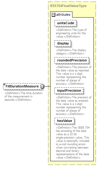 |
||||||||||||||||||||||||||||||||||||||||||||||
| namespace | http://water.usgs.gov/XML/NWIS/5.0 | ||||||||||||||||||||||||||||||||||||||||||||||
| type | IEEE754FloatValueType | ||||||||||||||||||||||||||||||||||||||||||||||
| properties |
|
||||||||||||||||||||||||||||||||||||||||||||||
| facets |
|
||||||||||||||||||||||||||||||||||||||||||||||
| attributes |
|
||||||||||||||||||||||||||||||||||||||||||||||
| annotation |
|
||||||||||||||||||||||||||||||||||||||||||||||
| source | <xsd:element name="FillDurationMeasure" type="IEEE754FloatValueType" minOccurs="0"> <xsd:annotation> <xsd:documentation> <Definition>The time duration of the measurement in seconds.</Definition> </xsd:documentation> </xsd:annotation> </xsd:element> |
element VolumetricReading/DischargeMeasure
| diagram |  |
||||||||||||||||||||||||||||||||||||||||||||||
| namespace | http://water.usgs.gov/XML/NWIS/5.0 | ||||||||||||||||||||||||||||||||||||||||||||||
| type | IEEE754FloatValueType | ||||||||||||||||||||||||||||||||||||||||||||||
| properties |
|
||||||||||||||||||||||||||||||||||||||||||||||
| facets |
|
||||||||||||||||||||||||||||||||||||||||||||||
| attributes |
|
||||||||||||||||||||||||||||||||||||||||||||||
| annotation |
|
||||||||||||||||||||||||||||||||||||||||||||||
| source | <xsd:element name="DischargeMeasure" type="IEEE754FloatValueType" minOccurs="0"> <xsd:annotation> <xsd:documentation> <Definition>The stream discharge of the discharge measurement in this channel. The default units are in cubic feet per second.</Definition> </xsd:documentation> </xsd:annotation> </xsd:element> |
element FlumeHeadMeasurement
| diagram | 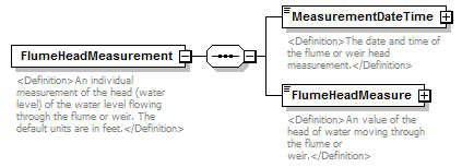 |
||
| namespace | http://water.usgs.gov/XML/NWIS/5.0 | ||
| properties |
|
||
| children | MeasurementDateTime FlumeHeadMeasure | ||
| used by |
|
||
| annotation |
|
||
| source | <xsd:element name="FlumeHeadMeasurement"> <xsd:annotation> <xsd:documentation> <Definition>An individual measurement of the head (water level) of the water level flowing through the flume or weir. The default units are in feet.</Definition> </xsd:documentation> </xsd:annotation> <xsd:complexType> <xsd:sequence> <xsd:element name="MeasurementDateTime" type="DateTimeWithDatum"> <xsd:annotation> <xsd:documentation> <Definition>The date and time of the flume or weir head measurement.</Definition> </xsd:documentation> </xsd:annotation> </xsd:element> <xsd:element name="FlumeHeadMeasure" type="IEEE754FloatValueType"> <xsd:annotation> <xsd:documentation> <Definition>An value of the head of water moving through the flume or weir.</Definition> </xsd:documentation> </xsd:annotation> </xsd:element> </xsd:sequence> </xsd:complexType> </xsd:element> |
element FlumeHeadMeasurement/MeasurementDateTime
| diagram | 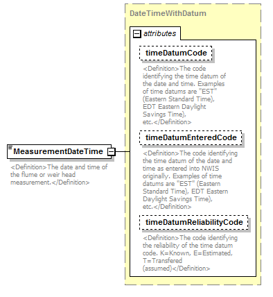 |
||||||||||||||||||||||||||||||
| namespace | http://water.usgs.gov/XML/NWIS/5.0 | ||||||||||||||||||||||||||||||
| type | DateTimeWithDatum | ||||||||||||||||||||||||||||||
| properties |
|
||||||||||||||||||||||||||||||
| attributes |
|
||||||||||||||||||||||||||||||
| annotation |
|
||||||||||||||||||||||||||||||
| source | <xsd:element name="MeasurementDateTime" type="DateTimeWithDatum"> <xsd:annotation> <xsd:documentation> <Definition>The date and time of the flume or weir head measurement.</Definition> </xsd:documentation> </xsd:annotation> </xsd:element> |
element FlumeHeadMeasurement/FlumeHeadMeasure
| diagram | 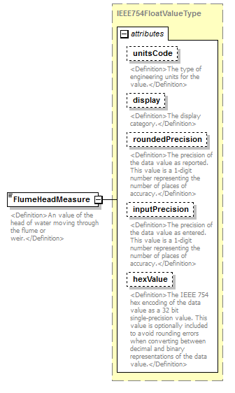 |
||||||||||||||||||||||||||||||||||||||||||||||
| namespace | http://water.usgs.gov/XML/NWIS/5.0 | ||||||||||||||||||||||||||||||||||||||||||||||
| type | IEEE754FloatValueType | ||||||||||||||||||||||||||||||||||||||||||||||
| properties |
|
||||||||||||||||||||||||||||||||||||||||||||||
| facets |
|
||||||||||||||||||||||||||||||||||||||||||||||
| attributes |
|
||||||||||||||||||||||||||||||||||||||||||||||
| annotation |
|
||||||||||||||||||||||||||||||||||||||||||||||
| source | <xsd:element name="FlumeHeadMeasure" type="IEEE754FloatValueType"> <xsd:annotation> <xsd:documentation> <Definition>An value of the head of water moving through the flume or weir.</Definition> </xsd:documentation> </xsd:annotation> </xsd:element> |
element AdcpTransect
| diagram | 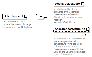 |
||
| namespace | http://water.usgs.gov/XML/NWIS/5.0 | ||
| properties |
|
||
| children | DischargeMeasure AdcpTransectAttribute | ||
| used by |
|
||
| annotation |
|
||
| source | <xsd:element name="AdcpTransect"> <xsd:annotation> <xsd:documentation> <Definition>A transect where the stream discharge was measured.</Definition> </xsd:documentation> </xsd:annotation> <xsd:complexType> <xsd:sequence> <xsd:element name="DischargeMeasure" type="IEEE754UncertaintyFloatValueType"> <xsd:annotation> <xsd:documentation> <Definition>The stream discharge of the discharge measurement sub-section. The default units are in cubic feet per second.</Definition> </xsd:documentation> </xsd:annotation> </xsd:element> <xsd:element ref="AdcpTransectAttribute" minOccurs="0" maxOccurs="unbounded"/> </xsd:sequence> </xsd:complexType> </xsd:element> |
element AdcpTransect/DischargeMeasure
| diagram |  |
||||||||||||||||||||||||||||||||||||||||||||||||||||||||||||||
| namespace | http://water.usgs.gov/XML/NWIS/5.0 | ||||||||||||||||||||||||||||||||||||||||||||||||||||||||||||||
| type | IEEE754UncertaintyFloatValueType | ||||||||||||||||||||||||||||||||||||||||||||||||||||||||||||||
| properties |
|
||||||||||||||||||||||||||||||||||||||||||||||||||||||||||||||
| facets |
|
||||||||||||||||||||||||||||||||||||||||||||||||||||||||||||||
| attributes |
|
||||||||||||||||||||||||||||||||||||||||||||||||||||||||||||||
| annotation |
|
||||||||||||||||||||||||||||||||||||||||||||||||||||||||||||||
| source | <xsd:element name="DischargeMeasure" type="IEEE754UncertaintyFloatValueType"> <xsd:annotation> <xsd:documentation> <Definition>The stream discharge of the discharge measurement sub-section. The default units are in cubic feet per second.</Definition> </xsd:documentation> </xsd:annotation> </xsd:element> |
element CrestStageGageReading
| diagram | 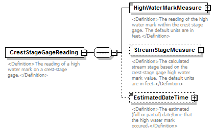 |
||
| namespace | http://water.usgs.gov/XML/NWIS/5.0 | ||
| properties |
|
||
| children | HighWaterMarkMeasure StreamStageMeasure EstimatedDateTime | ||
| used by |
|
||
| annotation |
|
||
| source | <xsd:element name="CrestStageGageReading"> <xsd:annotation> <xsd:documentation> <Definition>The reading of a high water mark on a crest-stage gage.</Definition> </xsd:documentation> </xsd:annotation> <xsd:complexType> <xsd:sequence> <xsd:element name="HighWaterMarkMeasure" type="IEEE754FloatValueType"> <xsd:annotation> <xsd:documentation> <Definition>The reading of the high water mark within the crest stage gage. The default units are in feet.</Definition> </xsd:documentation> </xsd:annotation> </xsd:element> <xsd:element name="StreamStageMeasure" type="IEEE754FloatValueType" minOccurs="0"> <xsd:annotation> <xsd:documentation> <Definition>The calculated stream stage based on the crest-stage gage high water mark value. The default units are in feet.</Definition> </xsd:documentation> </xsd:annotation> </xsd:element> <xsd:element name="EstimatedDateTime" type="DateTimeWithDatumPartial" minOccurs="0"> <xsd:annotation> <xsd:documentation> <Definition>The estimated (full or partial) date/time that the high water mark occured.</Definition> </xsd:documentation> </xsd:annotation> </xsd:element> </xsd:sequence> </xsd:complexType> </xsd:element> |
element CrestStageGageReading/HighWaterMarkMeasure
| diagram |  |
||||||||||||||||||||||||||||||||||||||||||||||
| namespace | http://water.usgs.gov/XML/NWIS/5.0 | ||||||||||||||||||||||||||||||||||||||||||||||
| type | IEEE754FloatValueType | ||||||||||||||||||||||||||||||||||||||||||||||
| properties |
|
||||||||||||||||||||||||||||||||||||||||||||||
| facets |
|
||||||||||||||||||||||||||||||||||||||||||||||
| attributes |
|
||||||||||||||||||||||||||||||||||||||||||||||
| annotation |
|
||||||||||||||||||||||||||||||||||||||||||||||
| source | <xsd:element name="HighWaterMarkMeasure" type="IEEE754FloatValueType"> <xsd:annotation> <xsd:documentation> <Definition>The reading of the high water mark within the crest stage gage. The default units are in feet.</Definition> </xsd:documentation> </xsd:annotation> </xsd:element> |
element CrestStageGageReading/StreamStageMeasure
| diagram | 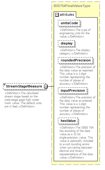 |
||||||||||||||||||||||||||||||||||||||||||||||
| namespace | http://water.usgs.gov/XML/NWIS/5.0 | ||||||||||||||||||||||||||||||||||||||||||||||
| type | IEEE754FloatValueType | ||||||||||||||||||||||||||||||||||||||||||||||
| properties |
|
||||||||||||||||||||||||||||||||||||||||||||||
| facets |
|
||||||||||||||||||||||||||||||||||||||||||||||
| attributes |
|
||||||||||||||||||||||||||||||||||||||||||||||
| annotation |
|
||||||||||||||||||||||||||||||||||||||||||||||
| source | <xsd:element name="StreamStageMeasure" type="IEEE754FloatValueType" minOccurs="0"> <xsd:annotation> <xsd:documentation> <Definition>The calculated stream stage based on the crest-stage gage high water mark value. The default units are in feet.</Definition> </xsd:documentation> </xsd:annotation> </xsd:element> |
element CrestStageGageReading/EstimatedDateTime
| diagram | 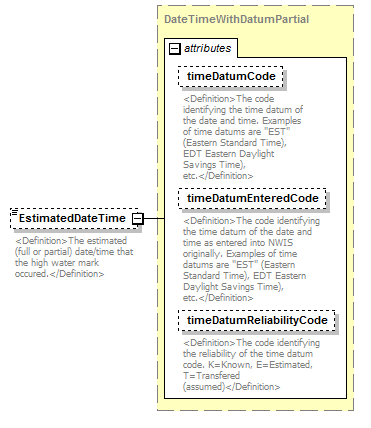 |
||||||||||||||||||||||||||||||
| namespace | http://water.usgs.gov/XML/NWIS/5.0 | ||||||||||||||||||||||||||||||
| type | DateTimeWithDatumPartial | ||||||||||||||||||||||||||||||
| properties |
|
||||||||||||||||||||||||||||||
| attributes |
|
||||||||||||||||||||||||||||||
| annotation |
|
||||||||||||||||||||||||||||||
| source | <xsd:element name="EstimatedDateTime" type="DateTimeWithDatumPartial" minOccurs="0"> <xsd:annotation> <xsd:documentation> <Definition>The estimated (full or partial) date/time that the high water mark occured.</Definition> </xsd:documentation> </xsd:annotation> </xsd:element> |
complexType CrossSectionStationReadingType
| diagram | 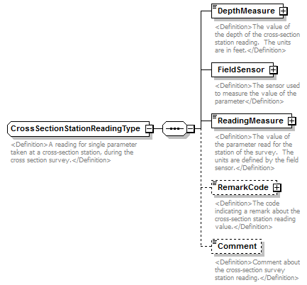 |
||
| namespace | http://water.usgs.gov/XML/NWIS/5.0 | ||
| properties |
|
||
| children | DepthMeasure FieldSensor ReadingMeasure RemarkCode Comment | ||
| used by |
|
||
| annotation |
|
||
| source | <xsd:complexType name="CrossSectionStationReadingType" abstract="false"> <xsd:annotation> <xsd:documentation> <Definition>A reading for single parameter taken at a cross-section station, during the cross section survey.</Definition> </xsd:documentation> </xsd:annotation> <xsd:sequence> <xsd:element name="DepthMeasure" type="IEEE754UncertaintyFloatValueType"> <xsd:annotation> <xsd:documentation> <Definition>The value of the depth of the cross-section station reading. The units are in feet.</Definition> </xsd:documentation> </xsd:annotation> </xsd:element> <xsd:element name="FieldSensor" type="Sensor"> <xsd:annotation> <xsd:documentation> <Definition>The sensor used to measure the value of the parameter</Definition> </xsd:documentation> </xsd:annotation> </xsd:element> <xsd:element name="ReadingMeasure" type="IEEE754UncertaintyFloatValueType"> <xsd:annotation> <xsd:documentation> <Definition>The value of the parameter read for the station of the survey. The units are defined by the field sensor.</Definition> </xsd:documentation> </xsd:annotation> </xsd:element> <xsd:element name="RemarkCode" type="ReferenceListCodeType" minOccurs="0"> <xsd:annotation> <xsd:documentation> <Definition>The code indicating a remark about the cross-section station reading value.</Definition> </xsd:documentation> </xsd:annotation> </xsd:element> <xsd:element name="Comment" type="xsd:string" minOccurs="0"> <xsd:annotation> <xsd:documentation> <Definition>Comment about the cross-section survey station reading.</Definition> </xsd:documentation> </xsd:annotation> </xsd:element> </xsd:sequence> </xsd:complexType> |
element CrossSectionStationReadingType/DepthMeasure
| diagram |  |
||||||||||||||||||||||||||||||||||||||||||||||||||||||||||||||
| namespace | http://water.usgs.gov/XML/NWIS/5.0 | ||||||||||||||||||||||||||||||||||||||||||||||||||||||||||||||
| type | IEEE754UncertaintyFloatValueType | ||||||||||||||||||||||||||||||||||||||||||||||||||||||||||||||
| properties |
|
||||||||||||||||||||||||||||||||||||||||||||||||||||||||||||||
| facets |
|
||||||||||||||||||||||||||||||||||||||||||||||||||||||||||||||
| attributes |
|
||||||||||||||||||||||||||||||||||||||||||||||||||||||||||||||
| annotation |
|
||||||||||||||||||||||||||||||||||||||||||||||||||||||||||||||
| source | <xsd:element name="DepthMeasure" type="IEEE754UncertaintyFloatValueType"> <xsd:annotation> <xsd:documentation> <Definition>The value of the depth of the cross-section station reading. The units are in feet.</Definition> </xsd:documentation> </xsd:annotation> </xsd:element> |
element CrossSectionStationReadingType/FieldSensor
| diagram | 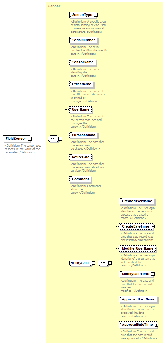 |
||||
| namespace | http://water.usgs.gov/XML/NWIS/5.0 | ||||
| type | Sensor | ||||
| properties |
|
||||
| children | SensorType SerialNumber SensorName OfficeName UserName PurchaseDate RetireDate Comment CreatorUserName CreateDateTime ModifierUserName ModifyDateTime ApproverUserName ApprovalDateTime | ||||
| annotation |
|
||||
| source | <xsd:element name="FieldSensor" type="Sensor"> <xsd:annotation> <xsd:documentation> <Definition>The sensor used to measure the value of the parameter</Definition> </xsd:documentation> </xsd:annotation> </xsd:element> |
element CrossSectionStationReadingType/ReadingMeasure
| diagram |  |
||||||||||||||||||||||||||||||||||||||||||||||||||||||||||||||
| namespace | http://water.usgs.gov/XML/NWIS/5.0 | ||||||||||||||||||||||||||||||||||||||||||||||||||||||||||||||
| type | IEEE754UncertaintyFloatValueType | ||||||||||||||||||||||||||||||||||||||||||||||||||||||||||||||
| properties |
|
||||||||||||||||||||||||||||||||||||||||||||||||||||||||||||||
| facets |
|
||||||||||||||||||||||||||||||||||||||||||||||||||||||||||||||
| attributes |
|
||||||||||||||||||||||||||||||||||||||||||||||||||||||||||||||
| annotation |
|
||||||||||||||||||||||||||||||||||||||||||||||||||||||||||||||
| source | <xsd:element name="ReadingMeasure" type="IEEE754UncertaintyFloatValueType"> <xsd:annotation> <xsd:documentation> <Definition>The value of the parameter read for the station of the survey. The units are defined by the field sensor.</Definition> </xsd:documentation> </xsd:annotation> </xsd:element> |
element CrossSectionStationReadingType/RemarkCode
| diagram |  |
||||||||||||||||||||||
| namespace | http://water.usgs.gov/XML/NWIS/5.0 | ||||||||||||||||||||||
| type | ReferenceListCodeType | ||||||||||||||||||||||
| properties |
|
||||||||||||||||||||||
| attributes |
|
||||||||||||||||||||||
| annotation |
|
||||||||||||||||||||||
| source | <xsd:element name="RemarkCode" type="ReferenceListCodeType" minOccurs="0"> <xsd:annotation> <xsd:documentation> <Definition>The code indicating a remark about the cross-section station reading value.</Definition> </xsd:documentation> </xsd:annotation> </xsd:element> |
element CrossSectionStationReadingType/Comment
| diagram |  |
||||||||
| namespace | http://water.usgs.gov/XML/NWIS/5.0 | ||||||||
| type | xsd:string | ||||||||
| properties |
|
||||||||
| annotation |
|
||||||||
| source | <xsd:element name="Comment" type="xsd:string" minOccurs="0"> <xsd:annotation> <xsd:documentation> <Definition>Comment about the cross-section survey station reading.</Definition> </xsd:documentation> </xsd:annotation> </xsd:element> |
element ExpandCode
| diagram |  |
||||||||||||
| namespace | http://water.usgs.gov/XML/NWIS/5.0 | ||||||||||||
| type | restriction of xsd:NMTOKEN | ||||||||||||
| properties |
|
||||||||||||
| used by |
|
||||||||||||
| facets |
|
||||||||||||
| annotation |
|
||||||||||||
| source | <xsd:element name="ExpandCode" default="LINR"> <xsd:annotation> <xsd:documentation> <Definition>The code that defines the type of curve.</Definition> </xsd:documentation> </xsd:annotation> <xsd:simpleType> <xsd:restriction base="xsd:NMTOKEN"> <xsd:enumeration value="LINR"/> <xsd:enumeration value="LOGX"/> <xsd:enumeration value="EQTN"/> </xsd:restriction> </xsd:simpleType> </xsd:element> |
element PointPair
| diagram | 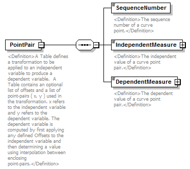 |
||
| namespace | http://water.usgs.gov/XML/NWIS/5.0 | ||
| properties |
|
||
| children | SequenceNumber IndependentMeasure DependentMeasure | ||
| used by |
|
||
| annotation |
|
||
| source | <xsd:element name="PointPair"> <xsd:annotation> <xsd:documentation> <Definition>A Table defines a transformation to be applied to an independent variable to produce a dependent variable. A Table contains an optional list of offsets and a list of point-pairs ( x, y ) used in the transformation. x refers to the independent variable and y refers to the dependent variable. The dependent variable is computed by first applying any defined Offsets to the independent variable and then determining a value using interpolation between enclosing point-pairs.</Definition> </xsd:documentation> </xsd:annotation> <xsd:complexType> <xsd:sequence> <xsd:element name="SequenceNumber" type="xsd:integer"> <xsd:annotation> <xsd:documentation> <Definition>The sequence number of a curve point.</Definition> </xsd:documentation> </xsd:annotation> </xsd:element> <xsd:element name="IndependentMeasure" type="IEEE754FloatValueType"> <xsd:annotation> <xsd:documentation> <Definition>The independent value of a curve point pair.</Definition> </xsd:documentation> </xsd:annotation> </xsd:element> <xsd:element name="DependentMeasure" type="IEEE754FloatValueType"> <xsd:annotation> <xsd:documentation> <Definition>The dependent value of a curve point pair.</Definition> </xsd:documentation> </xsd:annotation> </xsd:element> </xsd:sequence> </xsd:complexType> </xsd:element> |
element PointPair/SequenceNumber
| diagram |  |
||||
| namespace | http://water.usgs.gov/XML/NWIS/5.0 | ||||
| type | xsd:integer | ||||
| properties |
|
||||
| annotation |
|
||||
| source | <xsd:element name="SequenceNumber" type="xsd:integer"> <xsd:annotation> <xsd:documentation> <Definition>The sequence number of a curve point.</Definition> </xsd:documentation> </xsd:annotation> </xsd:element> |
element PointPair/IndependentMeasure
| diagram |  |
||||||||||||||||||||||||||||||||||||||||||||||
| namespace | http://water.usgs.gov/XML/NWIS/5.0 | ||||||||||||||||||||||||||||||||||||||||||||||
| type | IEEE754FloatValueType | ||||||||||||||||||||||||||||||||||||||||||||||
| properties |
|
||||||||||||||||||||||||||||||||||||||||||||||
| facets |
|
||||||||||||||||||||||||||||||||||||||||||||||
| attributes |
|
||||||||||||||||||||||||||||||||||||||||||||||
| annotation |
|
||||||||||||||||||||||||||||||||||||||||||||||
| source | <xsd:element name="IndependentMeasure" type="IEEE754FloatValueType"> <xsd:annotation> <xsd:documentation> <Definition>The independent value of a curve point pair.</Definition> </xsd:documentation> </xsd:annotation> </xsd:element> |
element PointPair/DependentMeasure
| diagram | 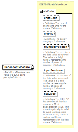 |
||||||||||||||||||||||||||||||||||||||||||||||
| namespace | http://water.usgs.gov/XML/NWIS/5.0 | ||||||||||||||||||||||||||||||||||||||||||||||
| type | IEEE754FloatValueType | ||||||||||||||||||||||||||||||||||||||||||||||
| properties |
|
||||||||||||||||||||||||||||||||||||||||||||||
| facets |
|
||||||||||||||||||||||||||||||||||||||||||||||
| attributes |
|
||||||||||||||||||||||||||||||||||||||||||||||
| annotation |
|
||||||||||||||||||||||||||||||||||||||||||||||
| source | <xsd:element name="DependentMeasure" type="IEEE754FloatValueType"> <xsd:annotation> <xsd:documentation> <Definition>The dependent value of a curve point pair.</Definition> </xsd:documentation> </xsd:annotation> </xsd:element> |
element Offset
| diagram | 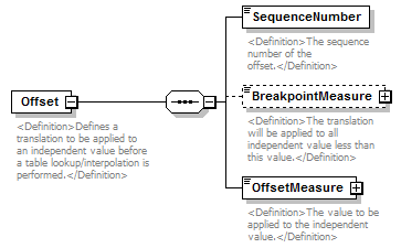 |
||
| namespace | http://water.usgs.gov/XML/NWIS/5.0 | ||
| properties |
|
||
| children | SequenceNumber BreakpointMeasure OffsetMeasure | ||
| used by |
|
||
| annotation |
|
||
| source | <xsd:element name="Offset"> <xsd:annotation> <xsd:documentation> <Definition>Defines a translation to be applied to an independent value before a table lookup/interpolation is performed.</Definition> </xsd:documentation> </xsd:annotation> <xsd:complexType> <xsd:sequence> <xsd:element name="SequenceNumber" type="xsd:integer"> <xsd:annotation> <xsd:documentation> <Definition>The sequence number of the offset.</Definition> </xsd:documentation> </xsd:annotation> </xsd:element> <xsd:element name="BreakpointMeasure" type="IEEE754FloatValueType" minOccurs="0"> <xsd:annotation> <xsd:documentation> <Definition>The translation will be applied to all independent value less than this value.</Definition> </xsd:documentation> </xsd:annotation> </xsd:element> <xsd:element name="OffsetMeasure" type="IEEE754FloatValueType"> <xsd:annotation> <xsd:documentation> <Definition>The value to be applied to the independent value.</Definition> </xsd:documentation> </xsd:annotation> </xsd:element> </xsd:sequence> </xsd:complexType> </xsd:element> |
element Offset/SequenceNumber
| diagram |  |
||||
| namespace | http://water.usgs.gov/XML/NWIS/5.0 | ||||
| type | xsd:integer | ||||
| properties |
|
||||
| annotation |
|
||||
| source | <xsd:element name="SequenceNumber" type="xsd:integer"> <xsd:annotation> <xsd:documentation> <Definition>The sequence number of the offset.</Definition> </xsd:documentation> </xsd:annotation> </xsd:element> |
element Offset/BreakpointMeasure
| diagram |  |
||||||||||||||||||||||||||||||||||||||||||||||
| namespace | http://water.usgs.gov/XML/NWIS/5.0 | ||||||||||||||||||||||||||||||||||||||||||||||
| type | IEEE754FloatValueType | ||||||||||||||||||||||||||||||||||||||||||||||
| properties |
|
||||||||||||||||||||||||||||||||||||||||||||||
| facets |
|
||||||||||||||||||||||||||||||||||||||||||||||
| attributes |
|
||||||||||||||||||||||||||||||||||||||||||||||
| annotation |
|
||||||||||||||||||||||||||||||||||||||||||||||
| source | <xsd:element name="BreakpointMeasure" type="IEEE754FloatValueType" minOccurs="0"> <xsd:annotation> <xsd:documentation> <Definition>The translation will be applied to all independent value less than this value.</Definition> </xsd:documentation> </xsd:annotation> </xsd:element> |
element Offset/OffsetMeasure
| diagram |  |
||||||||||||||||||||||||||||||||||||||||||||||
| namespace | http://water.usgs.gov/XML/NWIS/5.0 | ||||||||||||||||||||||||||||||||||||||||||||||
| type | IEEE754FloatValueType | ||||||||||||||||||||||||||||||||||||||||||||||
| properties |
|
||||||||||||||||||||||||||||||||||||||||||||||
| facets |
|
||||||||||||||||||||||||||||||||||||||||||||||
| attributes |
|
||||||||||||||||||||||||||||||||||||||||||||||
| annotation |
|
||||||||||||||||||||||||||||||||||||||||||||||
| source | <xsd:element name="OffsetMeasure" type="IEEE754FloatValueType"> <xsd:annotation> <xsd:documentation> <Definition>The value to be applied to the independent value.</Definition> </xsd:documentation> </xsd:annotation> </xsd:element> |
element StreamDefinition
| diagram | 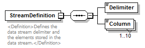 |
||||
| namespace | http://water.usgs.gov/XML/NWIS/5.0 | ||||
| properties |
|
||||
| children | Delimiter Column | ||||
| used by |
|
||||
| annotation |
|
||||
| source | <xsd:element name="StreamDefinition"> <xsd:annotation> <xsd:documentation> <Definition>Defines the data stream delimiter and the elements stored in the data stream.</Definition> </xsd:documentation> </xsd:annotation> <xsd:complexType> <xsd:sequence> <xsd:element name="Delimiter" type="string1"/> <xsd:element name="Column" type="xsd:string" maxOccurs="10"/> </xsd:sequence> </xsd:complexType> </xsd:element> |
element StreamDefinition/Delimiter
| diagram |  |
||||||
| namespace | http://water.usgs.gov/XML/NWIS/5.0 | ||||||
| type | string1 | ||||||
| properties |
|
||||||
| facets |
|
||||||
| source | <xsd:element name="Delimiter" type="string1"/> |
element StreamDefinition/Column
| diagram |  |
||||||||
| namespace | http://water.usgs.gov/XML/NWIS/5.0 | ||||||||
| type | xsd:string | ||||||||
| properties |
|
||||||||
| source | <xsd:element name="Column" type="xsd:string" maxOccurs="10"/> |
element DailyValueCode
| diagram |  |
||||
| namespace | http://water.usgs.gov/XML/NWIS/5.0 | ||||
| type | xsd:string | ||||
| properties |
|
||||
| used by |
|
||||
| annotation |
|
||||
| source | <xsd:element name="DailyValueCode" type="xsd:string" default="C"> <xsd:annotation> <xsd:documentation> <Definition>The code indicating the type of daily value.</Definition> </xsd:documentation> </xsd:annotation> </xsd:element> |
element MidSectionVelocityObservation
| diagram | 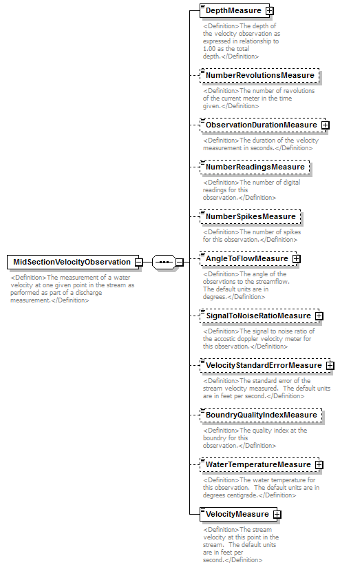 |
||
| namespace | http://water.usgs.gov/XML/NWIS/5.0 | ||
| properties |
|
||
| children | DepthMeasure NumberRevolutionsMeasure ObservationDurationMeasure NumberReadingsMeasure NumberSpikesMeasure AngleToFlowMeasure SignalToNoiseRatioMeasure VelocityStandardErrorMeasure BoundryQualityIndexMeasure WaterTemperatureMeasure VelocityMeasure | ||
| used by |
|
||
| annotation |
|
||
| source | <xsd:element name="MidSectionVelocityObservation"> <xsd:annotation> <xsd:documentation> <Definition>The measurement of a water velocity at one given point in the stream as performed as part of a discharge measurement.</Definition> </xsd:documentation> </xsd:annotation> <xsd:complexType> <xsd:sequence> <xsd:element name="DepthMeasure" type="IEEE754UncertaintyFloatValueType"> <xsd:annotation> <xsd:documentation> <Definition>The depth of the velocity observation as expressed in relationship to 1.00 as the total depth.</Definition> </xsd:documentation> </xsd:annotation> </xsd:element> <xsd:element name="NumberRevolutionsMeasure" type="xsd:nonNegativeInteger" minOccurs="0"> <xsd:annotation> <xsd:documentation> <Definition>The number of revolutions of the current meter in the time given.</Definition> </xsd:documentation> </xsd:annotation> </xsd:element> <xsd:element name="ObservationDurationMeasure" type="IEEE754FloatValueType" minOccurs="0"> <xsd:annotation> <xsd:documentation> <Definition>The duration of the velocity measurement in seconds.</Definition> </xsd:documentation> </xsd:annotation> </xsd:element> <xsd:element name="NumberReadingsMeasure" type="xsd:nonNegativeInteger" minOccurs="0"> <xsd:annotation> <xsd:documentation> <Definition>The number of digital readings for this observation.</Definition> </xsd:documentation> </xsd:annotation> </xsd:element> <xsd:element name="NumberSpikesMeasure" type="xsd:nonNegativeInteger" minOccurs="0"> <xsd:annotation> <xsd:documentation> <Definition>The number of spikes for this observation.</Definition> </xsd:documentation> </xsd:annotation> </xsd:element> <xsd:element name="AngleToFlowMeasure" type="IEEE754UncertaintyFloatValueType" minOccurs="0"> <xsd:annotation> <xsd:documentation> <Definition>The angle of the observtions to the streamflow. The default units are in degrees.</Definition> </xsd:documentation> </xsd:annotation> </xsd:element> <xsd:element name="SignalToNoiseRatioMeasure" type="IEEE754UncertaintyFloatValueType" minOccurs="0"> <xsd:annotation> <xsd:documentation> <Definition>The signal to noise ratio of the accostic doppler velocity meter for this observation.</Definition> </xsd:documentation> </xsd:annotation> </xsd:element> <xsd:element name="VelocityStandardErrorMeasure" type="IEEE754FloatValueType" minOccurs="0"> <xsd:annotation> <xsd:documentation> <Definition>The standard error of the stream velocity measured. The default units are in feet per second.</Definition> </xsd:documentation> </xsd:annotation> </xsd:element> <xsd:element name="BoundryQualityIndexMeasure" type="xsd:nonNegativeInteger" minOccurs="0"> <xsd:annotation> <xsd:documentation> <Definition>The quality index at the boundry for this observation.</Definition> </xsd:documentation> </xsd:annotation> </xsd:element> <xsd:element name="WaterTemperatureMeasure" type="IEEE754UncertaintyFloatValueType" minOccurs="0"> <xsd:annotation> <xsd:documentation> <Definition>The water temperature for this observation. The default units are in degrees centigrade.</Definition> </xsd:documentation> </xsd:annotation> </xsd:element> <xsd:element name="VelocityMeasure" type="IEEE754UncertaintyFloatValueType"> <xsd:annotation> <xsd:documentation> <Definition>The stream velocity at this point in the stream. The default units are in feet per second.</Definition> </xsd:documentation> </xsd:annotation> </xsd:element> </xsd:sequence> </xsd:complexType> </xsd:element> |
element MidSectionVelocityObservation/DepthMeasure
| diagram | 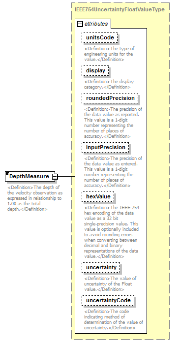 |
||||||||||||||||||||||||||||||||||||||||||||||||||||||||||||||
| namespace | http://water.usgs.gov/XML/NWIS/5.0 | ||||||||||||||||||||||||||||||||||||||||||||||||||||||||||||||
| type | IEEE754UncertaintyFloatValueType | ||||||||||||||||||||||||||||||||||||||||||||||||||||||||||||||
| properties |
|
||||||||||||||||||||||||||||||||||||||||||||||||||||||||||||||
| facets |
|
||||||||||||||||||||||||||||||||||||||||||||||||||||||||||||||
| attributes |
|
||||||||||||||||||||||||||||||||||||||||||||||||||||||||||||||
| annotation |
|
||||||||||||||||||||||||||||||||||||||||||||||||||||||||||||||
| source | <xsd:element name="DepthMeasure" type="IEEE754UncertaintyFloatValueType"> <xsd:annotation> <xsd:documentation> <Definition>The depth of the velocity observation as expressed in relationship to 1.00 as the total depth.</Definition> </xsd:documentation> </xsd:annotation> </xsd:element> |
element MidSectionVelocityObservation/NumberRevolutionsMeasure
| diagram |  |
||||||||
| namespace | http://water.usgs.gov/XML/NWIS/5.0 | ||||||||
| type | xsd:nonNegativeInteger | ||||||||
| properties |
|
||||||||
| annotation |
|
||||||||
| source | <xsd:element name="NumberRevolutionsMeasure" type="xsd:nonNegativeInteger" minOccurs="0"> <xsd:annotation> <xsd:documentation> <Definition>The number of revolutions of the current meter in the time given.</Definition> </xsd:documentation> </xsd:annotation> </xsd:element> |
element MidSectionVelocityObservation/ObservationDurationMeasure
| diagram | 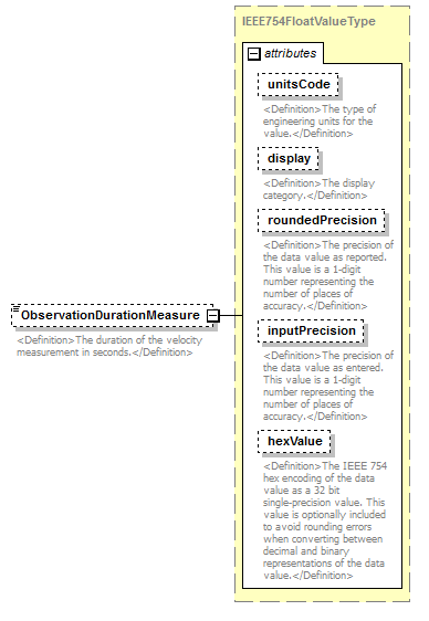 |
||||||||||||||||||||||||||||||||||||||||||||||
| namespace | http://water.usgs.gov/XML/NWIS/5.0 | ||||||||||||||||||||||||||||||||||||||||||||||
| type | IEEE754FloatValueType | ||||||||||||||||||||||||||||||||||||||||||||||
| properties |
|
||||||||||||||||||||||||||||||||||||||||||||||
| facets |
|
||||||||||||||||||||||||||||||||||||||||||||||
| attributes |
|
||||||||||||||||||||||||||||||||||||||||||||||
| annotation |
|
||||||||||||||||||||||||||||||||||||||||||||||
| source | <xsd:element name="ObservationDurationMeasure" type="IEEE754FloatValueType" minOccurs="0"> <xsd:annotation> <xsd:documentation> <Definition>The duration of the velocity measurement in seconds.</Definition> </xsd:documentation> </xsd:annotation> </xsd:element> |
element MidSectionVelocityObservation/NumberReadingsMeasure
| diagram |  |
||||||||
| namespace | http://water.usgs.gov/XML/NWIS/5.0 | ||||||||
| type | xsd:nonNegativeInteger | ||||||||
| properties |
|
||||||||
| annotation |
|
||||||||
| source | <xsd:element name="NumberReadingsMeasure" type="xsd:nonNegativeInteger" minOccurs="0"> <xsd:annotation> <xsd:documentation> <Definition>The number of digital readings for this observation.</Definition> </xsd:documentation> </xsd:annotation> </xsd:element> |
element MidSectionVelocityObservation/NumberSpikesMeasure
| diagram |  |
||||||||
| namespace | http://water.usgs.gov/XML/NWIS/5.0 | ||||||||
| type | xsd:nonNegativeInteger | ||||||||
| properties |
|
||||||||
| annotation |
|
||||||||
| source | <xsd:element name="NumberSpikesMeasure" type="xsd:nonNegativeInteger" minOccurs="0"> <xsd:annotation> <xsd:documentation> <Definition>The number of spikes for this observation.</Definition> </xsd:documentation> </xsd:annotation> </xsd:element> |
element MidSectionVelocityObservation/AngleToFlowMeasure
| diagram | 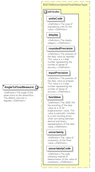 |
||||||||||||||||||||||||||||||||||||||||||||||||||||||||||||||
| namespace | http://water.usgs.gov/XML/NWIS/5.0 | ||||||||||||||||||||||||||||||||||||||||||||||||||||||||||||||
| type | IEEE754UncertaintyFloatValueType | ||||||||||||||||||||||||||||||||||||||||||||||||||||||||||||||
| properties |
|
||||||||||||||||||||||||||||||||||||||||||||||||||||||||||||||
| facets |
|
||||||||||||||||||||||||||||||||||||||||||||||||||||||||||||||
| attributes |
|
||||||||||||||||||||||||||||||||||||||||||||||||||||||||||||||
| annotation |
|
||||||||||||||||||||||||||||||||||||||||||||||||||||||||||||||
| source | <xsd:element name="AngleToFlowMeasure" type="IEEE754UncertaintyFloatValueType" minOccurs="0"> <xsd:annotation> <xsd:documentation> <Definition>The angle of the observtions to the streamflow. The default units are in degrees.</Definition> </xsd:documentation> </xsd:annotation> </xsd:element> |
element MidSectionVelocityObservation/SignalToNoiseRatioMeasure
| diagram | 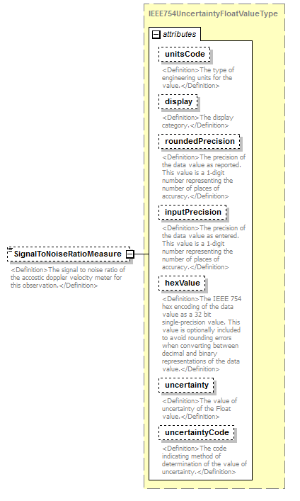 |
||||||||||||||||||||||||||||||||||||||||||||||||||||||||||||||
| namespace | http://water.usgs.gov/XML/NWIS/5.0 | ||||||||||||||||||||||||||||||||||||||||||||||||||||||||||||||
| type | IEEE754UncertaintyFloatValueType | ||||||||||||||||||||||||||||||||||||||||||||||||||||||||||||||
| properties |
|
||||||||||||||||||||||||||||||||||||||||||||||||||||||||||||||
| facets |
|
||||||||||||||||||||||||||||||||||||||||||||||||||||||||||||||
| attributes |
|
||||||||||||||||||||||||||||||||||||||||||||||||||||||||||||||
| annotation |
|
||||||||||||||||||||||||||||||||||||||||||||||||||||||||||||||
| source | <xsd:element name="SignalToNoiseRatioMeasure" type="IEEE754UncertaintyFloatValueType" minOccurs="0"> <xsd:annotation> <xsd:documentation> <Definition>The signal to noise ratio of the accostic doppler velocity meter for this observation.</Definition> </xsd:documentation> </xsd:annotation> </xsd:element> |
element MidSectionVelocityObservation/VelocityStandardErrorMeasure
| diagram | 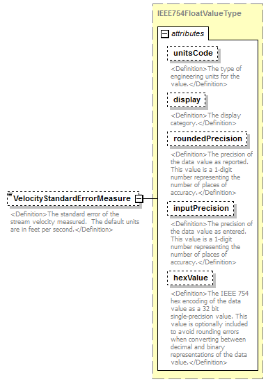 |
||||||||||||||||||||||||||||||||||||||||||||||
| namespace | http://water.usgs.gov/XML/NWIS/5.0 | ||||||||||||||||||||||||||||||||||||||||||||||
| type | IEEE754FloatValueType | ||||||||||||||||||||||||||||||||||||||||||||||
| properties |
|
||||||||||||||||||||||||||||||||||||||||||||||
| facets |
|
||||||||||||||||||||||||||||||||||||||||||||||
| attributes |
|
||||||||||||||||||||||||||||||||||||||||||||||
| annotation |
|
||||||||||||||||||||||||||||||||||||||||||||||
| source | <xsd:element name="VelocityStandardErrorMeasure" type="IEEE754FloatValueType" minOccurs="0"> <xsd:annotation> <xsd:documentation> <Definition>The standard error of the stream velocity measured. The default units are in feet per second.</Definition> </xsd:documentation> </xsd:annotation> </xsd:element> |
element MidSectionVelocityObservation/BoundryQualityIndexMeasure
| diagram | 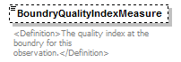 |
||||||||
| namespace | http://water.usgs.gov/XML/NWIS/5.0 | ||||||||
| type | xsd:nonNegativeInteger | ||||||||
| properties |
|
||||||||
| annotation |
|
||||||||
| source | <xsd:element name="BoundryQualityIndexMeasure" type="xsd:nonNegativeInteger" minOccurs="0"> <xsd:annotation> <xsd:documentation> <Definition>The quality index at the boundry for this observation.</Definition> </xsd:documentation> </xsd:annotation> </xsd:element> |
element MidSectionVelocityObservation/WaterTemperatureMeasure
| diagram | 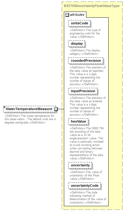 |
||||||||||||||||||||||||||||||||||||||||||||||||||||||||||||||
| namespace | http://water.usgs.gov/XML/NWIS/5.0 | ||||||||||||||||||||||||||||||||||||||||||||||||||||||||||||||
| type | IEEE754UncertaintyFloatValueType | ||||||||||||||||||||||||||||||||||||||||||||||||||||||||||||||
| properties |
|
||||||||||||||||||||||||||||||||||||||||||||||||||||||||||||||
| facets |
|
||||||||||||||||||||||||||||||||||||||||||||||||||||||||||||||
| attributes |
|
||||||||||||||||||||||||||||||||||||||||||||||||||||||||||||||
| annotation |
|
||||||||||||||||||||||||||||||||||||||||||||||||||||||||||||||
| source | <xsd:element name="WaterTemperatureMeasure" type="IEEE754UncertaintyFloatValueType" minOccurs="0"> <xsd:annotation> <xsd:documentation> <Definition>The water temperature for this observation. The default units are in degrees centigrade.</Definition> </xsd:documentation> </xsd:annotation> </xsd:element> |
element MidSectionVelocityObservation/VelocityMeasure
| diagram |  |
||||||||||||||||||||||||||||||||||||||||||||||||||||||||||||||
| namespace | http://water.usgs.gov/XML/NWIS/5.0 | ||||||||||||||||||||||||||||||||||||||||||||||||||||||||||||||
| type | IEEE754UncertaintyFloatValueType | ||||||||||||||||||||||||||||||||||||||||||||||||||||||||||||||
| properties |
|
||||||||||||||||||||||||||||||||||||||||||||||||||||||||||||||
| facets |
|
||||||||||||||||||||||||||||||||||||||||||||||||||||||||||||||
| attributes |
|
||||||||||||||||||||||||||||||||||||||||||||||||||||||||||||||
| annotation |
|
||||||||||||||||||||||||||||||||||||||||||||||||||||||||||||||
| source | <xsd:element name="VelocityMeasure" type="IEEE754UncertaintyFloatValueType"> <xsd:annotation> <xsd:documentation> <Definition>The stream velocity at this point in the stream. The default units are in feet per second.</Definition> </xsd:documentation> </xsd:annotation> </xsd:element> |
element AdcpTransectAttribute
| diagram | 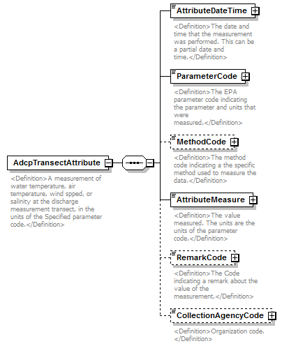 |
||
| namespace | http://water.usgs.gov/XML/NWIS/5.0 | ||
| properties |
|
||
| children | AttributeDateTime ParameterCode MethodCode AttributeMeasure RemarkCode CollectionAgencyCode | ||
| used by |
|
||
| annotation |
|
||
| source | <xsd:element name="AdcpTransectAttribute"> <xsd:annotation> <xsd:documentation> <Definition>A measurement of water temperature, air temperature, wind spped, or salinity at the discharge measurement transect, in the units of the Specified parameter code.</Definition> </xsd:documentation> </xsd:annotation> <xsd:complexType> <xsd:sequence> <xsd:element name="AttributeDateTime" type="DateTimeWithDatum"> <xsd:annotation> <xsd:documentation> <Definition>The date and time that the measurement was performed. This can be a partial date and time.</Definition> </xsd:documentation> </xsd:annotation> </xsd:element> <xsd:element name="ParameterCode" type="ReferenceListCodeType"> <xsd:annotation> <xsd:documentation> <Definition>The EPA parameter code indicating the parameter and units that were measured.</Definition> </xsd:documentation> </xsd:annotation> </xsd:element> <xsd:element name="MethodCode" type="ReferenceListCodeType" minOccurs="0"> <xsd:annotation> <xsd:documentation> <Definition>The method code indicating a the specific method used to measure the data.</Definition> </xsd:documentation> </xsd:annotation> </xsd:element> <xsd:element name="AttributeMeasure" type="IEEE754FloatValueType"> <xsd:annotation> <xsd:documentation> <Definition>The value measured. The units are the units of the parameter code.</Definition> </xsd:documentation> </xsd:annotation> </xsd:element> <xsd:element name="RemarkCode" type="ReferenceListCodeType" minOccurs="0"> <xsd:annotation> <xsd:documentation> <Definition>The Code indicating a remark about the value of the measurement.</Definition> </xsd:documentation> </xsd:annotation> </xsd:element> <xsd:element name="CollectionAgencyCode" type="ReferenceListCodeType" minOccurs="0"> <xsd:annotation> <xsd:documentation> <Definition>Organization code. </Definition> </xsd:documentation> </xsd:annotation> </xsd:element> </xsd:sequence> </xsd:complexType> </xsd:element> |
element AdcpTransectAttribute/AttributeDateTime
| diagram |  |
||||||||||||||||||||||||||||||
| namespace | http://water.usgs.gov/XML/NWIS/5.0 | ||||||||||||||||||||||||||||||
| type | DateTimeWithDatum | ||||||||||||||||||||||||||||||
| properties |
|
||||||||||||||||||||||||||||||
| attributes |
|
||||||||||||||||||||||||||||||
| annotation |
|
||||||||||||||||||||||||||||||
| source | <xsd:element name="AttributeDateTime" type="DateTimeWithDatum"> <xsd:annotation> <xsd:documentation> <Definition>The date and time that the measurement was performed. This can be a partial date and time.</Definition> </xsd:documentation> </xsd:annotation> </xsd:element> |
element AdcpTransectAttribute/ParameterCode
| diagram |  |
||||||||||||||||||||||
| namespace | http://water.usgs.gov/XML/NWIS/5.0 | ||||||||||||||||||||||
| type | ReferenceListCodeType | ||||||||||||||||||||||
| properties |
|
||||||||||||||||||||||
| attributes |
|
||||||||||||||||||||||
| annotation |
|
||||||||||||||||||||||
| source | <xsd:element name="ParameterCode" type="ReferenceListCodeType"> <xsd:annotation> <xsd:documentation> <Definition>The EPA parameter code indicating the parameter and units that were measured.</Definition> </xsd:documentation> </xsd:annotation> </xsd:element> |
element AdcpTransectAttribute/MethodCode
| diagram | 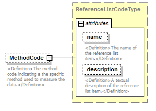 |
||||||||||||||||||||||
| namespace | http://water.usgs.gov/XML/NWIS/5.0 | ||||||||||||||||||||||
| type | ReferenceListCodeType | ||||||||||||||||||||||
| properties |
|
||||||||||||||||||||||
| attributes |
|
||||||||||||||||||||||
| annotation |
|
||||||||||||||||||||||
| source | <xsd:element name="MethodCode" type="ReferenceListCodeType" minOccurs="0"> <xsd:annotation> <xsd:documentation> <Definition>The method code indicating a the specific method used to measure the data.</Definition> </xsd:documentation> </xsd:annotation> </xsd:element> |
element AdcpTransectAttribute/AttributeMeasure
| diagram | 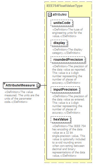 |
||||||||||||||||||||||||||||||||||||||||||||||
| namespace | http://water.usgs.gov/XML/NWIS/5.0 | ||||||||||||||||||||||||||||||||||||||||||||||
| type | IEEE754FloatValueType | ||||||||||||||||||||||||||||||||||||||||||||||
| properties |
|
||||||||||||||||||||||||||||||||||||||||||||||
| facets |
|
||||||||||||||||||||||||||||||||||||||||||||||
| attributes |
|
||||||||||||||||||||||||||||||||||||||||||||||
| annotation |
|
||||||||||||||||||||||||||||||||||||||||||||||
| source | <xsd:element name="AttributeMeasure" type="IEEE754FloatValueType"> <xsd:annotation> <xsd:documentation> <Definition>The value measured. The units are the units of the parameter code.</Definition> </xsd:documentation> </xsd:annotation> </xsd:element> |
element AdcpTransectAttribute/RemarkCode
| diagram | 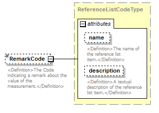 |
||||||||||||||||||||||
| namespace | http://water.usgs.gov/XML/NWIS/5.0 | ||||||||||||||||||||||
| type | ReferenceListCodeType | ||||||||||||||||||||||
| properties |
|
||||||||||||||||||||||
| attributes |
|
||||||||||||||||||||||
| annotation |
|
||||||||||||||||||||||
| source | <xsd:element name="RemarkCode" type="ReferenceListCodeType" minOccurs="0"> <xsd:annotation> <xsd:documentation> <Definition>The Code indicating a remark about the value of the measurement.</Definition> </xsd:documentation> </xsd:annotation> </xsd:element> |
element AdcpTransectAttribute/CollectionAgencyCode
| diagram | 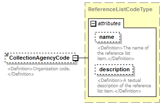 |
||||||||||||||||||||||
| namespace | http://water.usgs.gov/XML/NWIS/5.0 | ||||||||||||||||||||||
| type | ReferenceListCodeType | ||||||||||||||||||||||
| properties |
|
||||||||||||||||||||||
| attributes |
|
||||||||||||||||||||||
| annotation |
|
||||||||||||||||||||||
| source | <xsd:element name="CollectionAgencyCode" type="ReferenceListCodeType" minOccurs="0"> <xsd:annotation> <xsd:documentation> <Definition>Organization code. </Definition> </xsd:documentation> </xsd:annotation> </xsd:element> |
XML Schema documentation generated by XMLSpy Schema Editor http://www.altova.com/xmlspy